A 2020 Epic Adventure…Hiking the Colorado Trail PART I
Posted by Deb in Uncategorized on September 30, 2020
Part I
The year 2020 has been an odd one. When the pandemic hit we were in Mesa Arizona trying to decide what to do. We had a spring, summer and fall worth of plans all lined out to keep us moving from Baja to Banff.
But in March, everything changed!
Once we heard that campgrounds, National Forests and RV parks were shutting down we made the decision to high tail it back to our cabin in Arkansas to wait out the pandemic.
After 5 years on the road our life of travel was now on hold and we became home dwellers once again.
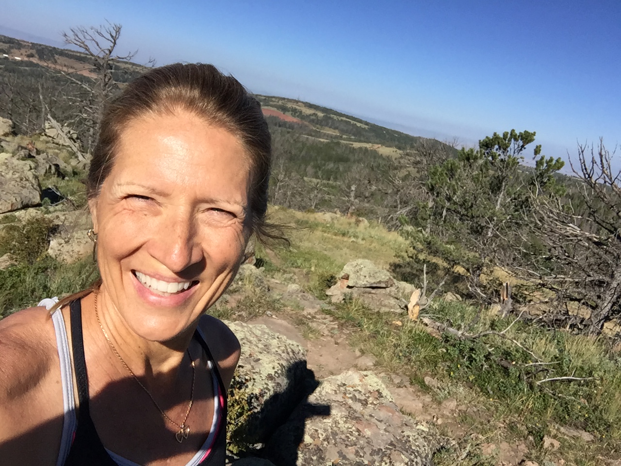
In reality I welcomed being home.
Traveling in an RV has many, many positive aspects. Any negatives are quickly forgotten as soon as you peer over the rim of the Grand Canyon or summit the highest peak in Colorado.
However, living in an RV is an everyday mental game.
Is there enough power to run the microwave? How long can I stand the noise of the AC before I want to pull my hair out? Is there enough water to take a shower today? How will I get out of the gas station parking lot? Is some idiot on the freeway going to cut me off?
Living in a house is sooooo mindlessly easy.
With all that mental free space created, we started to think about our next adventure. With most races cancelled or converted to “virtual”, we decided to look for a challenge to get our butts motivated to stay in shape.
We needed something epic. We needed something in a cooler climate for July-September. We needed something RV friendly.
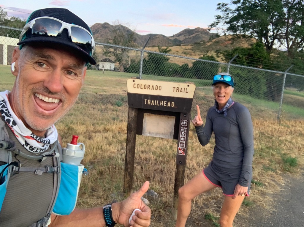
And that’s how we decided we would take on the Colorado Trail.
485 Miles
90,000’ of Elevation
Most of the trail is above 10,000’
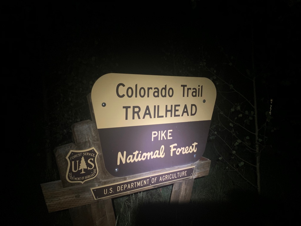
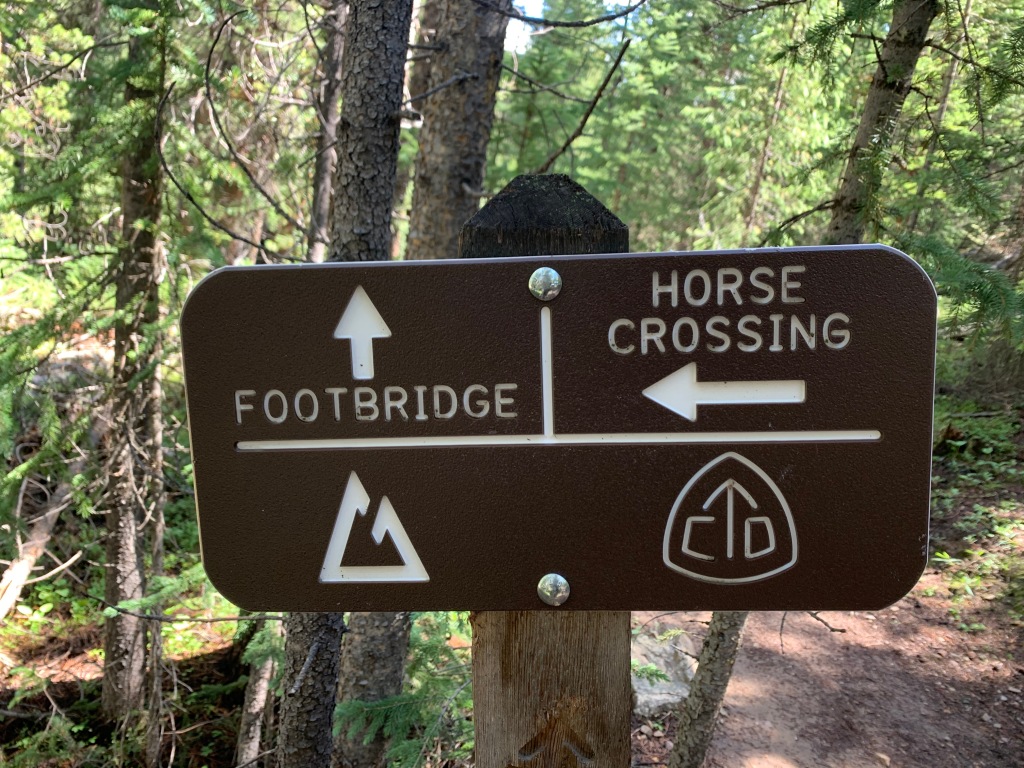
The Colorado Trail (CT) was constructed by volunteers between 1973 and 1987.
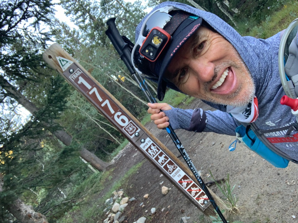
The trail is broken into 28 segments stretching from Denver to Durango. Most people backpack the trail by either “through hiking” or “segment hiking”. While through hikers take 30-45 days in one shot averaging 13 miles a day, segment hikers cover a segment or two over a long weekend, go home, then plan another weekend to knock out another section.
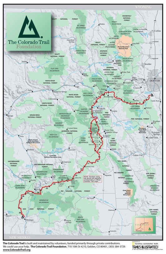
Since we were not backpacking we had to figure out the logistics based on where we could park the RV, then drive to start and finish trailheads for the day.
Segments were anywhere from 9 miles to 32 miles with lots of 20 milers in between.
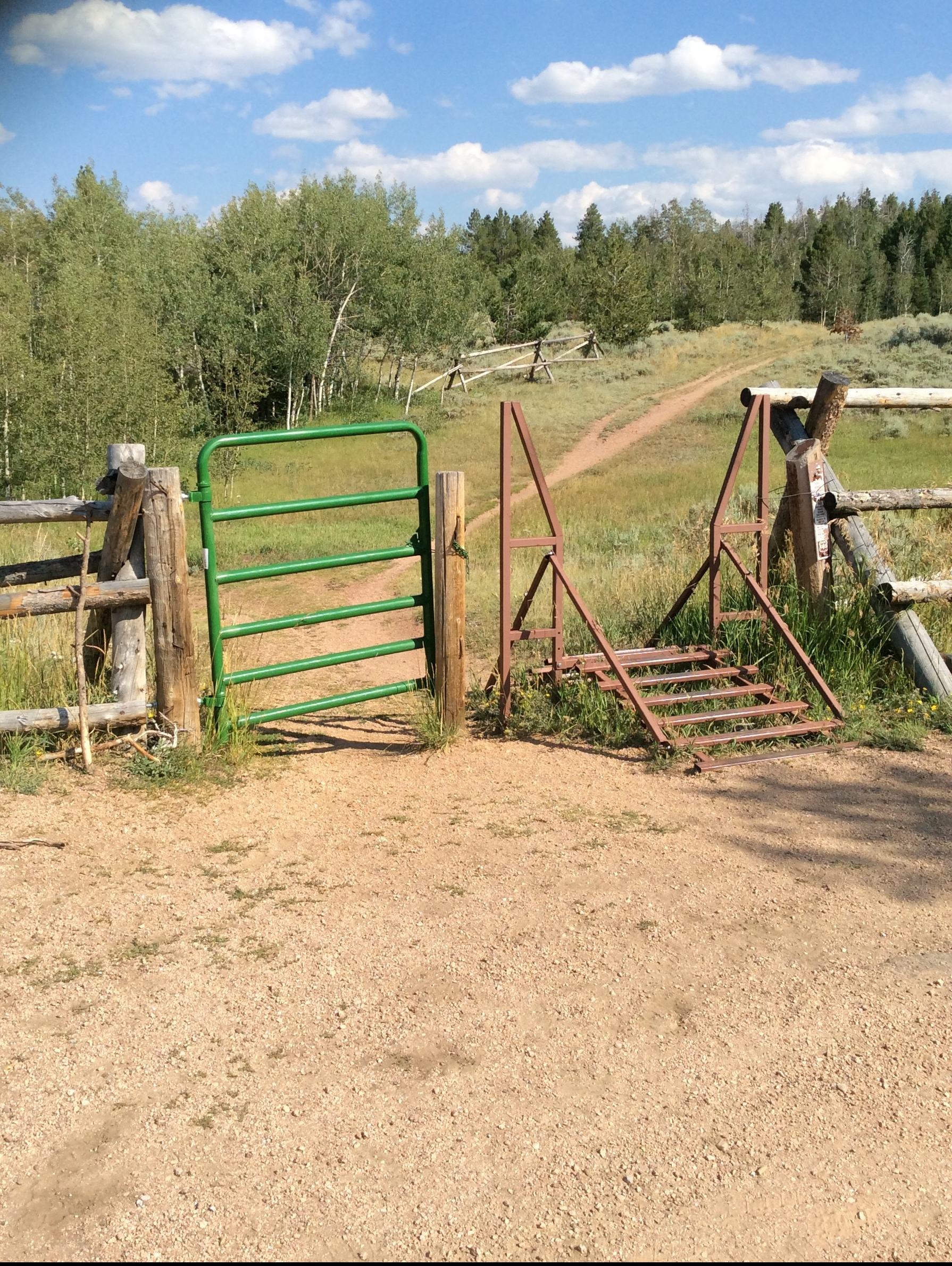
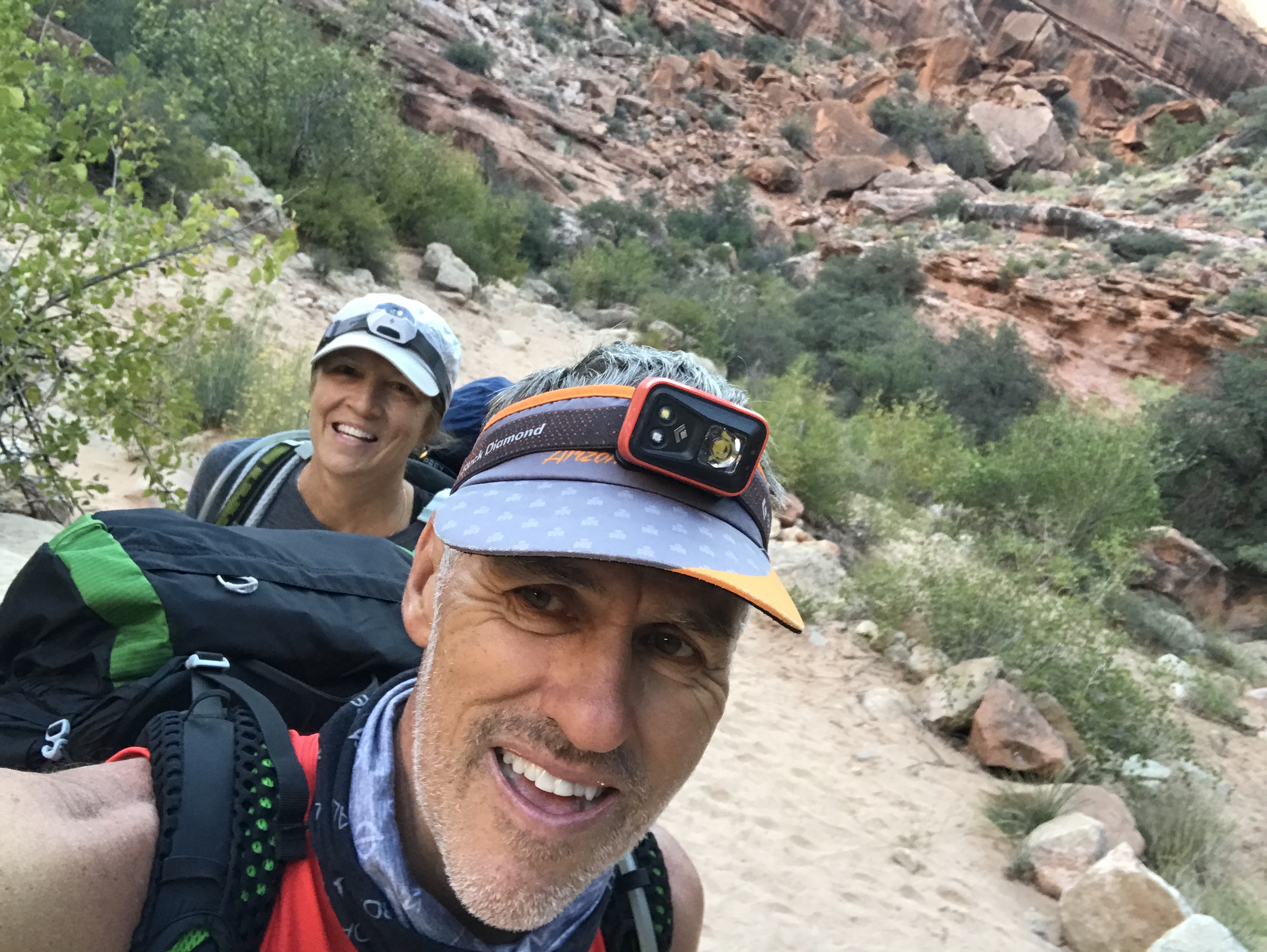
We decided the best approach for the two of us would be to leapfrog the trail. Jeff would do a segment, and then I would do a segment. That way I could drop Jeff off at the start of Segment 1, then drive around and park at the start of Segment 2. I would then hike Segment 2. Jeff would then pick up the truck at his finish (my start), then drive around and pick me up at the finish of #2. Easy peasy!
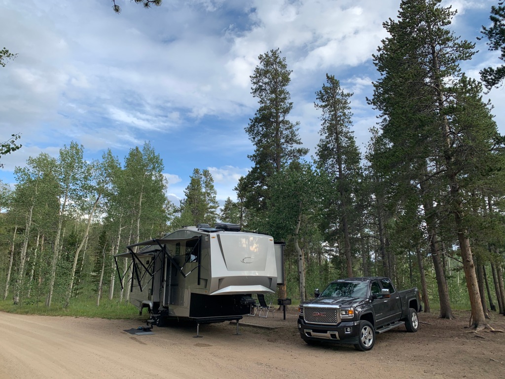
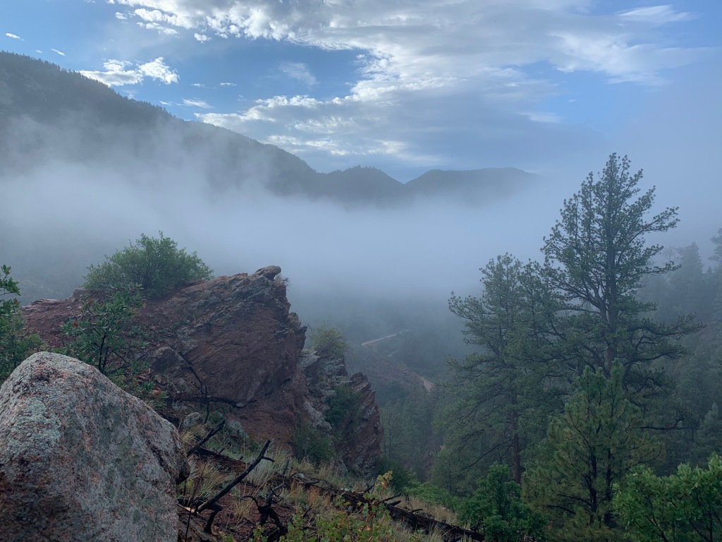
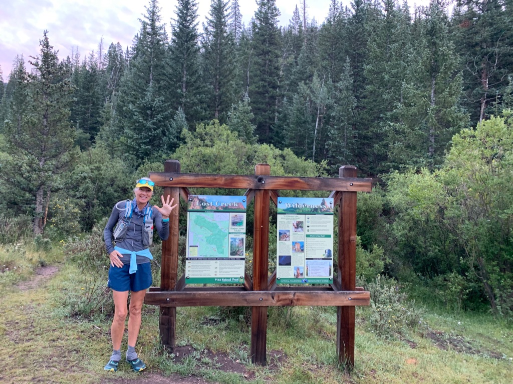
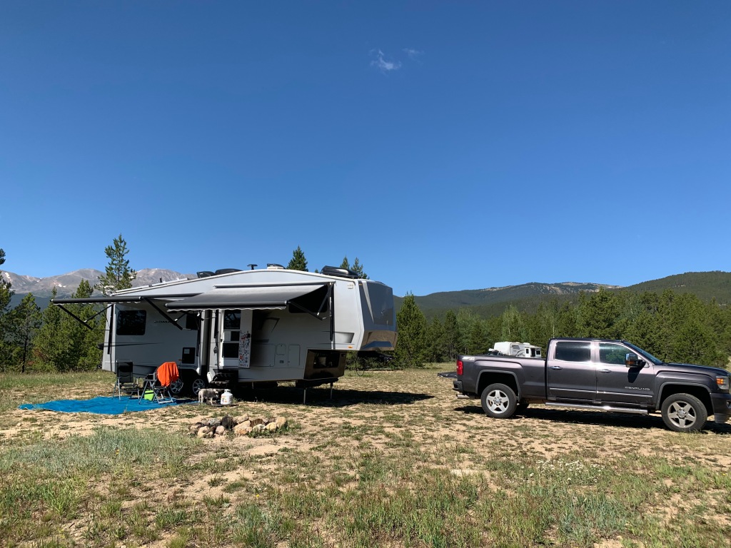
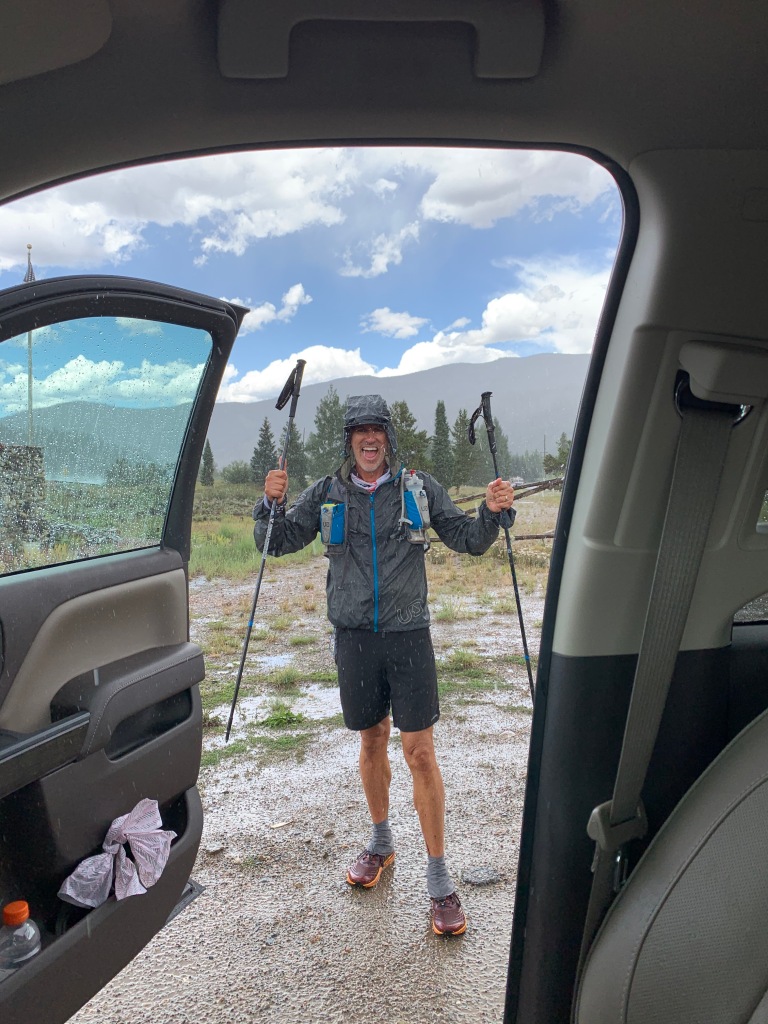
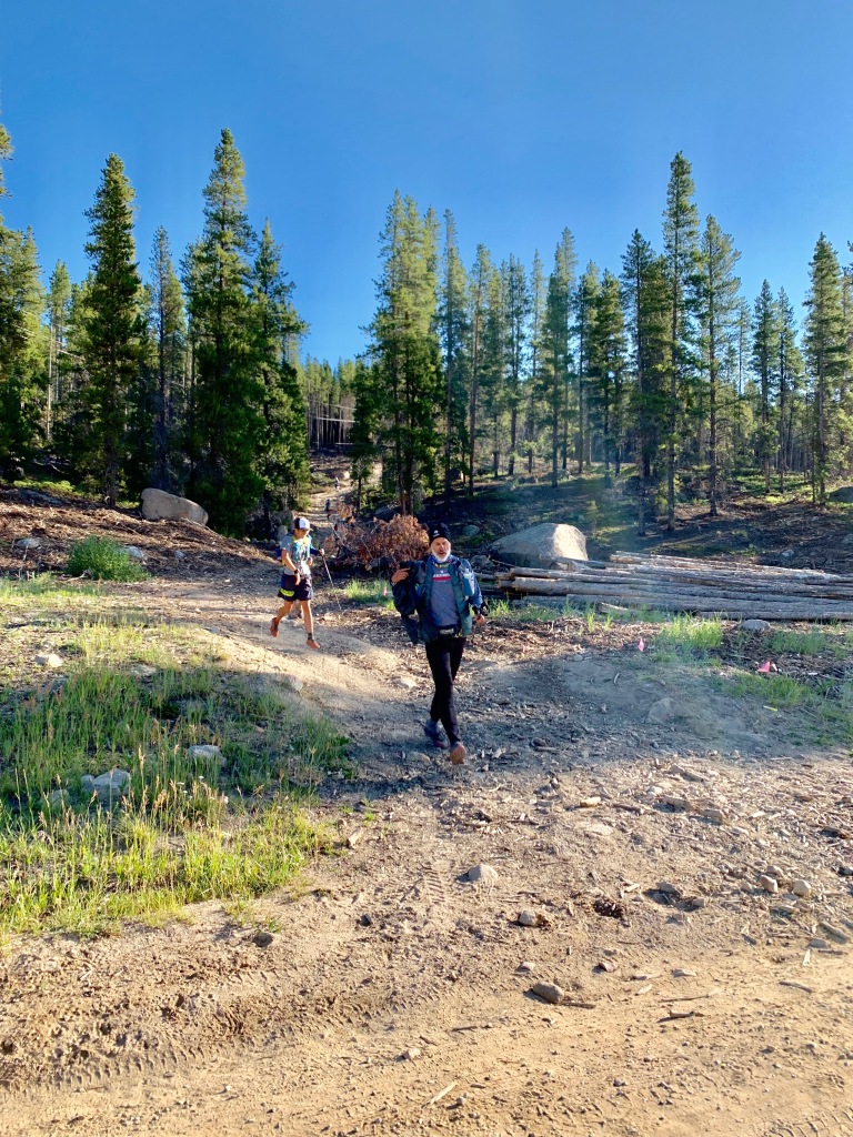
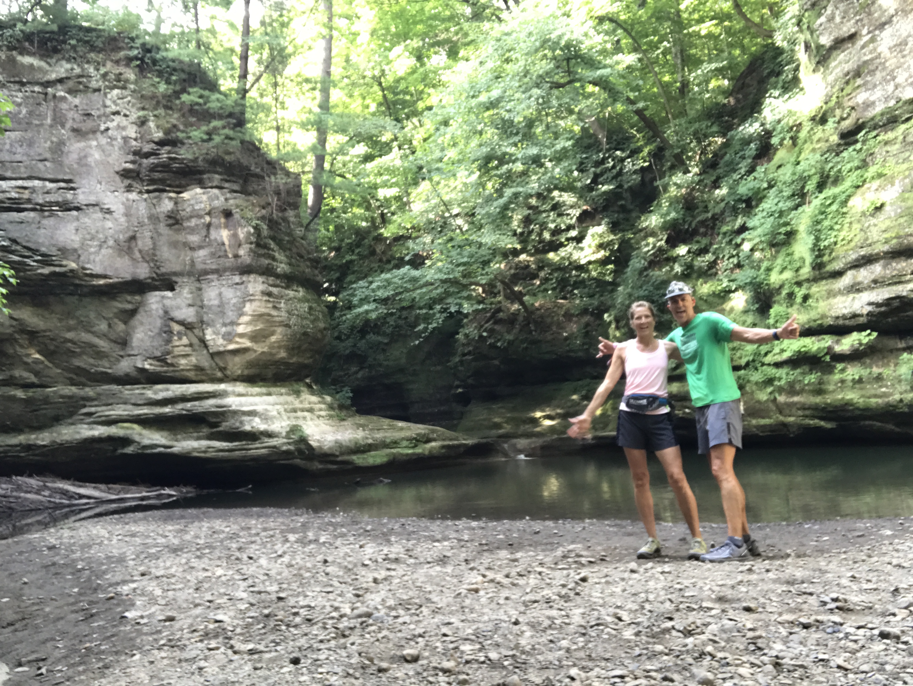
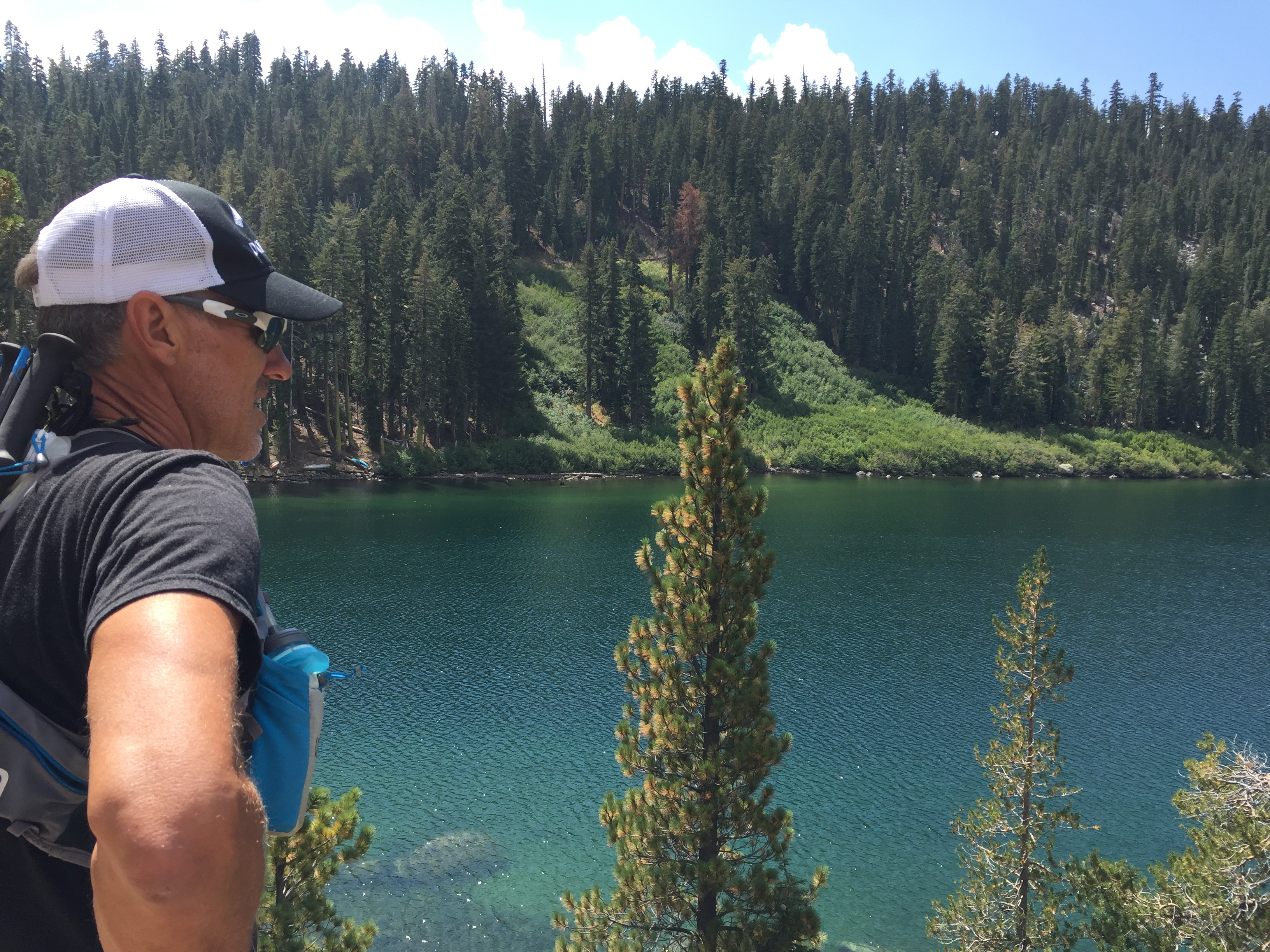
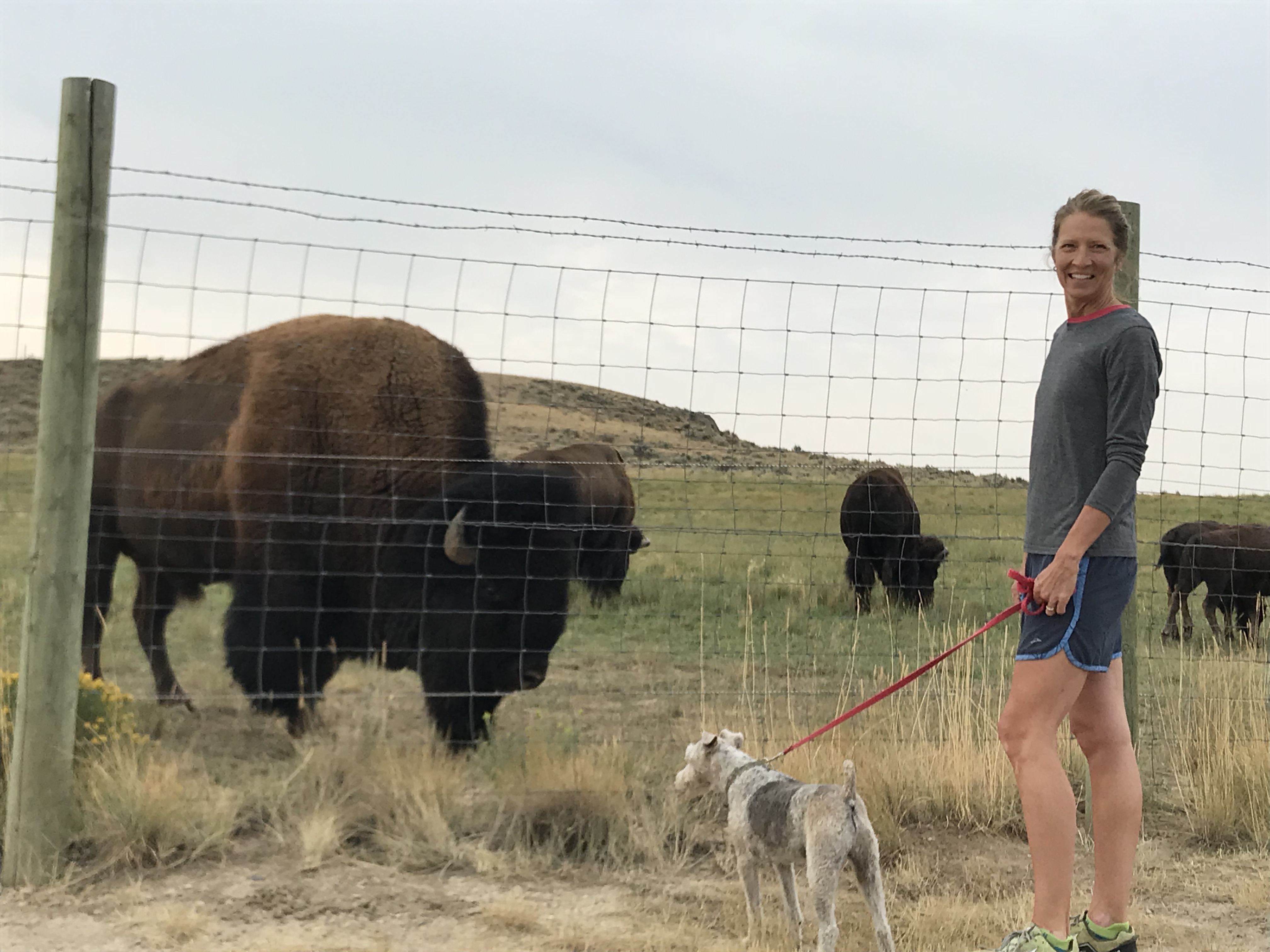
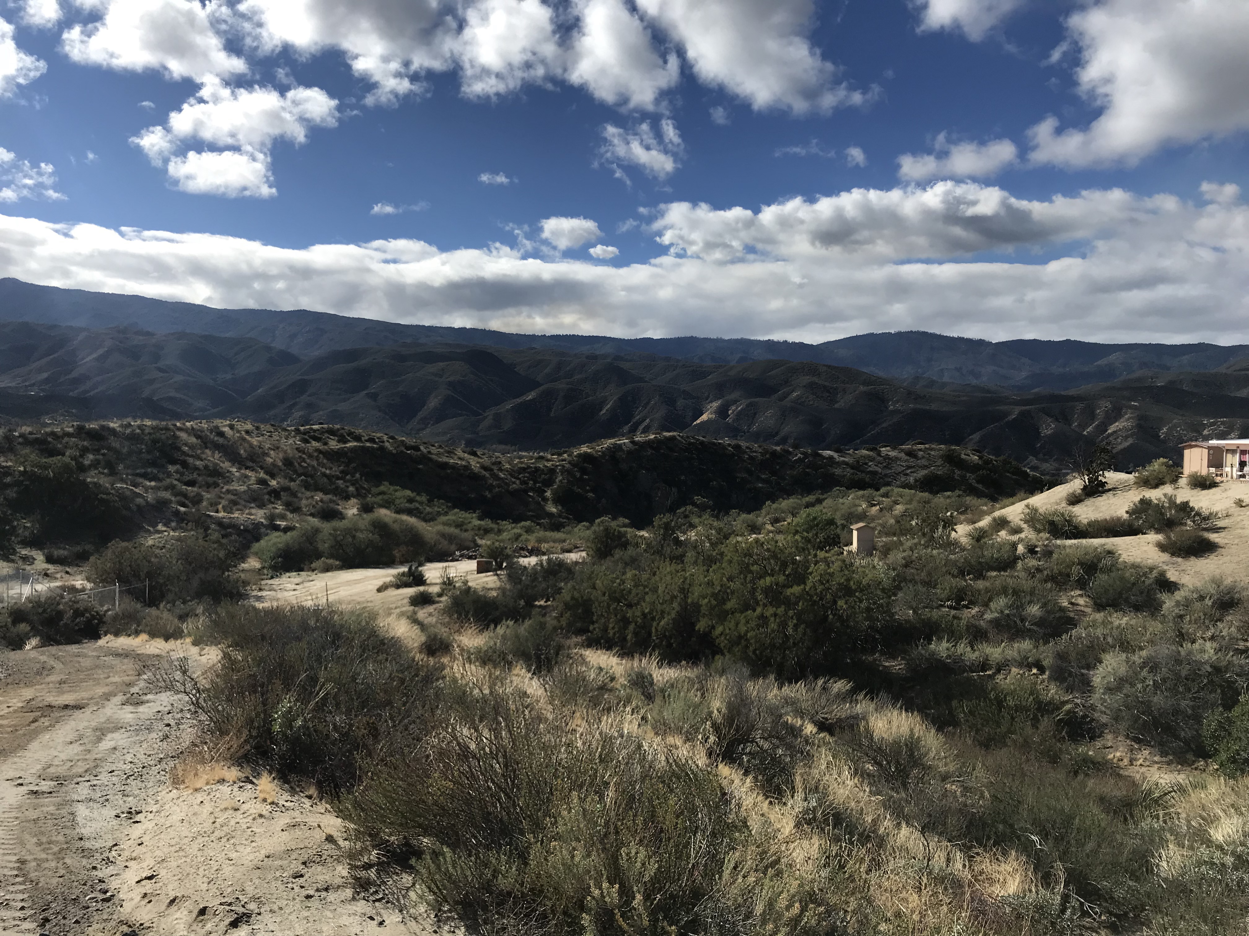
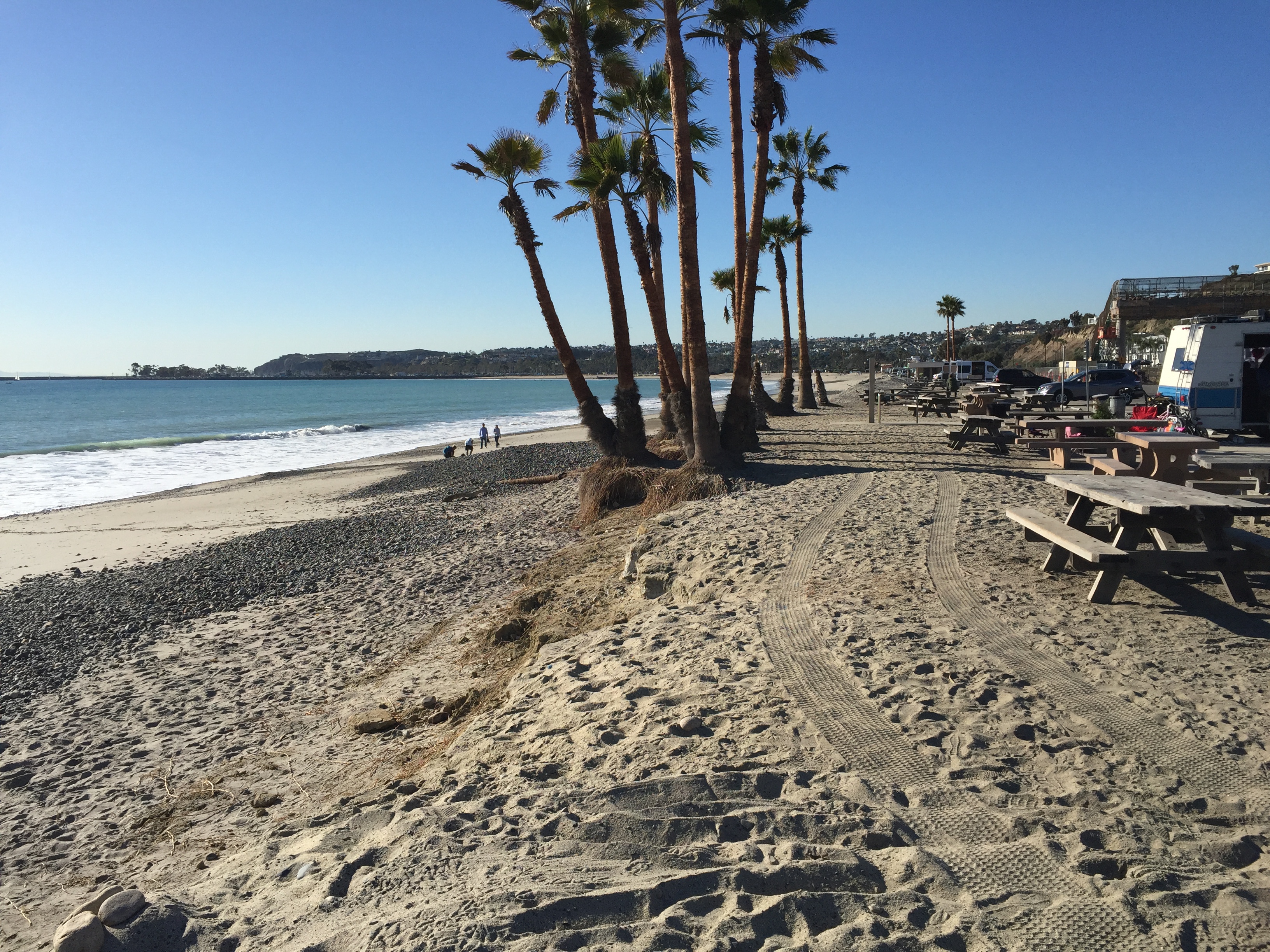
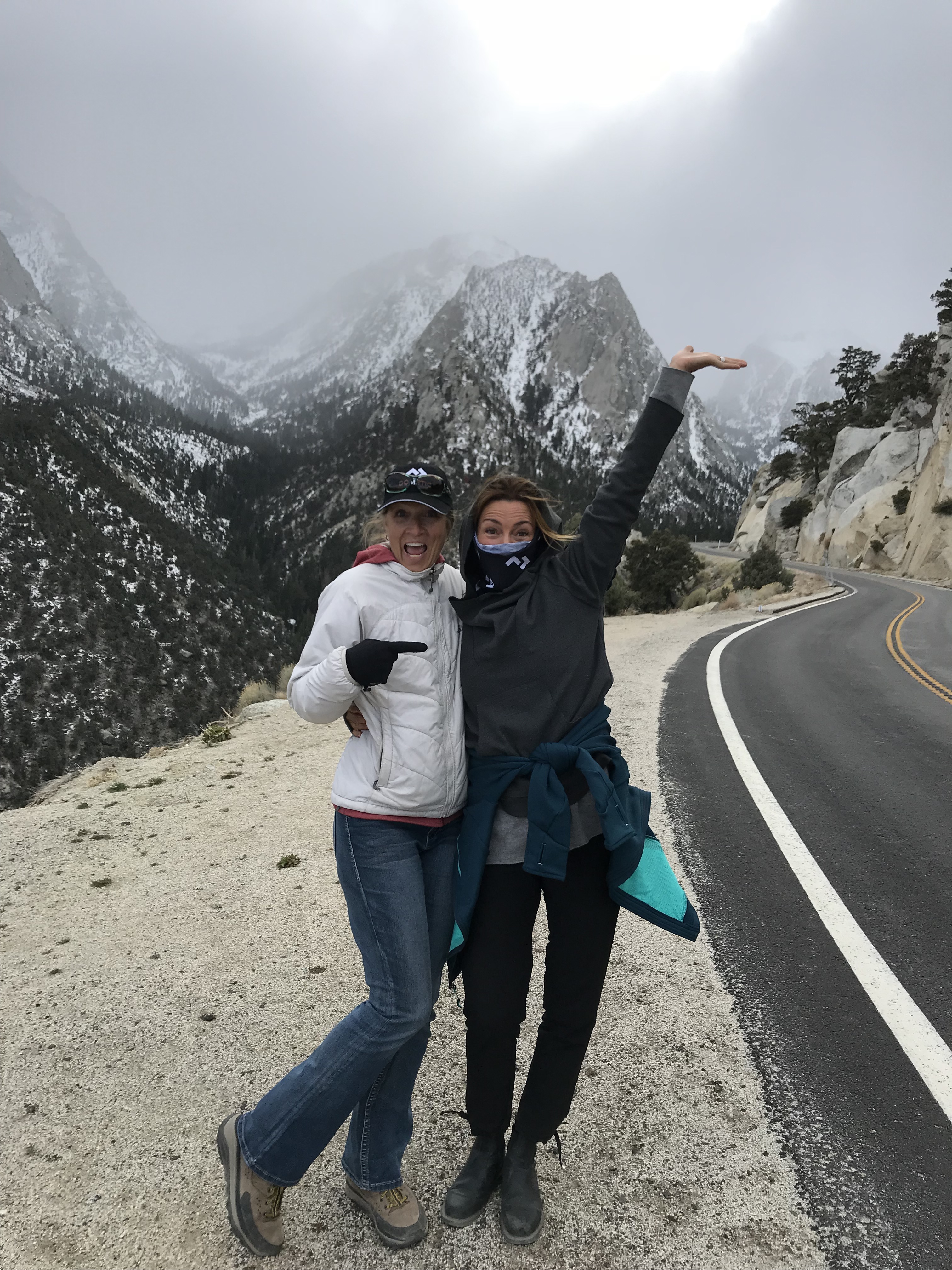
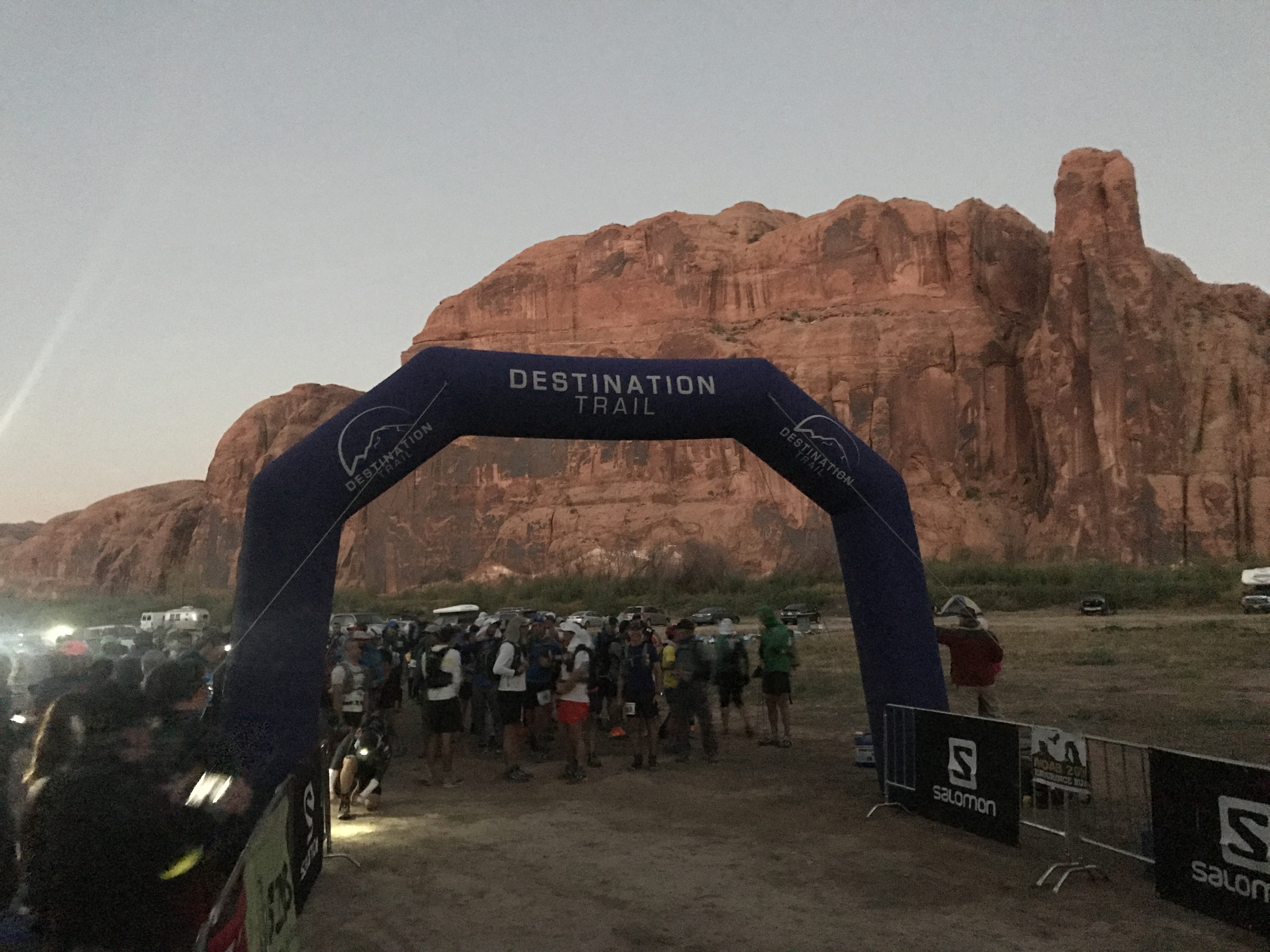
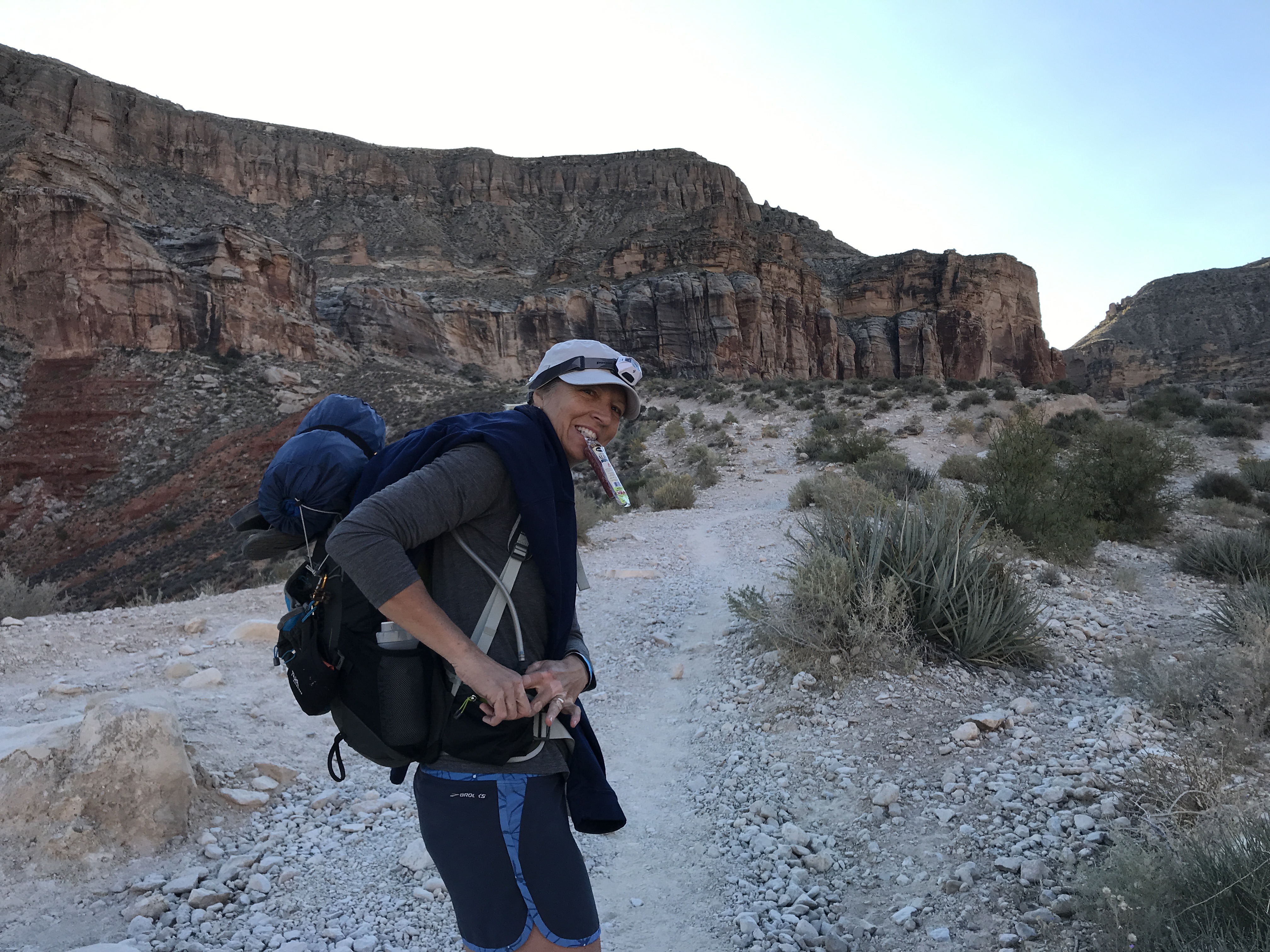
July 25, 2020 CT Segment 1 & 2
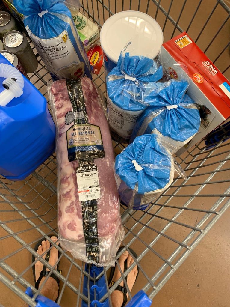
We base camped at Kenosha Pass East campground and commuted back to Denver to start the CT. It was an hour and forty-minute drive to the Waterton Canyon Trailhead to drop Jeff to begin his 16.8-mile trek. I then drove another hour to reach the South Platte River TH, the start of Segment 2 for a distance of 11.5 miles.
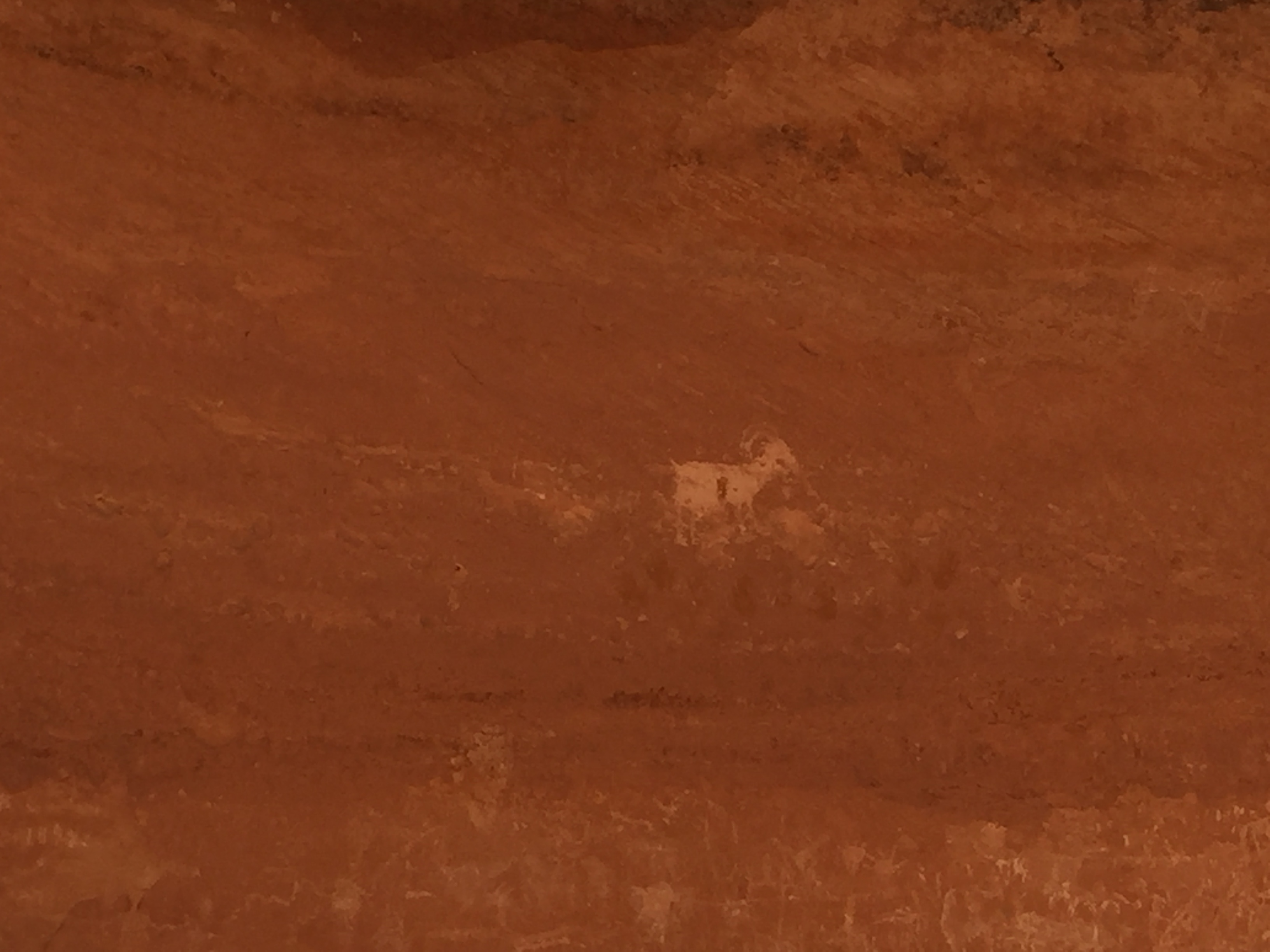
It was really exciting to get started and the trails did not disappoint! Within the first couple miles of S1, Jeff noticed another hiker looking up into the hillside. He pointed out bighorn sheep clinging to the rugged rock formations.
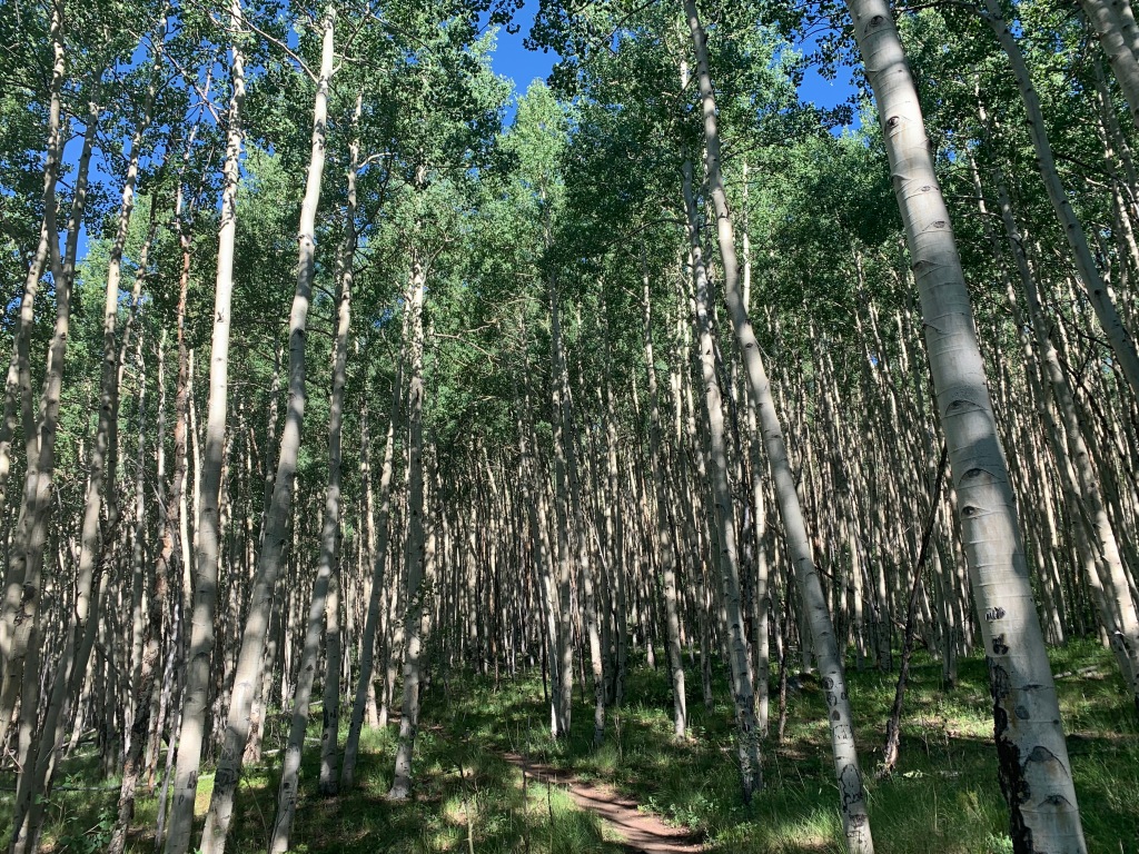
The sun was coming up over the mountains casting a warm glow on the trail, which were forestry roads for the first 5 or so miles until it jumped onto single track.
S2 started with low hanging clouds. The trail was cool and damp from the afternoon showers from the day before.
Taking that first step on the trail can be a bit overwhelming, especially since we had been at sea level since October 2019. Last summer we were in Colorado for 3 months and never really felt like we caught our breath at that elevation. Now here we were starting at around 6,000’ and expected to top out at 13,259’ within a month.
But to both of our surprise we handled the elevation with no issues whatsoever. It was as if we had never left! I guess all that humidity training in Arkansas for 4 months somehow helped us acclimate!
It was good to be on the tail!
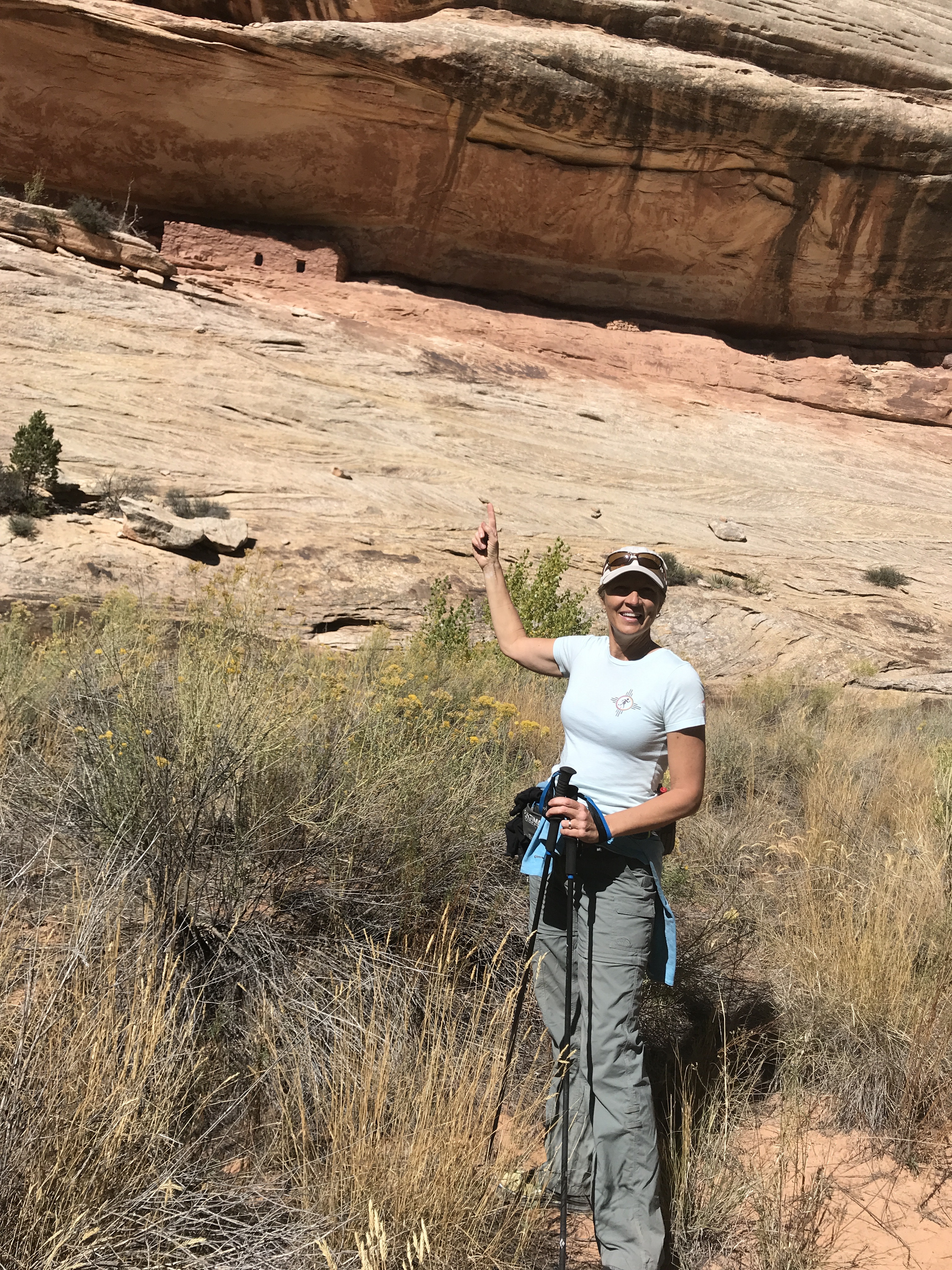
By the time Jeff was done with Segment 1 and drove the truck around to the finish of Segment 2, I was walking off the trail for a perfectly timed pick up.
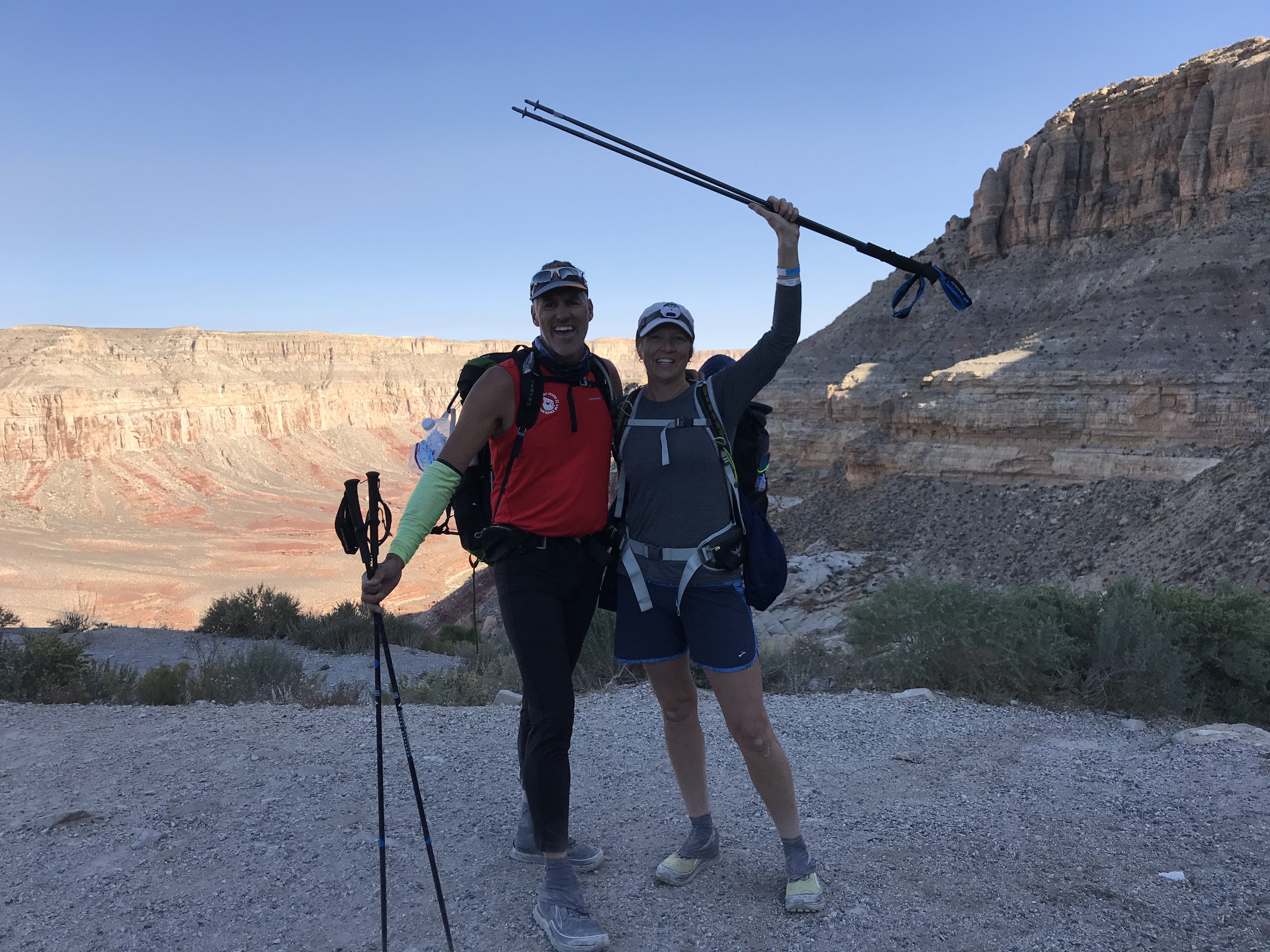
July 26, 2020 CT Segments 3 & 4
The next day we thought we would rest up from our long hikes. But as the morning pushed on we both felt really good and decided to bust out Segments 3 & 4.
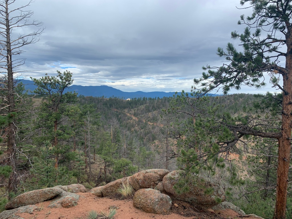
S3 left from the Little Scraggy TH for 12.2 miles while S4 was from Wellington Lake Road TH for 16.6 miles.
Since S4 was a longer hike (taking more time) we did these two segments in reverse. I dropped Jeff off at the end of S4 to start hiking while I drove around to the finish of S3 and hiked to where I finished the day before at the end of S2.
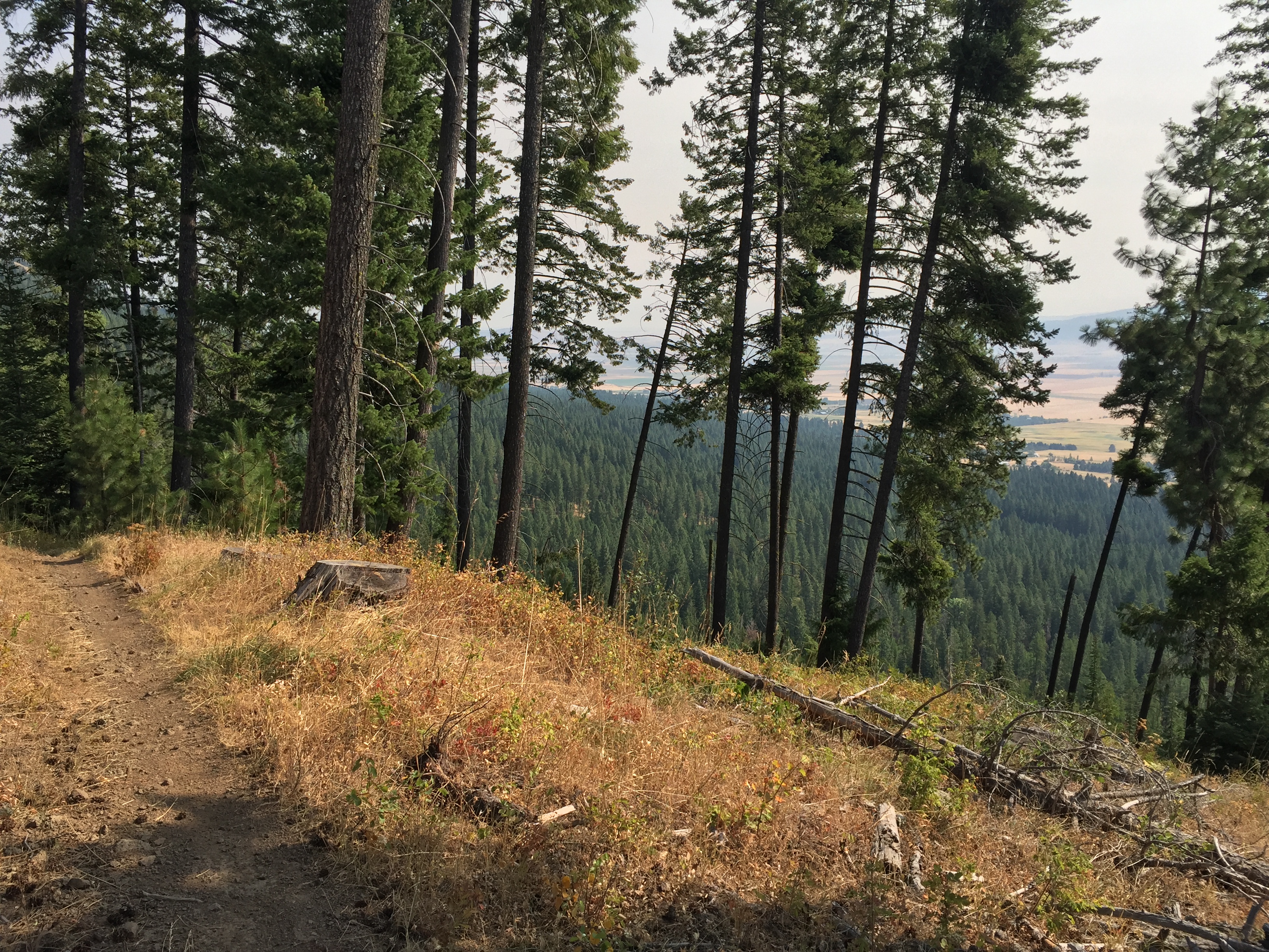
By the time I started on the trail it was already late morning and I could already hear thunder off in the distance. So instead of hiking I picked up the pace for some trail running. I could see the line of clouds moving closer, but it appeared I was hovering on the edge of the front with minimal sprinkles of rain.
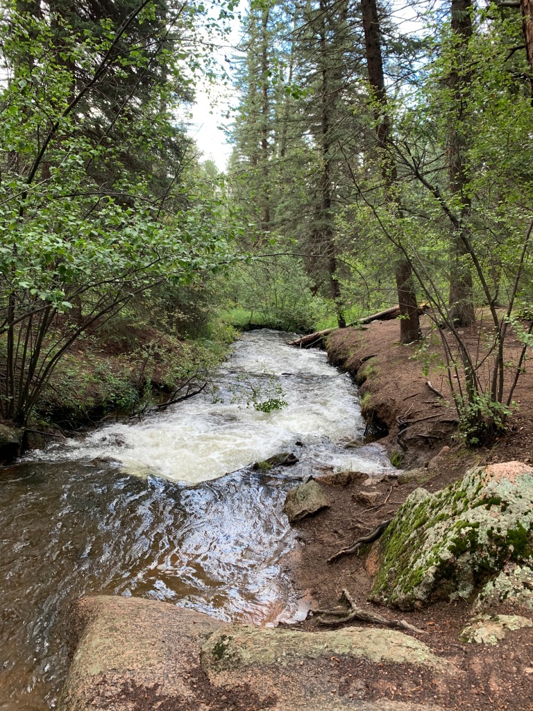
I have to say this trail was one of my favorite sections. The elevation was mostly a descent from west to east with minimal rollers. It made for an easy and exhilarating run! There were stream crossings and pine needle covered trails. It was well traveled and at times a bit crowded with it being so close to Denver on a weekend.
By the time I finished my segment it was misting and breezy. I was getting text updates from Jeff about terrible Sunday traffic heading back towards Denver. His ETA to pick me up kept getting pushed back further and further. After being sweaty and damp the cool breeze was downright cold and I had to resort to pulling out my emergency blanket to stay warm. An hour after I finished Jeff finally pulled in with the heater blowing.
We drove home in the rain stopping at a restaurant to pick up lunch/dinner. It was a great day!
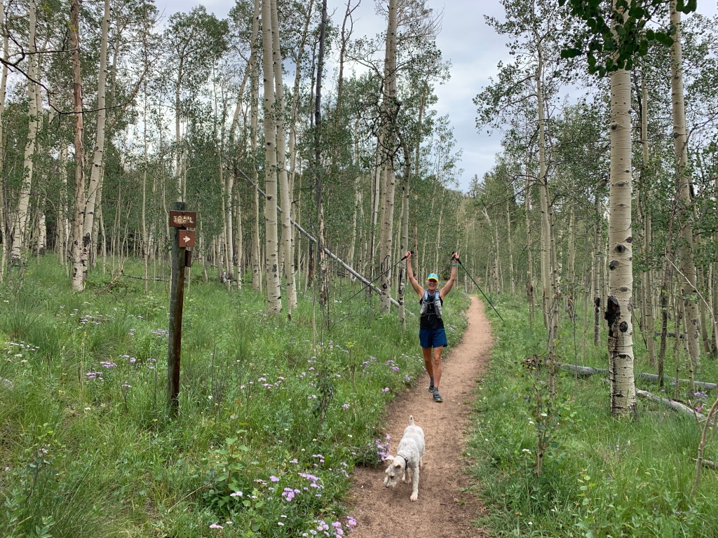
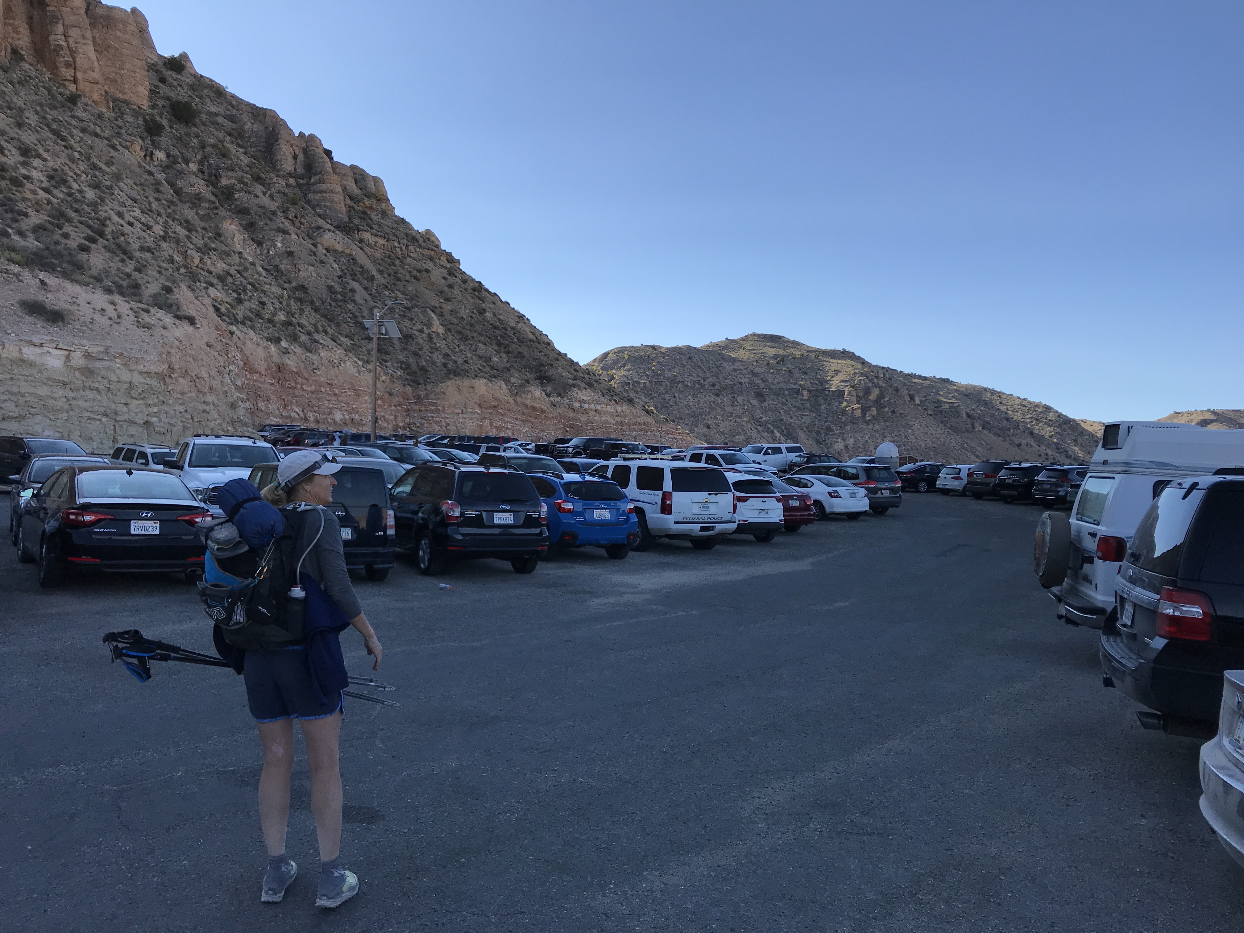
July 28-29, 2020 CT Segments 5 & 6
Hiking the CT has been easy so far. The trail is marked extremely well. But two tools we used were the Guthook and Gaia Apps for mapping. Also, we signed up on the Colorado Trail Through Hikers and Colorado Segment Hikers Facebook pages.
We were able to get the latest conditions, bear sightings, and water stops for every segment on the CT. And of course, you run into through and segment hikers and bikers every day on the trail.
With all these resources we had to learn a whole new dialogue to understand some of the communication within posts.
NoBo=Northbound
SoBo=Southbound
Zero=A no hiking day
We took a Zero on our third day. While we planned our next segments.
S6 was going to be a long 32.9 segment from Kenosha Pass to Breckenridge. Jeff, being the Ultra runner in the group, decided to cover this segment in one day. This put me covering S5 for 14.6 miles from Long Gulch to Kenosha Pass.
Logistically we could not pull off these two segments of hiking on the same day. So on day four Jeff dropped me off at the S5 TH not too far from our campground. Segment 5 finished right at our campground making for an easy logistics day.
Kenosha Pass was a beautiful trail with only 1,858’ of elevation. It took me through Aspen groves and pretty meadows. I even ran into a few herds of cows. It was nice to see Jeff and Sam at the end of the trail waiting for me.
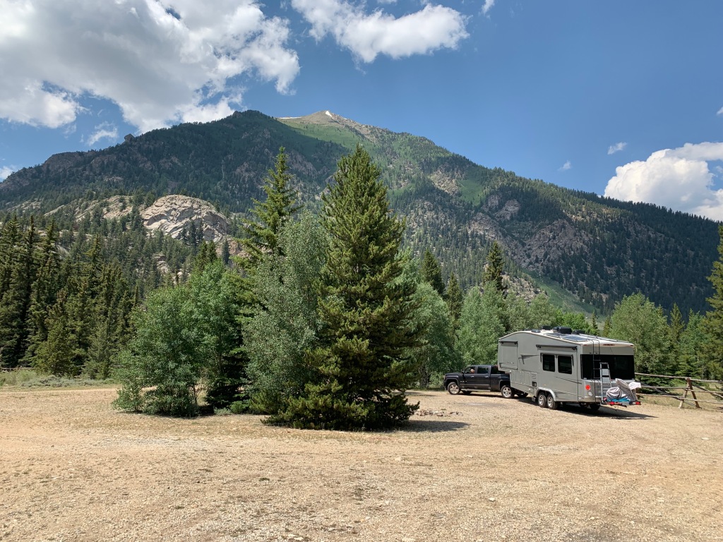
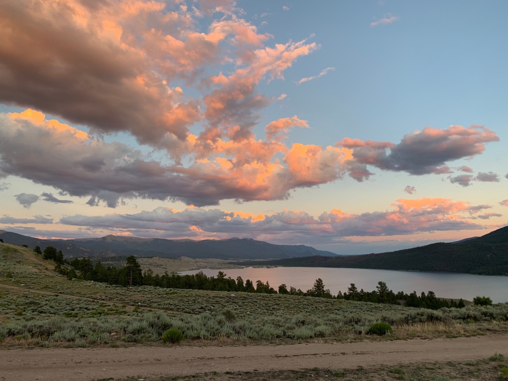
This put Jeff with two zero days in a row in order to rest up for his 33 miler. Since his pickup location would be Breckenridge and take him about 10 hours, I planned to relocate the RV to our new base camp in Leadville.
Day 5, Jeff headed out at 5am from S6 TH right from our campsite while I prepared the RV to move. All went smoothly on my trip to Leadville with a quick stop to dump our tanks and refill our water on the RV. I pulled into a favorite boondocking site from last year on the south side of Turquoise Lake.
I had enough time to set up the RV before leaving for Breckenridge to do some grocery shopping at Walmart, grab a burger for Jeff and then pick him up at the finish. The timing was once again perfect for the pick up, but the forecast for 100% sunshine was a bit off. I picked up Jeff in a torrential downpour. Cold and hungry, the triple cheeseburgers, fries and frosty hit the spot!
Jeff was beat after 32.9 miles and 5,200’ of elevation.
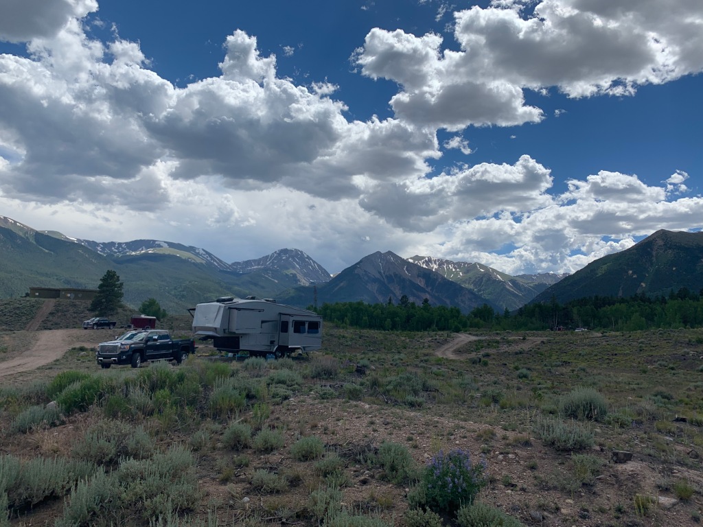
Once back at our Leadville base camp we hung out for a couple of days waiting for our friends Marge and Michael to arrive from Arizona. Marge would be joining the hiking fun for the rest of the CT while Michael would be helping with some pretty complicated Logistics to come.
Stay tuned for Part II
More Mountain Peaks Please
Posted by Deb in Biking, Boondocking, Cycling, Destinations, Full Time RV, Highest Peaks, Hiking, Running, Trail Run, Ultra Running on December 18, 2019
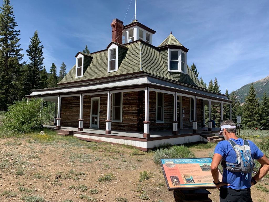
Twin Lakes, CO (Elevation: 9700’)
We would have liked to stay in Salida longer, but the summer temps, even at 7,000’, were starting to climb into the 90’s. So we moved on the Twin Lakes Colorado at 9,700’.
If you are familiar with the notorious Leadville 100 trail run or the Leadville 100 MTB race, then Twin Lakes will be familiar as one of the stops/aid stations runners and bikers resupply before heading over Hope Pass at 12,600’.
We initial boondocked at Lake Creek Dispersed camping area on the west side of Twin Lakes. This was a lovely pull out area with room for 10-12 RV’s with terrible connectivity. What we gave up in connectivity we gained back in proximity to the Willis Gulch trailhead, just 3/10ths of a mile away.
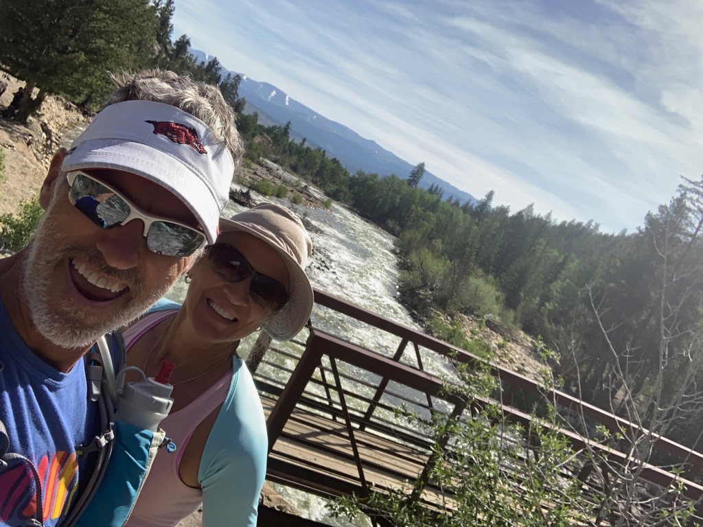
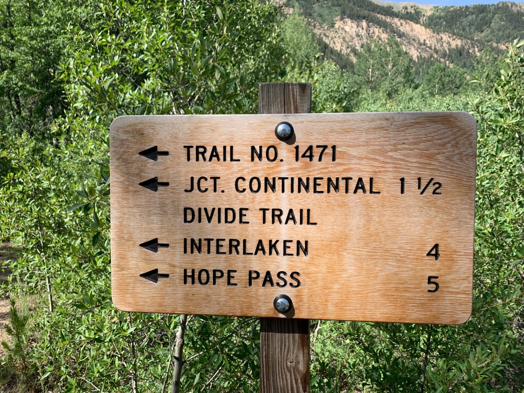
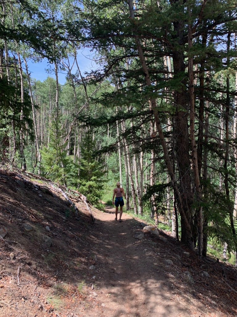
Willis Gulch offered access to the Colorado trail, the Continental Divide trail, Hope Pass and a 9-mile round trip hike to the restored 1880’s community of Interlaken.
The Interlaken Hotel complex was started in 1879 as a lakeside resort. It was considered a top destination in Colorado in its time with tavern, pool hall and a unique 6-sided outhouse.
Unfortunately Interlaken lost its attraction when Twin Lakes was dammed for irrigation purposed around the turn of the century. People considered the shallow waters of the lake a breeding ground for malaria and the hotel fell into disrepair until 1979 when the Bureau of Reclamation recorded and stabilized the community.
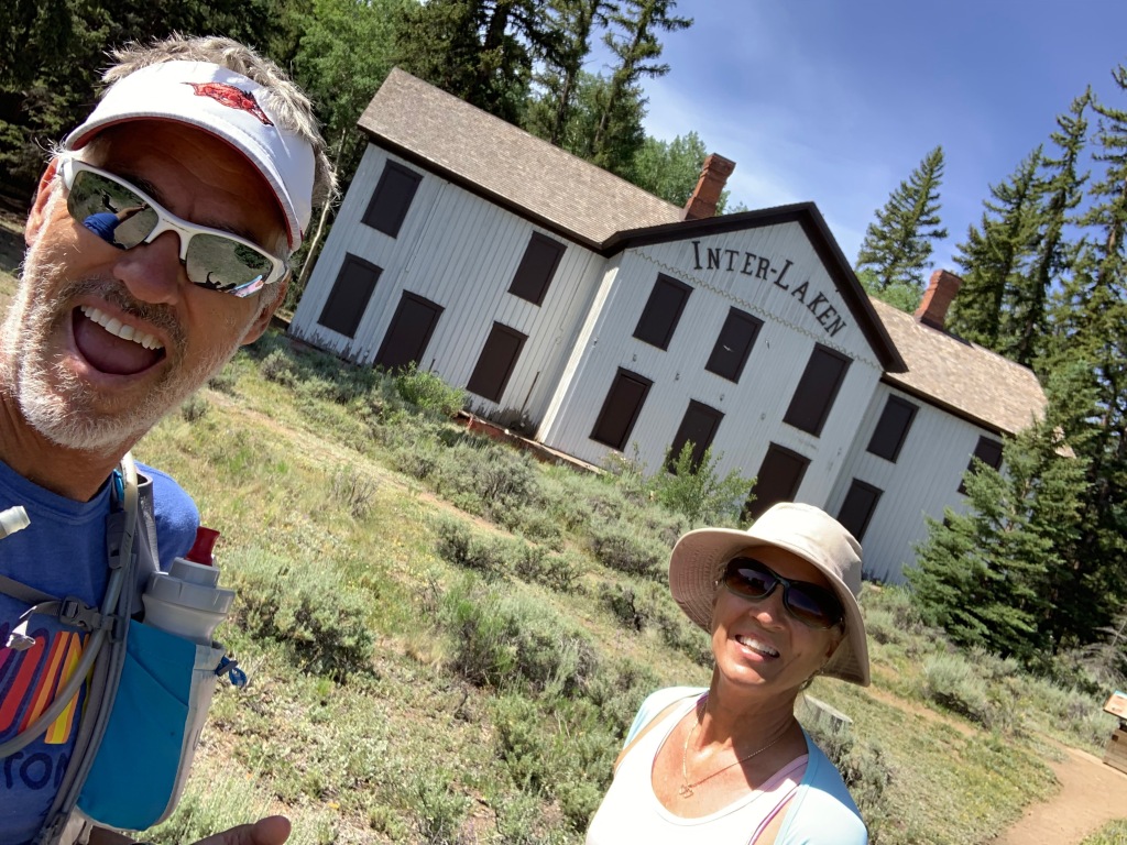
Today you can access Interlaken by hiking trails or boat.
After three days at Lake Creek camping area we jumped in the truck to look for some connectivity and found the most amazing campsite of our 4-½ years on the road.
Twin Lakes View dispersed area is on top of a mountain on the north side of Twin Lakes. There are several areas to camp on this mountain and it’s VERY popular in the summer. Sites are plentiful…if you are small and nimble or tent camping. But larger rigs will find it challenging to find a level, accessible site that isn’t occupied.
The day we were doing recon we took our camping chairs to hold a site in case we found one that would work for our big girl. As luck would have it a camper was packing up in an amazing site. So we left our chairs and raced back to relocate the RV.
WHAT. A. SPOT.
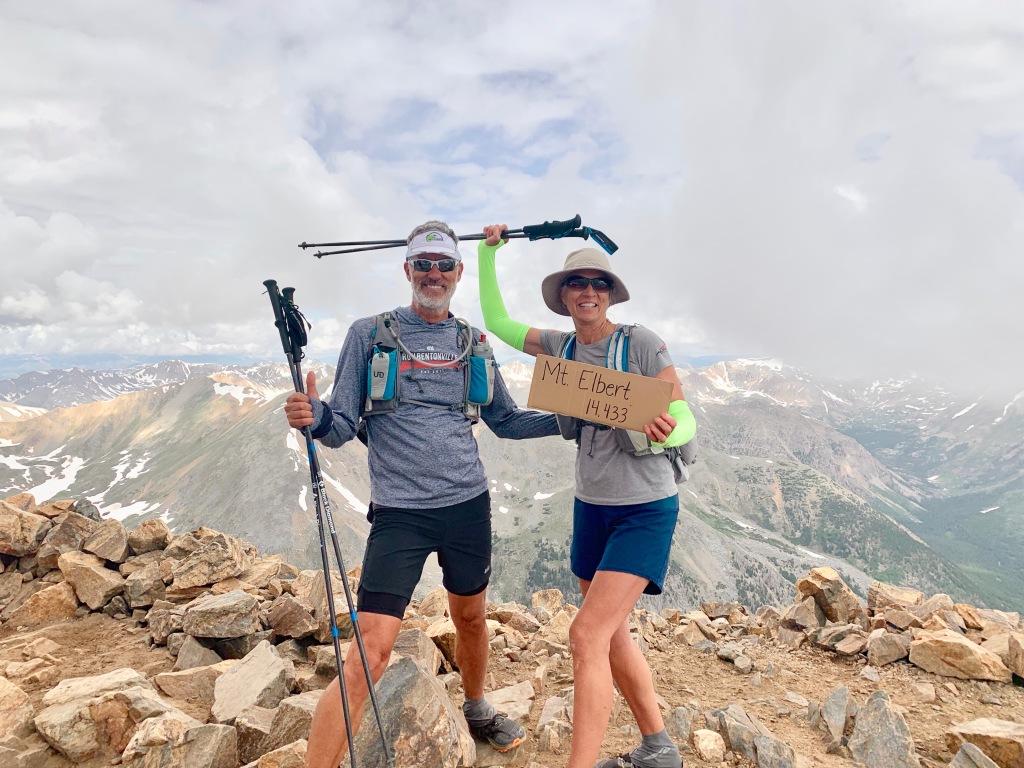
Not only did we have screaming fast Wi-Fi and stunning views, we were at the south trailhead for Mt. Elbert, the highest peak in Colorado.
Mt. Elbert (the second highest peak in the continental US) was on our list of peaks to bag at 14,440’. This strenuous 11-mile round-trip hike starts at 9,800’ and climbs 4,600’ to the summit.
There is parking at the trailhead, but if you have a high clearance 4X4 vehicle you can knock off 2 miles by driving to the “Upper” trailhead.
Getting to the upper trailhead was nerve racking, even in our GMC 2500 diesel 4X4 truck. Especially when we accidentally passed the trailhead taking ourselves about a mile too far down a sloppy, narrow, shear drop-off forestry road. Yikes!
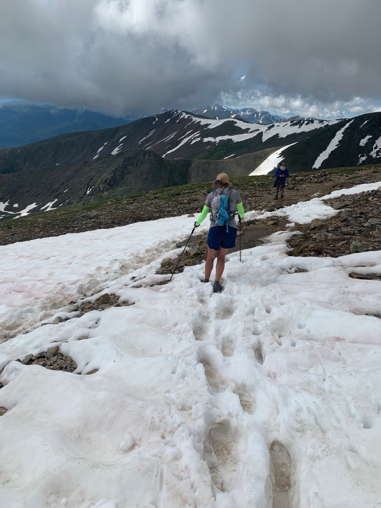
Hiking to Mt Elbert was much more enjoyable that Shavano. The trail was more gradual and less rocky, except for the last mile. Sections were so steep we used our hands in some areas to climb. We crossed snowfields and noticed that new trails are being cut in to make this climb a bit easier.
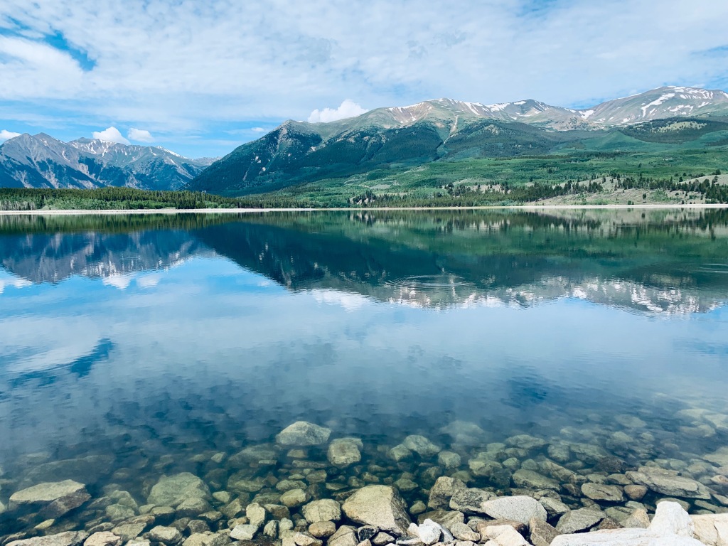
While camped at Twin Lakes we were situated just across the street from Mt Elbert Forebay. There is a lovely level 3-mile trail around the entire reservoir with an eagle’s nest on the southwest shoreline.
We loved everything about this location and can’t wait to get back there next summer!
Leadville, CO (Elevation 10,152’)
As the highest incorporated city in the US, Leadville has a rich past in gold, silver, lead, zinc and molybdenum.
And if mining wasn’t enough it had its share of western characters as well.
Dock Holliday spent his lasts days served as a lawman in Leadville. Buffalo Bill died here of pneumonia. The Unsinkable Molly Brown moved to Leadville at the age of 18 and later survived the sinking of the Titanic. Poker Alice learned to play poker in Leadville and was a sought after dealer that liked smoking cigars while wearing pretty dresses.
Un-like a lot of mining towns out west that experienced boom and bust in the 1,800’s, Leadville actually managed to hang on to mining up until 1983, when the Climax Mine was finally closed.
In an attempt to save the town, the Leadville 100 trail run was started in 1983 to boost tourism.
The LT100 or “Race Across the Sky” has a cult following with thousands of irrational runners applying for 1600-ish slots to run a course with 15,600 feet of elevation change, at elevations ranging from 9,200-12,620 feet.
In most years, fewer than half who start the race actually complete it within the 30-hour time limit.
A LT100 MTB mountain bike race was added in 1994.
We showed up a week before the LT100 with the hopes of pacing our friend and “Leadville Legend”, Marge Hickman. Marge holds the woman’s record for number of Leadville finishes of fourteen.
Since being in Colorado this summer Jeff ran the entire Leadville 100 course in sections to train for his responsibilities as a pacer. But after Marge published a book about the start of this iconic race that differed from the current race director’s recollection, Marge was dismissed from the race.
Not to be deterred, Jeff jumped into the final 25 miles of the race to pace some random strangers and got a small taste of this iconic race.
We absolutely loved the little town of Leadville and it’s sporty vibe. It’s another place we would like to return to in the future.
Lake Tahoe (Elevation: 6,225’)
After Leadville we allowed ourselves 6 weeks to meander to Southern California for our camp host position at Doheny State Beach at Dana Point, CA.
We raced across western Colorado into Utah in the heat of summer, so we opted to stay at RV parks in order to run the air conditioner.
We made a quick stop in Reno to pick up some new Battle Born lithium batteries on our way to northern California to camp for 2 weeks at Jeff’s sisters house. Our plan was to accomplish two things. Install the new batteries and have the fifth wheels axels aligned at All Wheel in Redding CA.
It’s always a joy to stay at Jeff’s sisters, especially since they have plentiful tools, 50amp service, fresh eggs, blueberries and two Airedales.
Once we had our projects done we headed to the South end of Lake Tahoe for the Tahoe 100k.
Last year Jeff competed in this race and missed a cut off, giving him a DNF for the race. He redeemed himself this year completing this race in 17hours.
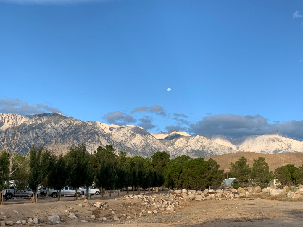
Mt Whitney (14,505’)
Two years ago I had a failed attempted of summiting Mt Whitney, the highest peak in the lower 48 and the highest peak in California.
It was a painful lesson in preparation, especially when I had to turn around within 1 ½ mile of the summit.
Since we were passing through the Alabama hills on our way to SoCal I decided to give this beast another shot…pending my ability to snag a permit.
We had left Tahoe early the next morning after Jeff’s race and put in a long day of driving to Lone Pine, CA. Planning a 4-day stay, I had hoped for a couple days rest in preparation to attempt to summit.
Plan A
I had borrowed a tent from a friend and planned to hike the 22-mile round trip with 6,100’ of elevation gain in two days. The first day start a leisure morning and hike 6-miles to Trail Camp, relax, eat and sleep, then head for the summit early the next morning, turn around and hike all the way back down.
Painful lesson #2 in preparation to summit Mt. Whitney…check your equipment well in advance of said hike!
The awesome lightweight tent I had borrowed only included the rain flap… but no tent. YEP! No tent.
Plan B
Forget the tent and camp out and leave on the hike at 3am to summit in one day. Once I got my brain wrapped around a 13-14hr hike I was all in.
But after checking on-line for a permit our first day in Lone Pine there was only one permit available…as long as I could start my hike by midnight…that night.
Plan C
Drive up to Whitney Portal after dinner, sleep in the truck for a few hours then start my hike at 11:59pm and summit in one day.
Next post…Mt. Whitney. Why do you hate me so?
Life Elevated
Posted by Deb in Full Time RV, Highest Peaks, Hiking, Running, Trail Run, Ultra Running on December 4, 2019

We’ve been bouncing around above 6000’ since May. The warmer the temps the higher we go.
That’s the beauty of living mobile. Too warm, move north or to a higher elevation. Too cold, time to head south and back to sea level.
Las Vegas, NV (Elevation: 2,001’)
We started our spring in Las Vegas for the Mt Charleston Marathon and Half Marathon. Our running group from NW Arkansas was bringing around 100 folks to the event. Since we needed to be in Vegas for the National Hardware Show about that time it only made sense to join in on the fun!

We arrived in Vegas about a week before the event and made a trip out to Red Rock Canyon for a training run. We’ve never been fans of Las Vegas, but the Red Rock Canyon could certainly change our minds. Spectacular red canyon views, safe roads for cycling and tons of trails to hike or run. It is certainly a special place!

Red Rock Canyon
The Mt Charleston race was a fun but very hot race. What made this event enjoyable was the route was completely downhill.
Busses transported us up to Mt Charleston in the wee hours of the morning. Temps were cold when we started. But by the time we crossed the finish line people were dropping like flies from the heat. So many people needed medical help that the race has now been moved a week or two earlier to try to avoid another disaster.

Mt Charleston Marathon and Half Marathon
Williams, AZ (Elevation: 6,700’)
As the temperatures were already getting into the 90’s in Vegas we moved to Williams, AZ. We had a week until we needed to be in Flagstaff for Overland West Expo, so we picked a new BLM site to kill some time.
Big open meadows to camp and plenty of trails for running, all within a few miles of the quaint little town of Williams.

Another trip down into the Big Ditch
Williams is on Historic Route 66 and is considered the Gateway to The Grand Canyon and houses the southernmost terminus of the Grand Canyon Railway. Williams was considered the last holdout for Hwy 40 to bypass Route 66.
We made a quick trip to the Grand Canyon for Easter Sunday sunrise service and stuck around for breakfast at the Bright Angel Lodge. The Grand Canyon is always special no matter how many times we have been there.
Farmington, NM (Elevation: 5,393’)
After Williams and Flagstaff, we decided to move on to New Mexico. We haven’t spent time here, except to get from Arkansas to Arizona. We kept hearing about a BLM campground in Farmington, NM that just opened.
We thought we were beyond frigid temperatures, but the closer we got to Farmington the more unsettled the weather. Rain turned to sleet and snow and when we turned onto the dirt road for our final 3 miles to the campground, we were not sure we could make it. Thank goodness for 4-wheel drive, because without it we never would have made it to the muddy dirt road to Brown Springs OHV Recreation Area.
As we pulled in we were greeted by 4 of our fellow Xscapers RV Club members. Not knowing they were there, it was a nice surprise to see them! One thing we have learned after 4 years of full-timing, we usually run into someone we know.
We had a cold and rainy start to our stay, but the clouds moved out and the temperature rose over our 14-day stay.

Snowy start to our stay
This first come first serve campground is completely free with 11 designated campsites and pit toilet, but no hookups or dump station. Each site was beautifully landscaped with fire pit and covered picnic tables. The grand opening of the campground was the week before and only filled up over the weekends.

Beautiful large campsite
There are OHV trails all over this place and we enjoyed trail running to our heart’s content. One downside was the OHV activity, especially over the weekends, which brought in a ton of loud folks who didn’t feel it necessary to pick up their trash. Every trail run we went on we picked up as much trash as we could carry. Mostly alcohol bottles and cans littered the trails. Occasionally responsible adults threw out the kid’s juice bottles too. You want to start them young, right?

Tons of hiking right from the campsite
If you make it to Farmington be sure to plan a trip to Bisti/De-Na-Zin Wilderness Area 50 miles south, also known as the Bisti Badlands.
The unique landscape looks alien in nature, and is like nothing we have ever seen. We saw fossils, hoodoos, petrified wood, dried lake beds and the famous “cracked eggs”. It’s definitely worth a day trip to explore this expansive area accessible only on foot!

Cracked Eggs


Taos, NM (Elevation: 6,969’)
After Farmington, we moved on to Taos, NM. Taos is a charming little town with a rich history of conquests, revolts, raids, treaties, and wars. Finally becoming a US territory in 1850 and a state in 1912 it is now home to a booming art community.
We took a trip to the Rio Grand River Gorge that carves an amazing canyon into its flat landscape just west of town. Little specks of rafters could be seen from the top.

Rio Grand River Gorge
Crossing over the Gorge we also toured the eco/self-sustaining community called The Earthship Biotecture. They specialize in solar, water catchment and recycling and walls made of dirt-filled tires and glass bottles. Water was first captured from rain and snowmelt to be used from showers and washing dishes. This wastewater was then used to flush toilets then filtered to provide water for drip irrigation systems in greenhouses to water plants and vegetables.
It was an impressive, completely sustainable community.

The Earthship community
While in Taos we planned on hiking the highest peak in NM, Wheeler Peak at 13,159’. But inquiring at the local Outdoor store, we learned the Wheeler Peak was still covered in late season snow. Instead, we opted for the more elevation friendly Devisadero Loop Tail just on the edge of town. It was an easy 5.7-mile loop and had beautiful views of Taos.

Devisadero Loop Tail
While in Taos we stayed at the quaint Hotel Luna Mystica. Hotel Luna is actually a vintage RV rental “hotel” with a dirt parking lot in back for dry RV and tent camping. There is room for a good 100+ RV’s so they do not take reservations. Reservations are required for vintage RV rentals.
Be sure to check out the brewery next-door at the “mothership” where they serve up great food!

Hotel Luna Mystica vintage rentals
Mosca, CO (Elevation: 7,559’)
Mosca contains the highest sand dunes in North America, The Great Sand Dunes. The Great Sand Dunes became a National Park in 2004.


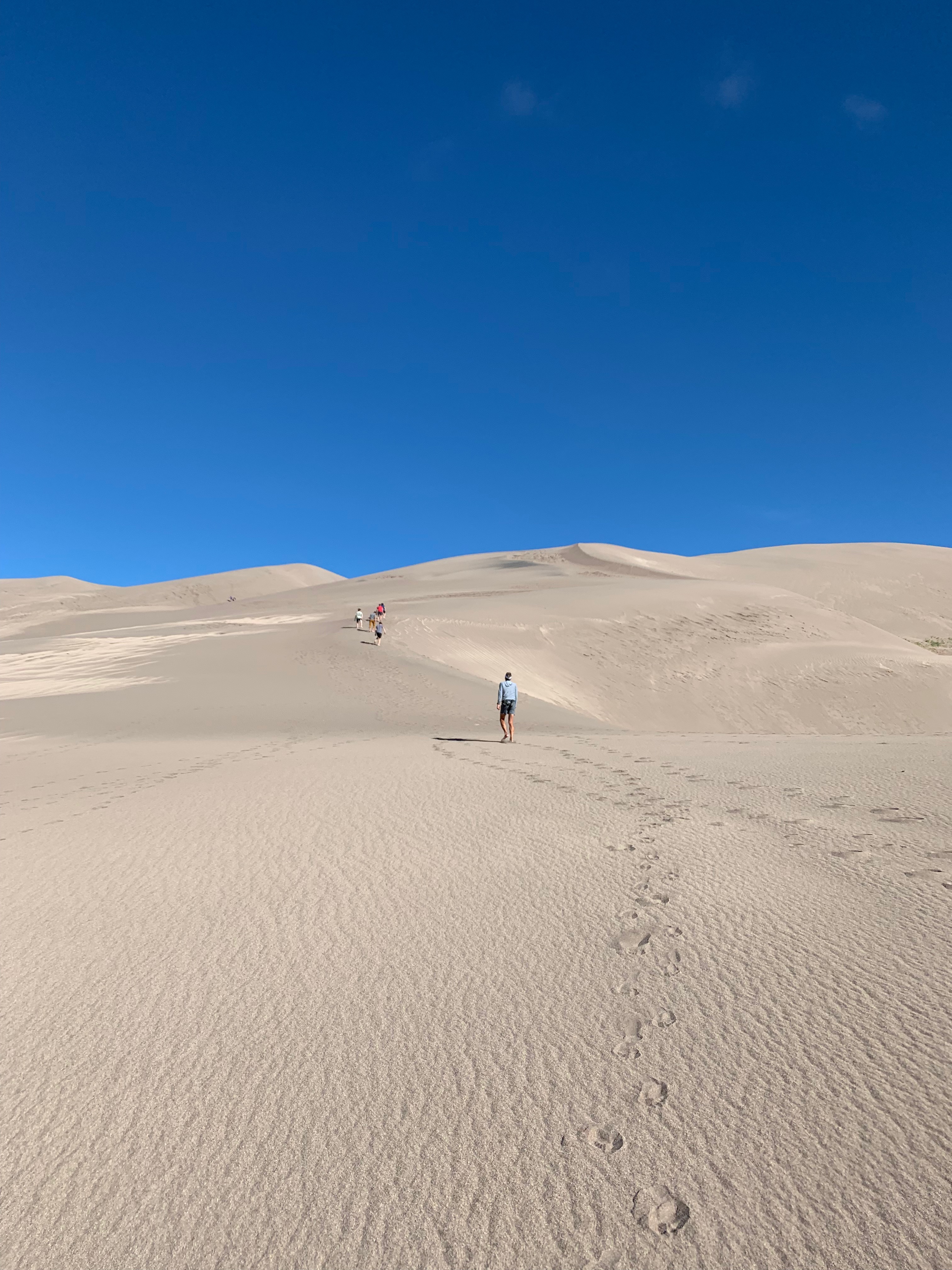
The dune is a fascinating ecosystem of recycled sand that gets kicked up by high southwesterly winds that push sand up east against the Sangre de Cristo Mountains. During storms, the wind shifts in the opposite direction pushing the sand back west. This back and forth forces the sand upward, creating the dunes. It’s suggested that there really isn’t any “new” sand, just the same old sand being pushed around by the wind.
Medano Creek runs at the base of the dunes and is used as a “beach” by the locals. While there, we saw hundreds of families set up beach toys and pop-up tents to spend the day at the creek. It’s very shallow but can run strong and cold. You can rent sandboards and sleds at the visitor center for sand surfing and sledding.

The Beach
Another worthwhile side hike is to Zapata Falls. This 30′ waterfall flows into a narrow crevasse south of Great Sand Dunes National Park. Depending on where you park it’s either a short .4-mile up to 4-mile hike to the falls with the last 400′ through freezing cold water. Take a hiking pole for stability in the water and prepare for the biggest brain freeze you’ve ever experienced!


Brain freeze!

We could only see a small portion of the falls
The falls are not completely visible from…well anywhere. Even after hiking through the creeks to the base of the falls we could only see the small bottom portion. A bit disappointing but still glad we did it.
Buena Vista, CO (Elevation: 7,965’)
We made a stopover in Buena Vista CO on our way to Denver for the Outdoor Retail Show. From the moment we rolled into “BV” (as the locals say) we were in L.O.V.E. Getting its start from rich agriculture and mining, BV is a flourishing summer tourist destination on the Arkansas River Headwaters.

The Arkansas River in Colorado

The Midland Trail along the Midland Railroad rails to trails
Many of the downtown buildings date back to the 1880-1890s, giving this town an amazing sense of history and resilience. Right from downtown, you have miles of mountain biking and hiking trails along the Arkansas River. And the river offers kayaking, white water rafting, and paddleboarding.
After running the Midland Trail, the old Midland Railroad line, we had an amazing lunch at the Simple Café downtown.

Adorable Buena Vista from the Midland Trail
After studying the very expensive house market we decided that we might plan to spend 3 months here next summer at one of the local RV parks. Monthly RV Park rates average about $500-700/month, much cheaper than rent or mortgage payment in this pricey little mountain town.
Salida, CO (Elevation: 7,083’)
After a week’s stay at Bear Creek County Park in Denver, we headed back through BV on our way to Salida. We were attending the Xscapers 4thof July Convergence. Salida is another neat little Colorado mountain town with all the charm that comes with the wild west of the 1880s.

Xscaper shenanigans in the Salida 4th of July parade

Downtown Salida
After the convergence at the Chaffee Fairgrounds, we moved 5 miles down the road to the Shavano BLM area. Once relocated we used this location to bag our first two Colorado 14’ers…Mt. Shavano (14,231’) and Tabeguache Peak (14,162’).

Our beautiful forestry campsite
This was a brutal Class 2, 12-mile round trip with 5,600 feet elevation gain that took us 9 hours to complete. Tabeguache Peak is only accessible via Mt. Shavano, so if you are going to do one you might as well do both.

The trail to these two peaks is a relentless steep uphill battle that gets no reprieve what so ever. No flat strolls through pretty little meadows. No rollers for a bit of recovery. No switchbacks to easy the steep grade. Just straight uphill…for 5 long hours. The final approach to both mountains are scrambling over bolder fields with no definitive trail and patches of snow.
But as tough as the uphill slog was, the downhill was just as painful, slow and rocky. It was a long day and I’m glad to be in enough shape to decide on any given day to hike a 14’er!
Next up, Mt Elbert, the highest peak in Colorado.
Camp Hosting…Not for the Faint of Heart
Posted by Deb in California, Full Time RV, Running, RV Parks, Trail Run, Ultra Running on June 28, 2019
After meeting the Doheny State Beach park ranger last spring, Jeff and I committed to camp host for 3 months on the beach at Dana Point, CA.
Doheny State Beach is California’s very first state beach. It was named after oil tycoon Edward L. Doheny who donated 41 acres for public use on May 31, 1931. An additional 21 acres was later added by acquisitions from the Santa Fe Railroad, University of California and the Union Oil Company.
It was interesting to learn that Edward Doheny drilled the first successful oil well in the Los Angeles City Oil Field in 1892 that set off a petroleum boom in Southern CA.
After selling off his California oil properties, he was the first to drill for oil in Mexico and opened new oil fields in Venezuela.
He was later implicated in the Teapot Dome Scandal in the 1920’s, being accused of offering a $100k bribe gift to US secretary of Interior in connection with obtaining a lease of 32,000 acres of government-owned land. The 2007 film There Will Be Blood is loosely based on Edward Doheny.
This is our first experience camp hosting and we where set to make the most of our free coastal living in exchange for 15-20hr of “work” each week.
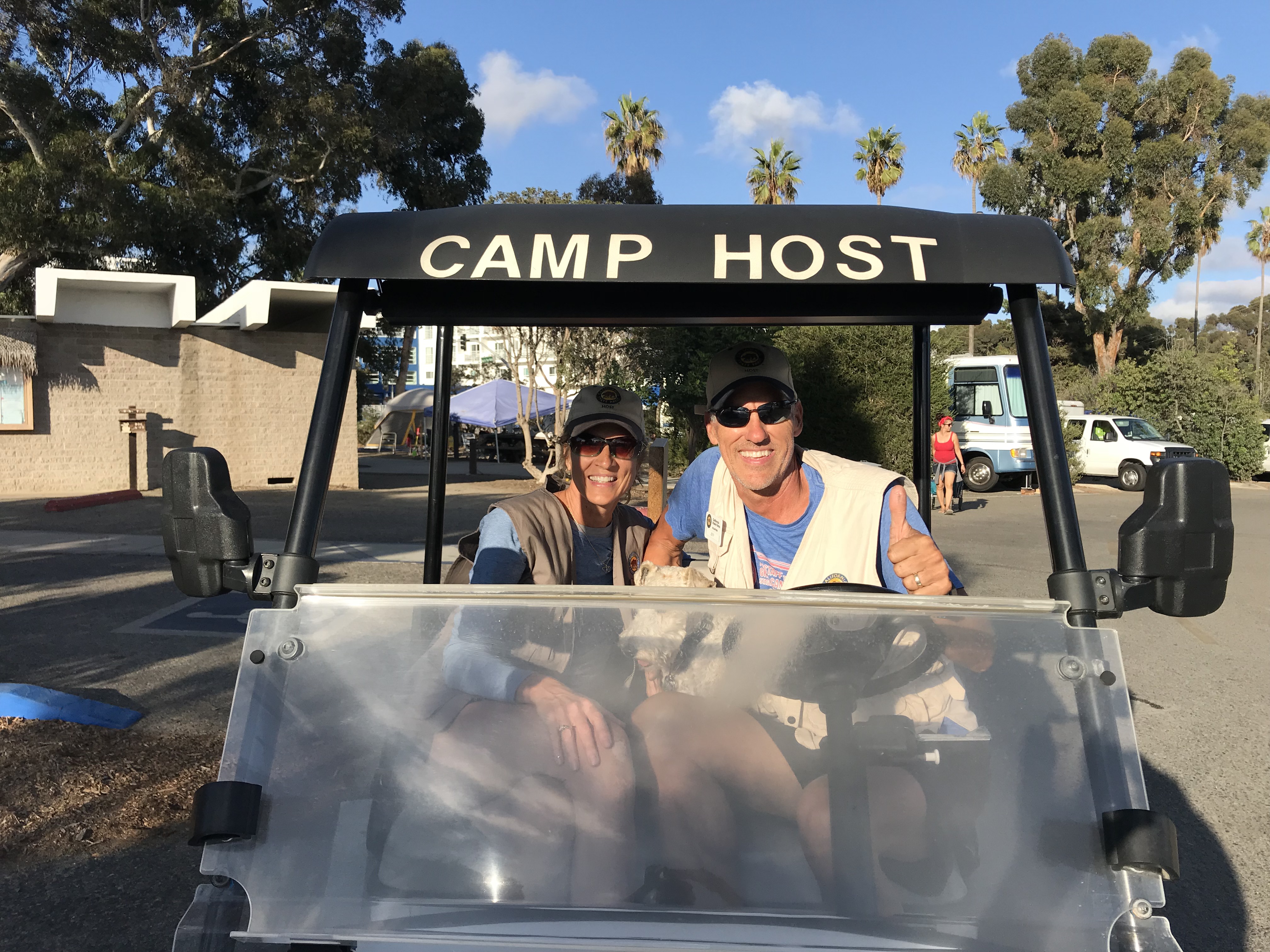
For those not familiar with Camp Hosting, RV parks, campgrounds and National Parks will offer a free campsite (usually with full hookups) in exchange for 15-20hrs/week of volunteer work. It’s a great benefit to the campgrounds to have camp hosts on site to monitor the comings and goings of campers and to help with grounds keeping, bathroom maintenance and selling of firewood.
It’s a win-win for both parties as it offers us full timers an opportunity to give back, have purpose and camp for free while providing the parks with much needed help.
Each campground has it’s own agreements with hosts with different expectations/responsibilities and length of stay. So understanding your roll prior to committing is quite important to having a positive experience.
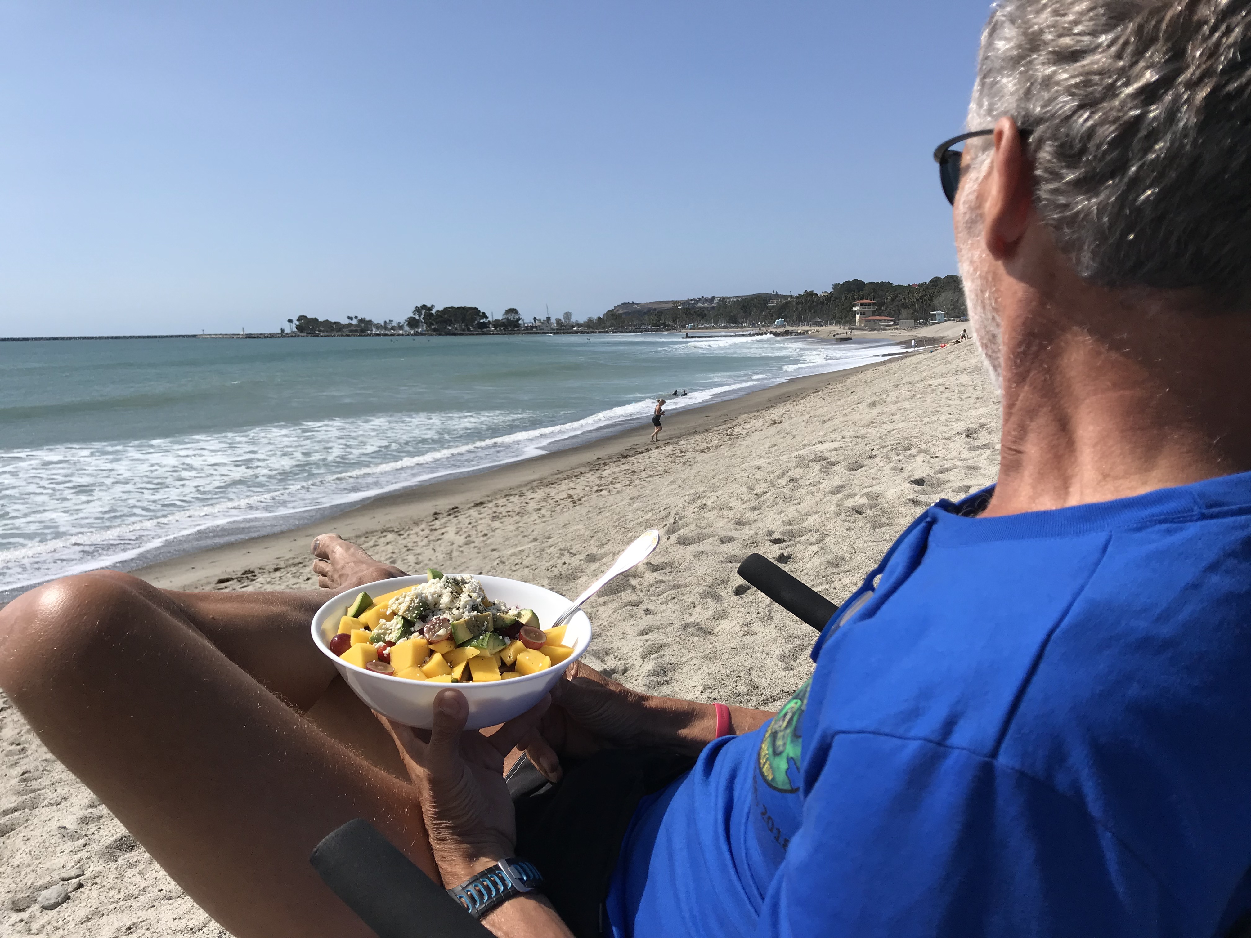
Beachside lunch
The reason we decided to make Doheny State Beach as our first experience was because it did not require cleaning of bathrooms or campsites, the campground is directly on the beach and it only required a 3-month commitment.
We showed up at Doheny a few days prior to our first day of work and did some training with the departing camp hosts.
Up at 5am to retrieve the camper log from the ranger station ½ mile from the campground with the provided golf cart. Drive around the campground to check registrations of campers, make stops around the shower houses, write up warnings to offending campers who string cloths lines from bushes or park in the landscaping. Then return the log back to the ranger station.
At 8am do a quick loop through the campground to remind campers that generator hours don’t start until 10am.
At noon it’s another trip around the campground to get those checking out to move along so that sites can be cleaned by staff before new campers start moving in about 1pm.
From 3-4pm we do an occasional loop to sell firewood for $7/bundle. We keep our RV door open until 8pm and make one more trip to remind folks that generator hours are over at 8pm before calling it a night.
We manage the campground with 1 other camp host couple and worked 2 days on/2 days off/3 days on. The following week we are 2 days off/2 days on/3 days off. That way we were off every other weekend. All hosts are flexible and if we needed a day off or just even a round covered, the other hosts were always willing to cover for us and us for them.
Easy peasy right?
So here is what really happens…
5AM while scanning the showers, if a door is closed and locked it usually means there is a homeless dude or meth-head encamped in the private confines of a shower stall. Whether they have chosen to take a sh*t in said shower stall is always the mystery when the ranger shows up to remove said homeless dude.
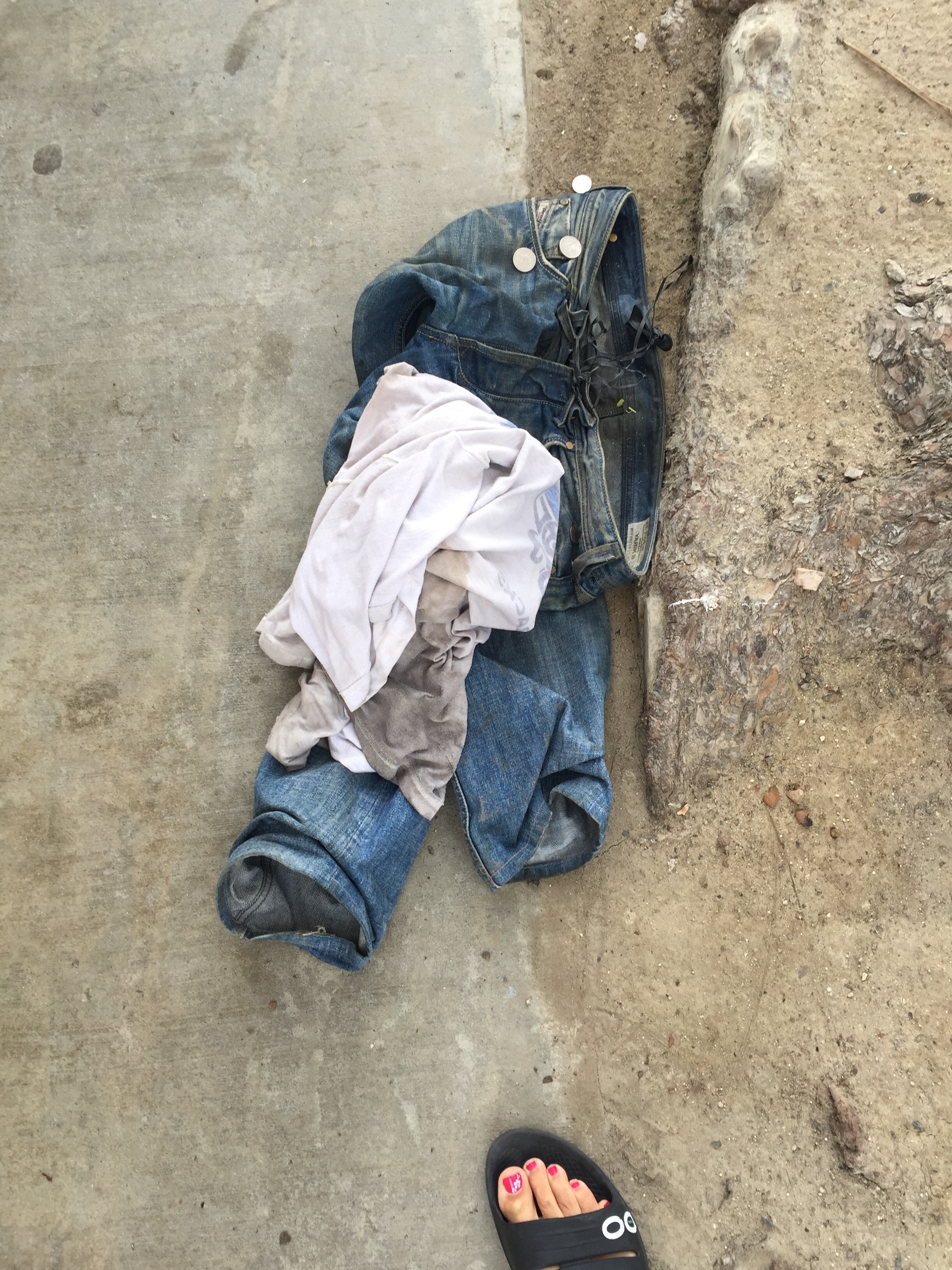
Removed these leftover with a stick and made $.55 in the process
Place “friendly reminders” on windshields of those who showed up after hours that they must report to the kiosk to get their tags. Some are legitimate campers with reservations. Others are trying to camp for free by showing up late and leaving early. The ranger issues tickets to offending parties.
8AM we get to delay camper’s consumption of coffee by having them turn off their generators until 10AM. You can imagine how that is received.
Usually between 12-3pm we escort more homeless folks out of the campground who are trying to use the showers, toilets or picking aluminum out of the trash cans or are simply trying to walk off with campers bicycles, cell phones and wallets.
Occasionally we call the rangers on non-camper interactions that involve drug use and/or mental health crazy talk. Excuses for their presence is usually brushed off as they are there to “see a friend” or “a photographer taking family pictures” all the while walking off with someones generator with the extension cord dragging behind.
We’ve also dealt with groups of homeless folks that get one campsite then invite 14 of their friends for late night raves. According to the rangers, there is nothing that can be done since they paid for a campsite.
And when you confront non-campers they usually excuse their poor behavior by saying they are a veteran, saying they are helping veterans or give you a hardy, “God bless you”.
Luckily we only had two midnight knocks on our door that involved loud music. And another incident that involved a car egging after a large group of noisy campers ticked off their neighbors. According to the large group their music was “barely audible”.
I’m not going to lie. The first couple of weeks were a challenge seeing the overt drug use and mental health issues that this campground is surrounded by. But after that we developed quite a sense of humor about it all and realized that MOST people were opportunists rather than physical threats.
Despite some of the riff raff, we met a lot of great campers and got to spend a season living on the coast of California…for free.
Would we do it again?
We committed going back in October!
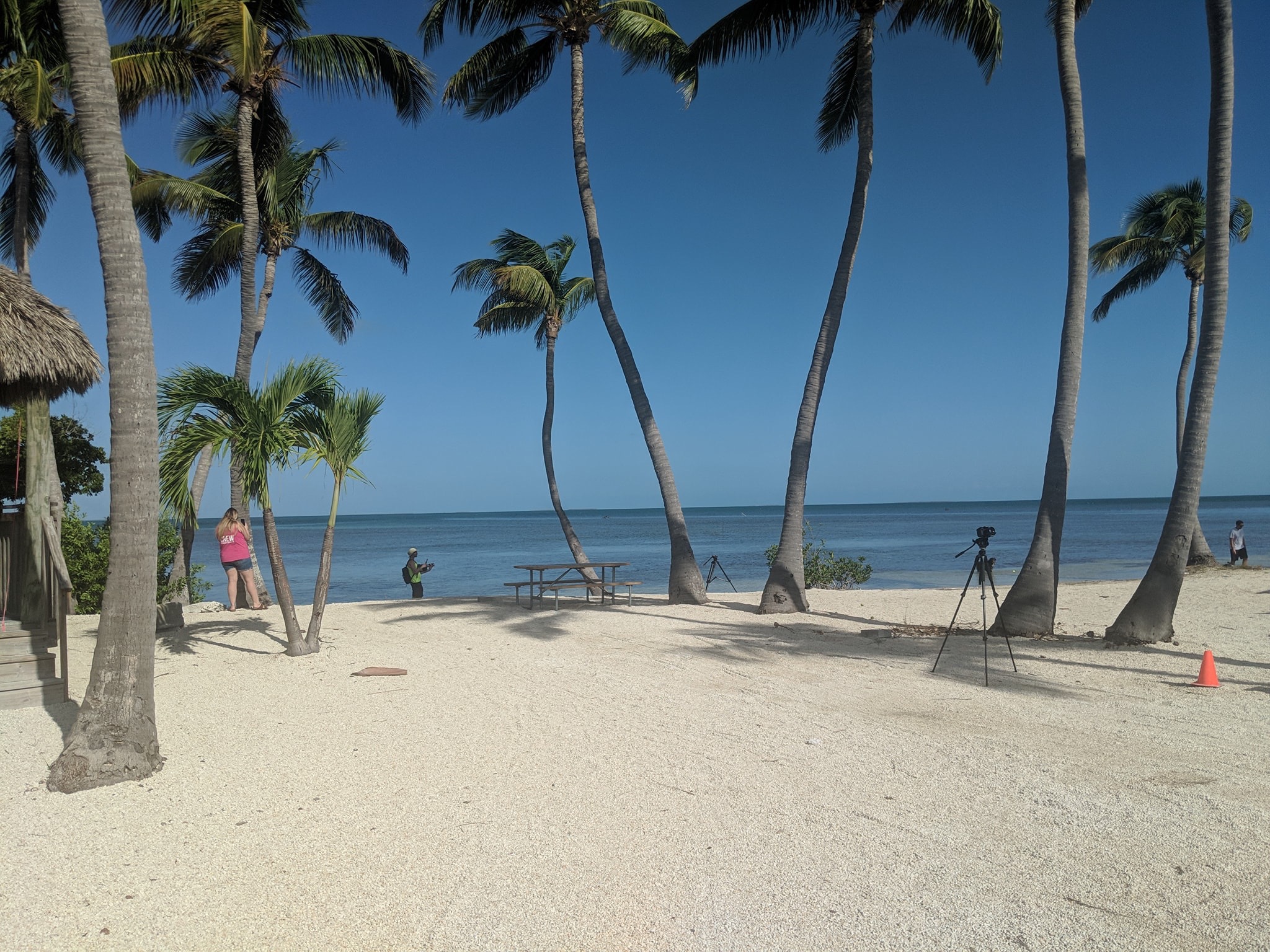
Doheny State Beach is located in the wonderful community of Dana Point. Within walking distance we had nice restaurants, grocery shopping and the Pacific Coast Trail to run and cycle.
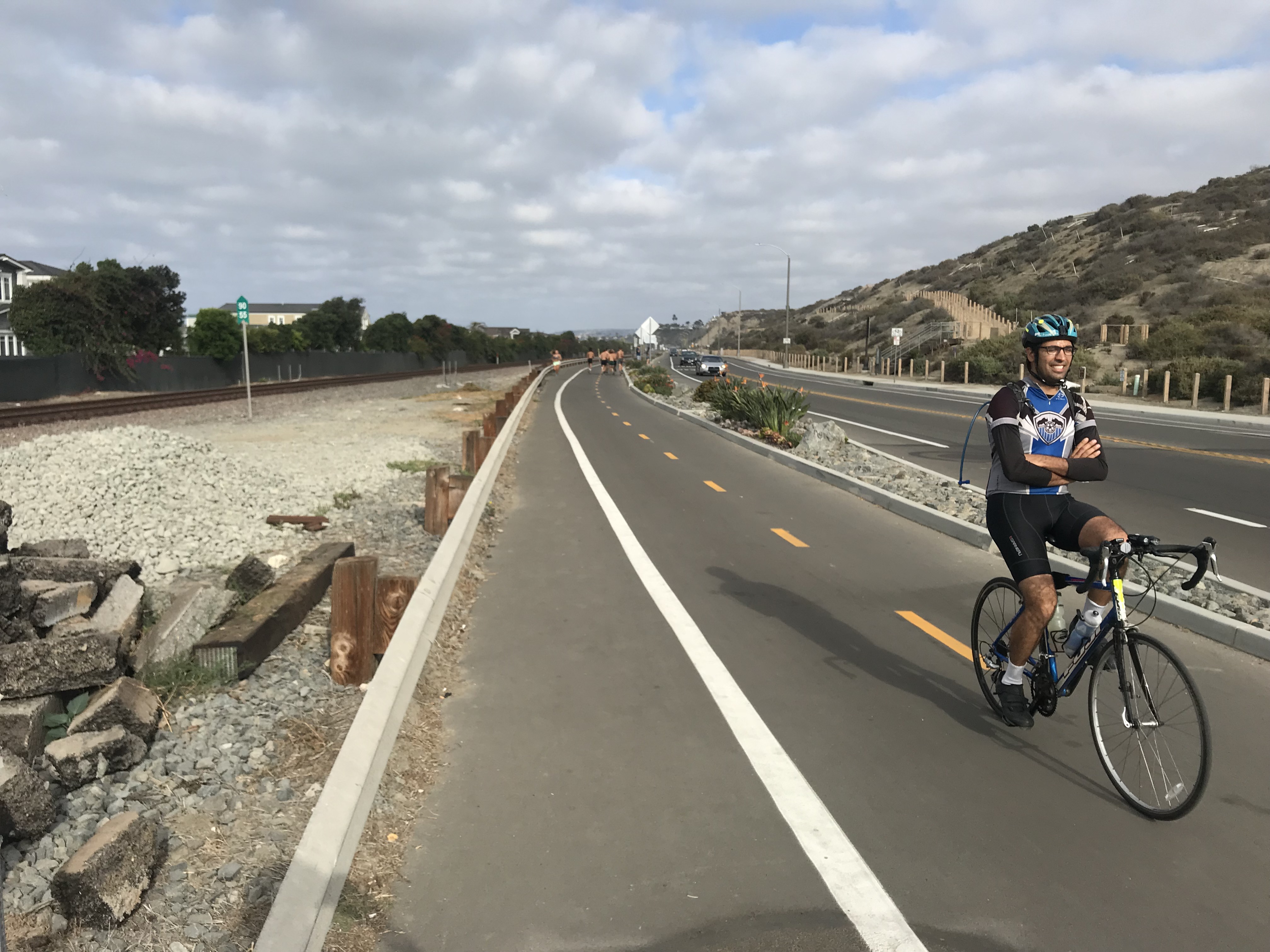
Pacific Coast Trail
Paddle Games
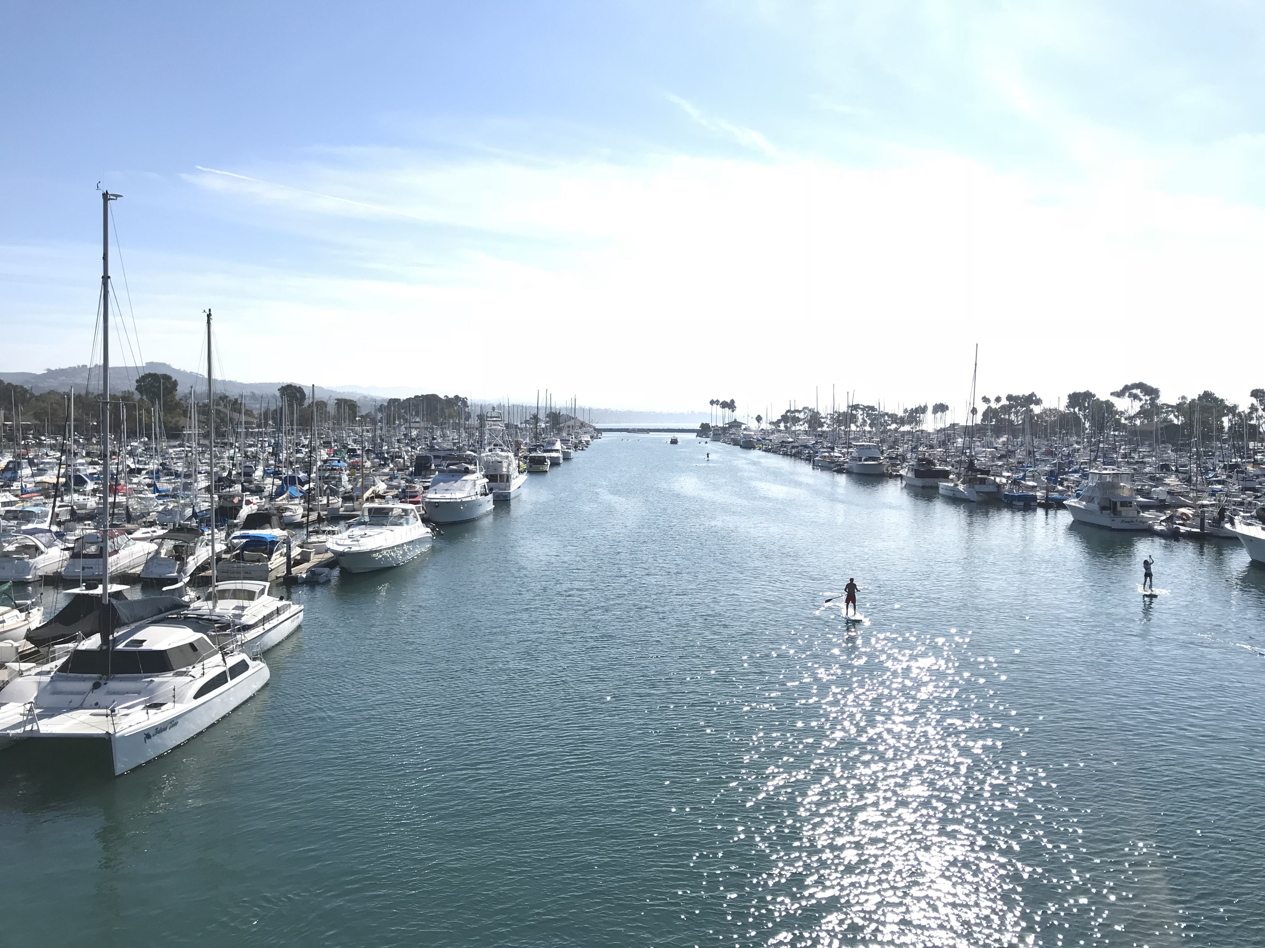
Dana Point Marina
It was a great location for the 10K Spooktacular Halloween run, 10K Turkey trot Thanksgiving Day run, the Cuyamaca 100k trail run and the Glamis Sand Dunes Veterans Day clean up.
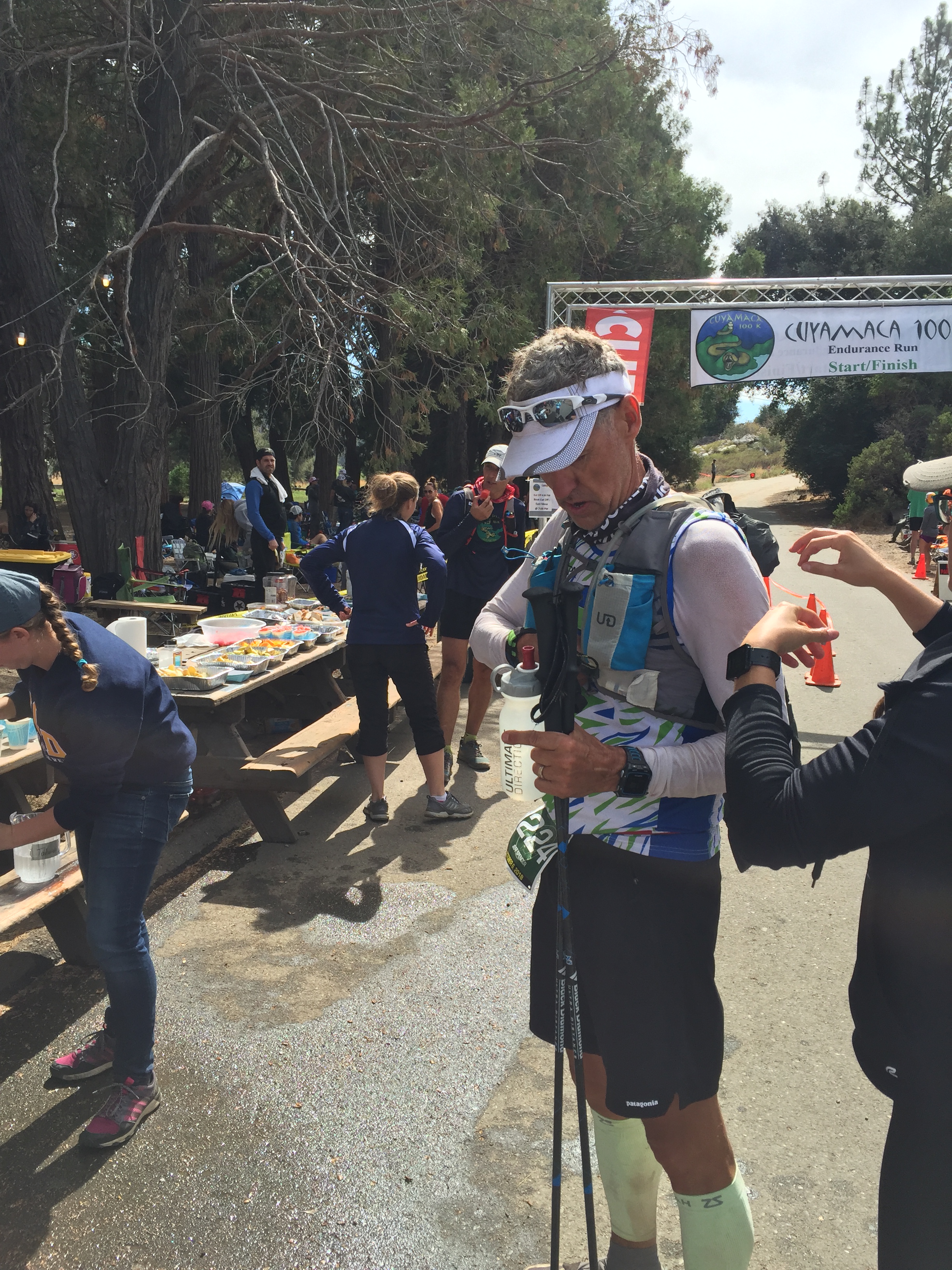
Cuyamaca 100K
We also drove to Newport Beach for the famous Christmas boat parade and took a trip to San Diego to have Thanksgiving dinner with some RV buddies.
Overall we really enjoyed spending fall/winter in shorts and t-shirts in southern California and look forward to returning to the coast in October.
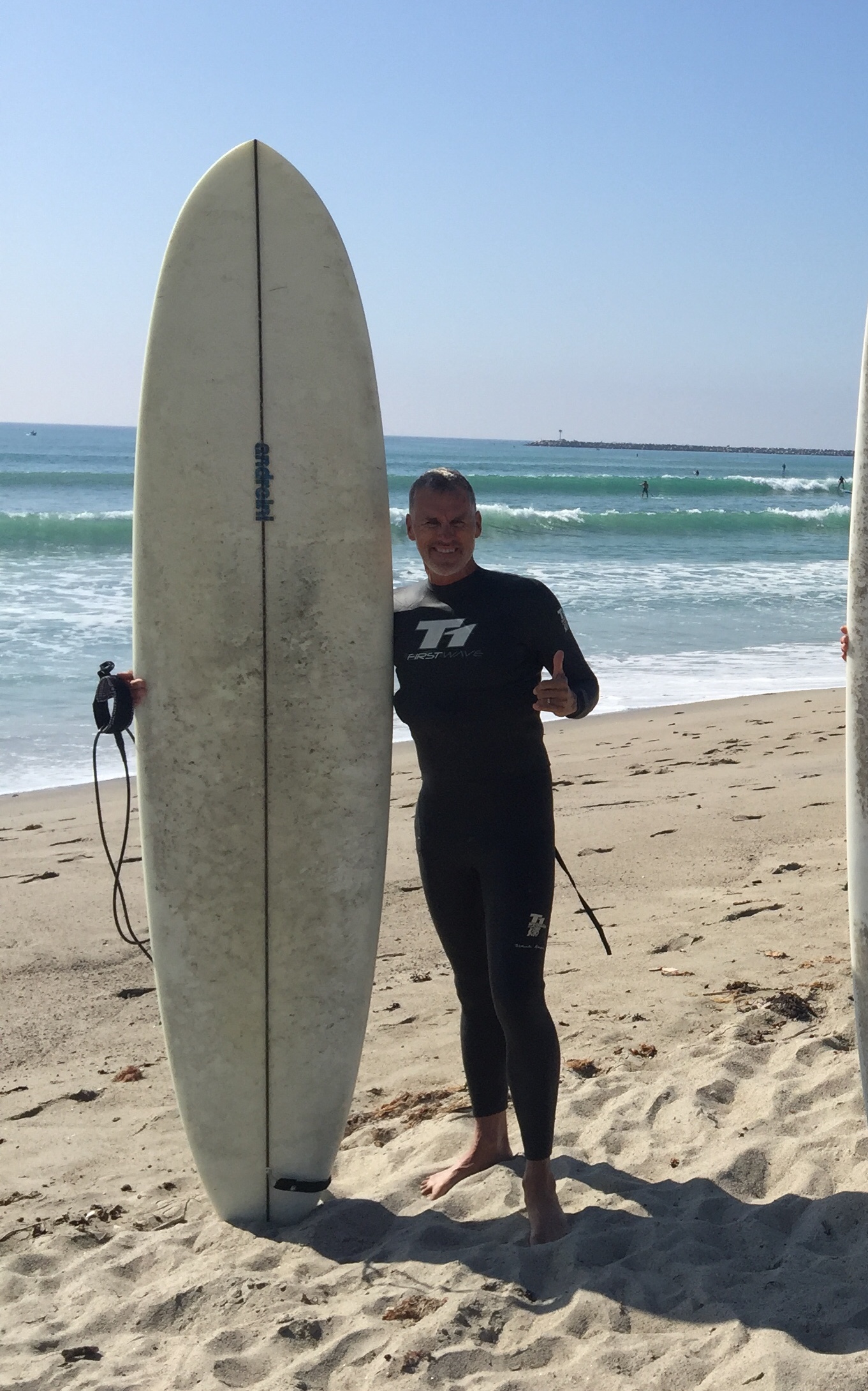
Surfer Jeff
Trail Running…What’s not to Love?
Posted by Deb in Full Time RV, Hiking, Running, Trail Run, Ultra Running on December 28, 2018
Running can sometimes be mundane. Especially when it is confined to concrete, stop signs and busy streets. But when you take running to the trails everything changes.
Changing scenery. Adventure and exploration of surroundings. Sights, sounds and smells of the wilderness. The crunch of dirt under your feet. AHHHHH!
Trail running requires an ever presence of mind and focus. One drifting thought about a work project can land you flat on your face with dirt permanently embedded in your palms.
I have scars to prove my love of the trails…each one has been totally worth it!
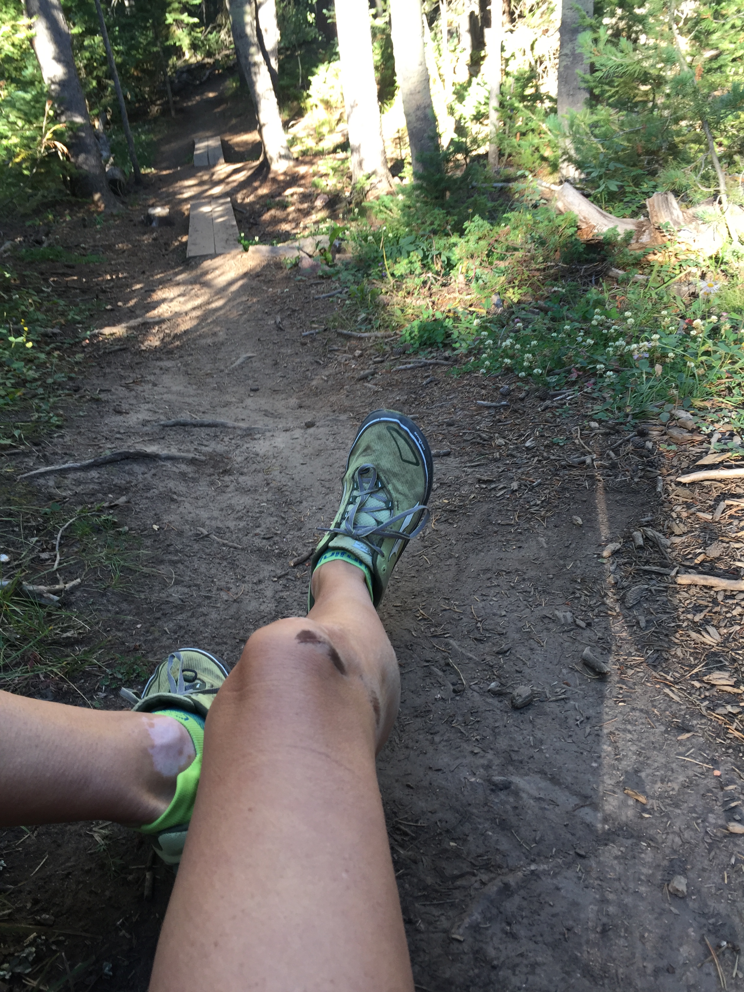
Man down…just another day in the park!
PINNACLES NATIONAL PARK
Jeff and I spent a month in Hollister, CA while having an upgrade to our holding tank valves. I saw a sign on the highway for Pinnacles National Park. Doing some research I discovered that PNP is the second newest National Park made so in 2012. (The newest being the St Louis Gateway Arch in 2018)
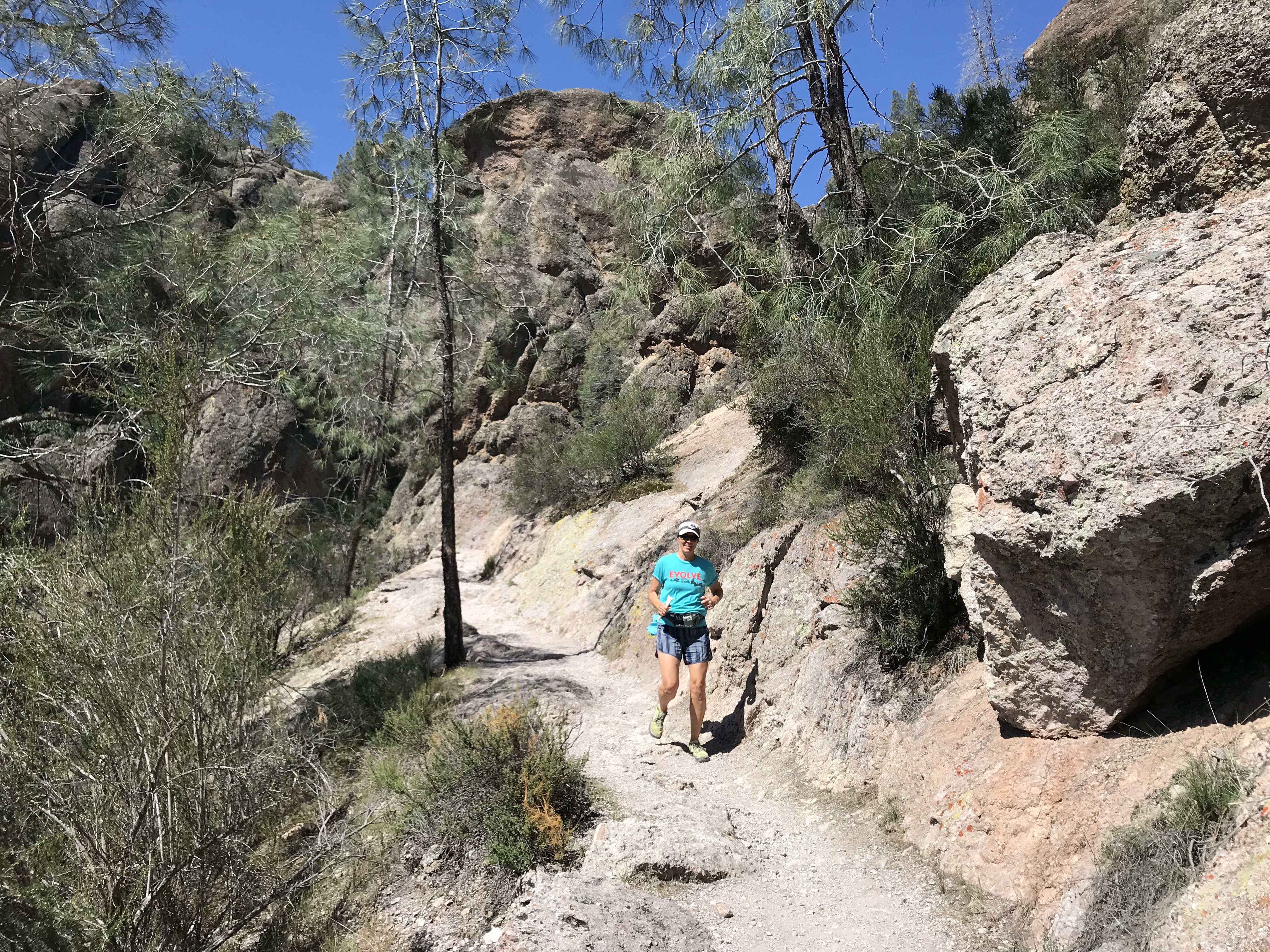
The Pinnacles are the remnants of the western half of an extinct volcano along the San Andreas Fault. It offers 30 miles of trails, pinnacles for rock climbers and is home to 13 species of bats, prairie falcons and is a release site for California condors that have hatched in captivity.
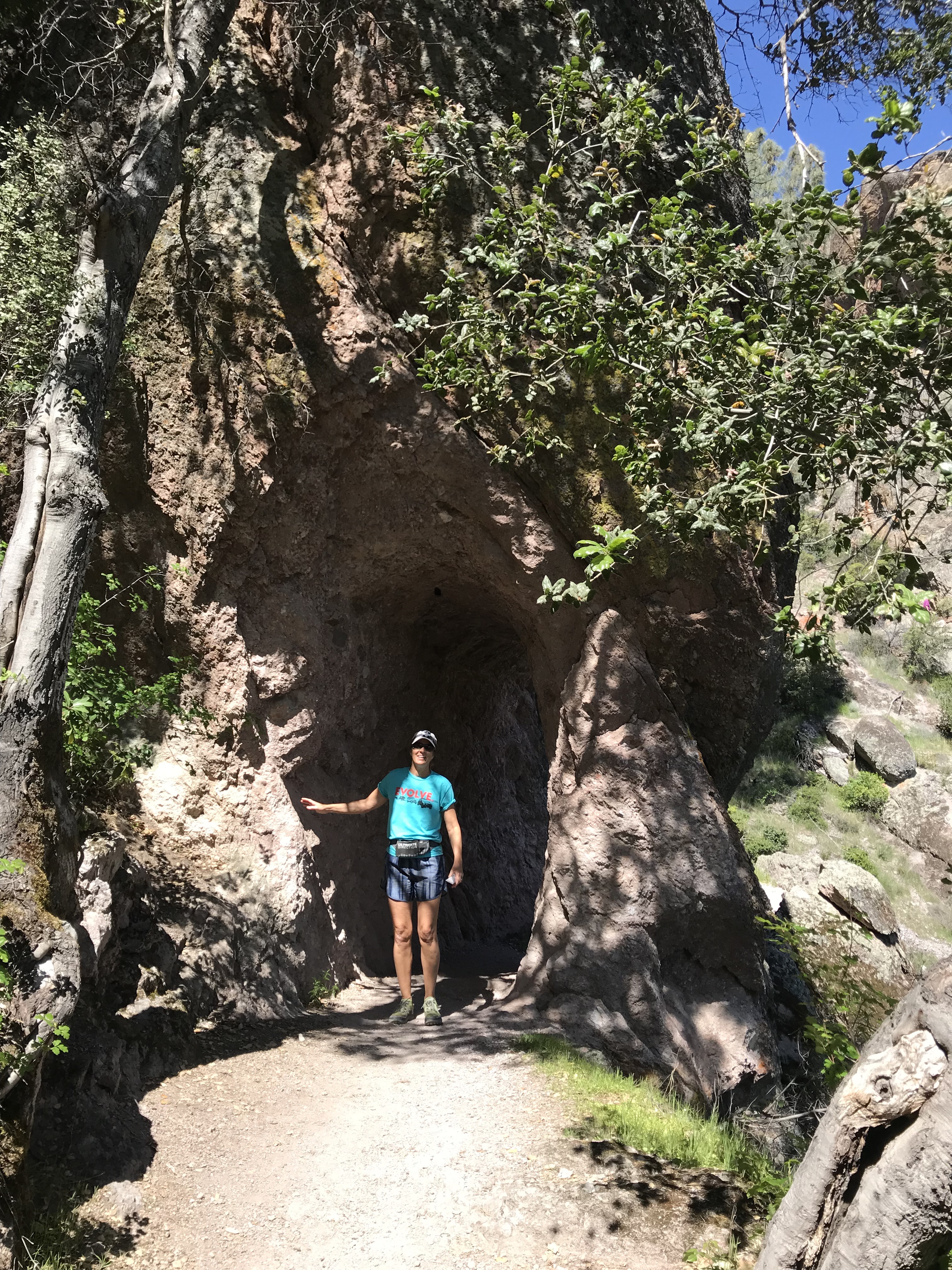
We started early as usual to avoid crowds and found the last parking spot at the Condor Gulch trailhead. We wanted to do a loop that took in the Bear Gulch Cave Trail. Starting on the Condor Gulch Trail we headed west on High Peaks Trail. Then we jumped on Tunnel Trail, Juniper Canyon and then back on the High Peaks Trail. This was a little over 5 miles.
This was a wonderful route with lots of diverse landscape. We were looking forward to exploring some tunnels and caves. But the tunnels were super short and we managed to miss Bear Gulch Cave completely. It was still totally worth the effort.
When we got back to the parking lot the traffic coming into the park was backed up for a couple miles. The parking situation did not hold up to the popularity of this place and rangers would not allow traffic to progress forward until someone left. So if you go to Pinnacles go early or on a weekday!
HENRY W. COE STATE PARK Hollister, CA
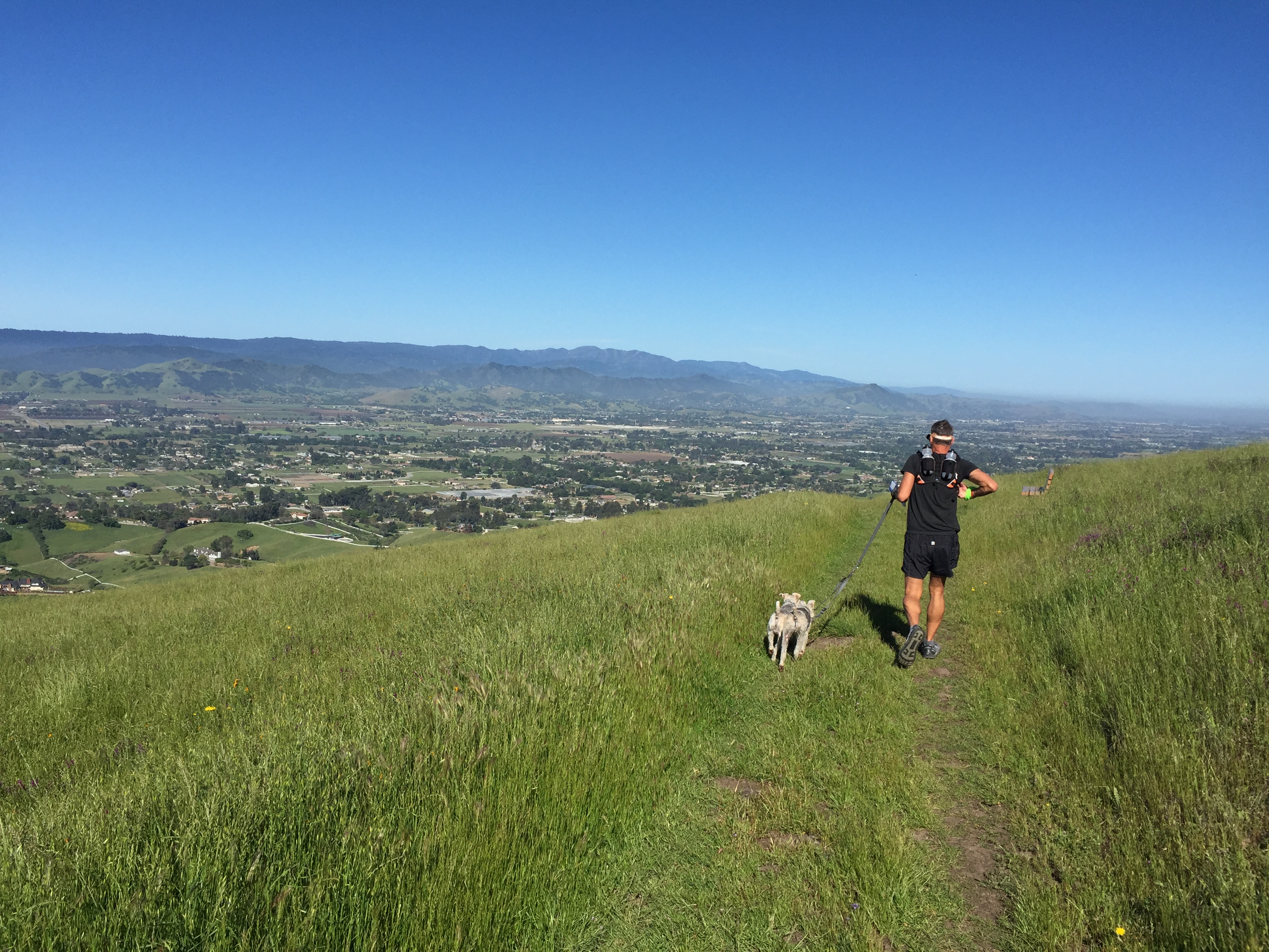
Another great trail running area near Hollister is the Henry W. Coe State Park. The trails are smooth with just enough hills to get the heart pumping. The park contains over 87,000 acres of rolling pastures for free range cattle to roam. With 200 miles of dirt roads and trails, it’s an outdoor paradise for hikers, runners and mountain bikers.
The stubborn cattle that tend to claim these trails can be a bit intimidating. As a chiropractor in the Midwest, I’ve seen my fair share of injured farmers that had been trampled by temperamental bovine…and it wasn’t pretty. But if you yell loud enough and wave your arms like a crazy person they slowly moved on.
The Katy Trail
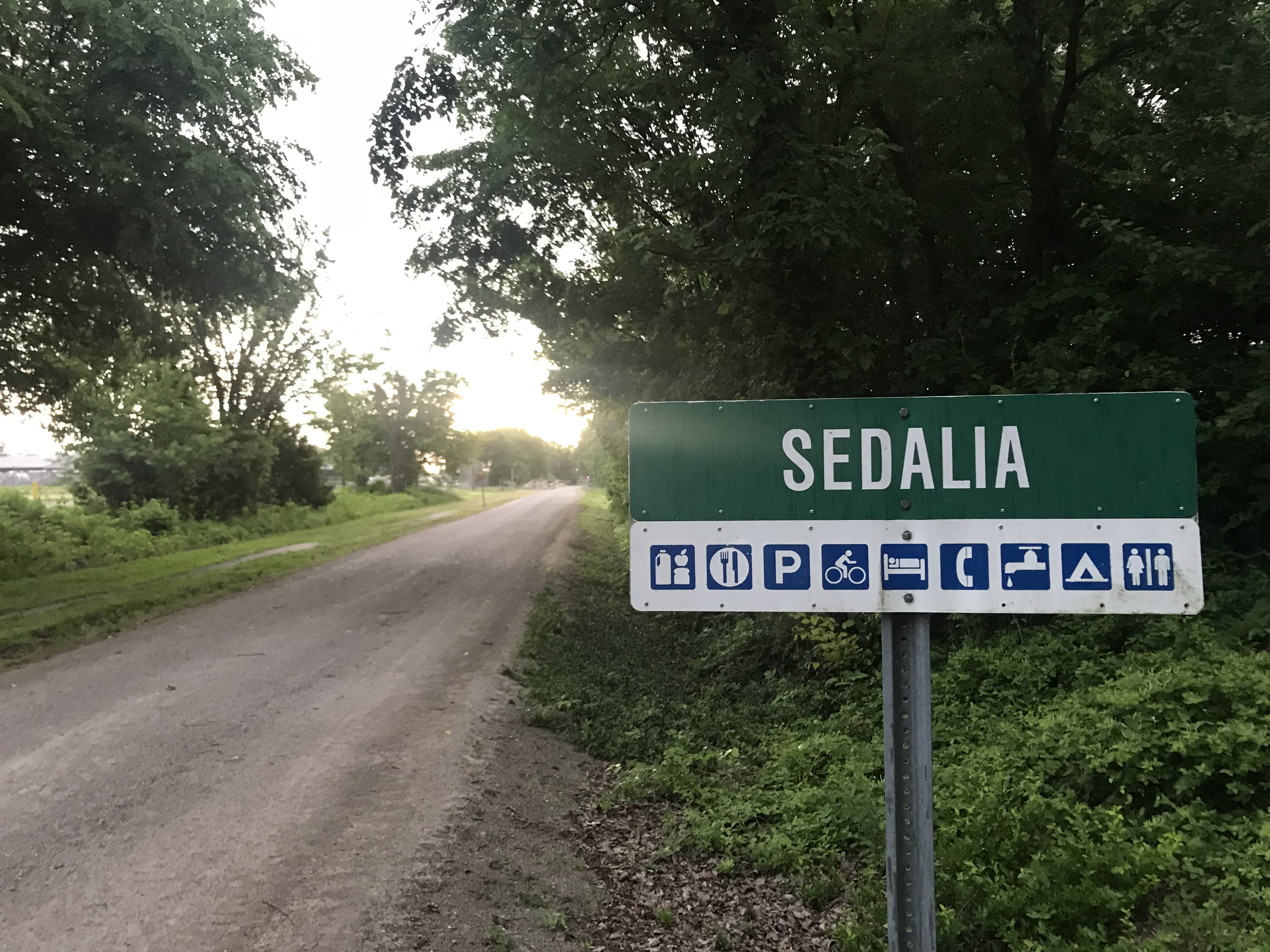
Jeff and I went to Sedalia Missouri for the Escapees annual Escapade. The event was held right along the Katy trail which was perfect to get our runs in each morning. I talked about the Katy trail here and its on our bucket list to bicycle one day. Previously we have run the Katy trail from Munson to St. Charles Missouri, the eastern most terminuses.
The wide packed gravel trail was consistent with what we saw in St Charles with lots of shade.
This was our first run back in humidity and we were both exasperated with our run performance until it dawned on us both…”Ooohhh ya. Humidity.”
Starved Rock State Park Oglesby, IL
St Louis Canyon
Starved Rock is 2630 acres located along the south bank of the Illinois River. In 1683 the French had established Fort St. Louis on a large sandstone butte overlooking the river they called Le Rocher(the Rock). Legend has it, that in 1769 the French had moved on the Native American group called Illiniwek or Illini claimed the butte. The Ottawa and Potowatomi Native Americans besieged the butte until all the Illiniweb had starved and the butte became known as “Starved Rock”.
Starved Rock is known for its 13 miles of trails, 18 deep canyons, many waterfalls and sandstone outcrops. Jeff and I hit the trails early morning to try and beat the crowds and the heat. Nice strategy until you are the first one to catch all the spider webs in this heavily wooded forest. Jeff ran with a vale of webs trailing behind. We ran to the furthest distance to the St Louis Canyon waterfall and back.
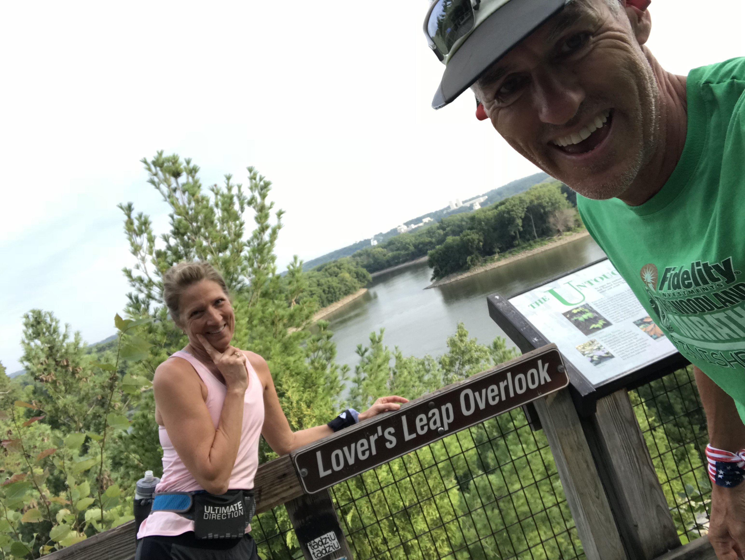
There are many scenic viewpoints including Lovers Leap Overlook where apparently two Native American forbidden lovers from different tribes hurled themselves off this point. Too bad they didn’t just run off to Vegas like the rest of us.
St. Vrain State Park
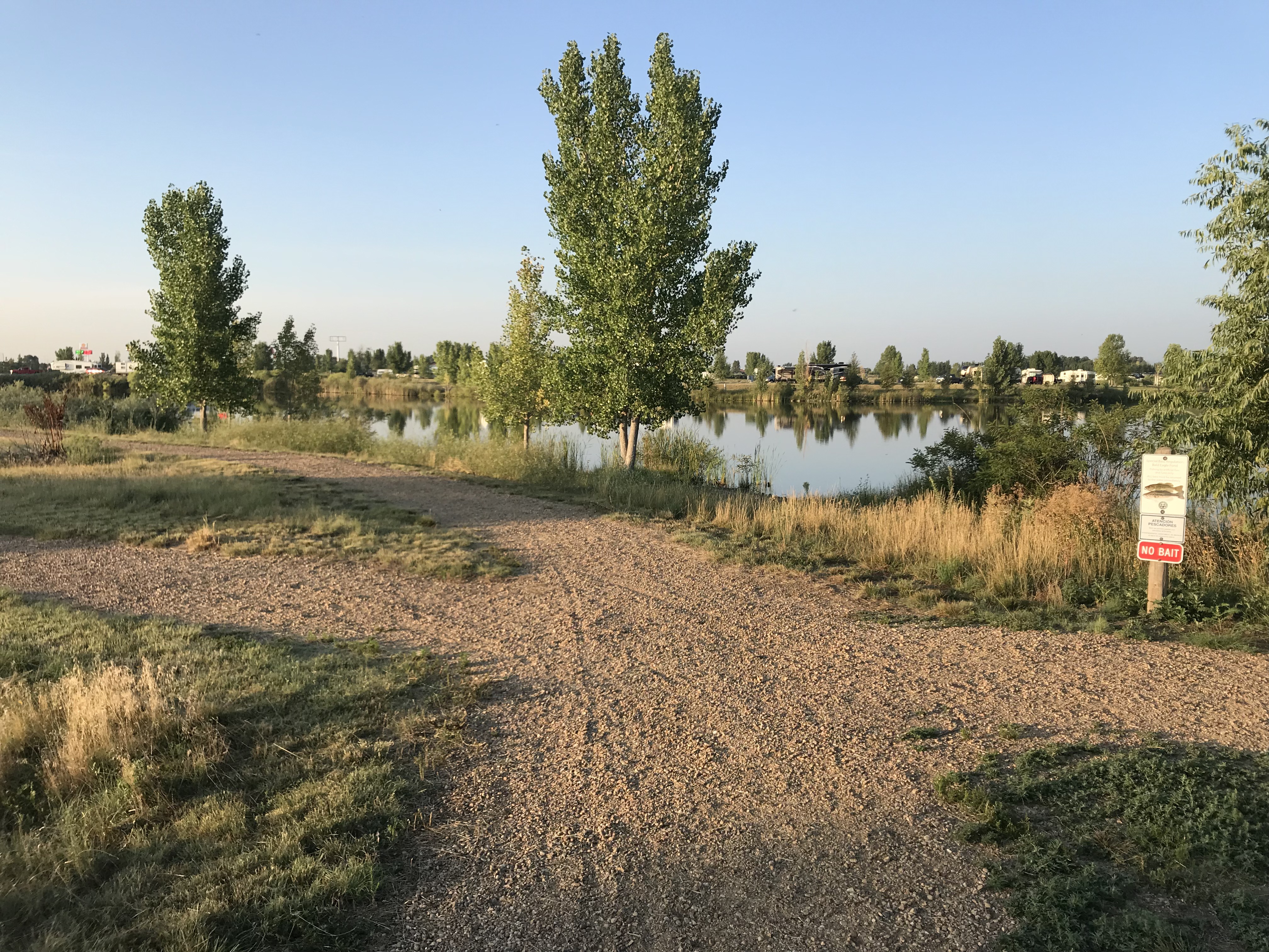
Lots of little ponds to run around
St Vrain was one of the very first state parks that we stayed at on our 3-week trip to Colorado in 2013. From reading reviews of other RV parks and campgrounds in the Denver/Boulder area this is the nicest, most cost affective place to stay. The campsites are well spaced with trails that wrap around multiple small ponds/lakes.
The trails are flat and dusty and good for a 5 miler. Any longer and you would have to keep repeating loops.
Tie City Campground Laramie, WY
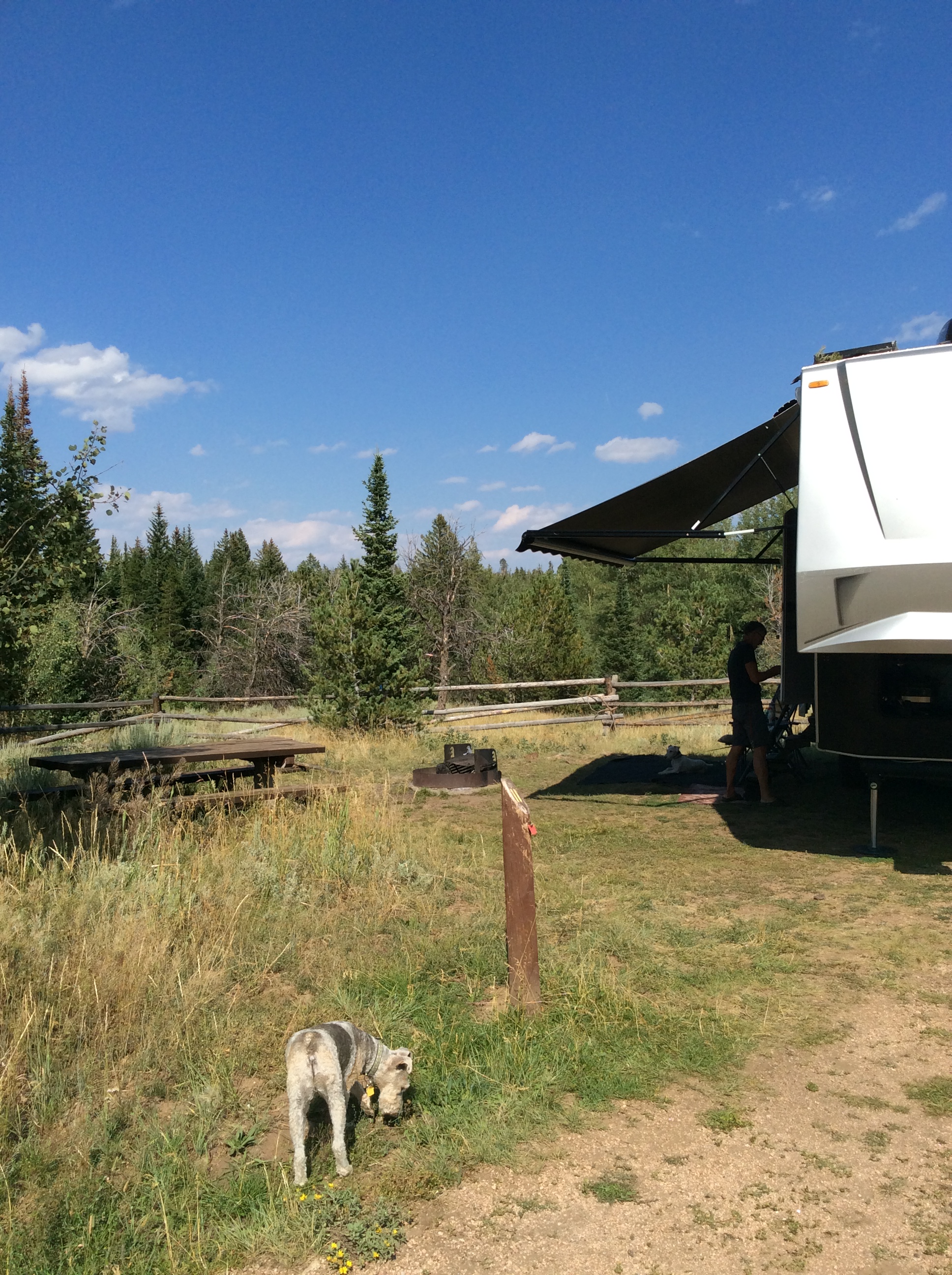
Tin City campground with trails on the other side of the fence
After an exhausting pushing to drive from Arkansas to Denver we made a last minute decision to stop for 4 days at the Tie City Campground just east of Laramie, WY. Oh what an amazing find this was!
Tie City was named for the railroad men who cut the ties for the union Pacific Railroad from the Lincoln National Forest.
This campground is a popular spot to take in 30 miles of trails that web itself all over these mountains. The trails are clearly marked by name and ski difficulty. Winter brings cross-country skiing and snowshoeing while summer offers trail running, horseback riding, mountain biking and hiking.
Trails right from our campsite
A place to turn around for 8 miles
Some rugged steep trails are considered black diamond while other wide and rolling trails were considered blue. It’s easy to get turned around on these trails (then again it could just be me) so bring a map if you want any hope of finding your way back to the trailhead.
Weekday or weekend these trails are used hard by some of the friendliest people we’ve met!
LOVE. LOVE. LOVE THIS PLACE!
Mt Emily Recreation Area (MERA) LaGrande, OR
MERA is located in the Blue Mountains of NE Oregon and has 40 miles of motorized and 45 miles of non-motorized trails.
I started at the Owsley Trailhead where there is plenty of parking for cars, horse trailers and pit toilets. Maps were available at the Kiosk so if you are not familiar with the area TAKE A MAP!
I started on Red Apple trail and ran Upper Hotshot to the Mera Loop. From there I’m not quite sure where I went, but by some miracle I ended up back at the parking lot for 7 miles. I promise you I did take a map. But what I didn’t bring was my reading glasses for the miniature print on those wonderful trail maps!
There are so many crazy offshoots of trails that it was easy to get off course. The trails range from single track to forestry roads. Some a bit more overgrown than others. The rolling hills and elevation ranging from 2900-5600’ made for a good challenging run.
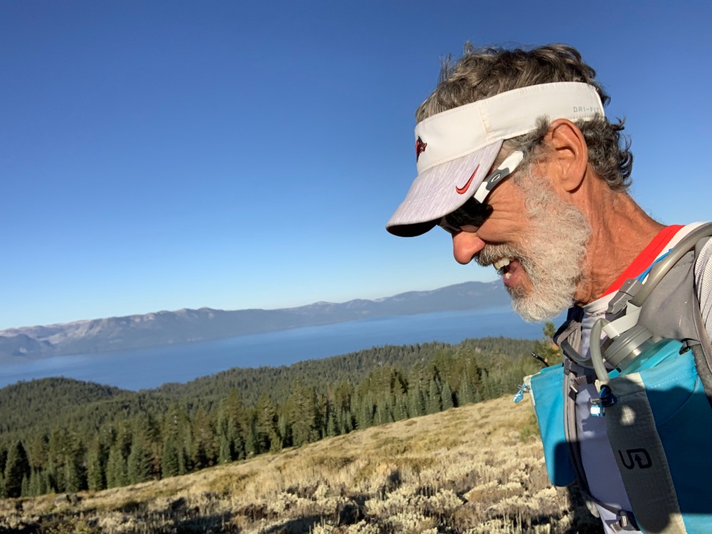
South Lake Tahoe 100k
Run to Echo Lake
We had a friend that had signed up for the Tahoe 200. Jeff decided that he would pace his friend for the last 40 miles. Since this friend had never ran longer than a marathon we were not confident this race would go down. Sure enough, two weeks before the race our friend decided to back down to the 100k. Since 100k runners cant have a pacer, Jeff decided to sign up for the 100k so that he could run with his friend, who in the end pulled out altogether 2 days before the race.
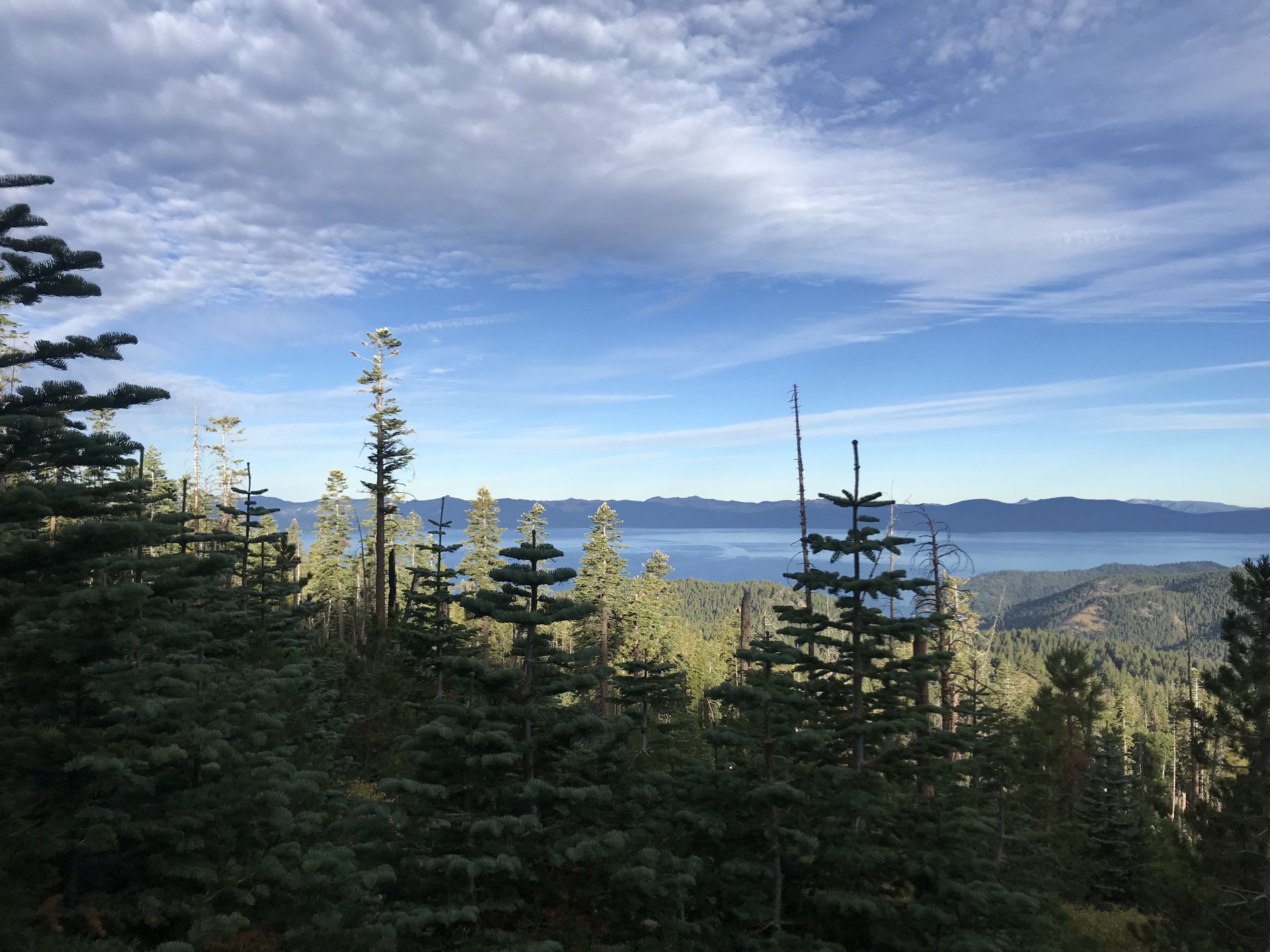
Views from Tahoe Rim Trail
Tahoe is in our top 5 places that we have been to. In case you are wondering, the others are Flagstaff, Sedona, Bend and south rim of the Grand Canyon.
What we really liked about this race is it was on the Tahoe Rim Trail with easily accessible aid stations for spectators. The views were spectacular. The weather was perfectly cool. Tahoe never disappoints…except when you misinterpret a “100k” tail sign for “look” and take a wrong turn during the race. At mile 48 Jeff missed the cutoff by 3 minutes and his race was over. Selfishly it was nice that Jeff was done at 9pm rather than midnight since we planned on pulling out the next day.
These are just a few of our fun trail runs/hikes as we made our way from Arkansas, Iowa, Indian, Colorado, Wyoming, Oregon and California. We finally stopped in Dana Point CA for our 3-month workkamping gig at Doheny State Beach.
More from our little beach community soon.
Honorable mention hikes & trail runs
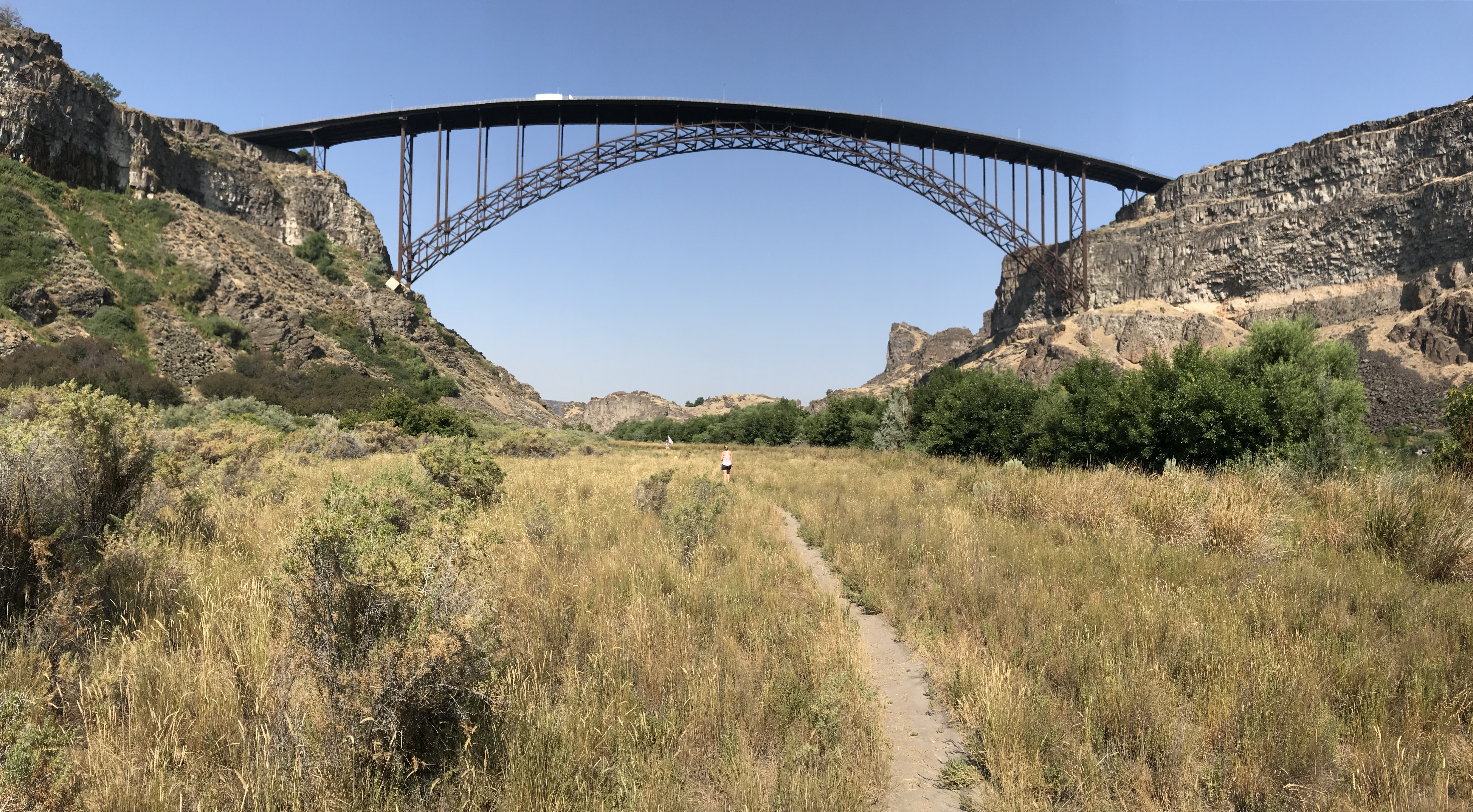
Twin Falls Idaho
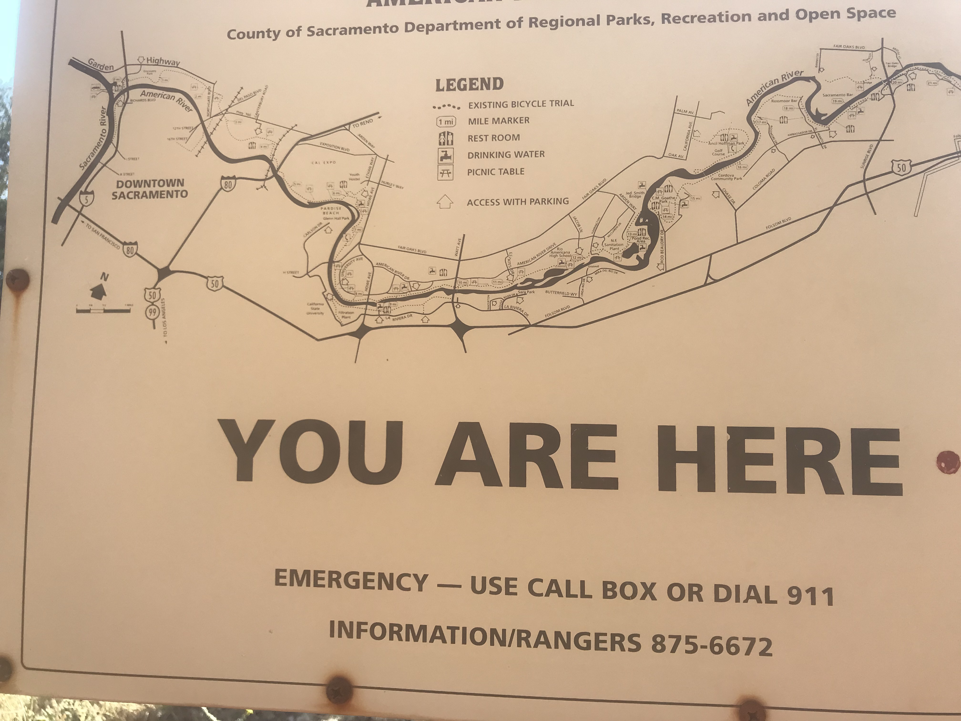
The American River Trail Folsom, CA
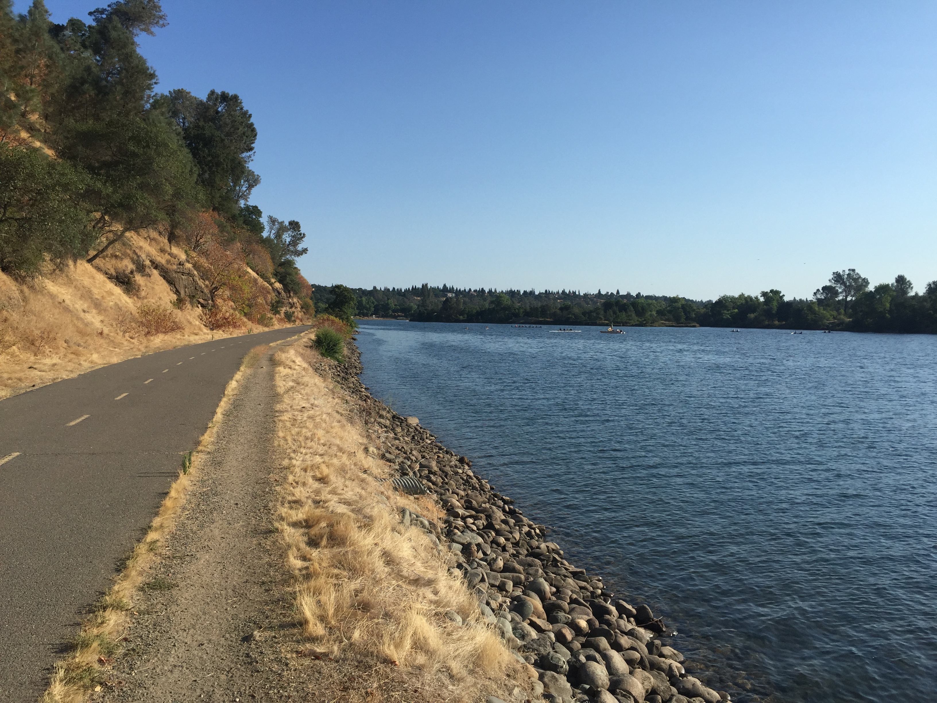
The American River Trail
Route 66 Newberry Springs, CA
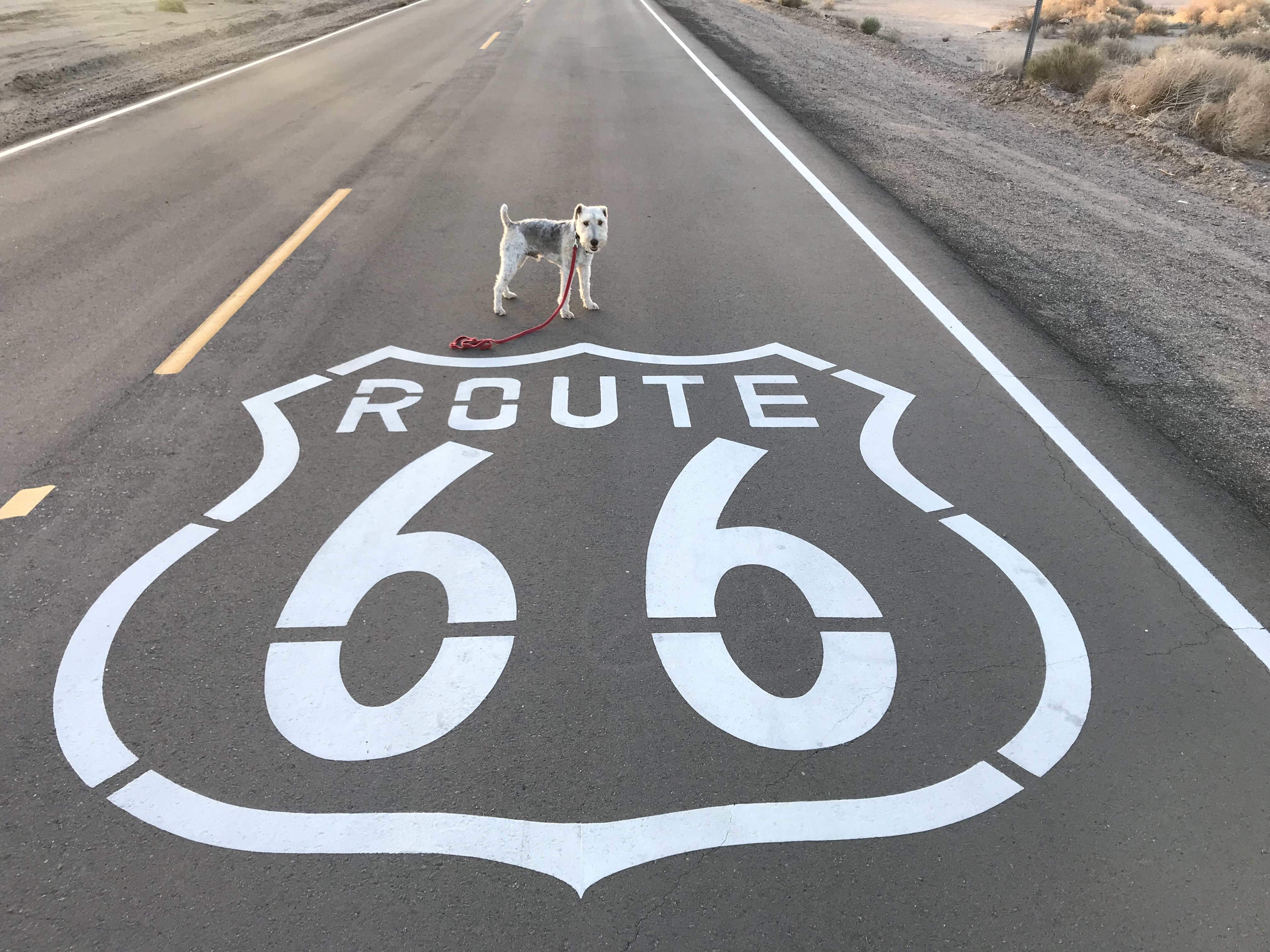
Sam getting his kicks on Route 66
Arkansas to California
Posted by Deb in Boondocking, Borrego Springs, Full Time RV, Trail Run on October 21, 2018

After leaving the comforts of our cabin in Arkansas we pointed the RV west. Lingering half the year in the mid-west was nice, but we were ready to get the RV rolling back to the land of eternal sunshine and bug-free living.
We were making the annual trek to Quartzsite for the big show. The difference this year over the last 3 was that we did not work a booth. Instead of a selling event, we were having a consumer insights event with 13 of Dometic’s engineers, product developers, and customer intercepts. It was a nice change roaming the desert talking to folks rather than being stuck in the booth for 9 days.
After Q we followed our Xscapers RV club to American Girl Mine just outside of Yuma. This is one of our favorite camping locations for the beautiful sunsets and endless trail running options. It’s nice being with a group sometimes because we learned of a few new things to explore. One was a local mine shaft that you can hike into quite far. With a pool at the bottom, it makes for an interesting underground destination. We didn’t actually make it to the mine shaft this trip, but look forward to going next time we camp there.
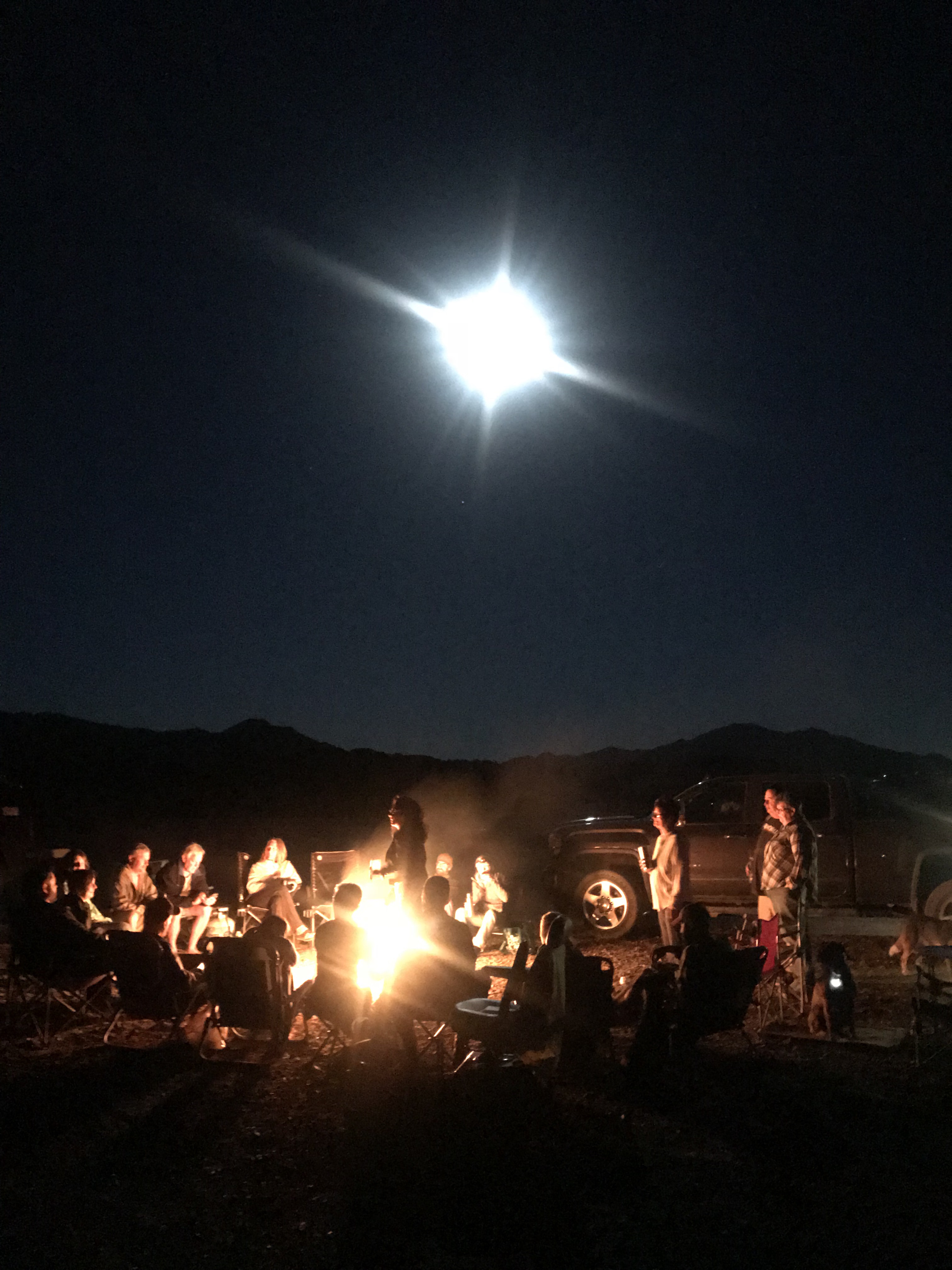
Xscaper friends enjoying a campfire and full moon
Imperial Sand Dunes
The other fun destination was the Imperial Sand Dunes just 4 miles from camp. The Dunes are such a striking contrast to the scrub and rugged landscape of AGM. It’s as if we landed in Egypt minus the camels. Mountains of sand smoothed and rippled by the wind as far as the eye can see. It is an ATV lovers dream location for off-road anything in designated areas. And then there are those who ride the dunes on sleds and snowboards for additional excitement.
I highly recommend stopping for this destination at sunset!
We pulled out of AGM to make our way to Southern California. We had a scheduled photo shoot for Dometic and needed to scout locations for video and photography and secure RV’s and boats.
We purposed to stop at Borrego Springs for a few nights on a friend’s RV lot. The last time we were here was 3 years ago during Soup Anarchy watching movies on the side of Technomadia’s bus in the desert!
Gosh, what a fun time that was! This was much more low key and quiet compared to our previous trip and we enjoyed the solitude of our location. We were within running distance of the trails at Borrego Palm Canyon Campground to trail run.
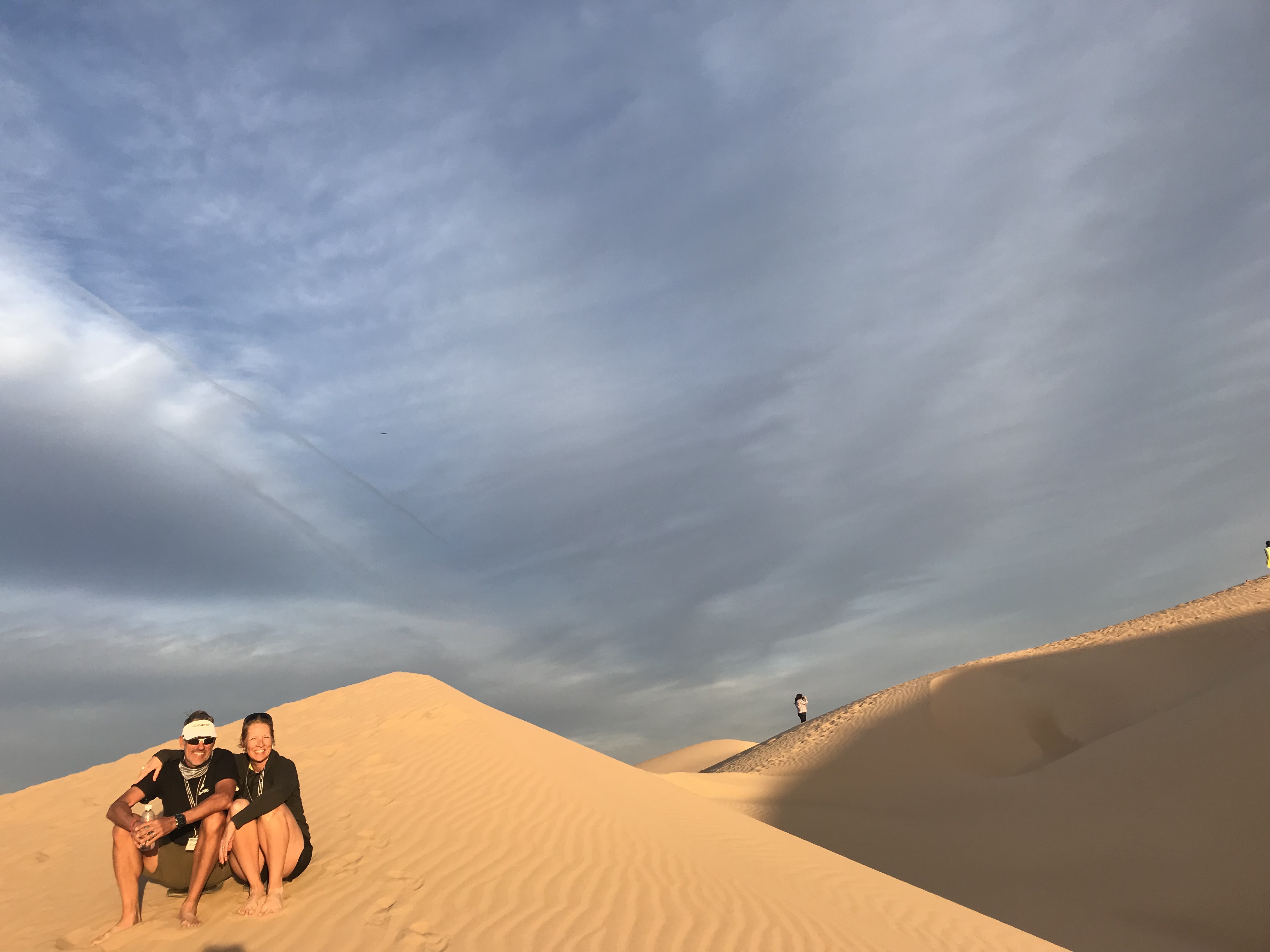
If you ever come to Borrego Springs be sure to check out the desert art!
Nice to have friends with RV lots
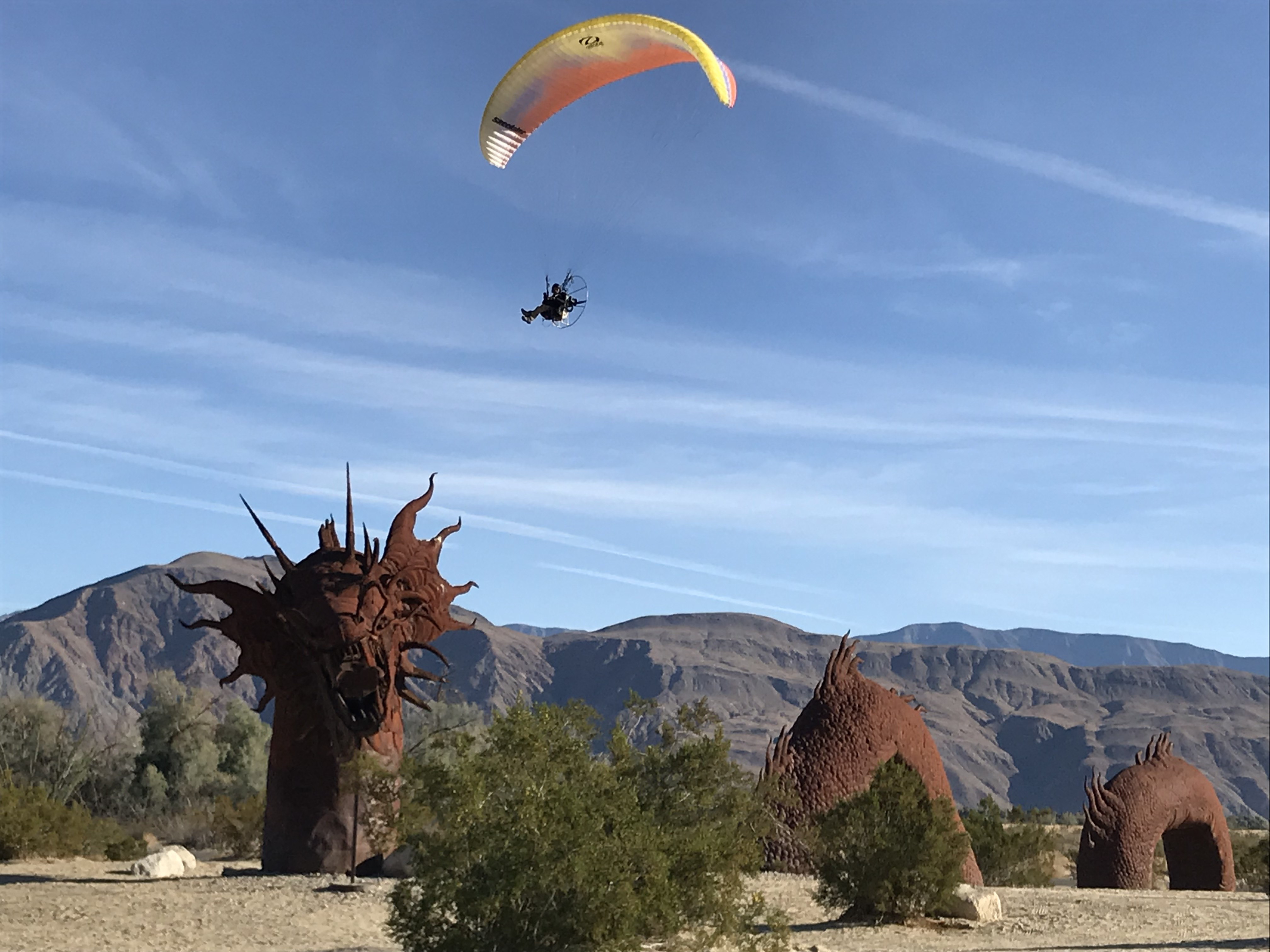
RICARDO BRECEDA SCULPTURES
We would have loved to stay longer but we really needed to get closer to the coast.
I had been researching RV Parks along the coast since we needed to park for about a month. Jeff and I had some air travel scheduled mixed in with our coastal scouting and we like to leave the rig plugged in while we are away.
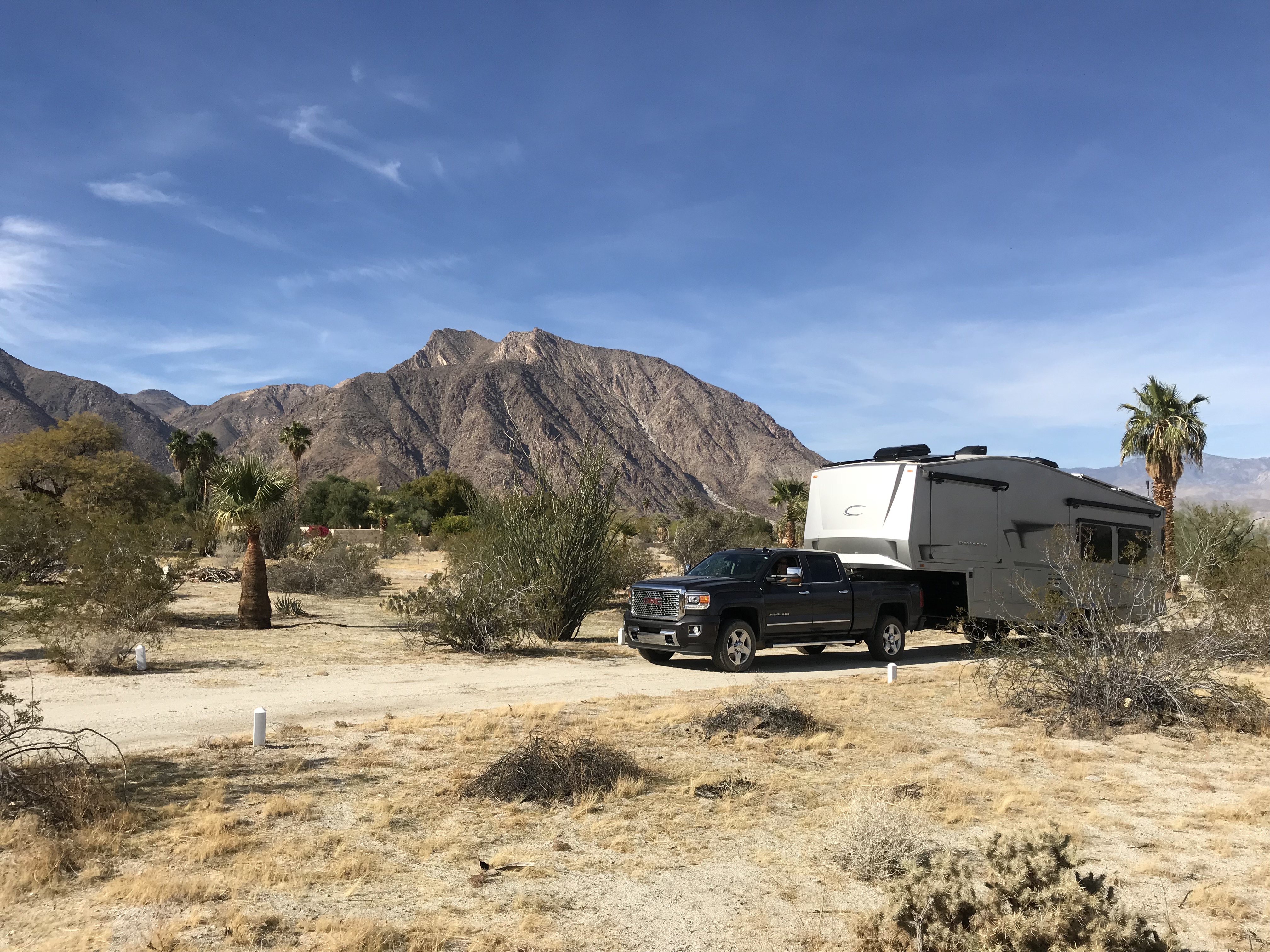
I was not prepared for the sticker shock of coastal living. Holy moly! The reasonably priced state parks were not available for a month stay; only offer dry camping or are too small to accommodate our size. While we were at American Girl Mine we met a couple that has a lot at the Escapees Jojoba (Ho-ho-ba) Hills RV Park in Temecula CA.
Since this location was “only” 70 miles from the coast and $40/night for full hookups or $7.50/night dry camping we decided to make it our home for the maximum 28-day limit.
Enormous campsite
BLM trails to run
Fabulous pool overlooking the valley
This is a STUNNING park beautifully maintained by lot owners. It’s your typical 55+ park with tons of activities, a pool overlooking the valley and pickleball courts. Just outside the gates is BLM with plenty of trails for hiking and running.
Temecula is known for its vineyards and old downtown nightlife. We met up with some friends and hit a couple of restaurants during our stay. We really enjoyed this community and Jojoba Hills offers affordable living for those who want to live the SoCal life.
We made several trips to Dana Point, Newport Beach, Balboa Island, and Oceanside. My plan of making quick trips over to the coast was delusional, to say the least. The traffic was insane, turning our 70 miles into 3 hours (6 hours round-trip). It didn’t matter if we left early or returned late the traffic was a consistent gridlock of red taillights.
Despite the painful drives we did see beautiful coastal settings and ate great seafood.
Balboa Island…Quaint but VERY EXPENSIVE!
Breakfast outside in February
Dana Point
One of the side trips we needed to make was the RV Entrepreneur Summit in Austin TX. We went on behalf of Dometic but we also wanted to attend for ourselves. We rented a park model cabin at the Jellystone RV Park and sat in on many seminars. The speakers were outstanding and we made a lot of new friends.
I flew back to LA while Jeff stayed in Austin for another week. One of Jeff’s goals has been to qualify for the Boston Marathon. There happened to be a qualifying race in Houston… The Woodlands Marathon. He has been getting coaching from a friend and was as prepared as I have ever seen him. He had an awesome race and beat the age group qualifying time by 6 minutes. WE HAVE A BOSTON QUALIFIER IN THE HOUSE! However, even though he has a qualifying time it doesn’t mean he will get to run the race.
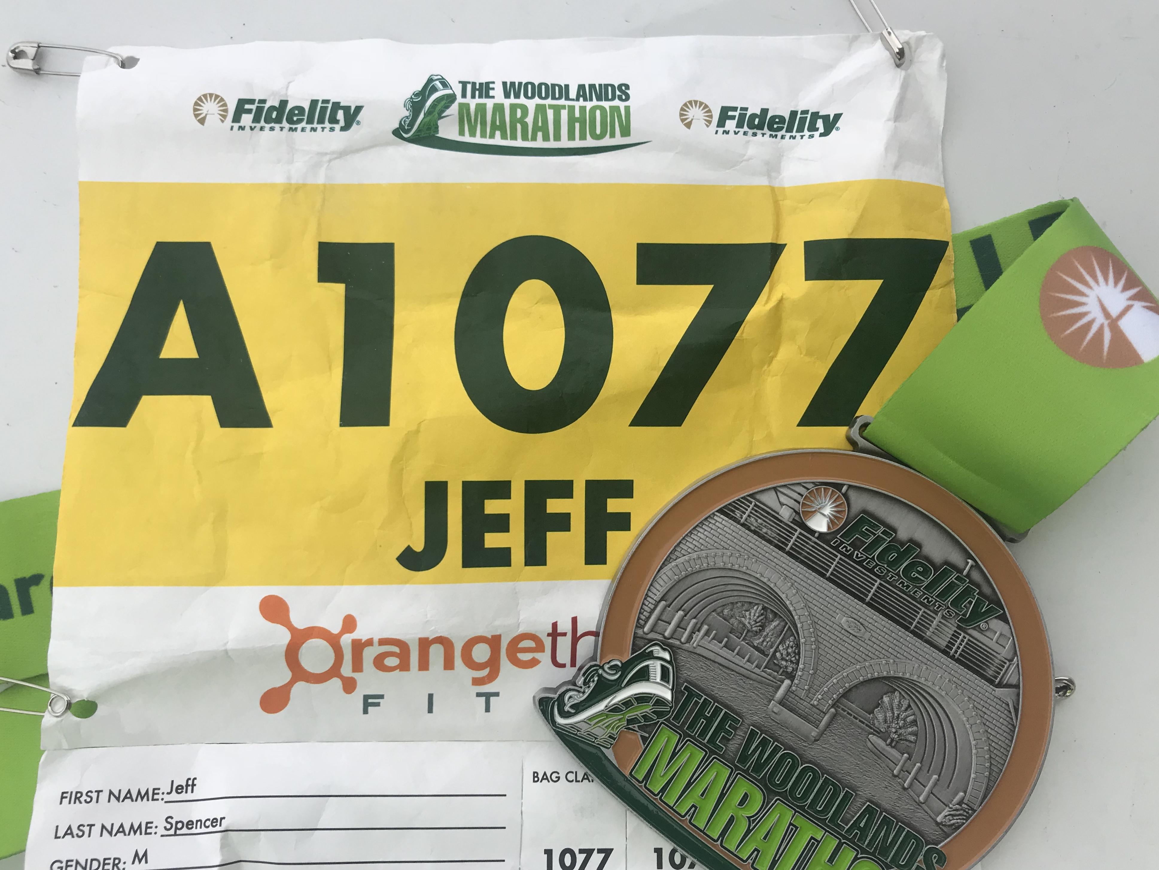
Since the number of “qualifiers” exceeds the number of available slots he will now be put in a pool by time. In the fall we will find out if he will actually receive a slot at the starting line in April 2019. (UPDATE: Jeff got a spot and is going to Boston!!!!)
After we were reunited back in Temecula we started to move around for the photo shoot. We hung out for a few days in Newport Beach at the VERY EXPENSIVE ($170/night…gasp) Newport Dunes RV Resort to meet up with the team from Sweden, France and Australia. Then we packed up and caravanned to Lone Pine, California.
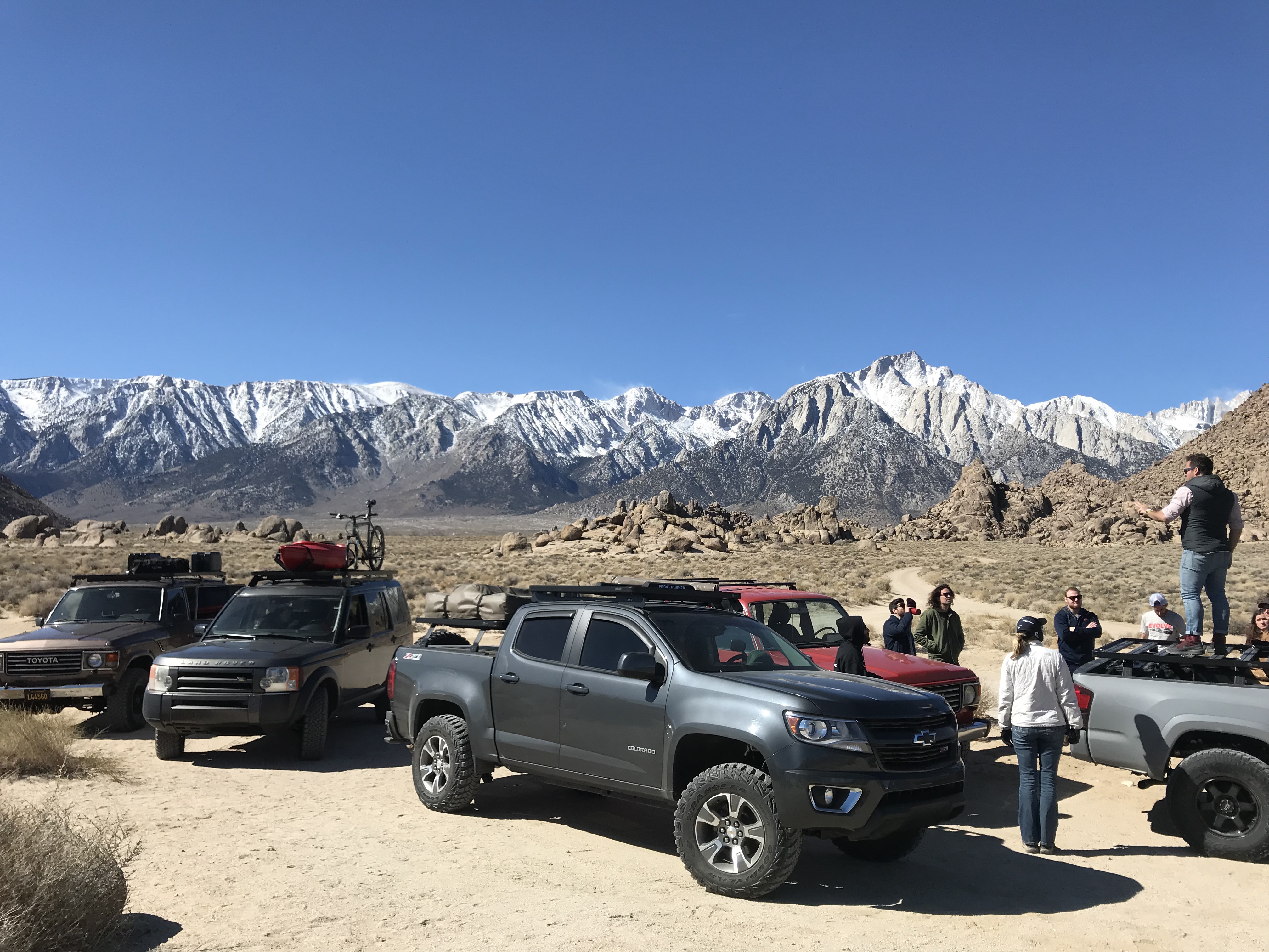
The team getting instructions from our favorite Aussie
Getting the RV’s positioned
Lone Pine is where the Whitney Mountain Portal is to the highest peak in the lower 48. After my failed attempt (and Jeff’s success) to the summit a couple years ago that mountain has been looming in the back of my mind. For a brief moment, I considered making the attempt again on this trip since I now have backpacking equipment to break up the hike. But then I realized that it’s still winter on the mountain and I put my aspiration down for a nice cozy nap.
Its still snowing in those hills
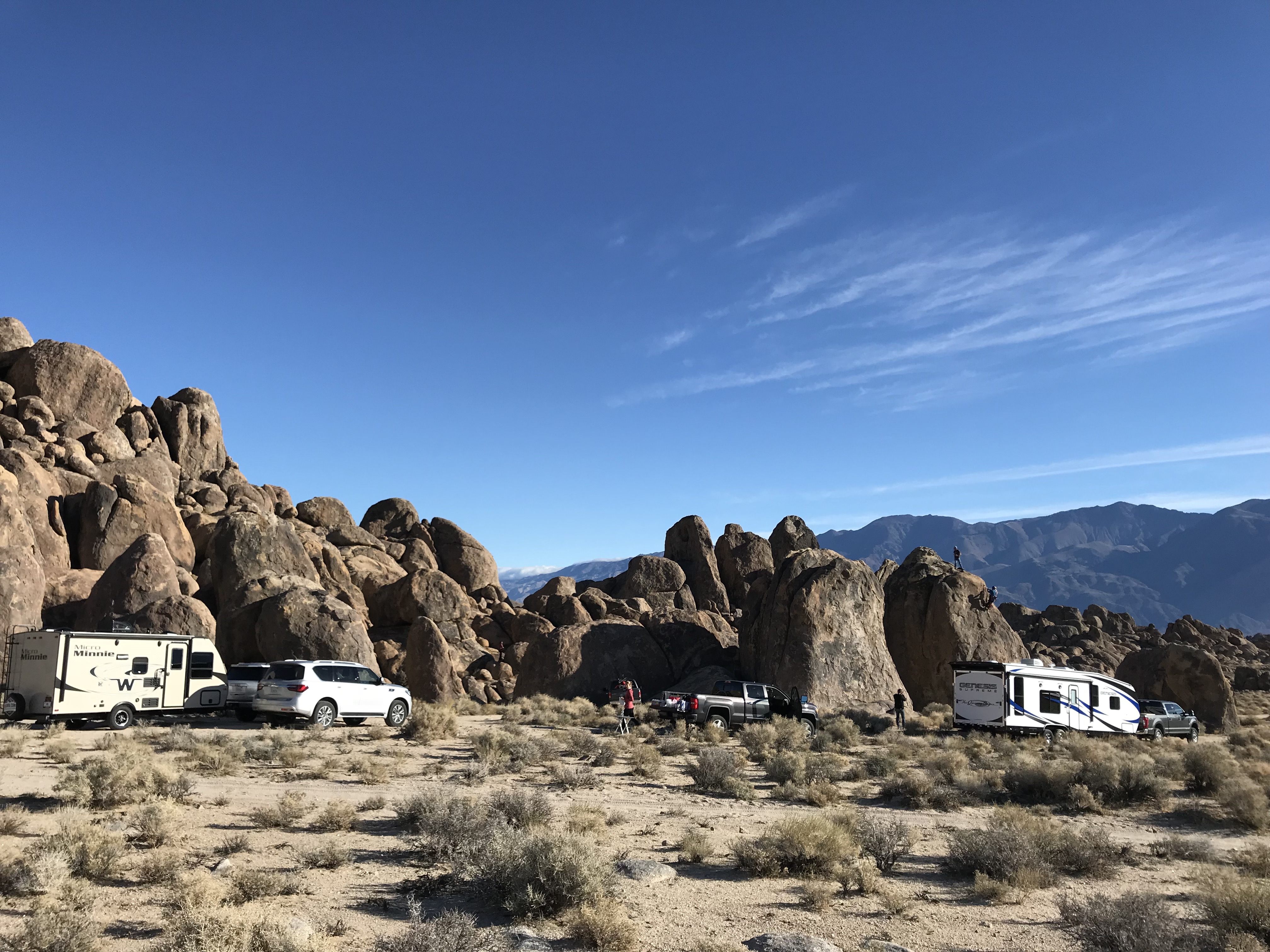
The photo shoot went amazingly smooth in Lone Pine. This sleepy little town is home to some of the most photographed locations for old Westerns. Of course, the rub in this town is that it runs on small-town time. We needed grocery supplies to keep everyone fed, but the tiny grocery store had limited hours due to “new management”. There was no consistency, rime or reason to their hours and we were forced to drive an hour away just to pick up some supplies for a night shoot.
Sorry to put you through this Lone Pine!
Despite the strain we put on local restaurants with 12 of us showing up at once, we ended up with some very successful shots.
After 5 days we headed back to Newport Beach to transition to the marine shots. While the team went out on a yacht, Jeff and I spent the day on land returning the borrowed RV’s and catching our breath. Our final day of shooting was at Dohaney State Beach area at Dana Point using our personal RV.
The team heading out for a day of shooting
Jeff and I kicking up our feet to catch our breath
While there, a ranger stopped by our RV and wanted to take a picture of it. He and Jeff got to talking and the ranger offered us a Camp Hosting position at Dohaney State Beach Campground the end of this year. We ended up camping for 3 nights at this park right on the beach and spoke with the current camp hosts for the down and dirty of the job.
After learning that the job only entails checking sites for proper permits and selling firewood for 15-20 hrs a week we decided to commit to hosting for October, November and December. We get a free full hook up site, surfing right from the park and no cleaning of bathrooms!
What’s funny is that I’ve wanted to try workamping but Jeff has been less than enthusiastic about the possibility. What I’ve learned is that he is more than exuberant if you mention surfing. Throw in a great Pacific Coast Trail that runs along the beach just outside your door and you’ve got yourself a winning combination for an “all in”, “why haven’t you suggested this before”, “sign me up on the spot” excitement! I should have thought of that sooner.
Until then we have a lot more travel planned, including a trip back to Arkansas. Stay tuned for another sweltering humidity, bug-filled summer of fun!
The Gifts of 2017
Posted by Deb in Biking, Cycling, Destinations, Full Time RV, Hiking, Running, RV Shows, Trail Run, Ultra Running on April 17, 2018
What can I say about 2017?
NOTE: I started this blog back in January…dang it! So here we are in April with a whole lot of travel under our belt for 2018 and I’m getting ready to post something about 2017. That is SO last year!
At the risk of feeling like I am writing about a time “back in the day”, I’m going to post it anyway!
What is it about January 1 that resets everything in our brains to start over?
Start a diet to lose weight. Start working out at the gym. Start emptying the inbox by the end of every day. Organize the kitchen cabinets…I got this!
I’ll be the first to admit that I do this myself… Every. Single. Year.
I started using my Lose It app again to take off these stubborn 10lbs. Why I couldn’t make myself do it October 17th is beyond me. But come January 1? I am so excited to track my intake, count every almond, cut out cream in my coffee and kick my evening piece of chocolate to the curb! Easy peasy.

But over time the enthusiasm fades, the rules become more like suggestions and I am once again carrying an extra 10lbs around my midsection.
I think from now on I’m going to declare “JANUARY 1” once a quarter, since that seems to be the longevity to my New Years commitments. WHO’S WITH ME???
Despite my lack of stamina for some things in 2017, Jeff and I had a wonderful year of RV’ing. Not everything went as planned, but we are thankful for a lifestyle that allows us to be nimble enough to take on whatever life throws us.
So here are some of our favorites and some of our surprises from 2017
Favorite Boondocking Location
We started the year thinking we were going to go to Rocky Point Mexico. But after pricing insurance for the rig we went to Yuma, Arizona instead. Specifically, American Girl Mine BLM just across the border of California from Yuma.
It’s probably the most barren landscape we have ever spent time at. But the amount of trail running was endless, the Internet speeds were crazy fast, city conveniences close by and a Mexico experience within a half marathon.
A few “things” you will see in Mexico!
Days are warm. Nights are cold. Unbelievable sunsets. Other RV’s as close or as distant as you please. All free for the taking.
Favorite Work Location
Working in the RV industry we worked plenty of RV shows in 2017.
Quartzsite
Good Sam Rally-Phoenix
The Escapees Rally-Tucson
National Hardware Show-Las Vegas
Overland West Expo-Flagstaff
Easter Jeep Safari-Moab
Overland East Expo-Ashville, NC
By far our favorite show is the Overland West Expo. To start, we love Flagstaff! Camping amongst the pines. The wind creating a very distinct sound through the trees. The smell of pine needles baking in the sun.


Then there are the customers we get to interact with. They are inventive, savvy, astute and creative. They are not only well travelled, but minimalists who travel in modified Land Rovers, Toyotas, Motorcycles and Earth Roamers. They are not confined to USA borders but prefer to explore the backwoods of the world.
Favorite Sporting Event
This category is a bit tough to isolate. Trail Runs, Hiking The Grand Canyon, Ultra Runs, The Bentonville Arkansas Half Marathon, and Vacation Race series.
I’m certain that Jeff would consider his very first 100-mile Trail Run at Bryce Canyon the highlight of 2017. Pushing his body not just during the race, but for a year of training was a challenge. All to see if he could actually do it! What an accomplishment.
Mile 51
For me was the Bentonville Half Marathon. I ran the race with my sister-in-loves in my hometown surrounded by friends. It was a race and a family reunion that was so special. I ran the Grand Canyon Half too, but Bentonville and family made this one a standout.
Lastly, the bike ride across Iowa during RAGBRAI was special as well. Riding along with our RV’ing buddies with endless laughter and great food made for a memorable time.


Favorite Hikes
We did a lot of hikes in 2017 but the two that stand out the most are two hikes that are hard to get permits for.
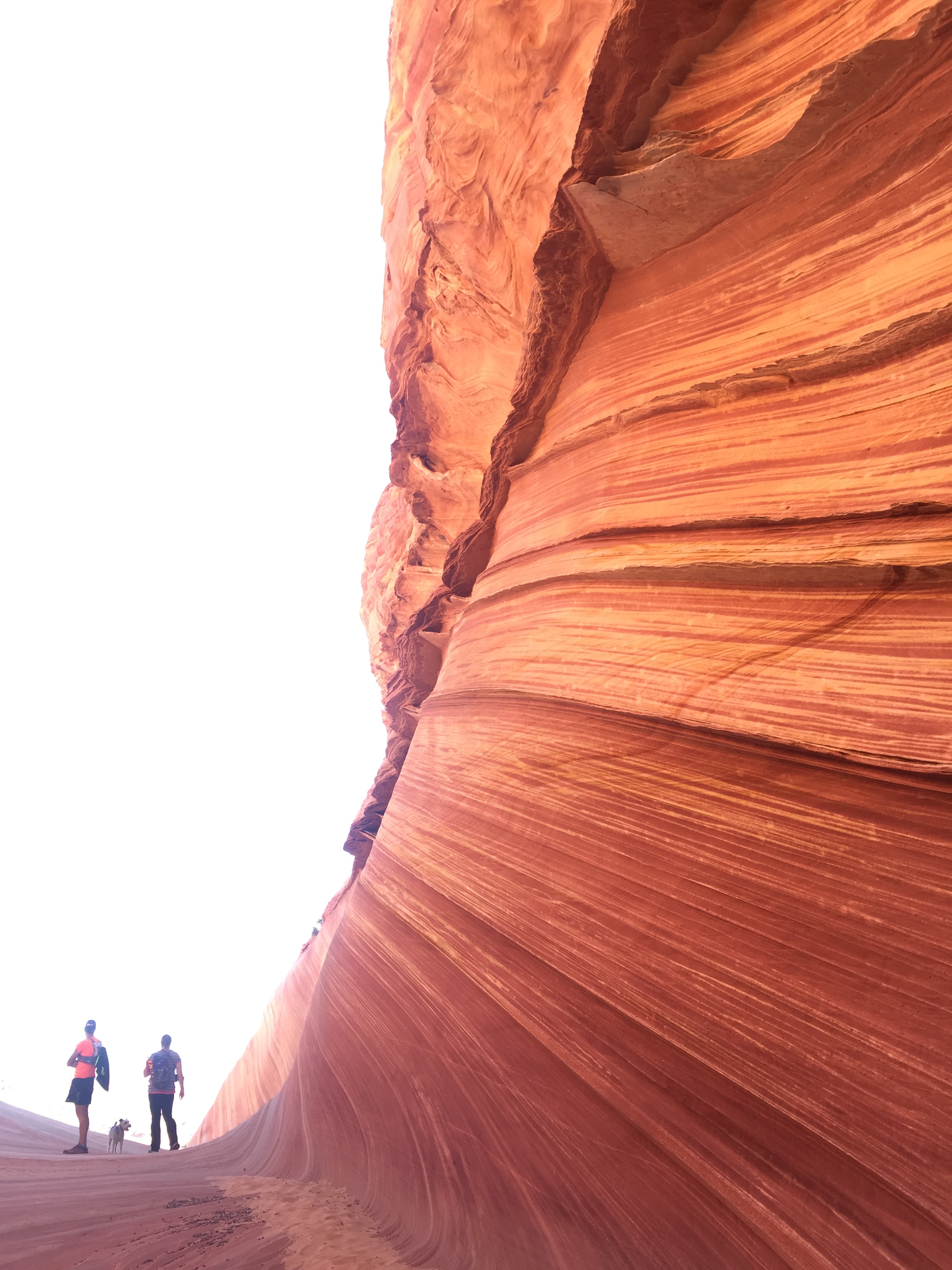
The Wave. What a special experience this was! Having our number drawn for a permit, the challenge of finding it, having our dog Sam and friend Whitney along and the isolation from it all made for a memorable experience. The color and texture was unlike anything I have ever seen and I feel so fortunate to have hiked there.
Havasupai Falls Part 1 and Part 2. The hike to the falls was not that incredible, but the falls themselves and day hikes from the campground were stunning. Blue green water that appears fake at times, were unbelievable. This was our first ever backpacking trip without the RV and it gave me confidence that, with the right equipment, I can manage some overnight hiking trips in the future.

Biggest Surprise
Spending 6 months in the mid-west. This was NOT part of the plan for 2017. My Grandmom passed away 7 days before her 100th birthday. So we stayed in St Louis for the memorial. Then I was so thankful that my Mom decided to move closer to my brother. So we sold her house, packed everything up and moved her to a new home.
Then I needed to have two unplanned surgeries. Nothing life threatening. Just necessary. Tests, doctor appointments, surgeries and recovery. All took a better part of June through December.
Second Biggest Surprise
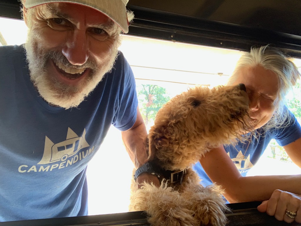
We adopted a new dog. Sammy-do-da is getting up in age (13 years) and we were considering getting a younger dog for Sam to mentor. Sam is an amazing dog and we would love for his good manners to rub off of another dog. We are partial to Wired Fox Terriers and had been keeping an eye out on WFT Rescue Facebook sites.
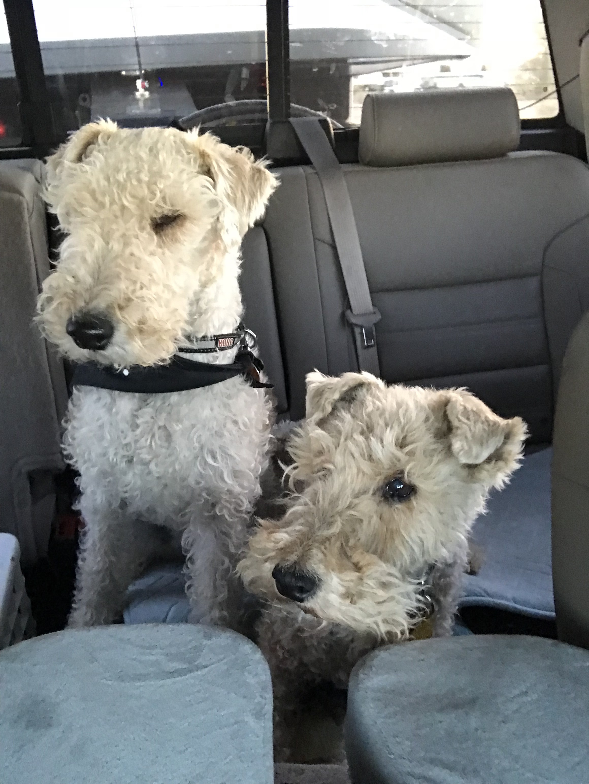
Bullet (L) and Sam (R)
Dogs have come up but Foxies have a certain temperament that doesn’t always mesh with kids or other dogs. We can’t have that with our RV lifestyle so we have taken our time to wait for just the right fit for our family.
One popped up in Tulsa just 2 hours from home. Bullet’s description sounded very similar to Sam’s and we reached out to his Foster. We set up a meeting and Sam and Bullet hit it off. That day we came home with a new dog.
Bullet (B for short) it super sweet just like our Sam with about 10 times more energy and hearing that can detect a wrapper from rooms away. We are having to adjust to having a dog that does not come when we call him or mind his manners. Training has become a new priority which leaves us exasperated at times. But he has a good heart and we will continue to do our part to bring out the best in our sweet B.
Well, thats it for 2017. I will hopefully get caught up on our travels in 2018 very soon. Since January 1 has come and gone and I am 17 days into my second January 1, I am committed to getting my blog back on track.
Now where did I hide that chocolate!
Off to another lame adventure!
Adventures in Car Camping
Posted by Deb in Boondocking, Full Time RV, Hiking, Moab, Running, Trail Run, Ultra Running, Utah on January 1, 2018
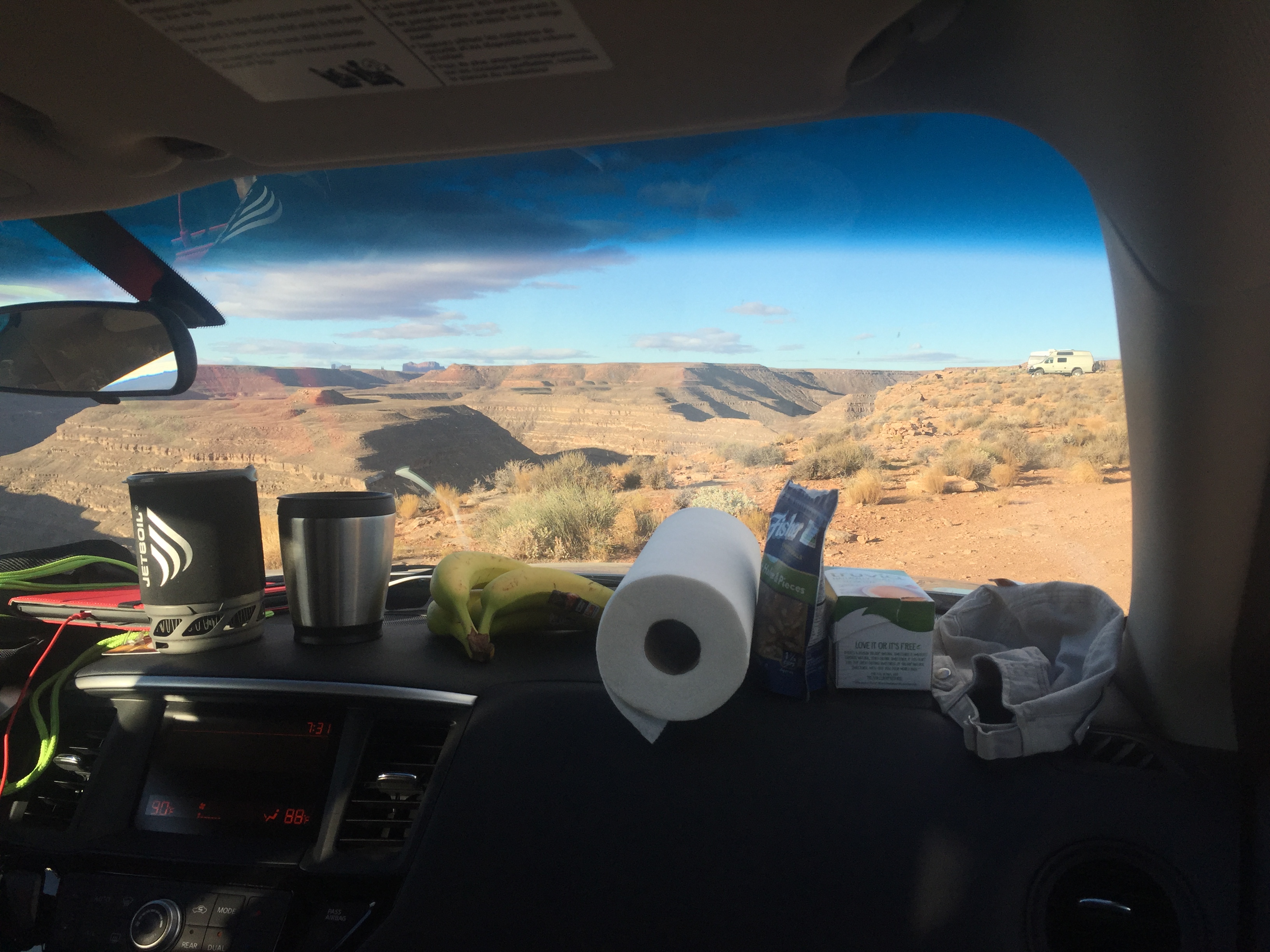
Dashboard Kitchen
After finishing our backpacking trip to Havasupai Falls here and here we planned an additional six days to car camp in Southern Utah.
Since we had purchased all this camping gear for the falls we decided to give car camping a try instead of getting hotels. And after sleeping on a picnic table for 3 nights, the car felt like a five star hotel (she laughs hysterically)!
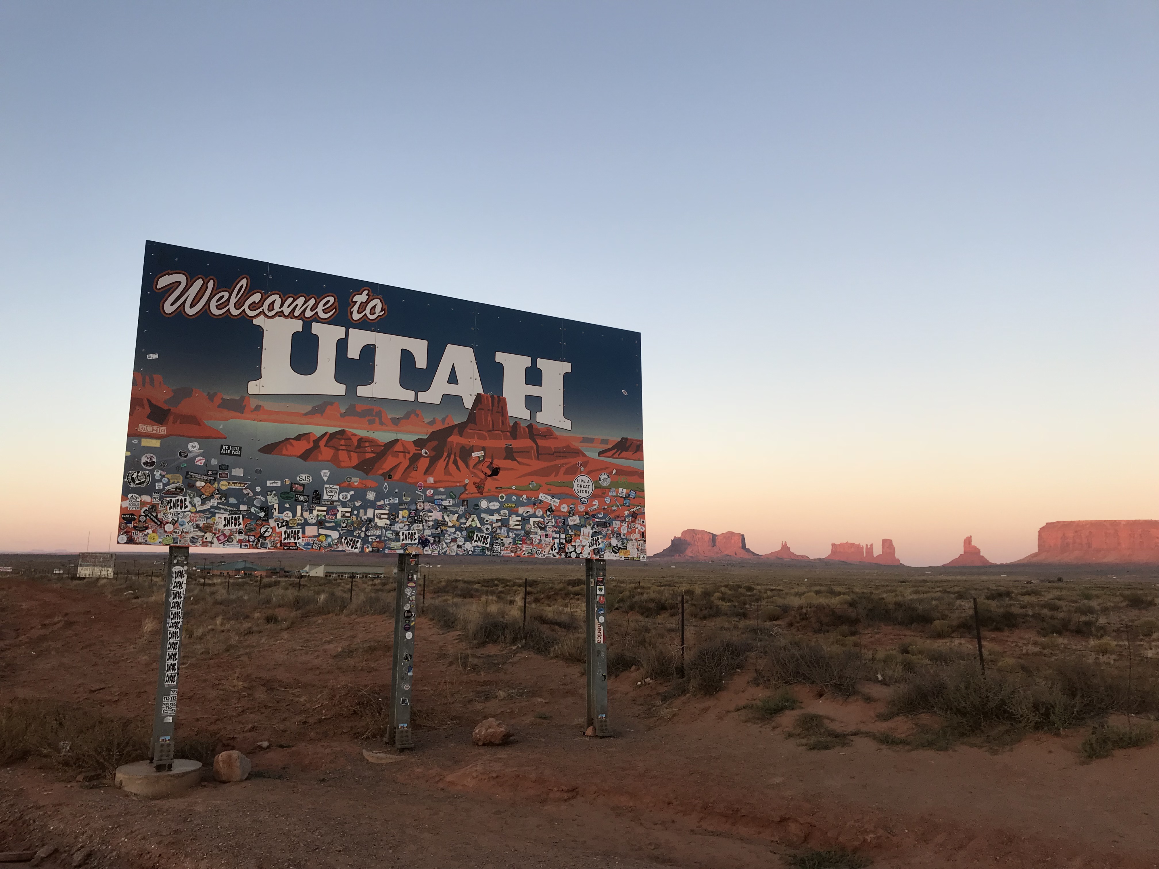
Welcome Back to Utah
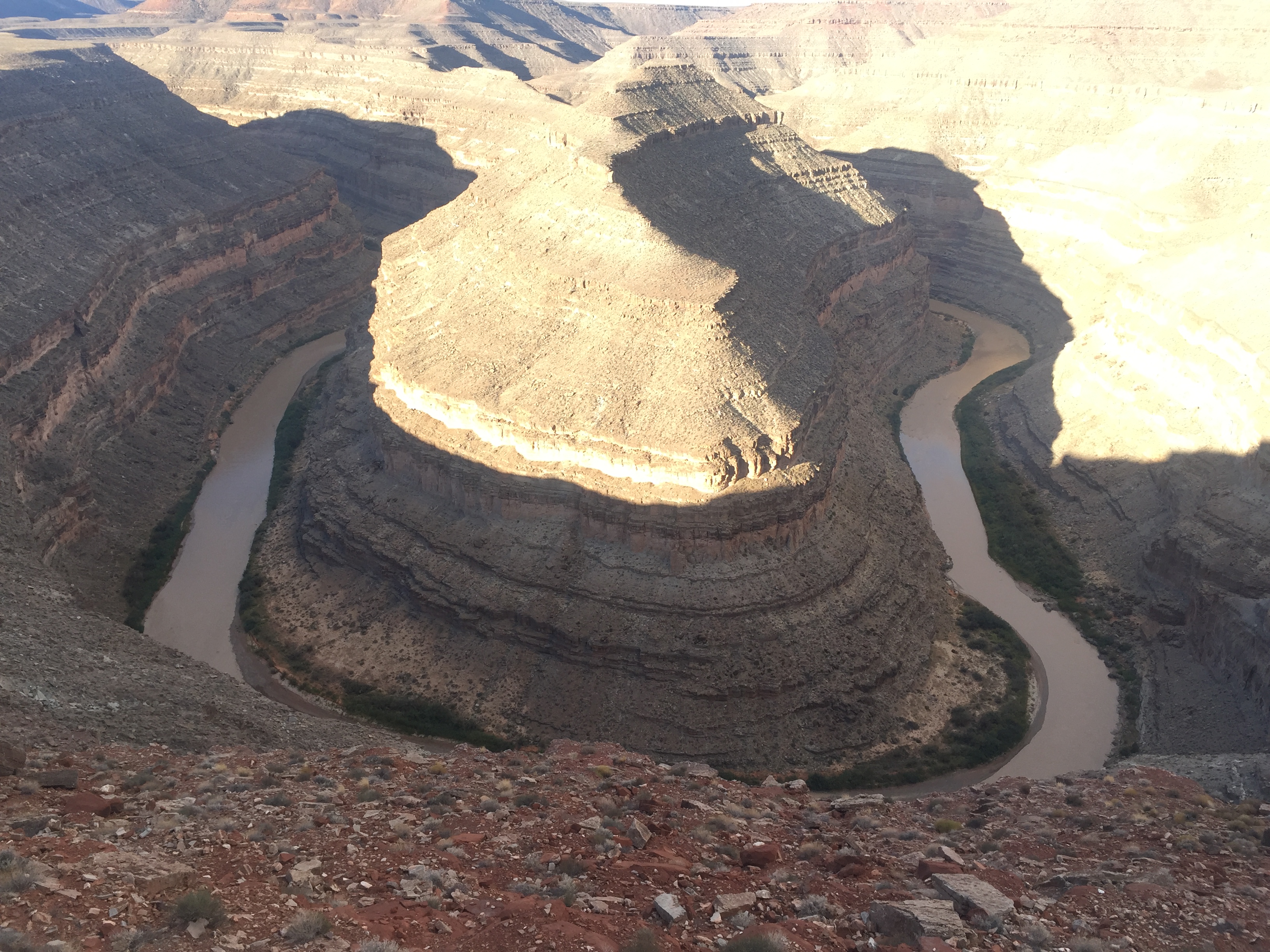
We drove from Havasu Falls trailhead past monument valley to find a nice campsite on the rim of Gooseneck State Park. The sun was going down by the time we got there and the temps were a very comfortable 70-ish. We set up our camp mattresses and sleeping bags in the back of our Nissan Pathfinder and left the tailgate open for ventilation.
It was such a beautiful night and the stars were fully visible with the lack of city lights. The rim of Gooseneck is barren rocky land completely void of any scrub or trees, which translates to magnificent sunset viewing. We set up our camp stove on the picnic table and kicked off our sandals just outside the tailgate and piled into the back of the SUV for a great night sleep under the stars.
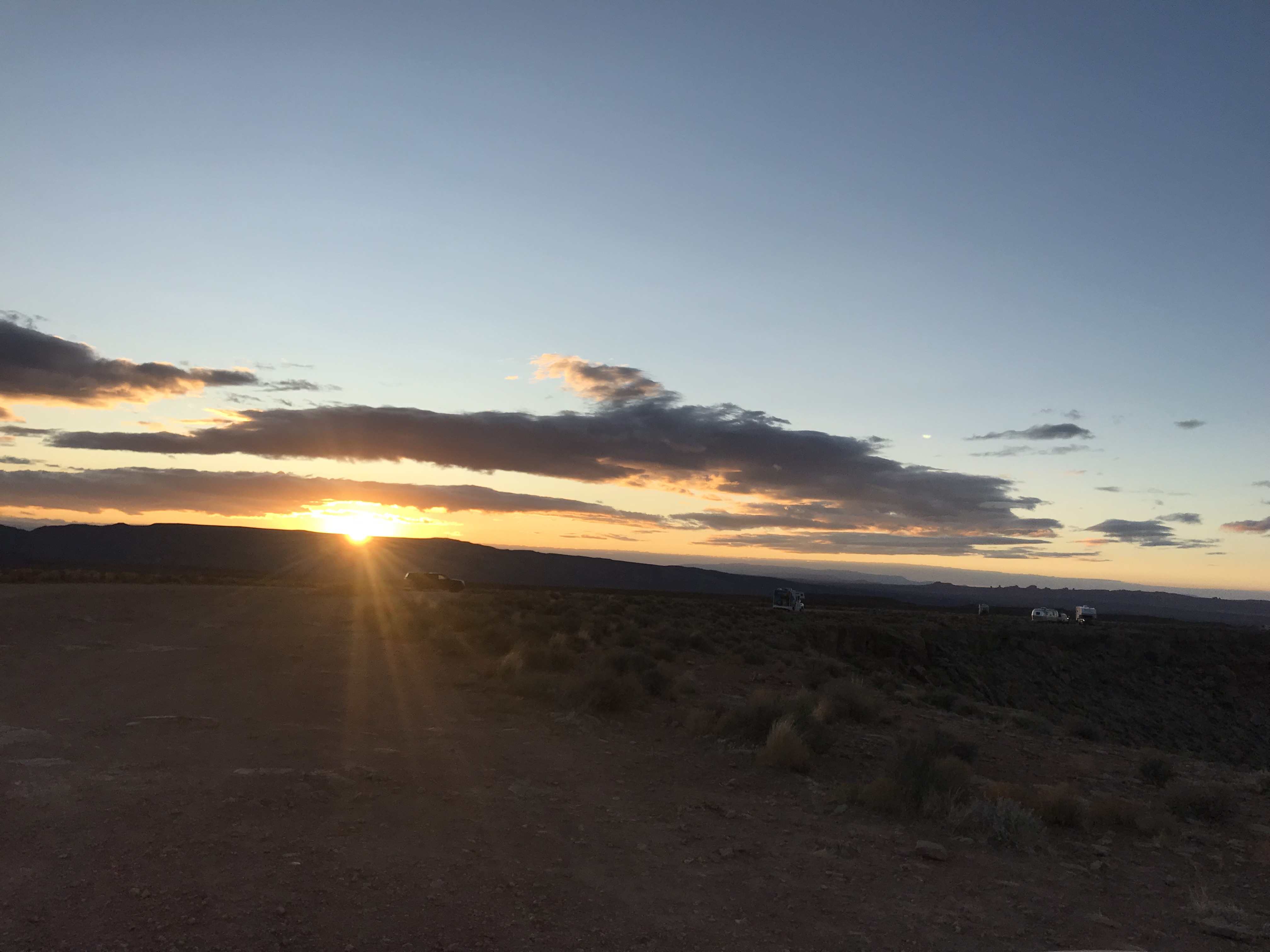
Camping along the rim
Car camping was pretty awesome…until about midnight.
I woke to some jostling of the car and the gritty taste of dirt and sand in my mouth. When I finally came too I realized that we were in the middle of a windstorm that had kicked up so much grit in the air that the clear full moon from two hours earlier was a blurred hazy glow.
I had to jump out of the car to shut the tailgate but my sandals were nowhere to be found. I got the gate down and climbed into the side door to find our sleeping bags covered in sand. By now Jeff had barely woken up and wanted to know what I was doing. I swear that guy could sleep through a parade of fireworks.
I settled back in and asked Jeff if there was anything else left outside. When he said that the Jetboil was out on the picnic table, all I could see was hundred dollar bills flying over the edge of the canyon.
The wind was so fierce that I could hardly get the car door open to retrieve the camp stove and to look for both sets of sandals…all of which were teetering on the edge of oblivion. One more little puff and we would have been shoe & coffee-less the rest of the trip.
Has anyone seen my sandals?
The temperatures were dropping quickly and I forced the car door back open to crawl back into my grit filled sleeping bag. A challenge for a 6’ tall gal with back problems. The car was being battered by the wind. The decline of the rear seats that we were sleeping on made it feel like we were angled down hill. All I could think about was rolling right over the edge of Gooseneck and crashing to a firry death in our rental car. Our remains permanently entombed in the canyon and memorialized with a jetfoil tombstone.
After surviving the night, we woke to 31 degrees. Jeff started the car to get the heater going. The wind had settled down a bit and we made coffee while I shared the story about how we barely survived being lifted in midair by the wind and discarded in the Land of Oz. If it weren’t for our rubber sandals that had wedged under the tires we would surely have been lost forever! (Jeff inserts eye roll here)
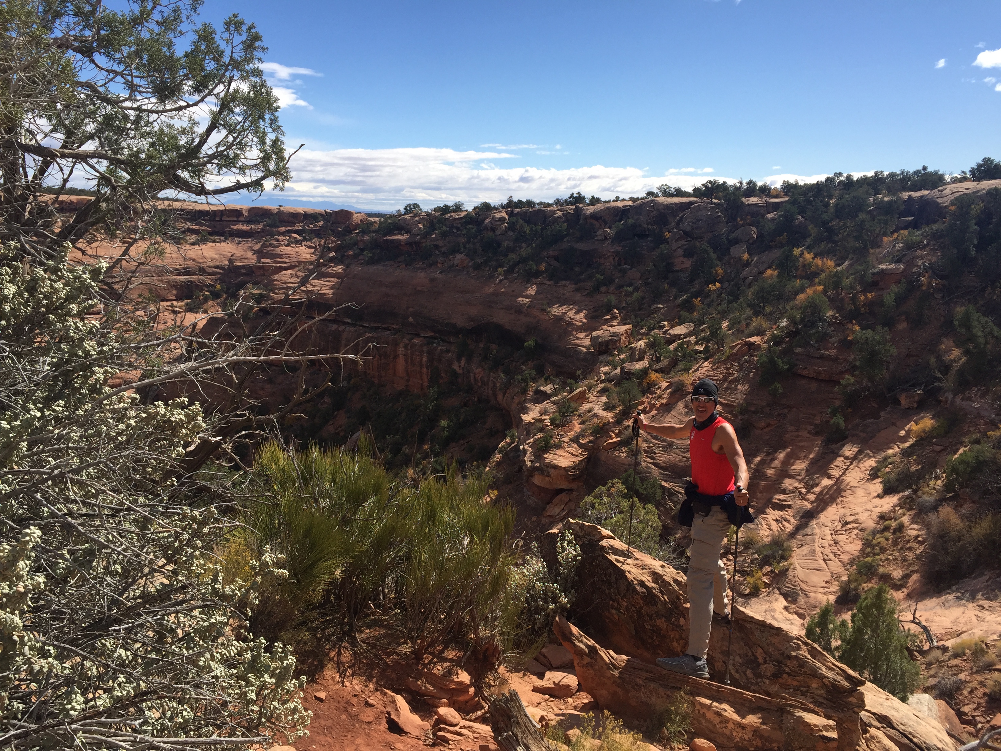
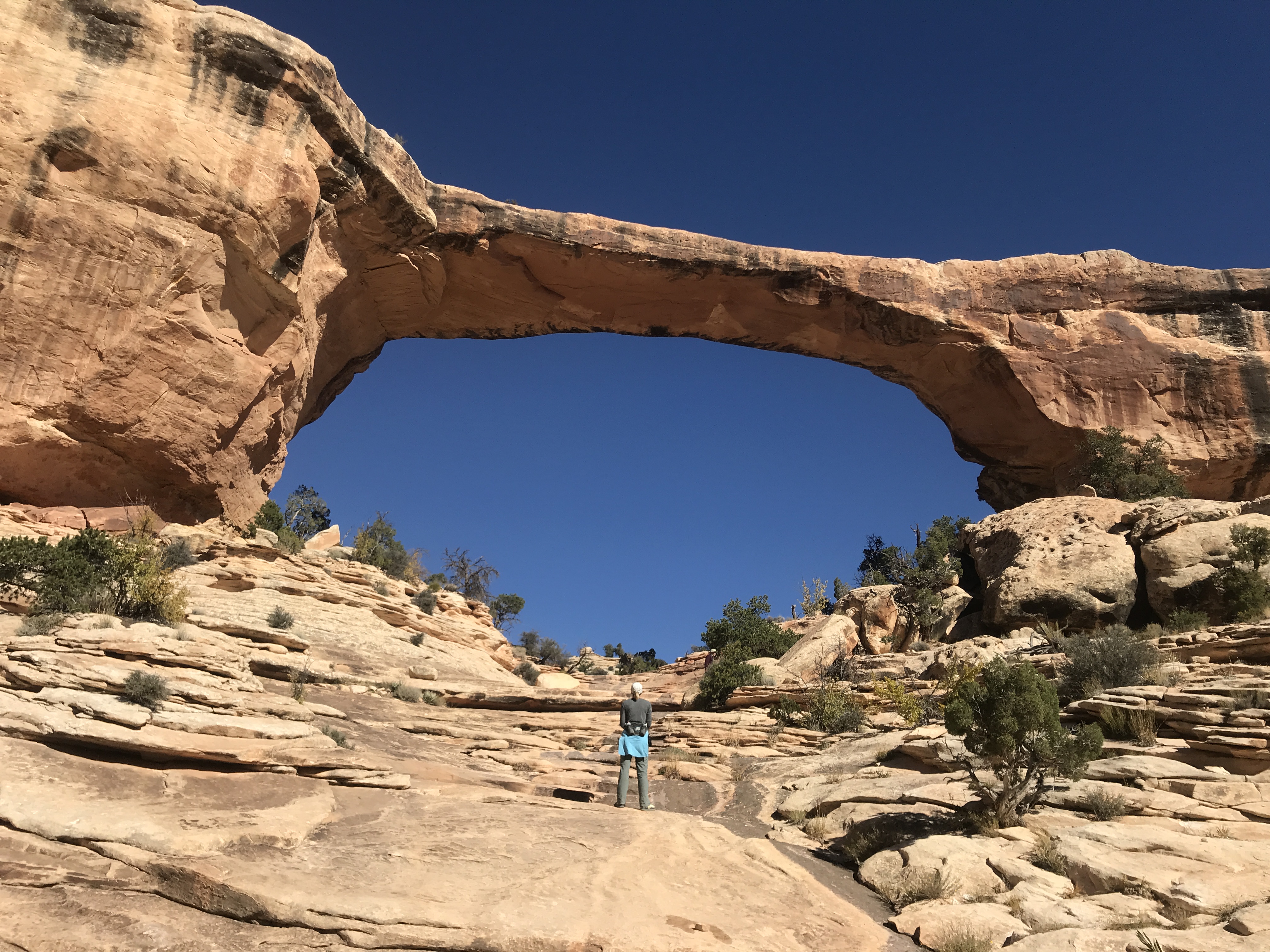
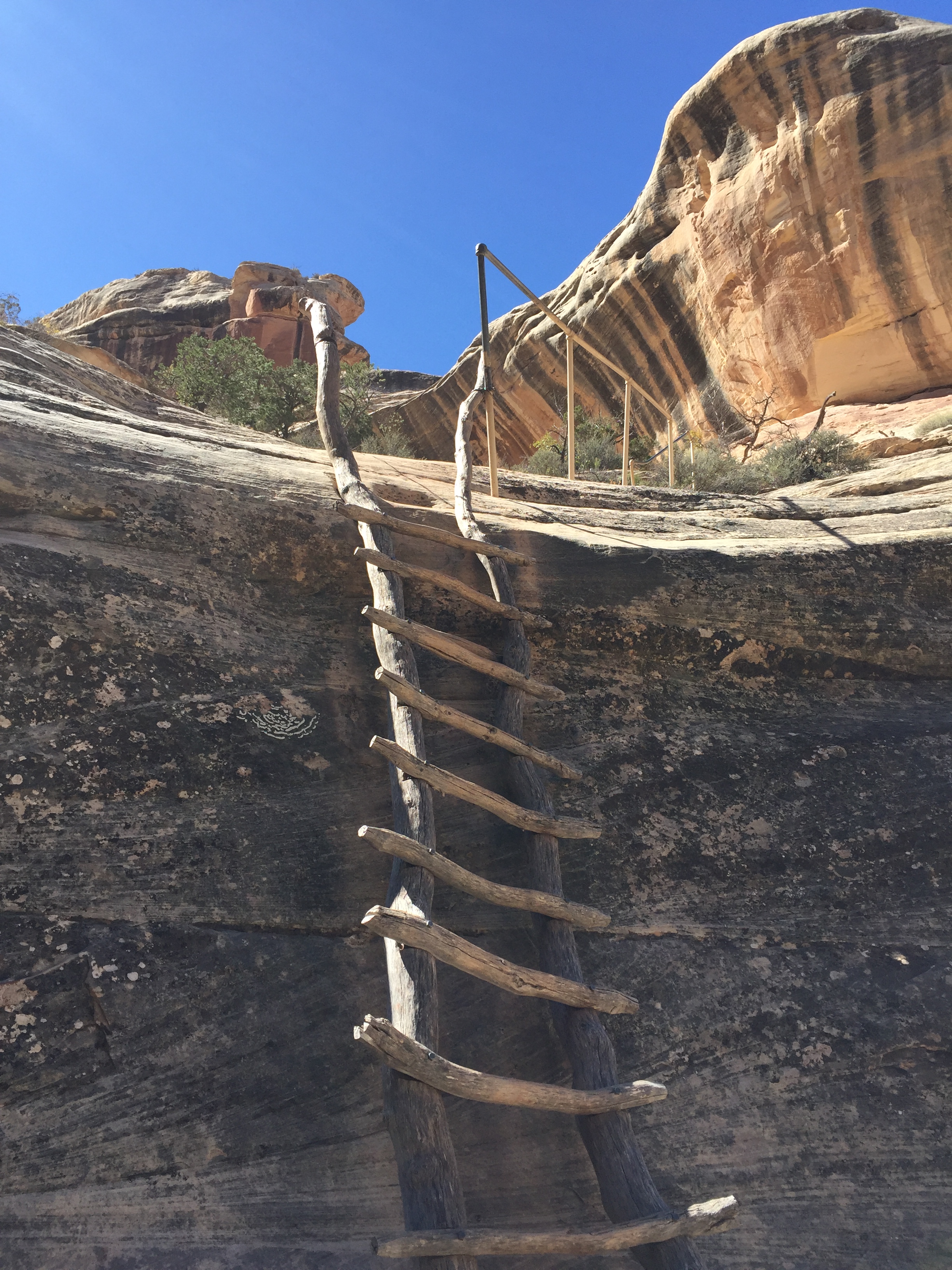
We would have done some hiking here but we wanted to reach the Kane Gulch Visitor Center just as they opened. We had read about several Anasazi cliff dwellings in Cedar Mesa and wanted to get more information about a hike to Moon House.
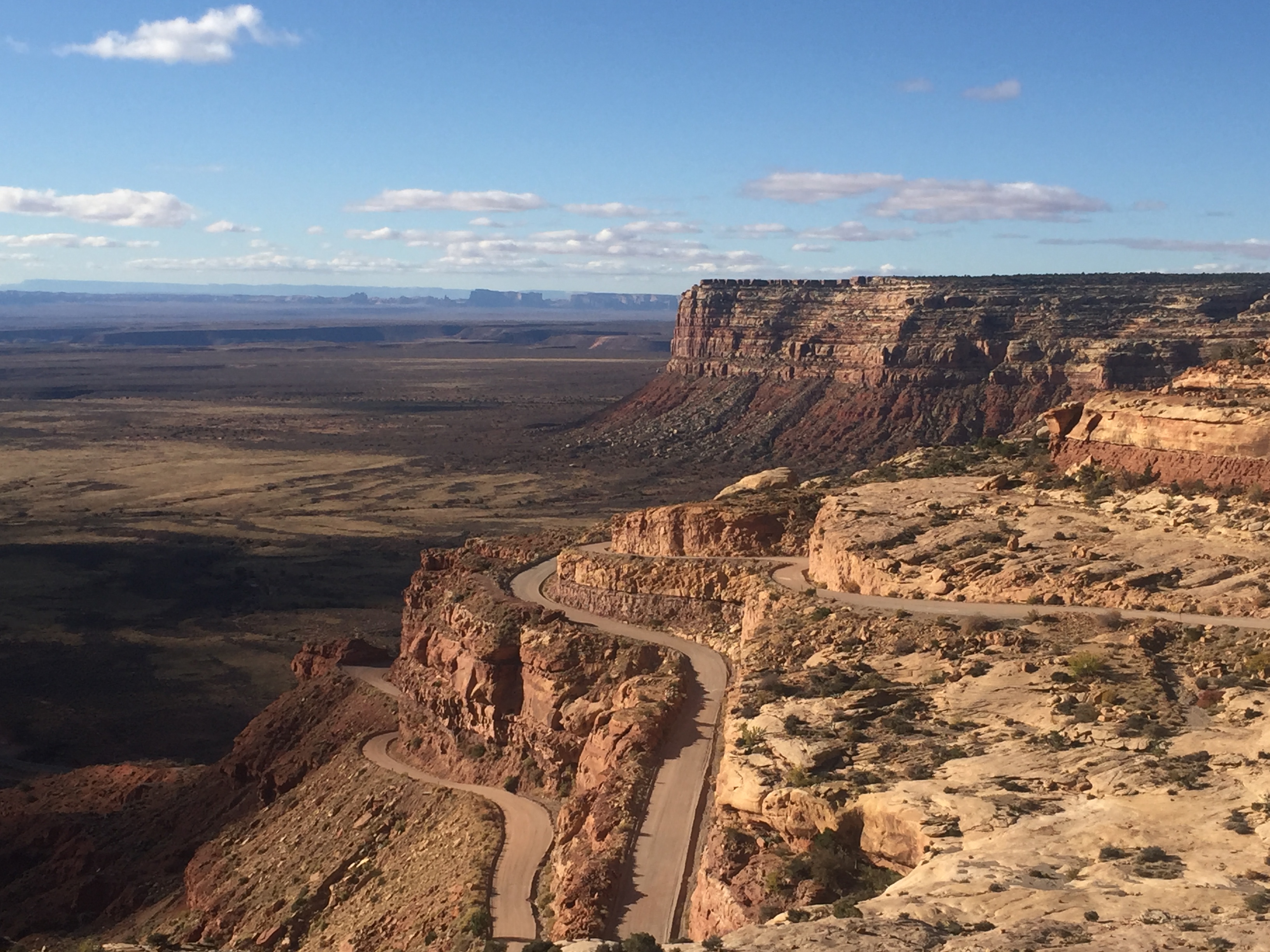
The stunning Trail of the Ancients Road
Moon House is a multi-room cliff dwelling named for its celestial pictograph depicting the moon in its different phases. It dates to the early 1200’s and is limited to 20 visitors per day via a first come permit system. It’s a rare cliff dwelling as you are allowed access to some interior rooms. Special instructions are given with the permit on how to enter the rooms without damaging the structures.
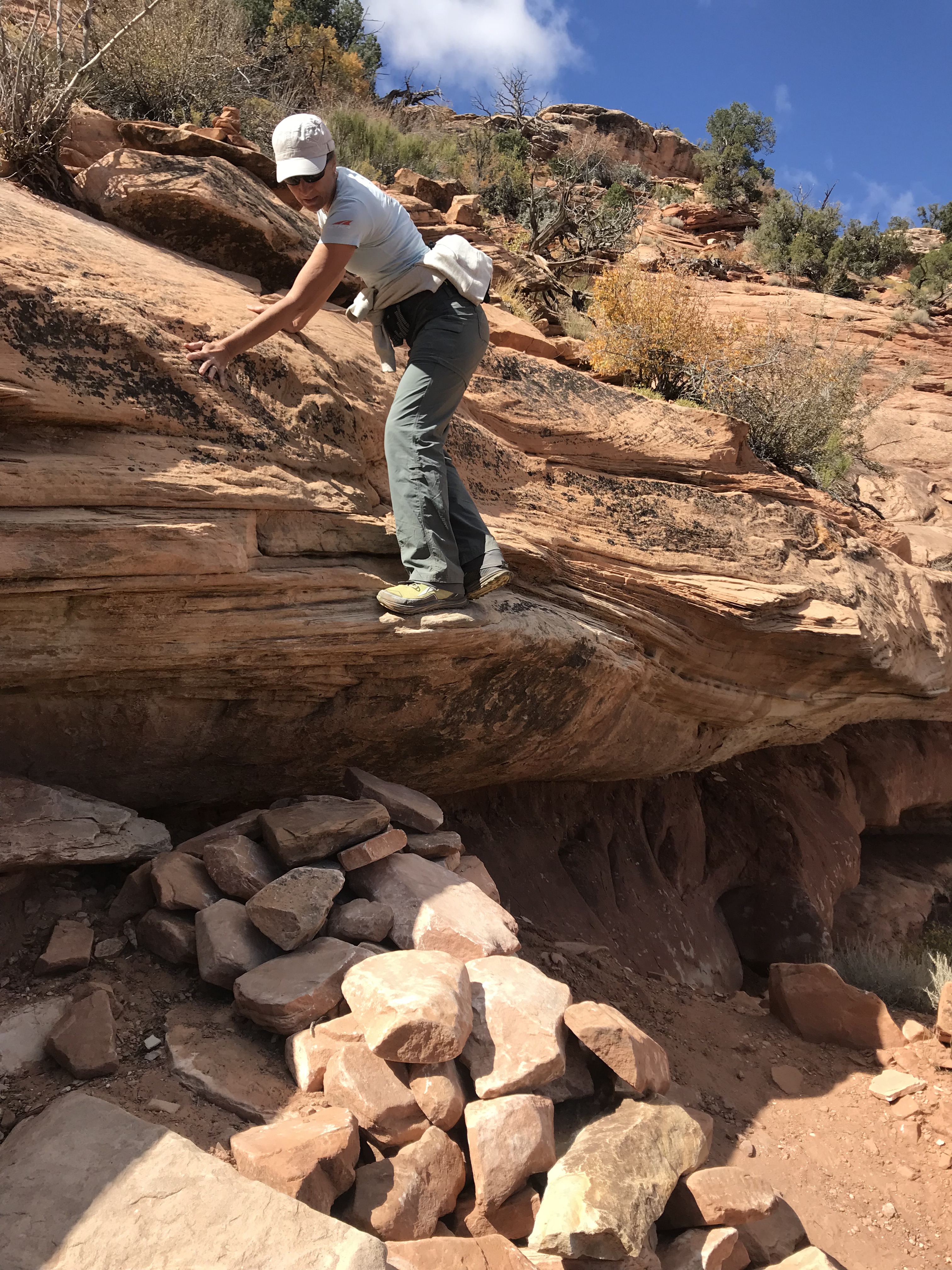
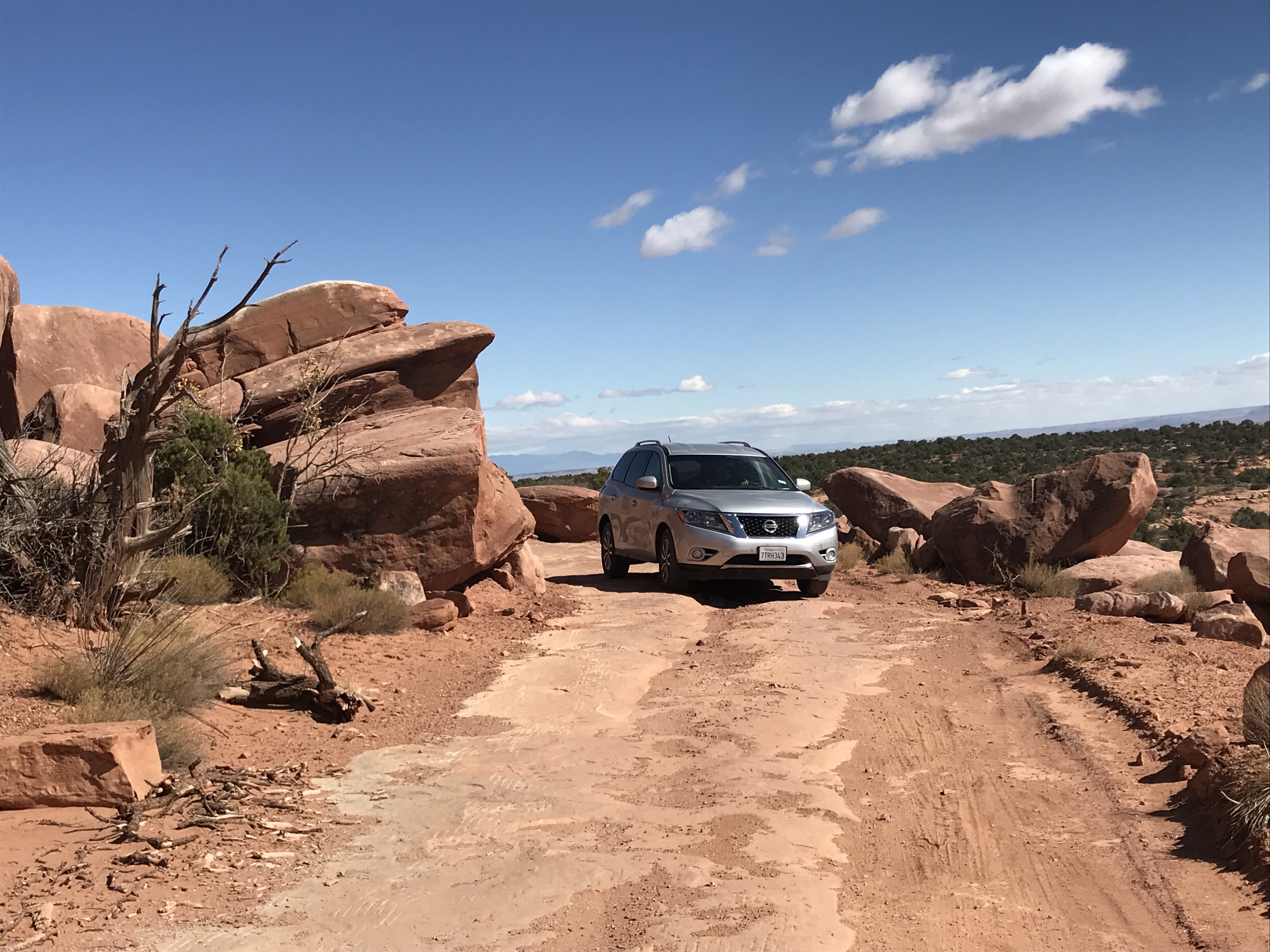
With permit in hand we headed towards McCloyd Canyon. We traveled about 8 miles down Snow Flat Road, a rough dirt road over rock slabs and rutted sections of sand and dirt. It was slow going and we were glad we had an all-wheel-drive SUV to get to the Trailhead parking area.
We started our hike and headed north on another road. After a mile we came a second parking area at the Moon House trailhead. Getting to this parking lot requires a true 4-wheel drive vehicle and we were glad we didn’t attempt it in our rental.
We are heading down there
One giant step for mankind
The trail started over sandstone slabs only visible by Cairns before it quickly starts a rocky decent. We took our time since the slope was steep and the rocks loose. At one point we had to slide down the lip of an overhung ledge to a rock pile down below.
We quickly dropped down into the canyon and reached the sandy floor before ascending the other side to Moon House.
Now you see me. Now you don’t!
Still standing after hundreds of years
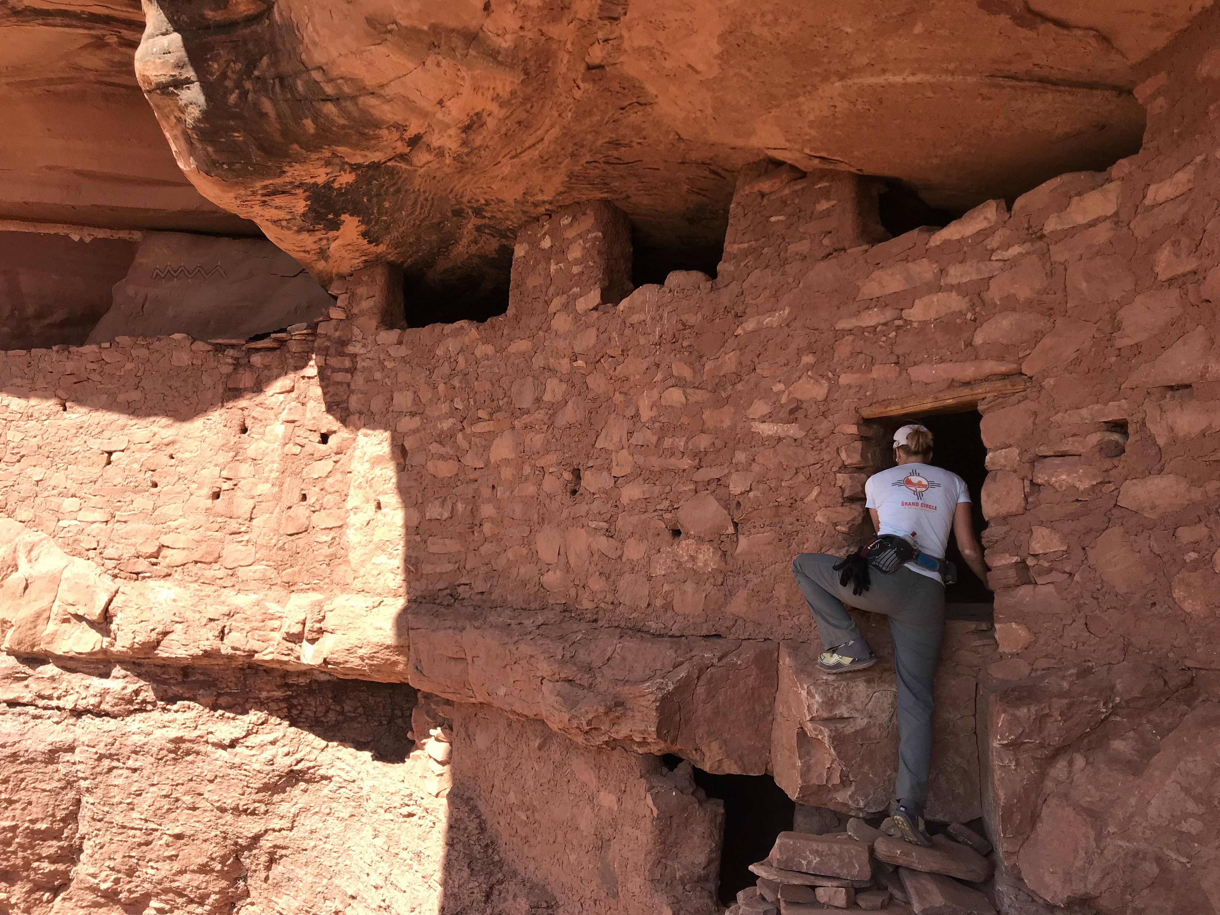
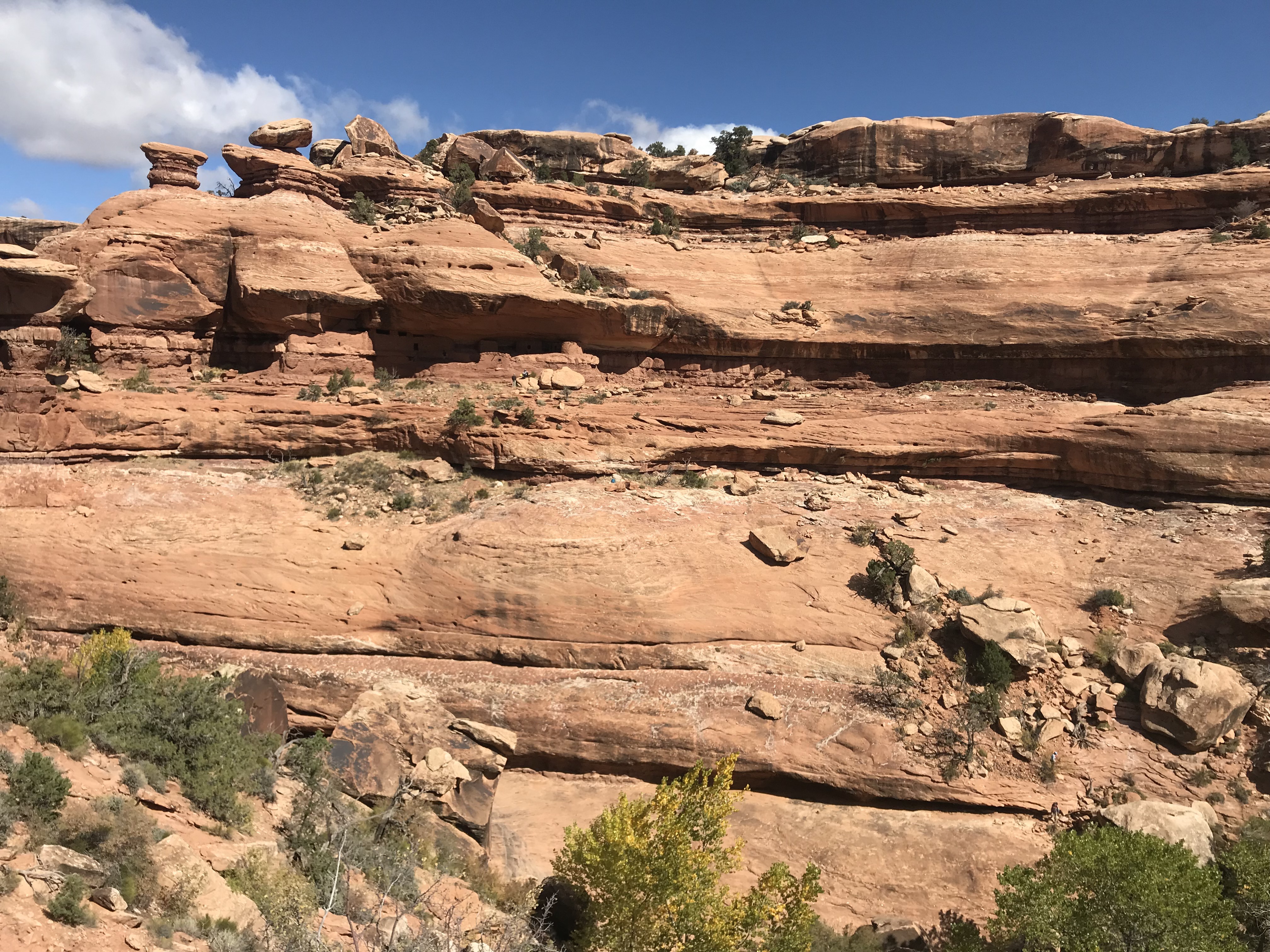
Enter with care
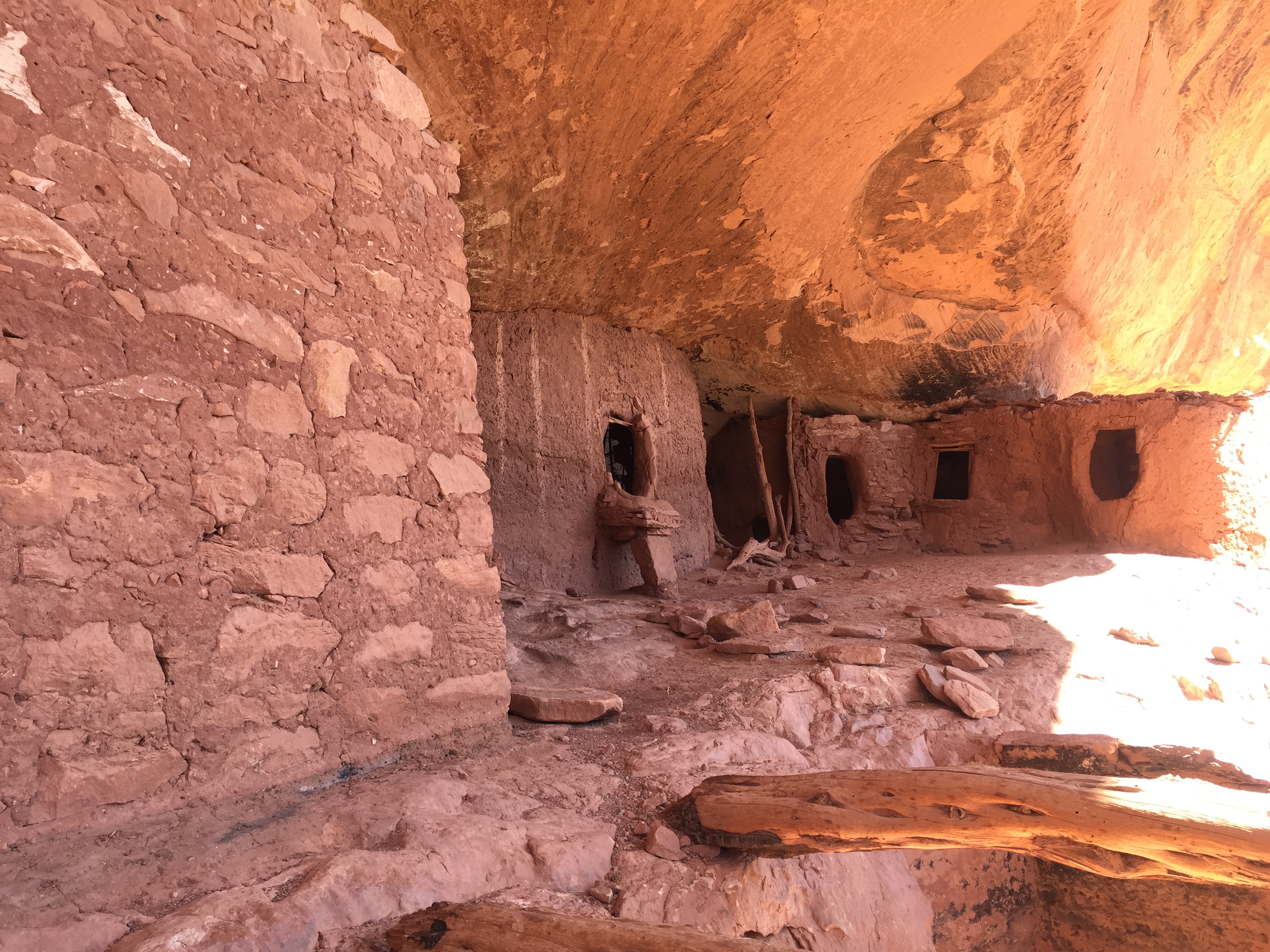
Cliff dwellings are amazing structures as they are built into the sides of raised ledges on the side of cliffs. They are very undetectable when you are not looking and sometimes when you are. We didn’t notice the dwelling until we were right up on it!
We explored the ruins and were glad we brought along our headlamps to shine into protected rooms. It was interesting to see the construction of vertical tree limbs smeared in mud to form small interior rooms or apartments.
The ancient pigment that created a long white band of Moon House was still vibrant and corncobs still lie on the floors in some of the rooms.
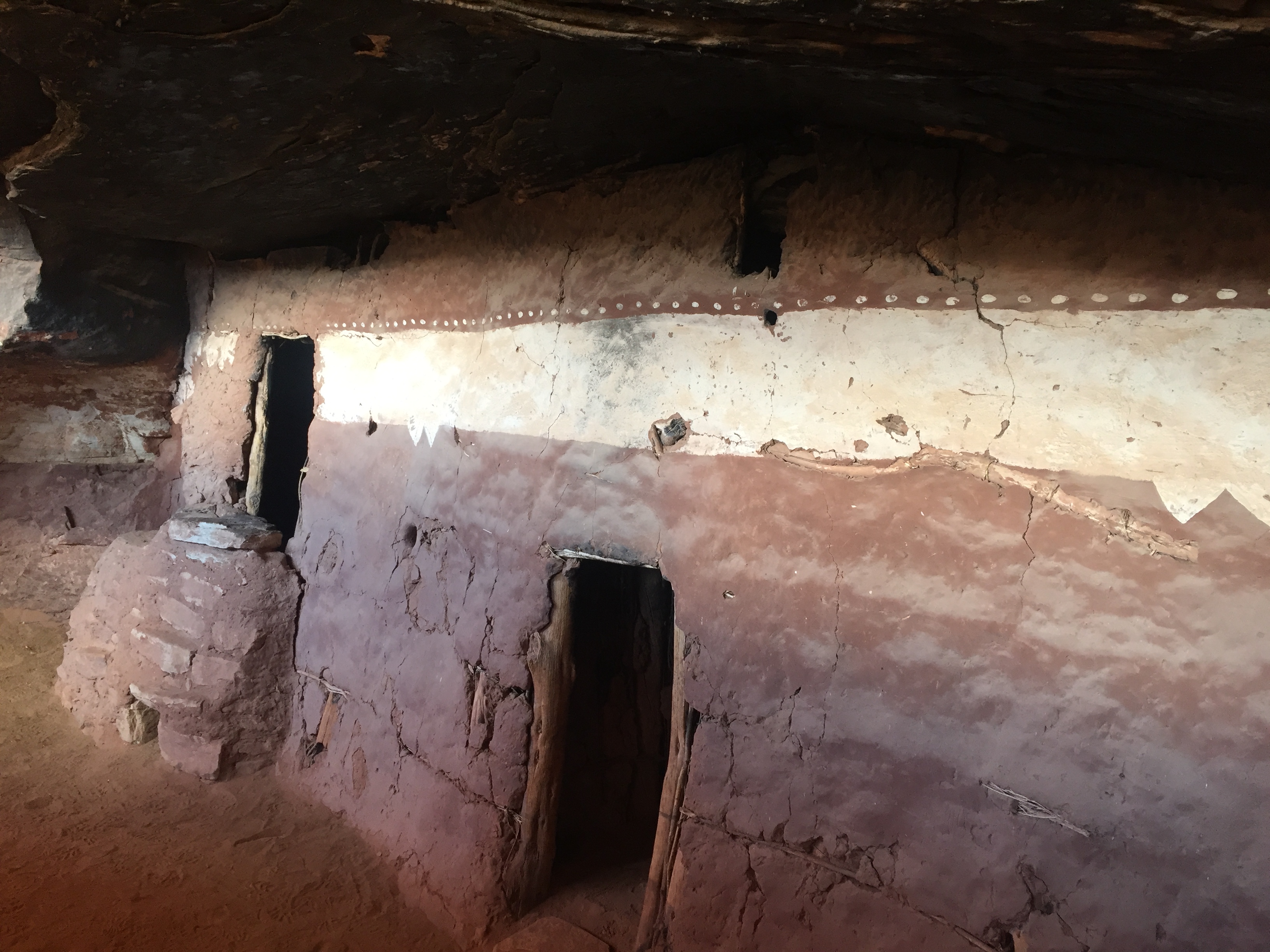
Pictograph giving Moon House its name
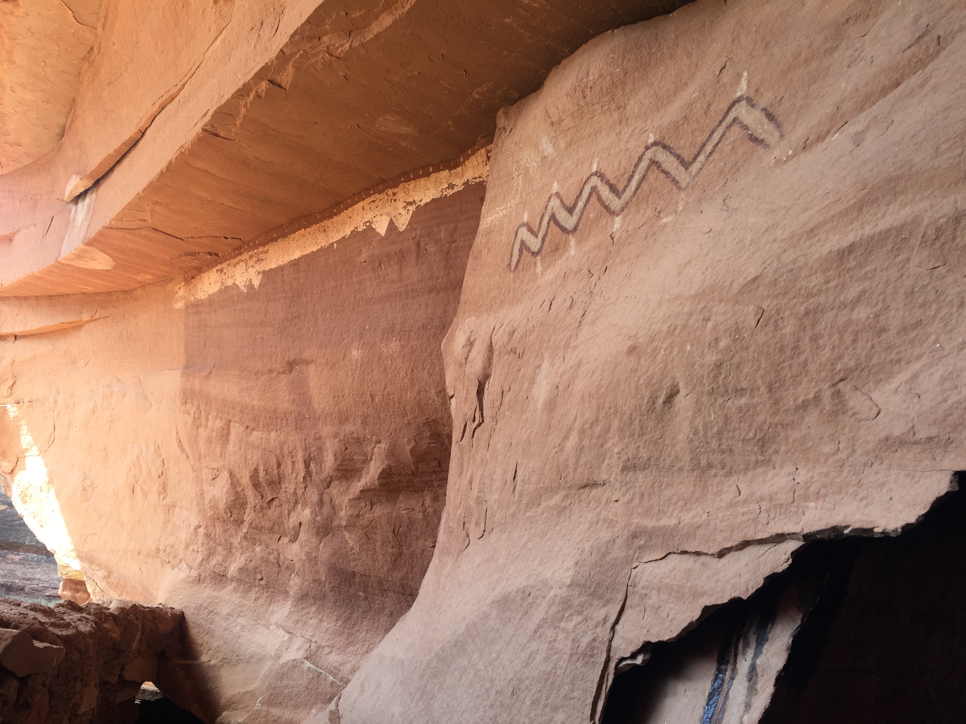
We followed more trails around the ledge that led to more buildings. After we started hiking back we turned around to take one last look and realized that we missed a whole other section of dwellings perfectly hidden in the side of the ledge where we sat to have lunch!
It was a nice 4.5-mile round trip hike. We like these destination hikes with history to research and a challenge to get to.
The rocky road to someplace special
By now it was late afternoon and we started to look for a place to camp overnight. The area is mostly BLM (Bureau of Land Management), which offers free camping off random dirt roads. Right off the corner of Hwy 95 and 261 was one of those dirt roads. We found a spot with the perfect amount of slope to make our bed level for the night.
Night two of car camping was not as volatile as night one, but dang it was freezing cold. The temperature dropped to 21 degrees and we had to run the car a good part of the night to stay warm. Of course I laid awake worrying about running out of gas and I had to get out of the car to pee behind a bush in the freezing cold while stepping through land mines of bull head stickers.
Come morning at the corner of Hwy 95 and 261 we needed to decide to turn left or right. To the left, at the risk of running out of gas, Natural Bridges National Monument. Turn right to Blanding for a service station and on to Moab.
Natural Bridges it is!
Unnamed tiny arch!
We didn’t know much about this National Monument so we drove through a beautiful little campground within the park for future RVing reference before heading to the visitor center.
It was too early to go inside, so we used the outdoor restrooms and made coffee with our recently rescued Jetboil.
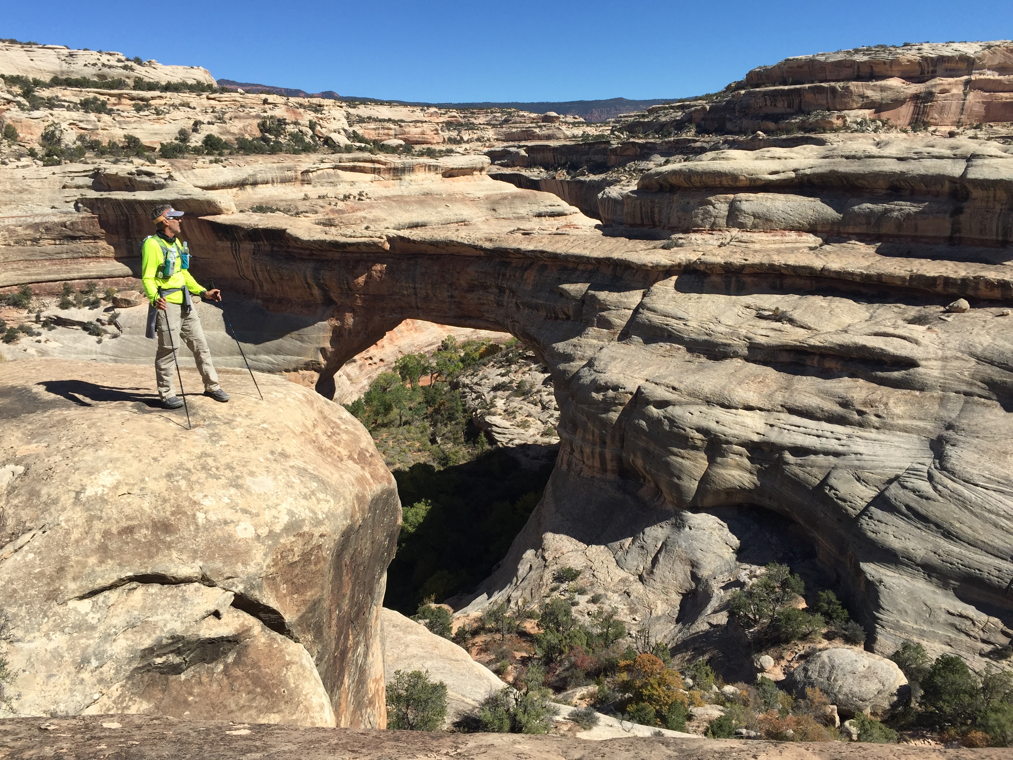
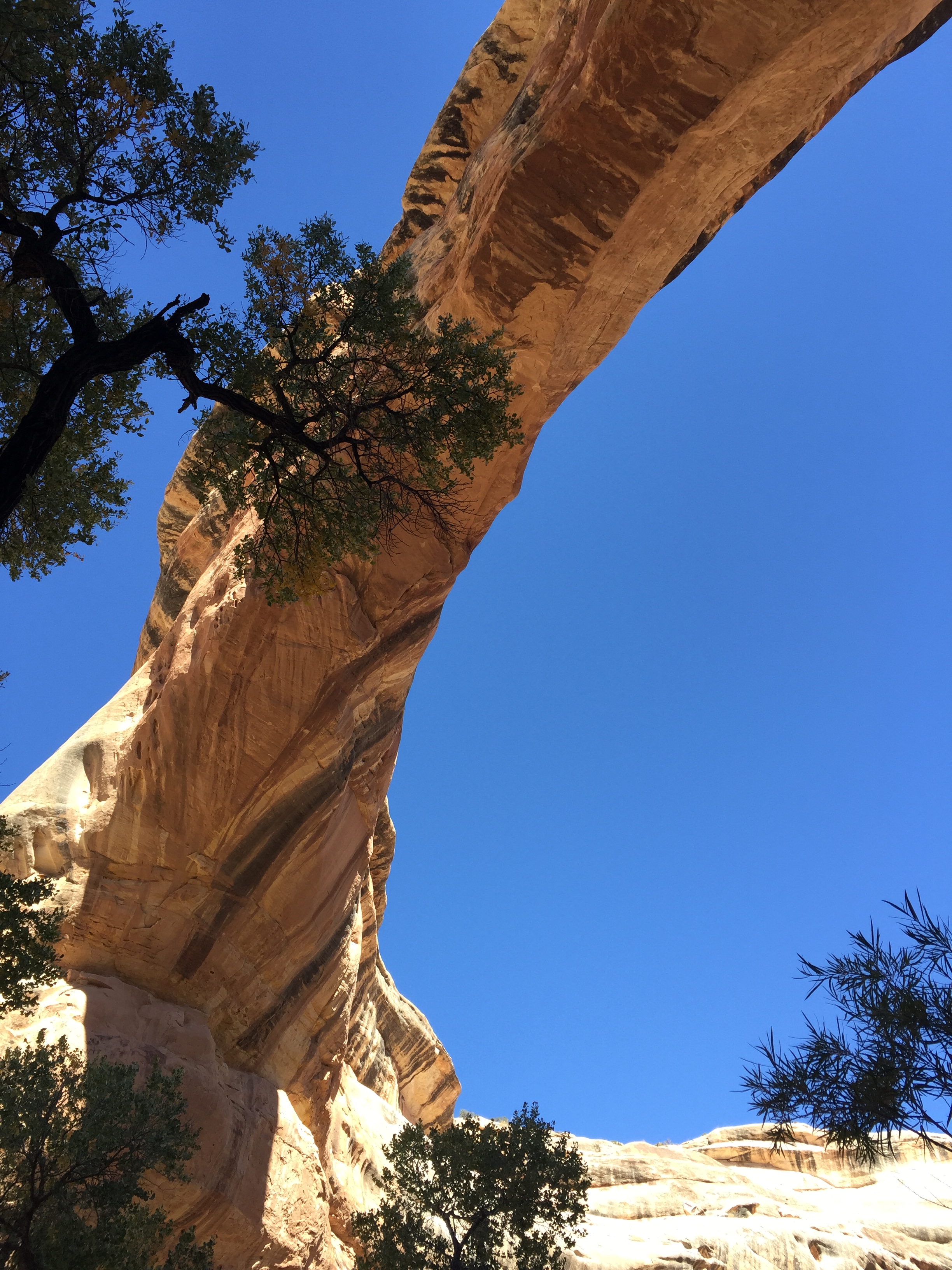
We read about taking the scenic 9-mile Bridge View Drive. The drive takes you to scenic viewpoints that overlook three spectacular arches. Sipapu (place of emergence), Kachina (dancer) and Owachomo (rock mound).
We wanted to do some hiking so we saw that there was an 8-mile loop along the canyon floor to each Bridge…up close and personal.
We started at the Kachina trailhead and descended down a staircase carved into the sandstone. We took the loop counter-clockwise since we thought we would be in the sun on this cold morning.
Chilly start
Aspens in October
Once we descending down to the riverbed the trail was flat and serpentine. Each rounded corner revealed new cliff views. We were keeping our eyes peel for petroglyphs and cliff dwellings that we heard were along the trail.
After a couple of miles the trail took a sharp left over slabs and ledges and there stood the magnificent Owachomo Bridge. It was so vast. So tall. The pure blue sky was the perfect backdrop for the white sandstone bridge.
There she is!
Owachomo Bridge
The trail traversed out of the canyon and crossed the inner circle of the Bridge View loop over to the Sipapu trailhead. This part of the trail is known for its dramatic vertical drop via sections of ladders and staircases to the base of Sipapu Bridge.
Just our kind of trail!
Sipapu from above
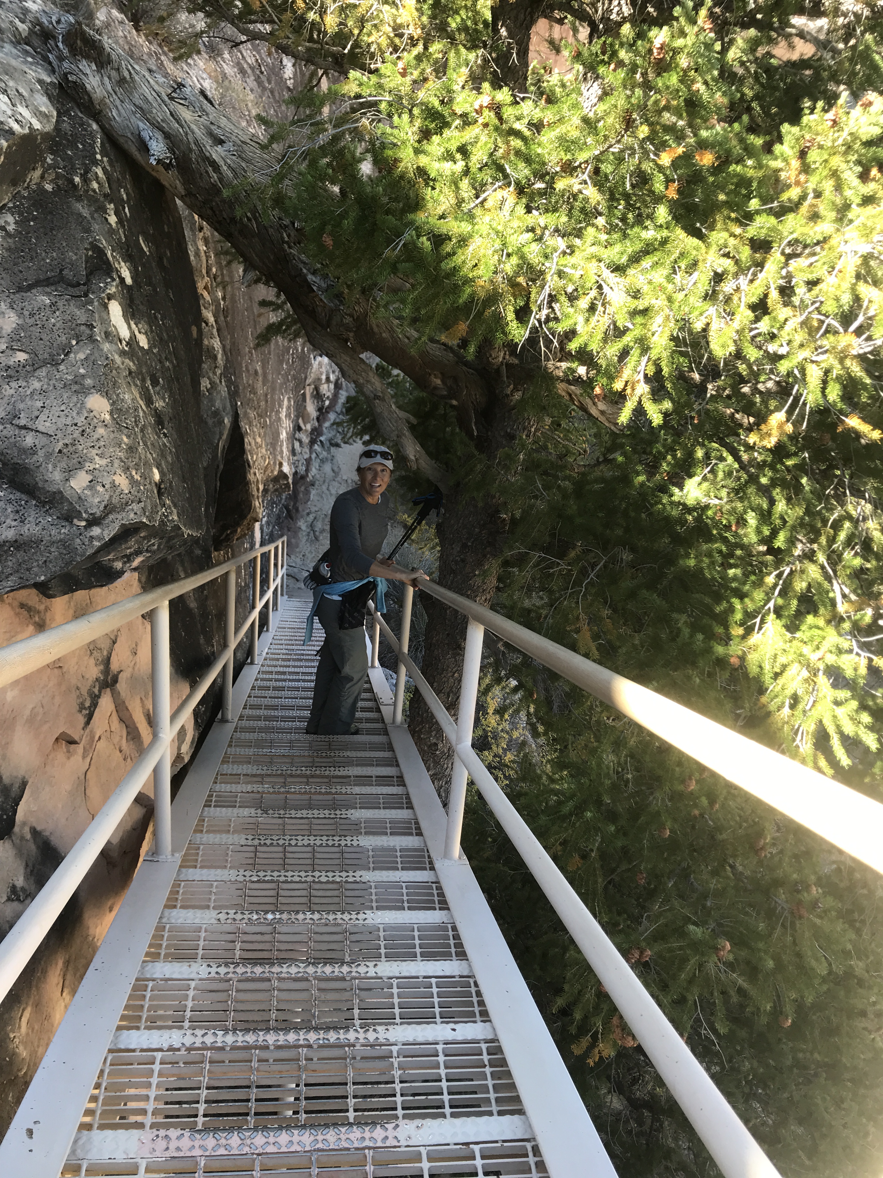
Staircase down the cliff edge
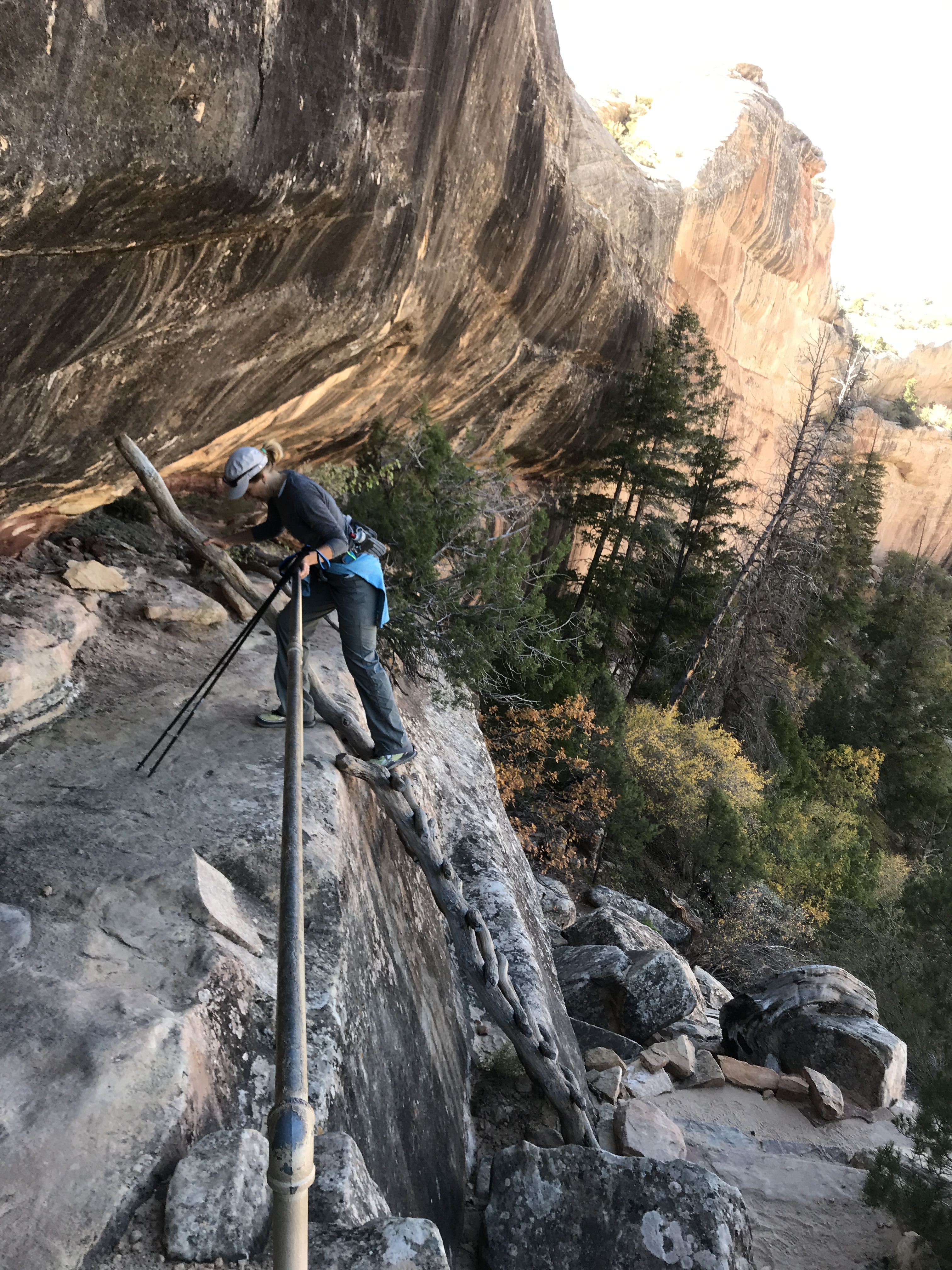
Descending ladders
Sipapu from below
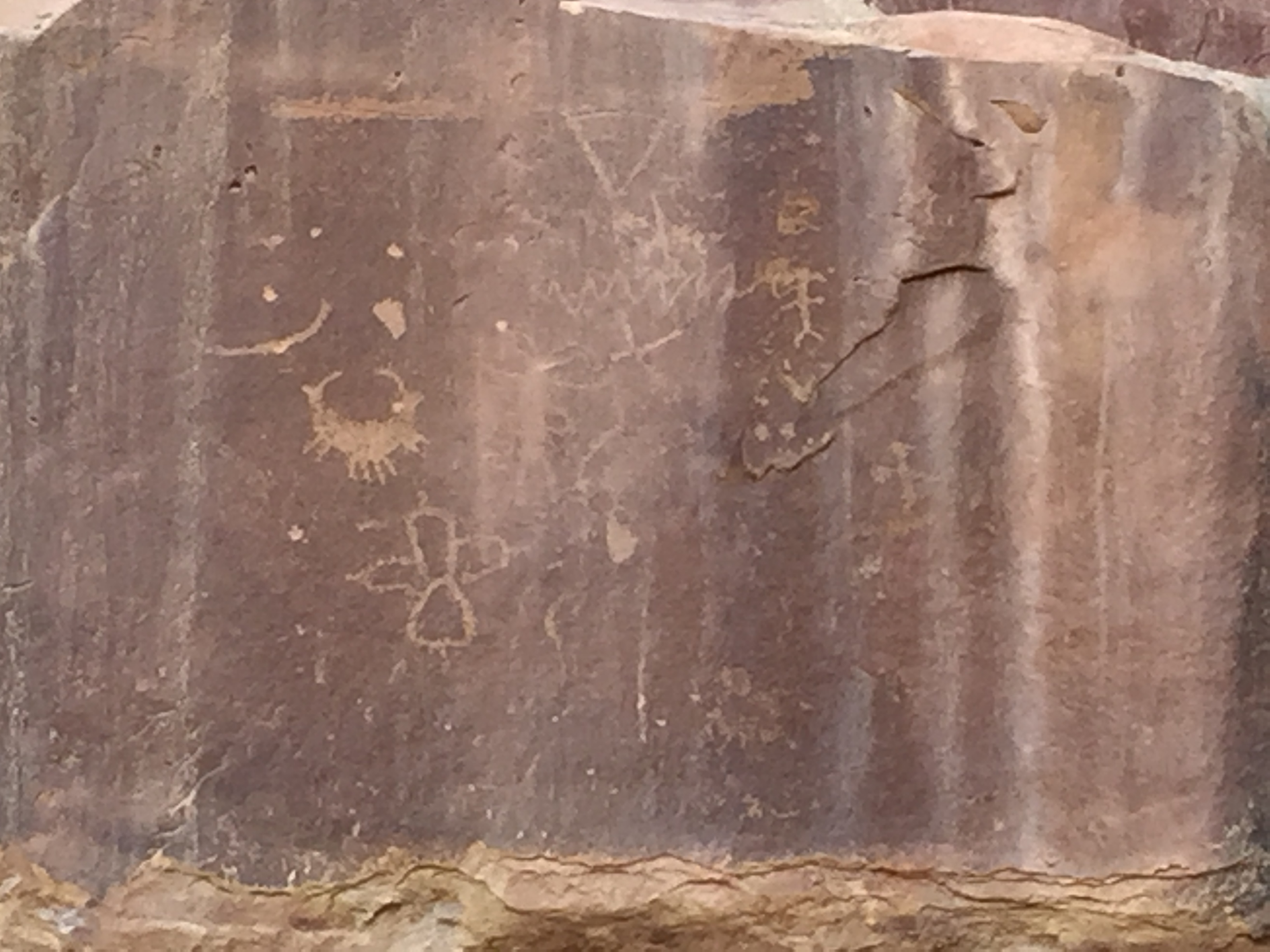
The ladders were a bit intimidating as first but we were back down in the canyon along the dried riverbed before we knew it. After spending some time at Sipapu Bridge we followed the trail along the cliff walls to Kachina Bridge. We finally found Horse Collar Ruins and came across Petroglyphs along the walls of Kachina.
Petroglyphs are really quite amazing to have stood the test of time. They tell a story of life our modern day selves have never known. Hunting and gathering. Conflicts and battles. Everyday life lived amongst the walls.
Horse Collar Ruins
Kachina Bridge
We hiked out of the canyon and back to the car. This was such an enjoyable hike and I would recommend it if ever in the area. I would like to come back and hike it in the opposite direction for another perspective of its walls, bridges and stairs.
After Natural Bridges Jeff and I made our way to Moab. By now it had been 6 days without modern conveniences. After looking at the freezing temps forecasted I cried UNCLE and made a reservation at a hotel. By now my back was killing me from trying to climb around in the back of an SUV and my fingernails were telling the truth about how badly I needed a shower. I couldn’t stand the smell of my own hair another day!
Ya…I had enough of this!
I can’t tell you how awesome that shower felt! And after that first night in a room and being able to stand up to put my pants on I begged Jeff for another night…then a couple more. We both had to admit at this point that we (ok, maybe me more than Jeff) were not the car camping sorts.
We never did spend another night in that car!
While in Moab we visited the local Laundromat, ate real food in restaurants and Jeff went to watch the start of the Moab Ultra 200 trail race. Being the Ultra runner he is he wanted to see what the next level of crazy looks like. Apparently, once you’ve finished a 100 race, you begin to wonder if you could do 200 (or so I’ve heard).
Crazy runners!
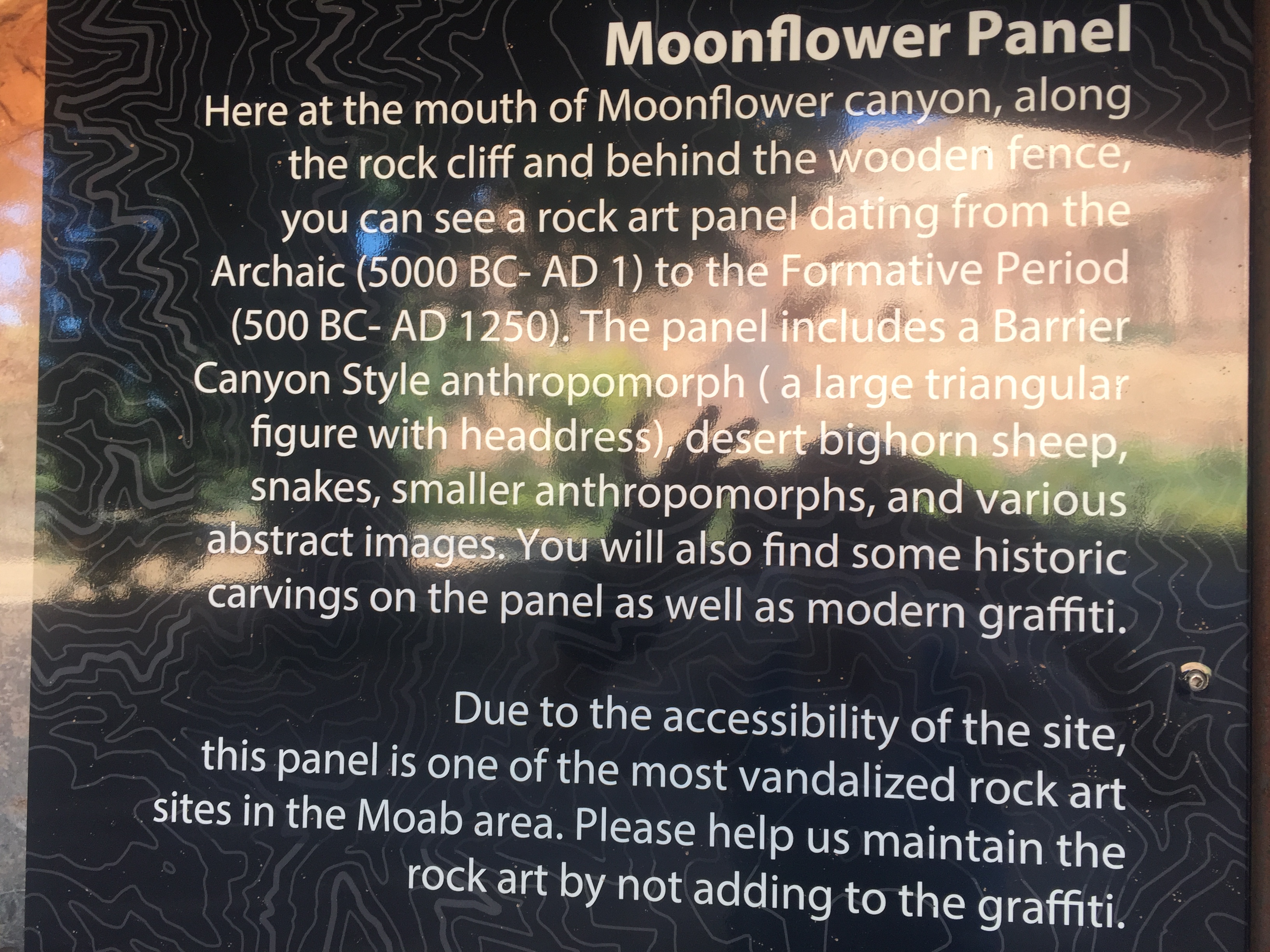
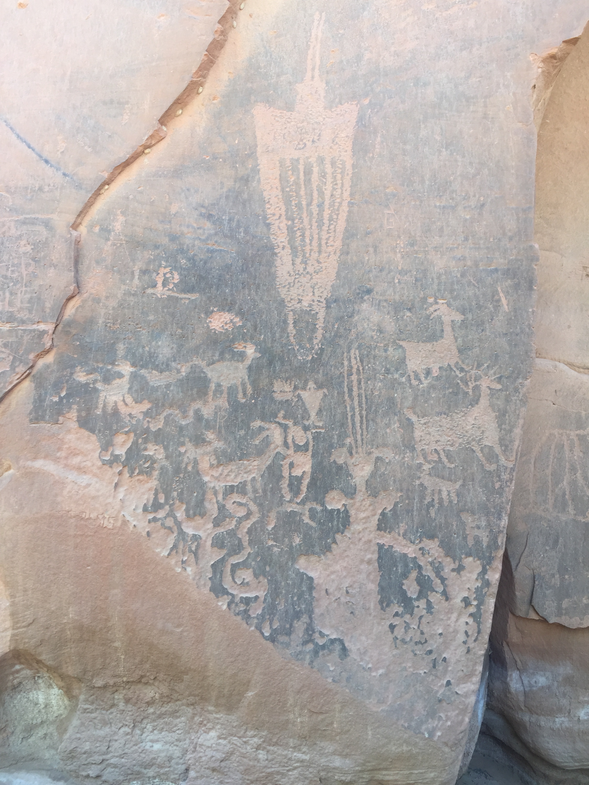
We took a drive out on the course and then stopped to look for the Moonflower Panel Petroglyph nearby. We took a trail a couple miles back without seeing a single Petroglyph but once back at the trailhead we realized the slab of ancient art was right at the parking lot.
It was very interesting to see the similarities of art from one location to the other.
While we were in Moab we hooked up with some friends from our RVing group, The Xscapers. We had burgers at Milts Stop & Eat. Milts is well known for their awesome burgers that totally lived up to the hype! It was a great time meeting new friends and getting reacquainted with some that we hadn’t seen in two years.
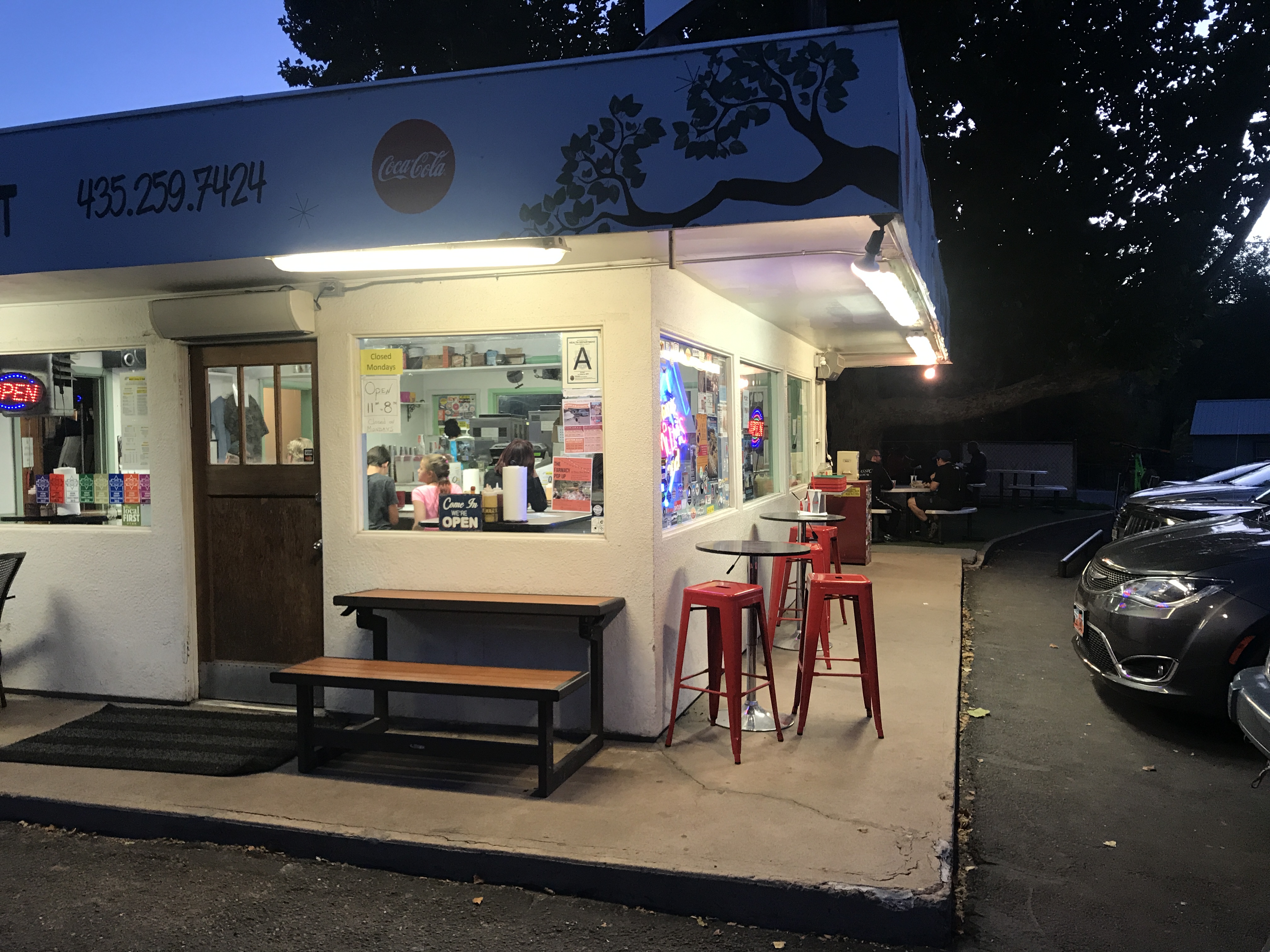
Milts Stop & Eat
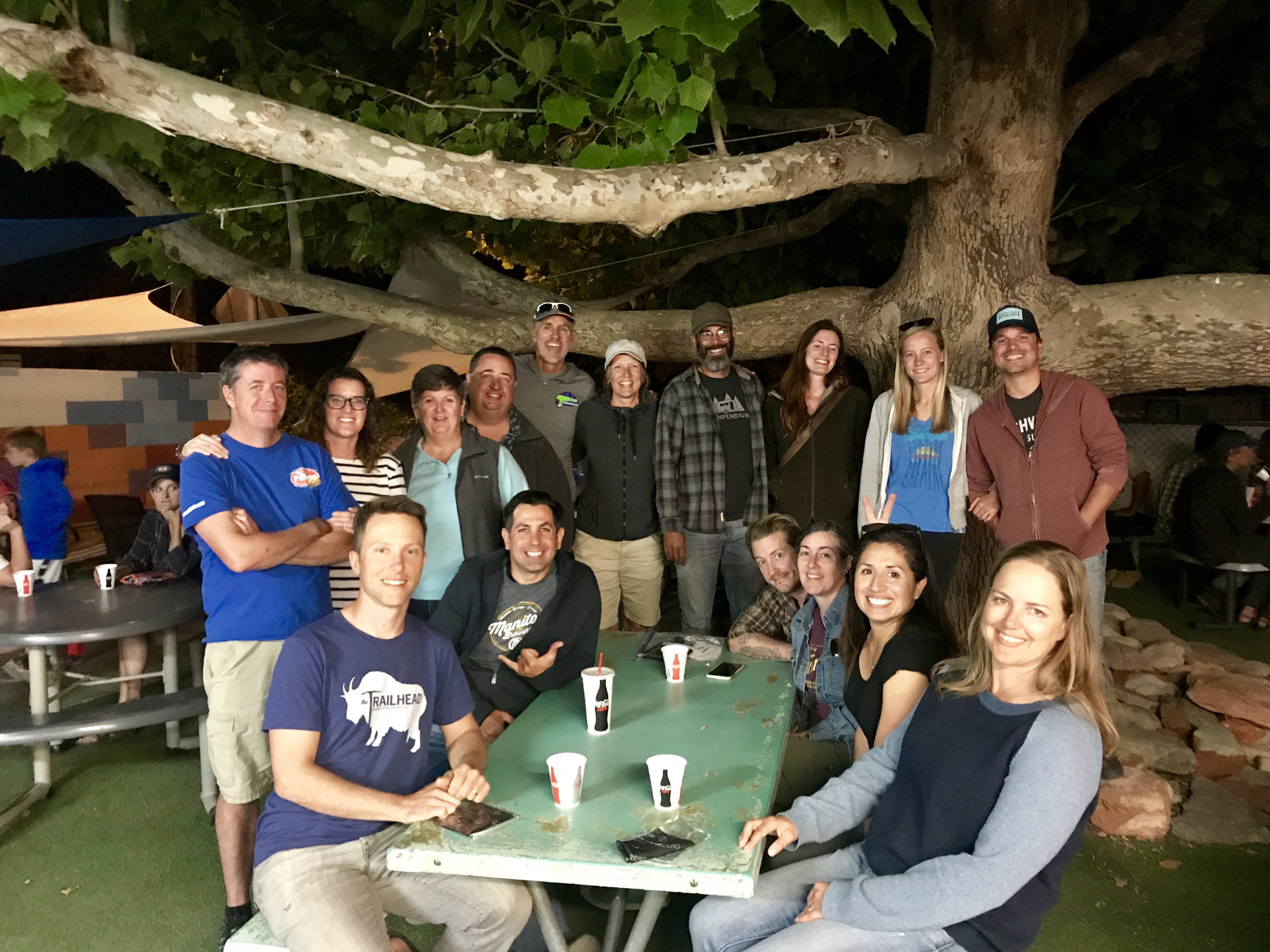
Crazy Xscapers friends
After Moab we drove to Park City, Utah for a quick overnight before flying out of Salt Lake City back to Arkansas.
Despite the challenges of car camping, this was an amazing trip. To be nimble in a small vehicle instead of a 32’ RV was refreshing to say the least and we found ourselves exploring/considering other routes and locations that we would not normally have the luxury of considering.
I’m certain we will keep that in mind when we pick our next RV!
Where to next?
Havasupai Falls. Leaving the RV Behind. Part II
Posted by Deb in Bucket List, Full Time RV, Grand Canyon, Hiking, Running, Trail Run, Ultra Running on December 28, 2017
Before we came on this trip, we had heard about Native American frybread. We passed the bread tent on our hike into the campground the day before, but it wasn’t opened. And after seeing the posted sign about its hours, I wasn’t sure it would open while we were there.
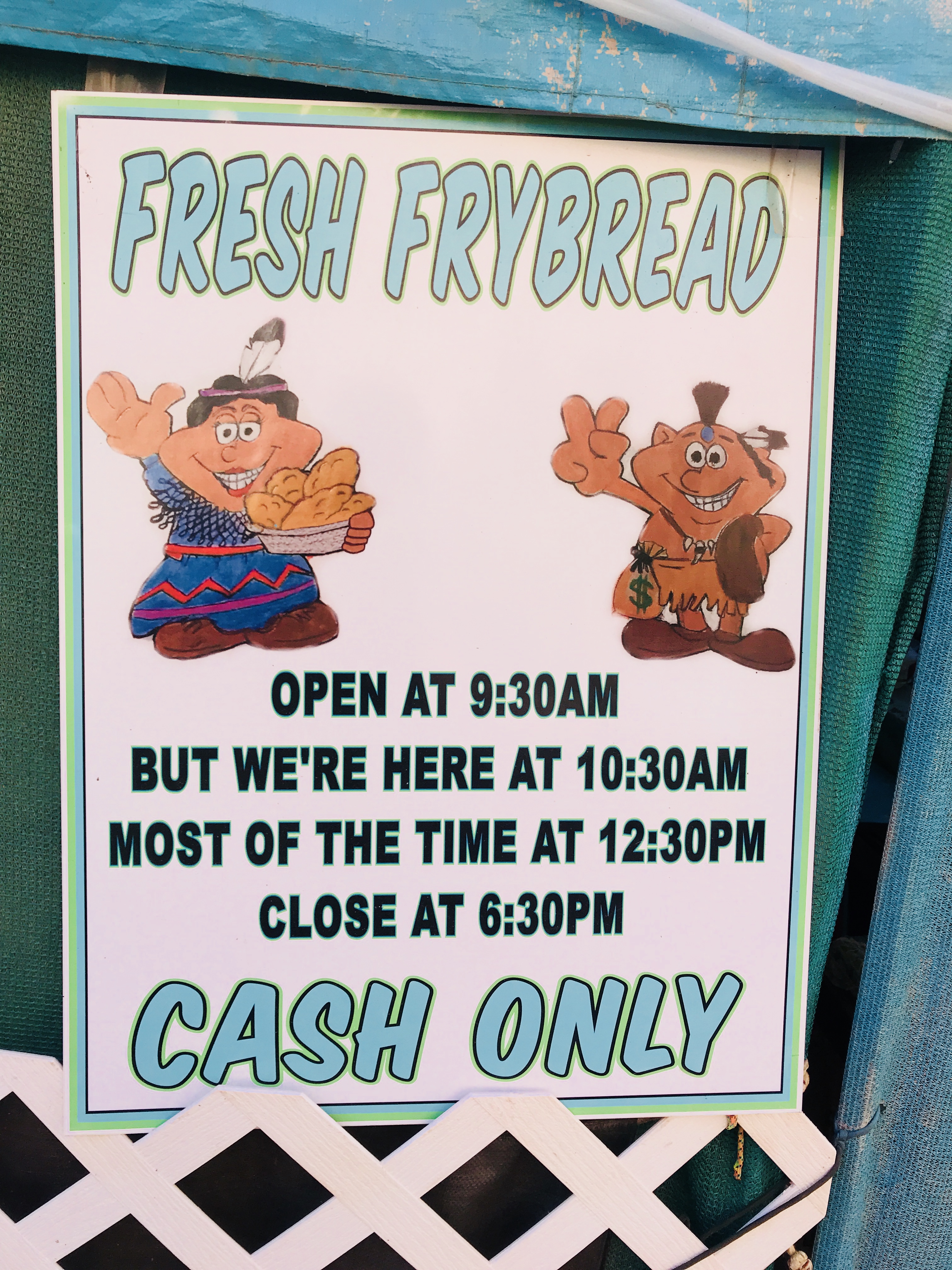
Non-committed business hours
After my hike to Beaver Falls I made the 1-mile hike through the campground to see if they were open. And sure enough, they were! After placing my order I was handed a ticket with a number. About an hour later this one-women show announced that my Navajo Taco was ready. Frybread is very similar to funnel cake topped but not as sweet. The taco was topped with seasoned hamburger, cheese and salsa. Just what the trail doctor ordered! It was REALLY good and I was kicking myself to for not ordering a sweet bread at the same time.
By the time I made it back to camp Jeff was back from his hike to the Confluence and sleeping soundly in his hammock.
“The Confluence”…Havasu Creek meets Colorado River
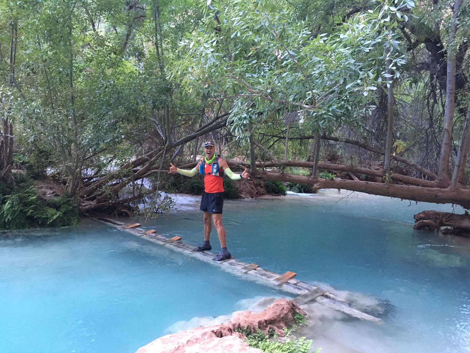
Day three we decided to stay closer to the campground. We started the morning with a picnic table birthday massage for Jeff. I could have made a pretty penny by those passing by ready to be next. Then we packed some snacks and made about a 1-½ mile hike up the campground to Havasu Falls.
The mist off the falls was pretty chilly, especially since the area was still shaded. We made it just in time to see a very large yoga class finishing up. One of the tour groups offers yoga and massages at the falls.
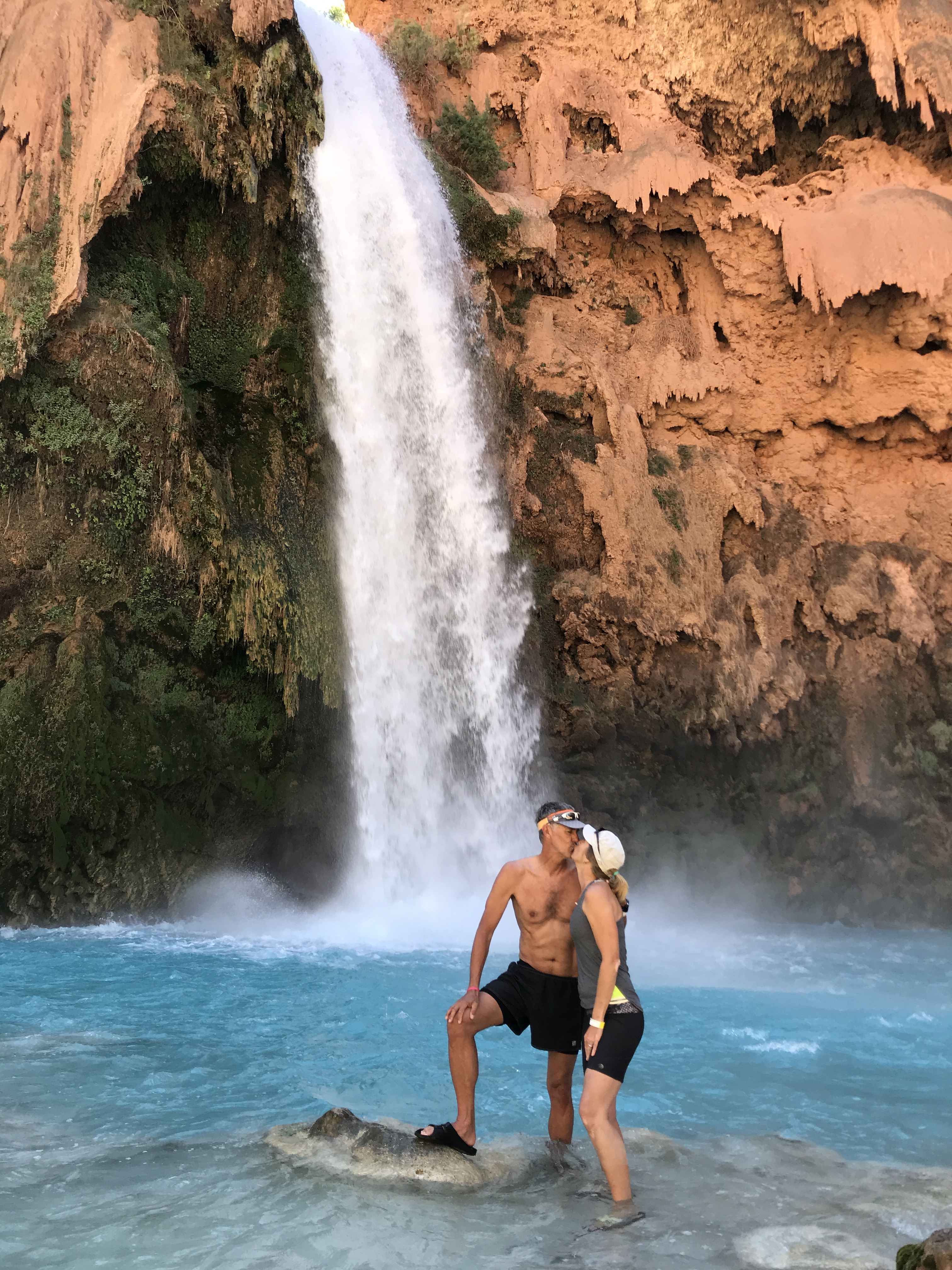
Havasu Falls Smooch
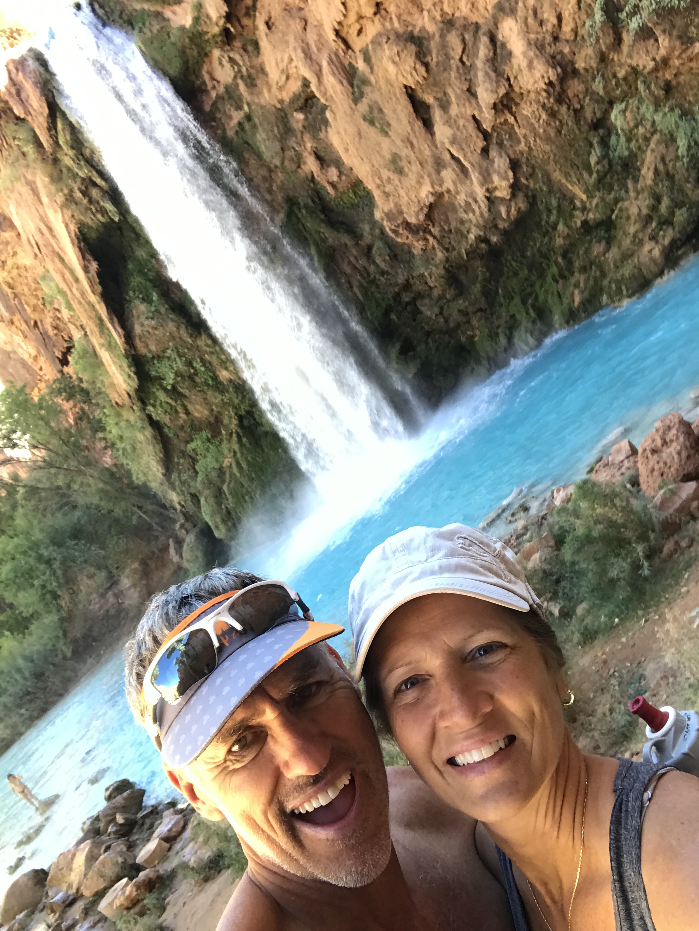
I still can’t believe this water!
We didn’t have much ground cover so we found ourselves sitting in sand and powdered dirt. We sunned ourselves and explored the falls before heading to the bread tent to place an order. This time we got a 3-layer sweat bread treat (aka Jeff’s Birthday Cake) and a Navajo taco. The sweet bread is topped with nutella, jelly, honey and/or powdered sugar to build your confection as you please. The bread is soft, doughy and the perfect amount of sweetness to go sweet or salty.
This was a special treat especially since we were going on day 3 of nut bars and dehydrated packaged meals.
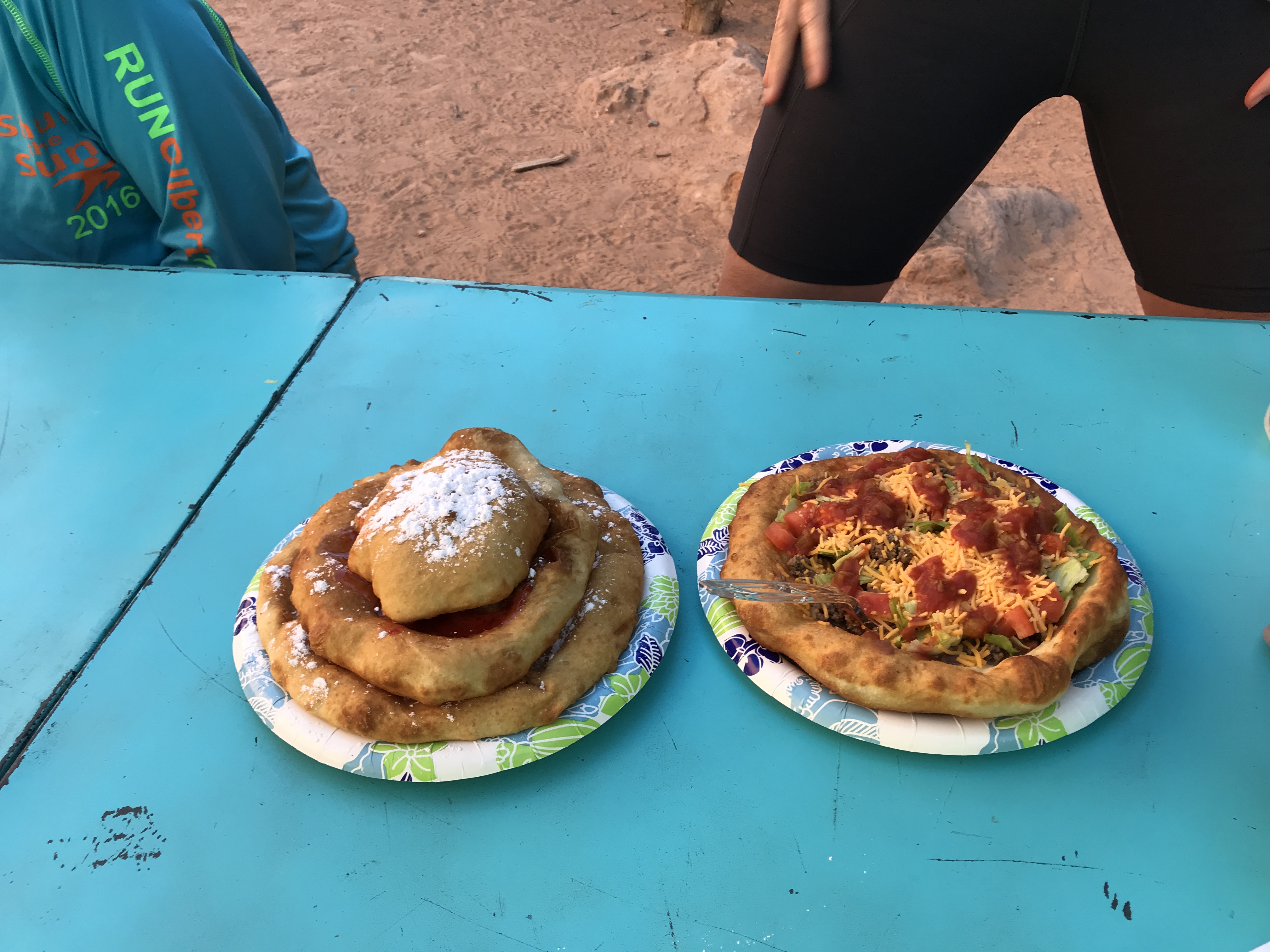
So yummy!
After our snack we decided to join some friends and hike up the hill further to explore Navajo Falls. We spent a couple of hours taking a bath splashing around the pools before heading back to camp.
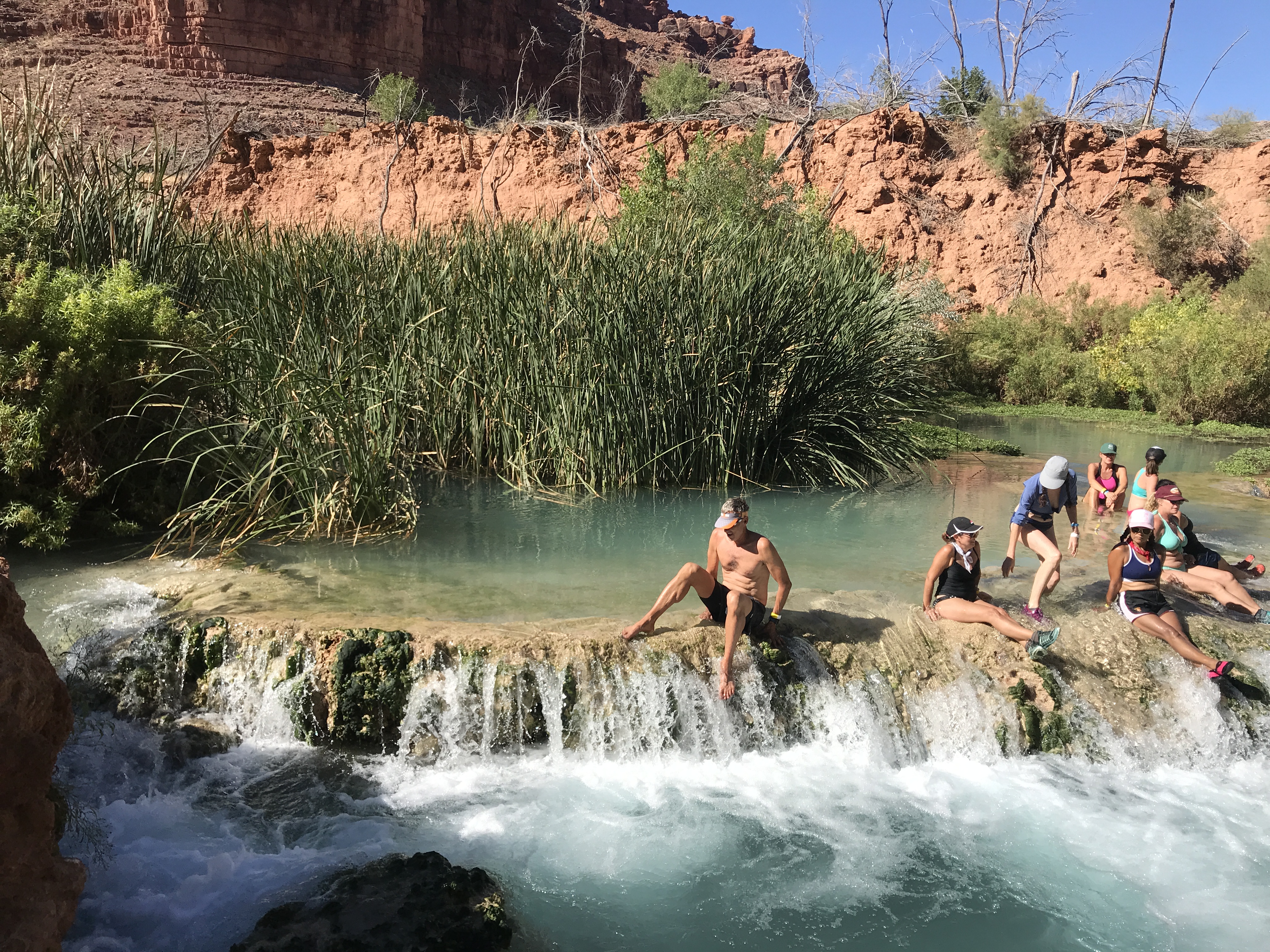
Navajo Falls
Each night as the sun went down about 6:30 the temperatures plummeted into the 40’s. Campfires are not allowed so all that was left to do to stay warm was go to bed. Surprisingly I slept very well on my camp mattress on top of the picnic table all bundled up in my mummy sack while Jeff slept well in his hammock. Note to self…spring for the tent!
Day four we planned to pack up quite early to beat the sun/heat on the hike back to the trailhead. We had that last mile of climb that we were thinking about. We knew that it would difficult with our heavy packs and didn’t want to add canyon heat to it.
It took us 4 ½ hours to hike down so we thought it would take us an extra hour to hike back up. We left camp at 4:30am to a full moon and made a quick stop for water at the campground spring before starting the two-mile steep incline to the village.
At the village we saw a long line already forming for those taking the helicopter out. The helicopter is pre-reserved, but the seats are first-come first-serve and can take all day. They still had hours to wait until the helicopter even fired up for the day.
We hiked through the village while it was still dark and followed posted signs directing us to the trail. Things sure look a lot different in the dark and before we knew it we were standing at a creek crossing that neither of us remembered from before. Realizing that we missed the trail somewhere we backtracked about a quarter mile and were led astray by mule poop that followed some miscellaneous path in the woods.
After reaching a dead end we backtracked to the main trail and started back towards the creek again. This time we saw the clear trail that led to a bridge (just steps away) to cross the creek.
The trail was easy from here as the sun started to rise. Jeff and I were booking it and we found ourselves at the base of the last 1-mile canyon climb before we knew it. I have often said on hikes like this that my mind takes a seemingly mundane molehill and turns it into an impossible mountain. I was dreading this section for days! But after about 40 minutes we were cresting the cliff and snapping pictures of our completed task.
We made it!
It really wasn’t a big deal and we made the entire trip in 4 hours. The thing that helped A LOT was that we figured out how to cinch up our packs to distribute the weight more to our hips than our shoulders. This made a HUGE difference!
Back at the SUV we offloaded our packs, refilled our water bottles from the gallon jug we stashed in the car and started to drive towards Moab for round two of our RV-less vacation.
Now where did we park the car?
Next stop…Gooseneck State Park!
Havasupai Falls Trip Tips:
- Get to the Trailhead early morning to find a somewhat close place to park. Some vehicles were parked a mile and a half away.
- Fuel up in Peach Springs or Flagstaff. From where we stayed in Peach Springs it was about 70 miles to the trailhead. There are neither service stations nor stores along the way, so be sure to plan ahead.
- Keep a gallon of water and some food/snacks in your car for your return trip.
- Keep your bathroom expectations low…REALLY LOW! They are kept clean, but the smell of ammonia literally made our eyes water. Use the outer bathrooms (not the center) for additional ventilation.
- Be sure to have a “rat sack” to store all of your food and suspend it from a rope. Use it to hold your trash as well. Our first night we had a raccoon shred our trash and make a mess.
- Pack-In Pack-Out. There are ZERO trashcans at the campground so be prepared to take every ounce of trash back with you.
- On your hike out pick up at least one piece of someone else’s trash. You will see trash littered everywhere along the trail either by the locals or by hikers. Treat the land respectfully and do your part to keep this treasure beautiful despite who made the mess.
- Get reservations through a group (Check out Grand Canyon Hikers Facebook page). Rumor has it that reservations were moving towards giving large lots of permits to organized groups rather than individuals. This way the Indian Reservation can manage one person responsible for the group rather than trying to police 300 individuals each day. However, these decisions are made season-to-season, so what may be true one year may not be true for the next!
- Do not bring drugs or alcohol. We saw one group get busted while we were there.
- Do not go to the campground without your reservation wristband. They do check and you will be removed and fined heavily for not following the rules.
- DO NOT leave valuables in your vehicle. The day after we left several cars were broken in to at the trailhead parking lot.
- You do have the option of mules (Up to 130lbs/mule for $80) taking your gear to/from the campground that needs to be arranged ahead of time. Some hikers split a mule with others to share the cost. There is concern on some forums regarding the treatment of the mules here. So depending on your level of concern this may or may not be an option for you. Also, it takes a long time before your gear reaches the campground and the trailhead. And when it does it is put on the ground where the local dogs love to hike a leg on it.
- The helicopter ride in/out (pre-reserved) can take all day to get a seat. Go VERY early to get in line for first come first serve (the local villagers have first right). When we hiked out there was already a long line at 4:30am and we were back in our car before the helicopter even started to run.
- Take a couple of empty 1-gallon milk jugs to fill up with water at the natural spring in the campground. Our campsite was 1 miles downhill from the spring. Our gallon jug of water was used for hydrating meals and we filled our water bottles for drinking.
- According to the Havasupai website, the spring water at camp is safe, but they leave the responsibility up to you. We did not treat our water and had no issues what so ever.
- If you are packing camp fuel to cook meals remember that airlines will not allow fuel canisters anywhere on the plane…not even checked bags. Plan on making a stop at REI in Las Vegas, Phoenix or Flag to pick up fuel if you are flying in for this hike.
Havasupai Falls. Leaving the RV Behind. Part I
Posted by Deb in Full Time RV, Hiking, Running, Trail Run, Ultra Running on December 26, 2017
Hualapai Hilltop Trailhead
There are some beautiful places in this world that can be difficult to get to.
Mount Whitney. Yosemite Half Dome. Crossing the Grand Canyon.
I realize these places are no comparison to the difficulty of reaching Mount Everest. But they are some of the most beautiful and difficult places I have personally dragged myself to.
One place that has been on our “list” is Havasupai Falls. Pictures of it’s incredible blue green waters set against the red rocks of the Grand Canyon created a longing and curiosity, despite the challenges to getting there.
Satellite View of Havasu Creek and Campground
Havasupai Falls is located on the Havasupai Indian Reservation. The Reservation consists of 188,077 acres that makes up the West side of the South rim of the Grand Canyon. The remote village of Supai, Arizona is an 8-mile hike below the rim and is home to Havasu Baaia, “people of the blue green waters”. Two additional miles past the village is the Havasupai primitive campground nestled along the Havasu creek.
There are no roads to Havasu Falls. Access to this Garden of Eden is strictly by your own two feet or pre-reserved helicopter ride that will drop patrons at the village.
There is a 2,000’ drop in elevation within the first mile. But once you hike the switchbacks the remaining 9 miles is mostly a gentle decline to the campground. However, the trail to the village is completely void of trees so temps can sore at the bottom of the canyon. And during monsoon season you must be aware of potential flash floods, as you will be hiking down the gut of the canyon.
Probably the biggest challenge to Havasupai Falls is getting a permit. There are only 300 permits issued per day via a very antiquated phone system; that for the most part, goes unanswered. I’ve read stories of people spending hours/days dialing over and over to get a busy signal. With large organized groups scooping up blocks of permits, it leaves very few to those individuals from around the world clamoring to get the rest.
After researching the falls, I didn’t think we would ever make the hike to this special place. We are RV’ers after all. Our camping supplies consist of holding tanks, fully equipped kitchen and queen sized tempurpedic mattress. We don’t own backpacks, sleeping bags or a tent nor do we have the space in the RV to store such items. And then, how would we ever get a permit?
But my attitude changed earlier this year when we noticed an invitation to go to the falls on the Grand Canyon Hikers Facebook page. They had 260 permits available for a 4-day/3-night trip in October of 2017. The permits were snatched up quickly and we put our names on a waiting list if others decided they couldn’t go after all.
Sure enough, as the date approached, people started cancelling and we were able to reserve permits for the trip! We just could not pass up an opportunity to see Havasu Falls.
After purchasing backpacking gear (that I hope to God we use again) we laid out 4 days worth of minimal food, clothing and gear, which came to 35lbs for Jeff and 25lbs for myself.
We met up with our group at the Haulapai Hilltop Trailhead at 6am to receive our group wristband and dropped down the tight switchbacks along the steep walls of the canyon. The view was vast with the sunrise waking up the treeless valley below.
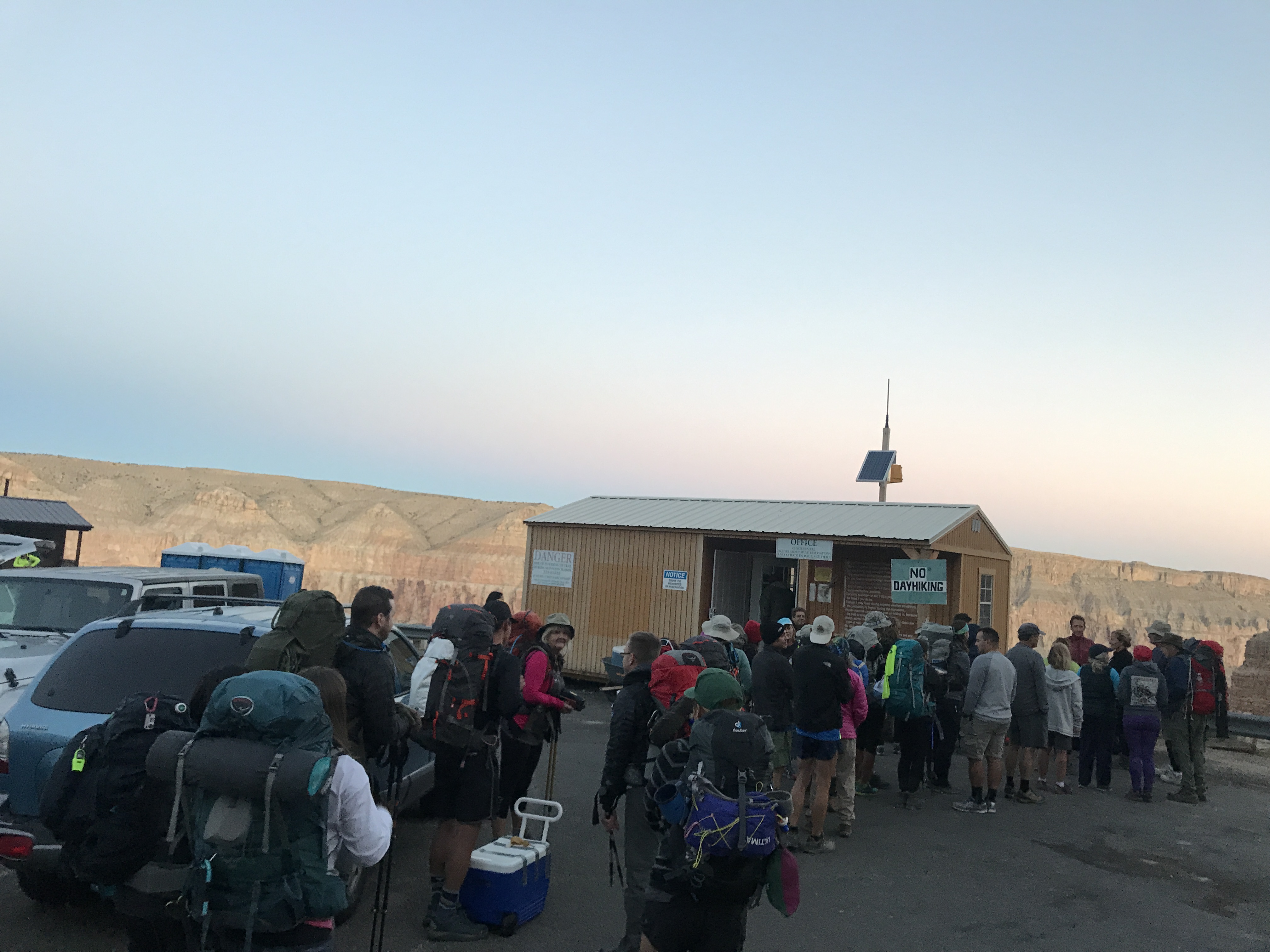
Waiting in line to pick up permits
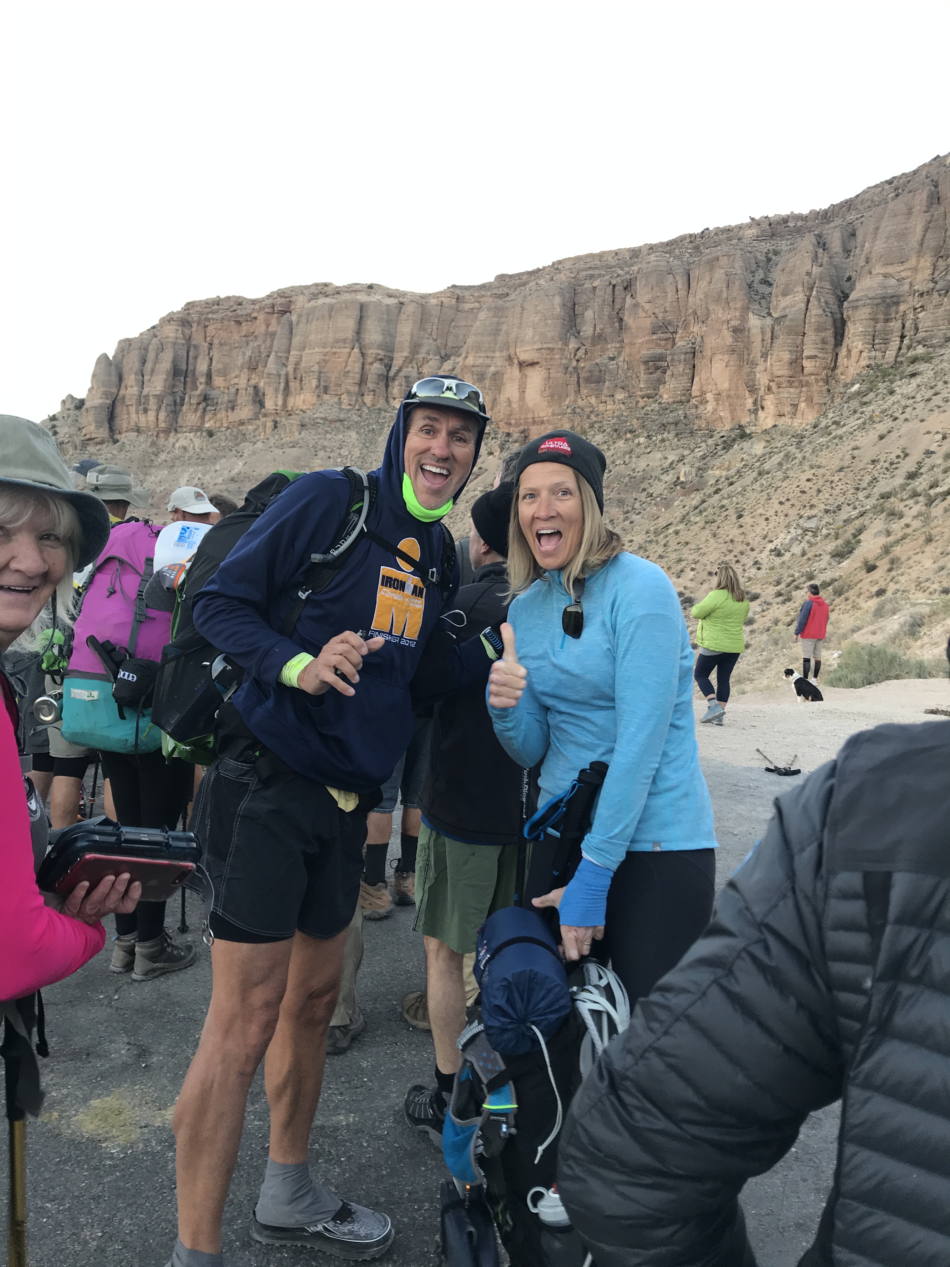
So exciting!
We quickly made it down the first mile and picked one of many trails that spread over a wide-open area. There are no trail markers here and everyone seemed to be on a different trail. But they all led to the same place so if you hike here pick a trail and go with it.
We eventually reached the wash that guided us directly through the canyon. The trail is rocky here but the views of the canyon walls were glowing red from the sun. We started to run into mule trains that were carrying hikers packs up to the trailhead. We also ran into other hikers who had left the campground at 3am to beat the heat.
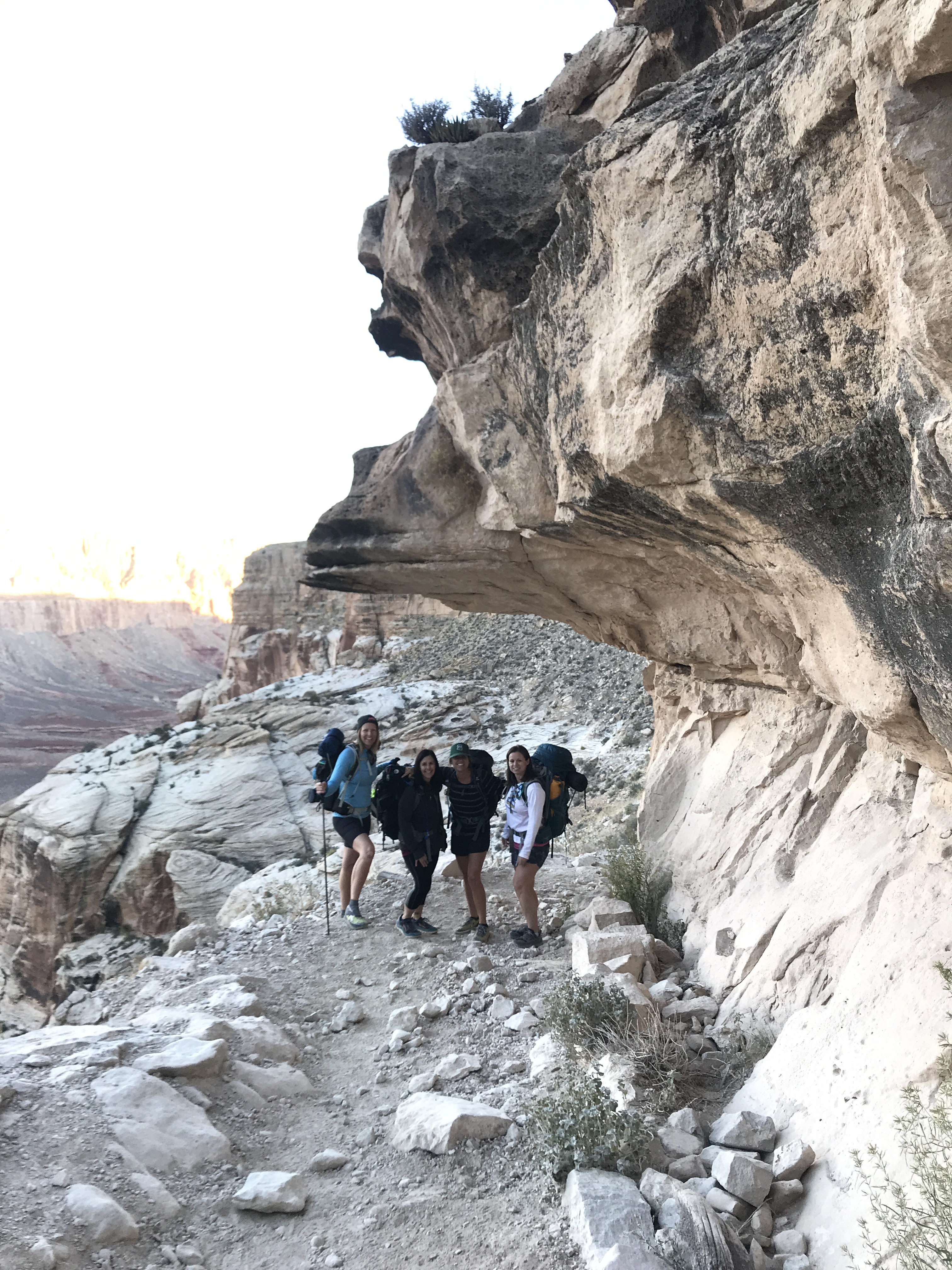
Im such a giant
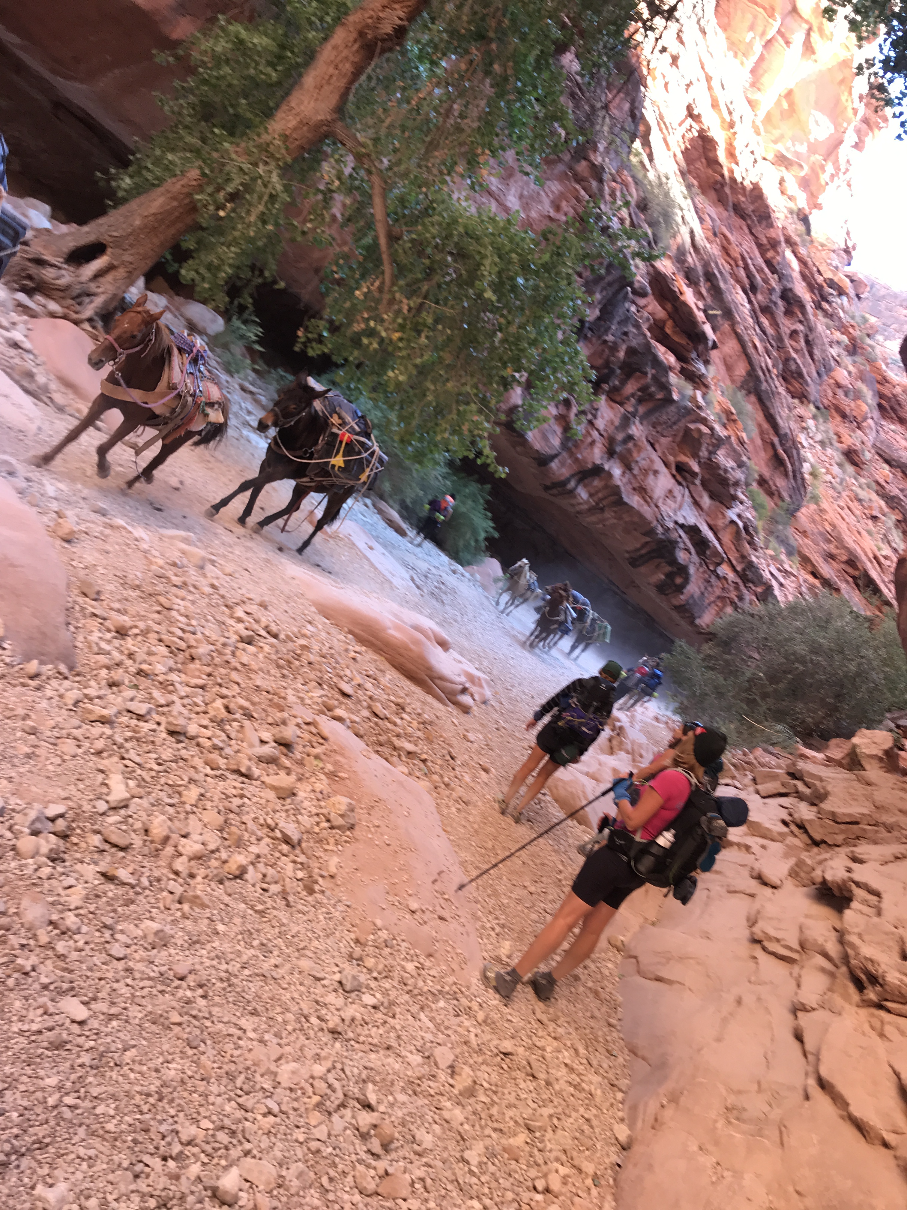
Running mule train
Once we entered the Supai Village we had to check in to receive a second wristband that allowed access to the campground. By the time we hiked 8 miles and made it to the Village, Jeff and I were miserable. Our legs were doing fine but our shoulders were screaming from the weight of our packs. We are trail runners after all and being newbies to backpacking, we hadn’t quite figured out how to distribute the weight of our packs to our hips.
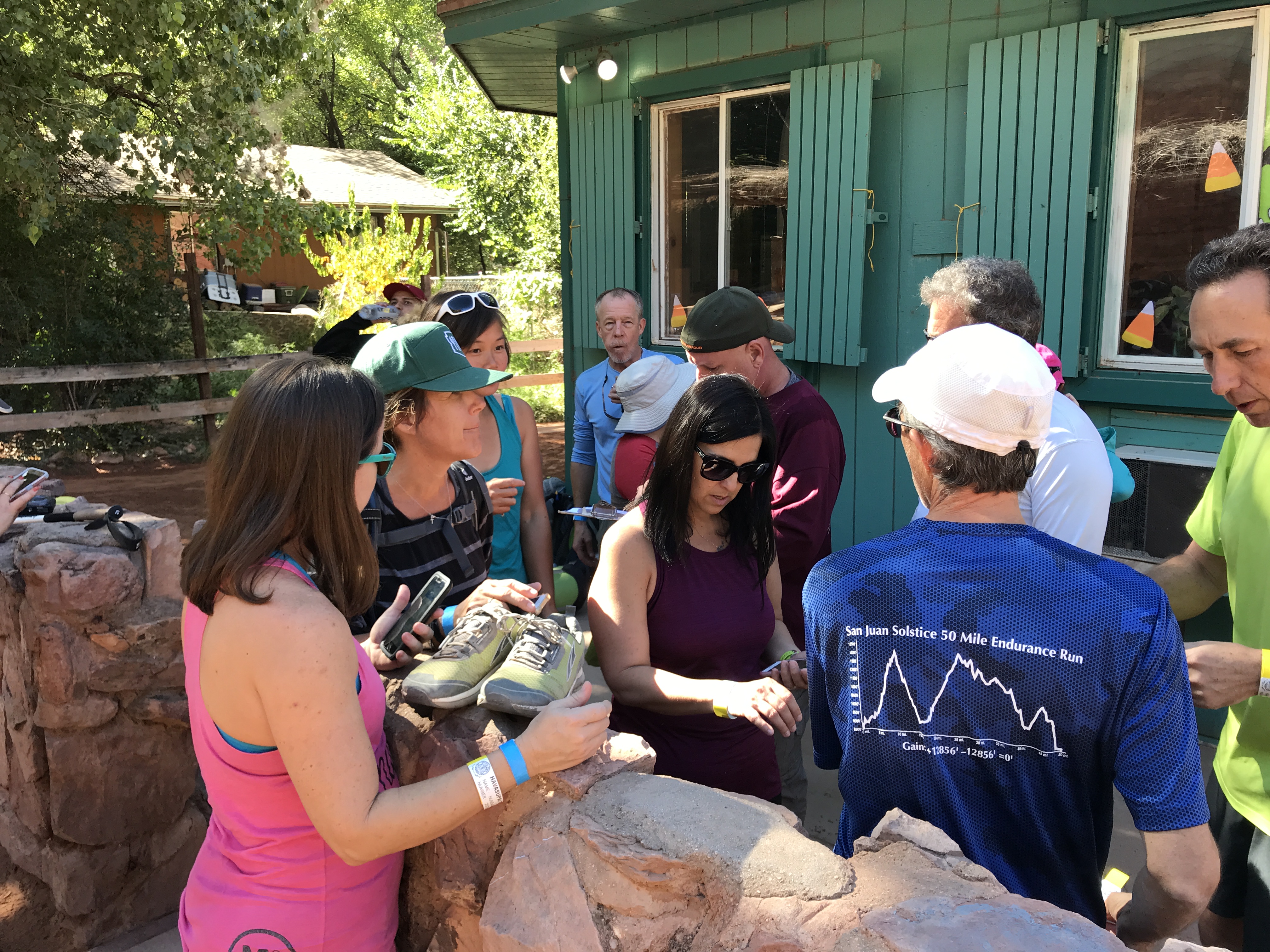
Village checkin for CG permits
Heli pad
We left the village quickly and headed down the last 2 miles to the campground. Thankfully this steeper section was more wooded offering nice shade on the dusty trail.
We started getting glimpses of Havasu Creek and its stunning blue green waters along the trail before reaching Navajo Falls. The water is like nothing we have ever seen before. What the eye sees looks fake. The lime content that cakes the bottom of the creek somehow reflects the blue sky through is perfectly clear water.
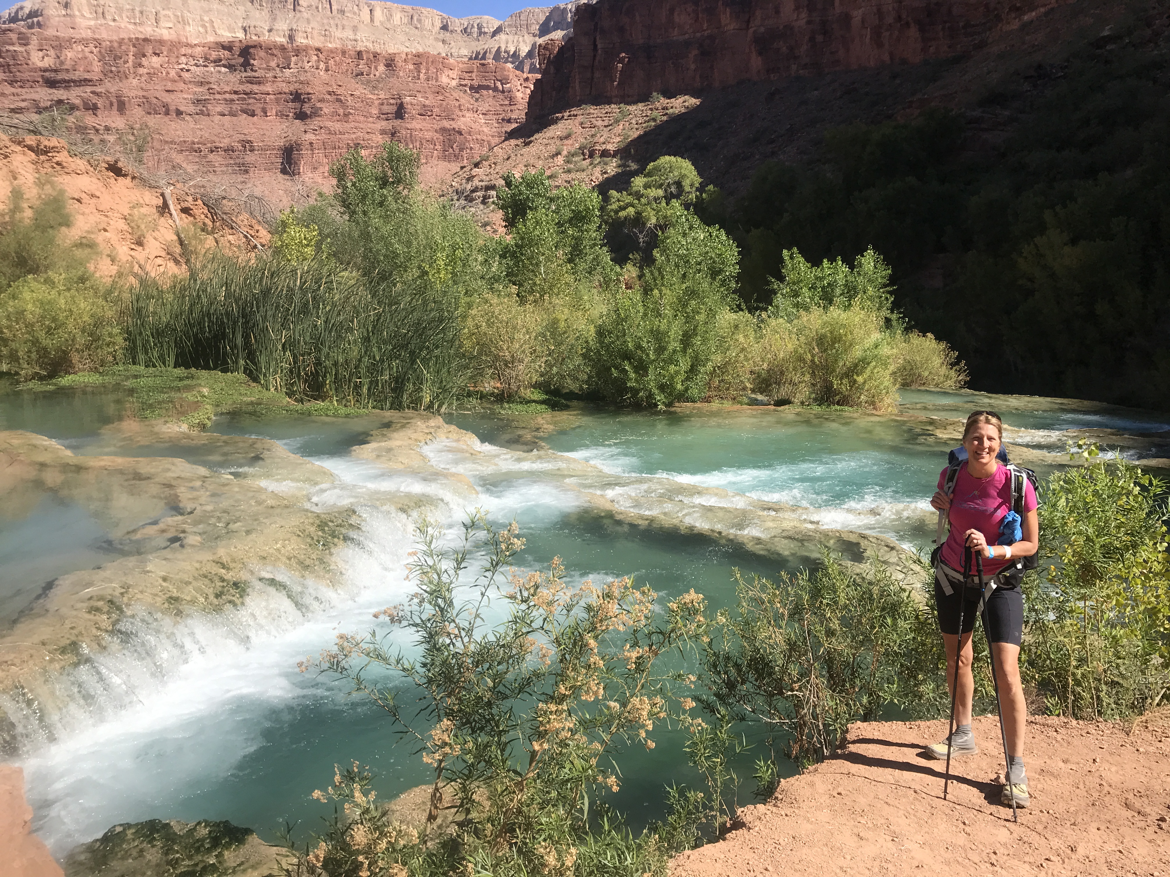
Our first look at Navajo Falls
Further down the trail we got our first glimpse of Havasu Falls. One large fall that spilled into a beautiful blue green reservoir made up of tiny pools of waterfalls. People were already swimming far below. They looked like tiny specs in a vast wall of blue.
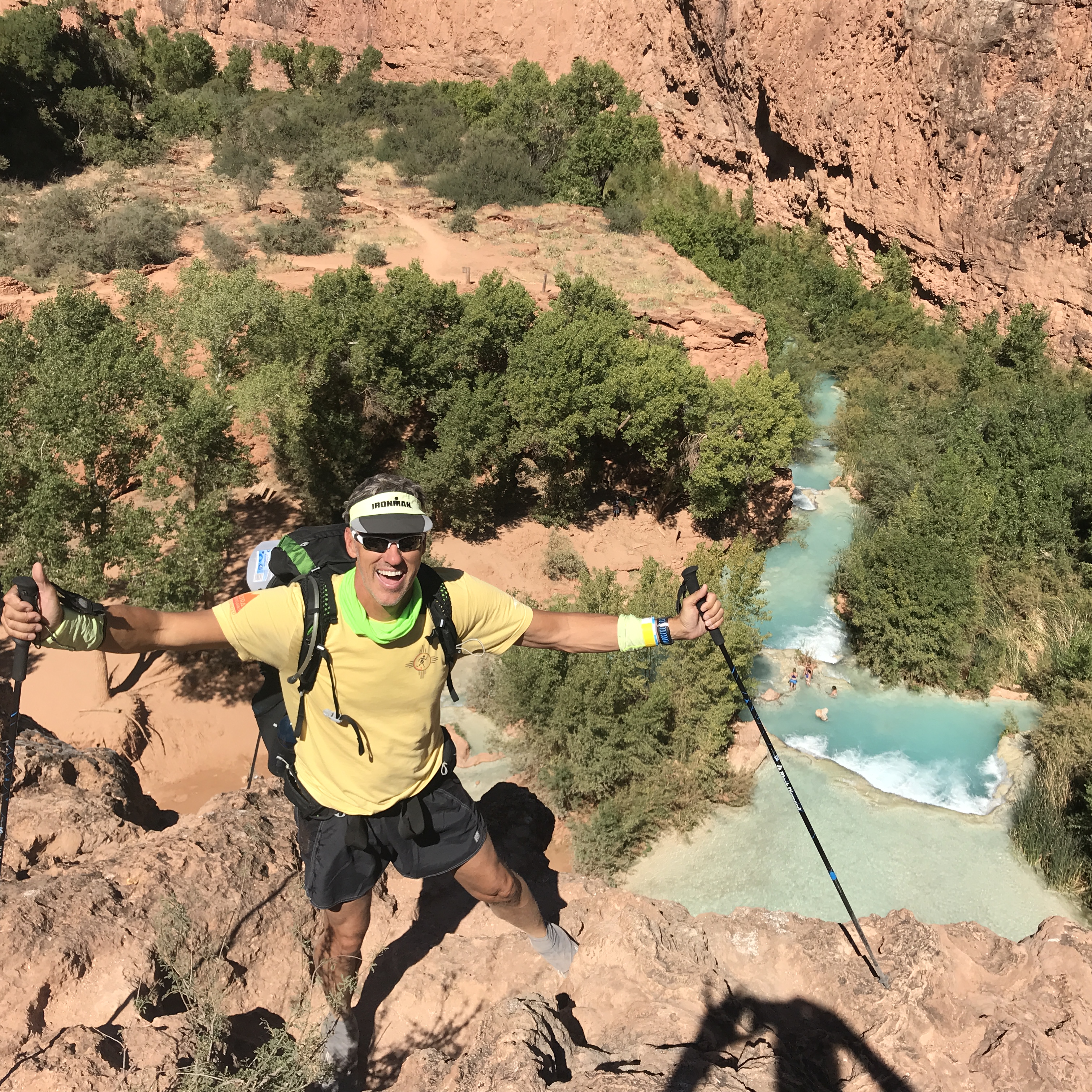
The top of Havasu Falls
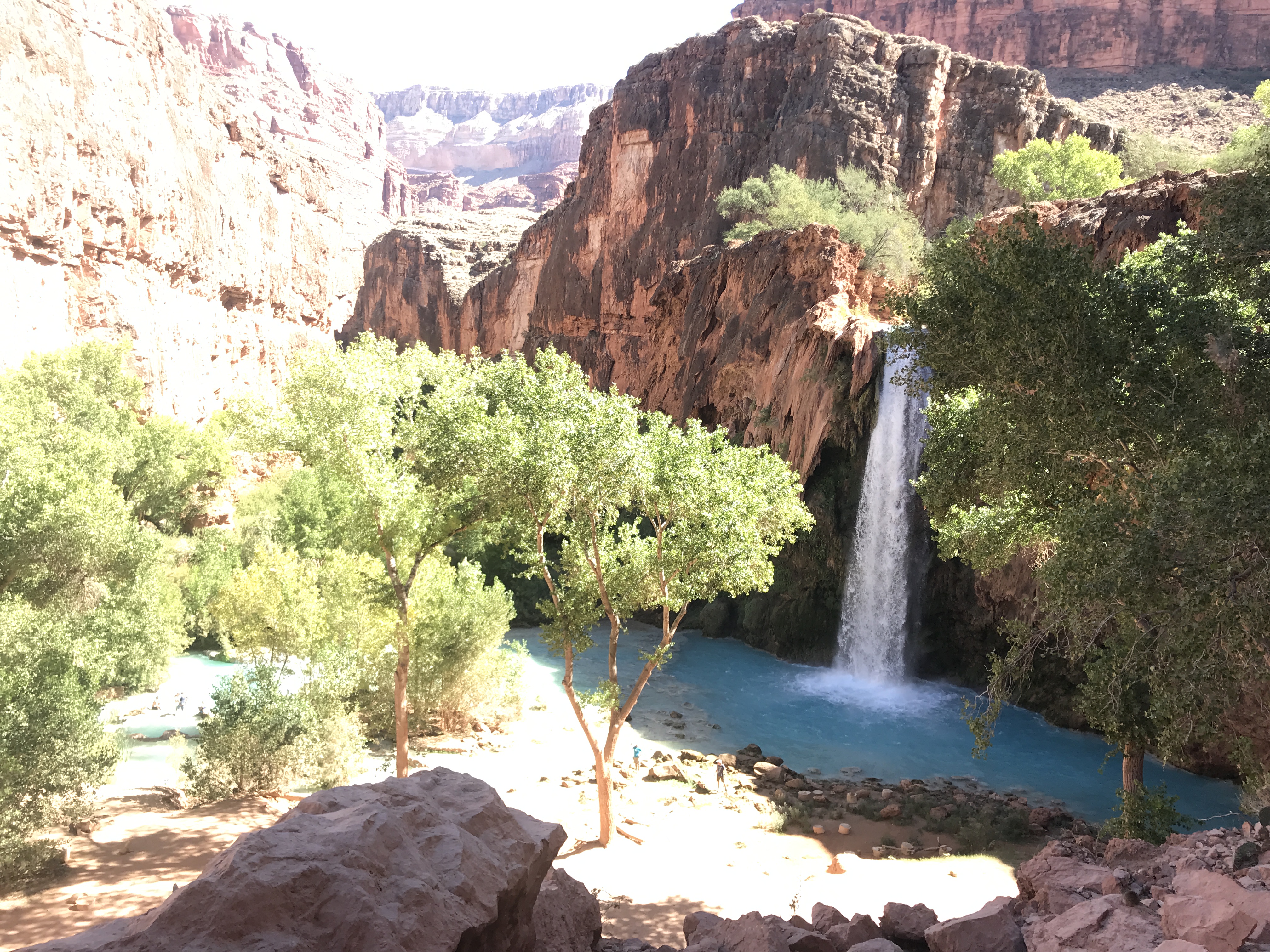
Havasu Falls
By 11:30AM we reached the campground and found a wonderful narrow peninsula wedged between the creek on either side to make camp. If you plan on hammock camping there are plenty of trees in the campground to stretch between. And the creek offers the perfect volume of babbling brook as background noise to shut out other campers.
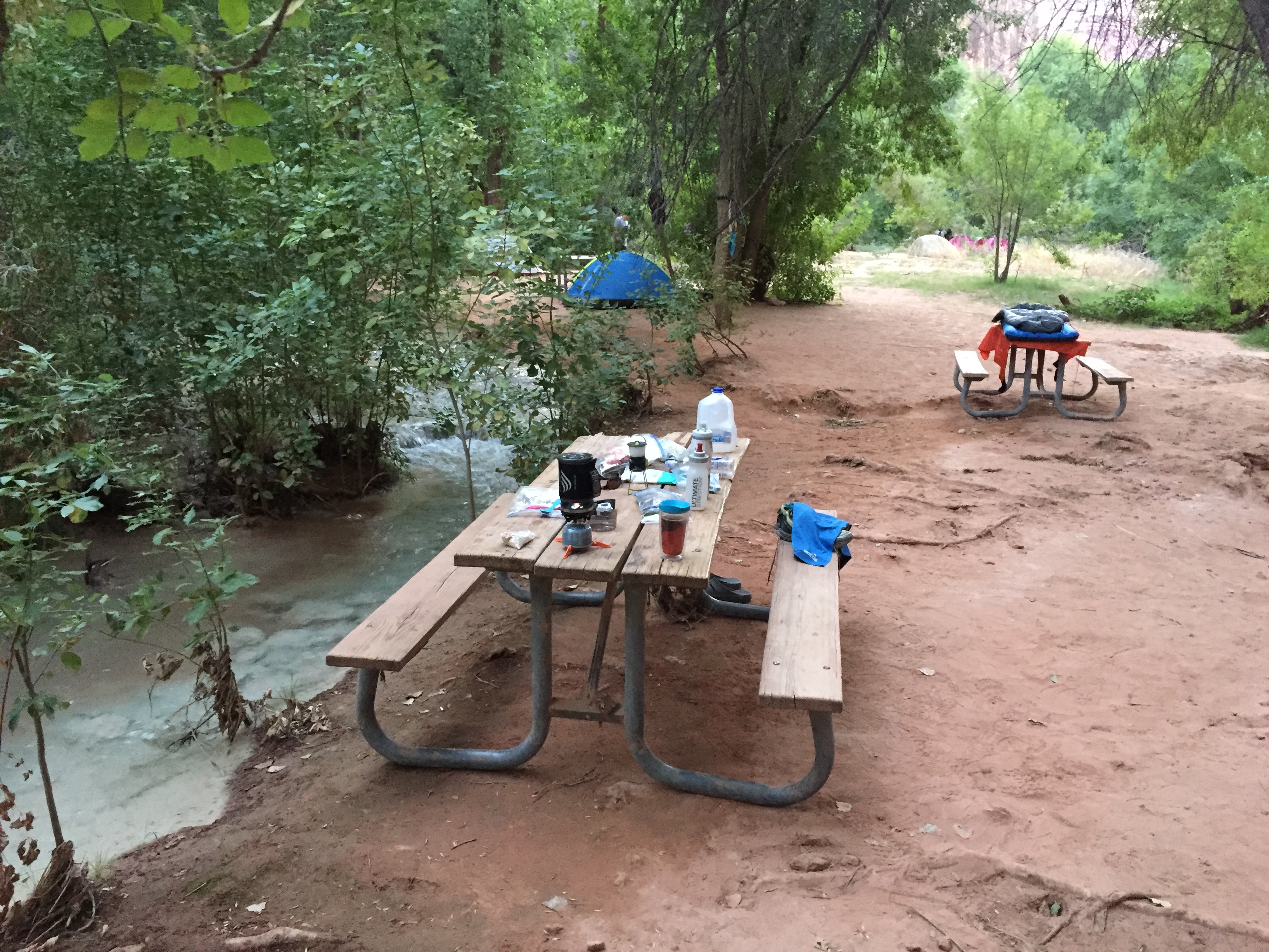
Creek on one side
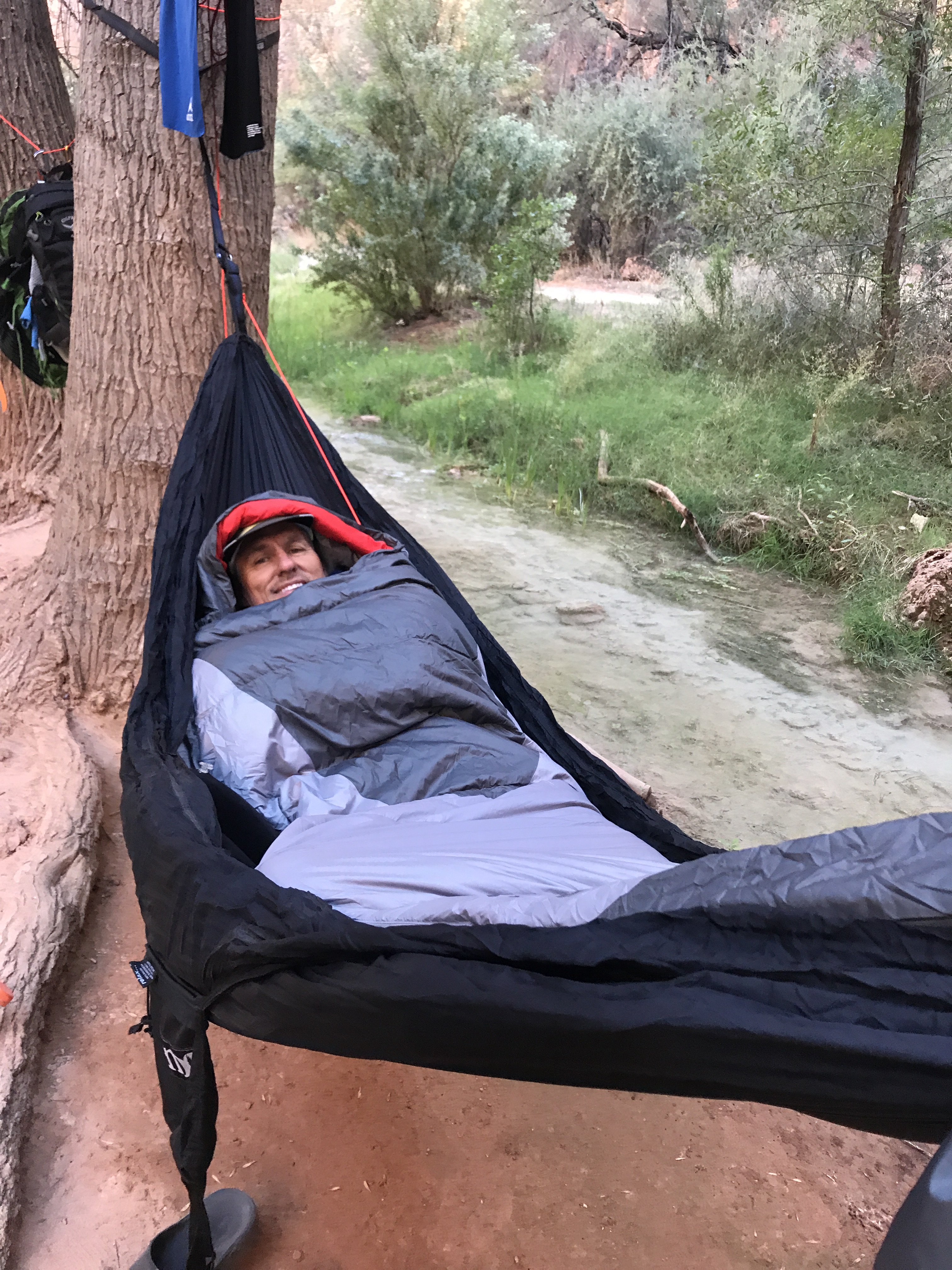
Creek on the other side
We took a quick nap before we explored the campground and met with our group for a meeting. We were instructed to be respectful, tidy and have a good time at one of North America’s most beautiful treasures.
Day two was Jeff’s birthday. And like any good camper without a calendar or reference for what day it was…I completely forgot!! (BAD WIFE!) Jeff and some friends made the 18-mile round trip hike to the confluence of Havasu Creek and the Colorado River while I made the 8-mile round trip to Beaver Falls. Both hikes follow the same trail that starts at the far end of the campground at Mooney Falls.
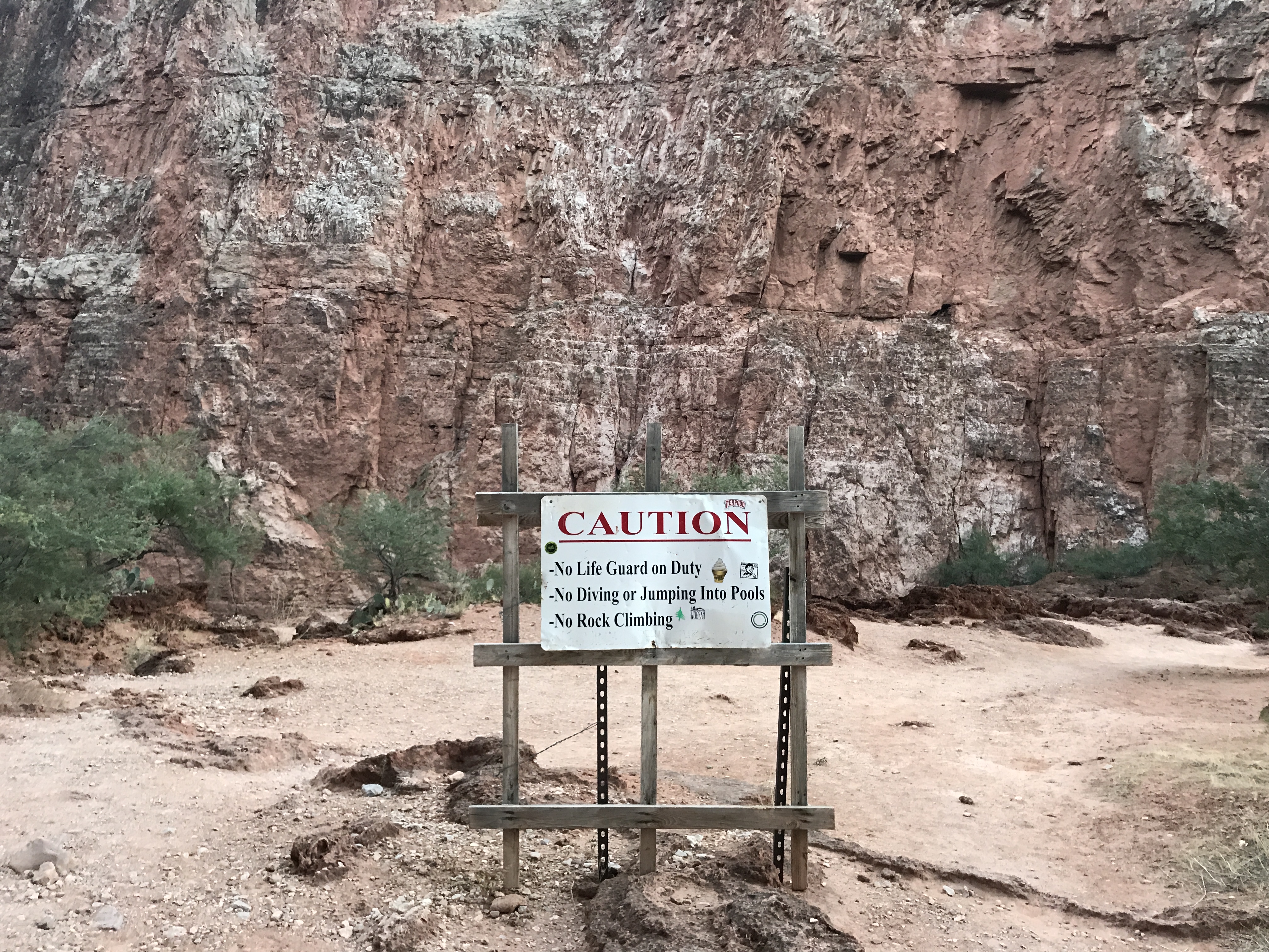
Take your caution seriously
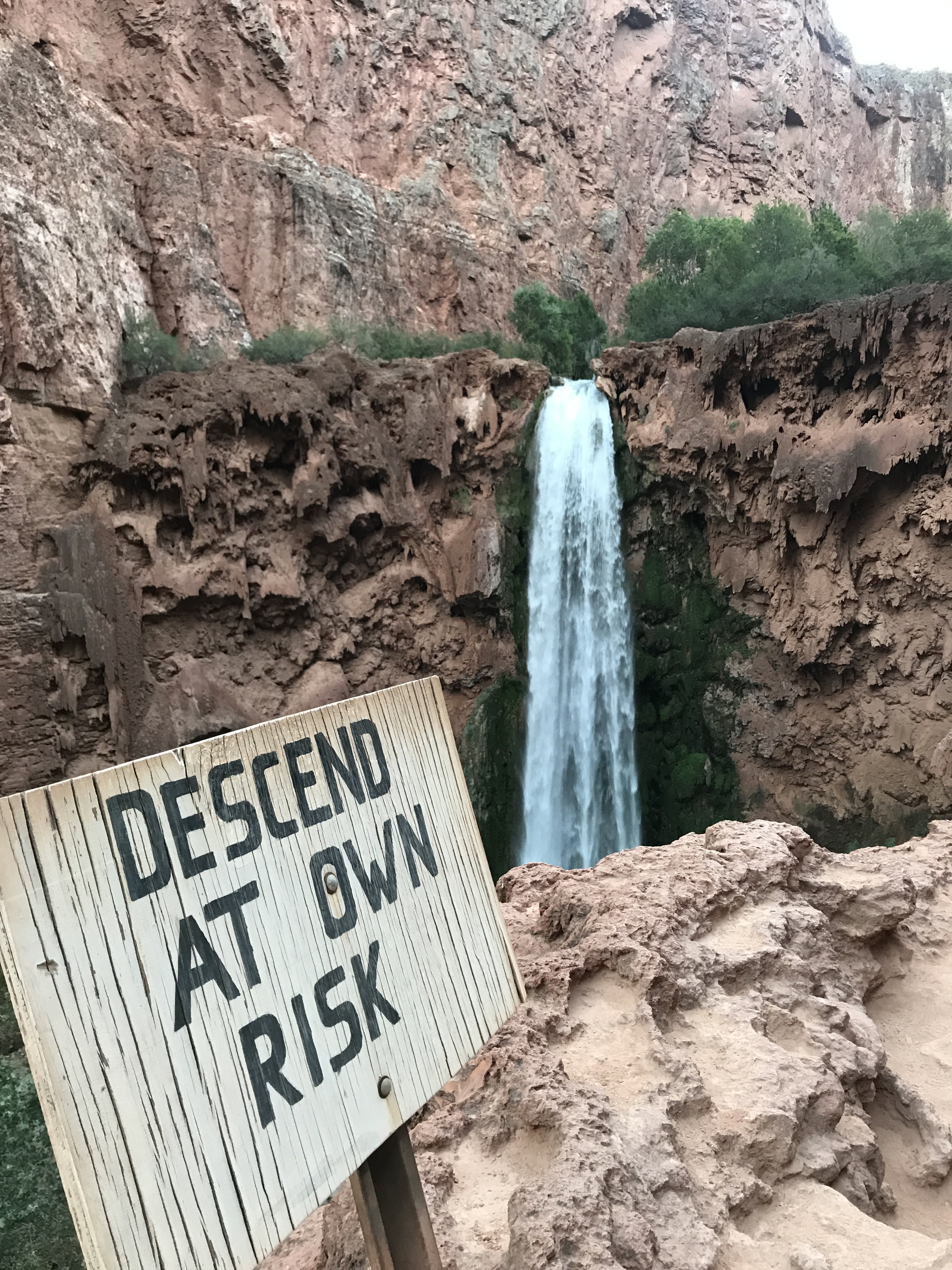
Mooney Falls
You HEAR Mooney Falls before you SEE Mooney Falls. There are excellent vantage points to see the falls and take pictures. From there, several of us were looking for the trail to head to the bottom of the falls. There was a small cave formed by large boulders, but none of use considered it the trail until I walked back to the area and finally saw a faint arrow pointing into the hole.
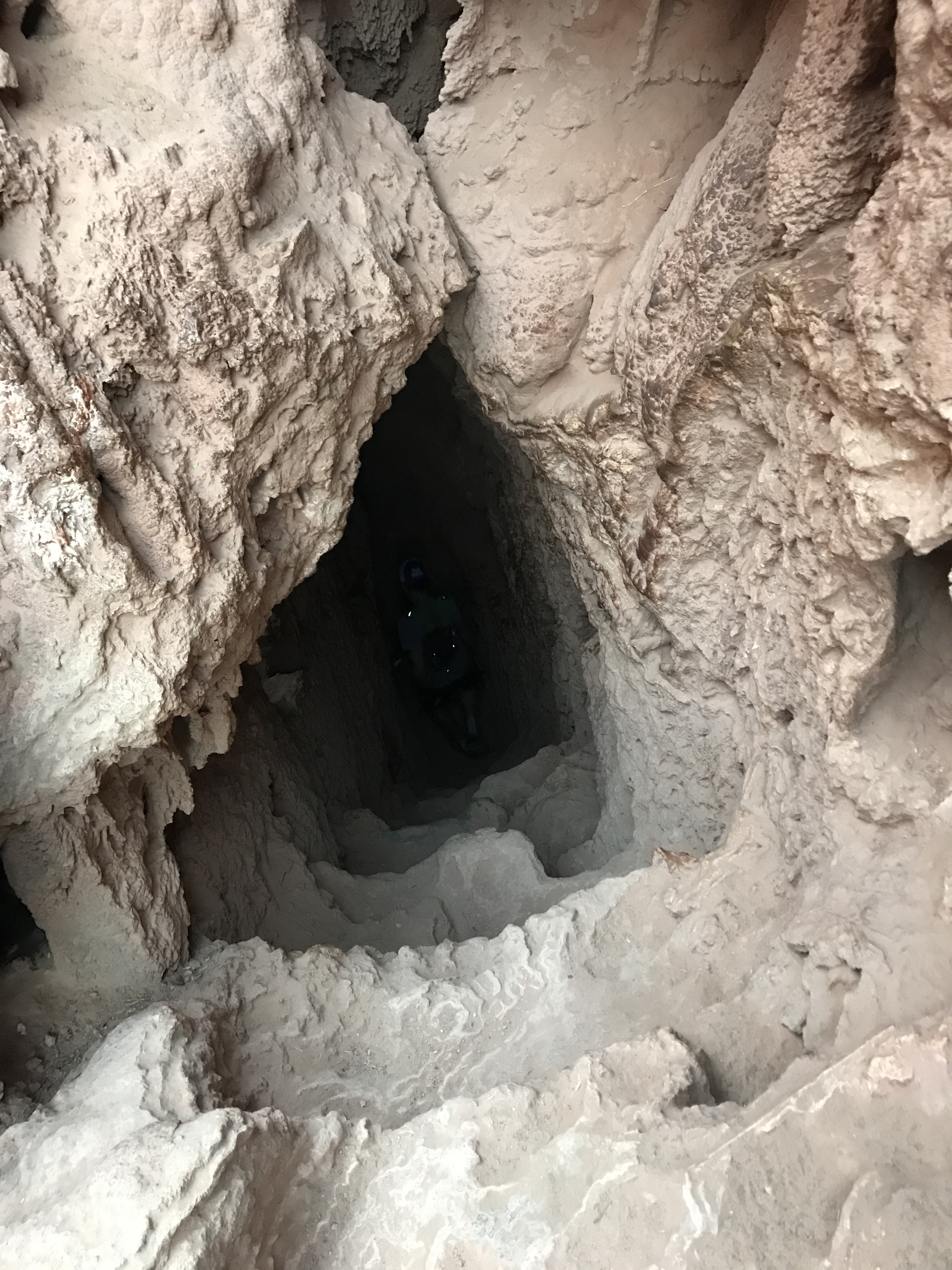
You want me to go down where?
The trail stepped down through the cave and poked out the side of a cliff with an amazing view of the falls. Chains led you a few steps to another cave that stepped down to another opening in the cliff. Visually I lost the trail here only to discover that it drops right over the edge by staggered indentations meant to be stairs, then chains and then a system of slick wooden ladders.
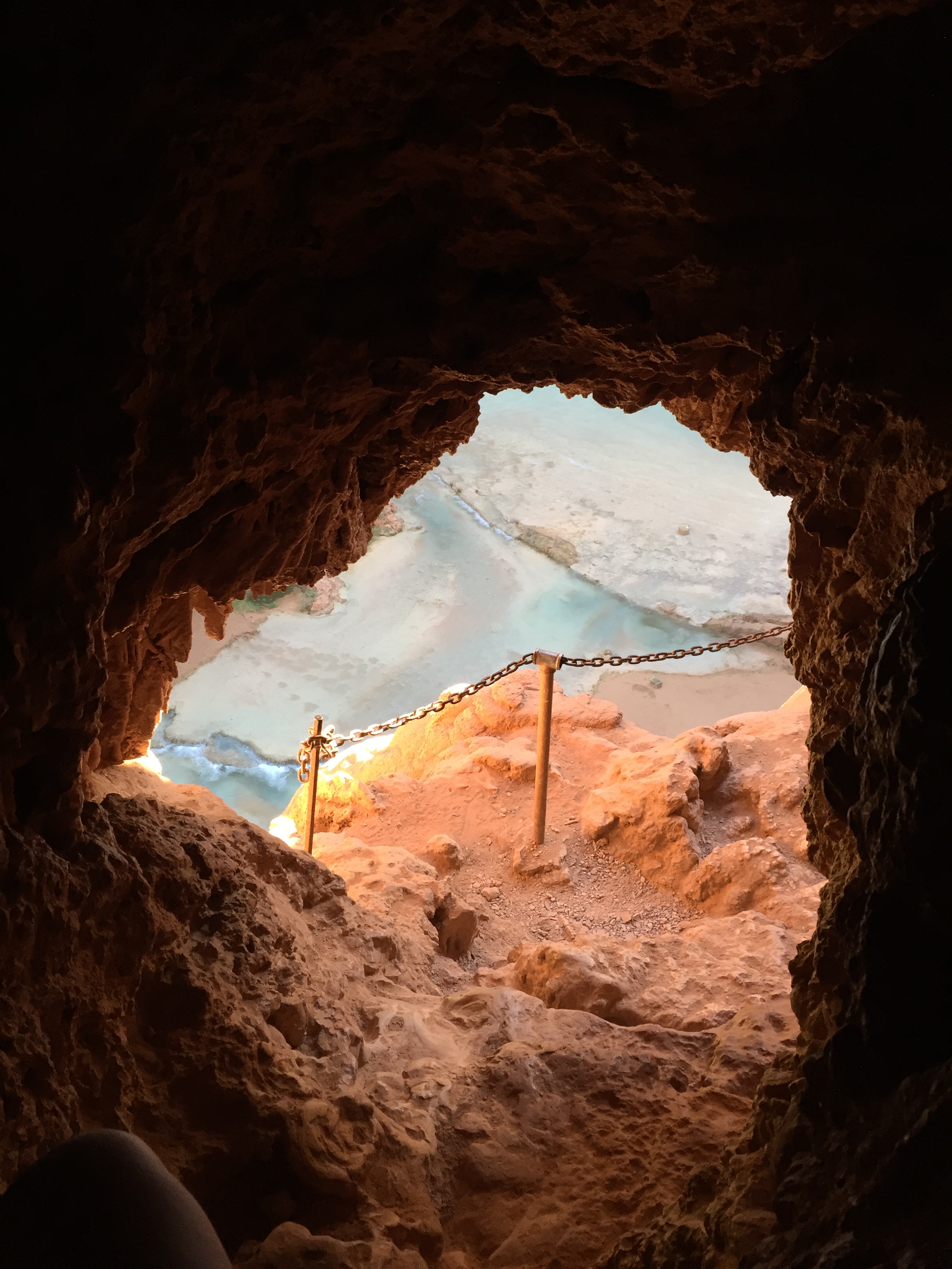
Coming out of the tunnel
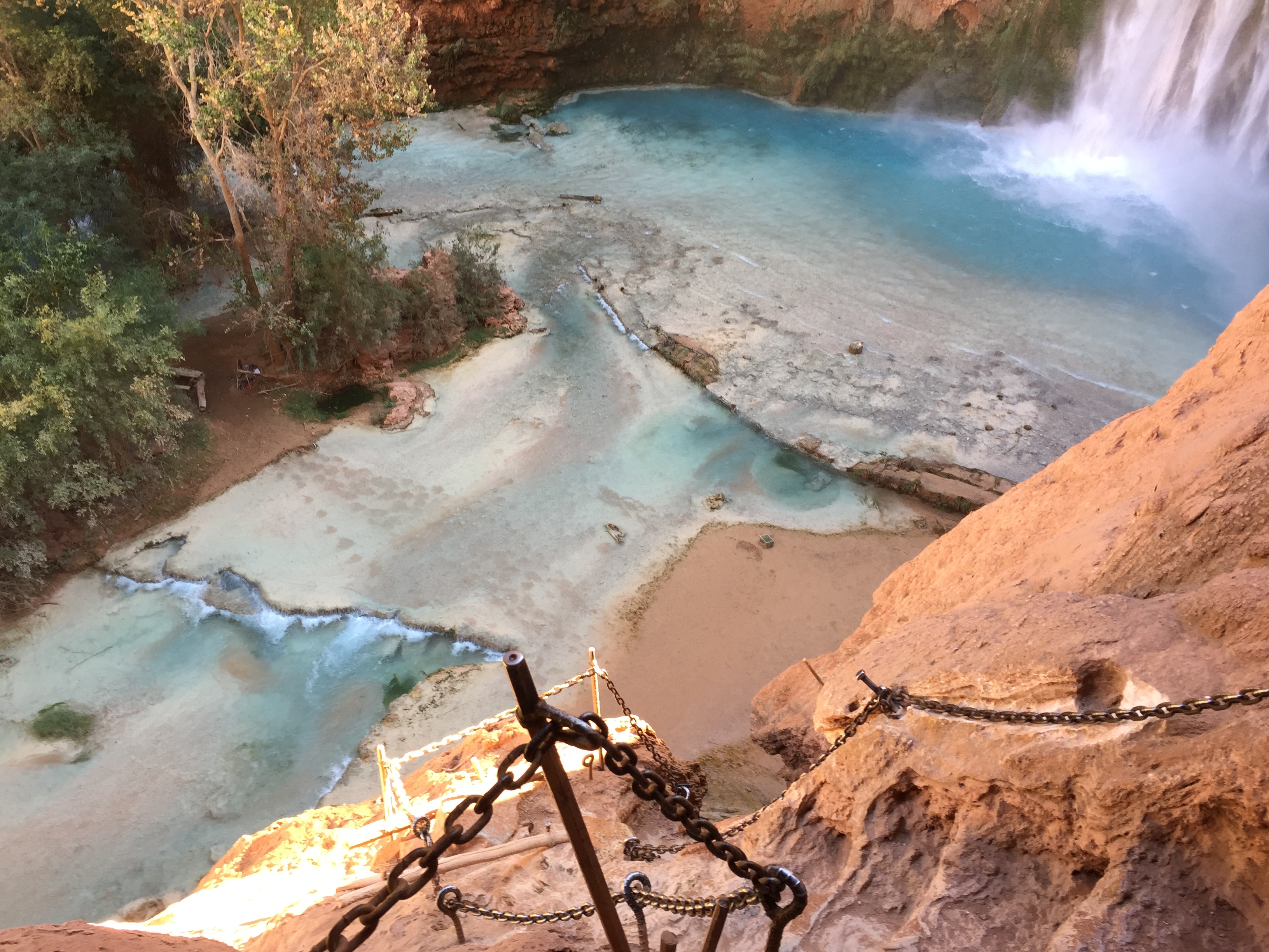
The trail drops over the edge
My heart was pumping out of my chest! At our group meeting the advise for Mooney Falls was to maintain 3 points of contact at all times. Two hands-one foot. Two feet-one hand. Take your time and be intentional with every movement.
When I finally reached the bottom my head thought, “that wasn’t so bad”. But then I went to take a couple of steps and almost collapsed from my scared s*%tless wobbly legs.
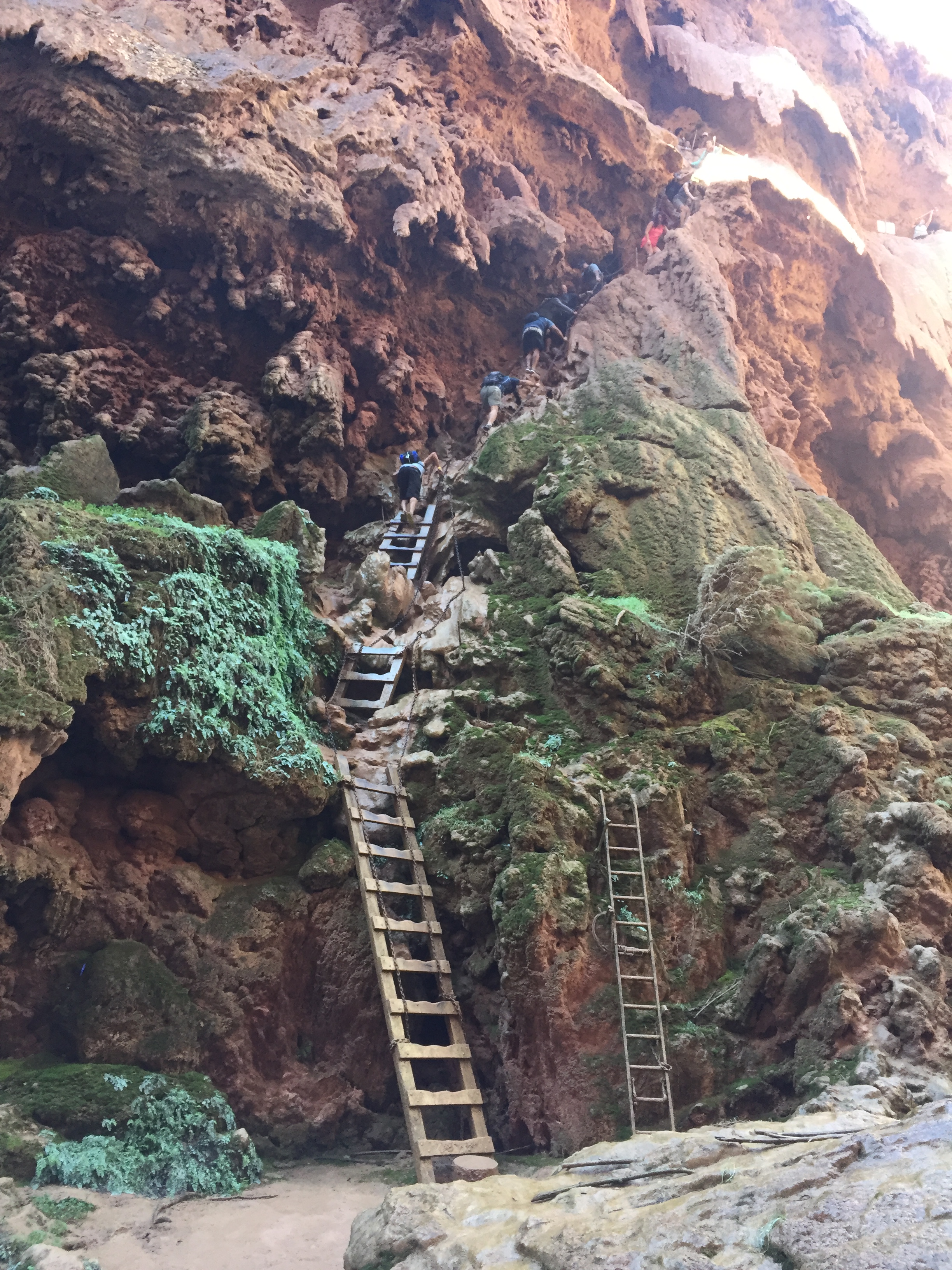
But as soon as I turned around and saw Mooney Falls up close, equilibrium was restored! IT. WAS. STUNNING!
There are a few picnic tables scattered about and beautiful natural pools of hallucinogenic colors. A rainbow forms from the mist given off by the falls in the sun that was just peaking over the canyon walls. It truly is a Garden of Eden.
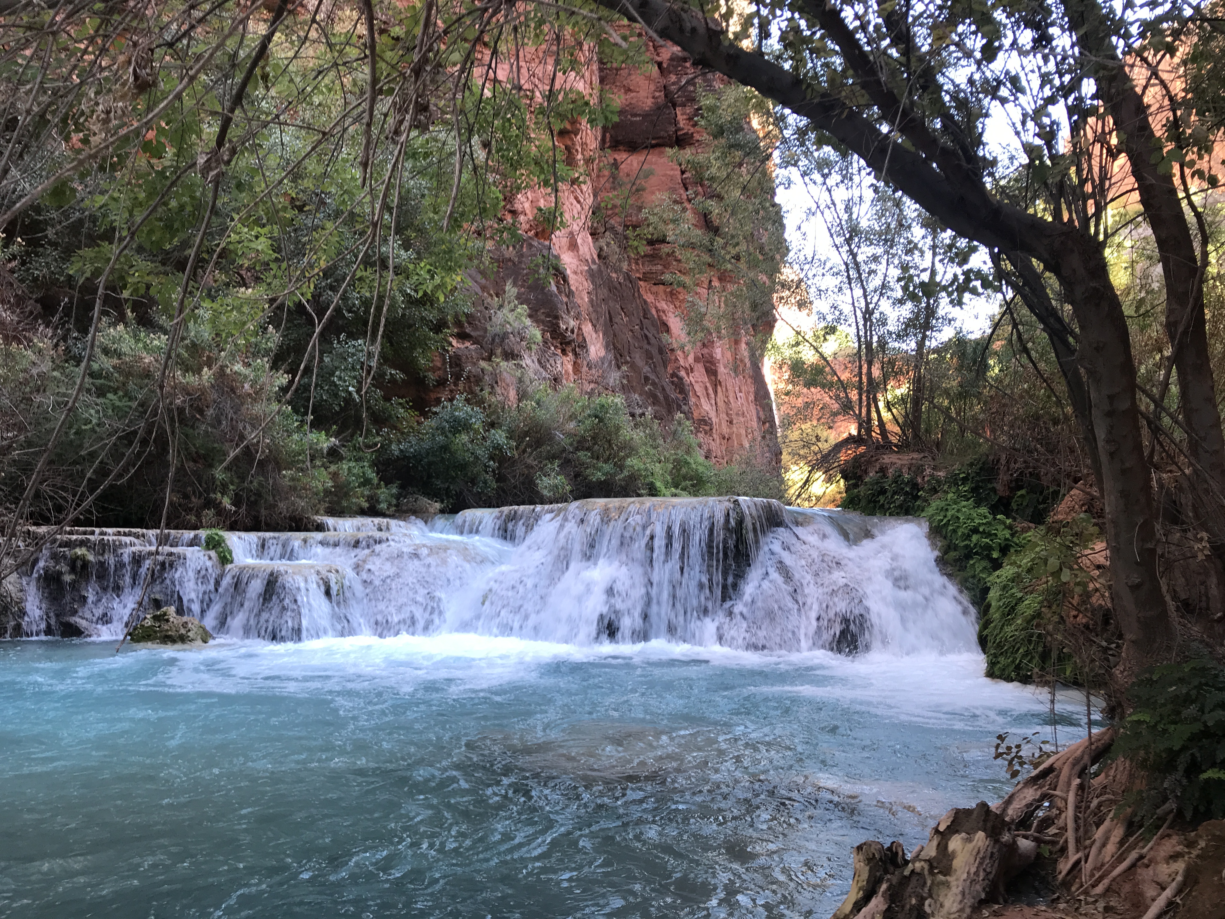
I followed the trail along Havasu Creek. The trail crossed the creek several times and I left my hiking shoes on to protect my feet from the lime coated creek bed. The trail veered away from the creek into what looks like a mangrove of foliage, then back to the creek again.
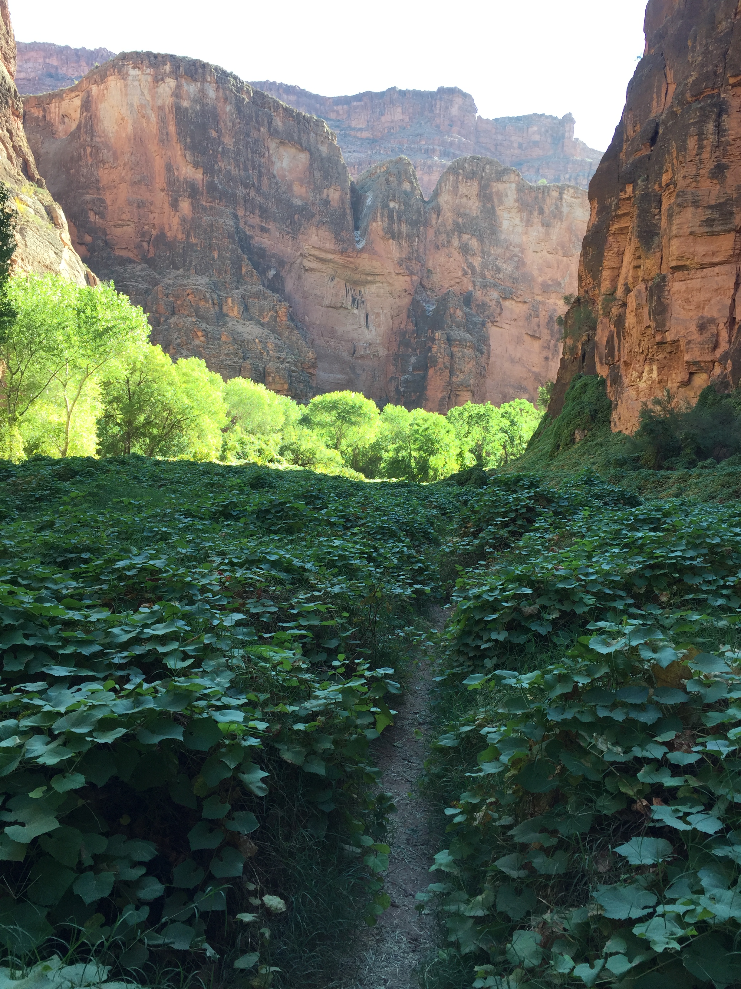
It was an easy hike and I reached another set of ladders that climbed up a cliff face and then along a bluff. The views were incredible with more of the same blue green waters along the red rock canyon until I reached Beaver Falls. And WOW!
There were people swimming in the falls and jumping off of rocks. The sun was fully over the canyon. The waters were crystal clear and not overly cold. Just the right temp in full sun and a bit cold in the shade. There are layers of waterfalls that are created by dammed up lime covered logs and branches. The logs are so covered that the surface is fully rounded over creating very nice places to sit and soak.
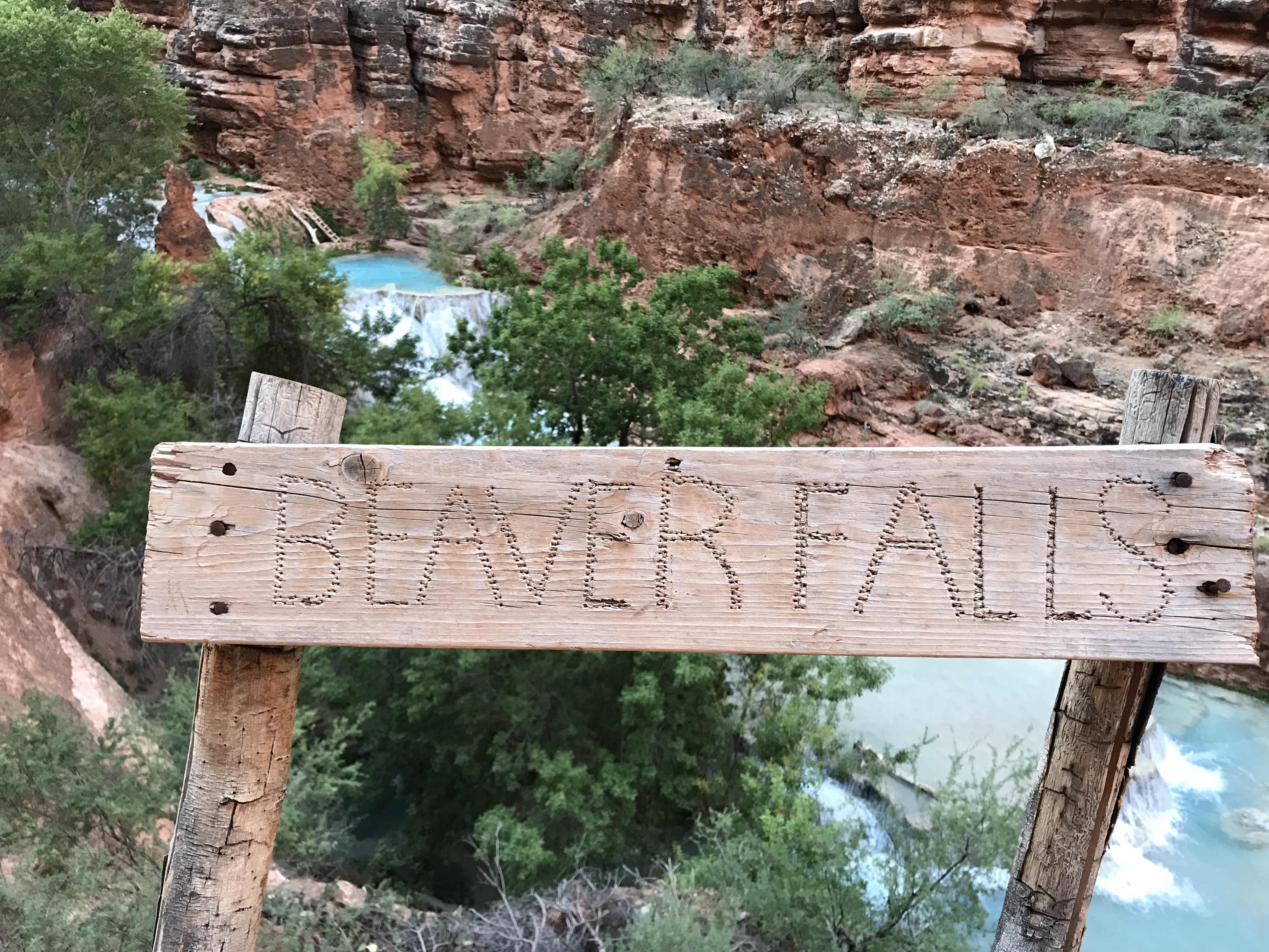
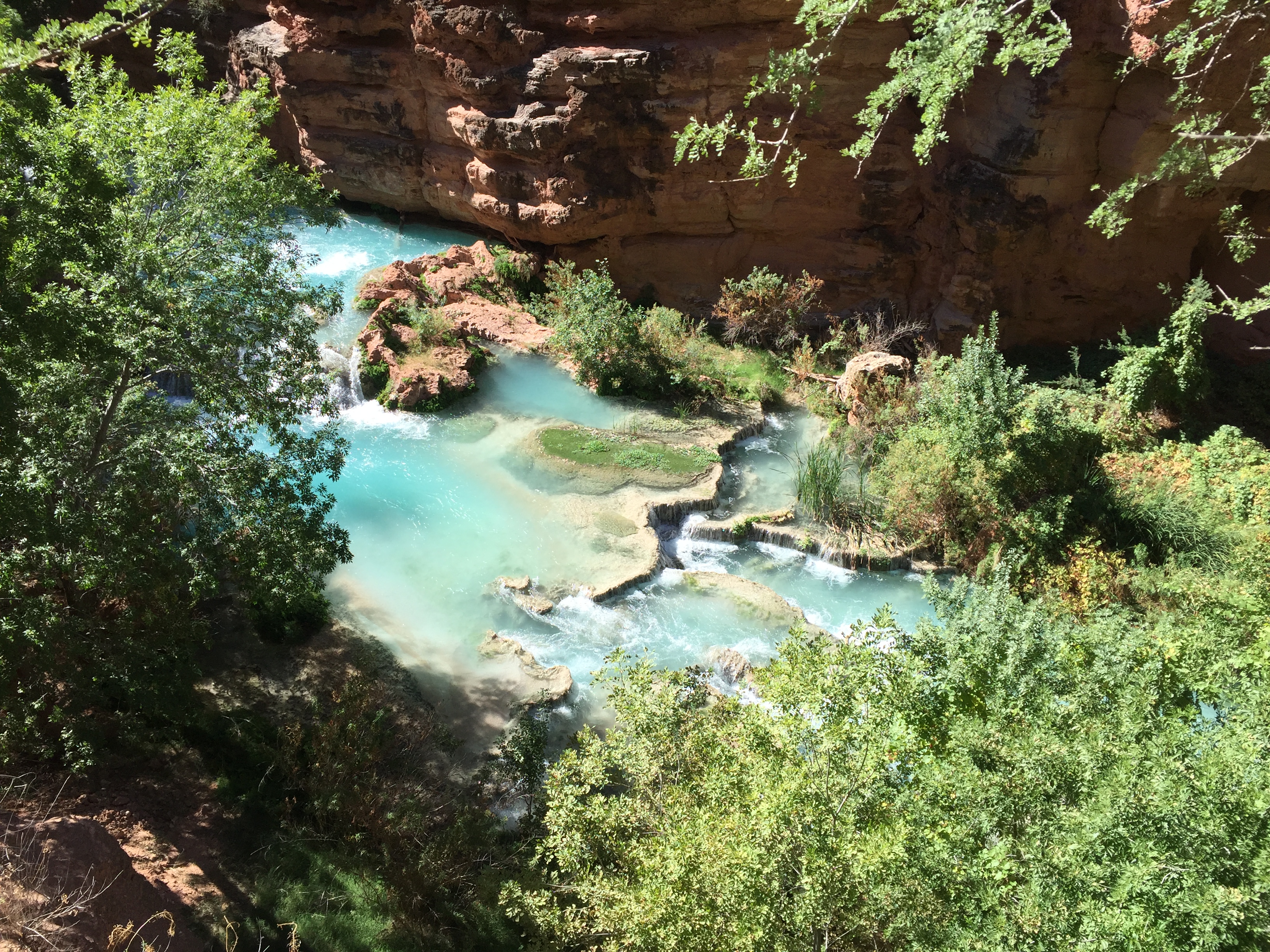
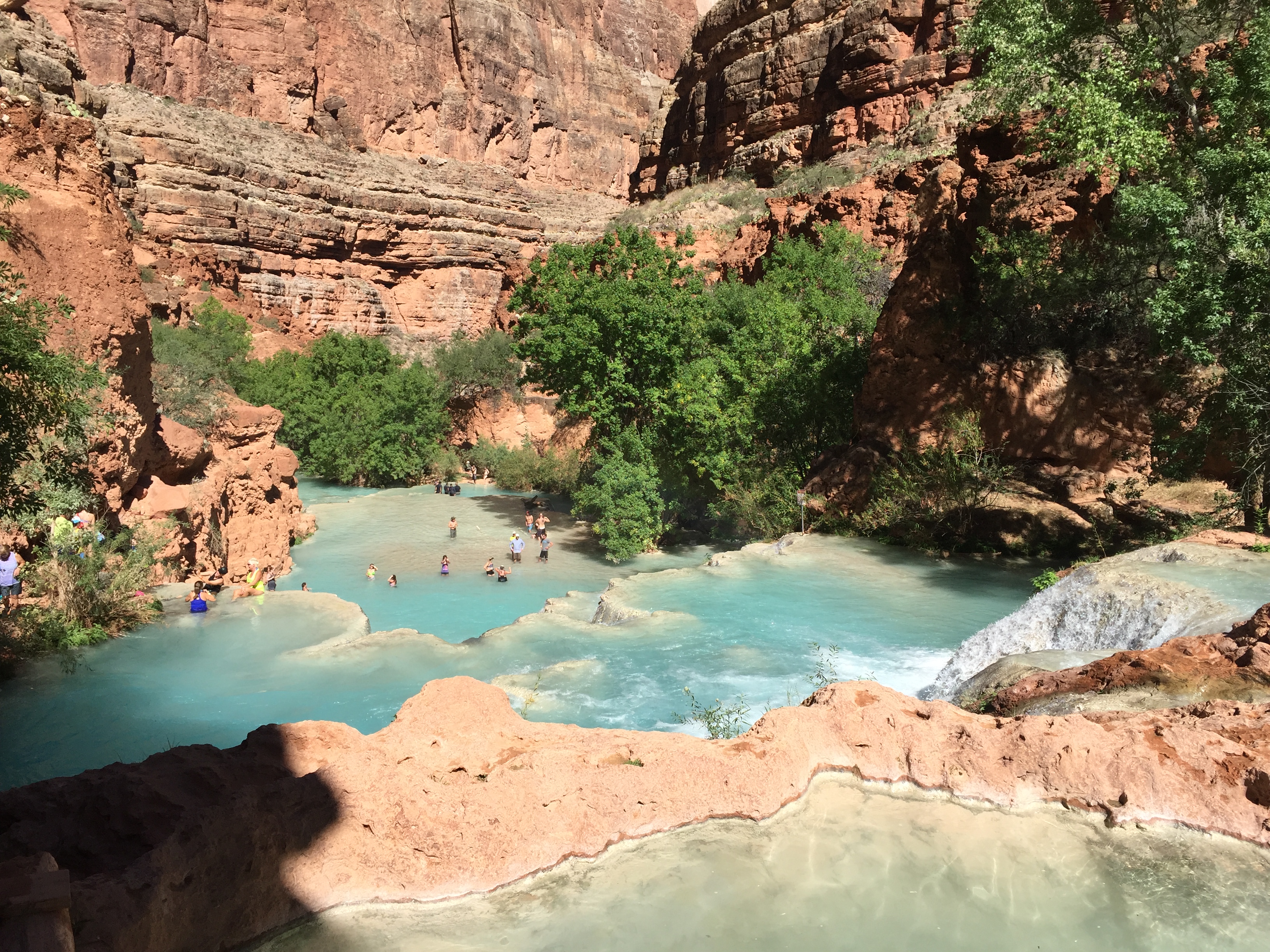
It was pretty crowded at the falls and I decided to hike back on the trail just a bit to find a private pool to soak in. It was such an interesting but easy hike (once you are past the ladders) that was a relief from my sore muscles from the day before.
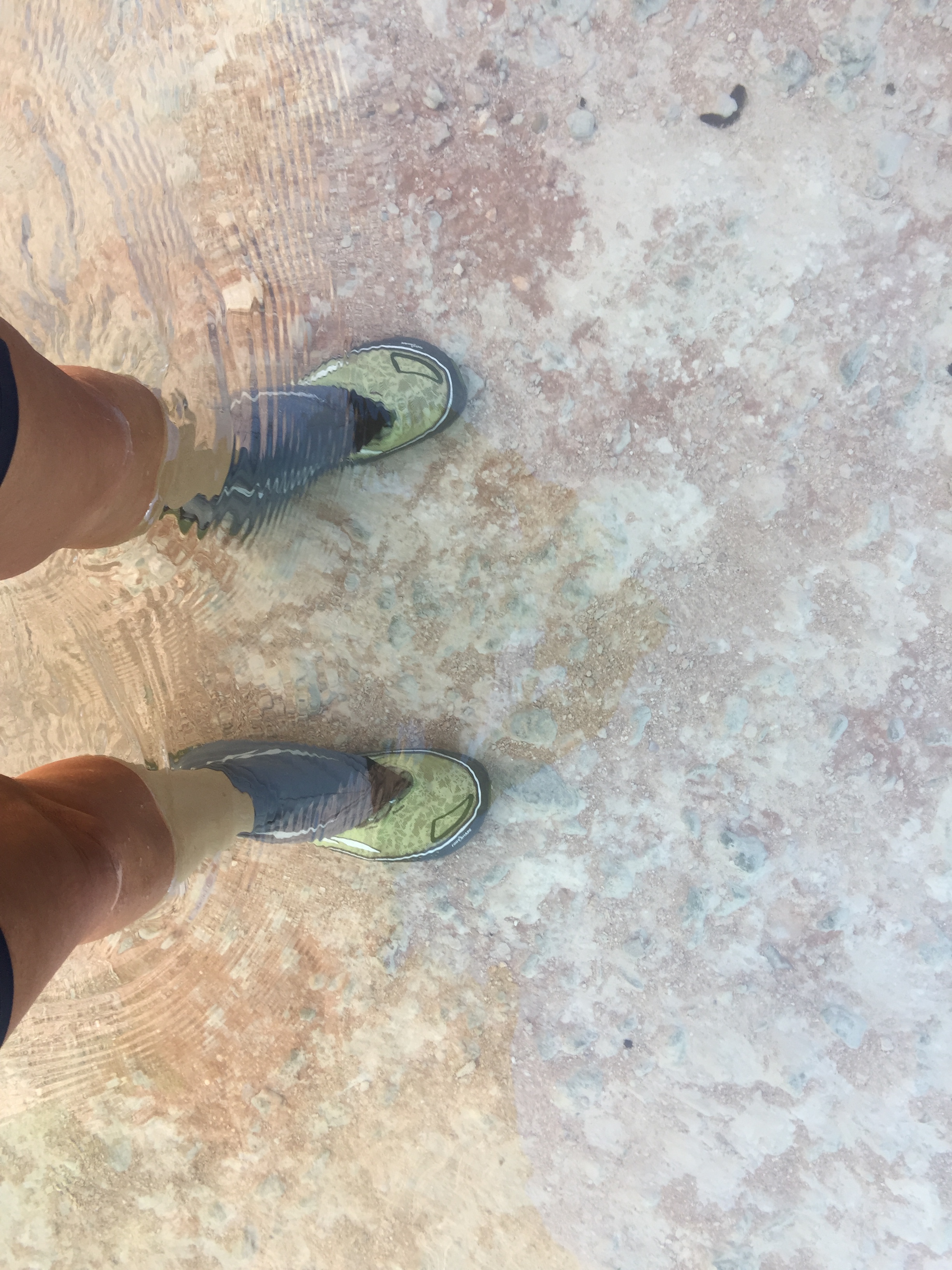
Can you see the water? Me neither!
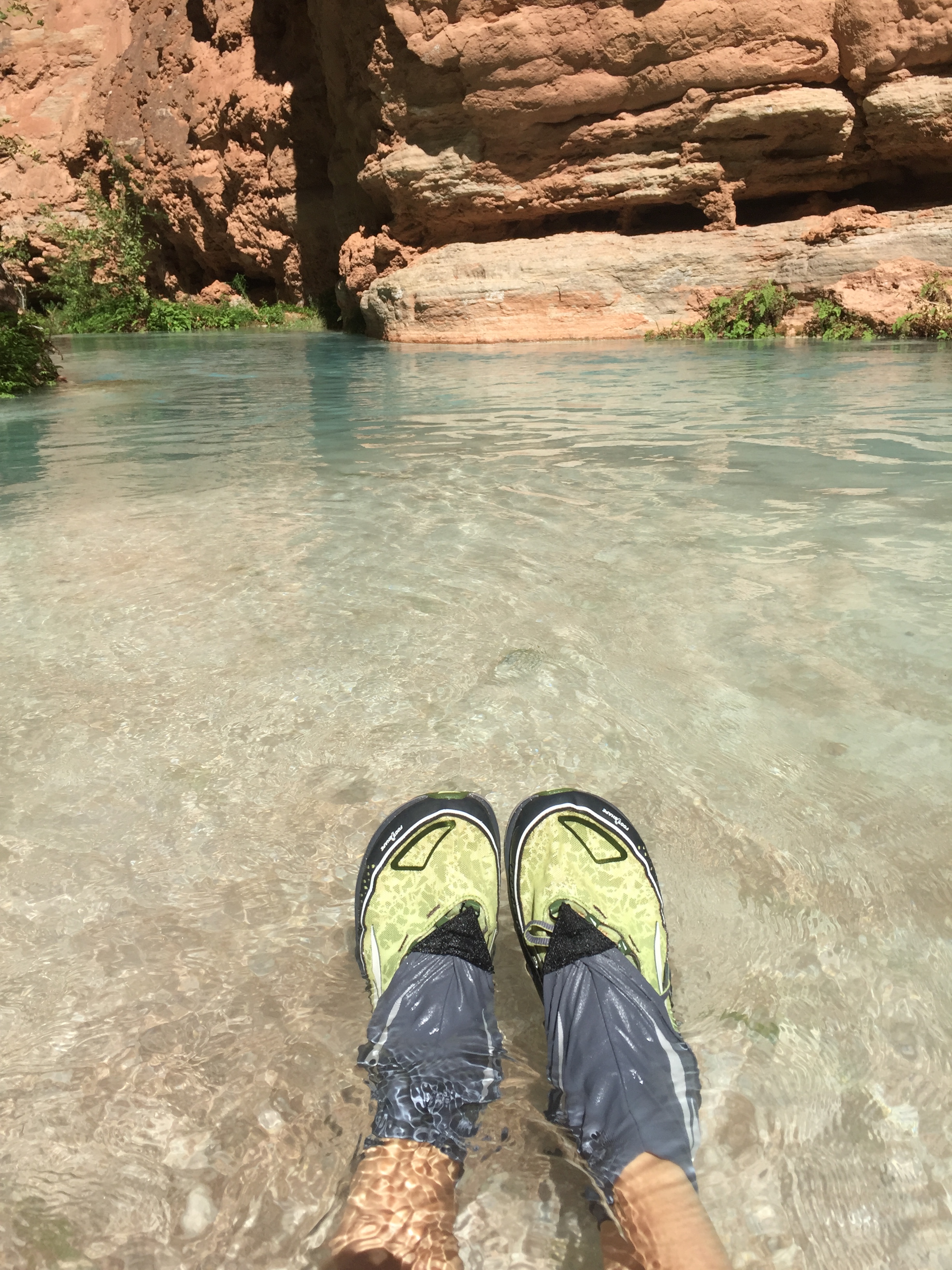
Cooling the dogs
I returned to camp and rinsed out the lime and sand from my shoes and swimsuit.
Part II Next Time
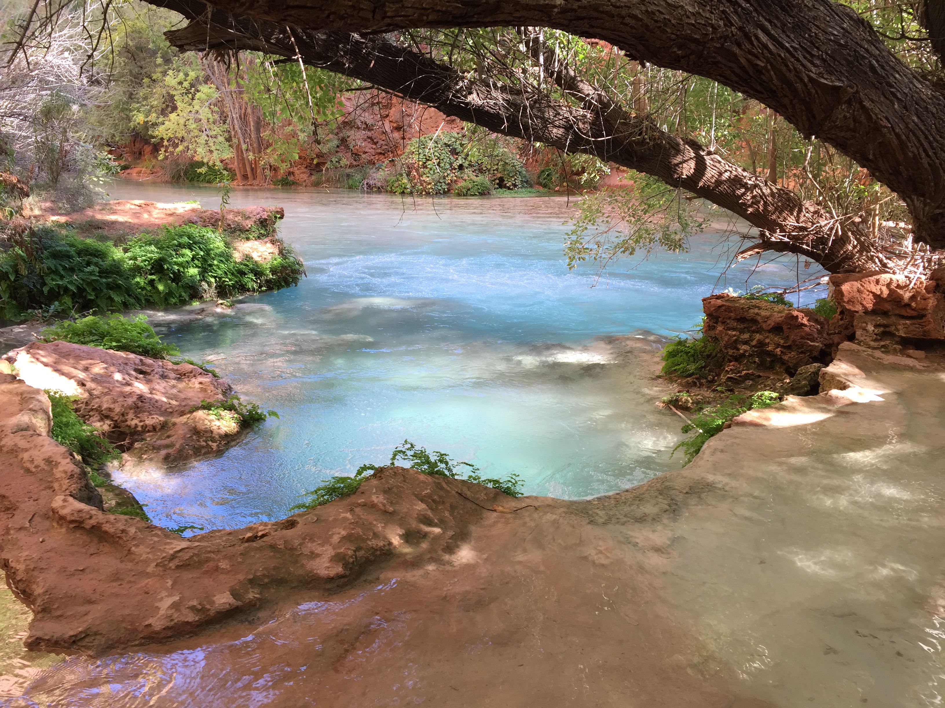
Real or Fake?
