Posts Tagged Running
Life Elevated
Posted by Deb in Full Time RV, Highest Peaks, Hiking, Running, Trail Run, Ultra Running on December 4, 2019

We’ve been bouncing around above 6000’ since May. The warmer the temps the higher we go.
That’s the beauty of living mobile. Too warm, move north or to a higher elevation. Too cold, time to head south and back to sea level.
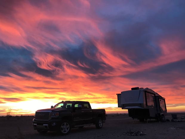
Las Vegas, NV (Elevation: 2,001’)
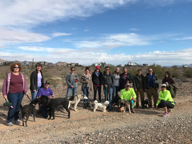
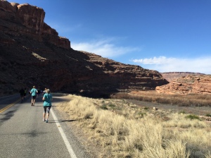
We started our spring in Las Vegas for the Mt Charleston Marathon and Half Marathon. Our running group from NW Arkansas was bringing around 100 folks to the event. Since we needed to be in Vegas for the National Hardware Show about that time it only made sense to join in on the fun!

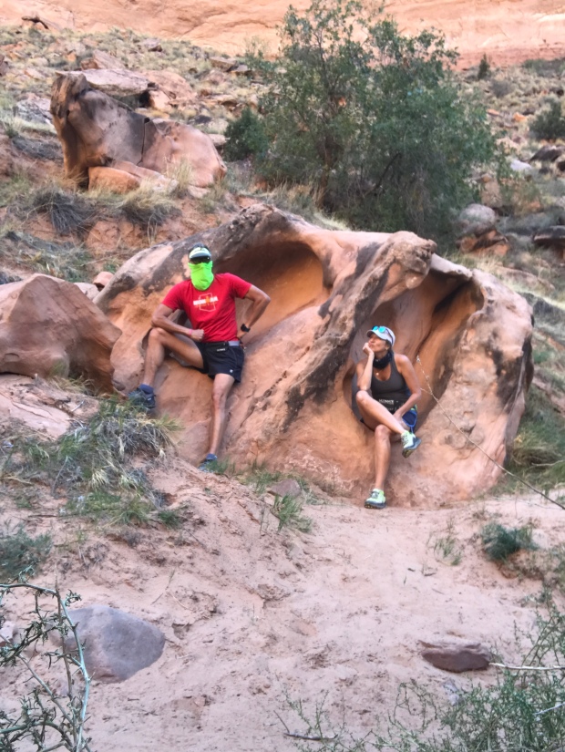
We arrived in Vegas about a week before the event and made a trip out to Red Rock Canyon for a training run. We’ve never been fans of Las Vegas, but the Red Rock Canyon could certainly change our minds. Spectacular red canyon views, safe roads for cycling and tons of trails to hike or run. It is certainly a special place!

Red Rock Canyon
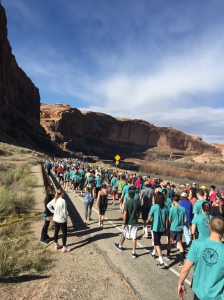
The Mt Charleston race was a fun but very hot race. What made this event enjoyable was the route was completely downhill.
Busses transported us up to Mt Charleston in the wee hours of the morning. Temps were cold when we started. But by the time we crossed the finish line people were dropping like flies from the heat. So many people needed medical help that the race has now been moved a week or two earlier to try to avoid another disaster.

Mt Charleston Marathon and Half Marathon
Williams, AZ (Elevation: 6,700’)
As the temperatures were already getting into the 90’s in Vegas we moved to Williams, AZ. We had a week until we needed to be in Flagstaff for Overland West Expo, so we picked a new BLM site to kill some time.
Big open meadows to camp and plenty of trails for running, all within a few miles of the quaint little town of Williams.

Another trip down into the Big Ditch
Williams is on Historic Route 66 and is considered the Gateway to The Grand Canyon and houses the southernmost terminus of the Grand Canyon Railway. Williams was considered the last holdout for Hwy 40 to bypass Route 66.
We made a quick trip to the Grand Canyon for Easter Sunday sunrise service and stuck around for breakfast at the Bright Angel Lodge. The Grand Canyon is always special no matter how many times we have been there.
Farmington, NM (Elevation: 5,393’)
After Williams and Flagstaff, we decided to move on to New Mexico. We haven’t spent time here, except to get from Arkansas to Arizona. We kept hearing about a BLM campground in Farmington, NM that just opened.
We thought we were beyond frigid temperatures, but the closer we got to Farmington the more unsettled the weather. Rain turned to sleet and snow and when we turned onto the dirt road for our final 3 miles to the campground, we were not sure we could make it. Thank goodness for 4-wheel drive, because without it we never would have made it to the muddy dirt road to Brown Springs OHV Recreation Area.
As we pulled in we were greeted by 4 of our fellow Xscapers RV Club members. Not knowing they were there, it was a nice surprise to see them! One thing we have learned after 4 years of full-timing, we usually run into someone we know.
We had a cold and rainy start to our stay, but the clouds moved out and the temperature rose over our 14-day stay.

Snowy start to our stay
This first come first serve campground is completely free with 11 designated campsites and pit toilet, but no hookups or dump station. Each site was beautifully landscaped with fire pit and covered picnic tables. The grand opening of the campground was the week before and only filled up over the weekends.

Beautiful large campsite
There are OHV trails all over this place and we enjoyed trail running to our heart’s content. One downside was the OHV activity, especially over the weekends, which brought in a ton of loud folks who didn’t feel it necessary to pick up their trash. Every trail run we went on we picked up as much trash as we could carry. Mostly alcohol bottles and cans littered the trails. Occasionally responsible adults threw out the kid’s juice bottles too. You want to start them young, right?

Tons of hiking right from the campsite
If you make it to Farmington be sure to plan a trip to Bisti/De-Na-Zin Wilderness Area 50 miles south, also known as the Bisti Badlands.
The unique landscape looks alien in nature, and is like nothing we have ever seen. We saw fossils, hoodoos, petrified wood, dried lake beds and the famous “cracked eggs”. It’s definitely worth a day trip to explore this expansive area accessible only on foot!

Cracked Eggs


Taos, NM (Elevation: 6,969’)
After Farmington, we moved on to Taos, NM. Taos is a charming little town with a rich history of conquests, revolts, raids, treaties, and wars. Finally becoming a US territory in 1850 and a state in 1912 it is now home to a booming art community.
We took a trip to the Rio Grand River Gorge that carves an amazing canyon into its flat landscape just west of town. Little specks of rafters could be seen from the top.

Rio Grand River Gorge
Crossing over the Gorge we also toured the eco/self-sustaining community called The Earthship Biotecture. They specialize in solar, water catchment and recycling and walls made of dirt-filled tires and glass bottles. Water was first captured from rain and snowmelt to be used from showers and washing dishes. This wastewater was then used to flush toilets then filtered to provide water for drip irrigation systems in greenhouses to water plants and vegetables.
It was an impressive, completely sustainable community.

The Earthship community
While in Taos we planned on hiking the highest peak in NM, Wheeler Peak at 13,159’. But inquiring at the local Outdoor store, we learned the Wheeler Peak was still covered in late season snow. Instead, we opted for the more elevation friendly Devisadero Loop Tail just on the edge of town. It was an easy 5.7-mile loop and had beautiful views of Taos.

Devisadero Loop Tail
While in Taos we stayed at the quaint Hotel Luna Mystica. Hotel Luna is actually a vintage RV rental “hotel” with a dirt parking lot in back for dry RV and tent camping. There is room for a good 100+ RV’s so they do not take reservations. Reservations are required for vintage RV rentals.
Be sure to check out the brewery next-door at the “mothership” where they serve up great food!

Hotel Luna Mystica vintage rentals
Mosca, CO (Elevation: 7,559’)
Mosca contains the highest sand dunes in North America, The Great Sand Dunes. The Great Sand Dunes became a National Park in 2004.


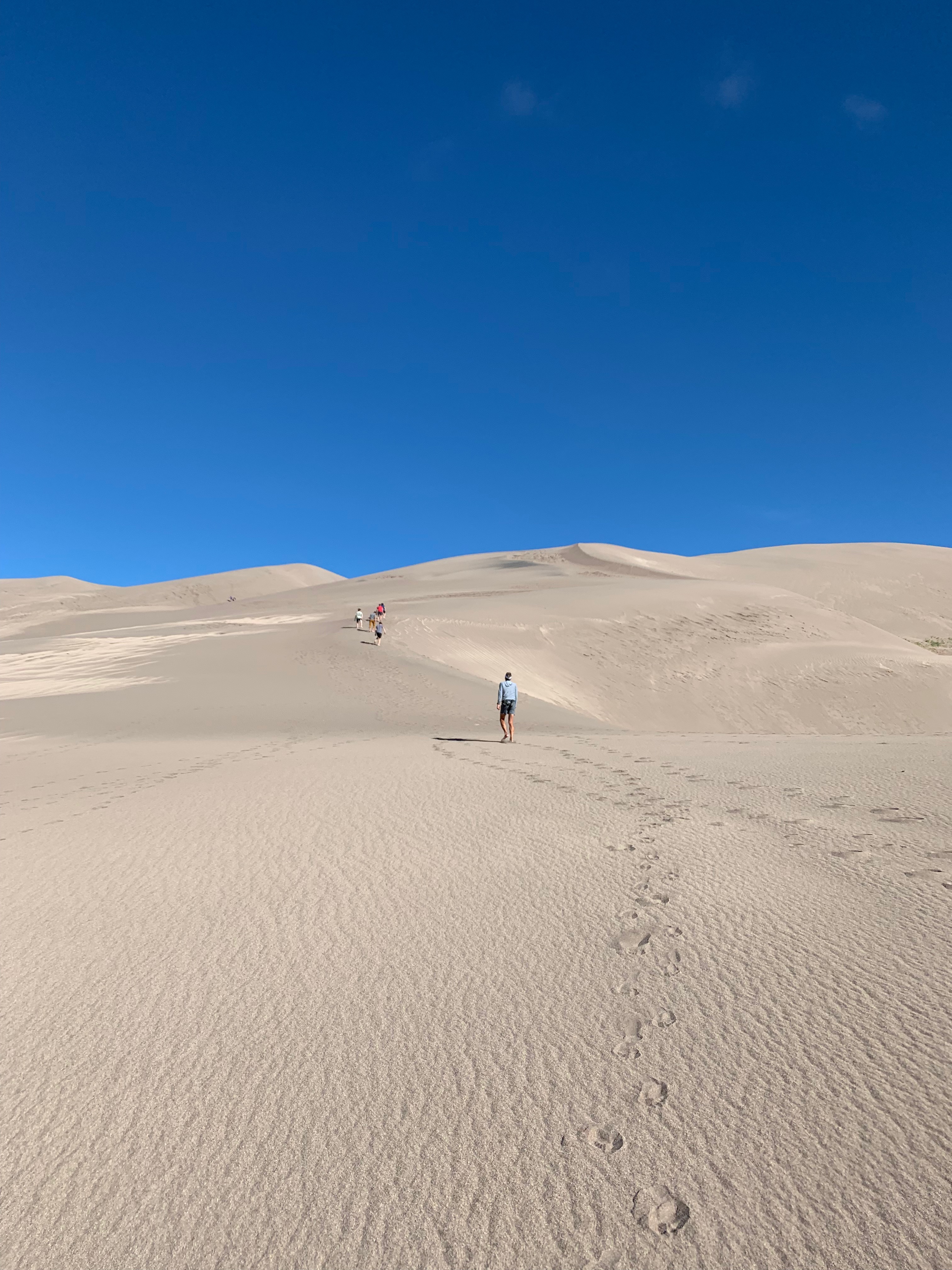
The dune is a fascinating ecosystem of recycled sand that gets kicked up by high southwesterly winds that push sand up east against the Sangre de Cristo Mountains. During storms, the wind shifts in the opposite direction pushing the sand back west. This back and forth forces the sand upward, creating the dunes. It’s suggested that there really isn’t any “new” sand, just the same old sand being pushed around by the wind.
Medano Creek runs at the base of the dunes and is used as a “beach” by the locals. While there, we saw hundreds of families set up beach toys and pop-up tents to spend the day at the creek. It’s very shallow but can run strong and cold. You can rent sandboards and sleds at the visitor center for sand surfing and sledding.

The Beach
Another worthwhile side hike is to Zapata Falls. This 30′ waterfall flows into a narrow crevasse south of Great Sand Dunes National Park. Depending on where you park it’s either a short .4-mile up to 4-mile hike to the falls with the last 400′ through freezing cold water. Take a hiking pole for stability in the water and prepare for the biggest brain freeze you’ve ever experienced!


Brain freeze!

We could only see a small portion of the falls
The falls are not completely visible from…well anywhere. Even after hiking through the creeks to the base of the falls we could only see the small bottom portion. A bit disappointing but still glad we did it.
Buena Vista, CO (Elevation: 7,965’)
We made a stopover in Buena Vista CO on our way to Denver for the Outdoor Retail Show. From the moment we rolled into “BV” (as the locals say) we were in L.O.V.E. Getting its start from rich agriculture and mining, BV is a flourishing summer tourist destination on the Arkansas River Headwaters.

The Arkansas River in Colorado

The Midland Trail along the Midland Railroad rails to trails
Many of the downtown buildings date back to the 1880-1890s, giving this town an amazing sense of history and resilience. Right from downtown, you have miles of mountain biking and hiking trails along the Arkansas River. And the river offers kayaking, white water rafting, and paddleboarding.
After running the Midland Trail, the old Midland Railroad line, we had an amazing lunch at the Simple Café downtown.

Adorable Buena Vista from the Midland Trail
After studying the very expensive house market we decided that we might plan to spend 3 months here next summer at one of the local RV parks. Monthly RV Park rates average about $500-700/month, much cheaper than rent or mortgage payment in this pricey little mountain town.
Salida, CO (Elevation: 7,083’)
After a week’s stay at Bear Creek County Park in Denver, we headed back through BV on our way to Salida. We were attending the Xscapers 4thof July Convergence. Salida is another neat little Colorado mountain town with all the charm that comes with the wild west of the 1880s.

Xscaper shenanigans in the Salida 4th of July parade

Downtown Salida
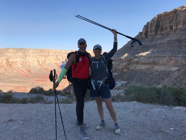
After the convergence at the Chaffee Fairgrounds, we moved 5 miles down the road to the Shavano BLM area. Once relocated we used this location to bag our first two Colorado 14’ers…Mt. Shavano (14,231’) and Tabeguache Peak (14,162’).

Our beautiful forestry campsite
This was a brutal Class 2, 12-mile round trip with 5,600 feet elevation gain that took us 9 hours to complete. Tabeguache Peak is only accessible via Mt. Shavano, so if you are going to do one you might as well do both.

The trail to these two peaks is a relentless steep uphill battle that gets no reprieve what so ever. No flat strolls through pretty little meadows. No rollers for a bit of recovery. No switchbacks to easy the steep grade. Just straight uphill…for 5 long hours. The final approach to both mountains are scrambling over bolder fields with no definitive trail and patches of snow.
But as tough as the uphill slog was, the downhill was just as painful, slow and rocky. It was a long day and I’m glad to be in enough shape to decide on any given day to hike a 14’er!
Next up, Mt Elbert, the highest peak in Colorado.
Camp Hosting…Not for the Faint of Heart
Posted by Deb in California, Full Time RV, Running, RV Parks, Trail Run, Ultra Running on June 28, 2019
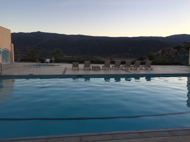
After meeting the Doheny State Beach park ranger last spring, Jeff and I committed to camp host for 3 months on the beach at Dana Point, CA.
Doheny State Beach is California’s very first state beach. It was named after oil tycoon Edward L. Doheny who donated 41 acres for public use on May 31, 1931. An additional 21 acres was later added by acquisitions from the Santa Fe Railroad, University of California and the Union Oil Company.
It was interesting to learn that Edward Doheny drilled the first successful oil well in the Los Angeles City Oil Field in 1892 that set off a petroleum boom in Southern CA.
After selling off his California oil properties, he was the first to drill for oil in Mexico and opened new oil fields in Venezuela.
He was later implicated in the Teapot Dome Scandal in the 1920’s, being accused of offering a $100k bribe gift to US secretary of Interior in connection with obtaining a lease of 32,000 acres of government-owned land. The 2007 film There Will Be Blood is loosely based on Edward Doheny.
This is our first experience camp hosting and we where set to make the most of our free coastal living in exchange for 15-20hr of “work” each week.
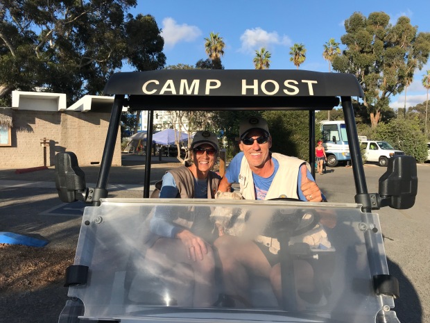
For those not familiar with Camp Hosting, RV parks, campgrounds and National Parks will offer a free campsite (usually with full hookups) in exchange for 15-20hrs/week of volunteer work. It’s a great benefit to the campgrounds to have camp hosts on site to monitor the comings and goings of campers and to help with grounds keeping, bathroom maintenance and selling of firewood.
It’s a win-win for both parties as it offers us full timers an opportunity to give back, have purpose and camp for free while providing the parks with much needed help.
Each campground has it’s own agreements with hosts with different expectations/responsibilities and length of stay. So understanding your roll prior to committing is quite important to having a positive experience.
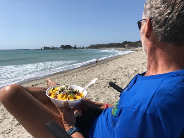
Beachside lunch
The reason we decided to make Doheny State Beach as our first experience was because it did not require cleaning of bathrooms or campsites, the campground is directly on the beach and it only required a 3-month commitment.
We showed up at Doheny a few days prior to our first day of work and did some training with the departing camp hosts.
Up at 5am to retrieve the camper log from the ranger station ½ mile from the campground with the provided golf cart. Drive around the campground to check registrations of campers, make stops around the shower houses, write up warnings to offending campers who string cloths lines from bushes or park in the landscaping. Then return the log back to the ranger station.
At 8am do a quick loop through the campground to remind campers that generator hours don’t start until 10am.
At noon it’s another trip around the campground to get those checking out to move along so that sites can be cleaned by staff before new campers start moving in about 1pm.
From 3-4pm we do an occasional loop to sell firewood for $7/bundle. We keep our RV door open until 8pm and make one more trip to remind folks that generator hours are over at 8pm before calling it a night.
We manage the campground with 1 other camp host couple and worked 2 days on/2 days off/3 days on. The following week we are 2 days off/2 days on/3 days off. That way we were off every other weekend. All hosts are flexible and if we needed a day off or just even a round covered, the other hosts were always willing to cover for us and us for them.
Easy peasy right?
So here is what really happens…
5AM while scanning the showers, if a door is closed and locked it usually means there is a homeless dude or meth-head encamped in the private confines of a shower stall. Whether they have chosen to take a sh*t in said shower stall is always the mystery when the ranger shows up to remove said homeless dude.
Removed these leftover with a stick and made $.55 in the process
Place “friendly reminders” on windshields of those who showed up after hours that they must report to the kiosk to get their tags. Some are legitimate campers with reservations. Others are trying to camp for free by showing up late and leaving early. The ranger issues tickets to offending parties.
8AM we get to delay camper’s consumption of coffee by having them turn off their generators until 10AM. You can imagine how that is received.
Usually between 12-3pm we escort more homeless folks out of the campground who are trying to use the showers, toilets or picking aluminum out of the trash cans or are simply trying to walk off with campers bicycles, cell phones and wallets.
Occasionally we call the rangers on non-camper interactions that involve drug use and/or mental health crazy talk. Excuses for their presence is usually brushed off as they are there to “see a friend” or “a photographer taking family pictures” all the while walking off with someones generator with the extension cord dragging behind.
We’ve also dealt with groups of homeless folks that get one campsite then invite 14 of their friends for late night raves. According to the rangers, there is nothing that can be done since they paid for a campsite.
And when you confront non-campers they usually excuse their poor behavior by saying they are a veteran, saying they are helping veterans or give you a hardy, “God bless you”.
Luckily we only had two midnight knocks on our door that involved loud music. And another incident that involved a car egging after a large group of noisy campers ticked off their neighbors. According to the large group their music was “barely audible”.
I’m not going to lie. The first couple of weeks were a challenge seeing the overt drug use and mental health issues that this campground is surrounded by. But after that we developed quite a sense of humor about it all and realized that MOST people were opportunists rather than physical threats.
Despite some of the riff raff, we met a lot of great campers and got to spend a season living on the coast of California…for free.
Would we do it again?
We committed going back in October!
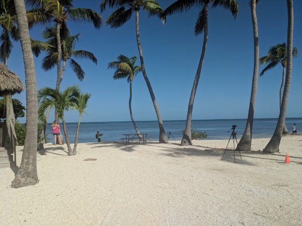
Doheny State Beach is located in the wonderful community of Dana Point. Within walking distance we had nice restaurants, grocery shopping and the Pacific Coast Trail to run and cycle.
Pacific Coast Trail
Paddle Games
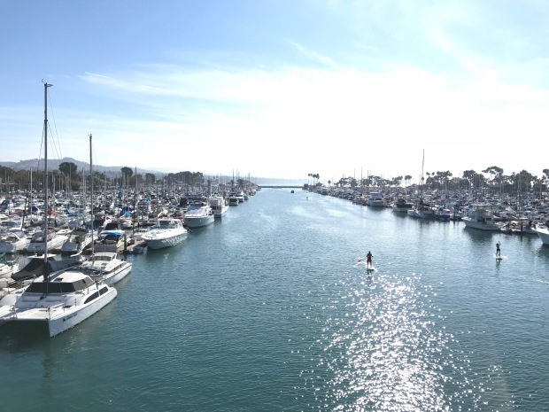
Dana Point Marina
It was a great location for the 10K Spooktacular Halloween run, 10K Turkey trot Thanksgiving Day run, the Cuyamaca 100k trail run and the Glamis Sand Dunes Veterans Day clean up.
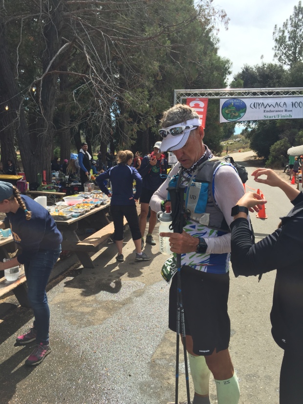
Cuyamaca 100K
We also drove to Newport Beach for the famous Christmas boat parade and took a trip to San Diego to have Thanksgiving dinner with some RV buddies.
Overall we really enjoyed spending fall/winter in shorts and t-shirts in southern California and look forward to returning to the coast in October.

Surfer Jeff
Trail Running…What’s not to Love?
Posted by Deb in Full Time RV, Hiking, Running, Trail Run, Ultra Running on December 28, 2018
Running can sometimes be mundane. Especially when it is confined to concrete, stop signs and busy streets. But when you take running to the trails everything changes.
Changing scenery. Adventure and exploration of surroundings. Sights, sounds and smells of the wilderness. The crunch of dirt under your feet. AHHHHH!
Trail running requires an ever presence of mind and focus. One drifting thought about a work project can land you flat on your face with dirt permanently embedded in your palms.
I have scars to prove my love of the trails…each one has been totally worth it!
Man down…just another day in the park!
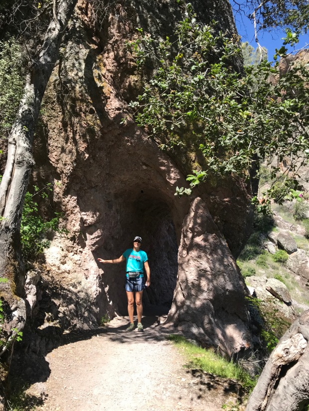
PINNACLES NATIONAL PARK
Jeff and I spent a month in Hollister, CA while having an upgrade to our holding tank valves. I saw a sign on the highway for Pinnacles National Park. Doing some research I discovered that PNP is the second newest National Park made so in 2012. (The newest being the St Louis Gateway Arch in 2018)
The Pinnacles are the remnants of the western half of an extinct volcano along the San Andreas Fault. It offers 30 miles of trails, pinnacles for rock climbers and is home to 13 species of bats, prairie falcons and is a release site for California condors that have hatched in captivity.
We started early as usual to avoid crowds and found the last parking spot at the Condor Gulch trailhead. We wanted to do a loop that took in the Bear Gulch Cave Trail. Starting on the Condor Gulch Trail we headed west on High Peaks Trail. Then we jumped on Tunnel Trail, Juniper Canyon and then back on the High Peaks Trail. This was a little over 5 miles.
This was a wonderful route with lots of diverse landscape. We were looking forward to exploring some tunnels and caves. But the tunnels were super short and we managed to miss Bear Gulch Cave completely. It was still totally worth the effort.
When we got back to the parking lot the traffic coming into the park was backed up for a couple miles. The parking situation did not hold up to the popularity of this place and rangers would not allow traffic to progress forward until someone left. So if you go to Pinnacles go early or on a weekday!
HENRY W. COE STATE PARK Hollister, CA
Another great trail running area near Hollister is the Henry W. Coe State Park. The trails are smooth with just enough hills to get the heart pumping. The park contains over 87,000 acres of rolling pastures for free range cattle to roam. With 200 miles of dirt roads and trails, it’s an outdoor paradise for hikers, runners and mountain bikers.
The stubborn cattle that tend to claim these trails can be a bit intimidating. As a chiropractor in the Midwest, I’ve seen my fair share of injured farmers that had been trampled by temperamental bovine…and it wasn’t pretty. But if you yell loud enough and wave your arms like a crazy person they slowly moved on.
The Katy Trail
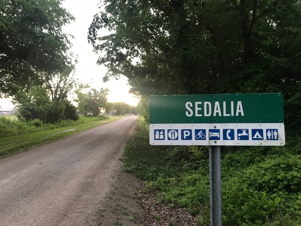
Jeff and I went to Sedalia Missouri for the Escapees annual Escapade. The event was held right along the Katy trail which was perfect to get our runs in each morning. I talked about the Katy trail here and its on our bucket list to bicycle one day. Previously we have run the Katy trail from Munson to St. Charles Missouri, the eastern most terminuses.
The wide packed gravel trail was consistent with what we saw in St Charles with lots of shade.
This was our first run back in humidity and we were both exasperated with our run performance until it dawned on us both…”Ooohhh ya. Humidity.”
Starved Rock State Park Oglesby, IL
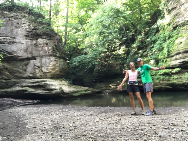
St Louis Canyon
Starved Rock is 2630 acres located along the south bank of the Illinois River. In 1683 the French had established Fort St. Louis on a large sandstone butte overlooking the river they called Le Rocher(the Rock). Legend has it, that in 1769 the French had moved on the Native American group called Illiniwek or Illini claimed the butte. The Ottawa and Potowatomi Native Americans besieged the butte until all the Illiniweb had starved and the butte became known as “Starved Rock”.
Starved Rock is known for its 13 miles of trails, 18 deep canyons, many waterfalls and sandstone outcrops. Jeff and I hit the trails early morning to try and beat the crowds and the heat. Nice strategy until you are the first one to catch all the spider webs in this heavily wooded forest. Jeff ran with a vale of webs trailing behind. We ran to the furthest distance to the St Louis Canyon waterfall and back.
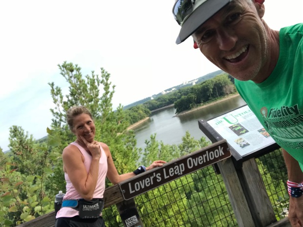
There are many scenic viewpoints including Lovers Leap Overlook where apparently two Native American forbidden lovers from different tribes hurled themselves off this point. Too bad they didn’t just run off to Vegas like the rest of us.
St. Vrain State Park
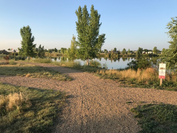
Lots of little ponds to run around
St Vrain was one of the very first state parks that we stayed at on our 3-week trip to Colorado in 2013. From reading reviews of other RV parks and campgrounds in the Denver/Boulder area this is the nicest, most cost affective place to stay. The campsites are well spaced with trails that wrap around multiple small ponds/lakes.
The trails are flat and dusty and good for a 5 miler. Any longer and you would have to keep repeating loops.
Tie City Campground Laramie, WY
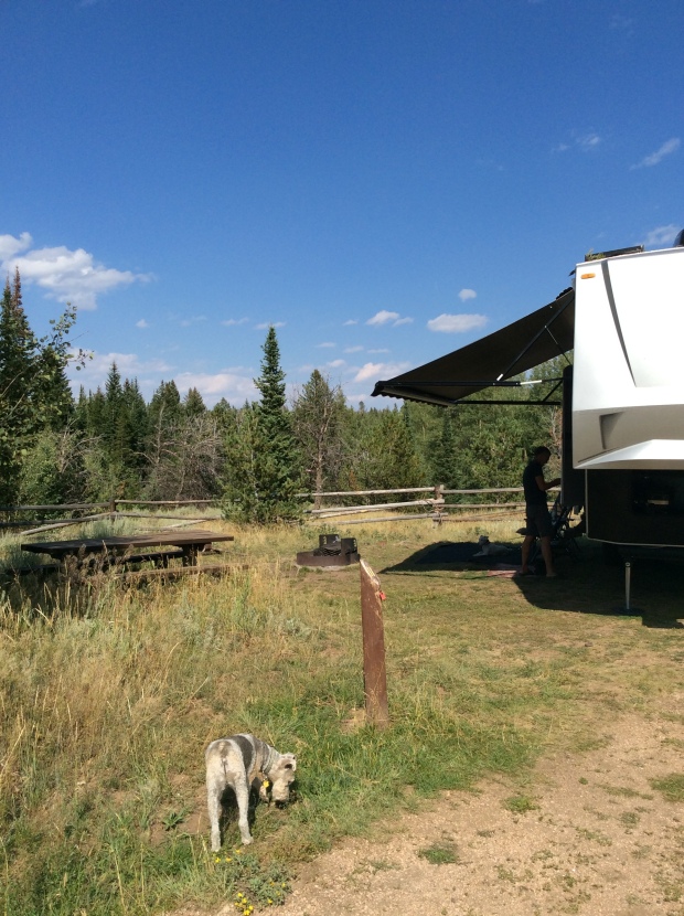
Tin City campground with trails on the other side of the fence
After an exhausting pushing to drive from Arkansas to Denver we made a last minute decision to stop for 4 days at the Tie City Campground just east of Laramie, WY. Oh what an amazing find this was!
Tie City was named for the railroad men who cut the ties for the union Pacific Railroad from the Lincoln National Forest.
This campground is a popular spot to take in 30 miles of trails that web itself all over these mountains. The trails are clearly marked by name and ski difficulty. Winter brings cross-country skiing and snowshoeing while summer offers trail running, horseback riding, mountain biking and hiking.
Trails right from our campsite
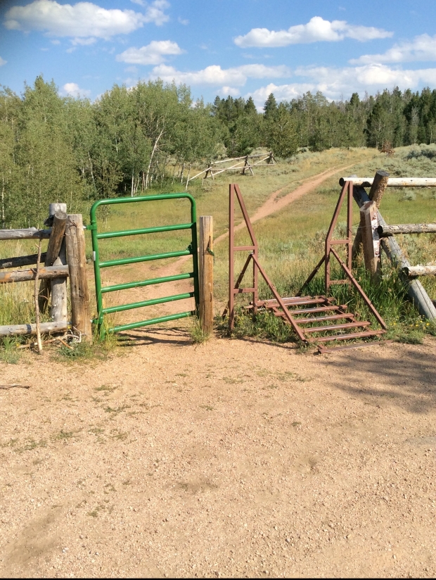
A place to turn around for 8 miles
Some rugged steep trails are considered black diamond while other wide and rolling trails were considered blue. It’s easy to get turned around on these trails (then again it could just be me) so bring a map if you want any hope of finding your way back to the trailhead.
Weekday or weekend these trails are used hard by some of the friendliest people we’ve met!
LOVE. LOVE. LOVE THIS PLACE!
Mt Emily Recreation Area (MERA) LaGrande, OR
MERA is located in the Blue Mountains of NE Oregon and has 40 miles of motorized and 45 miles of non-motorized trails.
I started at the Owsley Trailhead where there is plenty of parking for cars, horse trailers and pit toilets. Maps were available at the Kiosk so if you are not familiar with the area TAKE A MAP!
I started on Red Apple trail and ran Upper Hotshot to the Mera Loop. From there I’m not quite sure where I went, but by some miracle I ended up back at the parking lot for 7 miles. I promise you I did take a map. But what I didn’t bring was my reading glasses for the miniature print on those wonderful trail maps!
There are so many crazy offshoots of trails that it was easy to get off course. The trails range from single track to forestry roads. Some a bit more overgrown than others. The rolling hills and elevation ranging from 2900-5600’ made for a good challenging run.
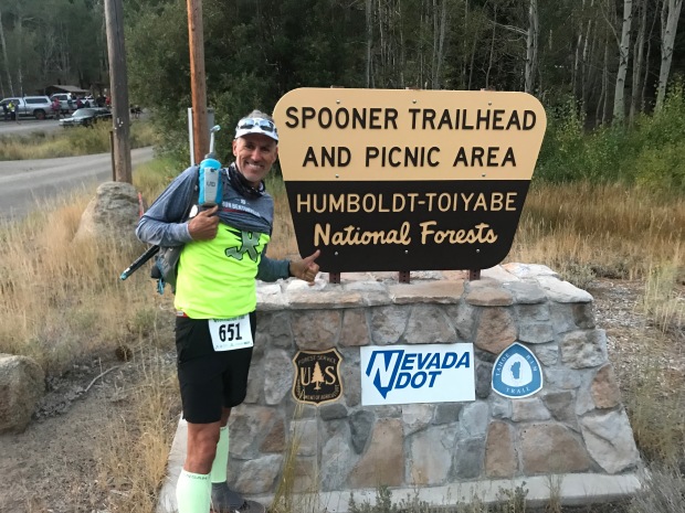
South Lake Tahoe 100k
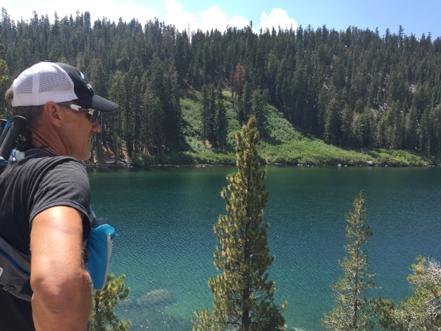
Run to Echo Lake
We had a friend that had signed up for the Tahoe 200. Jeff decided that he would pace his friend for the last 40 miles. Since this friend had never ran longer than a marathon we were not confident this race would go down. Sure enough, two weeks before the race our friend decided to back down to the 100k. Since 100k runners cant have a pacer, Jeff decided to sign up for the 100k so that he could run with his friend, who in the end pulled out altogether 2 days before the race.
Views from Tahoe Rim Trail
Tahoe is in our top 5 places that we have been to. In case you are wondering, the others are Flagstaff, Sedona, Bend and south rim of the Grand Canyon.
What we really liked about this race is it was on the Tahoe Rim Trail with easily accessible aid stations for spectators. The views were spectacular. The weather was perfectly cool. Tahoe never disappoints…except when you misinterpret a “100k” tail sign for “look” and take a wrong turn during the race. At mile 48 Jeff missed the cutoff by 3 minutes and his race was over. Selfishly it was nice that Jeff was done at 9pm rather than midnight since we planned on pulling out the next day.
These are just a few of our fun trail runs/hikes as we made our way from Arkansas, Iowa, Indian, Colorado, Wyoming, Oregon and California. We finally stopped in Dana Point CA for our 3-month workkamping gig at Doheny State Beach.
More from our little beach community soon.
Honorable mention hikes & trail runs
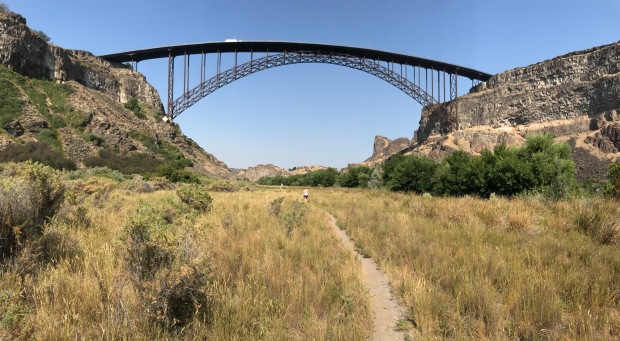
Twin Falls Idaho
The American River Trail Folsom, CA
The American River Trail
Route 66 Newberry Springs, CA
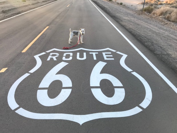
Sam getting his kicks on Route 66
Arkansas to California
Posted by Deb in Boondocking, Borrego Springs, Full Time RV, Trail Run on October 21, 2018

After leaving the comforts of our cabin in Arkansas we pointed the RV west. Lingering half the year in the mid-west was nice, but we were ready to get the RV rolling back to the land of eternal sunshine and bug-free living.
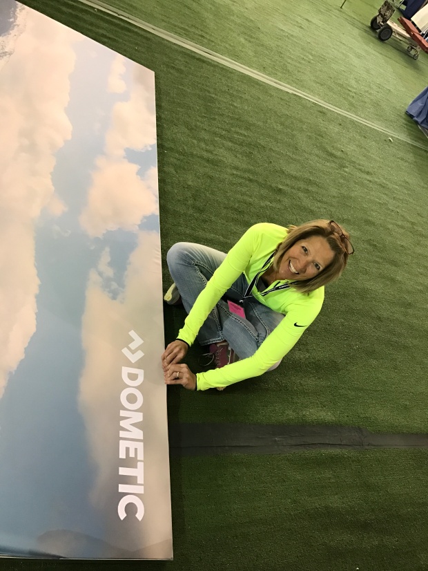
We were making the annual trek to Quartzsite for the big show. The difference this year over the last 3 was that we did not work a booth. Instead of a selling event, we were having a consumer insights event with 13 of Dometic’s engineers, product developers, and customer intercepts. It was a nice change roaming the desert talking to folks rather than being stuck in the booth for 9 days.
After Q we followed our Xscapers RV club to American Girl Mine just outside of Yuma. This is one of our favorite camping locations for the beautiful sunsets and endless trail running options. It’s nice being with a group sometimes because we learned of a few new things to explore. One was a local mine shaft that you can hike into quite far. With a pool at the bottom, it makes for an interesting underground destination. We didn’t actually make it to the mine shaft this trip, but look forward to going next time we camp there.
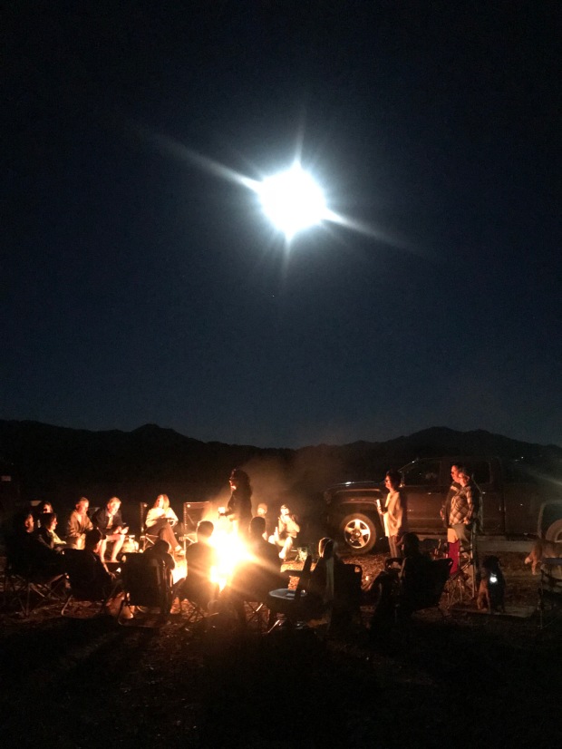
Xscaper friends enjoying a campfire and full moon
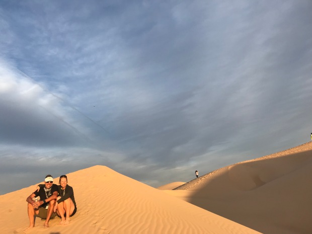
Imperial Sand Dunes
The other fun destination was the Imperial Sand Dunes just 4 miles from camp. The Dunes are such a striking contrast to the scrub and rugged landscape of AGM. It’s as if we landed in Egypt minus the camels. Mountains of sand smoothed and rippled by the wind as far as the eye can see. It is an ATV lovers dream location for off-road anything in designated areas. And then there are those who ride the dunes on sleds and snowboards for additional excitement.
I highly recommend stopping for this destination at sunset!
We pulled out of AGM to make our way to Southern California. We had a scheduled photo shoot for Dometic and needed to scout locations for video and photography and secure RV’s and boats.
We purposed to stop at Borrego Springs for a few nights on a friend’s RV lot. The last time we were here was 3 years ago during Soup Anarchy watching movies on the side of Technomadia’s bus in the desert!
Gosh, what a fun time that was! This was much more low key and quiet compared to our previous trip and we enjoyed the solitude of our location. We were within running distance of the trails at Borrego Palm Canyon Campground to trail run.
If you ever come to Borrego Springs be sure to check out the desert art!
Nice to have friends with RV lots
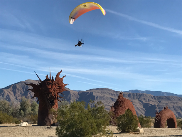
RICARDO BRECEDA SCULPTURES
We would have loved to stay longer but we really needed to get closer to the coast.
I had been researching RV Parks along the coast since we needed to park for about a month. Jeff and I had some air travel scheduled mixed in with our coastal scouting and we like to leave the rig plugged in while we are away.
I was not prepared for the sticker shock of coastal living. Holy moly! The reasonably priced state parks were not available for a month stay; only offer dry camping or are too small to accommodate our size. While we were at American Girl Mine we met a couple that has a lot at the Escapees Jojoba (Ho-ho-ba) Hills RV Park in Temecula CA.
Since this location was “only” 70 miles from the coast and $40/night for full hookups or $7.50/night dry camping we decided to make it our home for the maximum 28-day limit.
Enormous campsite
BLM trails to run
Fabulous pool overlooking the valley
This is a STUNNING park beautifully maintained by lot owners. It’s your typical 55+ park with tons of activities, a pool overlooking the valley and pickleball courts. Just outside the gates is BLM with plenty of trails for hiking and running.
Temecula is known for its vineyards and old downtown nightlife. We met up with some friends and hit a couple of restaurants during our stay. We really enjoyed this community and Jojoba Hills offers affordable living for those who want to live the SoCal life.
We made several trips to Dana Point, Newport Beach, Balboa Island, and Oceanside. My plan of making quick trips over to the coast was delusional, to say the least. The traffic was insane, turning our 70 miles into 3 hours (6 hours round-trip). It didn’t matter if we left early or returned late the traffic was a consistent gridlock of red taillights.
Despite the painful drives we did see beautiful coastal settings and ate great seafood.
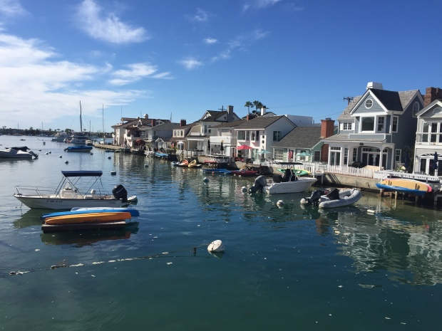
Balboa Island…Quaint but VERY EXPENSIVE!
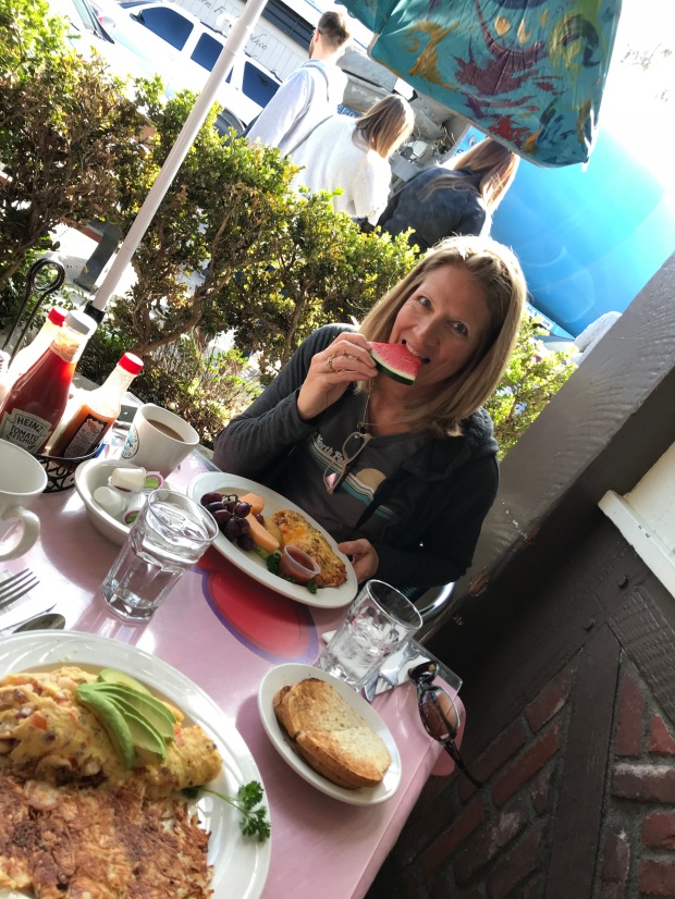
Breakfast outside in February
Dana Point
One of the side trips we needed to make was the RV Entrepreneur Summit in Austin TX. We went on behalf of Dometic but we also wanted to attend for ourselves. We rented a park model cabin at the Jellystone RV Park and sat in on many seminars. The speakers were outstanding and we made a lot of new friends.
I flew back to LA while Jeff stayed in Austin for another week. One of Jeff’s goals has been to qualify for the Boston Marathon. There happened to be a qualifying race in Houston… The Woodlands Marathon. He has been getting coaching from a friend and was as prepared as I have ever seen him. He had an awesome race and beat the age group qualifying time by 6 minutes. WE HAVE A BOSTON QUALIFIER IN THE HOUSE! However, even though he has a qualifying time it doesn’t mean he will get to run the race.
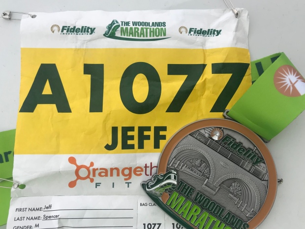
Since the number of “qualifiers” exceeds the number of available slots he will now be put in a pool by time. In the fall we will find out if he will actually receive a slot at the starting line in April 2019. (UPDATE: Jeff got a spot and is going to Boston!!!!)
After we were reunited back in Temecula we started to move around for the photo shoot. We hung out for a few days in Newport Beach at the VERY EXPENSIVE ($170/night…gasp) Newport Dunes RV Resort to meet up with the team from Sweden, France and Australia. Then we packed up and caravanned to Lone Pine, California.
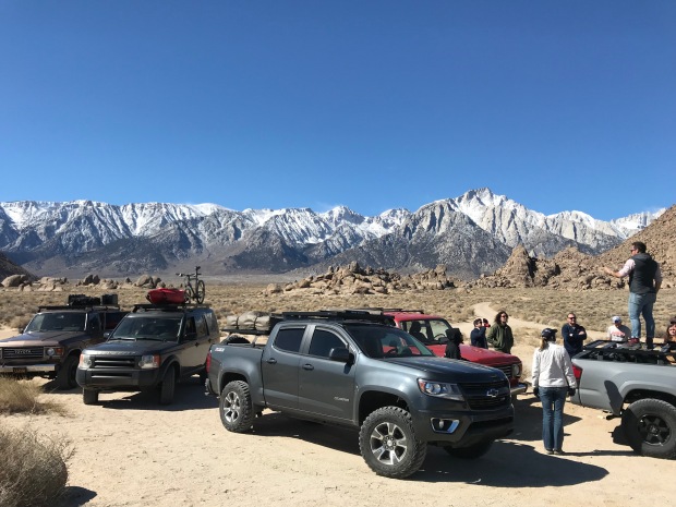
The team getting instructions from our favorite Aussie
Getting the RV’s positioned
Lone Pine is where the Whitney Mountain Portal is to the highest peak in the lower 48. After my failed attempt (and Jeff’s success) to the summit a couple years ago that mountain has been looming in the back of my mind. For a brief moment, I considered making the attempt again on this trip since I now have backpacking equipment to break up the hike. But then I realized that it’s still winter on the mountain and I put my aspiration down for a nice cozy nap.
Its still snowing in those hills
The photo shoot went amazingly smooth in Lone Pine. This sleepy little town is home to some of the most photographed locations for old Westerns. Of course, the rub in this town is that it runs on small-town time. We needed grocery supplies to keep everyone fed, but the tiny grocery store had limited hours due to “new management”. There was no consistency, rime or reason to their hours and we were forced to drive an hour away just to pick up some supplies for a night shoot.
Sorry to put you through this Lone Pine!
Despite the strain we put on local restaurants with 12 of us showing up at once, we ended up with some very successful shots.
After 5 days we headed back to Newport Beach to transition to the marine shots. While the team went out on a yacht, Jeff and I spent the day on land returning the borrowed RV’s and catching our breath. Our final day of shooting was at Dohaney State Beach area at Dana Point using our personal RV.
The team heading out for a day of shooting
Jeff and I kicking up our feet to catch our breath
While there, a ranger stopped by our RV and wanted to take a picture of it. He and Jeff got to talking and the ranger offered us a Camp Hosting position at Dohaney State Beach Campground the end of this year. We ended up camping for 3 nights at this park right on the beach and spoke with the current camp hosts for the down and dirty of the job.
After learning that the job only entails checking sites for proper permits and selling firewood for 15-20 hrs a week we decided to commit to hosting for October, November and December. We get a free full hook up site, surfing right from the park and no cleaning of bathrooms!
What’s funny is that I’ve wanted to try workamping but Jeff has been less than enthusiastic about the possibility. What I’ve learned is that he is more than exuberant if you mention surfing. Throw in a great Pacific Coast Trail that runs along the beach just outside your door and you’ve got yourself a winning combination for an “all in”, “why haven’t you suggested this before”, “sign me up on the spot” excitement! I should have thought of that sooner.
Until then we have a lot more travel planned, including a trip back to Arkansas. Stay tuned for another sweltering humidity, bug-filled summer of fun!
The Gifts of 2017
Posted by Deb in Biking, Cycling, Destinations, Full Time RV, Hiking, Running, RV Shows, Trail Run, Ultra Running on April 17, 2018
What can I say about 2017?
NOTE: I started this blog back in January…dang it! So here we are in April with a whole lot of travel under our belt for 2018 and I’m getting ready to post something about 2017. That is SO last year!
At the risk of feeling like I am writing about a time “back in the day”, I’m going to post it anyway!
What is it about January 1 that resets everything in our brains to start over?
Start a diet to lose weight. Start working out at the gym. Start emptying the inbox by the end of every day. Organize the kitchen cabinets…I got this!
I’ll be the first to admit that I do this myself… Every. Single. Year.
I started using my Lose It app again to take off these stubborn 10lbs. Why I couldn’t make myself do it October 17th is beyond me. But come January 1? I am so excited to track my intake, count every almond, cut out cream in my coffee and kick my evening piece of chocolate to the curb! Easy peasy.
But over time the enthusiasm fades, the rules become more like suggestions and I am once again carrying an extra 10lbs around my midsection.
I think from now on I’m going to declare “JANUARY 1” once a quarter, since that seems to be the longevity to my New Years commitments. WHO’S WITH ME???
Despite my lack of stamina for some things in 2017, Jeff and I had a wonderful year of RV’ing. Not everything went as planned, but we are thankful for a lifestyle that allows us to be nimble enough to take on whatever life throws us.
So here are some of our favorites and some of our surprises from 2017
Favorite Boondocking Location
We started the year thinking we were going to go to Rocky Point Mexico. But after pricing insurance for the rig we went to Yuma, Arizona instead. Specifically, American Girl Mine BLM just across the border of California from Yuma.
It’s probably the most barren landscape we have ever spent time at. But the amount of trail running was endless, the Internet speeds were crazy fast, city conveniences close by and a Mexico experience within a half marathon.
A few “things” you will see in Mexico!
Days are warm. Nights are cold. Unbelievable sunsets. Other RV’s as close or as distant as you please. All free for the taking.
Favorite Work Location
Working in the RV industry we worked plenty of RV shows in 2017.
Quartzsite
Good Sam Rally-Phoenix
The Escapees Rally-Tucson
National Hardware Show-Las Vegas
Overland West Expo-Flagstaff
Easter Jeep Safari-Moab
Overland East Expo-Ashville, NC
By far our favorite show is the Overland West Expo. To start, we love Flagstaff! Camping amongst the pines. The wind creating a very distinct sound through the trees. The smell of pine needles baking in the sun.


Then there are the customers we get to interact with. They are inventive, savvy, astute and creative. They are not only well travelled, but minimalists who travel in modified Land Rovers, Toyotas, Motorcycles and Earth Roamers. They are not confined to USA borders but prefer to explore the backwoods of the world.
Favorite Sporting Event
This category is a bit tough to isolate. Trail Runs, Hiking The Grand Canyon, Ultra Runs, The Bentonville Arkansas Half Marathon, and Vacation Race series.
I’m certain that Jeff would consider his very first 100-mile Trail Run at Bryce Canyon the highlight of 2017. Pushing his body not just during the race, but for a year of training was a challenge. All to see if he could actually do it! What an accomplishment.
Mile 51
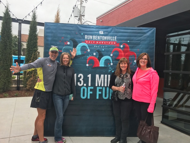
For me was the Bentonville Half Marathon. I ran the race with my sister-in-loves in my hometown surrounded by friends. It was a race and a family reunion that was so special. I ran the Grand Canyon Half too, but Bentonville and family made this one a standout.
Lastly, the bike ride across Iowa during RAGBRAI was special as well. Riding along with our RV’ing buddies with endless laughter and great food made for a memorable time.


Favorite Hikes
We did a lot of hikes in 2017 but the two that stand out the most are two hikes that are hard to get permits for.
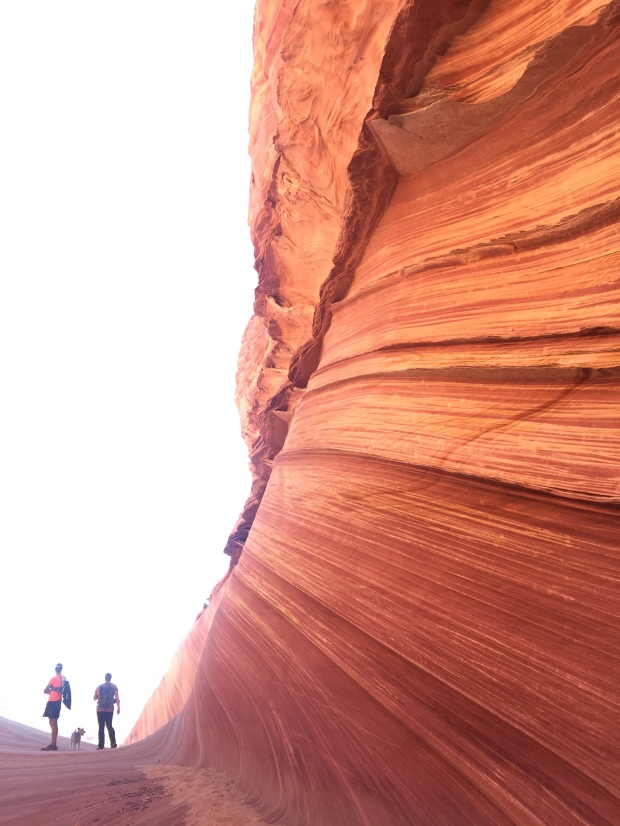
The Wave. What a special experience this was! Having our number drawn for a permit, the challenge of finding it, having our dog Sam and friend Whitney along and the isolation from it all made for a memorable experience. The color and texture was unlike anything I have ever seen and I feel so fortunate to have hiked there.
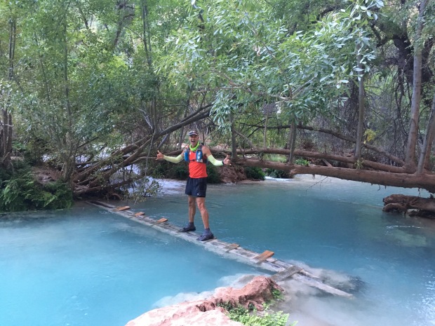
Havasupai Falls Part 1 and Part 2. The hike to the falls was not that incredible, but the falls themselves and day hikes from the campground were stunning. Blue green water that appears fake at times, were unbelievable. This was our first ever backpacking trip without the RV and it gave me confidence that, with the right equipment, I can manage some overnight hiking trips in the future.
Biggest Surprise
Spending 6 months in the mid-west. This was NOT part of the plan for 2017. My Grandmom passed away 7 days before her 100th birthday. So we stayed in St Louis for the memorial. Then I was so thankful that my Mom decided to move closer to my brother. So we sold her house, packed everything up and moved her to a new home.
Then I needed to have two unplanned surgeries. Nothing life threatening. Just necessary. Tests, doctor appointments, surgeries and recovery. All took a better part of June through December.
Second Biggest Surprise
We adopted a new dog. Sammy-do-da is getting up in age (13 years) and we were considering getting a younger dog for Sam to mentor. Sam is an amazing dog and we would love for his good manners to rub off of another dog. We are partial to Wired Fox Terriers and had been keeping an eye out on WFT Rescue Facebook sites.
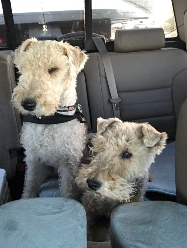
Bullet (L) and Sam (R)
Dogs have come up but Foxies have a certain temperament that doesn’t always mesh with kids or other dogs. We can’t have that with our RV lifestyle so we have taken our time to wait for just the right fit for our family.
One popped up in Tulsa just 2 hours from home. Bullet’s description sounded very similar to Sam’s and we reached out to his Foster. We set up a meeting and Sam and Bullet hit it off. That day we came home with a new dog.
Bullet (B for short) it super sweet just like our Sam with about 10 times more energy and hearing that can detect a wrapper from rooms away. We are having to adjust to having a dog that does not come when we call him or mind his manners. Training has become a new priority which leaves us exasperated at times. But he has a good heart and we will continue to do our part to bring out the best in our sweet B.
Well, thats it for 2017. I will hopefully get caught up on our travels in 2018 very soon. Since January 1 has come and gone and I am 17 days into my second January 1, I am committed to getting my blog back on track.
Now where did I hide that chocolate!
Off to another lame adventure!
Havasupai Falls. Leaving the RV Behind. Part II
Posted by Deb in Bucket List, Full Time RV, Grand Canyon, Hiking, Running, Trail Run, Ultra Running on December 28, 2017

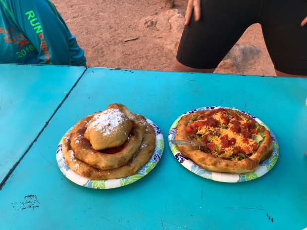
Before we came on this trip, we had heard about Native American frybread. We passed the bread tent on our hike into the campground the day before, but it wasn’t opened. And after seeing the posted sign about its hours, I wasn’t sure it would open while we were there.
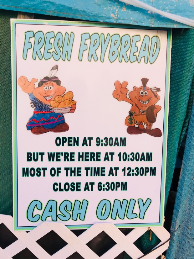
Non-committed business hours
After my hike to Beaver Falls I made the 1-mile hike through the campground to see if they were open. And sure enough, they were! After placing my order I was handed a ticket with a number. About an hour later this one-women show announced that my Navajo Taco was ready. Frybread is very similar to funnel cake topped but not as sweet. The taco was topped with seasoned hamburger, cheese and salsa. Just what the trail doctor ordered! It was REALLY good and I was kicking myself to for not ordering a sweet bread at the same time.
By the time I made it back to camp Jeff was back from his hike to the Confluence and sleeping soundly in his hammock.
“The Confluence”…Havasu Creek meets Colorado River
Day three we decided to stay closer to the campground. We started the morning with a picnic table birthday massage for Jeff. I could have made a pretty penny by those passing by ready to be next. Then we packed some snacks and made about a 1-½ mile hike up the campground to Havasu Falls.
The mist off the falls was pretty chilly, especially since the area was still shaded. We made it just in time to see a very large yoga class finishing up. One of the tour groups offers yoga and massages at the falls.
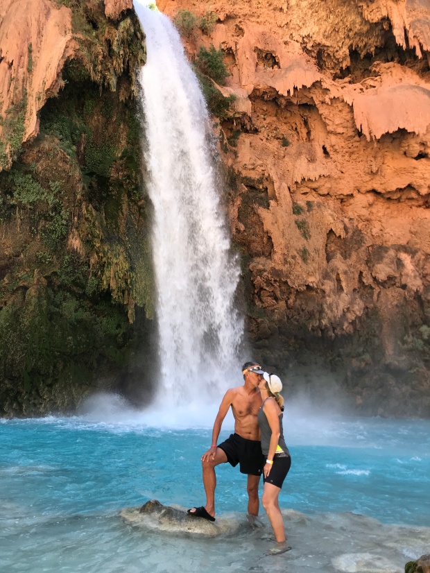
Havasu Falls Smooch
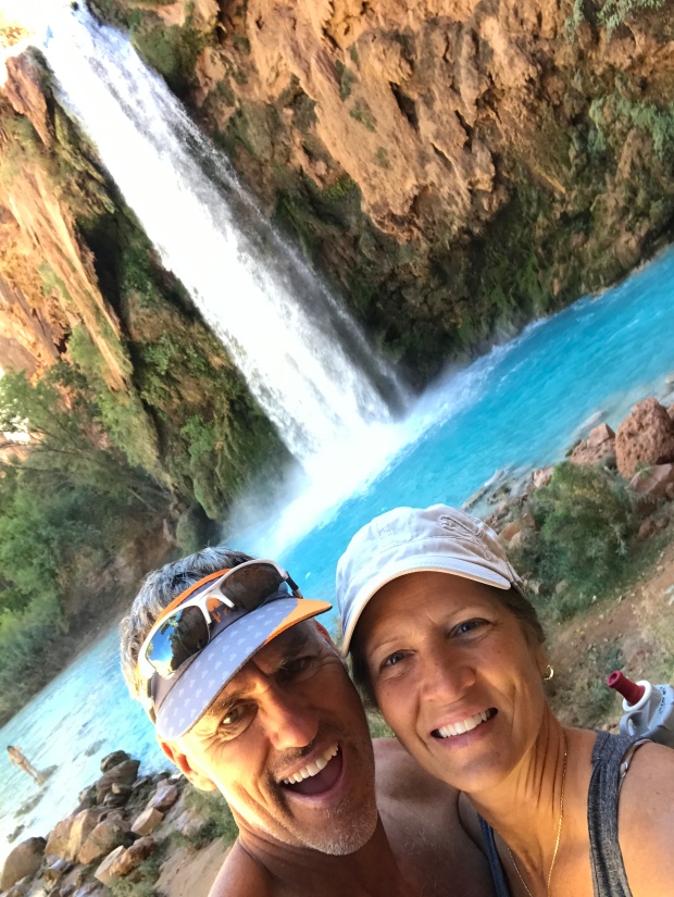
I still can’t believe this water!
We didn’t have much ground cover so we found ourselves sitting in sand and powdered dirt. We sunned ourselves and explored the falls before heading to the bread tent to place an order. This time we got a 3-layer sweat bread treat (aka Jeff’s Birthday Cake) and a Navajo taco. The sweet bread is topped with nutella, jelly, honey and/or powdered sugar to build your confection as you please. The bread is soft, doughy and the perfect amount of sweetness to go sweet or salty.
This was a special treat especially since we were going on day 3 of nut bars and dehydrated packaged meals.
So yummy!
After our snack we decided to join some friends and hike up the hill further to explore Navajo Falls. We spent a couple of hours taking a bath splashing around the pools before heading back to camp.
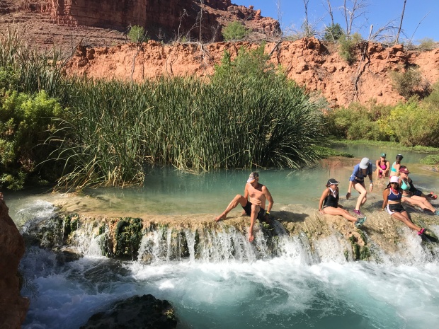
Navajo Falls
Each night as the sun went down about 6:30 the temperatures plummeted into the 40’s. Campfires are not allowed so all that was left to do to stay warm was go to bed. Surprisingly I slept very well on my camp mattress on top of the picnic table all bundled up in my mummy sack while Jeff slept well in his hammock. Note to self…spring for the tent!
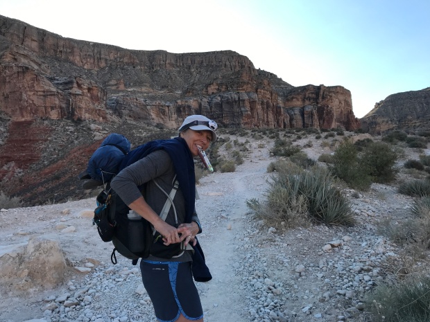
Day four we planned to pack up quite early to beat the sun/heat on the hike back to the trailhead. We had that last mile of climb that we were thinking about. We knew that it would difficult with our heavy packs and didn’t want to add canyon heat to it.
It took us 4 ½ hours to hike down so we thought it would take us an extra hour to hike back up. We left camp at 4:30am to a full moon and made a quick stop for water at the campground spring before starting the two-mile steep incline to the village.
At the village we saw a long line already forming for those taking the helicopter out. The helicopter is pre-reserved, but the seats are first-come first-serve and can take all day. They still had hours to wait until the helicopter even fired up for the day.
We hiked through the village while it was still dark and followed posted signs directing us to the trail. Things sure look a lot different in the dark and before we knew it we were standing at a creek crossing that neither of us remembered from before. Realizing that we missed the trail somewhere we backtracked about a quarter mile and were led astray by mule poop that followed some miscellaneous path in the woods.
After reaching a dead end we backtracked to the main trail and started back towards the creek again. This time we saw the clear trail that led to a bridge (just steps away) to cross the creek.
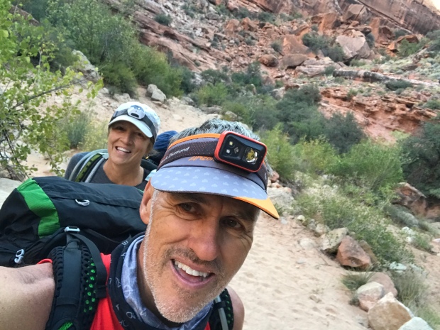
The trail was easy from here as the sun started to rise. Jeff and I were booking it and we found ourselves at the base of the last 1-mile canyon climb before we knew it. I have often said on hikes like this that my mind takes a seemingly mundane molehill and turns it into an impossible mountain. I was dreading this section for days! But after about 40 minutes we were cresting the cliff and snapping pictures of our completed task.
We made it!
It really wasn’t a big deal and we made the entire trip in 4 hours. The thing that helped A LOT was that we figured out how to cinch up our packs to distribute the weight more to our hips than our shoulders. This made a HUGE difference!
Back at the SUV we offloaded our packs, refilled our water bottles from the gallon jug we stashed in the car and started to drive towards Moab for round two of our RV-less vacation.
Now where did we park the car?
Next stop…Gooseneck State Park!
Havasupai Falls Trip Tips:
- Get to the Trailhead early morning to find a somewhat close place to park. Some vehicles were parked a mile and a half away.
- Fuel up in Peach Springs or Flagstaff. From where we stayed in Peach Springs it was about 70 miles to the trailhead. There are neither service stations nor stores along the way, so be sure to plan ahead.
- Keep a gallon of water and some food/snacks in your car for your return trip.
- Keep your bathroom expectations low…REALLY LOW! They are kept clean, but the smell of ammonia literally made our eyes water. Use the outer bathrooms (not the center) for additional ventilation.
- Be sure to have a “rat sack” to store all of your food and suspend it from a rope. Use it to hold your trash as well. Our first night we had a raccoon shred our trash and make a mess.
- Pack-In Pack-Out. There are ZERO trashcans at the campground so be prepared to take every ounce of trash back with you.
- On your hike out pick up at least one piece of someone else’s trash. You will see trash littered everywhere along the trail either by the locals or by hikers. Treat the land respectfully and do your part to keep this treasure beautiful despite who made the mess.
- Get reservations through a group (Check out Grand Canyon Hikers Facebook page). Rumor has it that reservations were moving towards giving large lots of permits to organized groups rather than individuals. This way the Indian Reservation can manage one person responsible for the group rather than trying to police 300 individuals each day. However, these decisions are made season-to-season, so what may be true one year may not be true for the next!
- Do not bring drugs or alcohol. We saw one group get busted while we were there.
- Do not go to the campground without your reservation wristband. They do check and you will be removed and fined heavily for not following the rules.
- DO NOT leave valuables in your vehicle. The day after we left several cars were broken in to at the trailhead parking lot.
- You do have the option of mules (Up to 130lbs/mule for $80) taking your gear to/from the campground that needs to be arranged ahead of time. Some hikers split a mule with others to share the cost. There is concern on some forums regarding the treatment of the mules here. So depending on your level of concern this may or may not be an option for you. Also, it takes a long time before your gear reaches the campground and the trailhead. And when it does it is put on the ground where the local dogs love to hike a leg on it.
- The helicopter ride in/out (pre-reserved) can take all day to get a seat. Go VERY early to get in line for first come first serve (the local villagers have first right). When we hiked out there was already a long line at 4:30am and we were back in our car before the helicopter even started to run.
- Take a couple of empty 1-gallon milk jugs to fill up with water at the natural spring in the campground. Our campsite was 1 miles downhill from the spring. Our gallon jug of water was used for hydrating meals and we filled our water bottles for drinking.
- According to the Havasupai website, the spring water at camp is safe, but they leave the responsibility up to you. We did not treat our water and had no issues what so ever.
- If you are packing camp fuel to cook meals remember that airlines will not allow fuel canisters anywhere on the plane…not even checked bags. Plan on making a stop at REI in Las Vegas, Phoenix or Flag to pick up fuel if you are flying in for this hike.
More Arizona Love
Posted by Deb in Arizona, Boondocking, Full Time RV, Hiking, Quartzsite, Running, RV Shows, Trail Run on March 16, 2017
After leaving Yuma Jeff and I headed to Quartzsite Arizona for the big RV, Rock and Gem show held every January.
Quartzsite is a sleepy little town that explodes in population in the month of January as RV’ers from all over North American swallows it up. The draw is the largest gathering of RV’ers in the world (so the legend goes).
The city of Quartzsite embraces us as best it can, but the town struggles during the weeks leading up to and after the big show.
It’s a sight to behold and one you need to experience at least once. I wrote about the show highlights here from last year. Nothing about the show changes much from one year to the next, so I’m going to focus on other things this time.
We showed up at the big tent a few days early to check on the shipped items for the Dometic booth that we would be working for nine days. We wanted to make our way to Dome Rock where our RV’ing group, the Xscapers, were having events for two weeks. We made it for a dog hike one morning with the group and then stopped to say hi to our friends John & Becky and Kurt & Toni.
Xscapers Dog Walk…its a hairy bunch!
Xscapers is a sub-group of the Escapees RV Club, but focused on full time RV’ers who are still working full time. Whenever there is a “converge”, events are planned for late afternoon or evenings so not to interfere with our workday. It’s a fun group and we have such a wonderful network of fellow RV’ers. We support, offer advice and just plain hang out with each other as our travels ebb, flow and intertwine.
When Jeff and I started FT RV’ing we would have never dreamed that it would be so social. But thanks to social media we all stay tightly connected despite being miles apart.
We had hoped to join the group in the evenings during the show, but after working the booth all day in a very cold tent we just wanted to isolate ourselves to our warm RV. As an introvert, I only have so many words for the day. By nighttime, I’ve got nothing left.
We never did make it back to Dome Rock.
Booth setup at Q
While at the show, we manage to get in some trail runs. There are lots of jeeping roads up, over and around Q-Mountain. We managed 5-11 miles just by taking any number of intertwining trails. One got the best of me and I tripped over a rock and fell hard. Skinned knees and palms, bruised hips, elbows and shoulders are all a part of the trail running experience. The trick is to not break something in the process.
Wind is always a factor here so expect a good coating of dust in and on everything you own. And expect to catch the “Quartzsite Crud” while you are here…everyone does.
Besides visiting the laundromat, the only other highlight was getting Silly Al’s Pizza. It is one of just a few restaurants in Q and actually had really good pizza. If you want to go to dinner any time during the week of Q, be sure to get there before 5pm to avoid long lines for a table.
Q Trails
Sam checks out the views
After Q we made our way back to Mesa for a couple of weeks. Jeff had to fly to South Bend, IN for business while I tried to vacuum dirt that had coated every surface in the RV.
The weather was amazing in Mesa. Mid-70’s during the day, mid-50’s at night. We stayed in our friend’s driveway again just a ½ miles walk from the canal system. It’s so nice to run on gravel right in town. Since we are training for the Bentonville Half Marathon we got right back into the routine.
While in Mesa we had a sales conference to attend. We pulled our rig to the Westin Resort in Scottsdale. We didn’t bring the RV to stay in it, but to make a quick departure for the Black Canyon after the conference. This is a very nice pet friendly hotel. Sam got the special pet treatment with dog bowls and special bed just for himself.
The Black Canyon is just 40-miles north of Scottsdale on the way to Flagstaff. We have never stopped here, so we wanted to get to some solitude before we had to be back in Phoenix for the Good Sam Rally. That and the Black Canyon Ultra Trail Run was scheduled the same weekend we were there.
Black Canyon Views
We pulled off Hwy 17 at Table Mesa Rd, just south of Black Canyon City. We set up the RV on BLM land at the Black Canyon Trailhead. This area is STUNNING! Gorgeous mountains, lush green foliage and miles of rugged trails and jeep roads. The only downfall to this area is that it is a mecca for gun enthusiasts who come here to shoot. All. Day. Long!
Thankfully shooting is only allowed in specific areas, so we had a couple of hills between the ranges and us. We still heard the gunfire, but at least it wasn’t right next door.
Jeff and I did not sign up for the Black Canyon Ultra, but we did want to run on the coarse. So we set off the day before the projected rain to get our long training runs in. I had 10 miles to run while Jeff thought he would try for a 50K.
We drove north about 20-miles to the starting line and followed the very well marked route that the race crew had already put out. It started as maintained hard packed dirt road, turned onto a cattle road then to a very rocky rugged single track. It was a test for the sturdiest of ankles, but we both managed to stay upright!
Scenes from the trail
Black Canyon Trail Ultra Route
We got a late start so Jeff ended up running in the dark to mile 27 before calling me to pick him up. He was getting cold and hungry. I on the other hand got my 10 miles out and back in, drove back to the RV, took a hot shower, made an early dinner then had coffee and dessert.
Ultimately the racecourse had to be altered due to the forecasted flash flooding. There were numerous river crossing that became virtually impassable with the rising waters. This is one race I am so glad we were not a part of. After mudageddon in Zion last spring, I’ve had enough of terrible weather conditions on race day.
It was a weekend of the most rain we have ever seen in Arizona, which made access roads to this area pretty soupy. We were becoming a bit concerned about our departure, especially since ATV’s and 4-wheel drive trucks decided the mud was the perfect consistency for donuts. But we had two full days of sunshine to dry out the road just enough to get us back to the highway.
It really was a beautiful area. But between the endless gunshots and ATV’s rolling by, we have crossed Black Canyon off our list of places to return to.
We hitched up and headed back to Phoenix for our next show.
A date with Good Sam
On a sad note, we got a call from one of our Xscaper friends that let us know that another Xscaper had suddenly and unexpectedly passed away right here in Phoenix. She was in her 50’s and full of life. One of those ladies who made you feel welcome from the moment you met her. We met Kurt and Toni at the Albuquerque Balloon Fiesta over a year ago and developed an instant friendship.
We went to Toni’s funeral and as family talked about her, it was evident that full time RV’ing was the best time of her life! They spoke of her deliberate choice to have experiences over stuff as she and Kurt sold everything to move in and travel full time in their RV.
We left feeling privileged having made that same choice ourselves. You never know how long we have on this earth before we are called home. Our time here is but a brief moment on a spectrum of time. Toni reminded us to make the most of it!
We will miss you around the campfire Toni!
Remembering Toni!
2017! A New Year to Travel
Posted by Deb in Arizona, Boondocking, Full Time RV, Hiking, Running, Trail Run on March 2, 2017
A hardy cactus hello!
Jeff and I spent Christmas and New Years in Why, Arizona. After being in the big city of Mesa for 6 weeks it was time to get to some desolation, isolation and motivation of the desert.
Why Why, Arizona?
It was supposed to be our launch site to travel to Rocky Point, Mexico just 80 miles to the south. Beachside living, endless shrimp dining and the sound of waves lulling us to sleep. It would be our first Mexico crossing in the RV and we had our dog health certificate and passports ready.
But when we went online to get our insurance, we were shocked to say the least! $600 for a two-week stay in Mexico! OUCH!!!
Why go to Mexico when you can have the international experience here in Why?
As much as we were looking forward to spending New Years in Mexico, the $600 spend was just too much for us to justify. The waves. The sand. The shrimp. They would all have to wait for another time. We were spending NYE in Why, Arizona.
Don’t feel bad though. Once we got over our visions of beachside grandeur we settled in nicely to our new surroundings while free camping on Bureau of Land Management property.
This is our third winter in the desert southwest and we love it here.
Not many years ago, I would be on a flight over the Southwest and think, “Why would anyone want to live there”? Brown. Dull. Dusty. Void of any green. It always seemed to lack any beauty or color.
There is something special about the desert
Good night
But what I’ve learned the last three winters is if you spend a little time in the desert she will show you her true colors.
You see. The beauty of the desert is cast low in those few minutes of sunrise and sunset. When the sun is making itself known and when it finishes its day. It casts a glowing spell on the desert, turning it into the beautiful creature that she is. Texture. Dimension. Color. It’s all there if you are patient!
Our BLM spot is just north of Organ Pipe Cactus National Monument. Organ Pipe is a UNESCO biosphere reserve that stretches 517 square miles along the boarder of Mexico. It is the only place in the US where the Organ Pipe Cactus grows wild. It got its name due to its shape that looks similar to the pipes of an organ.
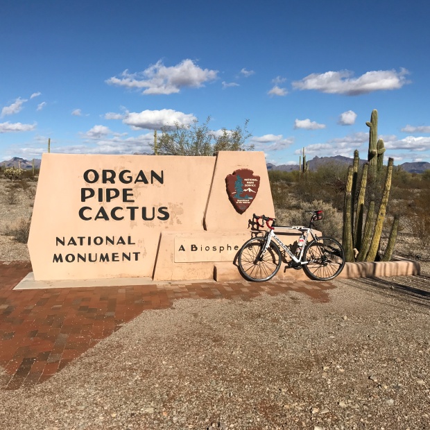
Organ Pipe Cactus National Monument
Right at the perimeter of the reserve there is a distinct change in the landscape.
What’s flat, barren and brown suddenly turns to rolling hills, black volcanic rock and a lush green. Well…as “lush” as a desert can be. But it is beautiful and very different than the mid-west landscape that I grew up seeing.
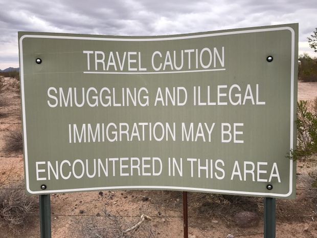
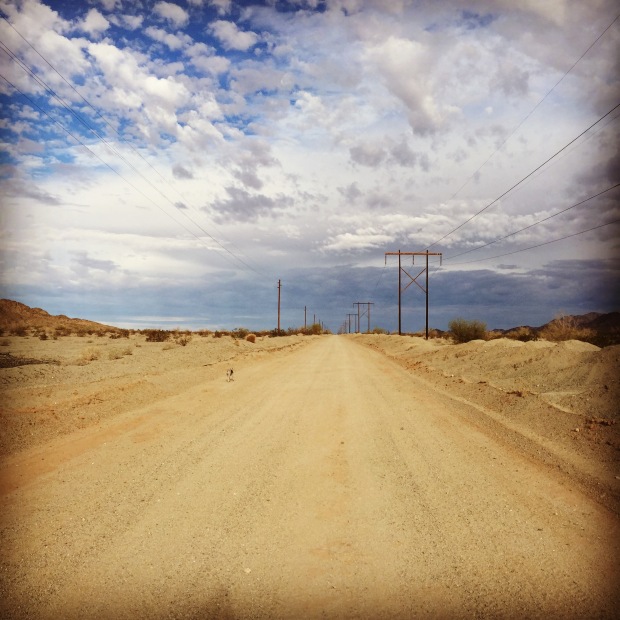
Our camping area is in a hotbed of illegal border crossings, drug trade and human trafficking. For the most part, they leave us campers alone. Unless you happen to leave out a water bottle or leave bicycles unlocked. You may wake up to some things missing. The dessert is scattered with rusty bike skeletons that didn’t hold up the rigors of a rugged desert crossing.
There are endless ATV roads scattered all over this place that are under the watchful eye of the Border Patrol via helicopters, trucks and 4-wheelers. Their presence is felt, seen and heard at all times. I had a helicopter swoop down over my head while out on a run…just to say, “I know you are there”.
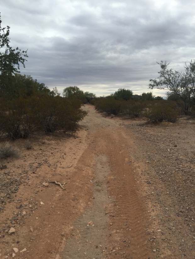
Endless ATV trails under the watchful eye of border patrol
The trail running was great and Jeff decided to ride his bike 27-miles to the Mexico border on Christmas Day where I picked him up in the truck. Then he had to outdo himself by running from the border to our campsite on New Years Day. His run was a bit eventful. Four drug smugglers darting across the road mere steps from him in broad daylight. All five of them were startled! Jeff later looked at his Strava from his run and saw the spike in his heart rate at that moment. Everyone went their own ways and we called the incident into the border patrol.
The community of Why has a Christmas day potluck at the local community center. For $5 each, the town provided the turkey and ham, while the attendees brought in the side dishes. It was a great deal, super food and a lot of fun visiting with the winter locals of this tiny community.


Though the desert here was nice, we never quite felt settled. We would check and double check if things were locked and we turned on a few more lights to take the dog out after dark. Even Sam was on edge since coyotes would run right through our campsite.
After two weeks we finally pulled up stakes and made our way to Yuma.
We stayed in Yuma 2 years ago and didn’t particularly enjoy our stay at Mitrey Lake. Between mosquitoes and mice we weren’t sure we would ever come back. But cooler heads prevailed and we decided to give it another go.
This time we headed to BLM at American Girl Mine off of Olgilby and boy were we so glad we gave this town another go. That location turned into one of our favorite campsites ever!
It might be a bit barren for some folks, but for us it was boondocking perfection. Full exposure to sun for solar charging. Well-groomed wide roads. As much or as little privacy as you want. ENDLESS and I mean ENDLESS trails to run. No worry about coyotes for Sam or drug runners for us. Lightening fast Internet. And those sunsets!
We just could not get enough of this place!
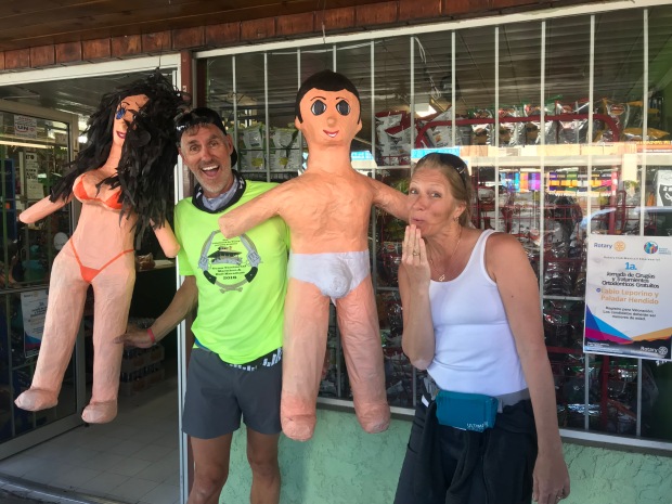
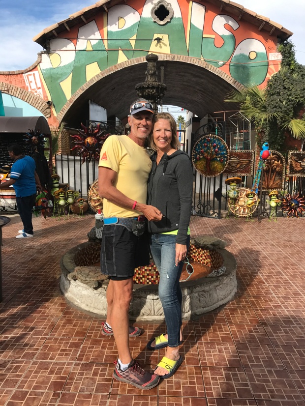
Yuma is the closest city to the Los Algodones border crossings. We crossed the border two years ago and found a delightful restaurant that we wanted to go back to. And since we didn’t make it to Rocky Point the previous week we decided to walk to Los Algodones for a dental cleaning and some lunch.
This was our first experience with Mexico dental. I say “our”, but Jeff was the guinea pig.
It was an AMAZING experience, and we will not longer be hesitant at taking the plunge. We picked a dentist that was highly recommended by other FT RV’ers that we personally know and decided to walk to the office a couple days before his appointment to make sure we knew where she was. And if you have any hesitation about walking there yourself, the dental office will send someone to meet you at the border to escort you to their door.
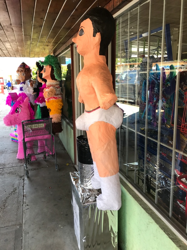
One thing you have to be prepared for when crossing the border is the bombardment of sales folks trying to sell you the exact same thing the guy right across the street is selling. Pharmaceuticals, dentists, eyeglasses and your typical assortments of trinkets, jewelry, blankets and cowboy hats are about it for this small town. A polite “no thank you” is enough to put a stop to it, until you hit the next booth.
A special anniversary lunch
Plentiful Viagra and…ah…pinatas
While at lunch one day a nice lady from a local “spa” stopped by and gave me a free 1-minute shoulder massage while I drank my margarita. Her skills were impressive, and we actually went to her shop a couple days’ later and got $13 pedicures.
Our original intent was to stay in Yuma for a week before heading to Quartzsite, where our fellow Xscapers RV club was having a convergence. But Olgilby Road was just too perfect a spot to breeze through and we stayed for two weeks.
We did get to see our RV buddies Flying the Koop, Mike and Donna. It had been a while and they were blowing through town on their way from San Diego to Phoenix. Our time was short, but oh so sweet. We will get to see them a bit more after Q.
Well, onward to Q for the largest gathering RV’ers on earth!
This is why I love the desert! (Zero filters)
Hello Moab
Posted by Deb in Destinations, Full Time RV, Hiking, Running, RV Shows, Trail Run on April 1, 2016
After a 3-week visit back to Nashville and Bentonville Arkansas…or as I call it, the land of humidity, we flew back to our RV in Mesa.
We had lunch with our RV buddies John & Becky and Don & Debbie at Liberty Market in Gilbert. There was so much to talk and laugh about and so little time before we all headed off into different directions. We are going to miss these guys but are confident we will see them out on the road!
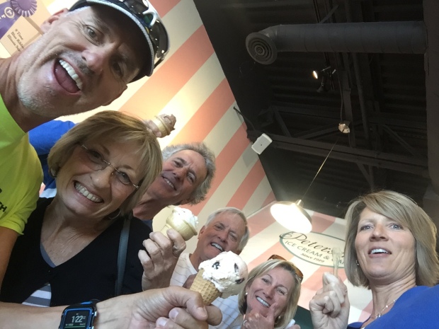
One last ice cream with friends
We pulled out of Mesa for the last time Thursday, March 10 and started our northern trek to Moab. We would have taken our time for the 488-mile journey but Jeff and I signed up for the Canyonlands Half Marathon & 5Mile run on the 12th.
Our plan was to stop half way, but I find that after we have been in one place for a while, we don’t mind putting in some miles on our first day back on the road. We drove 428 miles (9.5 hours) and got within an hours drive of Moab, stopping in a truckers lot in small town Utah for a free overnight.
Neither Jeff nor I have ever been to Moab and when we pulled into town I felt…disappointed. I guess I had pictured a quaint little mountain town like Breckenridge or Tahoe. But my first impression was…junky.
I hate to say that out loud especially now that we have stayed for two weeks. After experiencing all that the great outdoors Moab has to offer, I’m a fan…sort of.
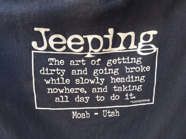
We were in Moab during the Easter Jeep Safari, when 5,000 jeeps roll into town for this annual event. Jeff and I worked the Dometic booth at the expo showcasing their mobile cooling products. The patrons were fun and everyone remain completely clothed!
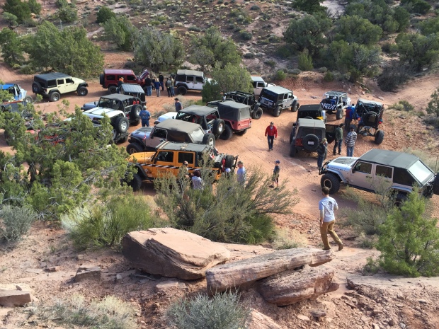
Jeeps rounding up for an adventure
We camped at the Sand Flats Recreation Area, home of the famous Slick Rock off road trail system. This is a mecca for off-roading anything. Jeeps, ATV’s, dirt bikes and mountain bikes and they flow constantly through this campground…all hours of the day and night.
It wasn’t our customary dispersed camping. That, leave your shades up, silent paradise that we strive for. But more of the dusty, loud, drive as fast as you can in a 25 mph speed zone, don’t care how loud my radio is at 1AM and the rules don’t apply to me type of camping.
But despite the noise, here are the highlights for Moab.
Moab Half Marathon (Jeff) & 5 Mile run (Deb) and Monument Valley Half Marathon
This race takes place on the very scenic HWY 128 that runs along the Colorado River. The city shuts down Hwy 128 where 2300 entrants were shuttled by bus from downtown Moab to the start of the race. We had the entire highway to consume while running through the canyons.
-
- Start of the race
-
- Looks downhill to me!
I’m not sure but it felt like the race was all downhill…my kind of race for sure! Either that or I was just taken in by the surroundings. Colorado River flowing on my right, shear red cliffs everywhere I looked, Native American drummers out on the course and lots of local support.
Also, Jeff decided to enter the Monument Valley Ultra Half Marathon the following weekend…It was spectacular!!!
Monument Valley
Hiking Slick Rock Loop
Slick Rock was just out our RV door, so we laced up our shoes and got after it. This is a 9.5 Mile loop over petrified sand dunes that make Slick Rock what it is.
Contrary to the name, Slick Rock is not actually slick, but very sticky. That’s what makes it the mountain bike & 4×4 mecca that it is. The texture of the rock makes these trails very tacky which is great for rubber to hold on too. It’s a good thing because this trail has some vertical climbs that defy gravity.
Slick Rock Trail overlooking the Colorado River

Share the road
The mounds of petrified dunes are endless and all look the same. So I was thankful for the very well marked trails by white stripes painted along the surfaces.
We had to share the trail with mountain bikes and dirt bikes, which isn’t really my preferred nature experience.
We found that the best time to hike/run Slick Rock was before 8AM. By the time we finished up the parking lot and trails became full with people there to enjoy their adventure too.
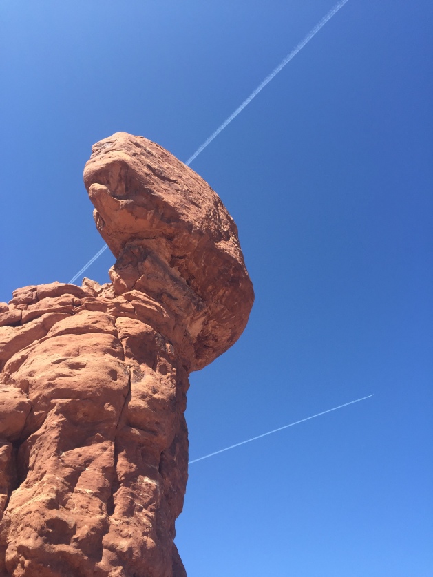
The Arches National Park
Jeff and I also headed to The Arches National Park. We toured the visitor’s center and watched a very good movie on how arches are formed, then headed to the Delicate Arch trailhead.
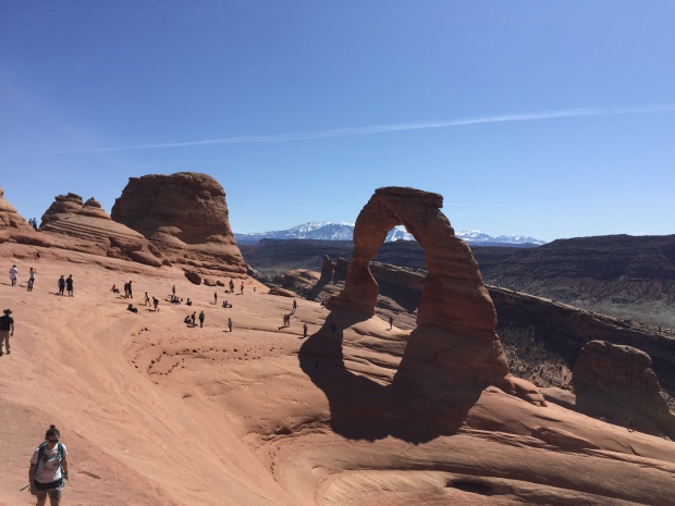
Delicate Arch
Delicate Arch is probably the most photographed arch in the park and requires a strenuous 1.5 mile one way hike to get to. We arrived about noon and the parking lot and trail was crowded. The majority of the trail was wide-open space so there was plenty of area for the crowd to spread out. That is until you get to the last ¼ mile where it is a somewhat narrow trail on the side of a bluff.
Once we rounded the final corner we caught view of this amazing arch that has a natural amphitheater built into its surroundings. You can sit and ponder life or visit with others from all over the world. It really was a beautiful sight to see!
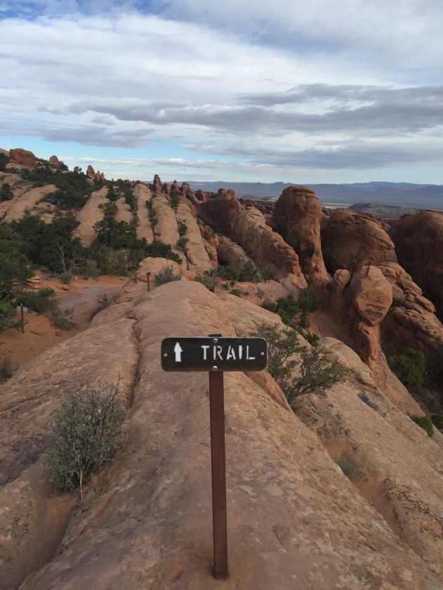
While Jeff went off jeeping one day I drove back to The Arches and hiked Devils Garden loop. It’s a 7.5 mile hike that gives you an opportunity to take in 7-8 arches.
Let me tell you…this trail did not disappoint!
It is probably my #2 most beautiful trails that I have ever hiked (#1 Grand Canyon).
Balanced Rock
Hiking along the fins
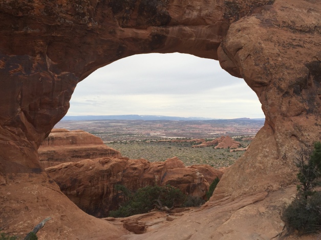
Partition Arch framing beautiful scenery
Landscape Arch
The rocks in this area form as fins that the trail traverses up, over and in between. Each turn around a corner showcased another view better than the last. At one point I just had to stop taking pictures and keep moving.
And the arches…most framed views just like a pretty portrait. WOW!
We made one last trip to The Arches on Easter Sunday morning for a sunrise service then to the Eklectic Cafe for a birthday breakfast (yea me).
Easter Sunrise Service…glad we didn’t sleep in!
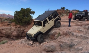
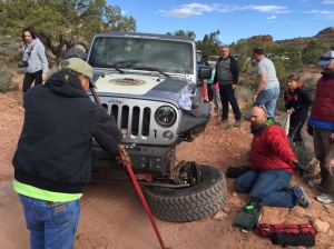
Jeeping Steel Bender
We met a very sweet couple, Jeff and Jennifer, in our camping section, who have been coming to the Jeep Safari for 20 years. Jeff asked my Jeff if he would like to ride along on a group 4×4 ride. How can you say no to something like that!
Jeeping is nothing either of us have experienced. The trails are steep and rugged and with a a name like, “Steel Bender”… they are not for the faint of heart. You creep along with 10-12 other jeeps, each driver challenging themselves to take the hardest route. Things fall off and jeeps break down all from the strain of being tested.
-
- Why take the easy route?
-
- Things break around here!
After 8 hours Jeff learned a lot about the jeeping community. If he ever trades in his bicycle a jeep may be a consideration.
Moab Overall
I think my ultimate struggle with Moab was just the shear natural beauty of the area that makes up the Canyonlands while having a feeling of destruction and wear.
It was both beautiful and sad at the same time.
The nice thing about RV’ing is we can move on from here and have a totally different type of experience just waiting around the corner!
Until next time Moab (maybe)….
I wonder what is over there…hummm!
On The Road Again
Posted by Deb in Arizona, Destinations, Indiana, Missouri, New Mexico, Oklahoma, Running on May 16, 2015
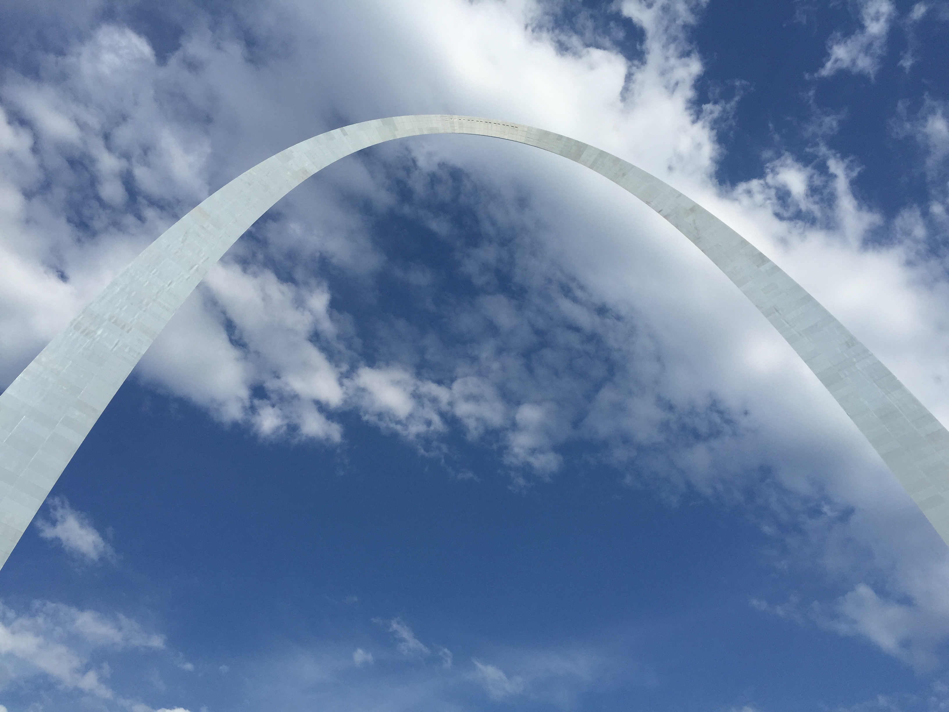
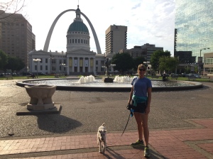
St. Louis Arch
We’ve spent the last two weeks traveling out west and back again.
Our trip started with driving to St. Louis to drop Sammy-do off at my Mom’s for a little paw sitting. Sam loves going to his grandma’s because the food scoop overflows, the squirrels are plentiful in a fenced in back yard and the cute factor gains a little extra loving. We hate traveling without him, but it’s comforting to know he is being super spoiled while we are gone.
-
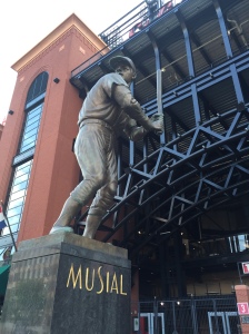
- “Stan the Man” Musial at Cardinal Stadium
-
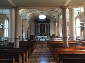
- Basilica of Saint Louis, also known as the Old Cathedral c. 1770
While we were in St. Louis Jeff and I decided to try something new. We took a running tour of downtown. After 3 hours and 6 miles I learned things about St. Louis that I never knew. We went with St. Louis Running Tour, THE ONLY running tour in St. Louis. Our tour guide Joe showed us iconic buildings like Union Station, The Arch and Cardinal Stadium. Joe also gave the behind the scenes facts and sometimes seedy drama that unfolds during the development of the new frontier.
It is a run and it is a tour so there are lots of stops to talk with bursts of running to the next destination. Our longest stretch of running was no more that ¼ mile, so if you do this thinking you are going to get your 4-6 mile solid run in, you won’t.
-
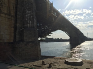
- Eads Bridge completed July 4, 1874
-
- Sam enjoyed the tour
We didn’t take the tour for the run, but to learn & see more about the city that I grew up around…while getting a little low-key exercise. Definitely a very fun morning with Joe!
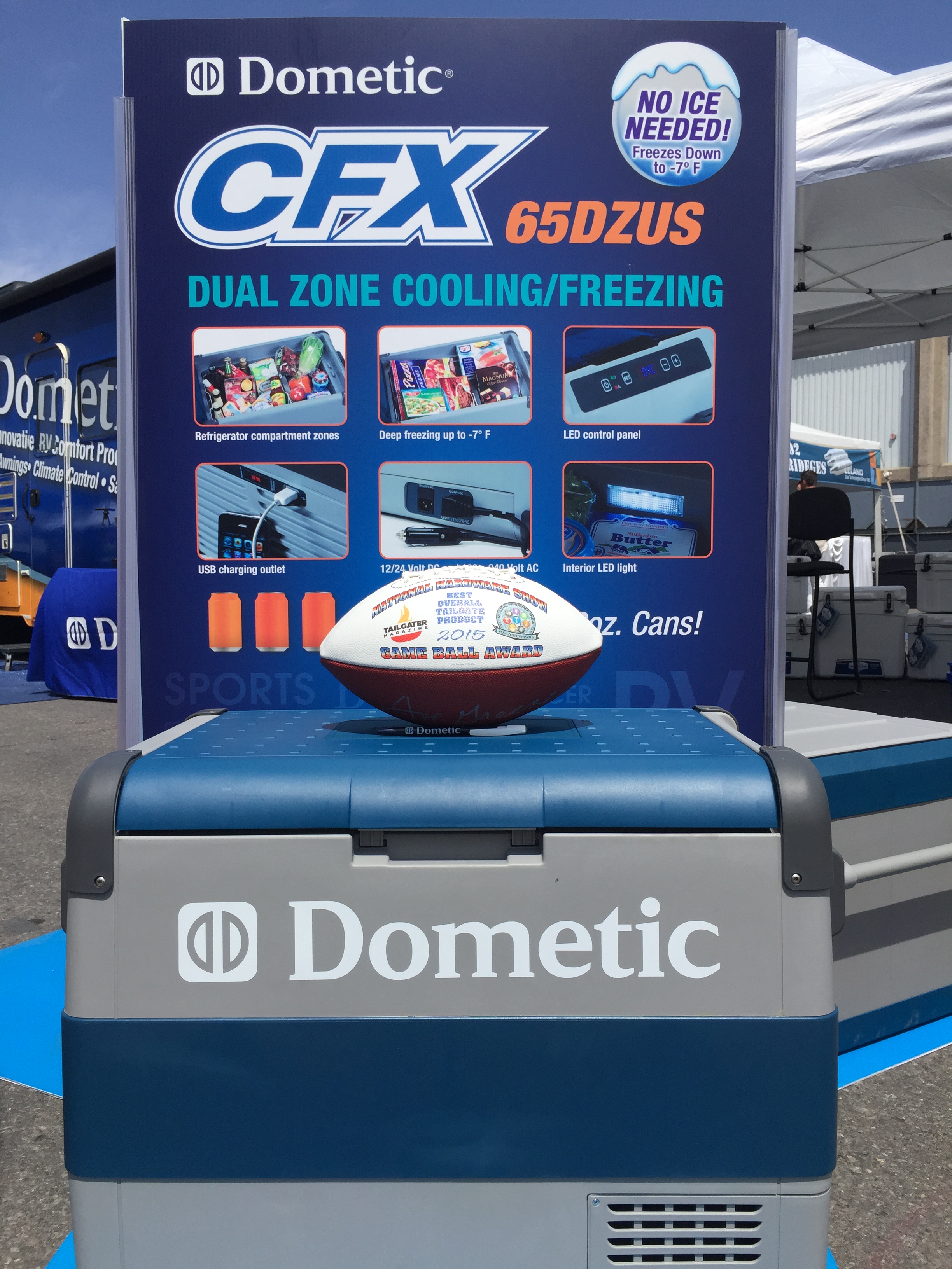
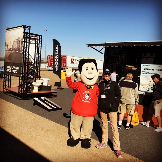
The super awesome CFX refrigerator/freezer by Dometic
That afternoon we flew off to Las Vegas for the National Hardware Show. Dometic had a huge display of their new portable refrigerator/freezers (CFX) that run off of 12V, 24V or 120 and their super insulated coolers. They are great for tailgating, RV’ing and boating. We have a CFX frig/freezer that is the best! You can set it to freeze or refrigerate anywhere from 50 degrees down to -8 degrees. That’s a lot of frozen solid ice cream…on 12volts of power no less! It makes up for the small refrigerators that RV’s typically have.
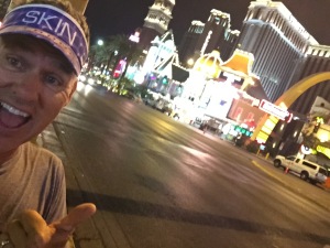
Las Vegas is an interesting town and one that neither of us is particularly comfortable in. I recharge in tranquility and nature. So when you go out for a run at 5AM and the street department is already at work with jack hammers and the all night partiers are just reaching their peak volume, my soul is just piled on with more noise that I went out to decompress from. Throw in a couple of propositions from some ladies of the night (Jeff) and we were ready to get rolling.
-
- Early morning Las Vegas run…bright and loud!
-
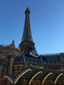
- The Paris Las Vegas Hotel
From Las Vegas we drove the Dometic RV back to Elkhart Indiana. We were going to hit the central, most direct route through Colorado, but with forecasted snow in the mountains we redirected to the southern route. Our first stop was in Flagstaff where we drove though sleet, snow and rain.
Saturday morning we woke to 1” of snow. The sun popped out and we decided to wash the Vegas grime off our running shoes with a trail run before hitting the road. We stayed at the Flagstaff KOA and they have access to trails right out the back gate. It was a stunning 5-mile run as the sun filtered through the snow-covered foliage. Now this is what I’m talking about! Running through the woods fully alive…nothing is better for the soul. I love this KOA for its convenience to town, trails right out back and very little road noise.
-
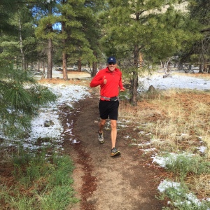
- Jeff on a snowy run
-
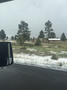
- Snowy drive into Flagstaff
Our other stops
Albuquerque, New Mexico– Long push day to the KOA. Very nice park with level sites, good spacing but very close to the highway. I was able to get a 3.5-mile walk in just within the park by making 3 loops. It was a big RV park! We met a group of French Canadians who where traveling together. One of them had a Heartland Edge, similar to our Ironman Can we just sold. We are hoping to come back here in October for the Xscapers very first Convergence at the Balloon Fiesta.
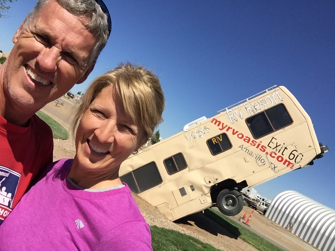
Oasis RV Park just down the road from the Cadillac Ranch
Amarillo, Texas-Oasis RV Resort. This was a really nice RV park as well. Very level and spacious sites with weight room, hot tub and pool. We didn’t use any of the amenities and reviews are mixed on this RV Park as it relates to smell. There are a couple of VERY LARGE cow farms nearby. So the prevailing winds has a directed correlation to the type of experience you will have here.
Luckily the temps were cold and the wind was blowing from the North, so we had no issues of smell.
Tulsa, Oklahoma-Long push day to KOA at Will Rogers horse racing track. This is mostly grass covered RV parking. A lot of the sites were flooded with the recent rains, so we were upgraded to a raised gravel site that backed right up to the horse track. We arrived at 4pm so we were able to catch the last 3 horse races.
It was entertaining as the horses made their 90-second run (if that) around the track, then a water truck and 3 tractors made their way around grading the course with diligence and speed. Their job took about 15 minutes that was repeated after each 90 second run. We found it quite humorous and had more fun watching the tractors than we did the horses. I know…we are strange that way.
We went out for a run the next morning at 6AM to soothing country music over the loud speakers while the horse trainers were already out running the horses. We definitely felt like we were back in our part of the country where people wave as they drive by. If you are from the country you know the wave…one or two fingers just barely lifted off the steering wheel just to give you a friendly hello.
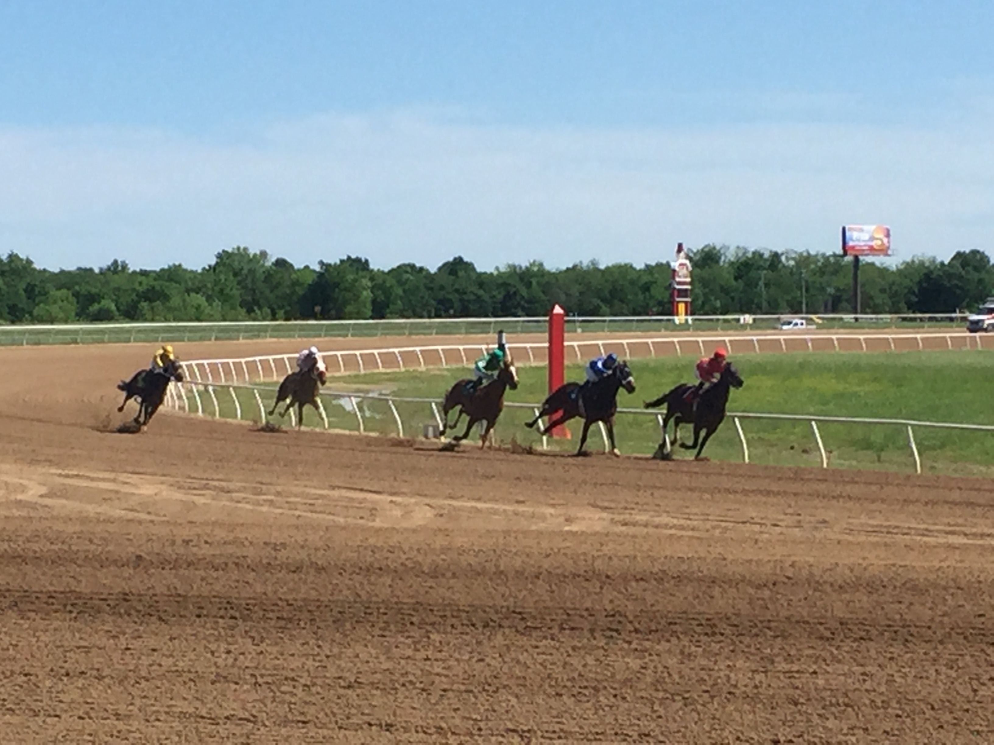
Horse Races at the Will Rogers Downs KOA Park
St. Louis, Missouri-Long push day to Mom’s house. We got to see our fur baby and stayed two nights so that Jeff could put in a solid workday that didn’t involve the swerving and jostling that comes with driving a can of marbles down the road at 70 mph. It was hard to leave Sam again especially when he was lying in front of doors, at our feet and around our shoes to ensure that he is not left behind. 😦
Elkhart, Indiana-Long push day to our final destination, MasterTech RV. They are doing the work on our personal RV project. The slide on the Dometic RV decided to stop working in Albuquerque so MasterTech is going to work on it for us. And they provide free parking with electric hookups.
It’s been a long trip with a few memorable moments. Now that we are here in Elkhart we get to check on the progress on our personal RV project over the weekend. The water damage on our roof was much more extensive than we originally thought…but everything is fixable.
More on our project in the next post. Until then…get out and play!
The new rolling crib will be good as new…we hope!
