Posts Tagged Ultra Running
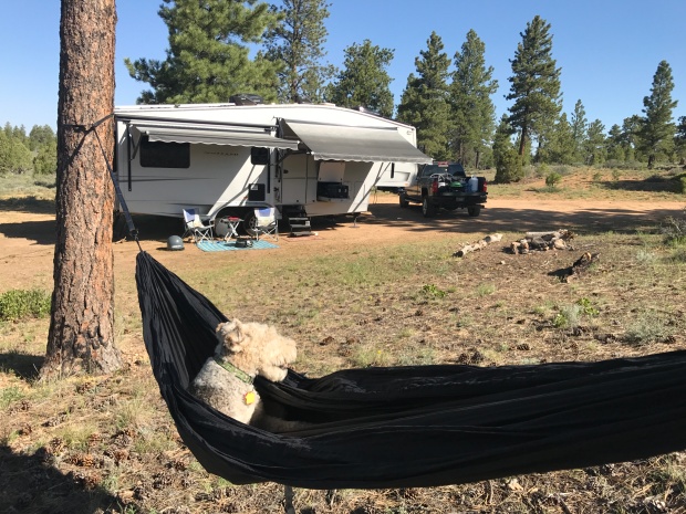
Adventures in Car Camping
Posted by Deb in Boondocking, Full Time RV, Hiking, Moab, Running, Trail Run, Ultra Running, Utah on January 1, 2018
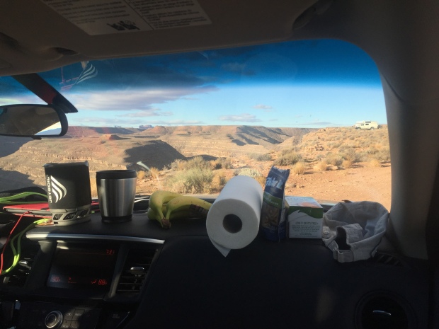
Dashboard Kitchen
After finishing our backpacking trip to Havasupai Falls here and here we planned an additional six days to car camp in Southern Utah.
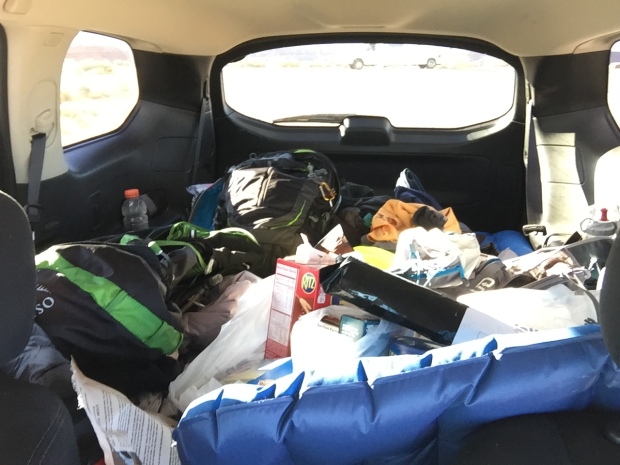
Since we had purchased all this camping gear for the falls we decided to give car camping a try instead of getting hotels. And after sleeping on a picnic table for 3 nights, the car felt like a five star hotel (she laughs hysterically)!
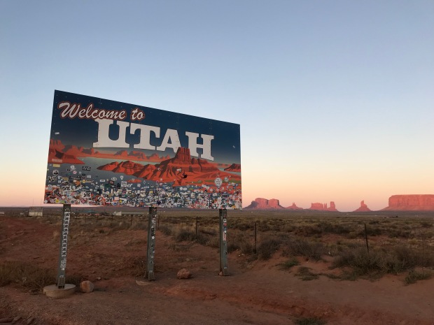
Welcome Back to Utah
We drove from Havasu Falls trailhead past monument valley to find a nice campsite on the rim of Gooseneck State Park. The sun was going down by the time we got there and the temps were a very comfortable 70-ish. We set up our camp mattresses and sleeping bags in the back of our Nissan Pathfinder and left the tailgate open for ventilation.
It was such a beautiful night and the stars were fully visible with the lack of city lights. The rim of Gooseneck is barren rocky land completely void of any scrub or trees, which translates to magnificent sunset viewing. We set up our camp stove on the picnic table and kicked off our sandals just outside the tailgate and piled into the back of the SUV for a great night sleep under the stars.
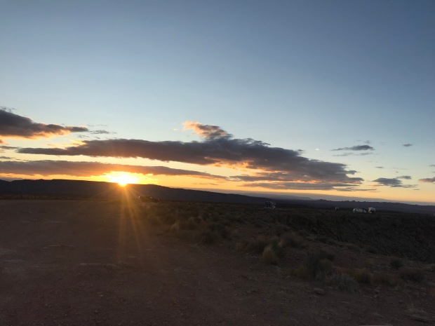
Camping along the rim
Car camping was pretty awesome…until about midnight.
I woke to some jostling of the car and the gritty taste of dirt and sand in my mouth. When I finally came too I realized that we were in the middle of a windstorm that had kicked up so much grit in the air that the clear full moon from two hours earlier was a blurred hazy glow.
I had to jump out of the car to shut the tailgate but my sandals were nowhere to be found. I got the gate down and climbed into the side door to find our sleeping bags covered in sand. By now Jeff had barely woken up and wanted to know what I was doing. I swear that guy could sleep through a parade of fireworks.
I settled back in and asked Jeff if there was anything else left outside. When he said that the Jetboil was out on the picnic table, all I could see was hundred dollar bills flying over the edge of the canyon.
The wind was so fierce that I could hardly get the car door open to retrieve the camp stove and to look for both sets of sandals…all of which were teetering on the edge of oblivion. One more little puff and we would have been shoe & coffee-less the rest of the trip.
Has anyone seen my sandals?
The temperatures were dropping quickly and I forced the car door back open to crawl back into my grit filled sleeping bag. A challenge for a 6’ tall gal with back problems. The car was being battered by the wind. The decline of the rear seats that we were sleeping on made it feel like we were angled down hill. All I could think about was rolling right over the edge of Gooseneck and crashing to a firry death in our rental car. Our remains permanently entombed in the canyon and memorialized with a jetfoil tombstone.
After surviving the night, we woke to 31 degrees. Jeff started the car to get the heater going. The wind had settled down a bit and we made coffee while I shared the story about how we barely survived being lifted in midair by the wind and discarded in the Land of Oz. If it weren’t for our rubber sandals that had wedged under the tires we would surely have been lost forever! (Jeff inserts eye roll here)
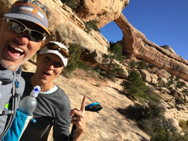
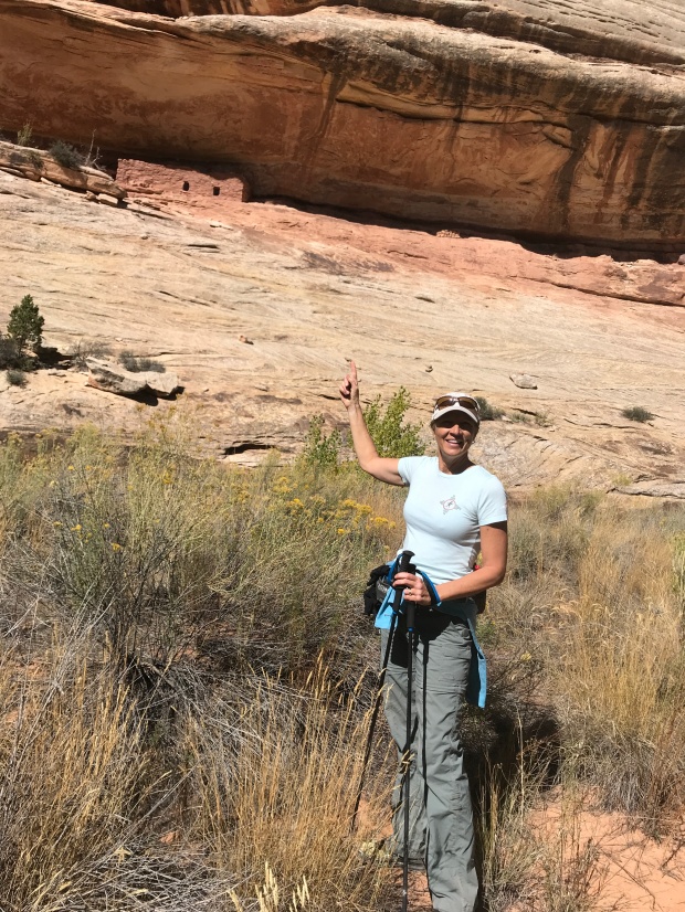
We would have done some hiking here but we wanted to reach the Kane Gulch Visitor Center just as they opened. We had read about several Anasazi cliff dwellings in Cedar Mesa and wanted to get more information about a hike to Moon House.
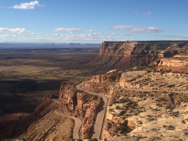
The stunning Trail of the Ancients Road
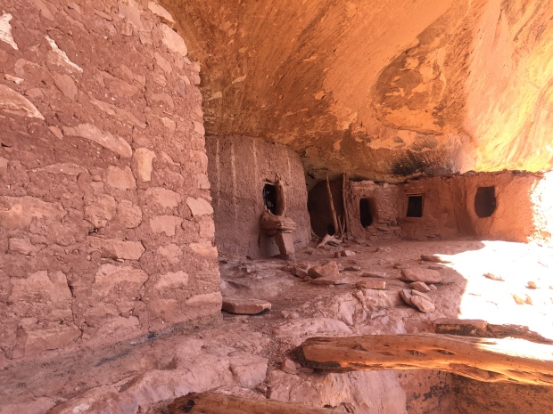
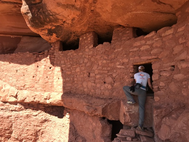
Moon House is a multi-room cliff dwelling named for its celestial pictograph depicting the moon in its different phases. It dates to the early 1200’s and is limited to 20 visitors per day via a first come permit system. It’s a rare cliff dwelling as you are allowed access to some interior rooms. Special instructions are given with the permit on how to enter the rooms without damaging the structures.
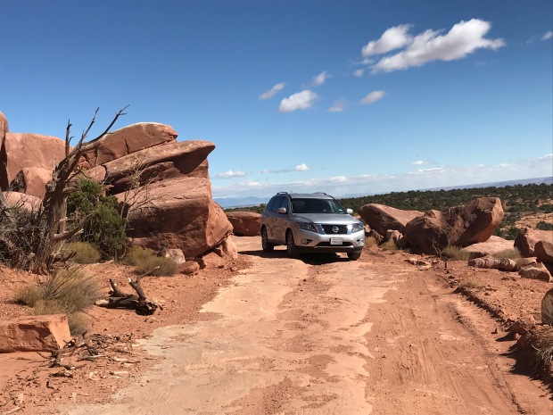
With permit in hand we headed towards McCloyd Canyon. We traveled about 8 miles down Snow Flat Road, a rough dirt road over rock slabs and rutted sections of sand and dirt. It was slow going and we were glad we had an all-wheel-drive SUV to get to the Trailhead parking area.
We started our hike and headed north on another road. After a mile we came a second parking area at the Moon House trailhead. Getting to this parking lot requires a true 4-wheel drive vehicle and we were glad we didn’t attempt it in our rental.
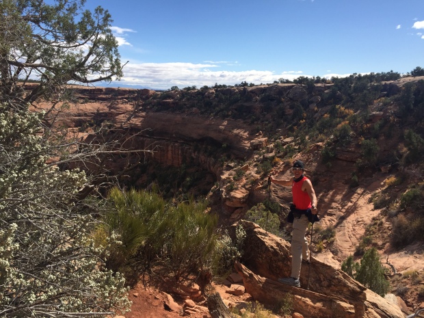
We are heading down there
One giant step for mankind
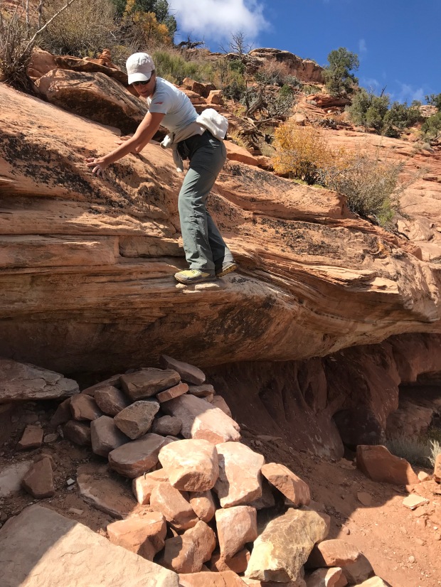
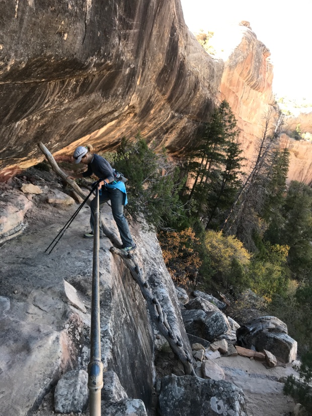
The trail started over sandstone slabs only visible by Cairns before it quickly starts a rocky decent. We took our time since the slope was steep and the rocks loose. At one point we had to slide down the lip of an overhung ledge to a rock pile down below.
We quickly dropped down into the canyon and reached the sandy floor before ascending the other side to Moon House.
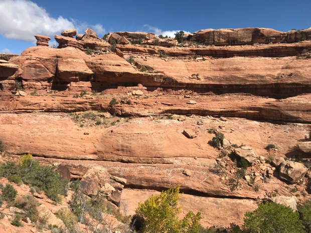
Now you see me. Now you don’t!
Still standing after hundreds of years
Enter with care
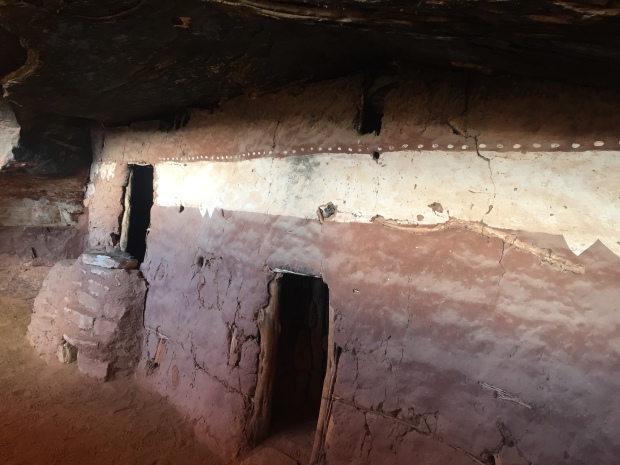
Cliff dwellings are amazing structures as they are built into the sides of raised ledges on the side of cliffs. They are very undetectable when you are not looking and sometimes when you are. We didn’t notice the dwelling until we were right up on it!
We explored the ruins and were glad we brought along our headlamps to shine into protected rooms. It was interesting to see the construction of vertical tree limbs smeared in mud to form small interior rooms or apartments.
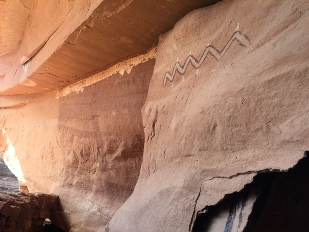
The ancient pigment that created a long white band of Moon House was still vibrant and corncobs still lie on the floors in some of the rooms.
Pictograph giving Moon House its name
We followed more trails around the ledge that led to more buildings. After we started hiking back we turned around to take one last look and realized that we missed a whole other section of dwellings perfectly hidden in the side of the ledge where we sat to have lunch!
It was a nice 4.5-mile round trip hike. We like these destination hikes with history to research and a challenge to get to.
The rocky road to someplace special
By now it was late afternoon and we started to look for a place to camp overnight. The area is mostly BLM (Bureau of Land Management), which offers free camping off random dirt roads. Right off the corner of Hwy 95 and 261 was one of those dirt roads. We found a spot with the perfect amount of slope to make our bed level for the night.
Night two of car camping was not as volatile as night one, but dang it was freezing cold. The temperature dropped to 21 degrees and we had to run the car a good part of the night to stay warm. Of course I laid awake worrying about running out of gas and I had to get out of the car to pee behind a bush in the freezing cold while stepping through land mines of bull head stickers.
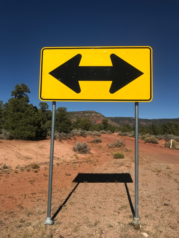
Come morning at the corner of Hwy 95 and 261 we needed to decide to turn left or right. To the left, at the risk of running out of gas, Natural Bridges National Monument. Turn right to Blanding for a service station and on to Moab.
Natural Bridges it is!
Unnamed tiny arch!
We didn’t know much about this National Monument so we drove through a beautiful little campground within the park for future RVing reference before heading to the visitor center.
It was too early to go inside, so we used the outdoor restrooms and made coffee with our recently rescued Jetboil.
We read about taking the scenic 9-mile Bridge View Drive. The drive takes you to scenic viewpoints that overlook three spectacular arches. Sipapu (place of emergence), Kachina (dancer) and Owachomo (rock mound).
We wanted to do some hiking so we saw that there was an 8-mile loop along the canyon floor to each Bridge…up close and personal.
We started at the Kachina trailhead and descended down a staircase carved into the sandstone. We took the loop counter-clockwise since we thought we would be in the sun on this cold morning.
Chilly start
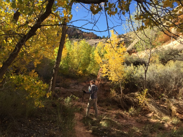
Aspens in October
Once we descending down to the riverbed the trail was flat and serpentine. Each rounded corner revealed new cliff views. We were keeping our eyes peel for petroglyphs and cliff dwellings that we heard were along the trail.
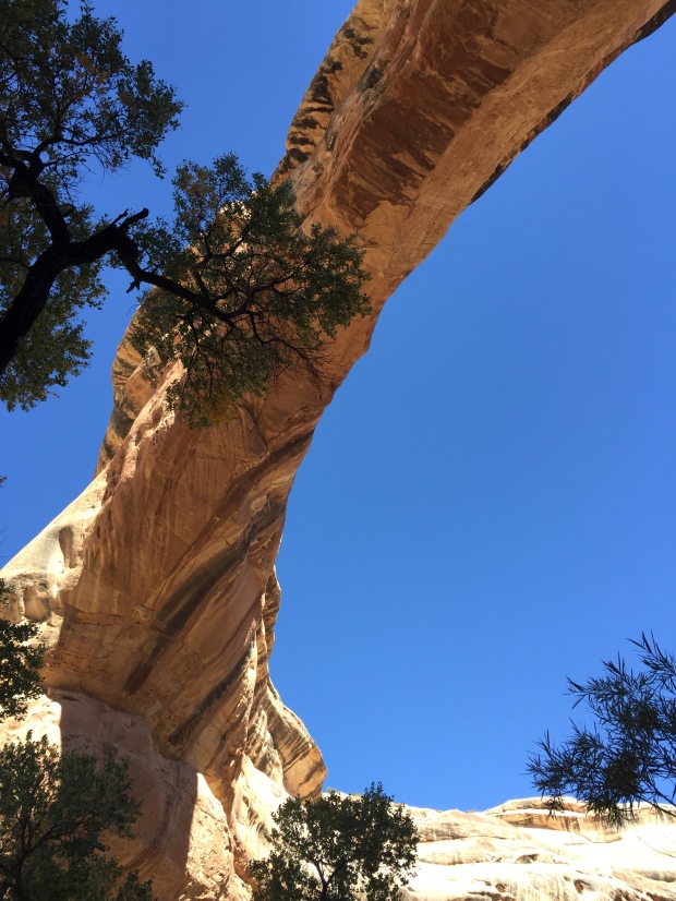
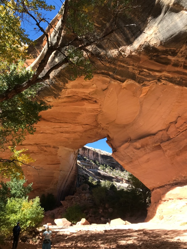
After a couple of miles the trail took a sharp left over slabs and ledges and there stood the magnificent Owachomo Bridge. It was so vast. So tall. The pure blue sky was the perfect backdrop for the white sandstone bridge.
There she is!
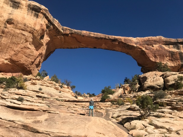
Owachomo Bridge
The trail traversed out of the canyon and crossed the inner circle of the Bridge View loop over to the Sipapu trailhead. This part of the trail is known for its dramatic vertical drop via sections of ladders and staircases to the base of Sipapu Bridge.
Just our kind of trail!
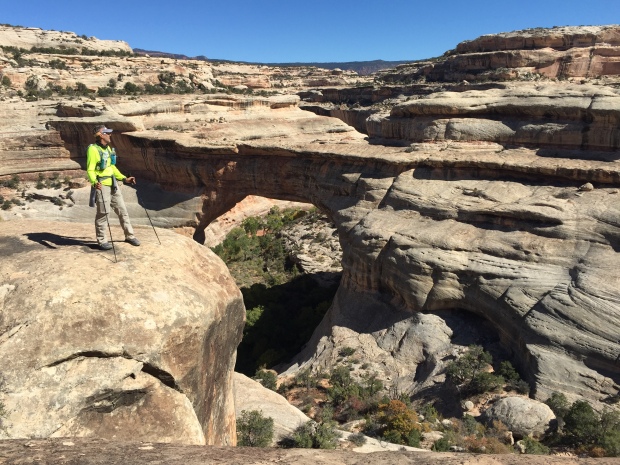
Sipapu from above
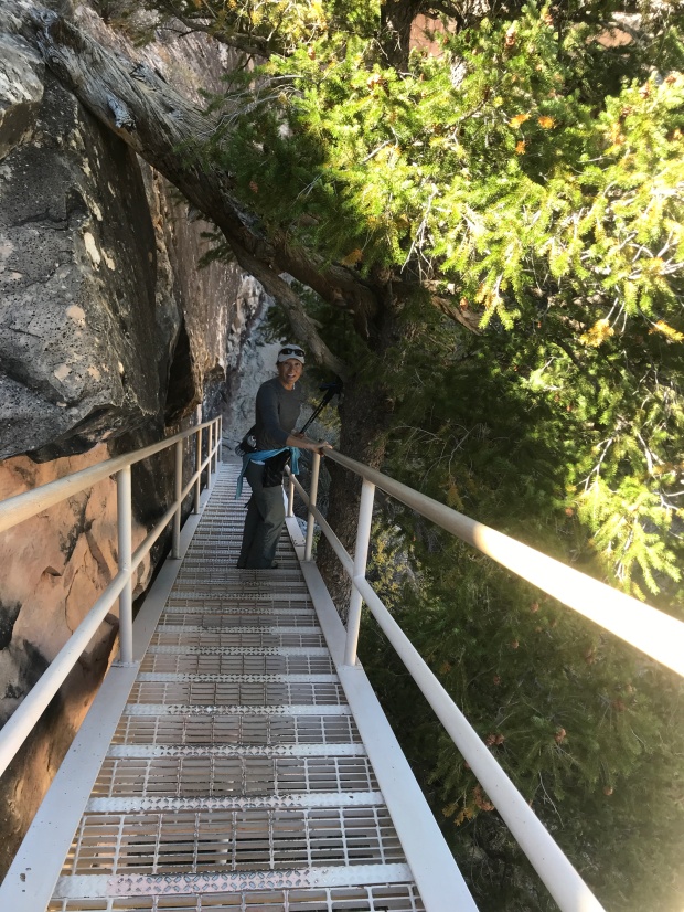
Staircase down the cliff edge
Descending ladders
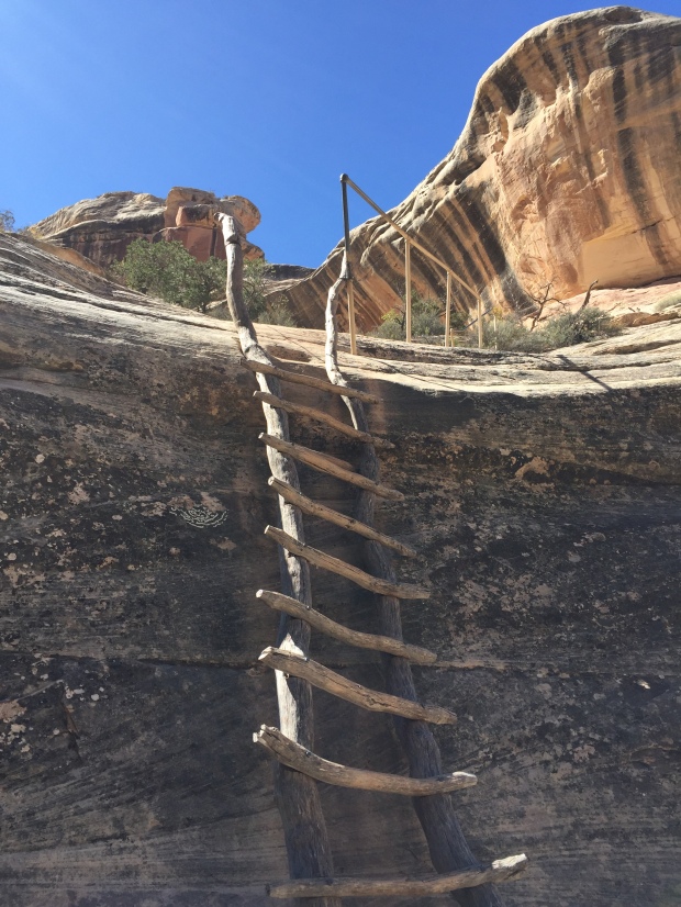
Sipapu from below
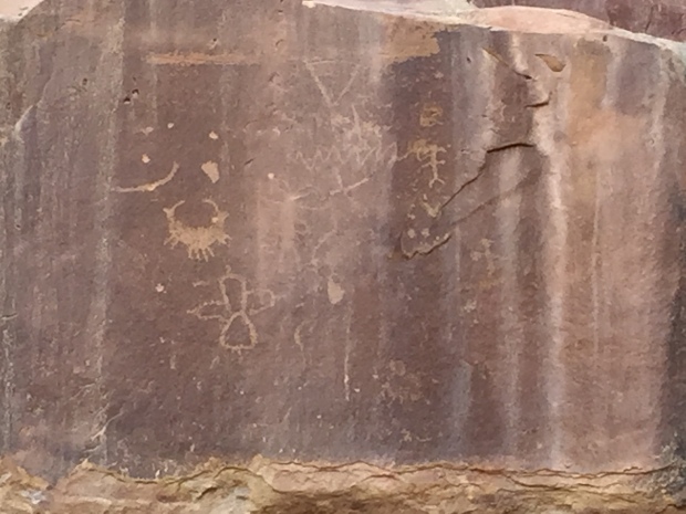
The ladders were a bit intimidating as first but we were back down in the canyon along the dried riverbed before we knew it. After spending some time at Sipapu Bridge we followed the trail along the cliff walls to Kachina Bridge. We finally found Horse Collar Ruins and came across Petroglyphs along the walls of Kachina.
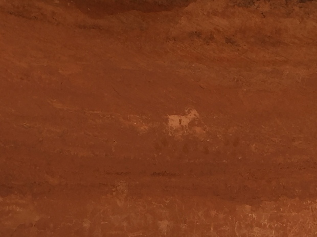
Petroglyphs are really quite amazing to have stood the test of time. They tell a story of life our modern day selves have never known. Hunting and gathering. Conflicts and battles. Everyday life lived amongst the walls.
Horse Collar Ruins
Kachina Bridge
We hiked out of the canyon and back to the car. This was such an enjoyable hike and I would recommend it if ever in the area. I would like to come back and hike it in the opposite direction for another perspective of its walls, bridges and stairs.
After Natural Bridges Jeff and I made our way to Moab. By now it had been 6 days without modern conveniences. After looking at the freezing temps forecasted I cried UNCLE and made a reservation at a hotel. By now my back was killing me from trying to climb around in the back of an SUV and my fingernails were telling the truth about how badly I needed a shower. I couldn’t stand the smell of my own hair another day!
Ya…I had enough of this!
I can’t tell you how awesome that shower felt! And after that first night in a room and being able to stand up to put my pants on I begged Jeff for another night…then a couple more. We both had to admit at this point that we (ok, maybe me more than Jeff) were not the car camping sorts.
We never did spend another night in that car!
While in Moab we visited the local Laundromat, ate real food in restaurants and Jeff went to watch the start of the Moab Ultra 200 trail race. Being the Ultra runner he is he wanted to see what the next level of crazy looks like. Apparently, once you’ve finished a 100 race, you begin to wonder if you could do 200 (or so I’ve heard).
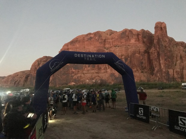
Crazy runners!
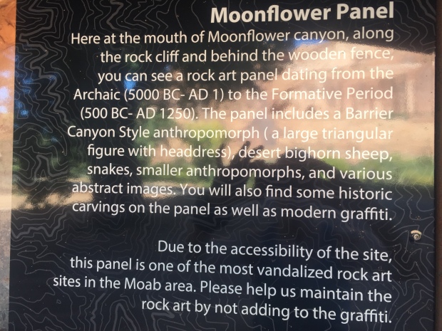
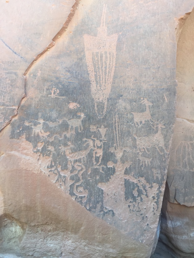
We took a drive out on the course and then stopped to look for the Moonflower Panel Petroglyph nearby. We took a trail a couple miles back without seeing a single Petroglyph but once back at the trailhead we realized the slab of ancient art was right at the parking lot.
It was very interesting to see the similarities of art from one location to the other.
While we were in Moab we hooked up with some friends from our RVing group, The Xscapers. We had burgers at Milts Stop & Eat. Milts is well known for their awesome burgers that totally lived up to the hype! It was a great time meeting new friends and getting reacquainted with some that we hadn’t seen in two years.
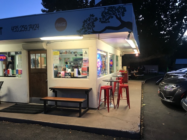
Milts Stop & Eat
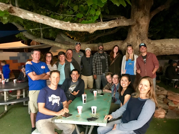
Crazy Xscapers friends
After Moab we drove to Park City, Utah for a quick overnight before flying out of Salt Lake City back to Arkansas.
Despite the challenges of car camping, this was an amazing trip. To be nimble in a small vehicle instead of a 32’ RV was refreshing to say the least and we found ourselves exploring/considering other routes and locations that we would not normally have the luxury of considering.
I’m certain we will keep that in mind when we pick our next RV!
Where to next?
Bryce 100 Ultra Trail Run
Posted by Deb in Boondocking, Full Time RV, Trail Run, Ultra Running, Utah on October 19, 2017
While we were camping at the North Rim of the Grand Canyon Jeff and I wanted to do a shakedown trip to Bryce Canyon before we moved the RV there for the Bryce 100.
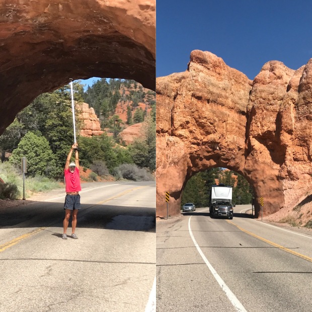
I had researched boondocking sites near the Bryce Canyon National Park. We drove down a couple of dirt roads and through the Red Canyon Campground but none of them had any connectivity. After passing through the two arches on Hwy 12 with a 13’6” height restriction, we found an incredible boondocking area on Toms Best Spring Rd, just across the street from the start of the Bryce 100 at Coyote Hollow.
And with excellent connectivity it was the winning location.
Our only apprehension was the height restriction through the arches. Our girl is tall like Jeff and I, so squeezing her through 13’6” was about 6” short of her Amazonian stature. Jeff devised a plan on how we could measure the height. With his 8’ overhead arm reach while holding our 5’ truck bed bike rack we could tell that the arch still had 5-6’ of clearance. As long as we stuck to the center of the lane we were golden!
Plenty of headroom for the Domani
A couple days later we packed up camp at the North Rim and made the two-hour trek to Bryce.
We left early in the morning and dumped our tanks at a gas station in Kanab. We wanted to get an early start so that we could avoid too much traffic while trying to fit our square peg of an RV through a round hole of the arches. All went smoothly with plenty of clearance and we picked an awesome boondocking spot to spend the next two weeks.
We used these two weeks to scout out trailheads and aid station checkpoints for the Bryce 100. Our campsite happened to be in the perfect location for hitting two different checkpoints on opposite sides of the course. This would allow me to swing by the RV to catch a quick nap and make Jeff a couple of smoothies during the 36-hour race.
Sweet Bryce campsite..Sam approved!
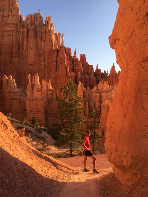
We took the opportunity to do a couple of training runs in Bryce National Park. Our first sunrise hike was on the Rim Trail that connected to the Navajo Loop Trail. The trip down the canyon was steep with switchback after switchback to make the grade more manageable. What was dynamic about this hike is that the initial trail takes you up close and personal with tall hoodoos and slots that appear to be held up by the smallest of pebbles of crumbling dirt. Just one flick of a finger would appear to bring it all tumbling down.
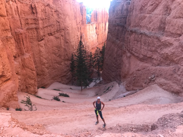
Switchback City
Nature at it’s finest
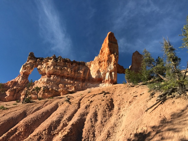
Another favorite is the Fairyland Loop. Eight miles of dusty dirt to kick up while taking in the sites!
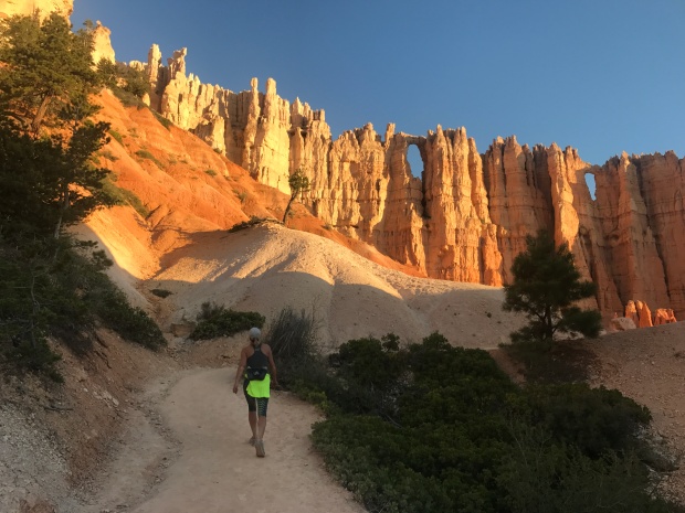
Hoodoos standing at attention
As the sun came up it set the rocks on fire, heating up the canyon with a warm radiant heat. Every turn gives a fresh vantage point of endless hoodoos that speak straight to my soul. “Come and explore so that I may show you a whole other world”.
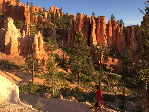
This is why I love Bryce
Holy smokes I love this guy
God’s creation moves me. It speaks to me. And I am whole again.
After such a moving experience we went to breakfast and did laundry at the Bryce Canyon Inn. Hey, that’s the reality of life on the road. One minute you are basking in the glory of nature, the next you are buying propane and dumping your poop at the local gas station.
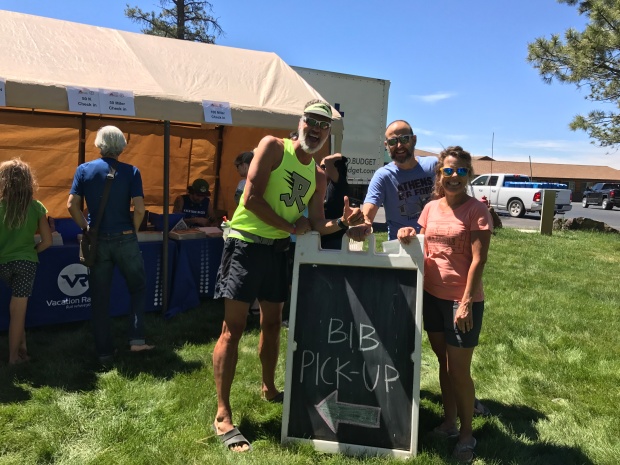
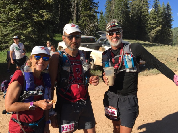
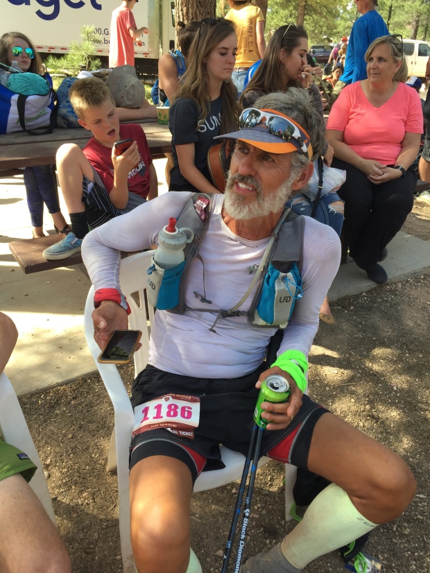
As the race quickly approached we met up with two friends from our Arkansas running group who also had entered Bryce 100. Janet and Chris are the ones who encouraged Jeff to run this race with them. Strategies were talked about, meals were eaten and all checked in for the race. The pain fest was about to begin!
Yup…crazy people!
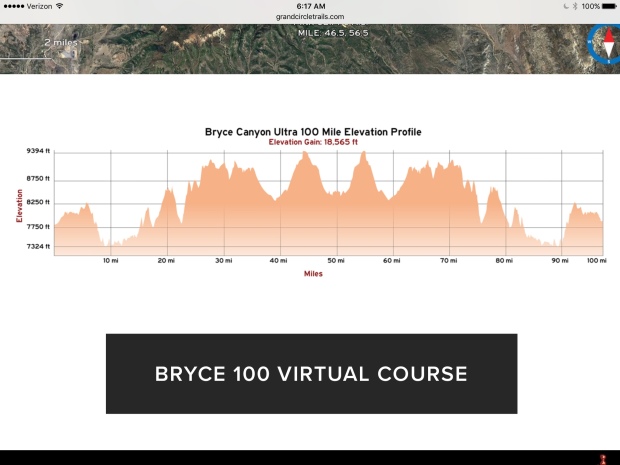
On June 16 the gun went off and the crowd of 250 shuffled off with high hopes for the next 24-36 hours of 18,565’ of vertical climb.
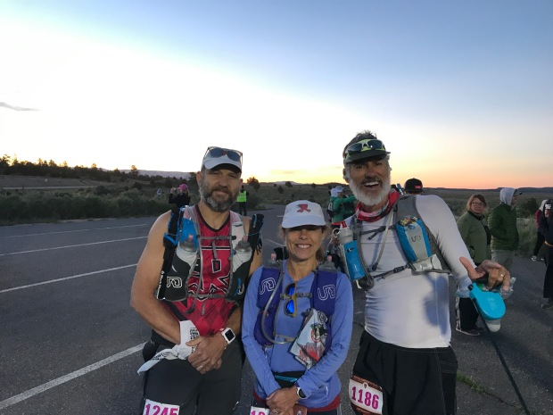
6AM start
I stopped at the RV for a quick nap and made Jeff a smoothie before heading off to the first check point about 19 miles out. The tough part of being a spectator at these types of events is that it can be challenging to spectate. Check points can be spread out over 100’s of driving miles down poorly maintained roads.
Proctor Canyon aid station was no exception.
Support crews had to park miles away and wait in long lines to hitch a ride on the back of a pickup truck who then made the 40 minute rock crawl to our destination. Thinking I had left a couple of hours gap before seeing the “Arkansas Travelers” (AT-team) they showed up 30 minutes after my arrival. They were making great time!
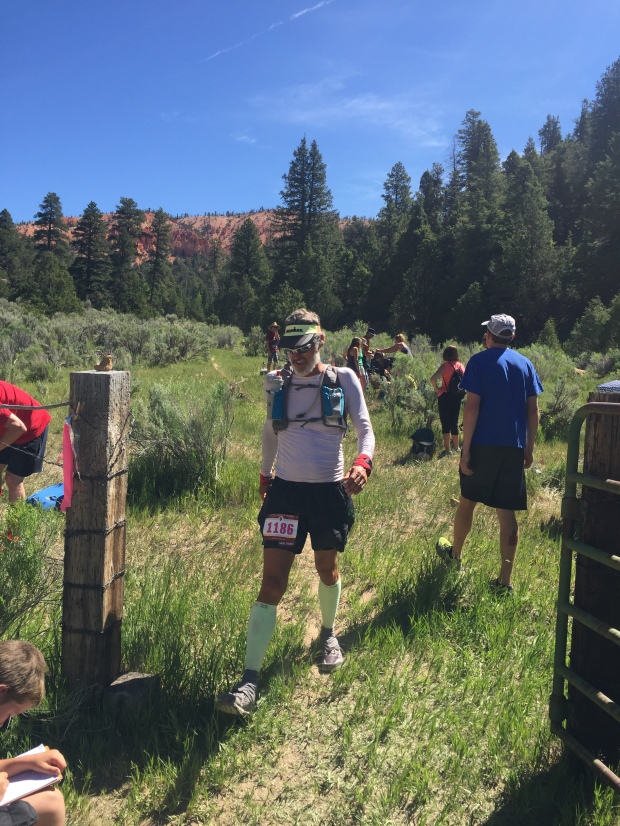
Walking it in to mile 19
Who is racing 100 miles? This guy!
All systems were a go and Jeff, Janet and Chris quickly moved on. I made the rock crawl back to my vehicle and drove back to the RV to reload for the next aid station at Straight Canyon, mile 41.
Another interesting thing that happens during these races is that you start questioning your timing. You do the math over and over again to insure you arrive at the aid stations when you “think” your athlete will be there. But then they show up early to the first location and throw off all your projected times for the day.
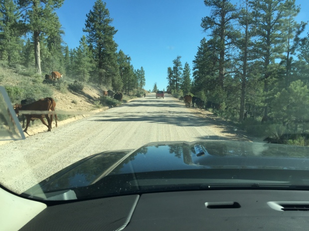
Got caught in a cattle traffic jam
Discussing the next leg over a smoothie
So when I made it to Straight Canyon the AT-team was already heading down the road to the next location. I managed to see Jeff for a few minutes, and then we were all off to the next spectator aid station at the turn around…mile 51.
Crawford Pass was 10 miles away for the runners, but only 3 miles for the crew. So I settled in for a bit of a wait. The sun was going down by this time and the temps were beginning to drop. I tried to nap in the truck but I wasn’t able to sleep. So I put on warmer clothes and decided to help the athletes coming in by picking out their needs bags and getting them food.
By mile 51, everyone is getting pretty tired and I saw quite of few people decide to call it quits. Jeff and I had a strategy in place, that if he came into an aid station and wanted to quit I would encourage him to wait to make the decision at the next aid station. These races are as much mental as physical and if you can delay a decision until the next stop, sometimes that’s enough time to get the athletes out of their own head and back on the trail.
Mile 51
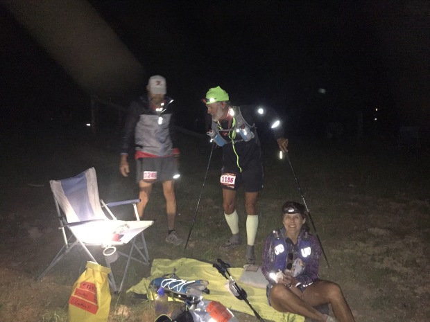
Taking a break at the turn around
Jeff came into Crawford pass about 10pm and the rest of AT about 40 min later. Jeff used this aid station to take a 30 min nap while I took his shoes and socks off, washed his feet and put on new, fresh socks. Jeff didn’t have a single blister in sight and was feeling pretty good after his nap.
Jeff has always been a VERY optimistic guy and to see him with his happy-go-lucky attitude at this stage amazed me to say the least. There was no hint of not making it to the finish and I knew then that he would accomplish this race!
Our other teammates were not having the same experience. Chris had such an upset stomach that he wanted to drop out. While the rest of us tried to encourage him to delay his decision he walked into the woods to throw up, then announced that he was out!
By this time Jeff had already left the aid station.
Janet wanted to continue on but did not want to run in the dark by herself. She was going to drop out as well until a pacer for another runner (that had dropped out) offered to run with Janet through the night. This wonderful gal ran with Janet until the finish of the race…50 miles away. What a super hero!!!
Since this race was an out-and-back, Chris and I drove back to Straight Canyon, now mile 62. We fell asleep in the truck and woke up just as Jeff was leaving the aid station. He made awesome time again and was still feeling good. Janet followed a bit later and Chris and I headed back to the RV where his car was parked.
I’m not going to lie. By now it was 3am and I was exhausted. The 45-minute drive was pure torture in sleep depravation. Chris went back to his hotel and I slept for a couple hours at the RV before making one more smoothie for Jeff. Our last spectator aid station was back at Proctor Canyon, mile 84. This time Chris and I drove my truck to the aid station and offered up rides to others waiting in the long line again.
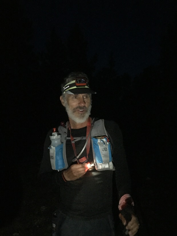
Jeff was able to get a text message every once in a while to let me know what time/mile he was at. I knew that he was within 4 miles of Proctor, so I set out back tracking the course to pace him into the aid station. I ran into him with two miles to Proctor and he filled me in on the perils of night running and things that go bump in the night. With sleep depravation, exhaustion and a bit of hallucinations there is quite a story to tell!
On the trail to Proctor Aid Station for the last time
By now it was getting very hot and the rest of the course was in full sun.
At Proctor we did one last foot cleaning and clean socks and Jeff made a quick exit. His cut off times were starting to get tight and he didn’t want to run the risk of not finishing under 36 hours.
I watched as other runners came into the aid station. Some looking fresh. Some looking terrible. It is scary when an athlete stumbles into an aid station not knowing who they are or babbling something incoherent. It was sad to see one runner who was pulled off the course by the medical team with just 16 miles to go. It was definitely warranted, but sad just the same.
By this mileage there are plenty of runners crying due to pain, skinned knees from falls, blisters on top of blisters and those who just want to stop. I admire all these runners for the perseverance it takes to finish a 100-mile race. My respect goes to each and every one of them…those who start and those who finish! Who does such a thing????
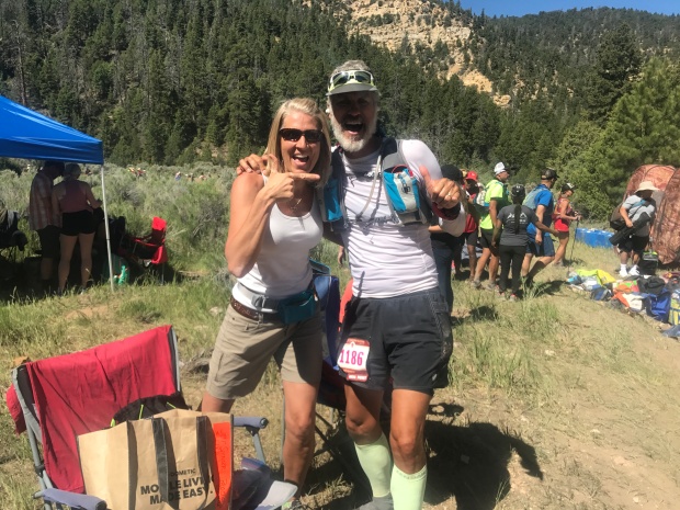
With 16 miles left Jeff pushed his legs further than he ever has and had a kick to the finish with an hour to spare.
Jeff completed his first 100!!!!
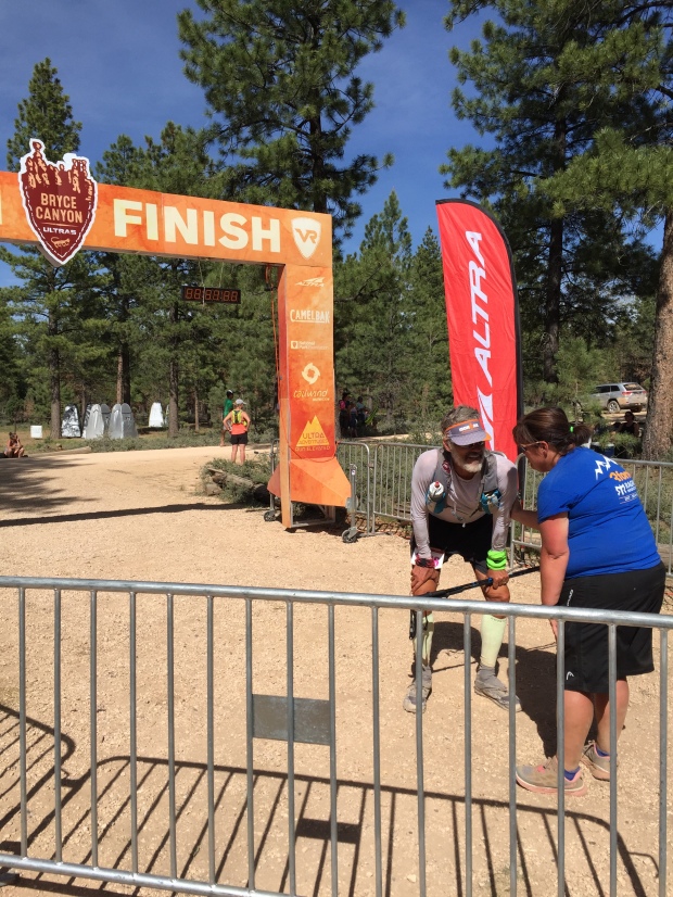
Bryce 100 in the books!
A well deserved seat!
I cant tell you how proud I am to see Jeff cross that finish line. All the long training runs, all the mounds of food consumed to fuel that training, all the head games to convince himself it can be done, all the research and conversations from those who have gone before. It all came together for a perfect race!
Janet showed up with her pacer about 20 minutes after the cutoff. Anyone that finishes a 100 mile race is a “finisher” in my book.
Jeff and Janet received their belt buckles!
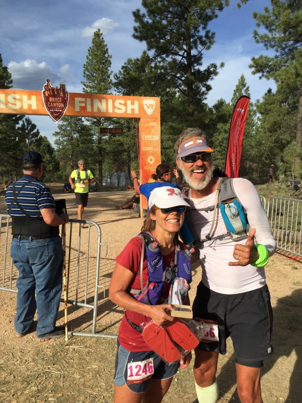
Way to go Janet!
48% of the field dropped out of the race that weekend…48%! There were ambulances at the finish to escort some weary runners to the hospital. Jeff got some food at the finisher’s tent, and then we made the short drive back to the RV.
We had a quick travel turn around to make it to Denver. With a flight scheduled to Elkhart IN for meetings within a couple days my plan was to load up Jeff and the RV right after his finish and head down the road. But we were both too exhausted. It wasn’t going to be safe for me to drive so we decided to wait until the next morning to leave Bryce.
After a VERY long day of driving to Frisco, CO we stopped at a campground before making the last push to Colorado Springs where we parked the RV in a friends driveway for our Indiana trip.
Since Jeff’s race 4 months ago (I know…I am waaay behind on this blog) we have been stationary for the most part in the mid-west. We have been hit with some life events back home so I will fill you in on the excitement next time!
Goodbye for now Utah!
Sammy Scare But Back On The Move
Posted by Deb in Boondocking, Full Time RV, Hiking, Moab, Running, RV Parks, Trail Run, Utah on April 18, 2017
Arches National Park
March-April 2017
If you have never smelled the South or Southwest when grapefruits, lemons, limes and oranges are blooming, you are in for a treat. The smell is fragrant, sweet and a bit intoxicating. It’s another reason we love the Southwest, especially because the blooming happens while the rest of the country is still experience arctic blasts.
We left the blossoms and Sam dog with the sitter while we flew back to Bentonville, Arkansas.
I had to delay my trip a bit because Sam was in bad shape. While we were in Tucson for the Escapees Rally, Sam started to act strangely. He couldn’t keep up with me on a simple walk around the RV Park. When we picked him up he would cry out in pain and he became lethargic.
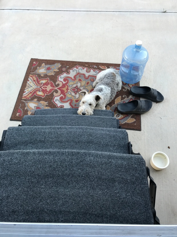
Too tired to hold his head up 😦
He was holding up his left front paw and I found an enlarged lymph node on his left chest. We immediately started thinking the worst and scheduled a visit to the vet. It was such an odd feeling to have such a healthy dog who was still running up to 11-miles one day, but was so incapacitated the next.
I’m not going to lie. We thought his lymph node was a sign of cancer and we cried all the way to Phoenix on the way to the vet. We even stopped at his favorite canal trail and carried him to the ducks for one last chase. We were saying goodbye to the best boy we have ever had. We really thought we were going to be putting our beloved Sam down that day.
After blood work and an X-ray the vet assured us that Sam’s demeanor was NOT cancer, but more spinal related and he was prescribes pain killers, muscle relaxers and anti-inflammatories. The vet then called a day later to let us know that the radiologist described two degenerated discs in his neck and what appeared to be bilateral ear infections. Antibiotics were added to his long list of meds.
This was all two days before we were supposed to fly to Arkansas. So I rescheduled my flight to later in the week so that Sam was more stable before taking him to the sitter.
It took a couple days, but Sam started to perk up day after day. By the time I left he still was not himself. All that medication made him loopy, shaky and sleepy. But at least his pain was finally under control and I felt OK enough to leave him in good hands.
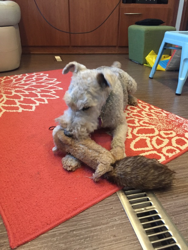
You know Sam feels better when the squirrel gets it!
By the time we got back, Sam was more spunky…but completely deaf! After a follow-up visit to the vet he was taken off all pain meds, but left on antibiotics for his ears. Currently, he has regained only a minimal amount of hearing. He is back to short runs and longer walks and now charges the door when we put our running shoes on. A sure sign that he is back!
It’s been a hard 4 weeks for Sam. At 11-12 years old he is finally starting to act his age I guess. We are just so happy he is still with us for a little longer. He is going to be a hard one to replace when the time comes for sure!


I did make it to Arkansas in time for the Bentonville Half Marathon.
Jeff and I and his two sisters, brother-in-love and nephew had all been training since mid-December for this race. We had a lot of fun texting and emailing accountability to the training program and talking about pain points on our bodies. This would be the first time our sisters, nephew and brother-in-love ever did a half!
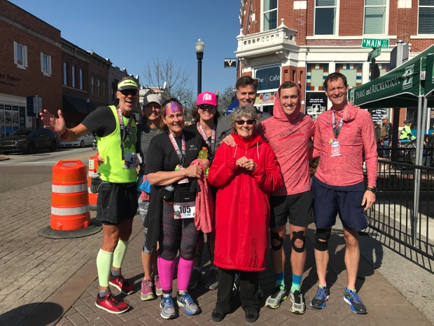
Mom so proud of her family of finishers!
In the end we all completed the race! It was a proud and emotional moment for all of us! This trip was about a family reunion, overcoming physical challenges and coming together to support their Mom who we had just moved into a local assisted living facility a couple week prior.
Jeff’s brother had their Mom at the finish line to cheer us all on. Though she has lost her ability to communicate, the pride of a mother over her kids was still evident on her face!
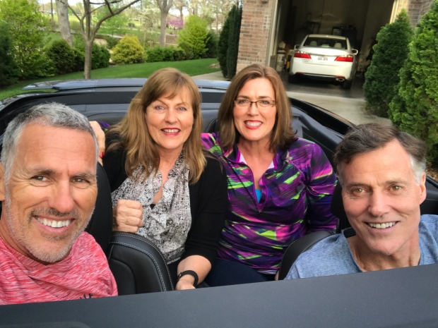
Sibling spin around the block…Jeff, Jerry, Jan & Jackie!
It was a special time for sure as we spent precious time with our families.
After checking on our lake cabin we flew back to Phoenix, picked up our dog and headed for Moab.
We split the drive into two days and stopped this time at Goulding Lodge and Campground at Monument Valley.
Wow. What a little gem of a campground! It is an RV Park so spacing is closer that a state park. But the sites are laid out very nicely so just about everyone has an amazing view of the monuments off in the distance. It is also on a hillside, so some sites are a little bit challenging to level. They have a nice short hiking trail from the park with perfect viewpoints for taking some awesome sunset pictures.
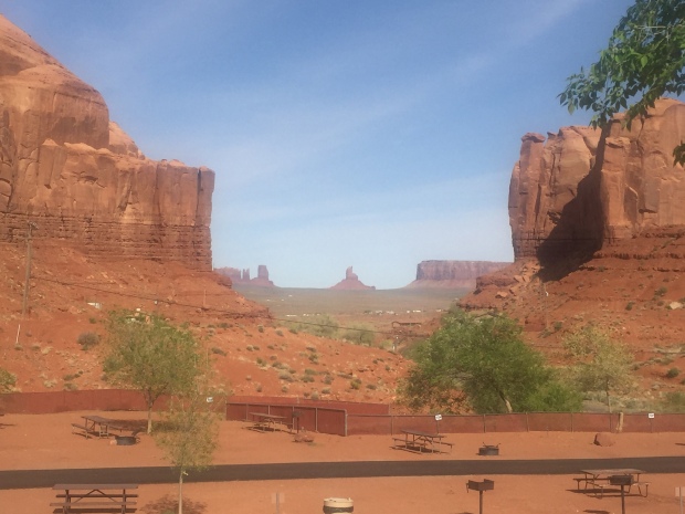
Impressive view from the Goulding Lodge and Campground
And if you want to schedule a hiking or jeeping tour, they will schedule your “Goulding” tour right from the campground. Or if you need groceries, stop at Goulding Market. Goulding has everything covered right from their grounds.
Jeff and I took a 5-mile sunrise trail run before we left and it did not disappoint. The red glow of the morning sun set the red rock formations on fire. We followed a horse path up the side of a mountain and hugged a fairly level trail once we got to it. We jumped on a jeep trail and looped us back around to the RV Park through sand dunes. We were chased by a few dogs in the distance on this run. But they quickly gave up the effort and retreated to their respected porches.
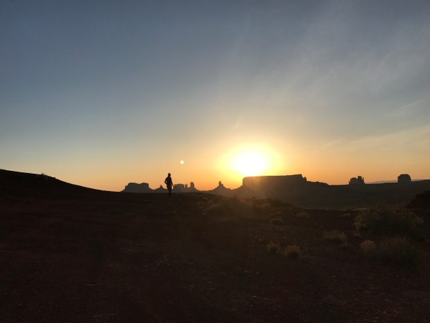
A sunrise to remember! I love this picture!
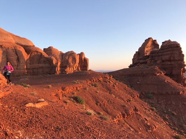
Glowing red rocks
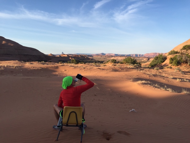
Sand dunes aid station
On day two we made it to Moab by lunch time.
We were at Moab again this year for the for the Easter Jeep Safari (EJS).
From the EJS website…
“The Jeep Safari was started in 1967 by the Moab Chamber of Commerce. The very 1st trail was “Behind the Rocks Trail” (according to what has been told to the club President, the road was made or improved with a BLM employee and equipment.) The “Moab Rim” was then added the next year. In those days, individual ice cream packages were dropped by airplane to the trails at lunch. All the leaders were Chamber members, there was no charge or entry fee, and only a Saturday trail. To register you showed up Saturday morning and signed up for the trail you wanted. The Safari was run this way through 1982 at which point the BLM required a permit and insurance. The Chamber was no longer able to run the safari and approached the club to run this event.
The Jeep Safari itself, and participation in the event has grown since the club officially formed in the early 80s. Once the event was coordinated by the Red Rock 4-Wheelers, the registration moved from the Chamber building north of town, to Lion’s Park, and on to what was called “the Barn” which is where McStiff’s is currently located near Center and Main. Over the years the increase in participation grew to expand the trail riding to more days until it finally reached a nine day event. “Big Saturday” still remains the culmination of the event on the Saturday of Easter weekend. With the increase in numbers, the registration was moved to the Spanish Trail Arena where it is located today four miles south of the city of Moab on highway 191. This also became the location for the gigantic safari raffle, Boy Scout BBQ dinner, and a vendor exposition featuring over 130 national 4×4 manufacturers”.
When we were in Moab last year I have to say that I was not that overly impressed with the area. The views are beautiful, but the area felt worn and a bit junky. I suspect my view of the area was a bit tarnished by the overwhelming amount of ATV’s, motorcycles, Razors and Jeeps that were streaming by our campsite at all hours of the day and night.
But this visit was different.
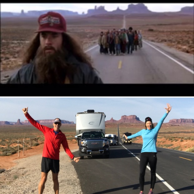
Our Forrest Gump Moment
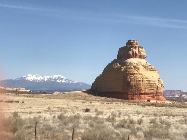
Scenes on the road to Moab
Last year we arrived a couple of weeks early to get a campsite at Slick Rock, which is a first come first serve campground…right in the middle of all the action.
This year we stayed at the KOA just a block away from the EJS expo, thanks to some creative finagling by fellow Xscapers who work camp here. We didn’t have a reservation anywhere in Moab! (NEVER come to Moab during Jeep week without a reservation!). This KOA is one of the nicer, well laid out KOA’s that we have been to. And compared to last year, made for a quiet relaxed location to enjoy the Moab Brewery and Quesadilla Mobilia Food Truck in town.
Trail running near the KOA is not nearly as convenient as Slick Rock, so we had to be a bit more strategic to get our runs in. My favorite is the greenway that runs through Moab, within a block of the Laundromat. I put in a wash load while I ran two miles. Then put it in the dryer for three more miles. How is that for multitasking!
Jeff and I worked the 2-day EJS expo. Our fellow Xscaper friends Finding Marshall, RV Chickadee and Mamasaysnamaste stopped by to say hello! They were all staying on BLM just north of Moab at Willow Springs.


Willow Springs is a very popular boondocking area, especially during jeep week. Jeff decided to do his long run from our KOA site 25-miles to Willow Springs. His route took him through The Arches National Park. He didn’t exactly take a trail, but a wash that turned into some bushwhacking and creek crossings. I picked him up at Willow Springs where I was visiting our friends.
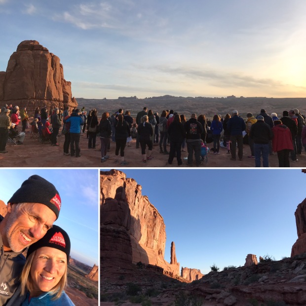
Before we left on Sunday we attended the Easter sunrise service at Arches. We started with a short 2-mile hike on the Park Avenue Trail by moonlight and finished at the La Sal Mountains Viewpoint, where there has been an Easter church service for more than 30 years.
We definitely had a much better experience with Moab this time. It is a stunning town with plenty of outdoor activities to last a lifetime. I look forward to coming back again.
After church we packed up the RV and headed to Salt Lake City. Sam and I are currently staying at the KOA while Jeff travels to Elkhart Indiana for meetings. Our next big show is the National Hardware Show in Vegas in about 3 weeks.
Until then, we are going to bounce around Utah and hit up some beautiful BLM sites to continue our training for the Bryce 100 (Jeff) and Half Marathon (Deb) trail run scheduled for June.
Look forward to seeing ya’ll down the road!
Flagstaff and The Fearsome Four
Posted by Deb in Arizona, Arkansas, Boondocking, Destinations, Full Time RV, Highest Peaks, Hiking, Running, Trail Run on October 21, 2016
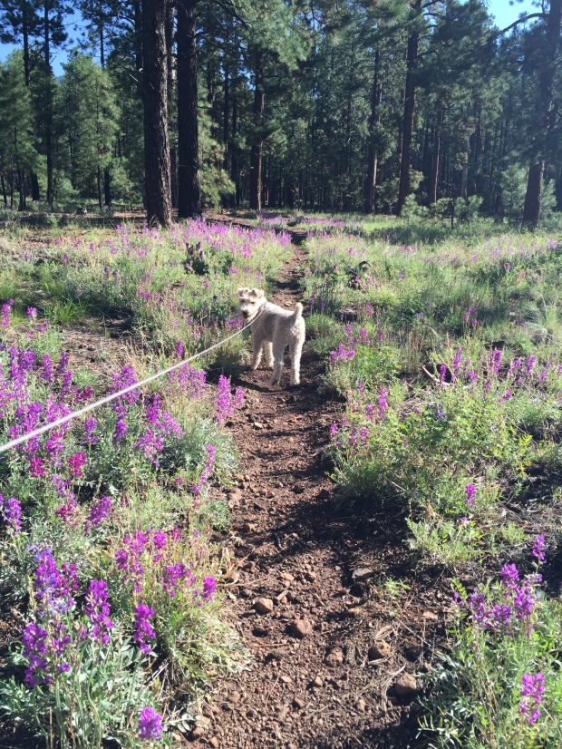
Sam back on the Arizona Trail
August 21-September 21, 2016
After climbing to new heights at Mt. Whitney Jeff and I had about a week before needing to be in steamy Phoenix for business travel. We wanted to camp where we could get a break from the heat just a little longer, so we headed straight for Flagstaff, Arizona.
We’ve been camping in Flag off and on for the past year, one of our favorite locations. There is an abundance of free forestry land to camp in with endless trails to run, hike or mountain bike just outside your door. This and being close to town makes us feel like we live in the community. Flag is definitely familiar to us now and there is no need for GPS to get around town any more.
A delightful sunny spot amongst the trees
Not only was the 70 degree temps sublime, but Jeff has been training for the Stagecoach 100. Stagecoach is a 100 mile ultra trail run that starts in Flag and ends at the IMAX theater at the Grand Canyon. Jeff is running a relay with a buddy. 55 miles for Jeff and his friend Jason running 45. Since the race was just 4 weeks away some high altitude trail training was in order.
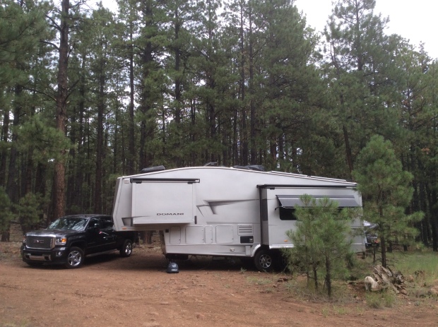
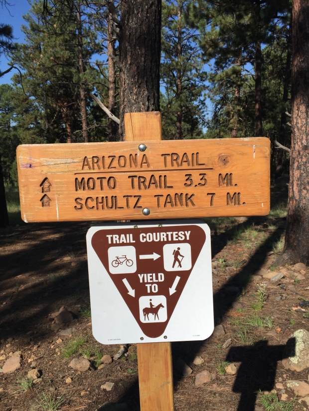
We camped at a new boondocking site on FR6051 near Snow Bowl on the North side of town. The road was a bit rough, but we were able to wedge our modest 32’ into a nice spot for maximum solar gain. There are endless forestry roads here with several short spurs that connect directly to the Arizona Trail. So getting in our trail runs was a piece of single track cake!
Oh Arizona Trail, how I love thee!
One of the first things we usually do when getting to a new location is to see if there are any running events happening during our stay. We have done this in Moab, Chico and Whistler among others, and it keeps us motivated to get out and exercise on a consistent basis. Without the motivation I would struggle with the RV-15 (think freshman-15) and bedsores!
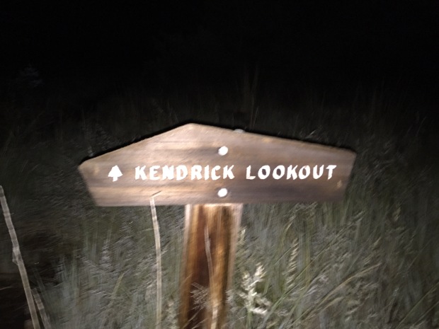
One of the things we learned about is the Flagstaff Fearsome Four Challenge. Four peaks, 34 miles, 10,307 of elevation over 2 days. Sure…why not! As part of Jeff’s ultra training this challenge was right up his ally.
Here is how the challenge works. Hike or run Humphreys Peak, Kendrick Peak, Mount Elden and O’Leary Peak in any order. If you accomplish this challenge under 15 hours (not including driving time) in a 24hr period you are honored with the status of “Ultra” runner. Well then. Lets get to it!
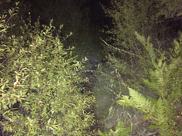
Things that go bump in the night…what was that noise?
Jeff started at 1am at Kendrick Peak. Besides being scared by some sort of large animal in the woods, this was pretty uneventful. Humphreys Peak, the highest peak in Arizona and most challenging of the four, was next. Jeff ran into a couple of trail runners that run Humphrey’s 9 miles in under 3hrs, twice as fast as I hiked this beast! It had snowed on this peak the day before, so some of the trail was still covered.
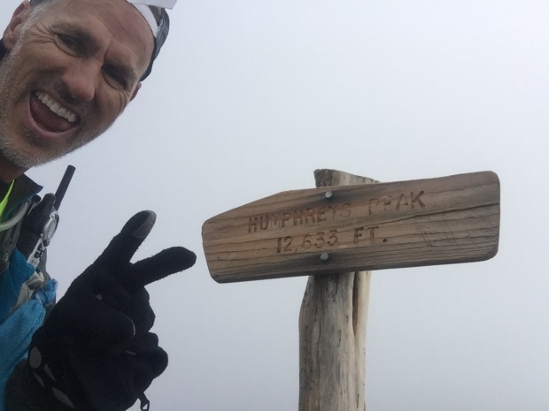
Summit of Humphrey’s Peak
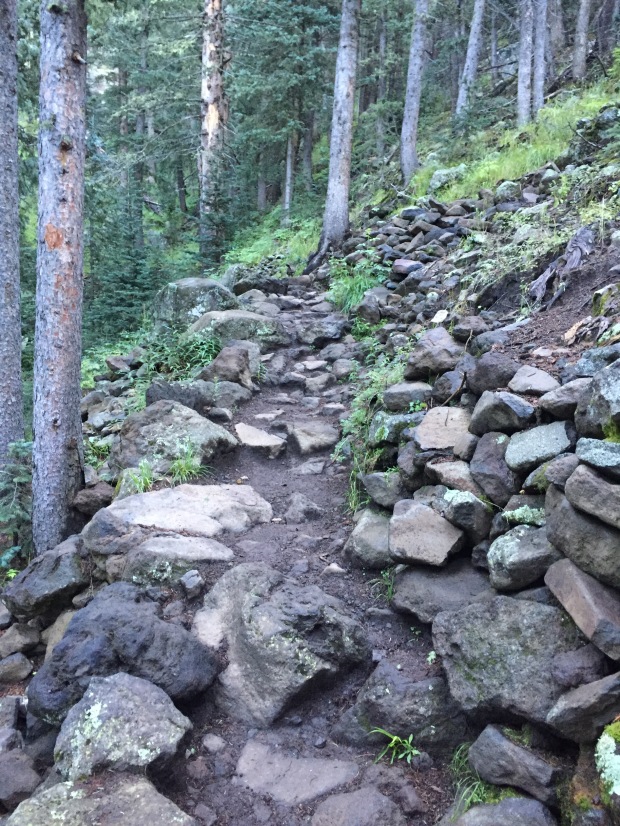
Rugged trail
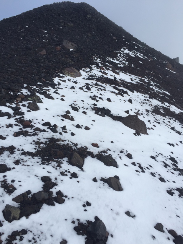
Snow covered trail
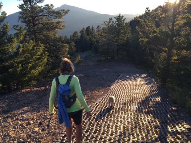
After a brief refueling of bacon and a nap at the RV it was on to Elden and O’Leary’s peak. Sam and I joined Jeff for the final two hikes. Though Elden is a short 4-5 miles round-trip, it is very rocky, technical and steep. We were glad to be hiking this one in the daylight!
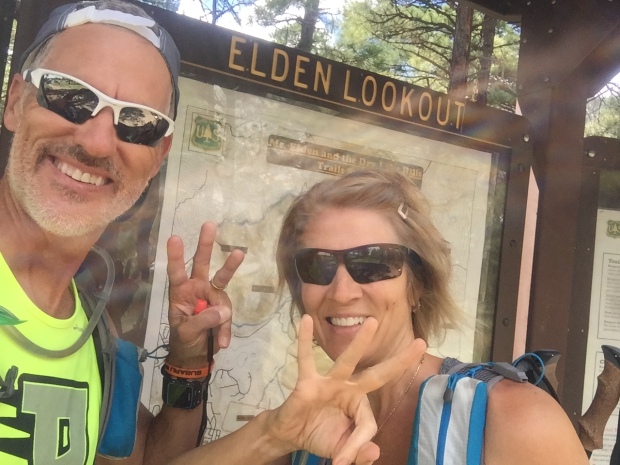
Third peak in the bank!
Heading further north we finished with O’Leary’s. This trail was a well-groomed forestry road all the way to O’Leary’s lookout, where we took in sunset views before racing back down the mountain to finished after dark.
Jeff did an amazing job coming in under 15 hours for the Fearsome Four and we celebrated with some late night BBQ!
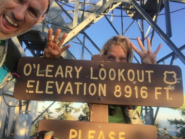
Number four…O’Leary Lookout!

Racing the sun
Steapest section at O’Leary Lookout
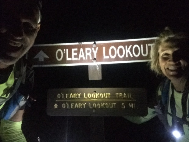
After dark finish!
The next day we packed up and headed for Phoenix where we jumped on a plane and flew to Dallas. The Dometic show vehicle needed to be transported to Elkhart, Indiana for the RV industries open house.
A stop over in Bentonville, Arkansas was in order and we stayed for two weeks. This gave us a chance to check on family and our beloved Beaver Lake cabin.
I tell ya, when I sit on that porch swing overlooking the Lake, it’s hard to think of ever leaving! I love the smell of fresh lake water, hearing fish flopping in the early morning hours, swimming in water so clear you can scuba dive. I love that I can lace up my shoes and go for a run on lake roads that only a few locals travel. I ended up with 5 of the neighborhood dogs on one of my runs, which helped with missing Sam on our trip.
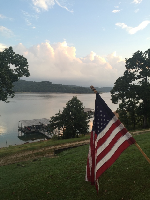
The view from our deck
Well hello humidity! Where have you been?
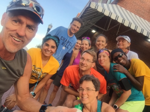
Getting in a Saturday morning run with friends
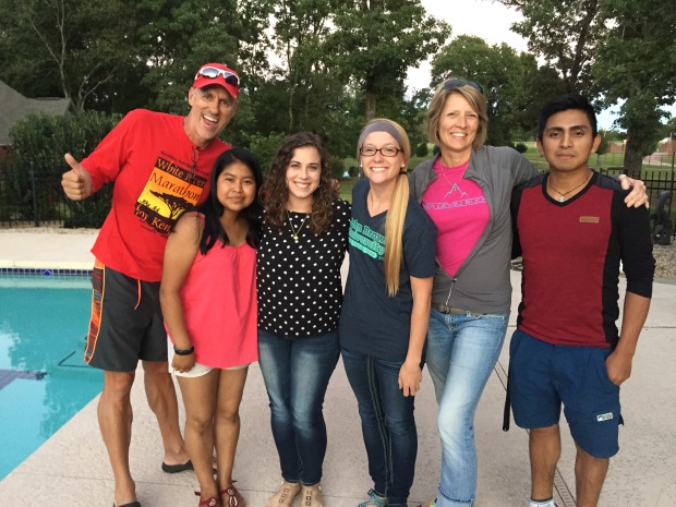
Quick visit with two of our Guatemalan students in AR on Walton Scholarships to John Brown University…so proud of them!
Arkansas is a beautiful place to call home for sure and I always shed a tear when we leave. But the road calls, and we must go and off to Elkhart we went.
We arrived over the weekend so that we could visit with some wonderful friends. The open house went well and we headed south with the RV to Louisville before flying back to Phoenix. It was a hard pressed 3 week trip and we were glad to get back to our dog and our RV.
With only 3 days before the Stagecoach 100, we were rushing again to get back to Flag for the race. So after landing at 6:45am, we picked up our dog and were on the road with the RV by 9am, and parked in the woods by that afternoon.
Holly moly…that was a tiring trip!