Archive for category Boondocking
More Mountain Peaks Please
Posted by Deb in Biking, Boondocking, Cycling, Destinations, Full Time RV, Highest Peaks, Hiking, Running, Trail Run, Ultra Running on December 18, 2019
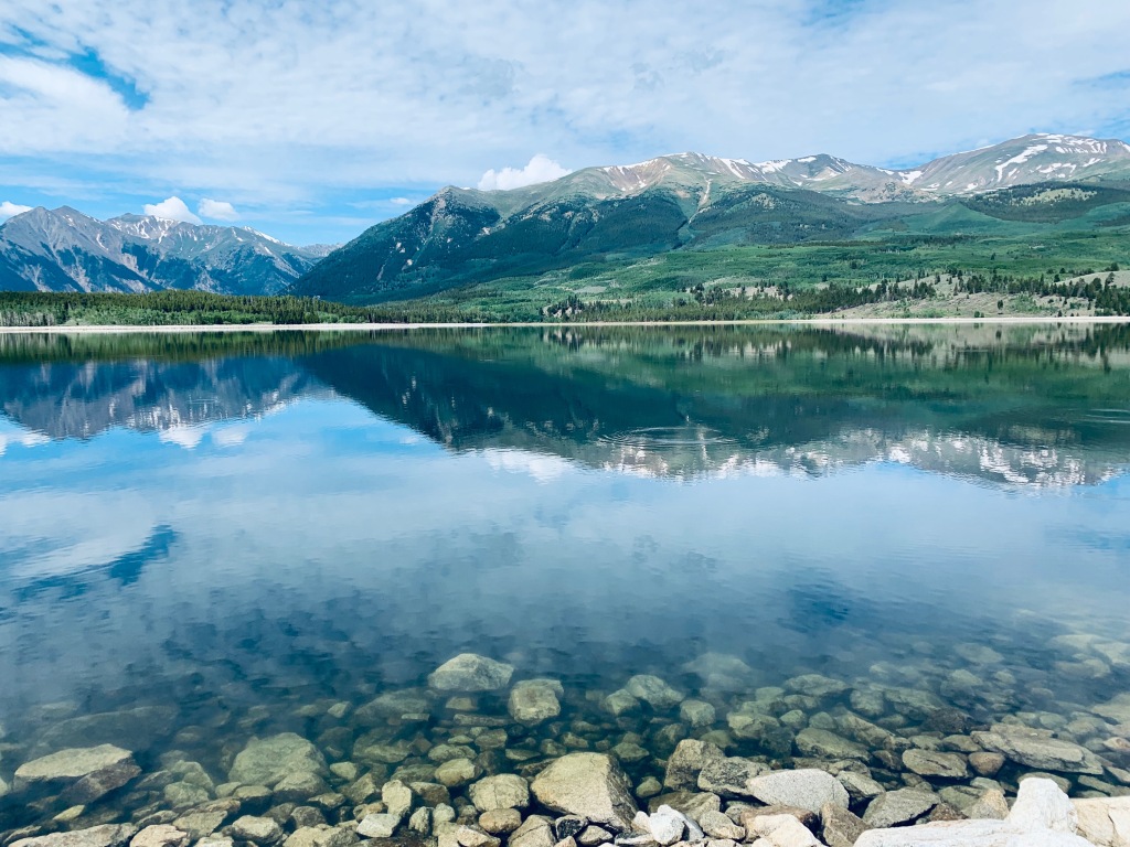
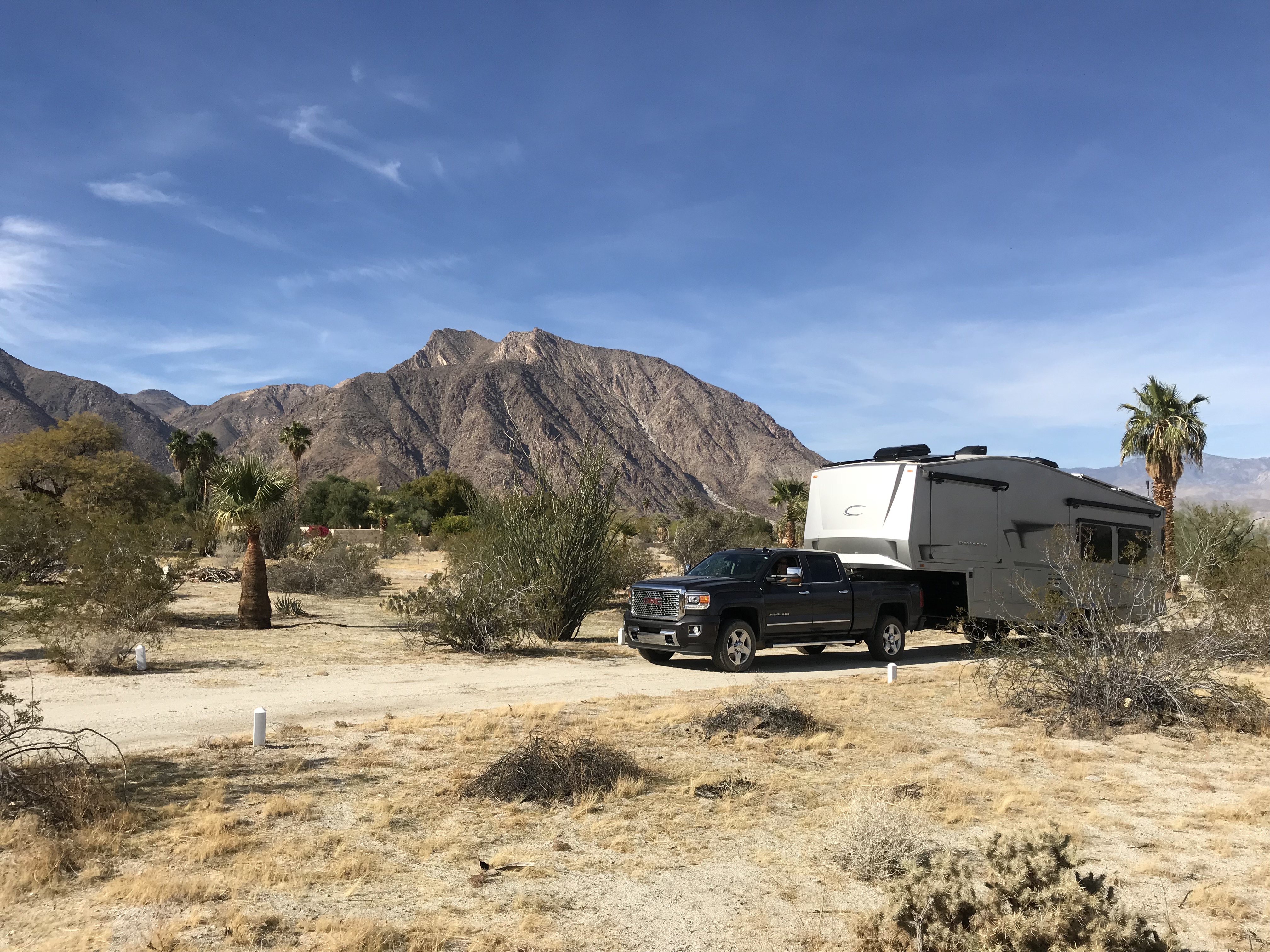
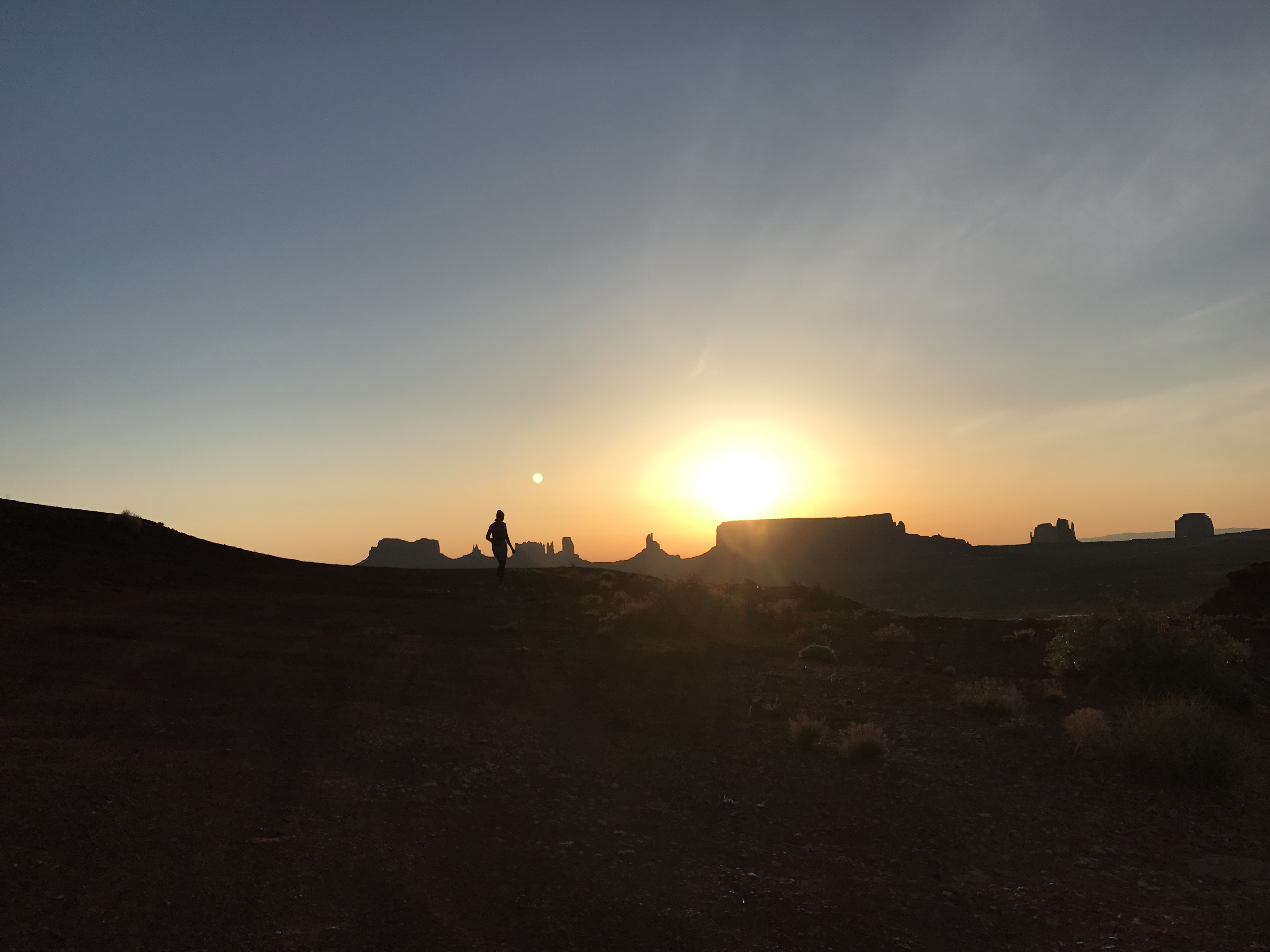
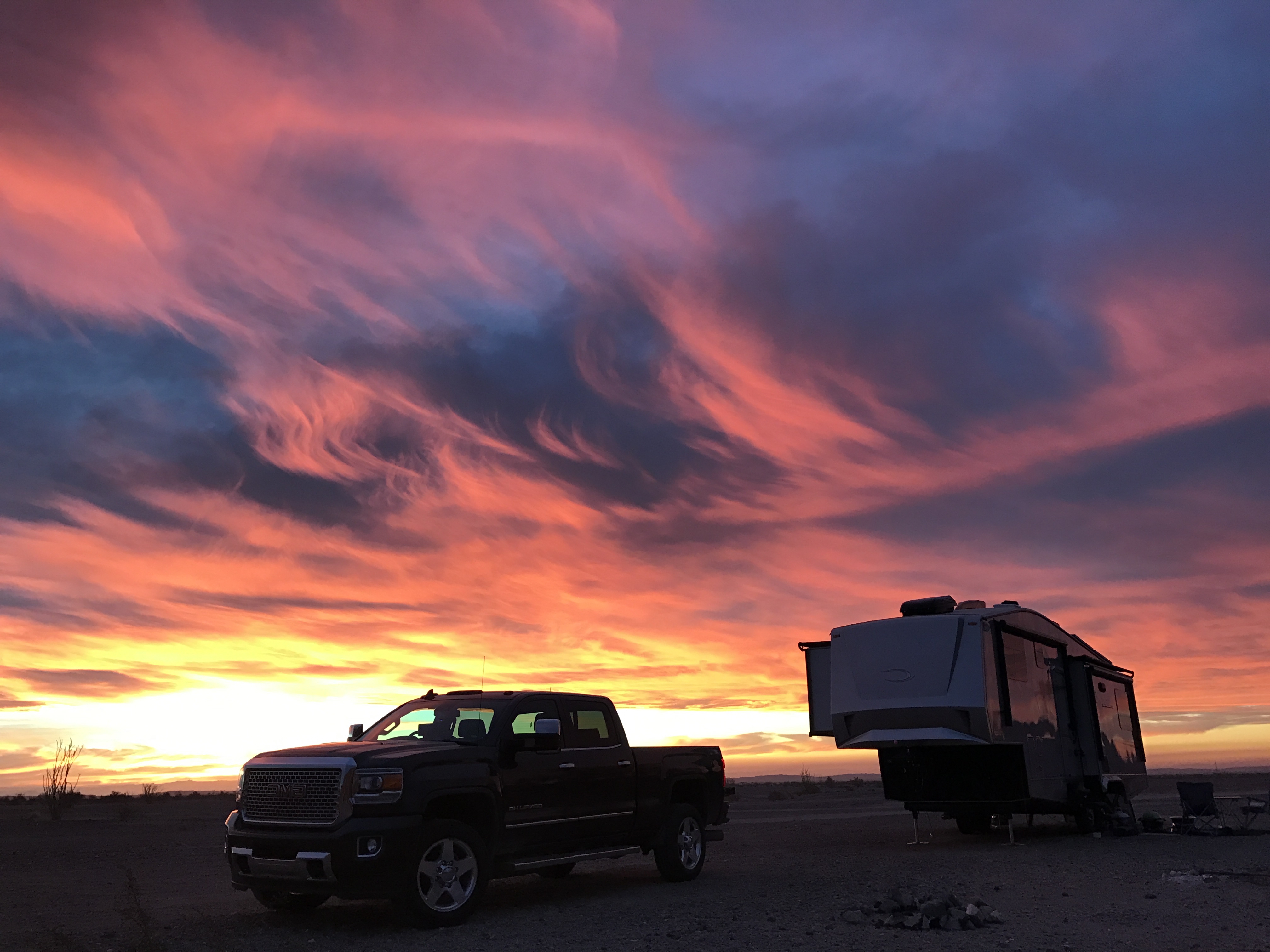
Twin Lakes, CO (Elevation: 9700’)
We would have liked to stay in Salida longer, but the summer temps, even at 7,000’, were starting to climb into the 90’s. So we moved on the Twin Lakes Colorado at 9,700’.
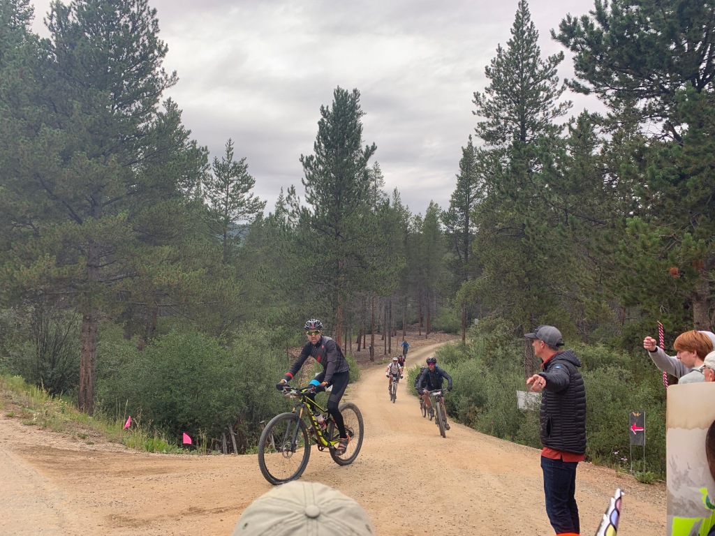
If you are familiar with the notorious Leadville 100 trail run or the Leadville 100 MTB race, then Twin Lakes will be familiar as one of the stops/aid stations runners and bikers resupply before heading over Hope Pass at 12,600’.
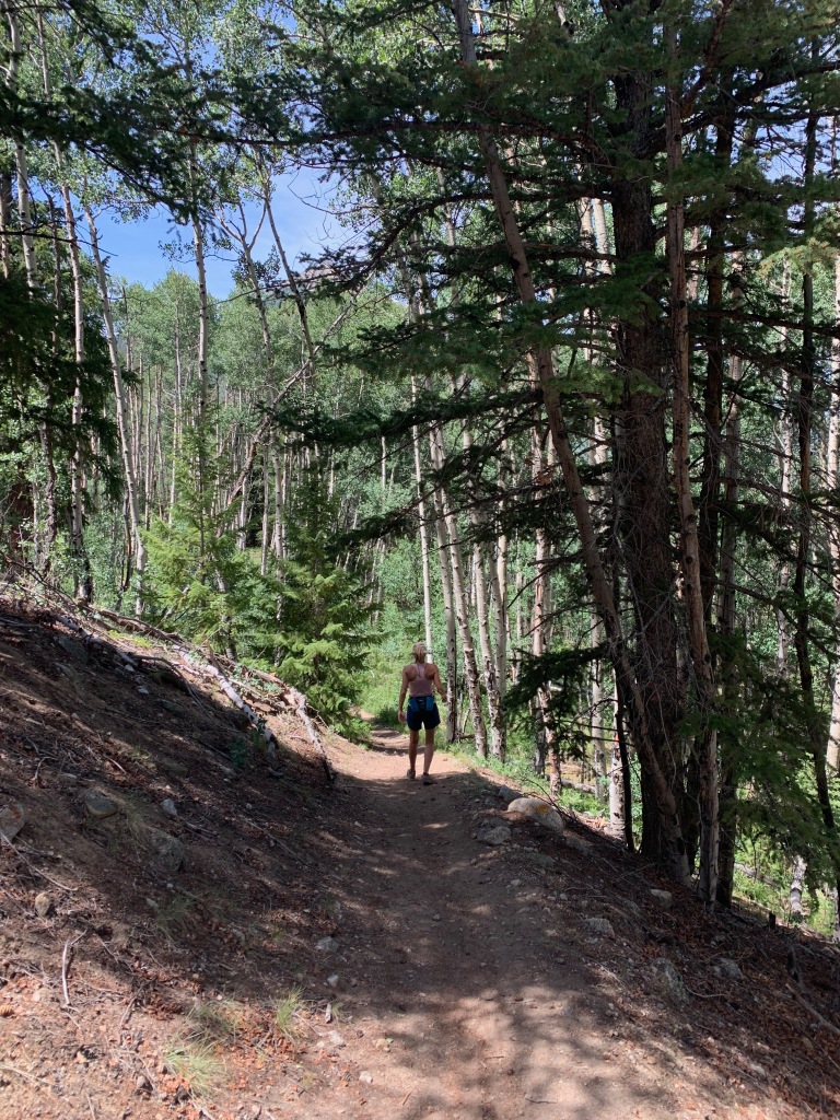
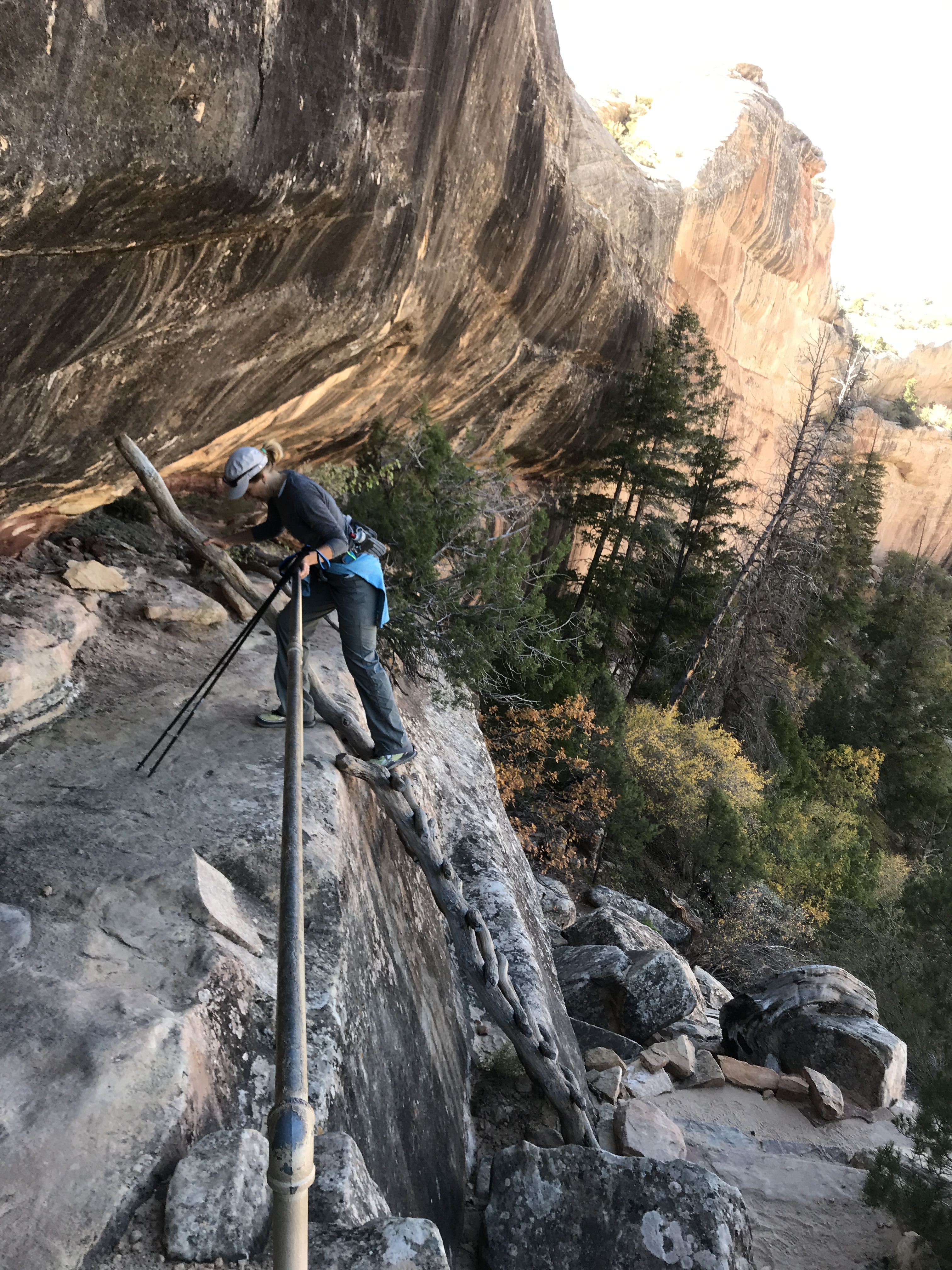
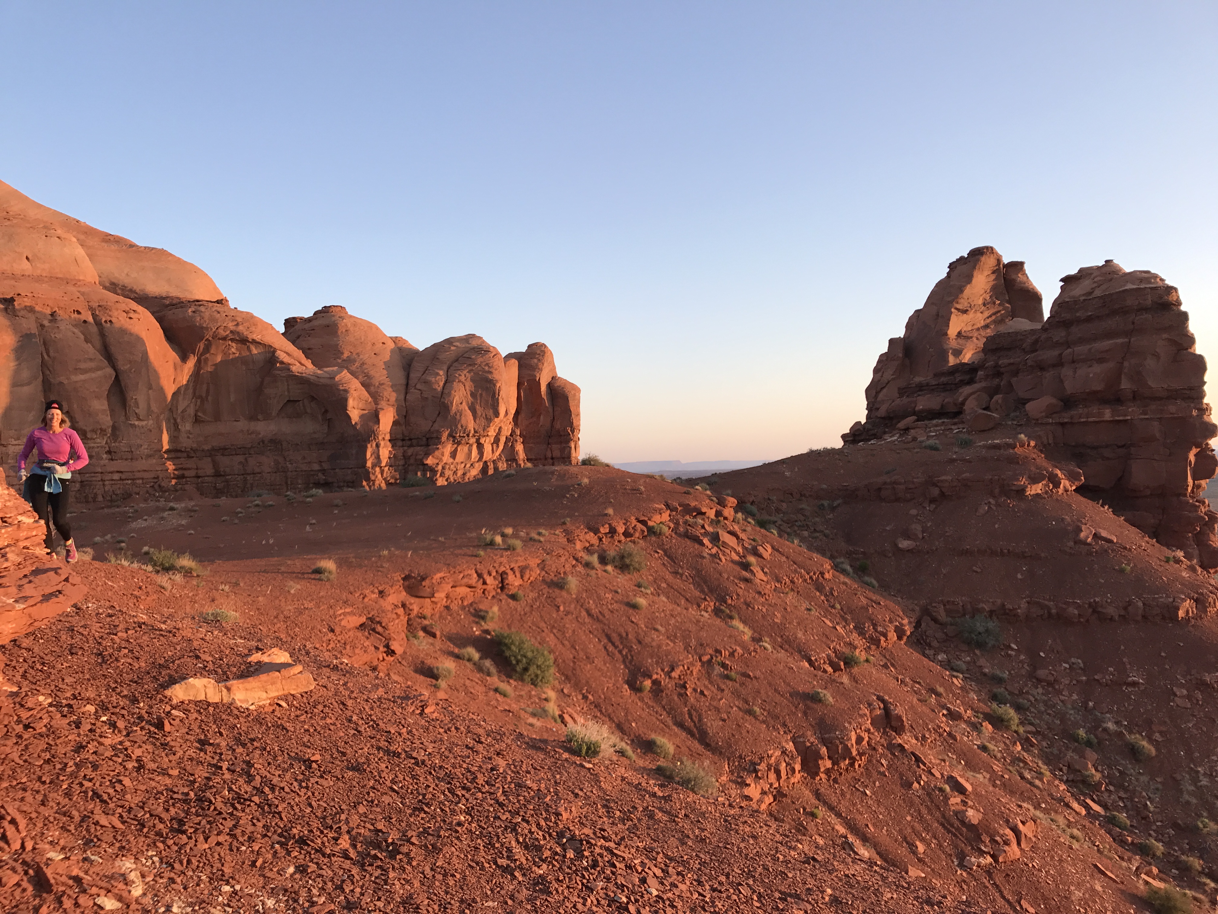
We initial boondocked at Lake Creek Dispersed camping area on the west side of Twin Lakes. This was a lovely pull out area with room for 10-12 RV’s with terrible connectivity. What we gave up in connectivity we gained back in proximity to the Willis Gulch trailhead, just 3/10ths of a mile away.
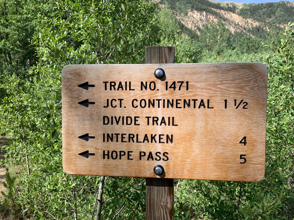
Willis Gulch offered access to the Colorado trail, the Continental Divide trail, Hope Pass and a 9-mile round trip hike to the restored 1880’s community of Interlaken.
The Interlaken Hotel complex was started in 1879 as a lakeside resort. It was considered a top destination in Colorado in its time with tavern, pool hall and a unique 6-sided outhouse.
Unfortunately Interlaken lost its attraction when Twin Lakes was dammed for irrigation purposed around the turn of the century. People considered the shallow waters of the lake a breeding ground for malaria and the hotel fell into disrepair until 1979 when the Bureau of Reclamation recorded and stabilized the community.
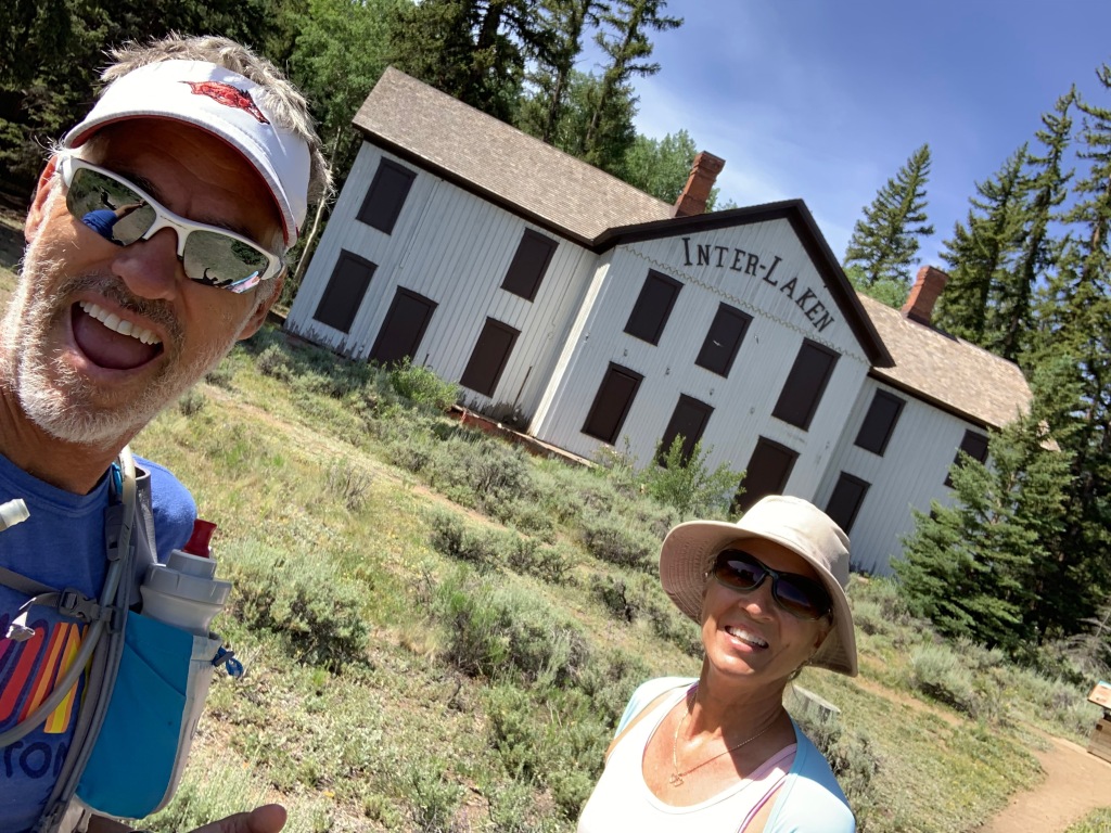
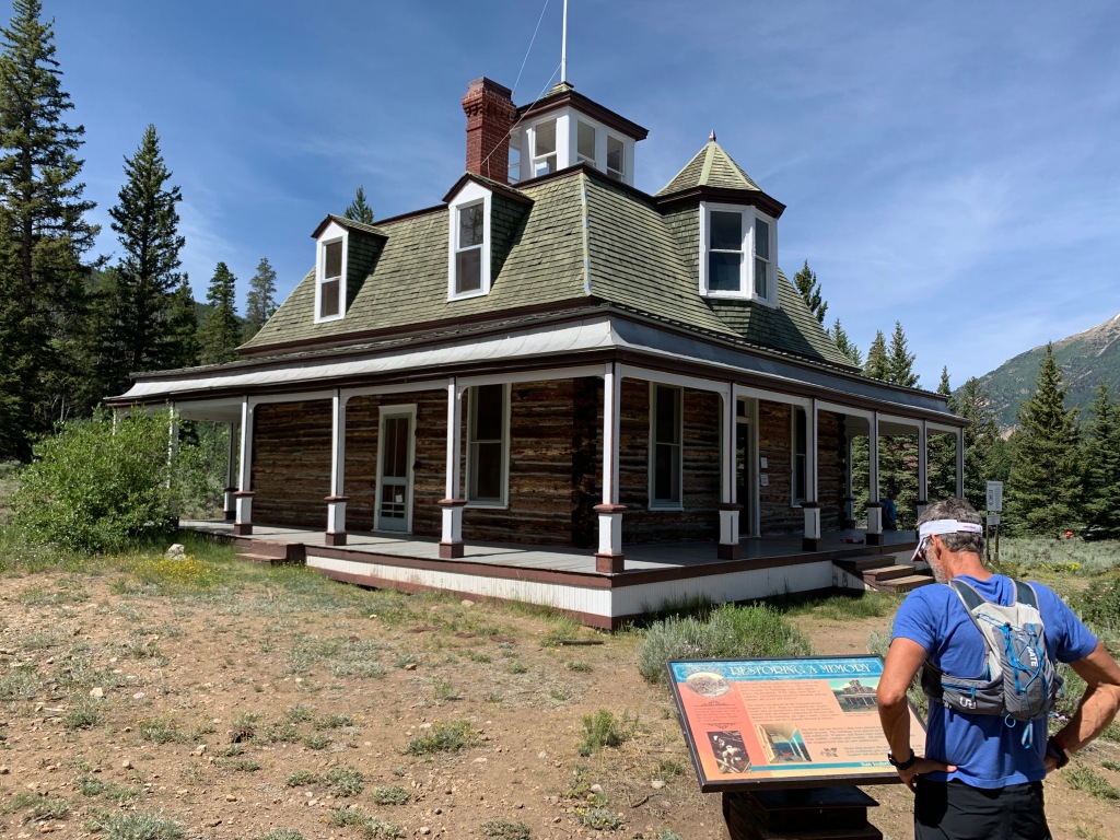
Today you can access Interlaken by hiking trails or boat.
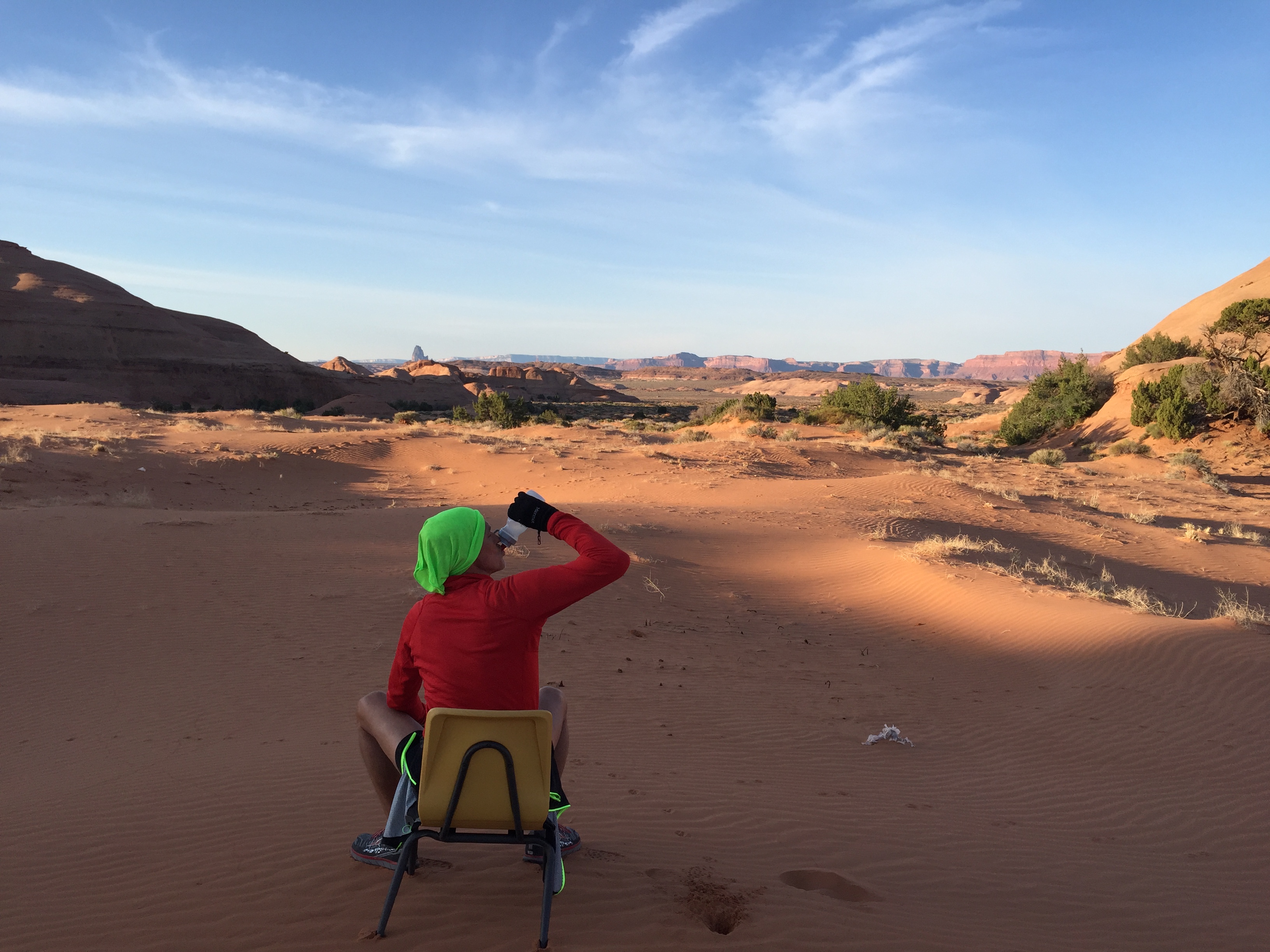
After three days at Lake Creek camping area we jumped in the truck to look for some connectivity and found the most amazing campsite of our 4-½ years on the road.
Twin Lakes View dispersed area is on top of a mountain on the north side of Twin Lakes. There are several areas to camp on this mountain and it’s VERY popular in the summer. Sites are plentiful…if you are small and nimble or tent camping. But larger rigs will find it challenging to find a level, accessible site that isn’t occupied.
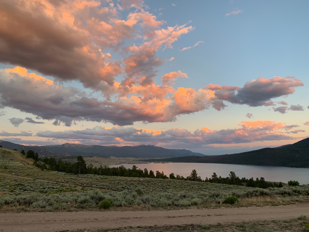
The day we were doing recon we took our camping chairs to hold a site in case we found one that would work for our big girl. As luck would have it a camper was packing up in an amazing site. So we left our chairs and raced back to relocate the RV.
WHAT. A. SPOT.
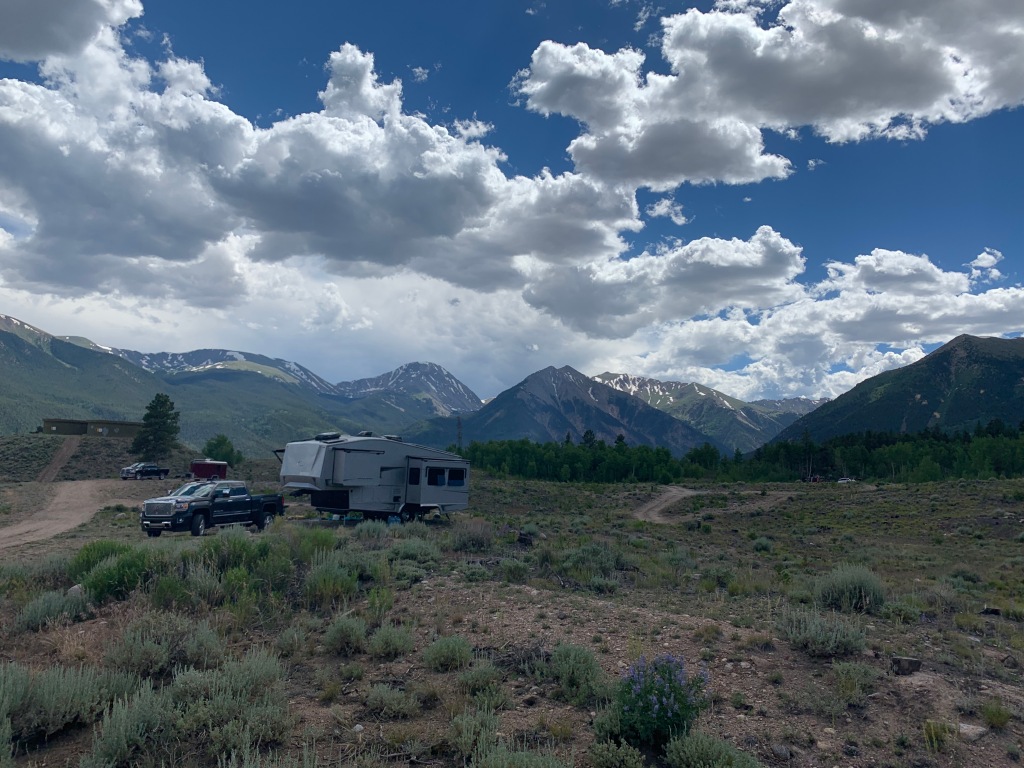
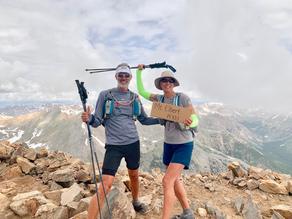
Not only did we have screaming fast Wi-Fi and stunning views, we were at the south trailhead for Mt. Elbert, the highest peak in Colorado.
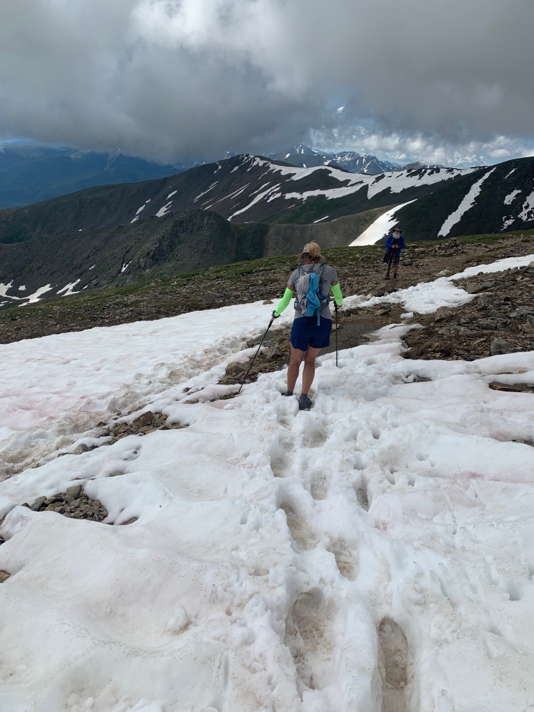
Mt. Elbert (the second highest peak in the continental US) was on our list of peaks to bag at 14,440’. This strenuous 11-mile round-trip hike starts at 9,800’ and climbs 4,600’ to the summit.
There is parking at the trailhead, but if you have a high clearance 4X4 vehicle you can knock off 2 miles by driving to the “Upper” trailhead.
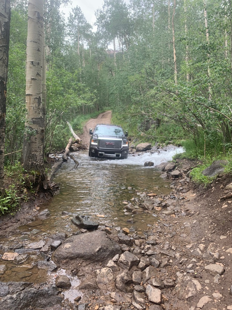
Getting to the upper trailhead was nerve racking, even in our GMC 2500 diesel 4X4 truck. Especially when we accidentally passed the trailhead taking ourselves about a mile too far down a sloppy, narrow, shear drop-off forestry road. Yikes!
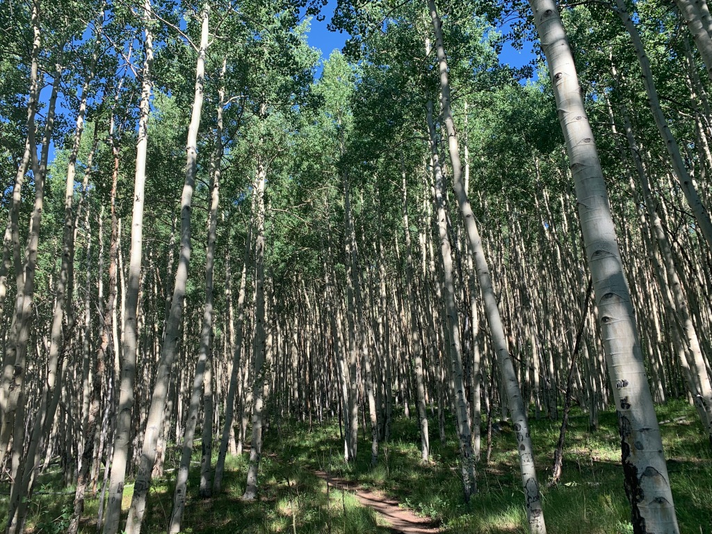
Hiking to Mt Elbert was much more enjoyable that Shavano. The trail was more gradual and less rocky, except for the last mile. Sections were so steep we used our hands in some areas to climb. We crossed snowfields and noticed that new trails are being cut in to make this climb a bit easier.
While camped at Twin Lakes we were situated just across the street from Mt Elbert Forebay. There is a lovely level 3-mile trail around the entire reservoir with an eagle’s nest on the southwest shoreline.
We loved everything about this location and can’t wait to get back there next summer!
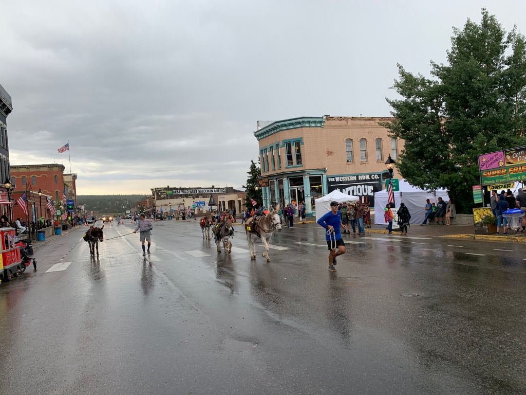
Leadville, CO (Elevation 10,152’)
As the highest incorporated city in the US, Leadville has a rich past in gold, silver, lead, zinc and molybdenum.
And if mining wasn’t enough it had its share of western characters as well.
Dock Holliday spent his lasts days served as a lawman in Leadville. Buffalo Bill died here of pneumonia. The Unsinkable Molly Brown moved to Leadville at the age of 18 and later survived the sinking of the Titanic. Poker Alice learned to play poker in Leadville and was a sought after dealer that liked smoking cigars while wearing pretty dresses.
Un-like a lot of mining towns out west that experienced boom and bust in the 1,800’s, Leadville actually managed to hang on to mining up until 1983, when the Climax Mine was finally closed.
In an attempt to save the town, the Leadville 100 trail run was started in 1983 to boost tourism.
The LT100 or “Race Across the Sky” has a cult following with thousands of irrational runners applying for 1600-ish slots to run a course with 15,600 feet of elevation change, at elevations ranging from 9,200-12,620 feet.
In most years, fewer than half who start the race actually complete it within the 30-hour time limit.
A LT100 MTB mountain bike race was added in 1994.
We showed up a week before the LT100 with the hopes of pacing our friend and “Leadville Legend”, Marge Hickman. Marge holds the woman’s record for number of Leadville finishes of fourteen.
Since being in Colorado this summer Jeff ran the entire Leadville 100 course in sections to train for his responsibilities as a pacer. But after Marge published a book about the start of this iconic race that differed from the current race director’s recollection, Marge was dismissed from the race.
Not to be deterred, Jeff jumped into the final 25 miles of the race to pace some random strangers and got a small taste of this iconic race.
We absolutely loved the little town of Leadville and it’s sporty vibe. It’s another place we would like to return to in the future.
Lake Tahoe (Elevation: 6,225’)
After Leadville we allowed ourselves 6 weeks to meander to Southern California for our camp host position at Doheny State Beach at Dana Point, CA.
We raced across western Colorado into Utah in the heat of summer, so we opted to stay at RV parks in order to run the air conditioner.
We made a quick stop in Reno to pick up some new Battle Born lithium batteries on our way to northern California to camp for 2 weeks at Jeff’s sisters house. Our plan was to accomplish two things. Install the new batteries and have the fifth wheels axels aligned at All Wheel in Redding CA.
It’s always a joy to stay at Jeff’s sisters, especially since they have plentiful tools, 50amp service, fresh eggs, blueberries and two Airedales.
Once we had our projects done we headed to the South end of Lake Tahoe for the Tahoe 100k.
Last year Jeff competed in this race and missed a cut off, giving him a DNF for the race. He redeemed himself this year completing this race in 17hours.
Mt Whitney (14,505’)
Two years ago I had a failed attempted of summiting Mt Whitney, the highest peak in the lower 48 and the highest peak in California.
It was a painful lesson in preparation, especially when I had to turn around within 1 ½ mile of the summit.
Since we were passing through the Alabama hills on our way to SoCal I decided to give this beast another shot…pending my ability to snag a permit.
We had left Tahoe early the next morning after Jeff’s race and put in a long day of driving to Lone Pine, CA. Planning a 4-day stay, I had hoped for a couple days rest in preparation to attempt to summit.
Plan A
I had borrowed a tent from a friend and planned to hike the 22-mile round trip with 6,100’ of elevation gain in two days. The first day start a leisure morning and hike 6-miles to Trail Camp, relax, eat and sleep, then head for the summit early the next morning, turn around and hike all the way back down.
Painful lesson #2 in preparation to summit Mt. Whitney…check your equipment well in advance of said hike!
The awesome lightweight tent I had borrowed only included the rain flap… but no tent. YEP! No tent.
Plan B
Forget the tent and camp out and leave on the hike at 3am to summit in one day. Once I got my brain wrapped around a 13-14hr hike I was all in.
But after checking on-line for a permit our first day in Lone Pine there was only one permit available…as long as I could start my hike by midnight…that night.
Plan C
Drive up to Whitney Portal after dinner, sleep in the truck for a few hours then start my hike at 11:59pm and summit in one day.
Next post…Mt. Whitney. Why do you hate me so?
Arkansas to California
Posted by Deb in Boondocking, Borrego Springs, Full Time RV, Trail Run on October 21, 2018

After leaving the comforts of our cabin in Arkansas we pointed the RV west. Lingering half the year in the mid-west was nice, but we were ready to get the RV rolling back to the land of eternal sunshine and bug-free living.
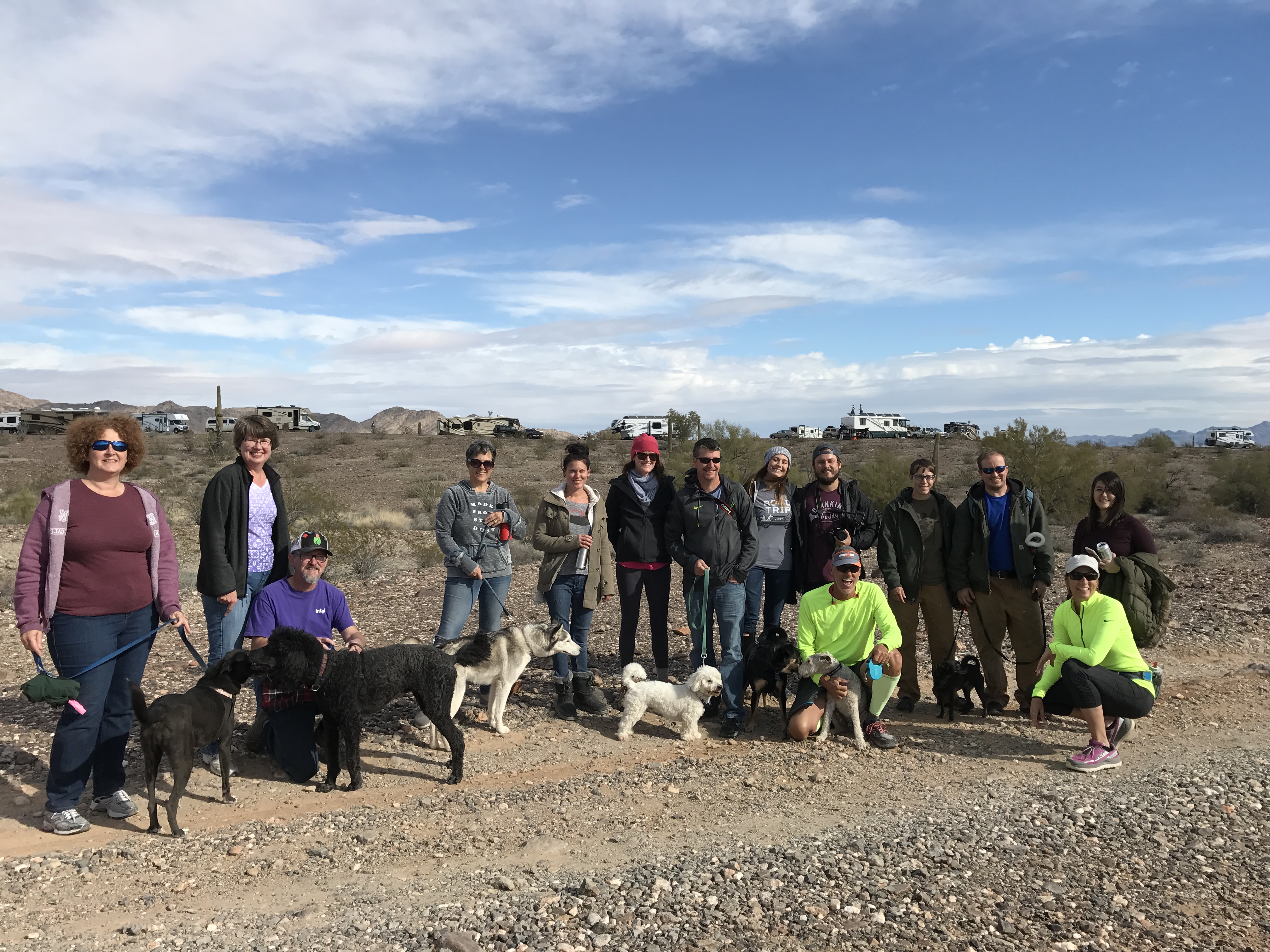
We were making the annual trek to Quartzsite for the big show. The difference this year over the last 3 was that we did not work a booth. Instead of a selling event, we were having a consumer insights event with 13 of Dometic’s engineers, product developers, and customer intercepts. It was a nice change roaming the desert talking to folks rather than being stuck in the booth for 9 days.
After Q we followed our Xscapers RV club to American Girl Mine just outside of Yuma. This is one of our favorite camping locations for the beautiful sunsets and endless trail running options. It’s nice being with a group sometimes because we learned of a few new things to explore. One was a local mine shaft that you can hike into quite far. With a pool at the bottom, it makes for an interesting underground destination. We didn’t actually make it to the mine shaft this trip, but look forward to going next time we camp there.
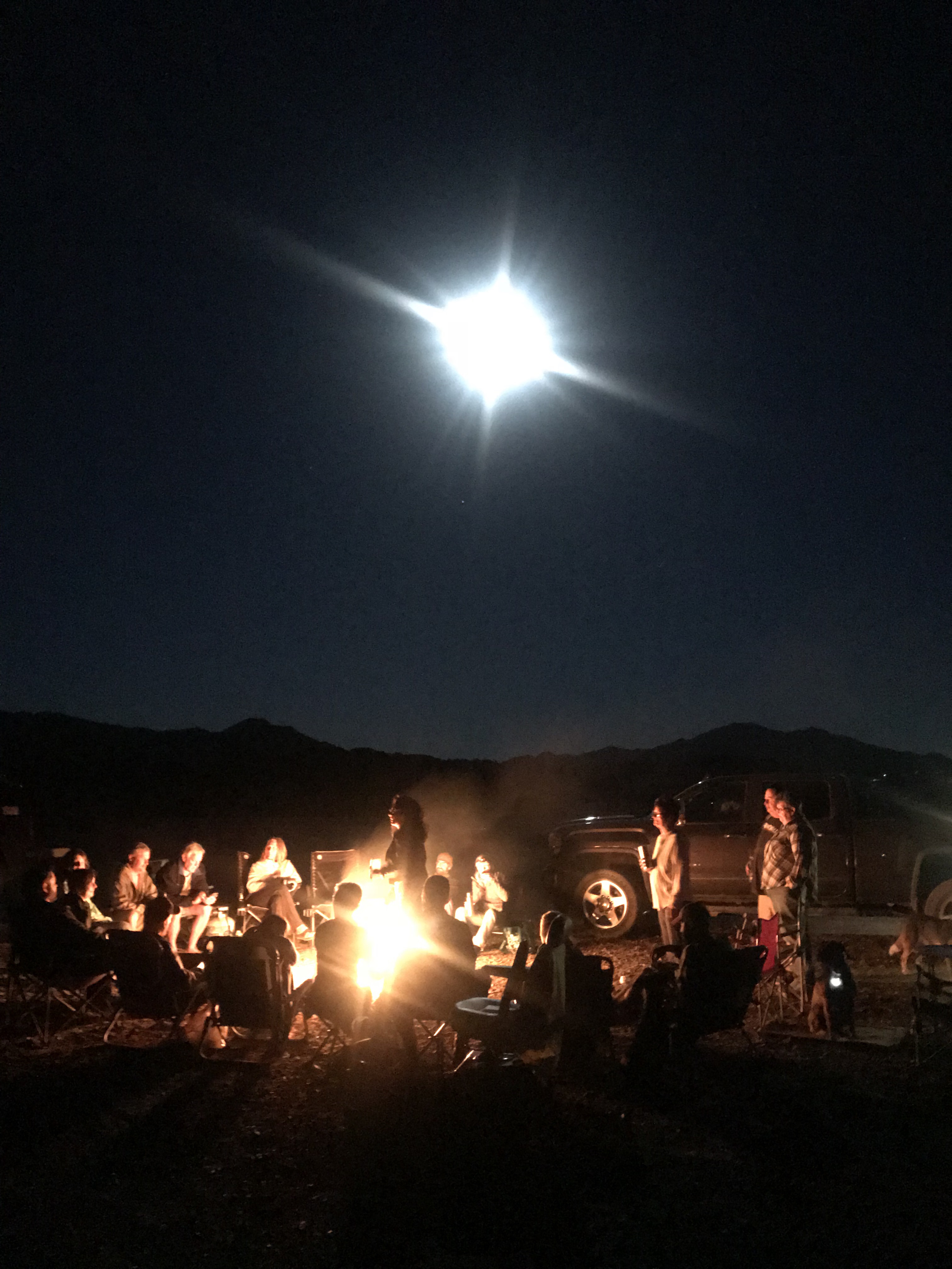
Xscaper friends enjoying a campfire and full moon
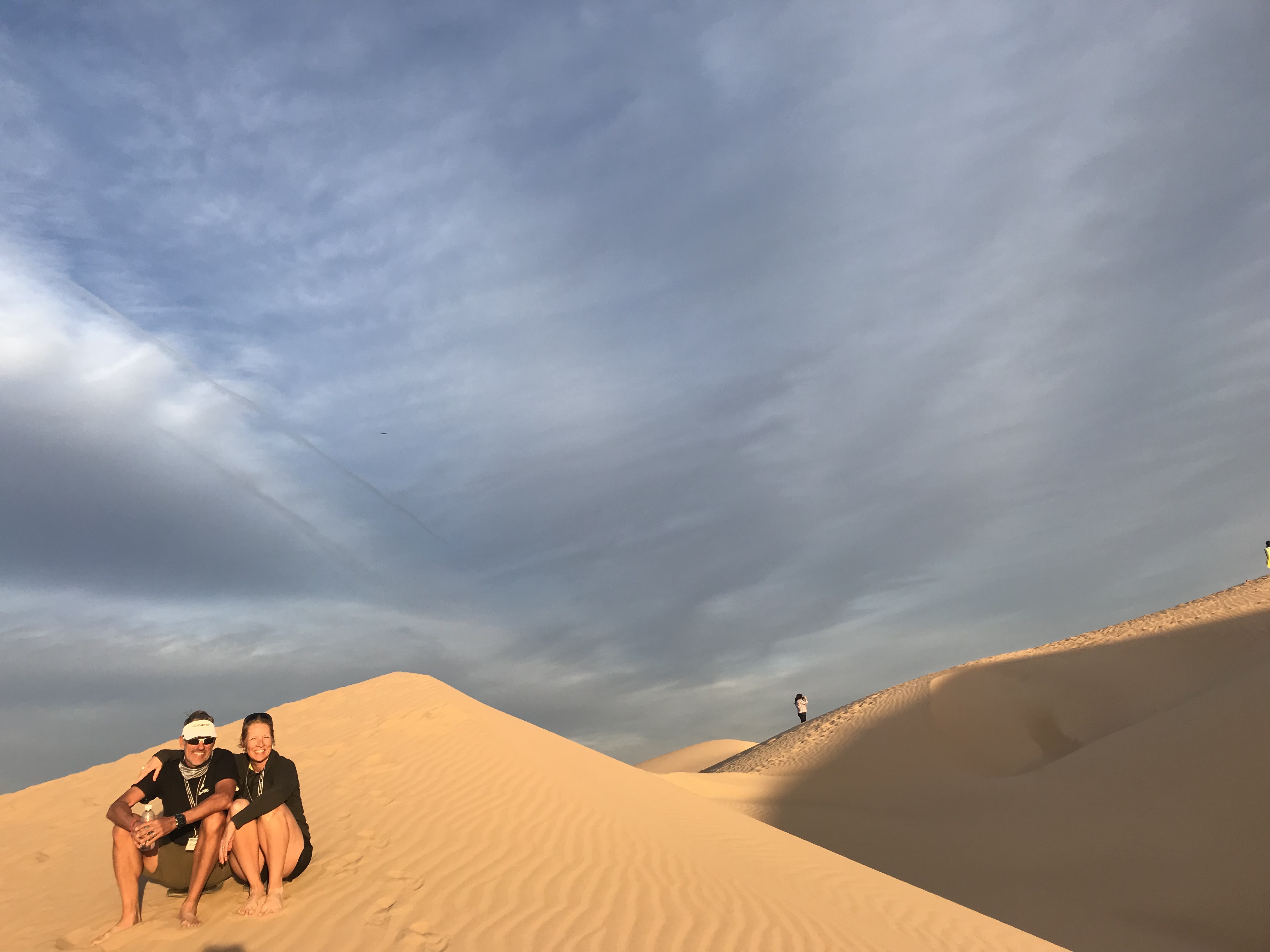
Imperial Sand Dunes
The other fun destination was the Imperial Sand Dunes just 4 miles from camp. The Dunes are such a striking contrast to the scrub and rugged landscape of AGM. It’s as if we landed in Egypt minus the camels. Mountains of sand smoothed and rippled by the wind as far as the eye can see. It is an ATV lovers dream location for off-road anything in designated areas. And then there are those who ride the dunes on sleds and snowboards for additional excitement.
I highly recommend stopping for this destination at sunset!
We pulled out of AGM to make our way to Southern California. We had a scheduled photo shoot for Dometic and needed to scout locations for video and photography and secure RV’s and boats.
We purposed to stop at Borrego Springs for a few nights on a friend’s RV lot. The last time we were here was 3 years ago during Soup Anarchy watching movies on the side of Technomadia’s bus in the desert!
Gosh, what a fun time that was! This was much more low key and quiet compared to our previous trip and we enjoyed the solitude of our location. We were within running distance of the trails at Borrego Palm Canyon Campground to trail run.
If you ever come to Borrego Springs be sure to check out the desert art!
Nice to have friends with RV lots
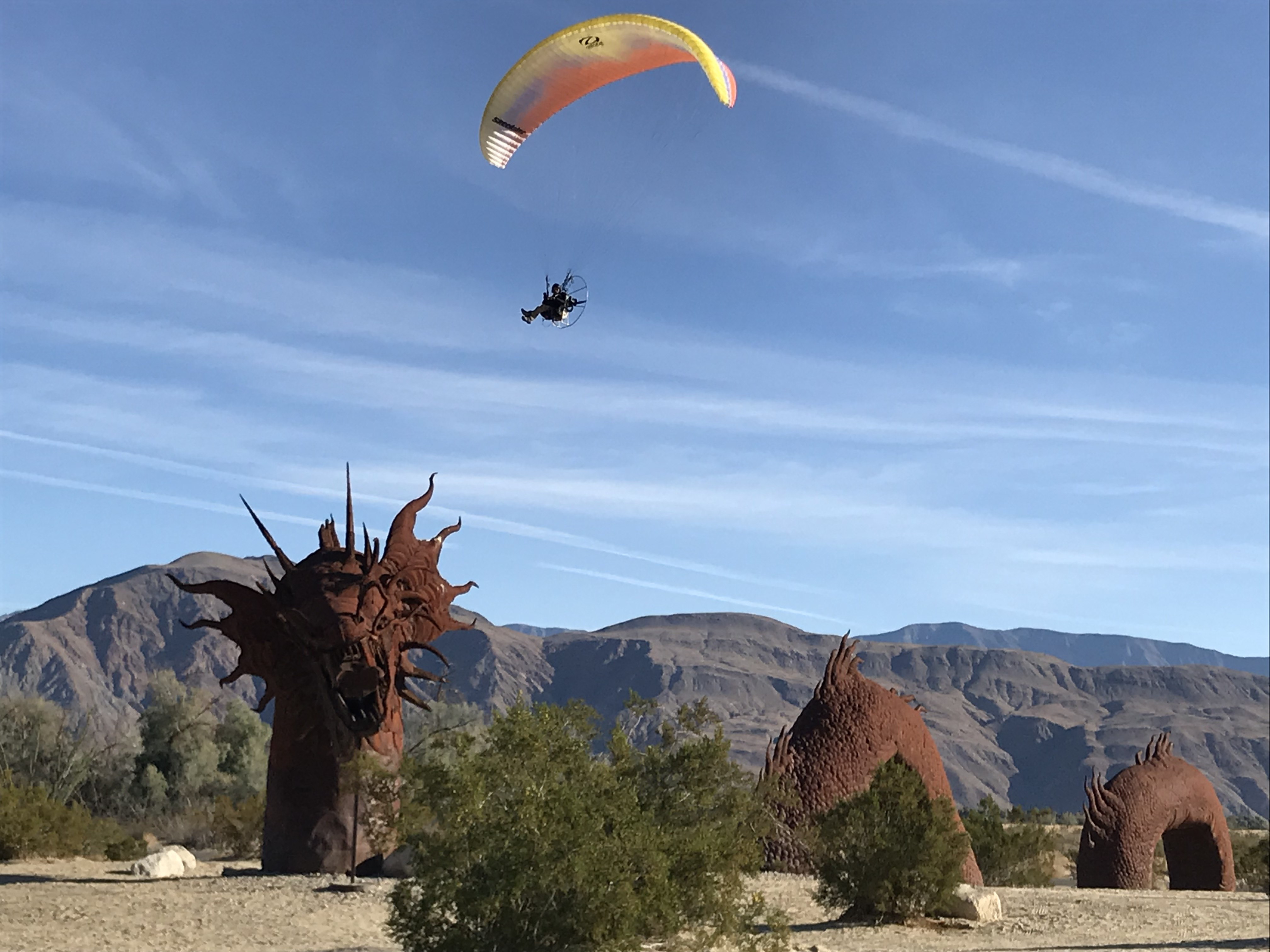
RICARDO BRECEDA SCULPTURES
We would have loved to stay longer but we really needed to get closer to the coast.
I had been researching RV Parks along the coast since we needed to park for about a month. Jeff and I had some air travel scheduled mixed in with our coastal scouting and we like to leave the rig plugged in while we are away.
I was not prepared for the sticker shock of coastal living. Holy moly! The reasonably priced state parks were not available for a month stay; only offer dry camping or are too small to accommodate our size. While we were at American Girl Mine we met a couple that has a lot at the Escapees Jojoba (Ho-ho-ba) Hills RV Park in Temecula CA.
Since this location was “only” 70 miles from the coast and $40/night for full hookups or $7.50/night dry camping we decided to make it our home for the maximum 28-day limit.
Enormous campsite
BLM trails to run
Fabulous pool overlooking the valley
This is a STUNNING park beautifully maintained by lot owners. It’s your typical 55+ park with tons of activities, a pool overlooking the valley and pickleball courts. Just outside the gates is BLM with plenty of trails for hiking and running.
Temecula is known for its vineyards and old downtown nightlife. We met up with some friends and hit a couple of restaurants during our stay. We really enjoyed this community and Jojoba Hills offers affordable living for those who want to live the SoCal life.
We made several trips to Dana Point, Newport Beach, Balboa Island, and Oceanside. My plan of making quick trips over to the coast was delusional, to say the least. The traffic was insane, turning our 70 miles into 3 hours (6 hours round-trip). It didn’t matter if we left early or returned late the traffic was a consistent gridlock of red taillights.
Despite the painful drives we did see beautiful coastal settings and ate great seafood.
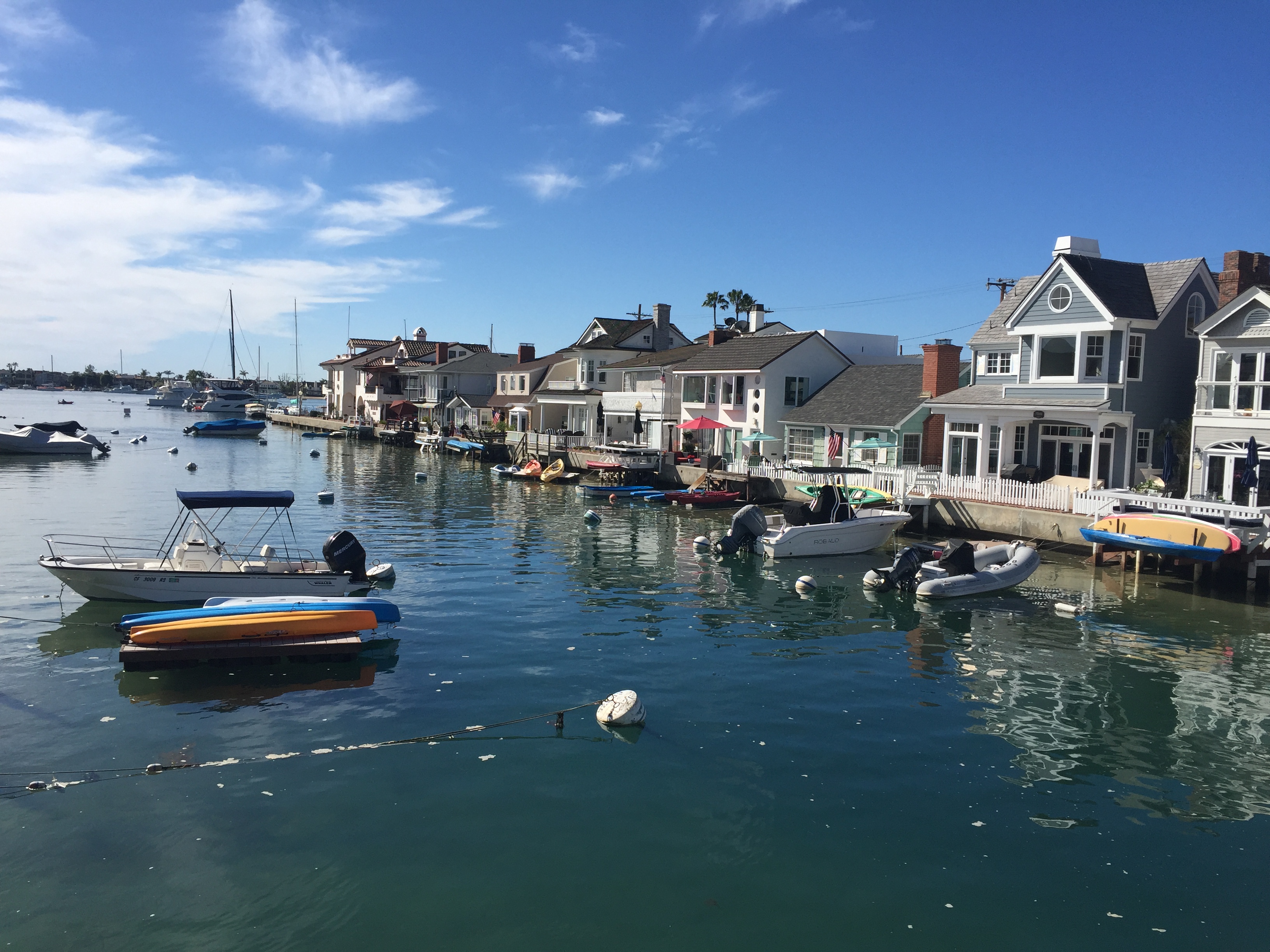
Balboa Island…Quaint but VERY EXPENSIVE!
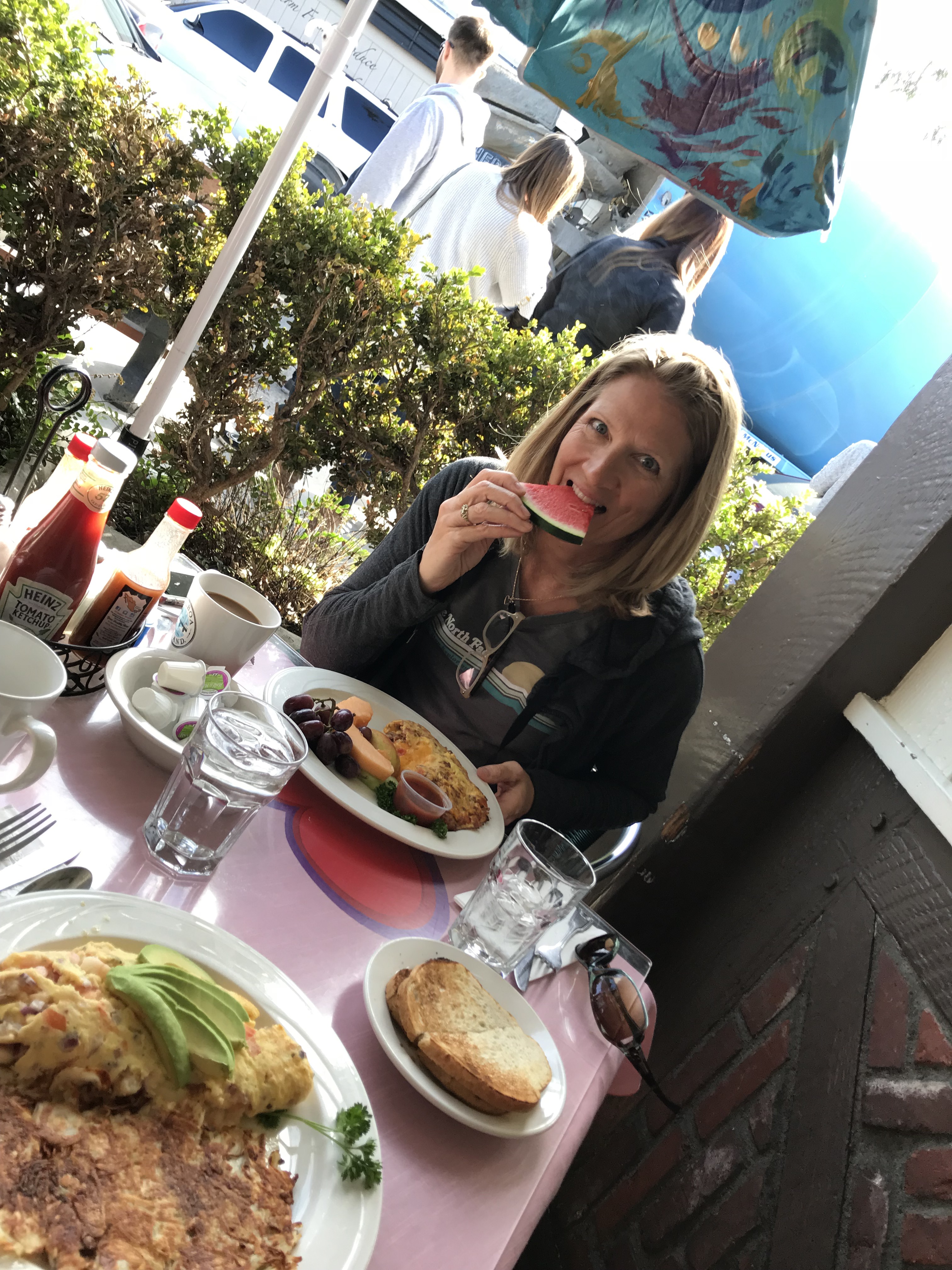
Breakfast outside in February
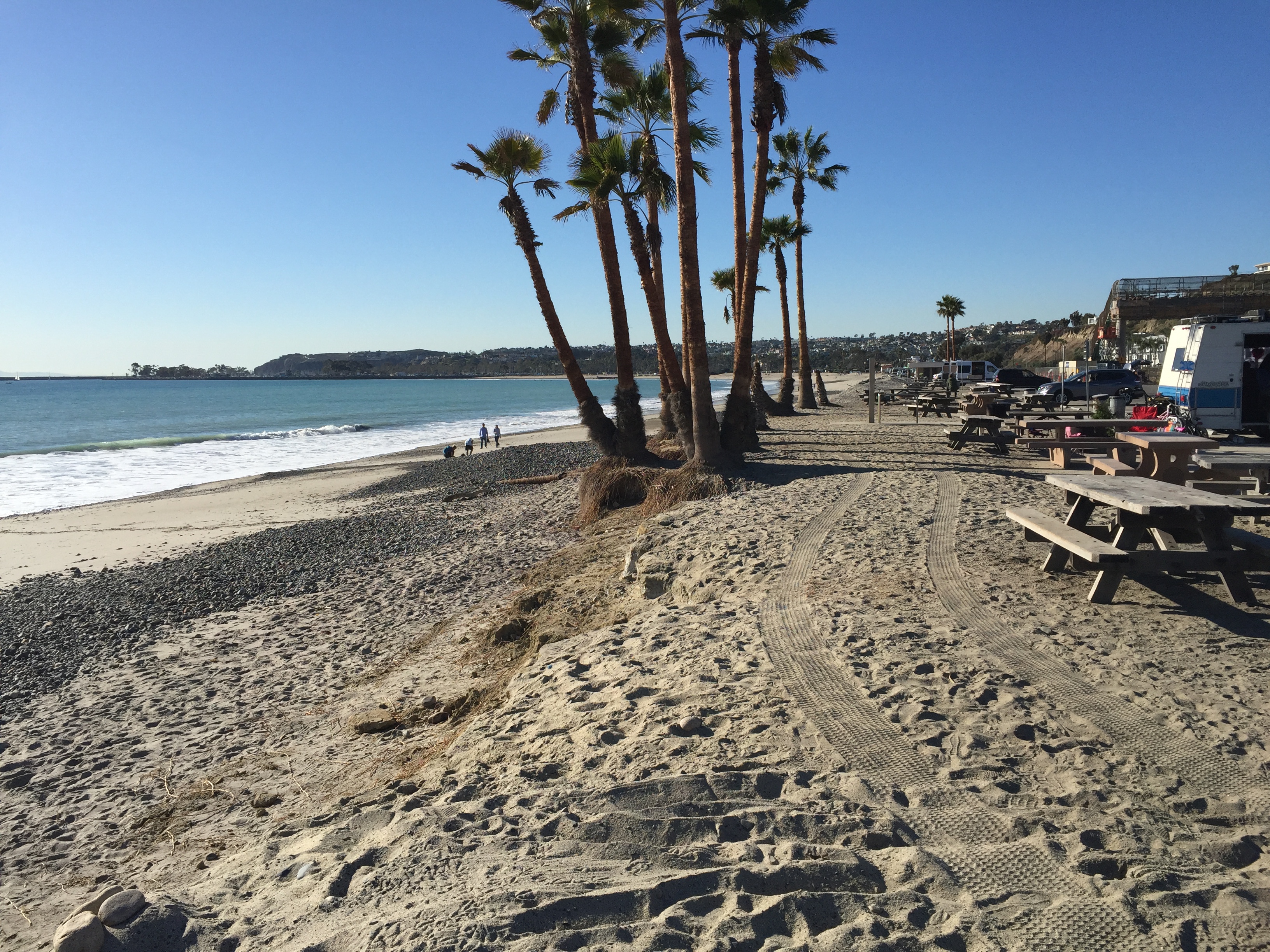
Dana Point
One of the side trips we needed to make was the RV Entrepreneur Summit in Austin TX. We went on behalf of Dometic but we also wanted to attend for ourselves. We rented a park model cabin at the Jellystone RV Park and sat in on many seminars. The speakers were outstanding and we made a lot of new friends.
I flew back to LA while Jeff stayed in Austin for another week. One of Jeff’s goals has been to qualify for the Boston Marathon. There happened to be a qualifying race in Houston… The Woodlands Marathon. He has been getting coaching from a friend and was as prepared as I have ever seen him. He had an awesome race and beat the age group qualifying time by 6 minutes. WE HAVE A BOSTON QUALIFIER IN THE HOUSE! However, even though he has a qualifying time it doesn’t mean he will get to run the race.
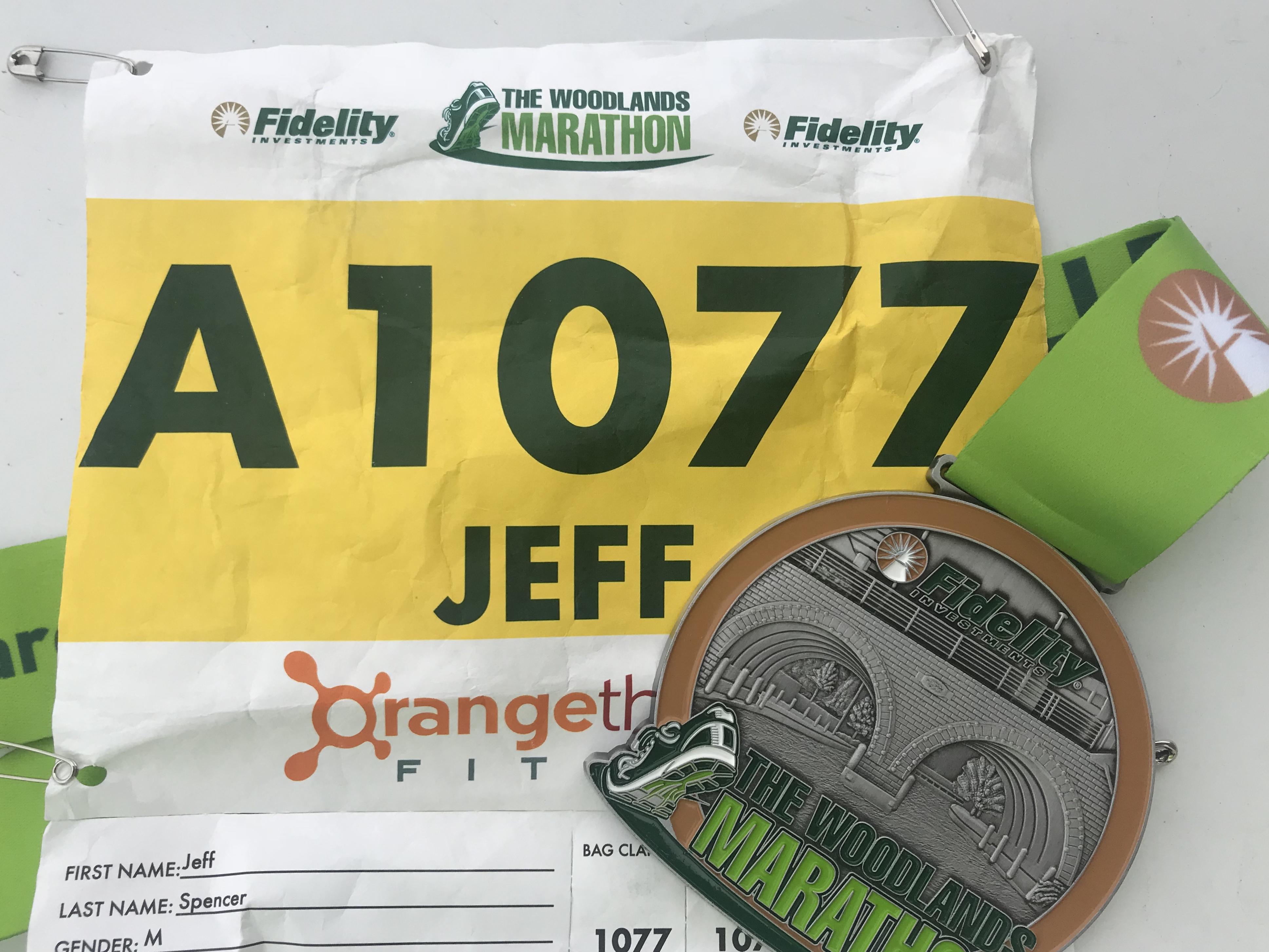
Since the number of “qualifiers” exceeds the number of available slots he will now be put in a pool by time. In the fall we will find out if he will actually receive a slot at the starting line in April 2019. (UPDATE: Jeff got a spot and is going to Boston!!!!)
After we were reunited back in Temecula we started to move around for the photo shoot. We hung out for a few days in Newport Beach at the VERY EXPENSIVE ($170/night…gasp) Newport Dunes RV Resort to meet up with the team from Sweden, France and Australia. Then we packed up and caravanned to Lone Pine, California.
The team getting instructions from our favorite Aussie
Getting the RV’s positioned
Lone Pine is where the Whitney Mountain Portal is to the highest peak in the lower 48. After my failed attempt (and Jeff’s success) to the summit a couple years ago that mountain has been looming in the back of my mind. For a brief moment, I considered making the attempt again on this trip since I now have backpacking equipment to break up the hike. But then I realized that it’s still winter on the mountain and I put my aspiration down for a nice cozy nap.
Its still snowing in those hills
The photo shoot went amazingly smooth in Lone Pine. This sleepy little town is home to some of the most photographed locations for old Westerns. Of course, the rub in this town is that it runs on small-town time. We needed grocery supplies to keep everyone fed, but the tiny grocery store had limited hours due to “new management”. There was no consistency, rime or reason to their hours and we were forced to drive an hour away just to pick up some supplies for a night shoot.
Sorry to put you through this Lone Pine!
Despite the strain we put on local restaurants with 12 of us showing up at once, we ended up with some very successful shots.
After 5 days we headed back to Newport Beach to transition to the marine shots. While the team went out on a yacht, Jeff and I spent the day on land returning the borrowed RV’s and catching our breath. Our final day of shooting was at Dohaney State Beach area at Dana Point using our personal RV.
The team heading out for a day of shooting
Jeff and I kicking up our feet to catch our breath
While there, a ranger stopped by our RV and wanted to take a picture of it. He and Jeff got to talking and the ranger offered us a Camp Hosting position at Dohaney State Beach Campground the end of this year. We ended up camping for 3 nights at this park right on the beach and spoke with the current camp hosts for the down and dirty of the job.
After learning that the job only entails checking sites for proper permits and selling firewood for 15-20 hrs a week we decided to commit to hosting for October, November and December. We get a free full hook up site, surfing right from the park and no cleaning of bathrooms!
What’s funny is that I’ve wanted to try workamping but Jeff has been less than enthusiastic about the possibility. What I’ve learned is that he is more than exuberant if you mention surfing. Throw in a great Pacific Coast Trail that runs along the beach just outside your door and you’ve got yourself a winning combination for an “all in”, “why haven’t you suggested this before”, “sign me up on the spot” excitement! I should have thought of that sooner.
Until then we have a lot more travel planned, including a trip back to Arkansas. Stay tuned for another sweltering humidity, bug-filled summer of fun!
Adventures in Car Camping
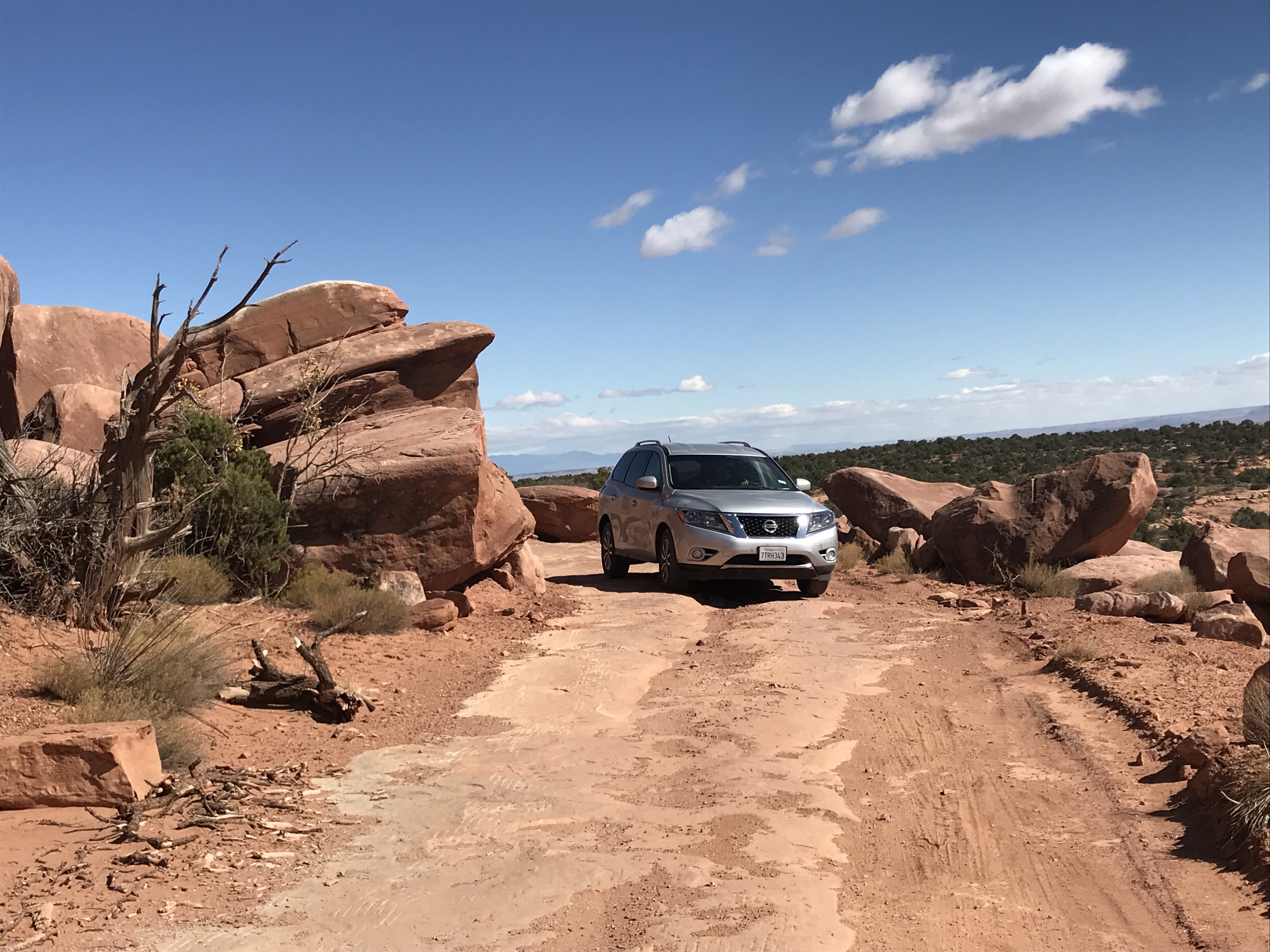
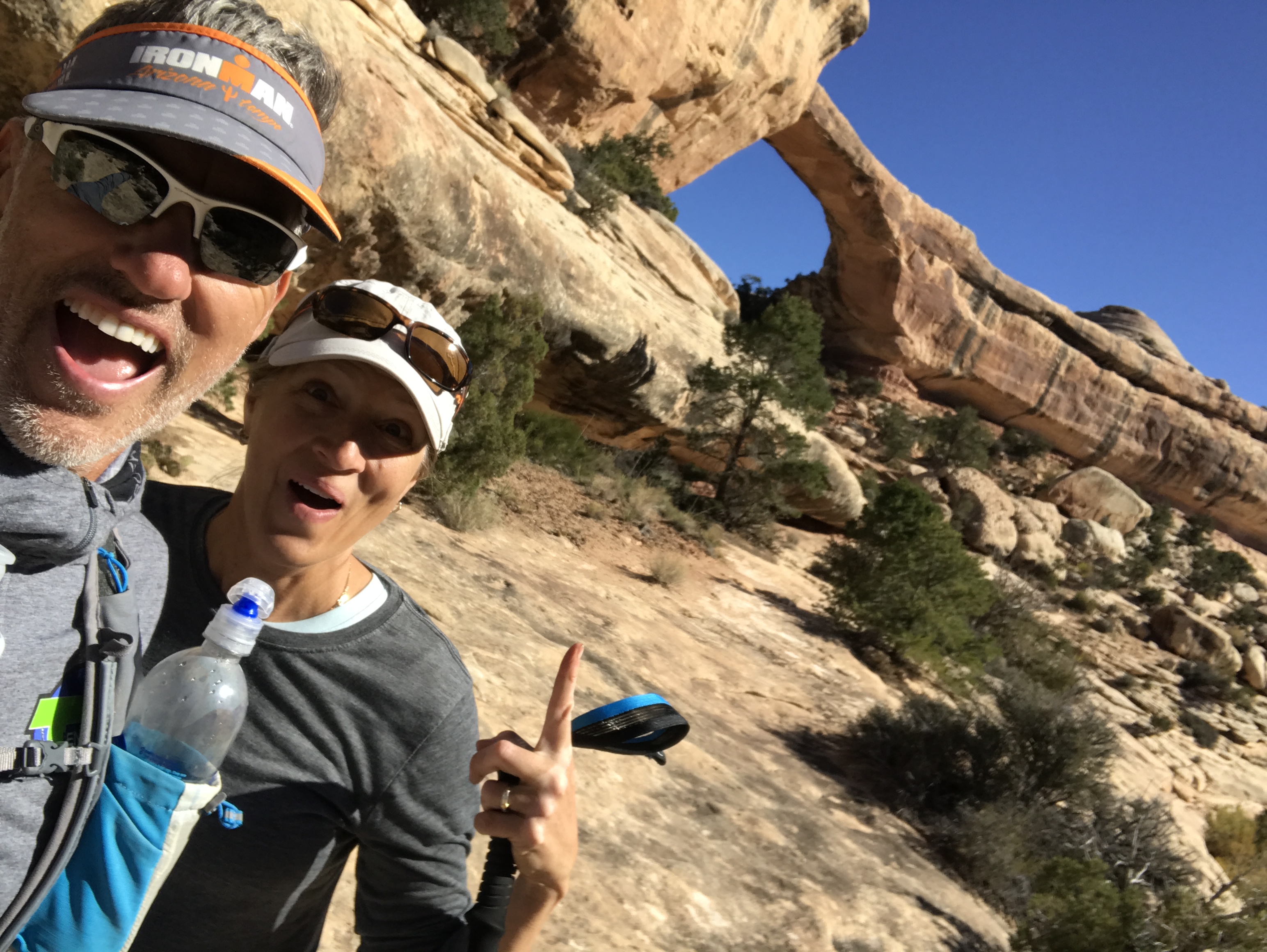
Posted by Deb in Boondocking, Full Time RV, Hiking, Moab, Running, Trail Run, Ultra Running, Utah on January 1, 2018
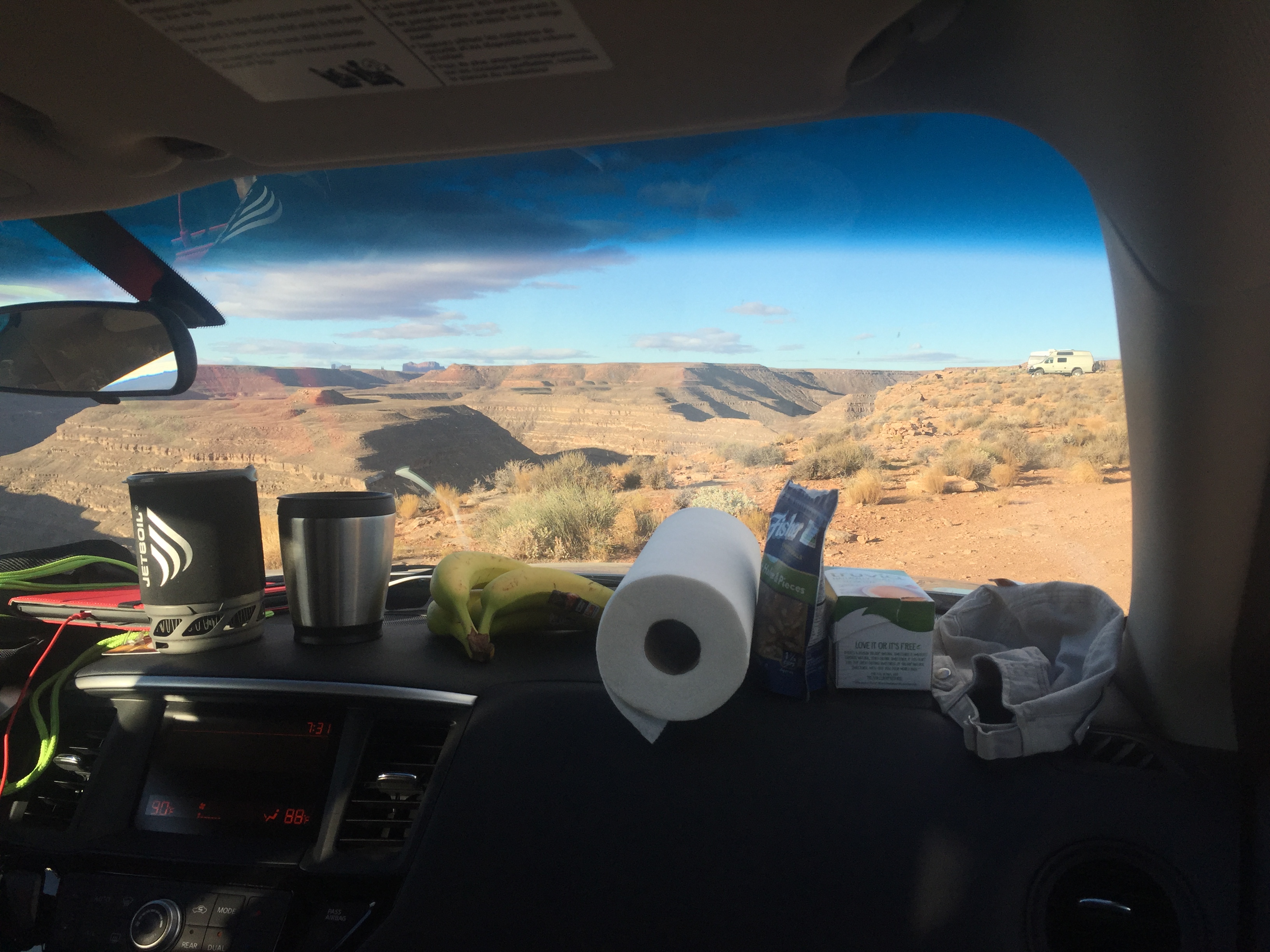
Dashboard Kitchen
After finishing our backpacking trip to Havasupai Falls here and here we planned an additional six days to car camp in Southern Utah.
Since we had purchased all this camping gear for the falls we decided to give car camping a try instead of getting hotels. And after sleeping on a picnic table for 3 nights, the car felt like a five star hotel (she laughs hysterically)!
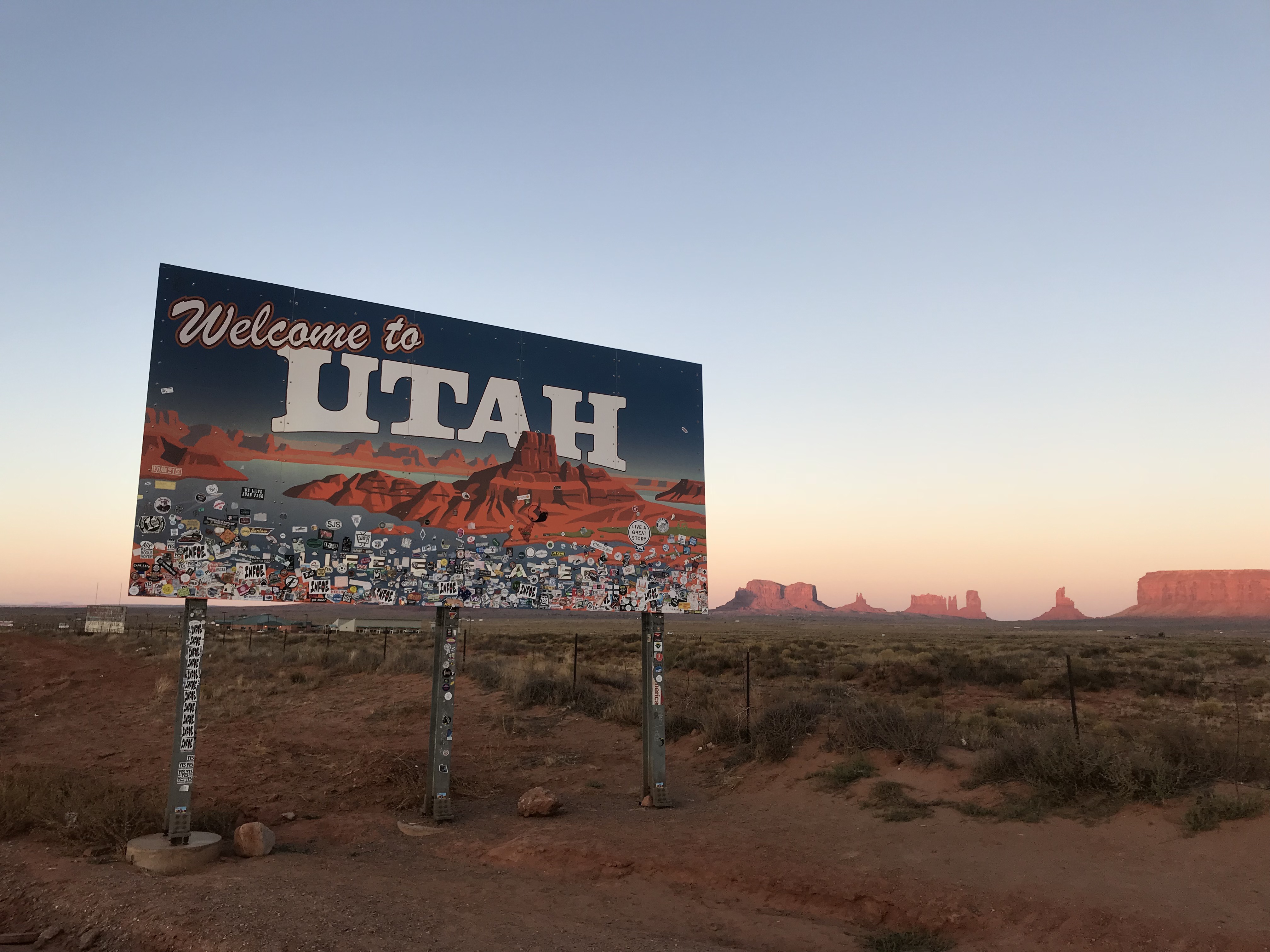
Welcome Back to Utah
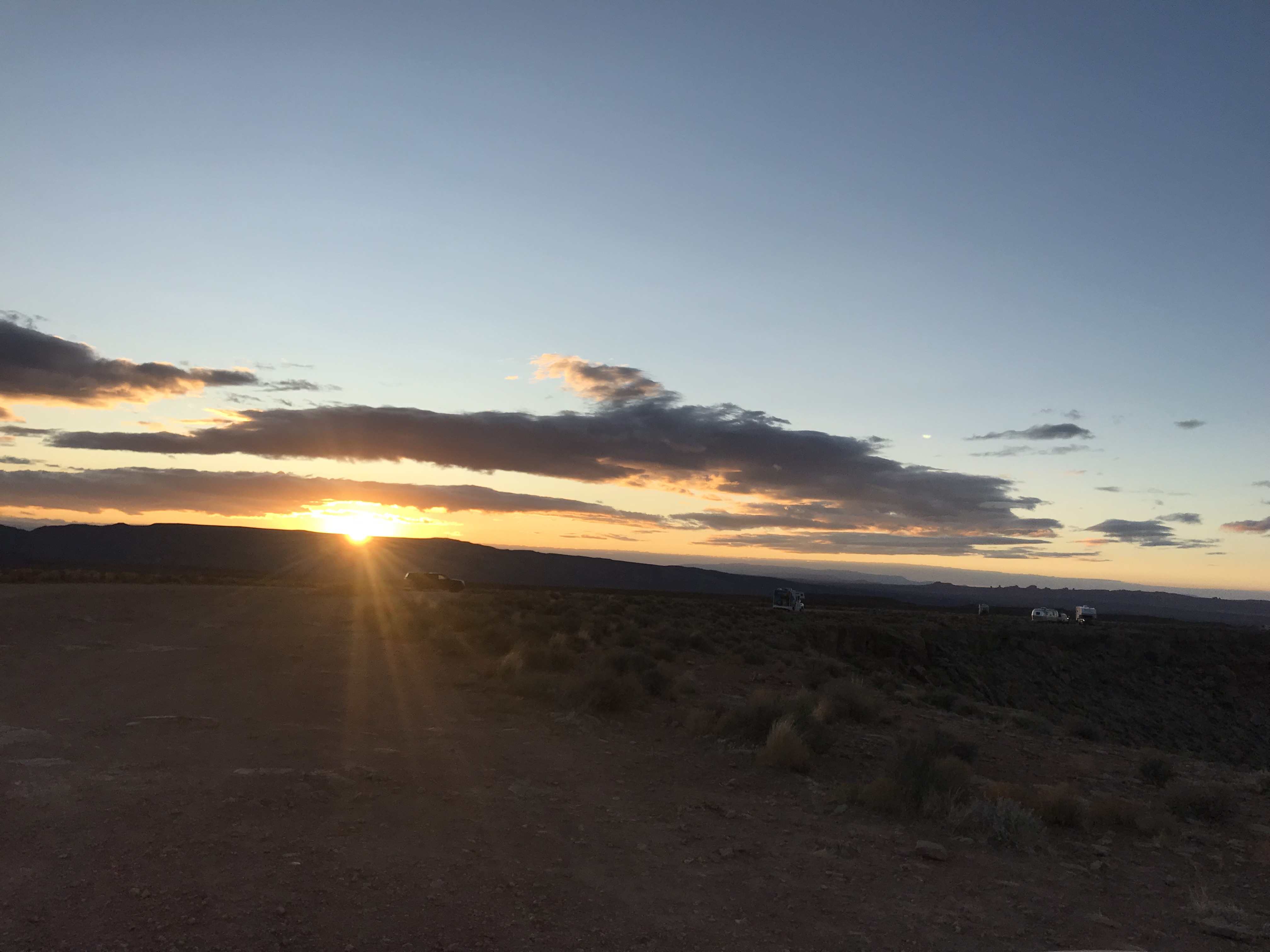
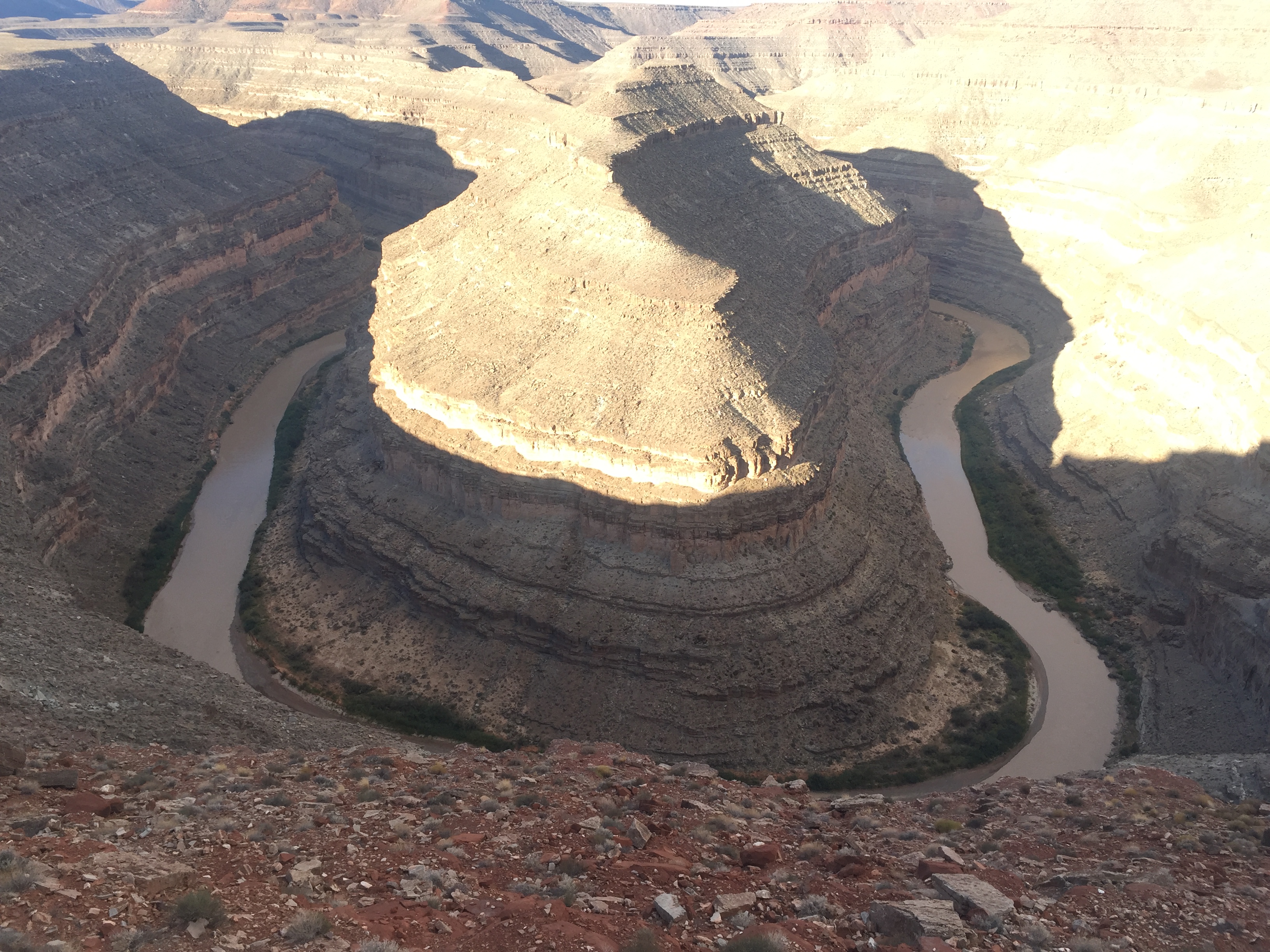
We drove from Havasu Falls trailhead past monument valley to find a nice campsite on the rim of Gooseneck State Park. The sun was going down by the time we got there and the temps were a very comfortable 70-ish. We set up our camp mattresses and sleeping bags in the back of our Nissan Pathfinder and left the tailgate open for ventilation.
It was such a beautiful night and the stars were fully visible with the lack of city lights. The rim of Gooseneck is barren rocky land completely void of any scrub or trees, which translates to magnificent sunset viewing. We set up our camp stove on the picnic table and kicked off our sandals just outside the tailgate and piled into the back of the SUV for a great night sleep under the stars.
Camping along the rim
Car camping was pretty awesome…until about midnight.
I woke to some jostling of the car and the gritty taste of dirt and sand in my mouth. When I finally came too I realized that we were in the middle of a windstorm that had kicked up so much grit in the air that the clear full moon from two hours earlier was a blurred hazy glow.
I had to jump out of the car to shut the tailgate but my sandals were nowhere to be found. I got the gate down and climbed into the side door to find our sleeping bags covered in sand. By now Jeff had barely woken up and wanted to know what I was doing. I swear that guy could sleep through a parade of fireworks.
I settled back in and asked Jeff if there was anything else left outside. When he said that the Jetboil was out on the picnic table, all I could see was hundred dollar bills flying over the edge of the canyon.
The wind was so fierce that I could hardly get the car door open to retrieve the camp stove and to look for both sets of sandals…all of which were teetering on the edge of oblivion. One more little puff and we would have been shoe & coffee-less the rest of the trip.
Has anyone seen my sandals?
The temperatures were dropping quickly and I forced the car door back open to crawl back into my grit filled sleeping bag. A challenge for a 6’ tall gal with back problems. The car was being battered by the wind. The decline of the rear seats that we were sleeping on made it feel like we were angled down hill. All I could think about was rolling right over the edge of Gooseneck and crashing to a firry death in our rental car. Our remains permanently entombed in the canyon and memorialized with a jetfoil tombstone.
After surviving the night, we woke to 31 degrees. Jeff started the car to get the heater going. The wind had settled down a bit and we made coffee while I shared the story about how we barely survived being lifted in midair by the wind and discarded in the Land of Oz. If it weren’t for our rubber sandals that had wedged under the tires we would surely have been lost forever! (Jeff inserts eye roll here)
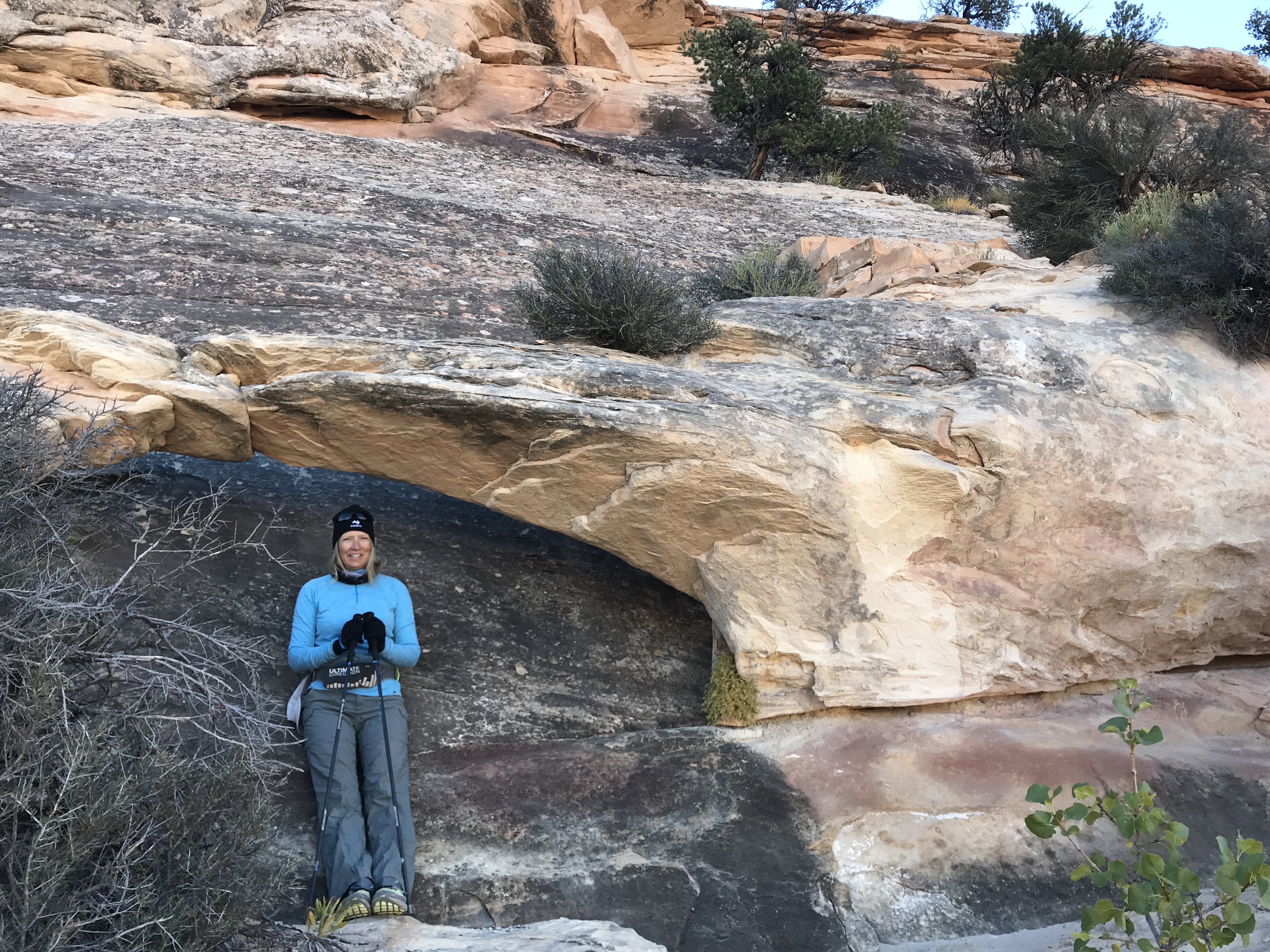
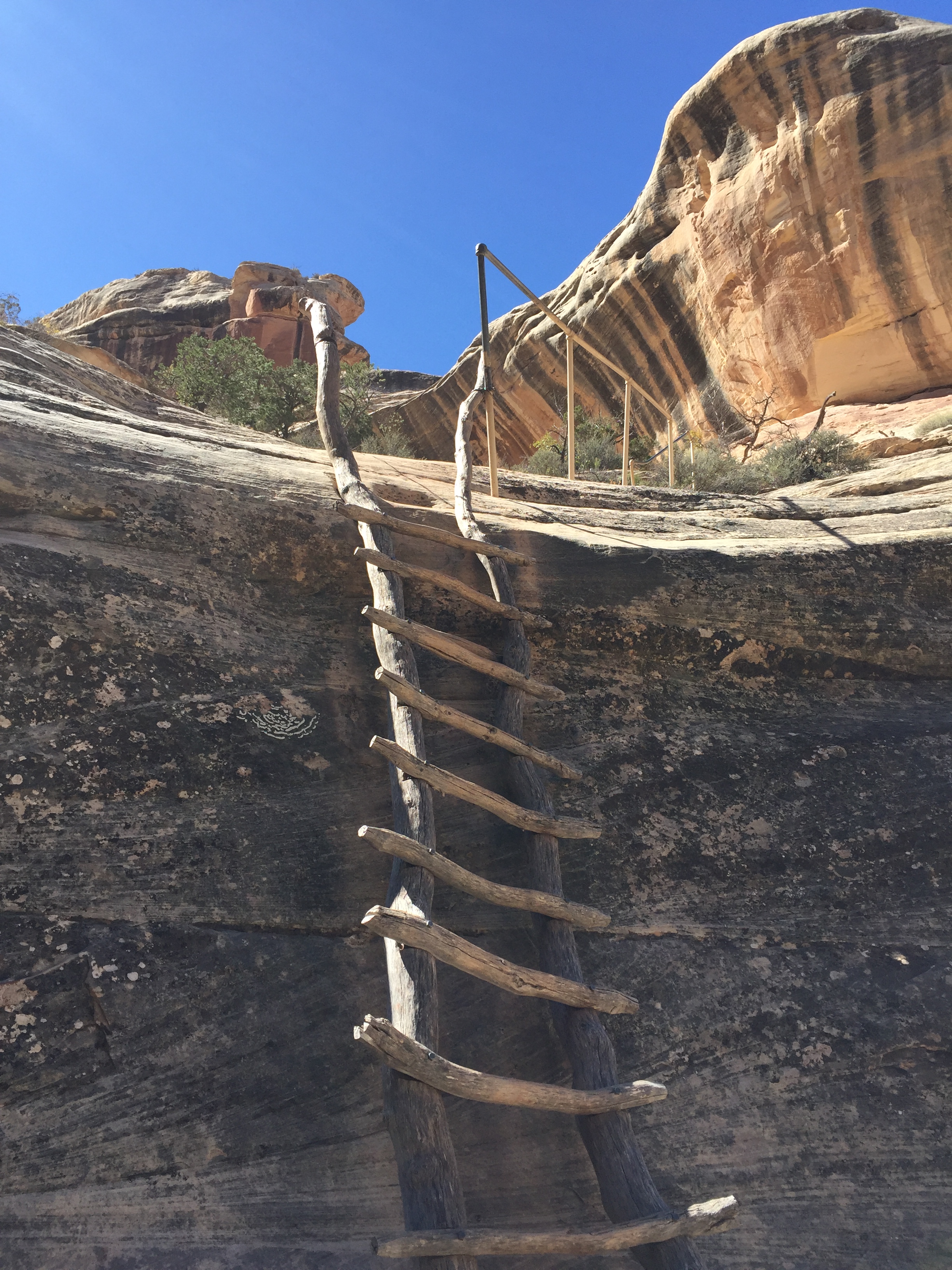
We would have done some hiking here but we wanted to reach the Kane Gulch Visitor Center just as they opened. We had read about several Anasazi cliff dwellings in Cedar Mesa and wanted to get more information about a hike to Moon House.
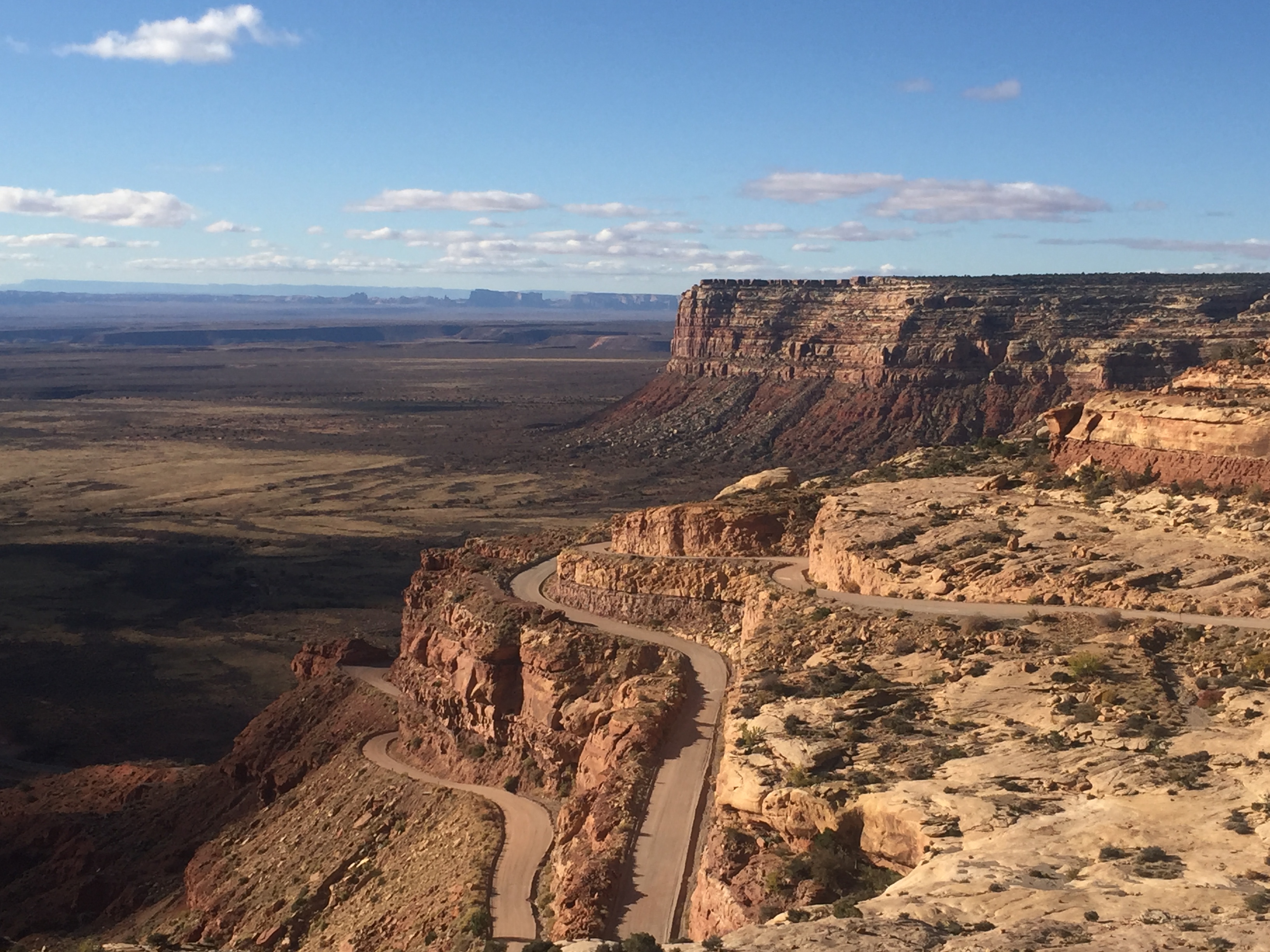
The stunning Trail of the Ancients Road
Moon House is a multi-room cliff dwelling named for its celestial pictograph depicting the moon in its different phases. It dates to the early 1200’s and is limited to 20 visitors per day via a first come permit system. It’s a rare cliff dwelling as you are allowed access to some interior rooms. Special instructions are given with the permit on how to enter the rooms without damaging the structures.
With permit in hand we headed towards McCloyd Canyon. We traveled about 8 miles down Snow Flat Road, a rough dirt road over rock slabs and rutted sections of sand and dirt. It was slow going and we were glad we had an all-wheel-drive SUV to get to the Trailhead parking area.
We started our hike and headed north on another road. After a mile we came a second parking area at the Moon House trailhead. Getting to this parking lot requires a true 4-wheel drive vehicle and we were glad we didn’t attempt it in our rental.
We are heading down there
One giant step for mankind
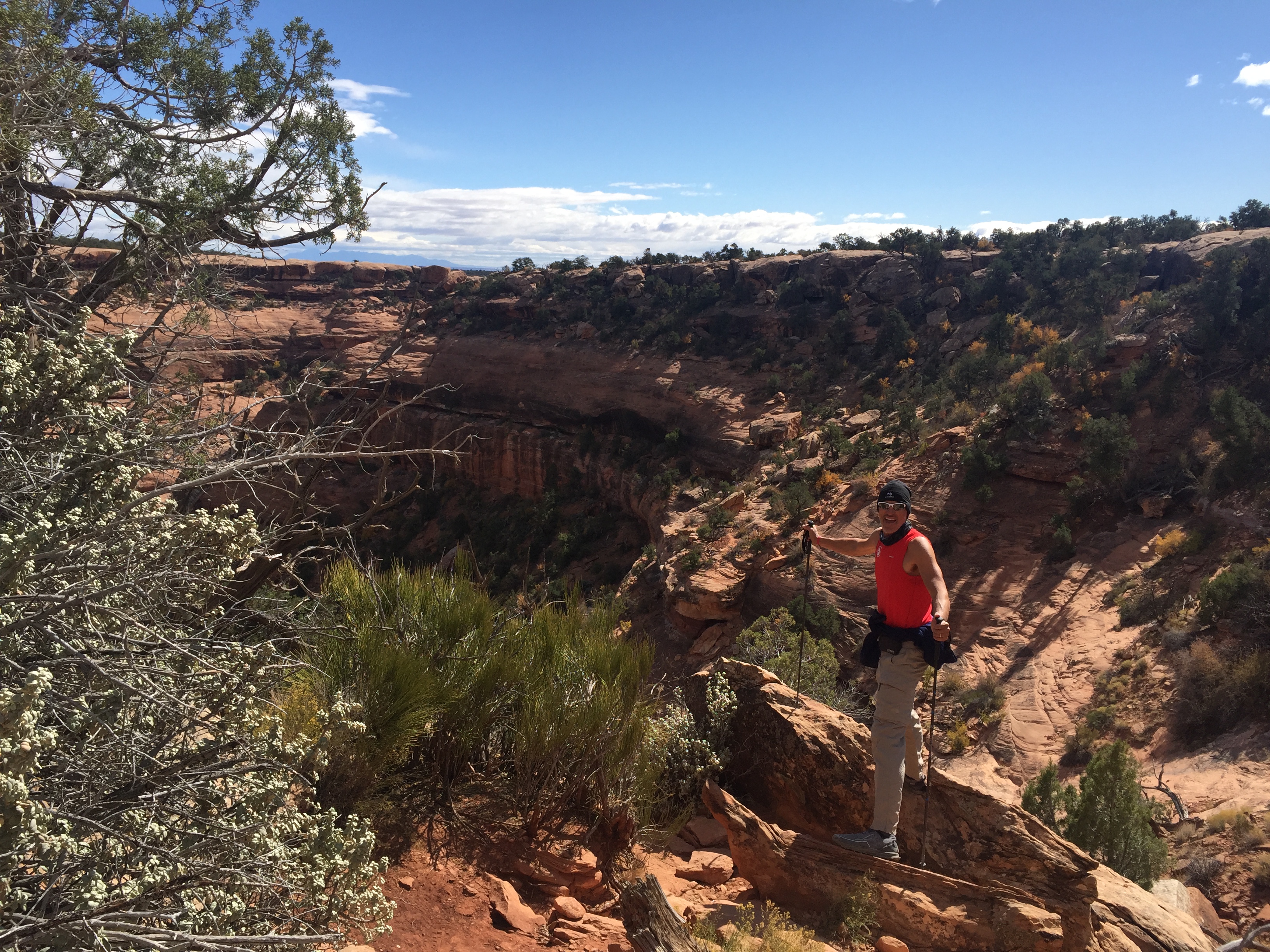
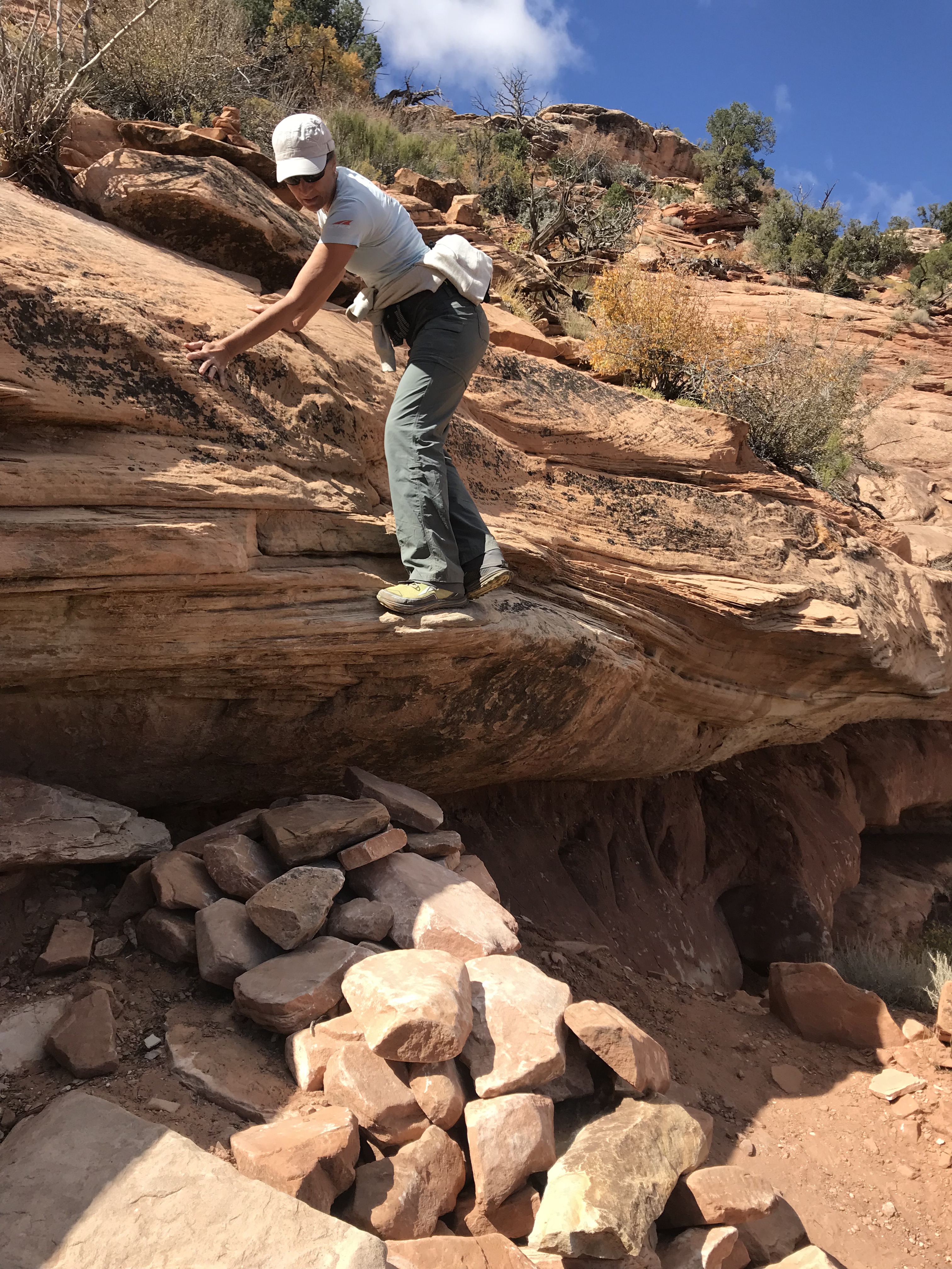
The trail started over sandstone slabs only visible by Cairns before it quickly starts a rocky decent. We took our time since the slope was steep and the rocks loose. At one point we had to slide down the lip of an overhung ledge to a rock pile down below.
We quickly dropped down into the canyon and reached the sandy floor before ascending the other side to Moon House.
Now you see me. Now you don’t!
Still standing after hundreds of years
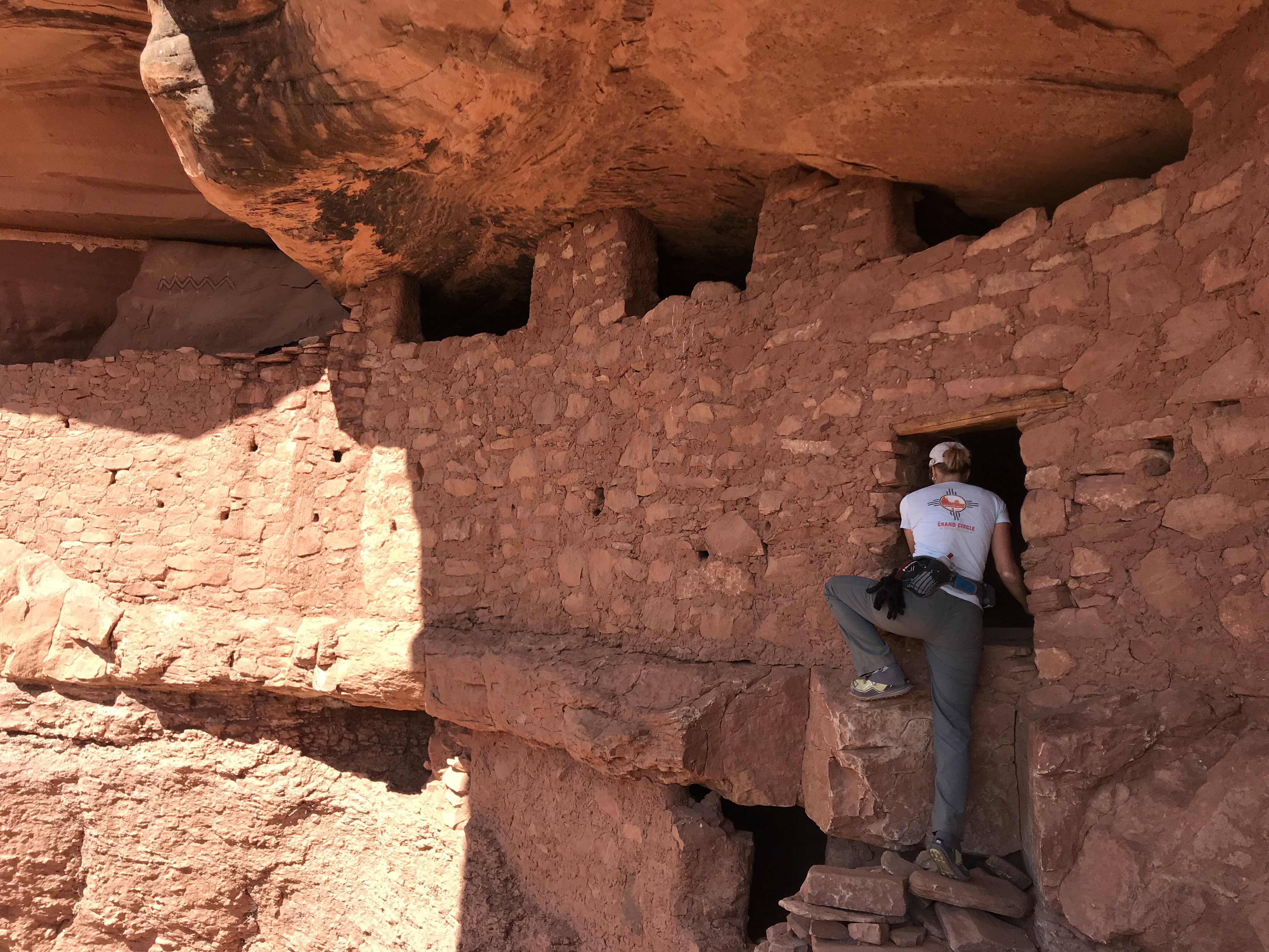
Enter with care
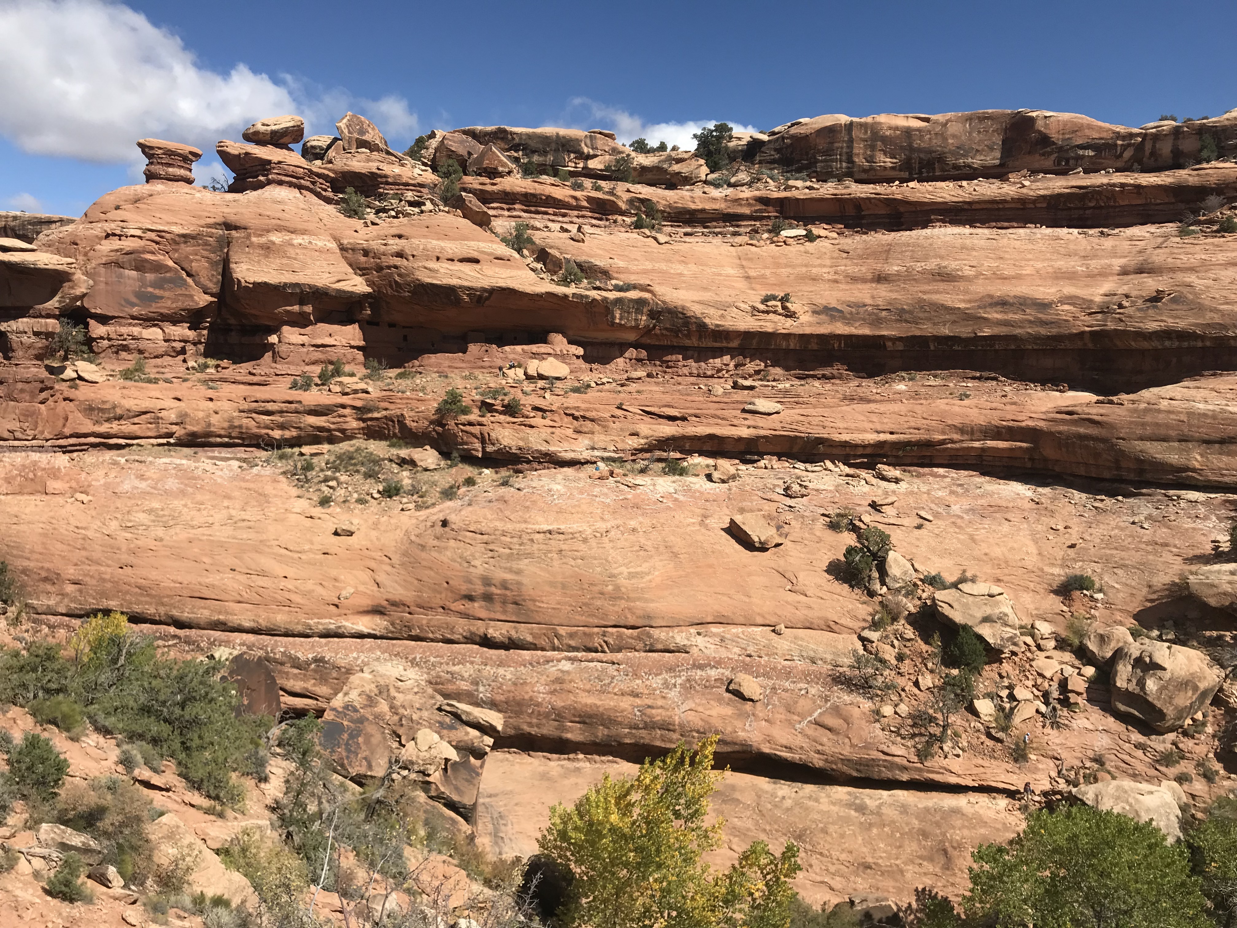
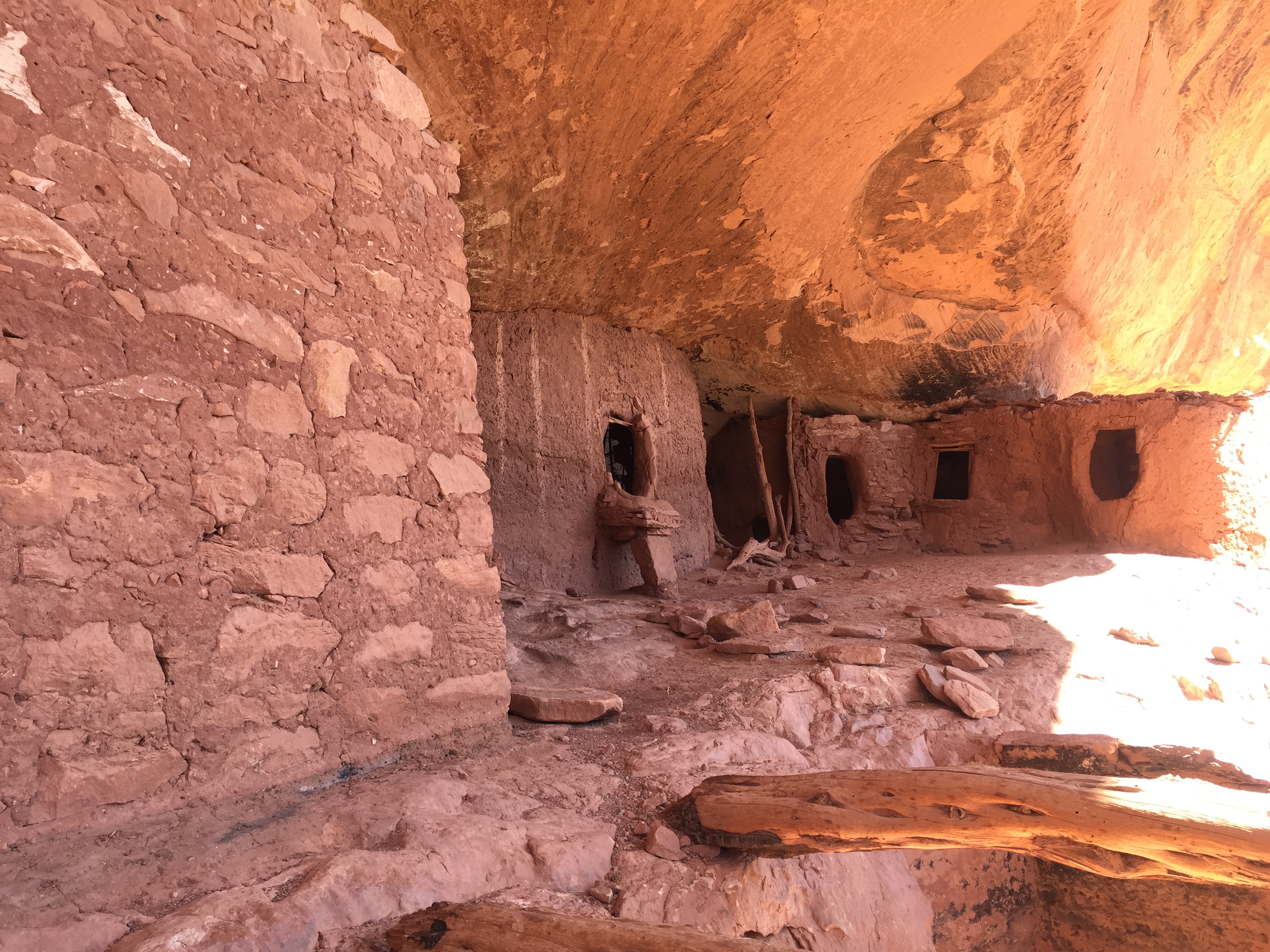
Cliff dwellings are amazing structures as they are built into the sides of raised ledges on the side of cliffs. They are very undetectable when you are not looking and sometimes when you are. We didn’t notice the dwelling until we were right up on it!
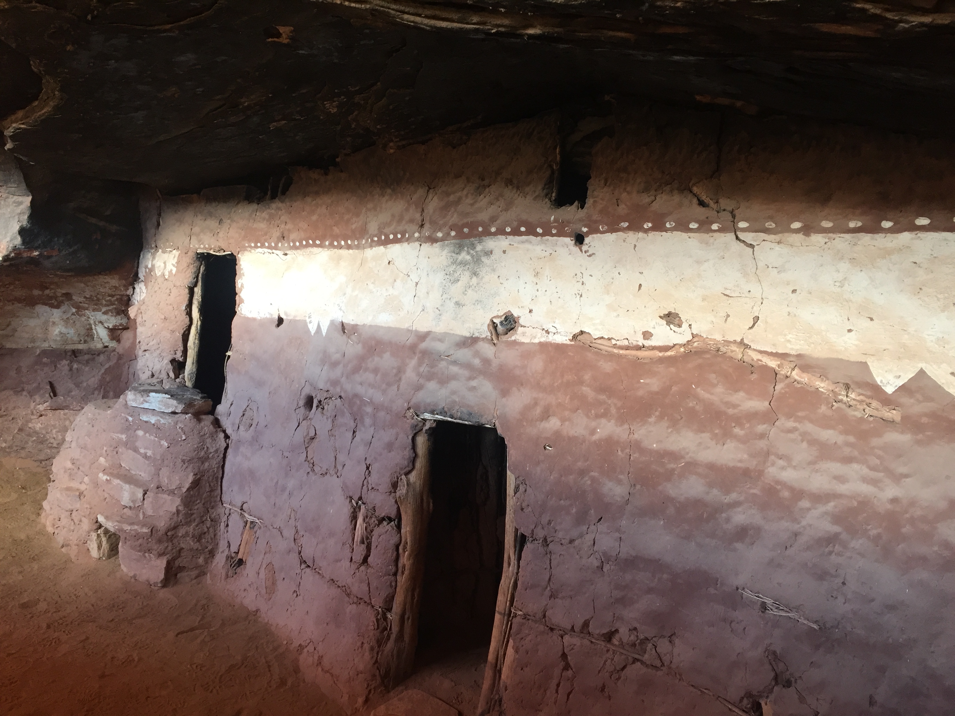
We explored the ruins and were glad we brought along our headlamps to shine into protected rooms. It was interesting to see the construction of vertical tree limbs smeared in mud to form small interior rooms or apartments.
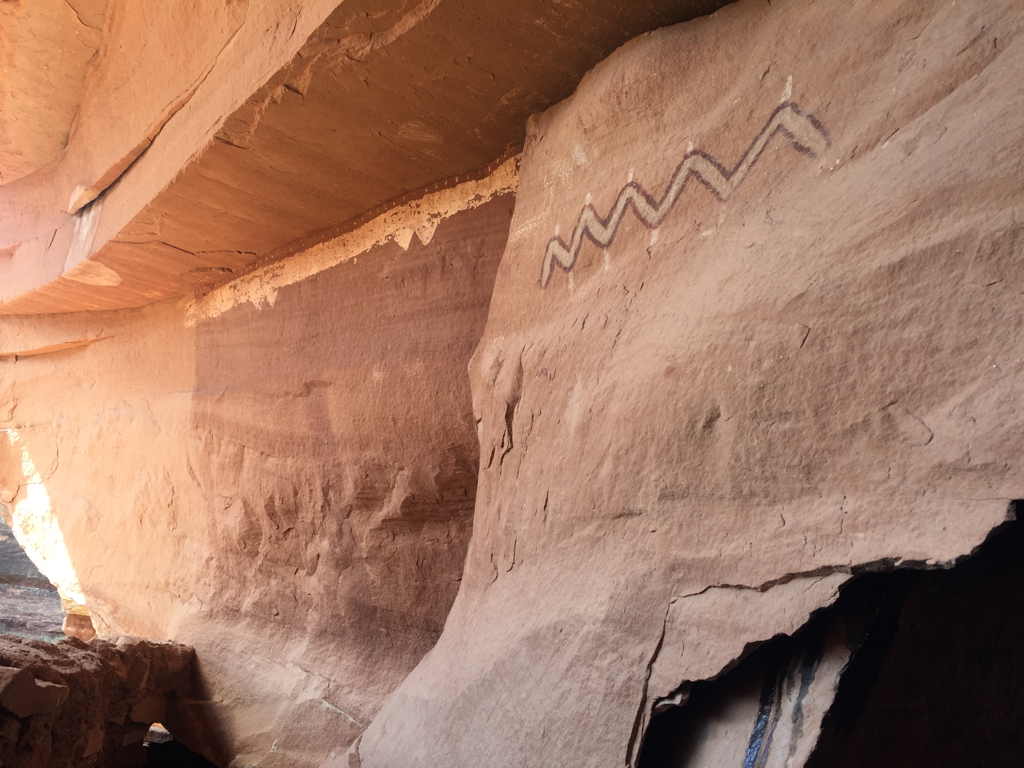
The ancient pigment that created a long white band of Moon House was still vibrant and corncobs still lie on the floors in some of the rooms.
Pictograph giving Moon House its name
We followed more trails around the ledge that led to more buildings. After we started hiking back we turned around to take one last look and realized that we missed a whole other section of dwellings perfectly hidden in the side of the ledge where we sat to have lunch!
It was a nice 4.5-mile round trip hike. We like these destination hikes with history to research and a challenge to get to.
The rocky road to someplace special
By now it was late afternoon and we started to look for a place to camp overnight. The area is mostly BLM (Bureau of Land Management), which offers free camping off random dirt roads. Right off the corner of Hwy 95 and 261 was one of those dirt roads. We found a spot with the perfect amount of slope to make our bed level for the night.
Night two of car camping was not as volatile as night one, but dang it was freezing cold. The temperature dropped to 21 degrees and we had to run the car a good part of the night to stay warm. Of course I laid awake worrying about running out of gas and I had to get out of the car to pee behind a bush in the freezing cold while stepping through land mines of bull head stickers.
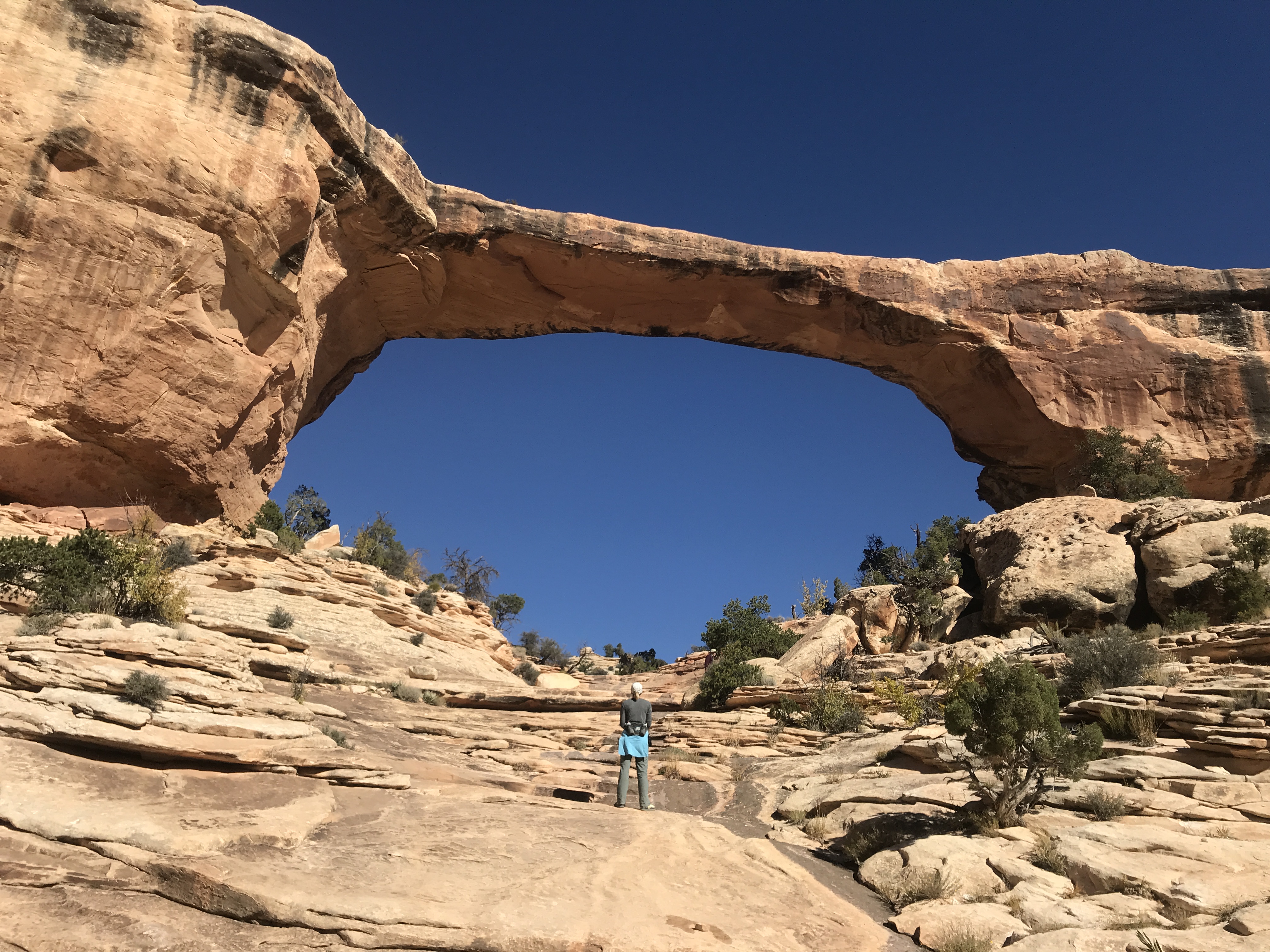
Come morning at the corner of Hwy 95 and 261 we needed to decide to turn left or right. To the left, at the risk of running out of gas, Natural Bridges National Monument. Turn right to Blanding for a service station and on to Moab.
Natural Bridges it is!
Unnamed tiny arch!
We didn’t know much about this National Monument so we drove through a beautiful little campground within the park for future RVing reference before heading to the visitor center.
It was too early to go inside, so we used the outdoor restrooms and made coffee with our recently rescued Jetboil.
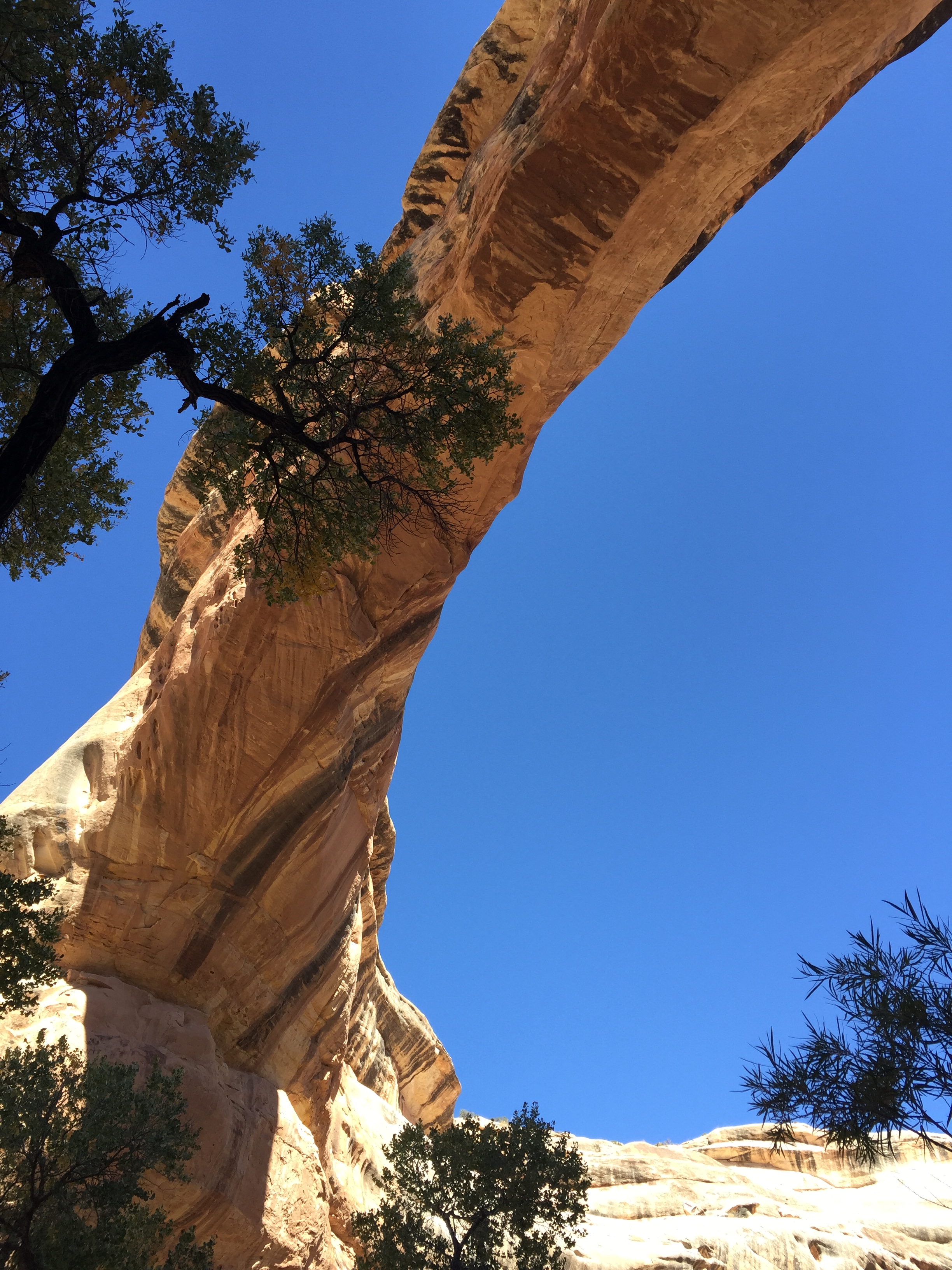
We read about taking the scenic 9-mile Bridge View Drive. The drive takes you to scenic viewpoints that overlook three spectacular arches. Sipapu (place of emergence), Kachina (dancer) and Owachomo (rock mound).
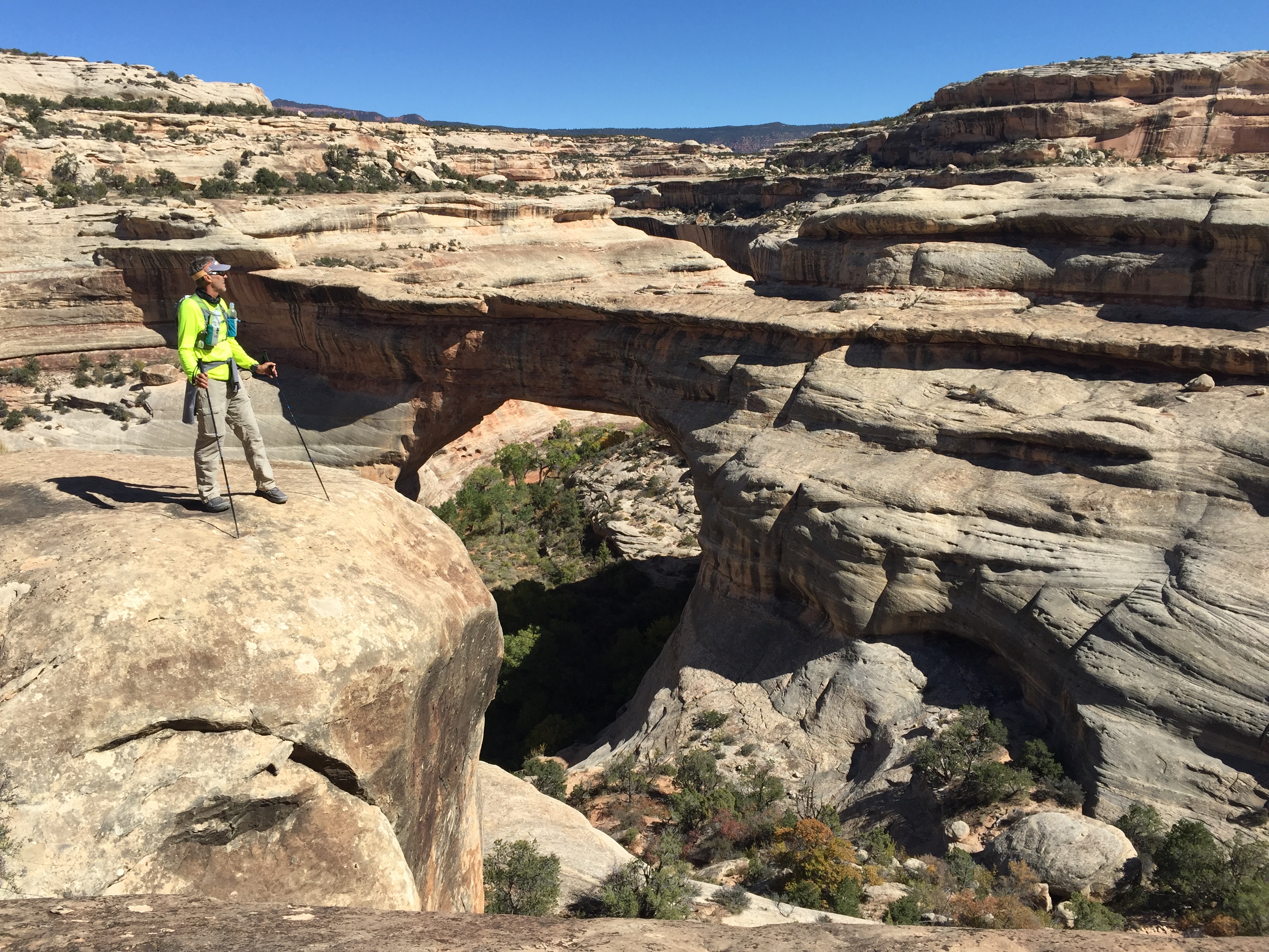
We wanted to do some hiking so we saw that there was an 8-mile loop along the canyon floor to each Bridge…up close and personal.
We started at the Kachina trailhead and descended down a staircase carved into the sandstone. We took the loop counter-clockwise since we thought we would be in the sun on this cold morning.
Chilly start
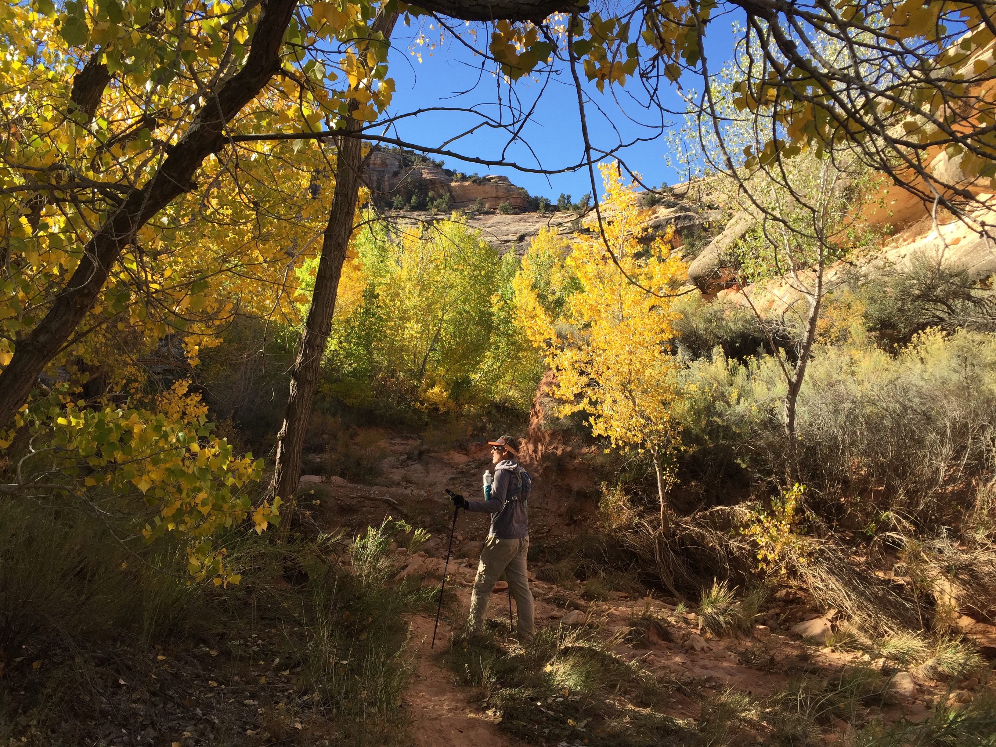
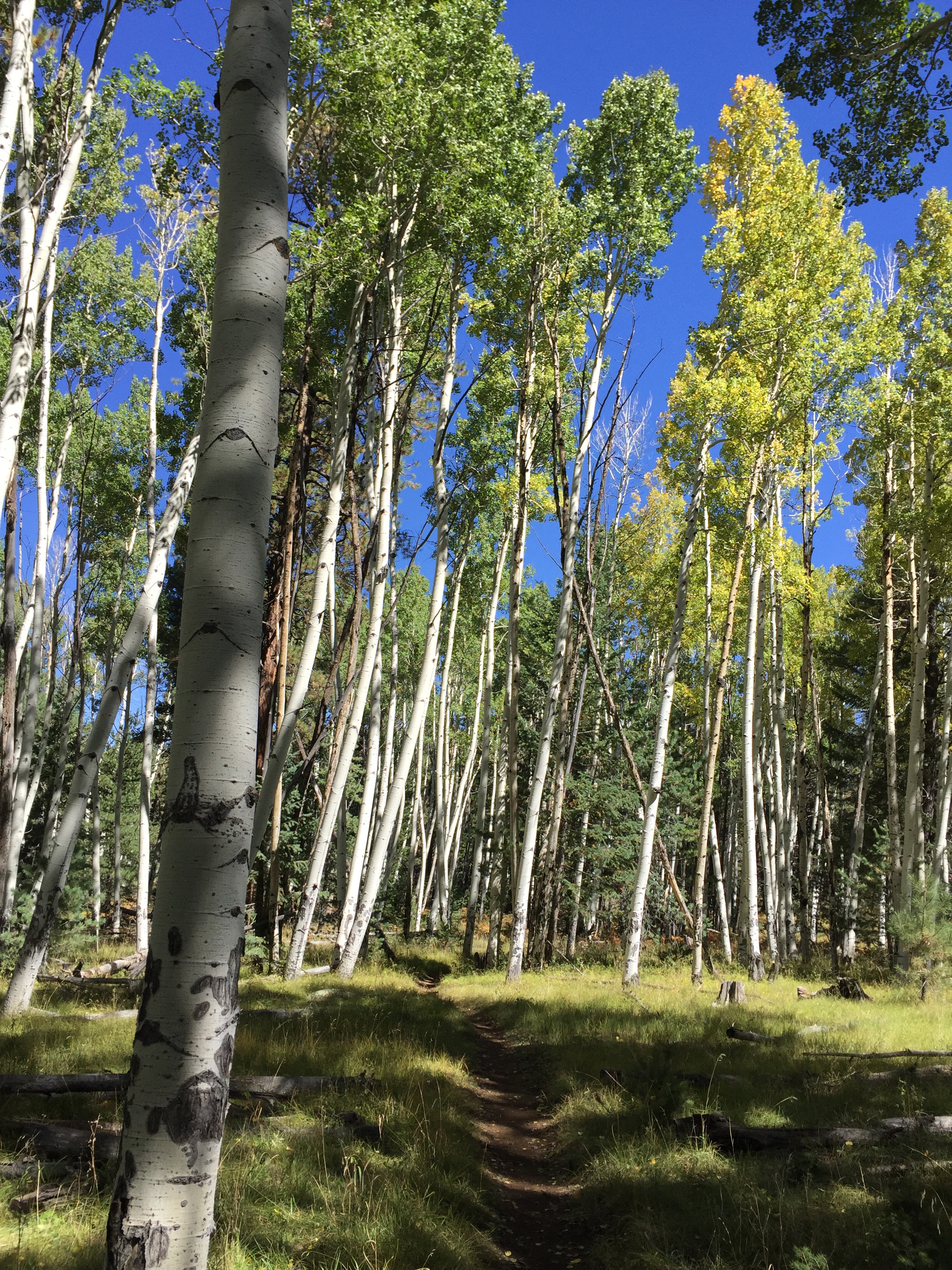
Aspens in October
Once we descending down to the riverbed the trail was flat and serpentine. Each rounded corner revealed new cliff views. We were keeping our eyes peel for petroglyphs and cliff dwellings that we heard were along the trail.
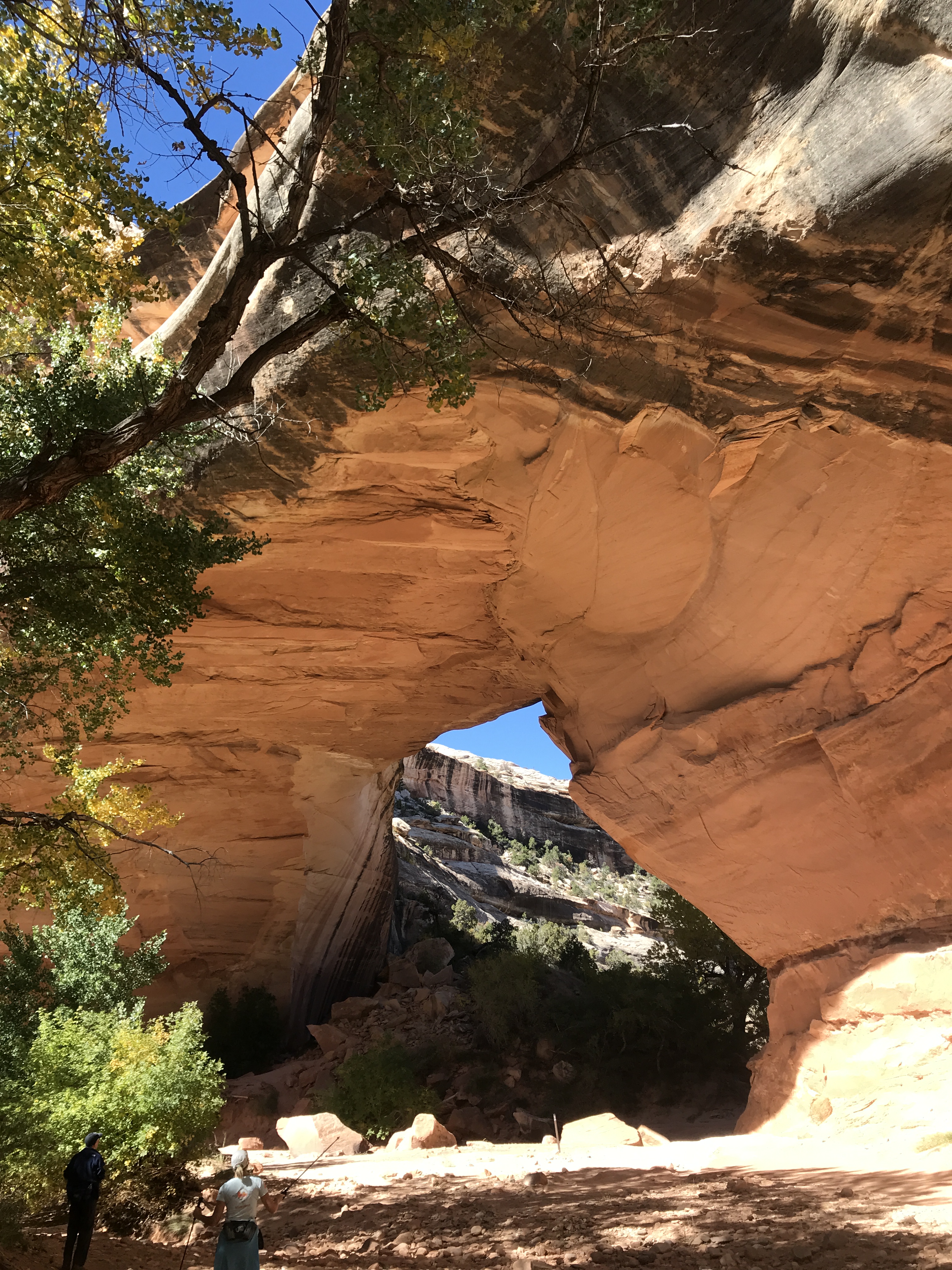
After a couple of miles the trail took a sharp left over slabs and ledges and there stood the magnificent Owachomo Bridge. It was so vast. So tall. The pure blue sky was the perfect backdrop for the white sandstone bridge.
There she is!
Owachomo Bridge
The trail traversed out of the canyon and crossed the inner circle of the Bridge View loop over to the Sipapu trailhead. This part of the trail is known for its dramatic vertical drop via sections of ladders and staircases to the base of Sipapu Bridge.
Just our kind of trail!
Sipapu from above
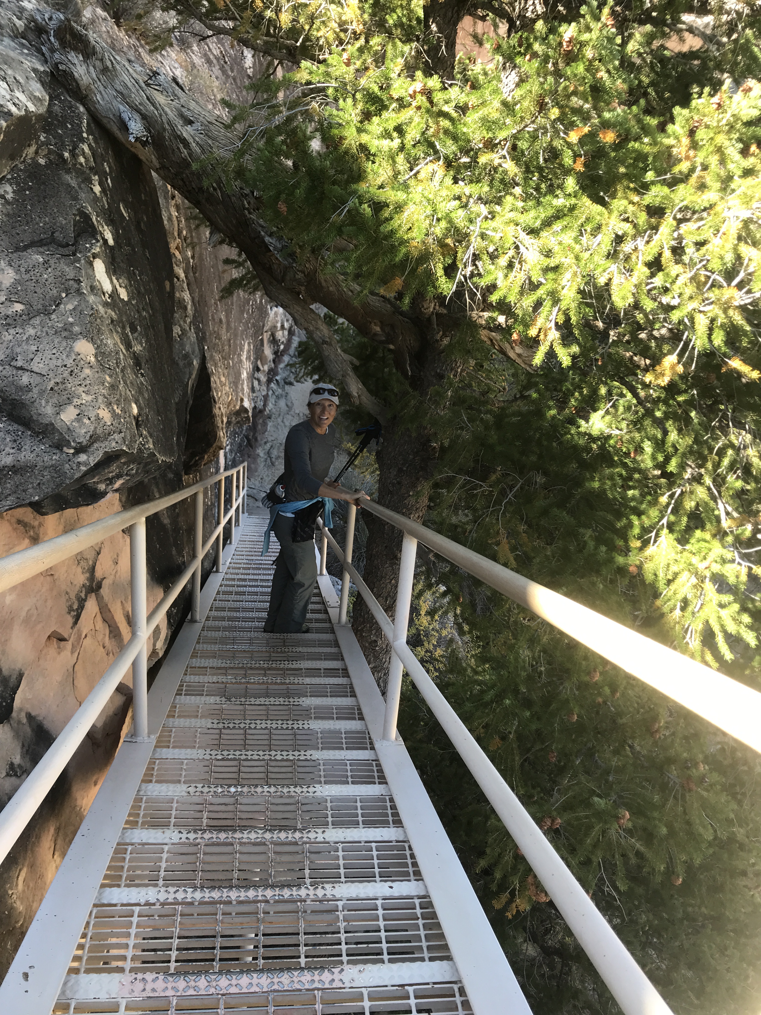
Staircase down the cliff edge
Descending ladders
Sipapu from below
The ladders were a bit intimidating as first but we were back down in the canyon along the dried riverbed before we knew it. After spending some time at Sipapu Bridge we followed the trail along the cliff walls to Kachina Bridge. We finally found Horse Collar Ruins and came across Petroglyphs along the walls of Kachina.
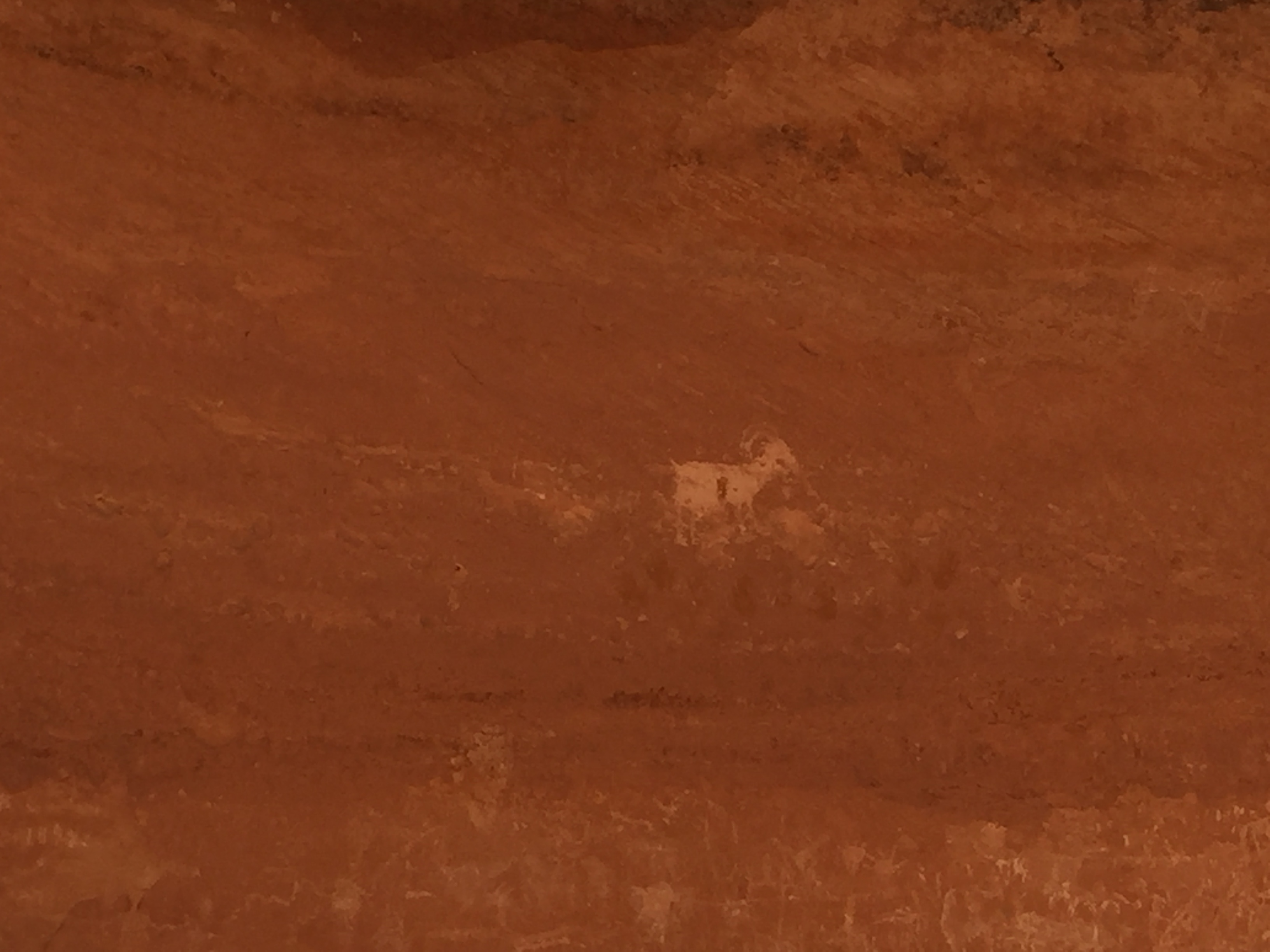
Petroglyphs are really quite amazing to have stood the test of time. They tell a story of life our modern day selves have never known. Hunting and gathering. Conflicts and battles. Everyday life lived amongst the walls.
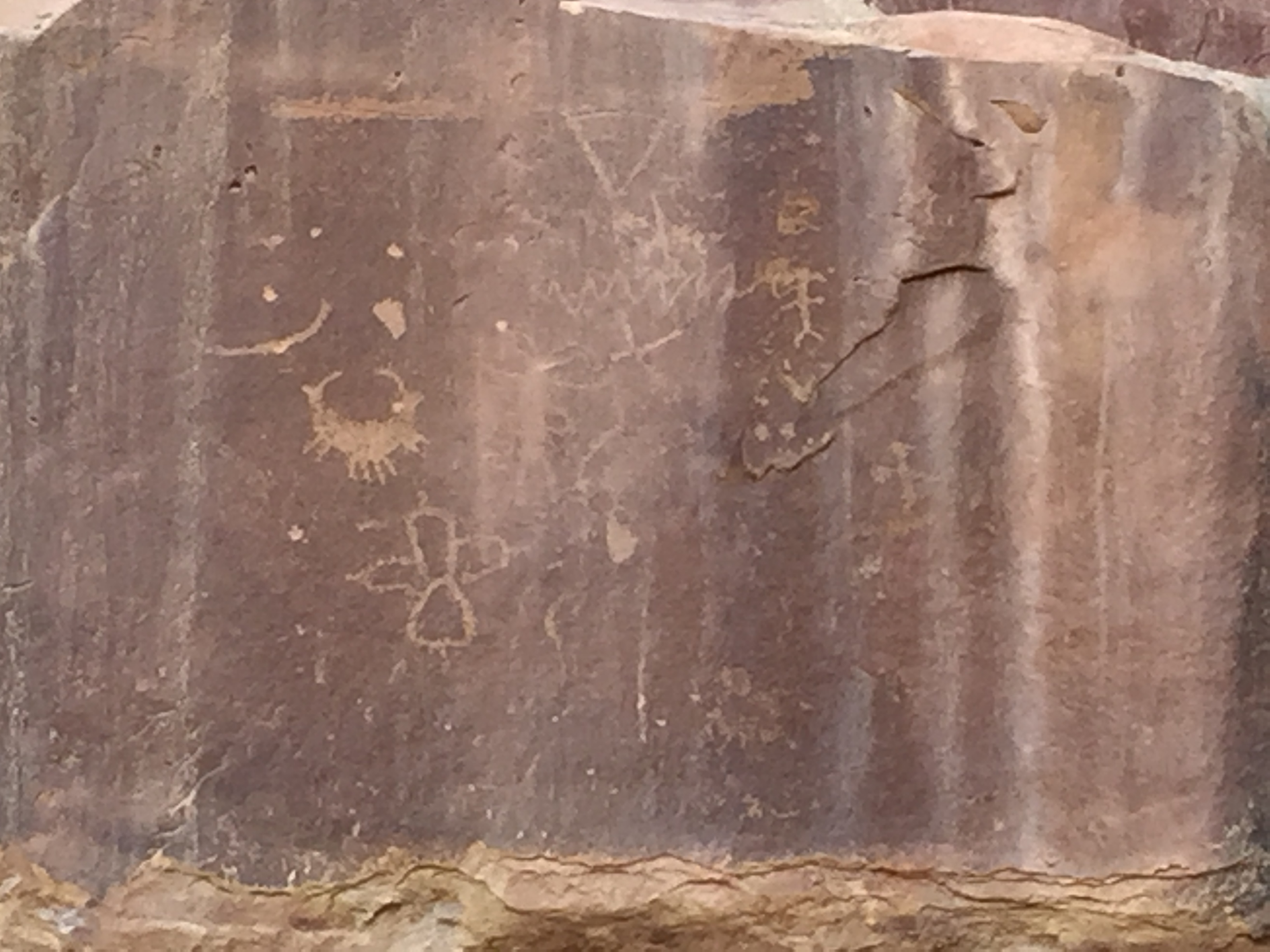
Horse Collar Ruins
Kachina Bridge
We hiked out of the canyon and back to the car. This was such an enjoyable hike and I would recommend it if ever in the area. I would like to come back and hike it in the opposite direction for another perspective of its walls, bridges and stairs.
After Natural Bridges Jeff and I made our way to Moab. By now it had been 6 days without modern conveniences. After looking at the freezing temps forecasted I cried UNCLE and made a reservation at a hotel. By now my back was killing me from trying to climb around in the back of an SUV and my fingernails were telling the truth about how badly I needed a shower. I couldn’t stand the smell of my own hair another day!
Ya…I had enough of this!
I can’t tell you how awesome that shower felt! And after that first night in a room and being able to stand up to put my pants on I begged Jeff for another night…then a couple more. We both had to admit at this point that we (ok, maybe me more than Jeff) were not the car camping sorts.
We never did spend another night in that car!
While in Moab we visited the local Laundromat, ate real food in restaurants and Jeff went to watch the start of the Moab Ultra 200 trail race. Being the Ultra runner he is he wanted to see what the next level of crazy looks like. Apparently, once you’ve finished a 100 race, you begin to wonder if you could do 200 (or so I’ve heard).
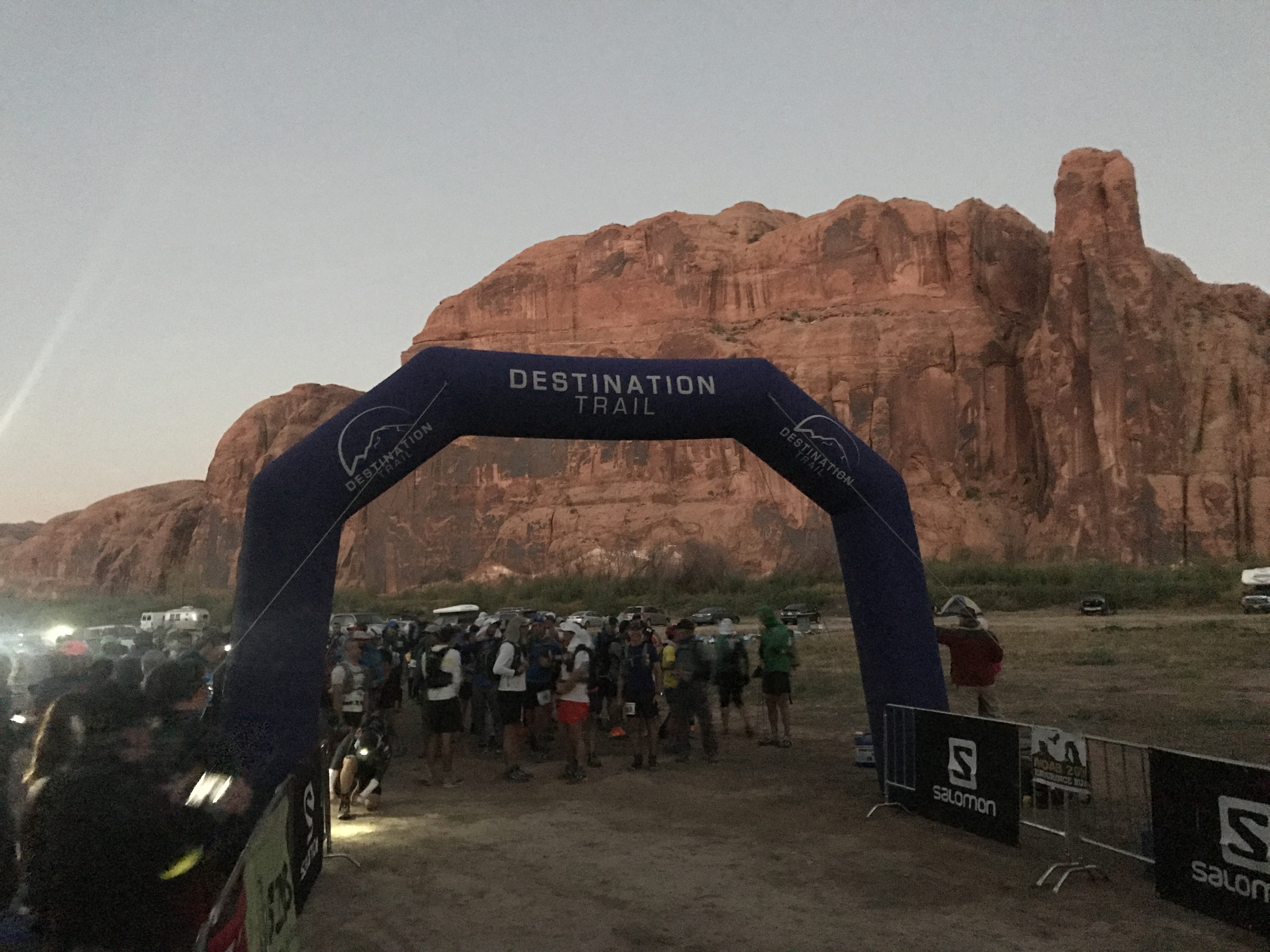
Crazy runners!
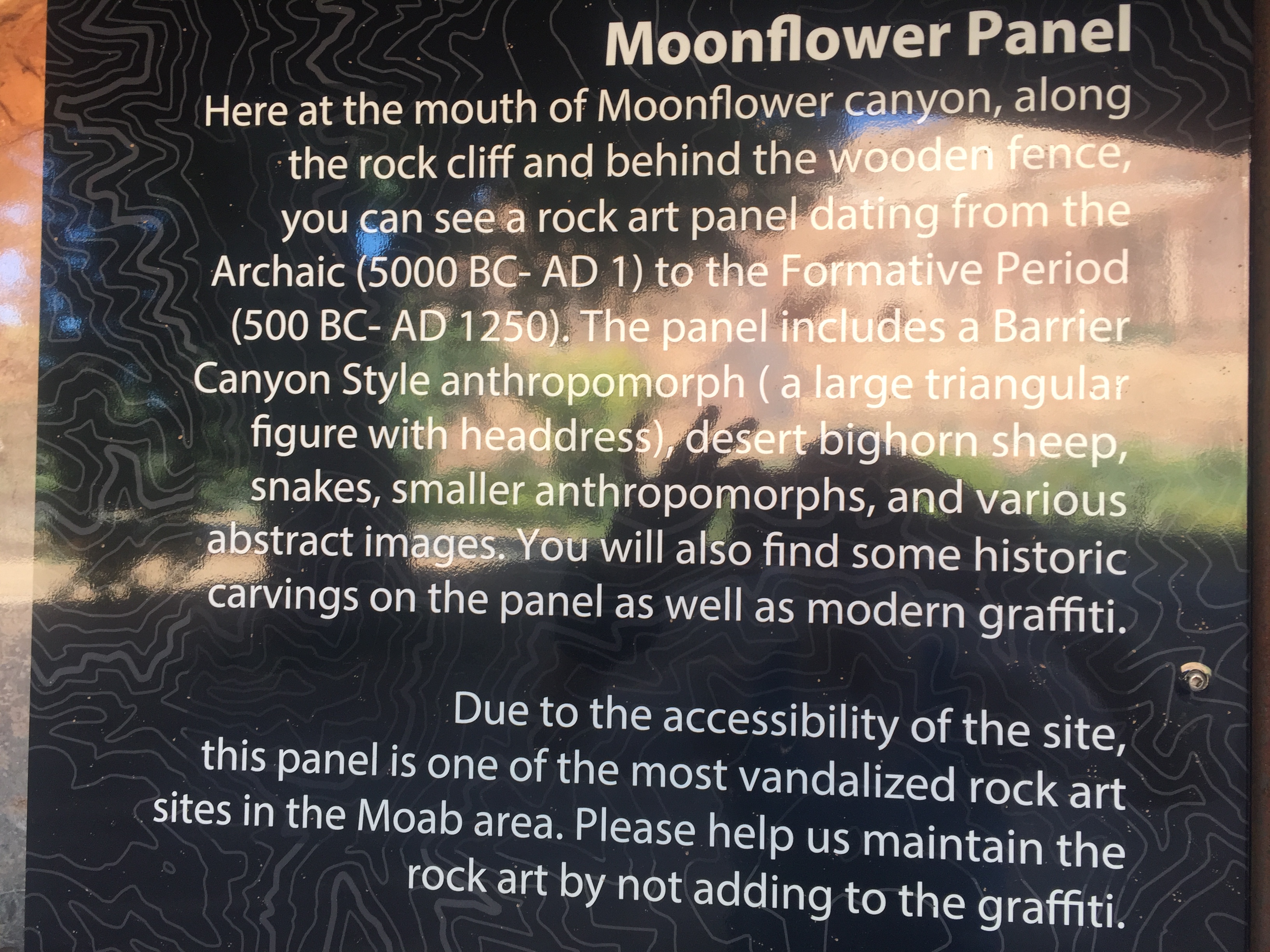
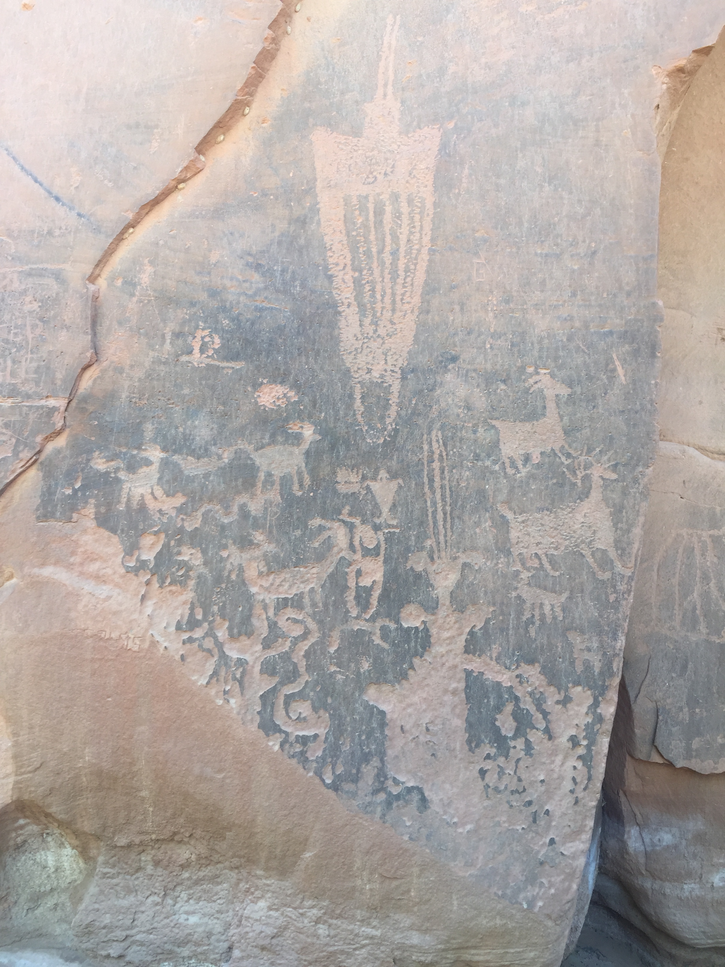
We took a drive out on the course and then stopped to look for the Moonflower Panel Petroglyph nearby. We took a trail a couple miles back without seeing a single Petroglyph but once back at the trailhead we realized the slab of ancient art was right at the parking lot.
It was very interesting to see the similarities of art from one location to the other.
While we were in Moab we hooked up with some friends from our RVing group, The Xscapers. We had burgers at Milts Stop & Eat. Milts is well known for their awesome burgers that totally lived up to the hype! It was a great time meeting new friends and getting reacquainted with some that we hadn’t seen in two years.
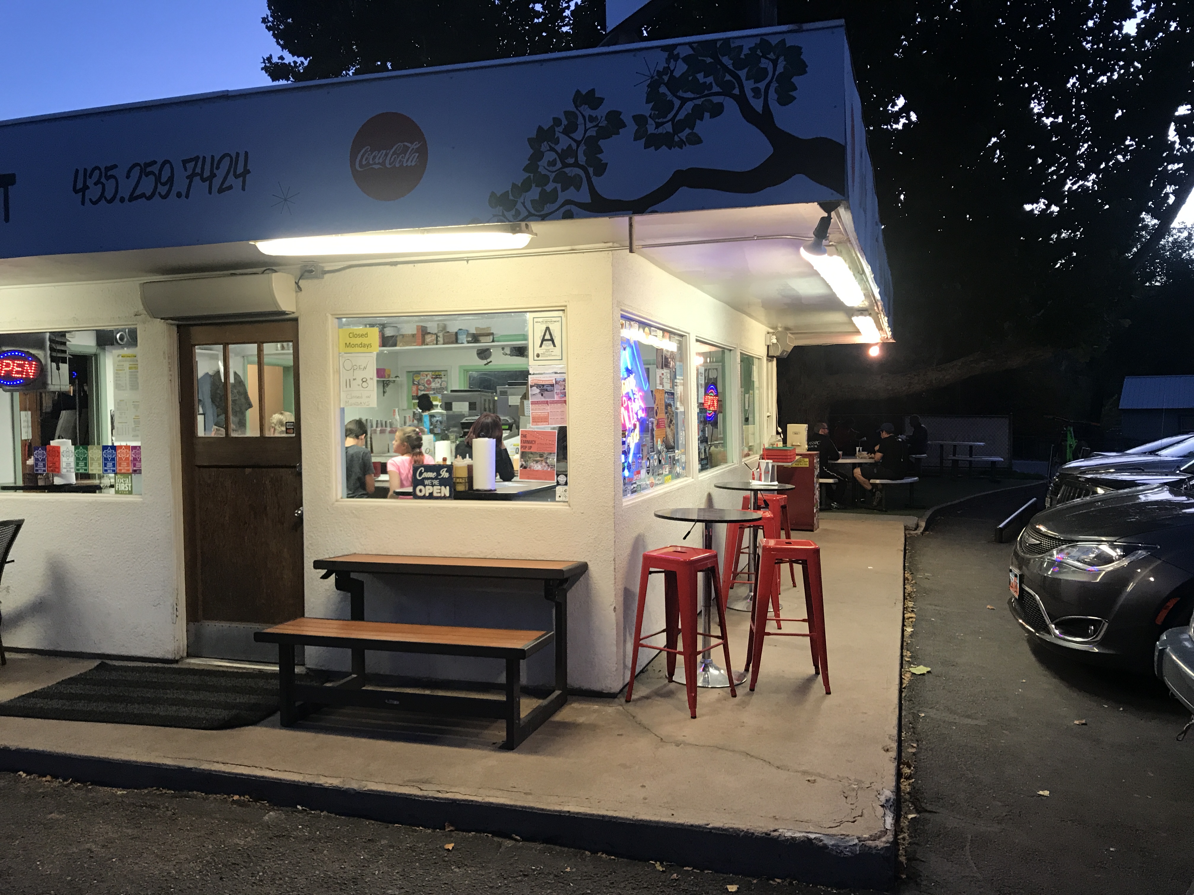
Milts Stop & Eat
Crazy Xscapers friends
After Moab we drove to Park City, Utah for a quick overnight before flying out of Salt Lake City back to Arkansas.
Despite the challenges of car camping, this was an amazing trip. To be nimble in a small vehicle instead of a 32’ RV was refreshing to say the least and we found ourselves exploring/considering other routes and locations that we would not normally have the luxury of considering.
I’m certain we will keep that in mind when we pick our next RV!
Where to next?
Back to the Midwest
Posted by Deb in Biking, Boondocking, Cycling, Destinations, Iowa, RAGBRAI on October 31, 2017
It’s been 2 ½ years since we’ve had the RV in the Midwest. We have visited plenty of times, just by air. But this time we needed the RV. In the humid Midwest. In the middle of summer. Insert whining.
It’s not that we don’t enjoy the Midwest. I grew up there for goodness sake. But after spending the last 2 years out west, beautifully dry and bug free, we were not looking forward to submerging ourselves in the sweat and mosquito, tick, gnat, fly (insert your most hated bug here) buffet.
We have grown accustomed to the dessert lifestyle. And when you can choose where you WANT to be in the summer it seemed odd to me that we were heading to the most avoided summer destination for RV’ers.
It takes something special to get us to leave the west and we had two events that were worthy of turning the truck east. My Grandma’s 100th Birthday and RAGBRAI.
Growing up in Belleville, IL I had the fortune of living next to my Grandparents. Grandma Tess was the built in babysitter and cook extraordinaire that filled our days with homemade pies, jellies and the most delicious cinnamon rolls you ever tasted. The only thing that rivaled Grandma’s roll was her cream puffs!
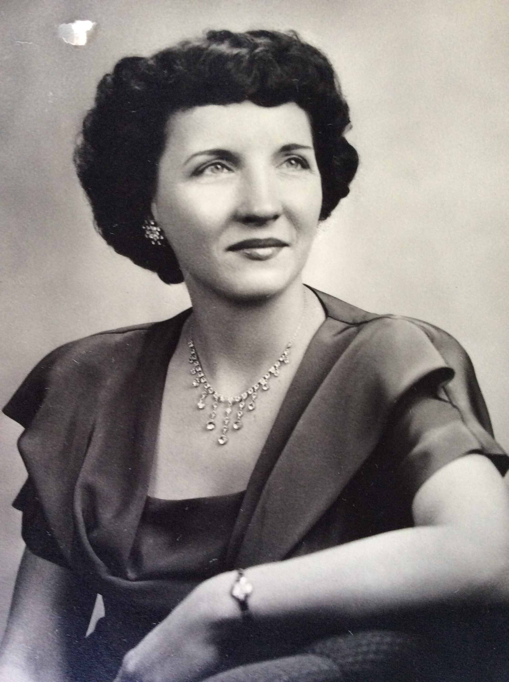
Grandma was a worker bee her entire life and didn’t see much reason to sit down.
Sometime in grade school she moved an hour away and I begged my mom to spend the night at Grandma’s. I spent 4 days washing and waxing the car, learning how to do laundry and iron shirts and cleaning windows. If it weren’t for Grandpa taking me fishing I’m sure there would have been nothing left of my fingers, being worked all the way down to the bone.
I never did ask to stay overnight there again!
Today I can see the fruits of her influence, tenacity and drive in me and I would not have wanted to grow up any other way!
Grandma had been living in a very nice Assisted Living facility just 1 mile from my Mom in St. Louis. She had had some recent falls and was fading quickly. I’m sad to say that she passed away while we were in route to St. Louis, seven days shy of her 100th birthday!
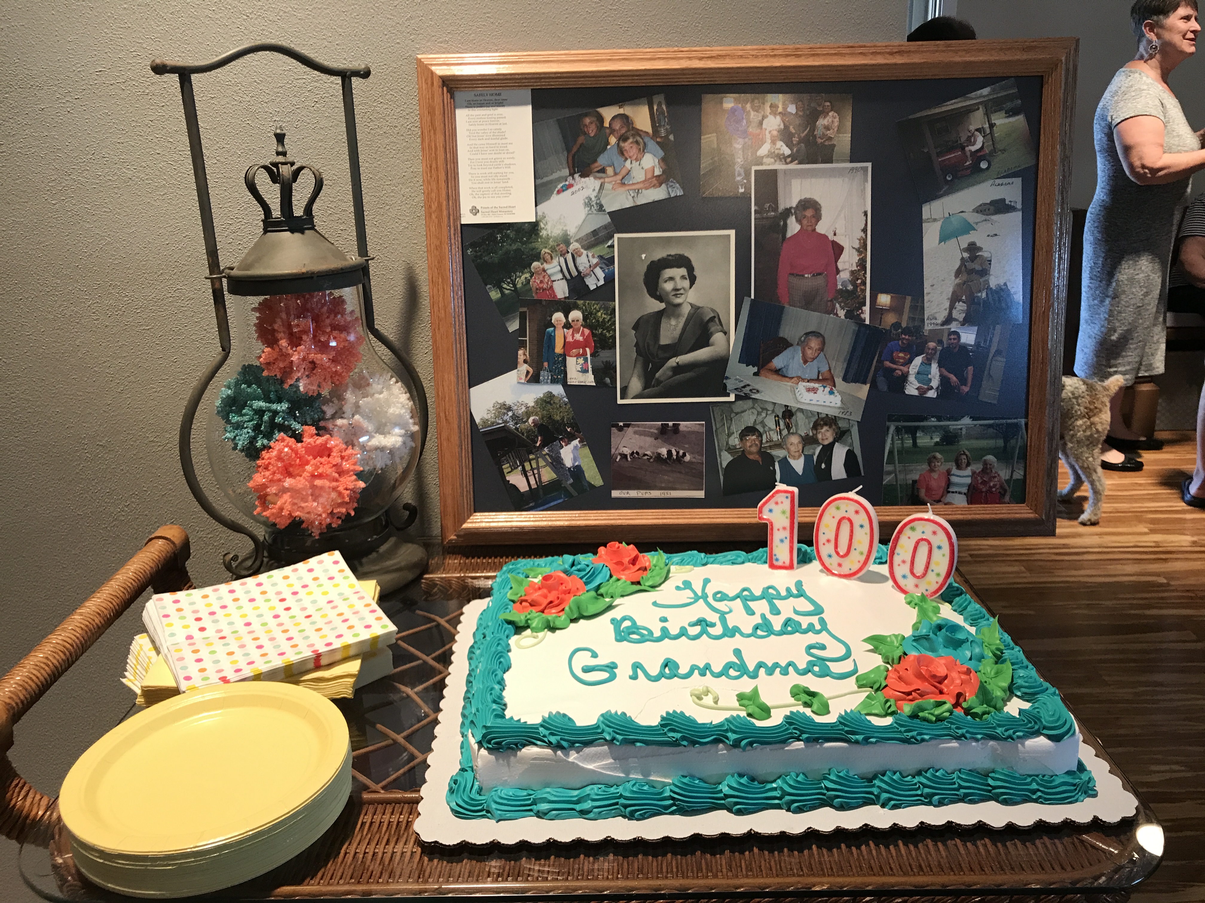
We had a 100th birthday party for her anyway and I’m thankful that we were able to attend. Family and friends celebrated her life, had food, sang Happy Birthday and ate cake and ice cream. How can you be sad about 100 years!?!
I Love you Grandma Tess!
RAGBRAI
The second reason we found ourselves in the Midwest was Jeff and I had committed to RAGBRAI.
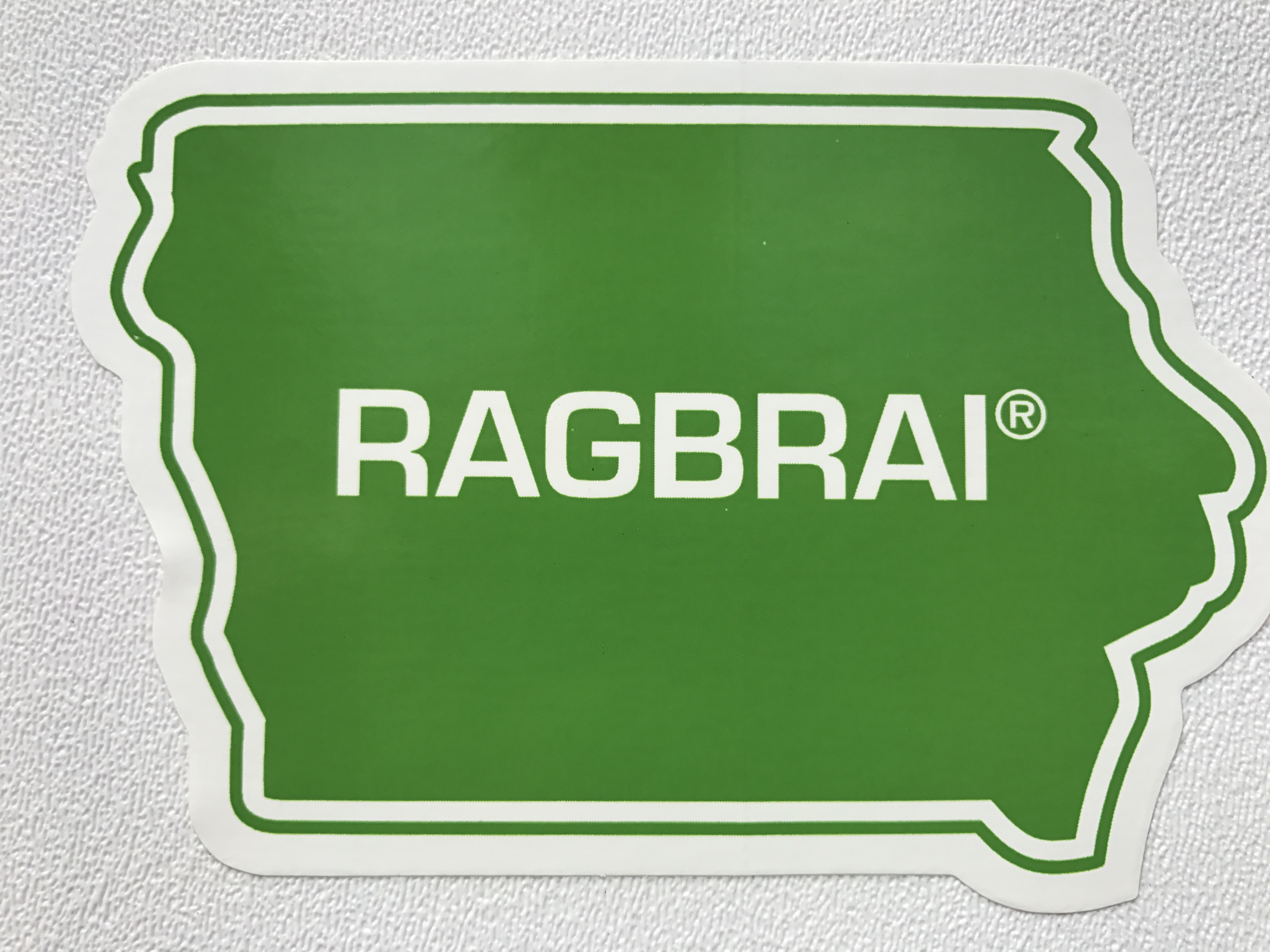
RAGBRAI, the Register’s Annual Great Bike Ride Across Iowa, is an Iowa cycling institution held the third week of July every year. I’m not sure what is bigger in Iowa. The State Fair or RAGBRAI.
From the RAGBRAI website…
“RAGBRAI is a bicycle ride, not a race. It started in 1973 as a six-day ride across the state of Iowa by two Des Moines Register columnists who invited a few friends along. It is held the last full week in July. RAGBRAI is planned and coordinated by The Des Moines Register, and riders who participate in RAGBRAI understand that they do so at their own risk.
The RAGBRAI route averages 468 miles and is not necessarily flat. It begins somewhere along Iowa’s western border on the Missouri River and ends along the eastern border on the Mississippi River. We change the route each year and announce the overnight towns in late January at the RAGBRAI Route Announcement Party, in The Des Moines Register and on our website.
Eight Iowa communities along the RAGBRAI route serve as “host” communities for overnight stays. RAGBRAI is a guest in these communities and we ask our riders to behave as such.”
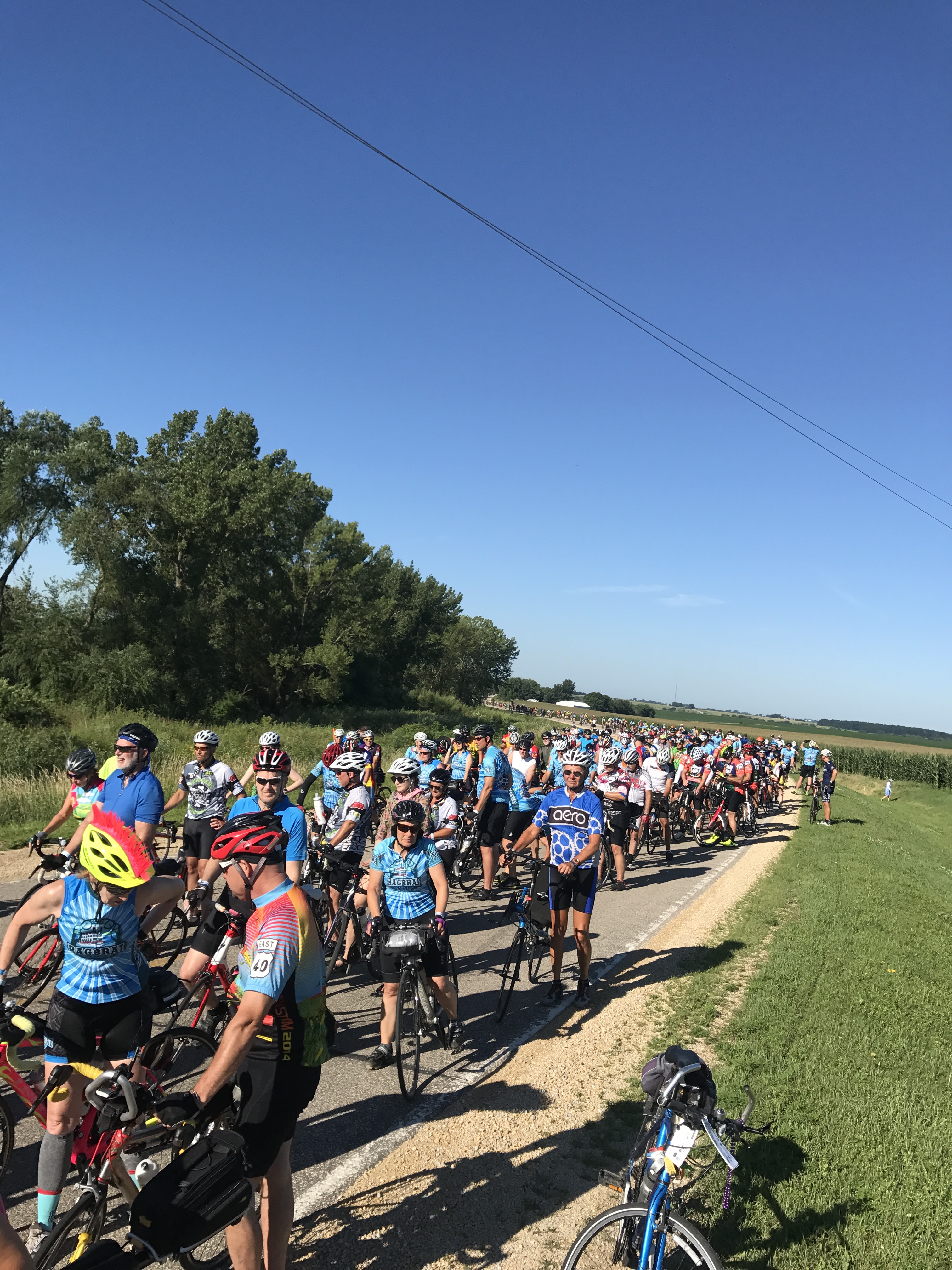
20,000-30,000 people show up from around the world to ride this event. This would be our third time to do the ride, but this time we had some friends along for their first time.
Don’t blink or you will lose your party
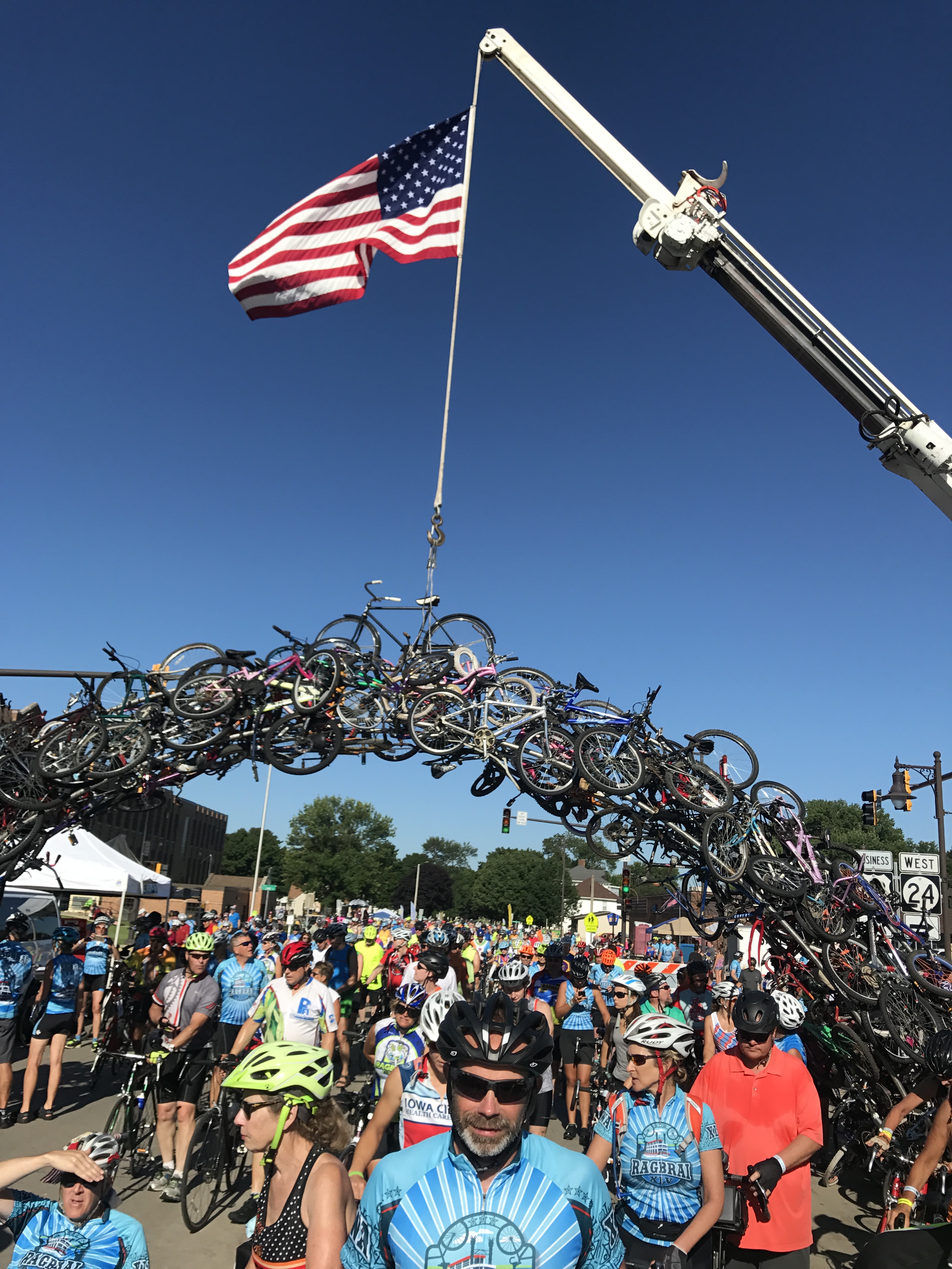
Geoff and Donna under the Bicycle Arch
Mike and Donna of Flying the Koop and Tom and his Father-in-love Fred from Elkhart, Indiana and Geoff from Austin, Texas. Team “RV there yet”!
We had such a great time. Iowans are a super friendly bunch and you get a feel for small town America at this event.
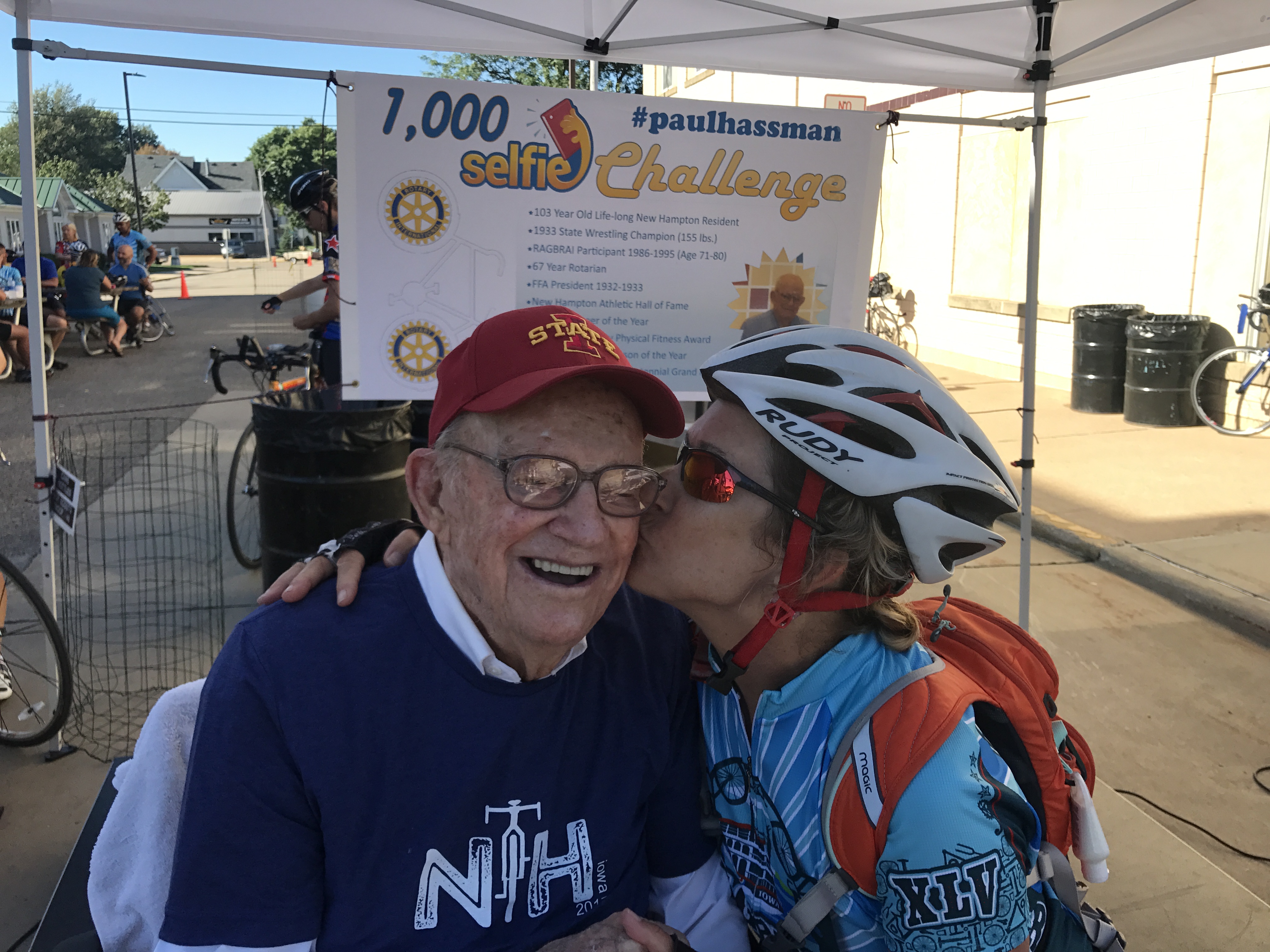
Mr. Hassman going for 1000 selfie kisses
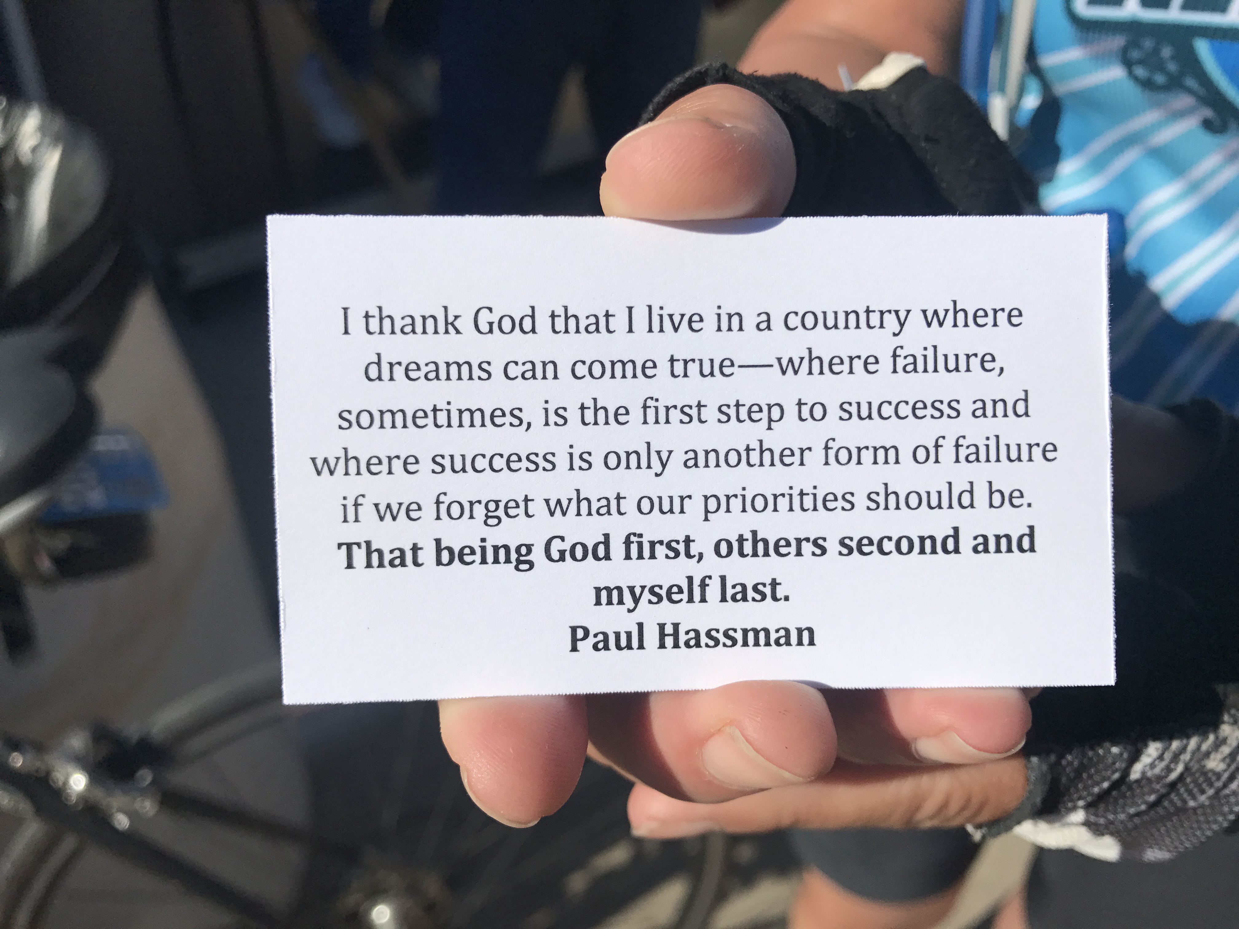
Mr. Hassman mission statement…AMEN!
The RAGRAI route is changed every year and towns bid much like the Olympics to have the event roll through their city. It’s a huge economic boost for RAGBRAI communities lucky enough to be chosen.
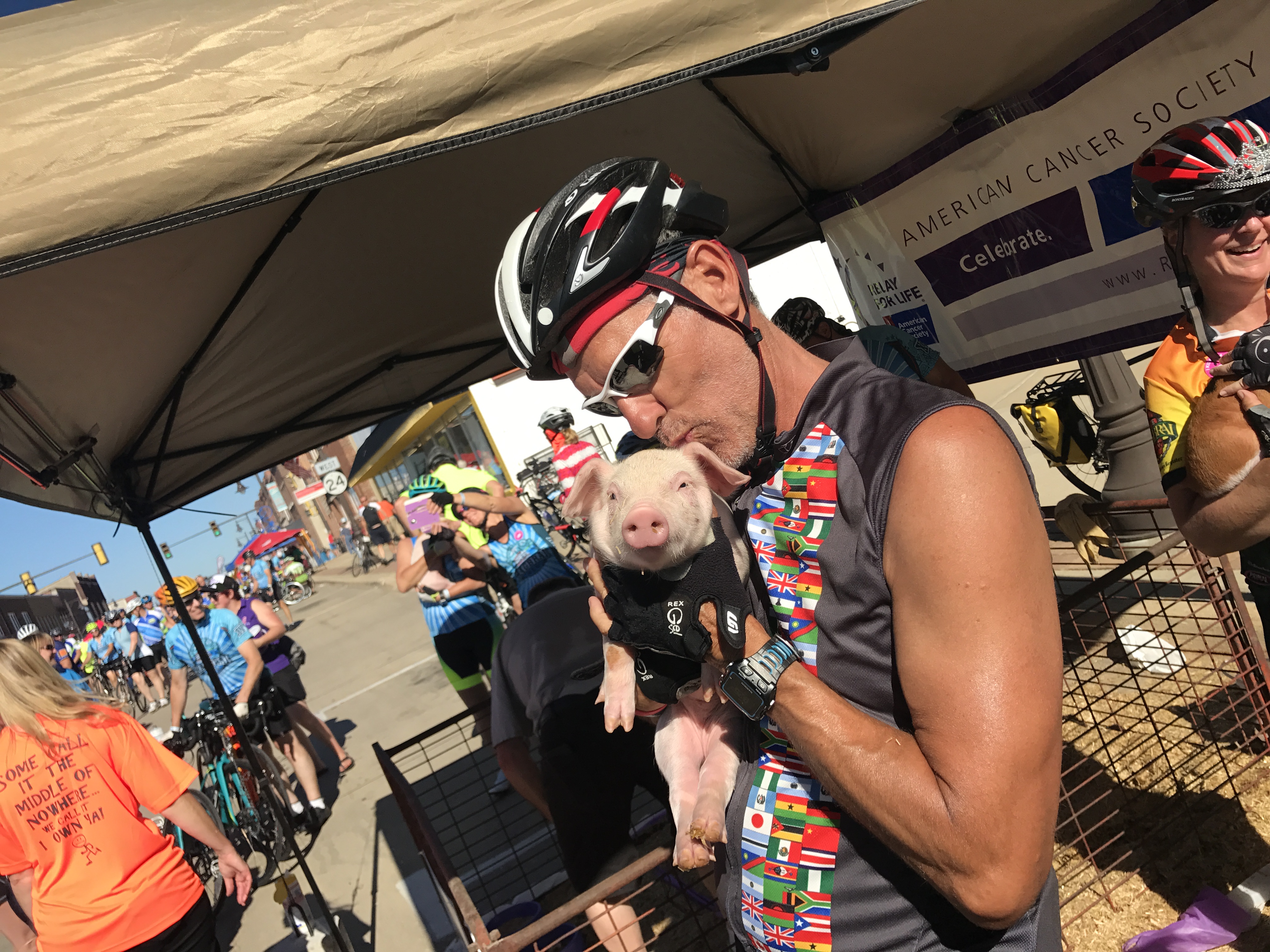
Towns are usually very small with populations around 1,500-6,000 that swells with the masses of hungry cyclists ready to purchase as much pie, homemade ice cream, burritos, turkey legs, pork chops, draft beer and brats they can make.
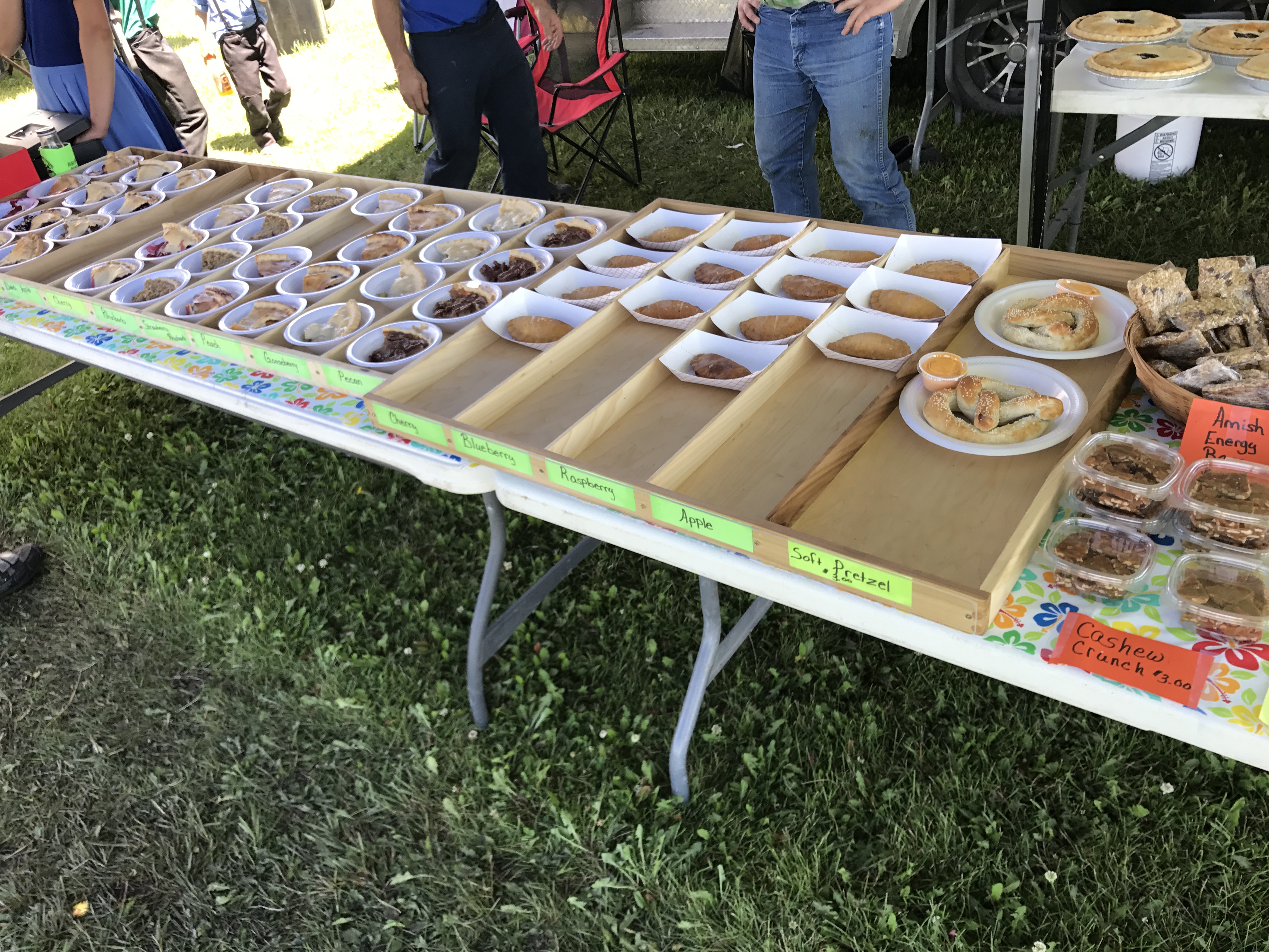
The Lutheran Church wins “Best Pie” award from our group
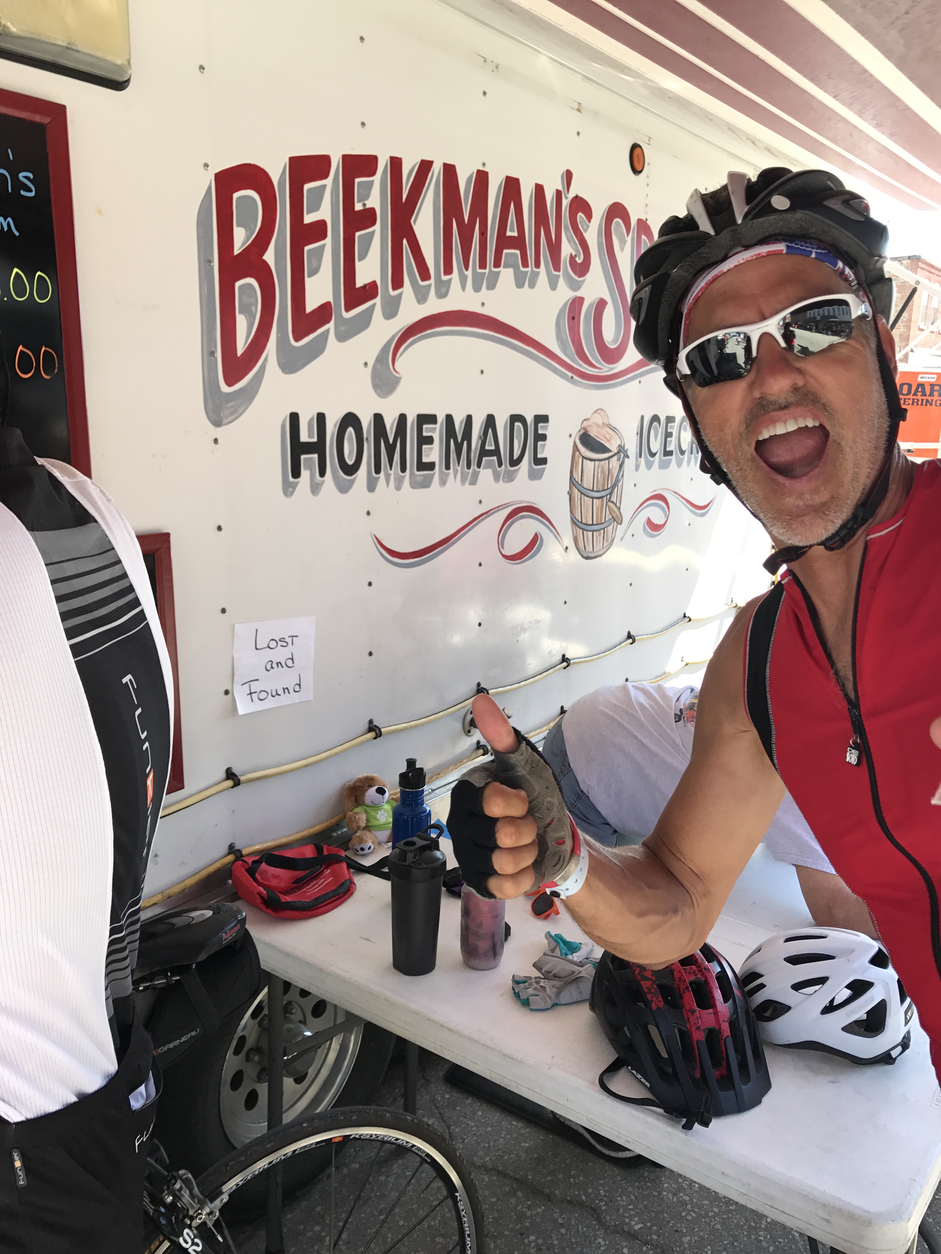
Jeff testing the lick-ability of Beekman’s Ice Cream
The weather was perfect this year! As team “RV There Yet?” head out each morning by 6:30-7:00 AM my job was to get our RV caravan to the next host city before the crowds of other RV’s got there.
Each host town has designated RV campgrounds that are usually located on fairground or school parking lots. The key to getting an easy in, easy out spot is to arrive early and stake your claim and let everyone else figure out how to fit a square peg into a round hole around you.
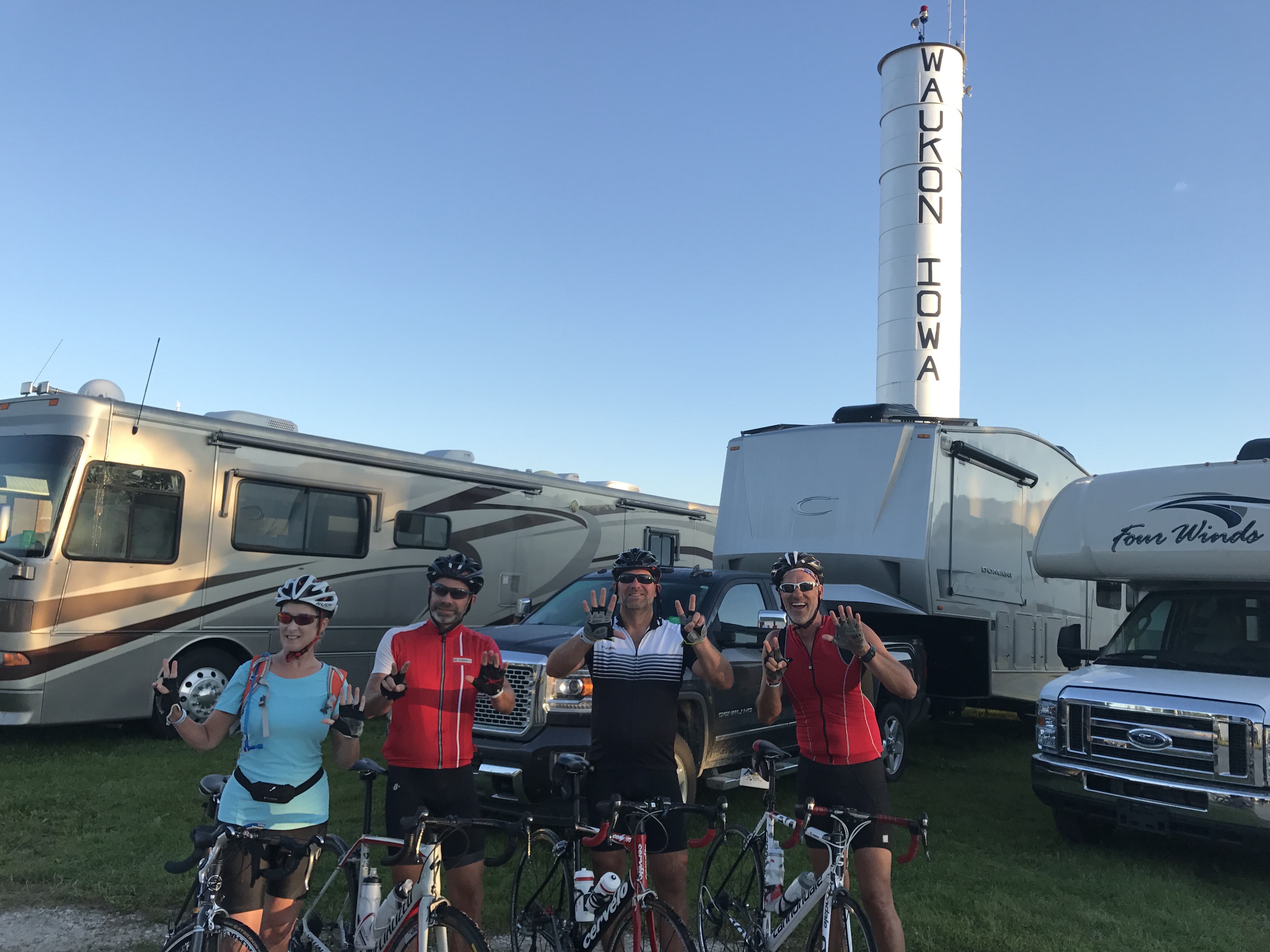
Fairground camping in Waukon IA
Our 7am strategy worked perfectly and all three of us were able to park together each day.
As our cyclists ate pedaled their way across the state Mike, Fred and I set up camp and relaxed a bit before the team rolled in anywhere from 1-3pm. After showers and naps we would all gather together for adult beverages and dinner.
After setting up Sam be like…chill!
The winning food for the week? Mike’s smoked ribs…YUM!!!
About day 6 we noticed that the The Craft Beer tent was about 6 miles from the destination town. So Mike, Fred and I hopped on bikes and back tracked the course to meet up with our team for a cold one. The ride ended up being a bit further than anticipated on a hot day. By the time we reached to tent we were thirsty and hungry.
It was fun pedaling back to the campsite with our team and getting to experience a small part of the cycling event. The energy of this group is off-the-chart and we got to hear all about our groups day.
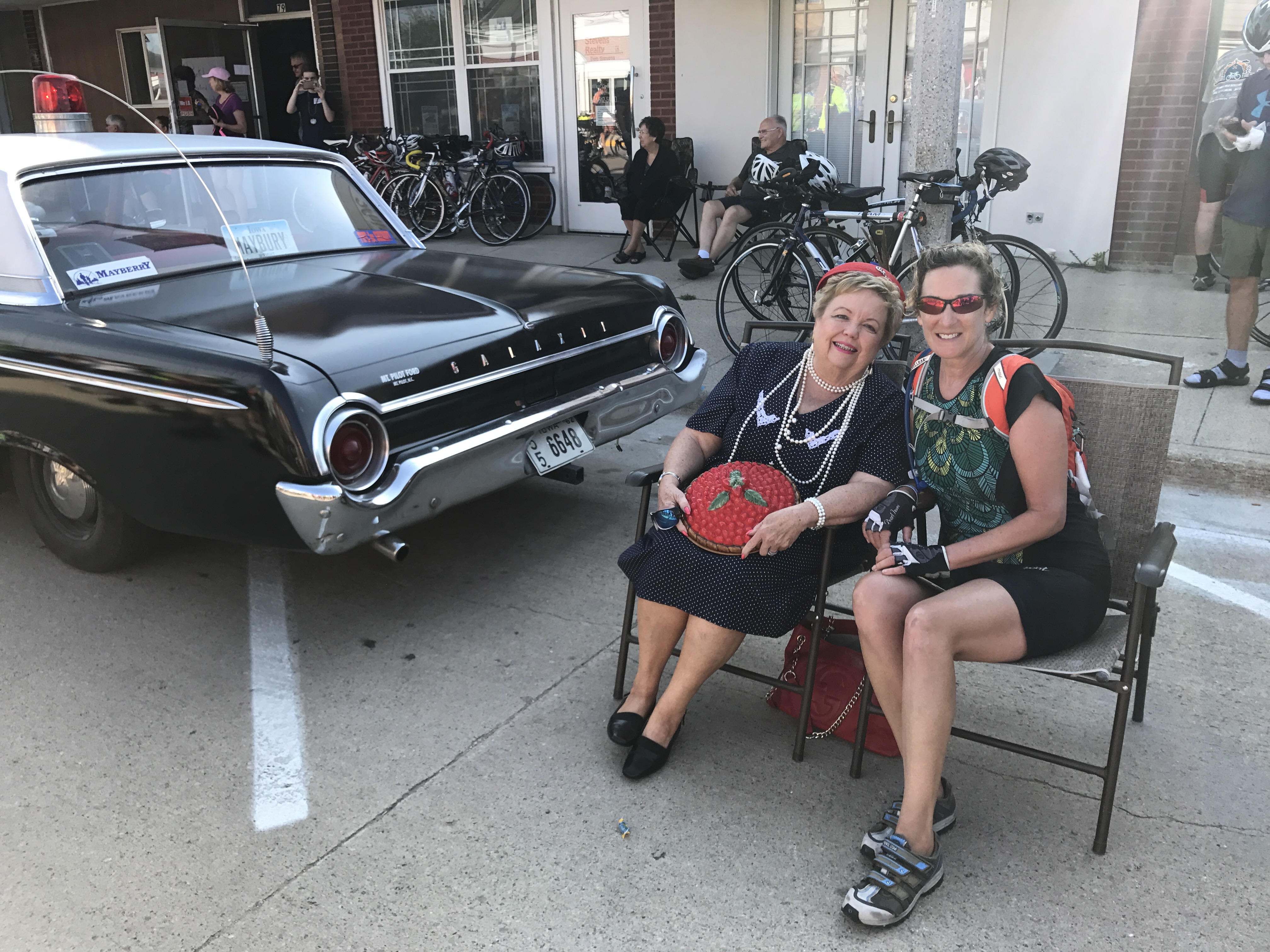
Everyday was like rolling through Mayberry. Donna “sit’n a spell” with Aunt Bea.
A lot of kissing going on at this event!
The last day of RAGBRAI is always a bit crazy. Tiny towns, tight streets and thousands of people trying to pick up their cyclists before heading back to distant corners of the world.
I look back on the pictures from RAGBRAI 2017 and remember what a special event this was, the interesting people we met along the way and all the calories consumed. We were with an amazing group of friends who will now have a story to tell about that time we all went to RAGBRAI.
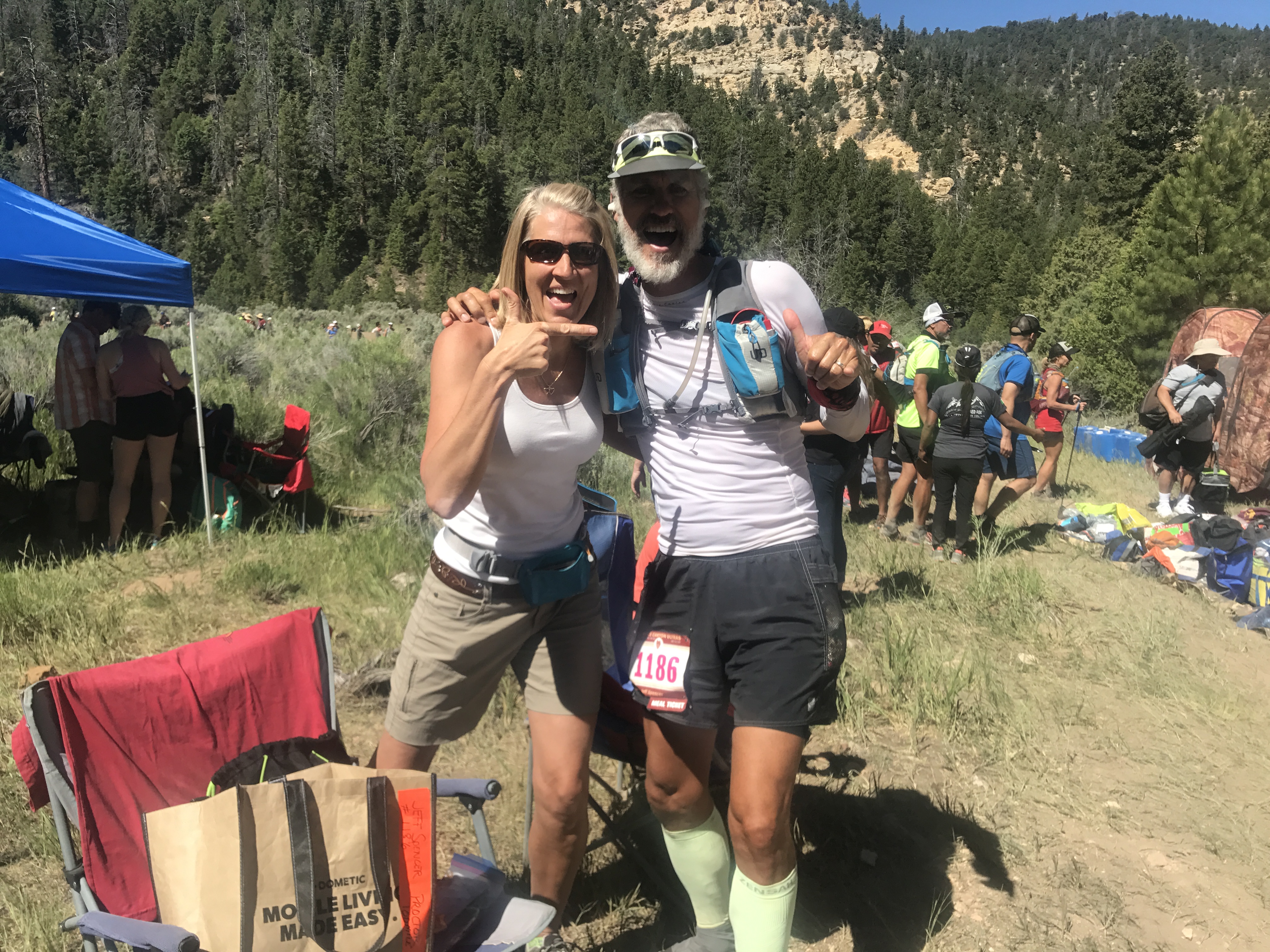
Bryce 100 Ultra Trail Run
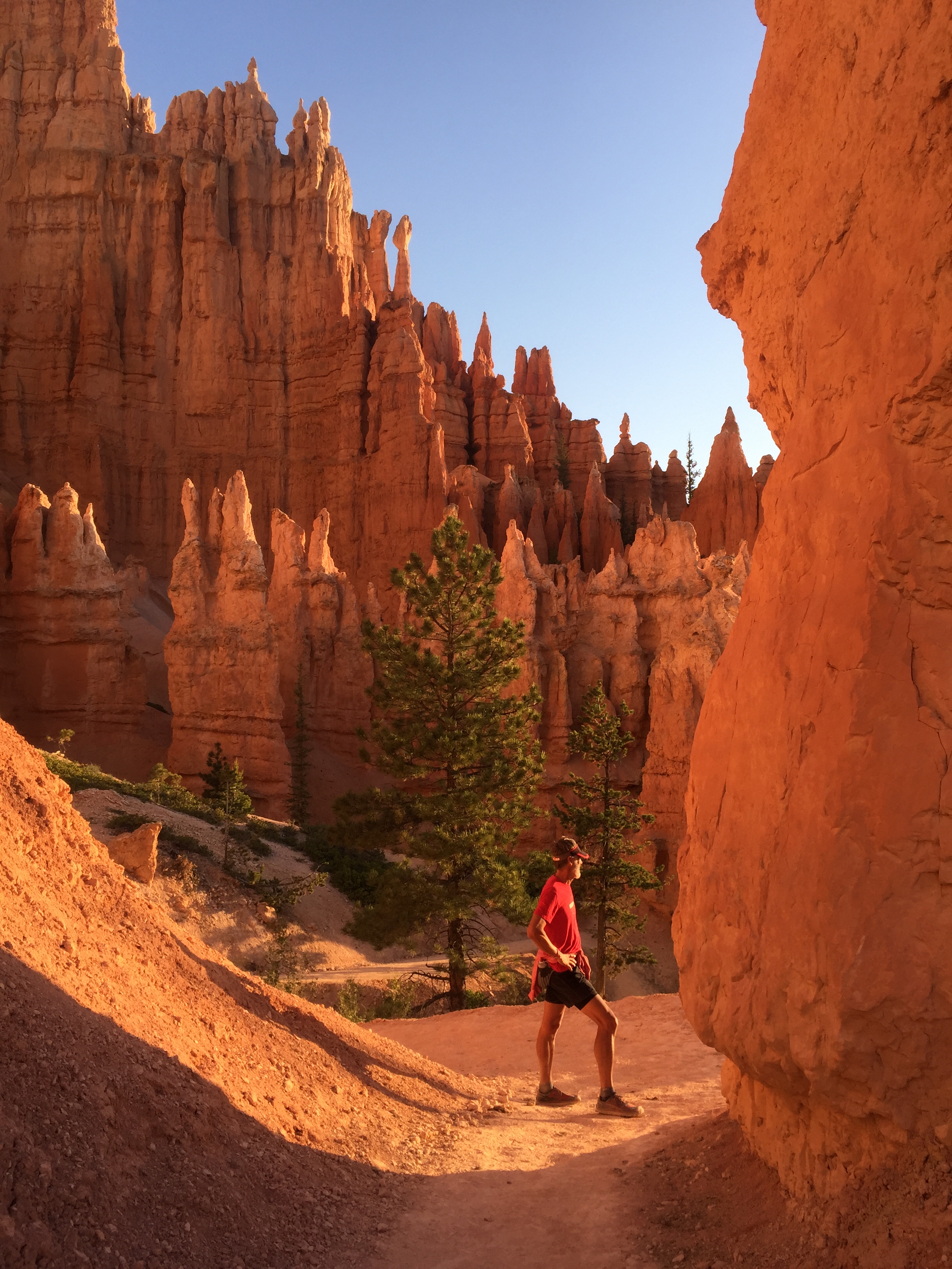
Posted by Deb in Boondocking, Full Time RV, Trail Run, Ultra Running, Utah on October 19, 2017
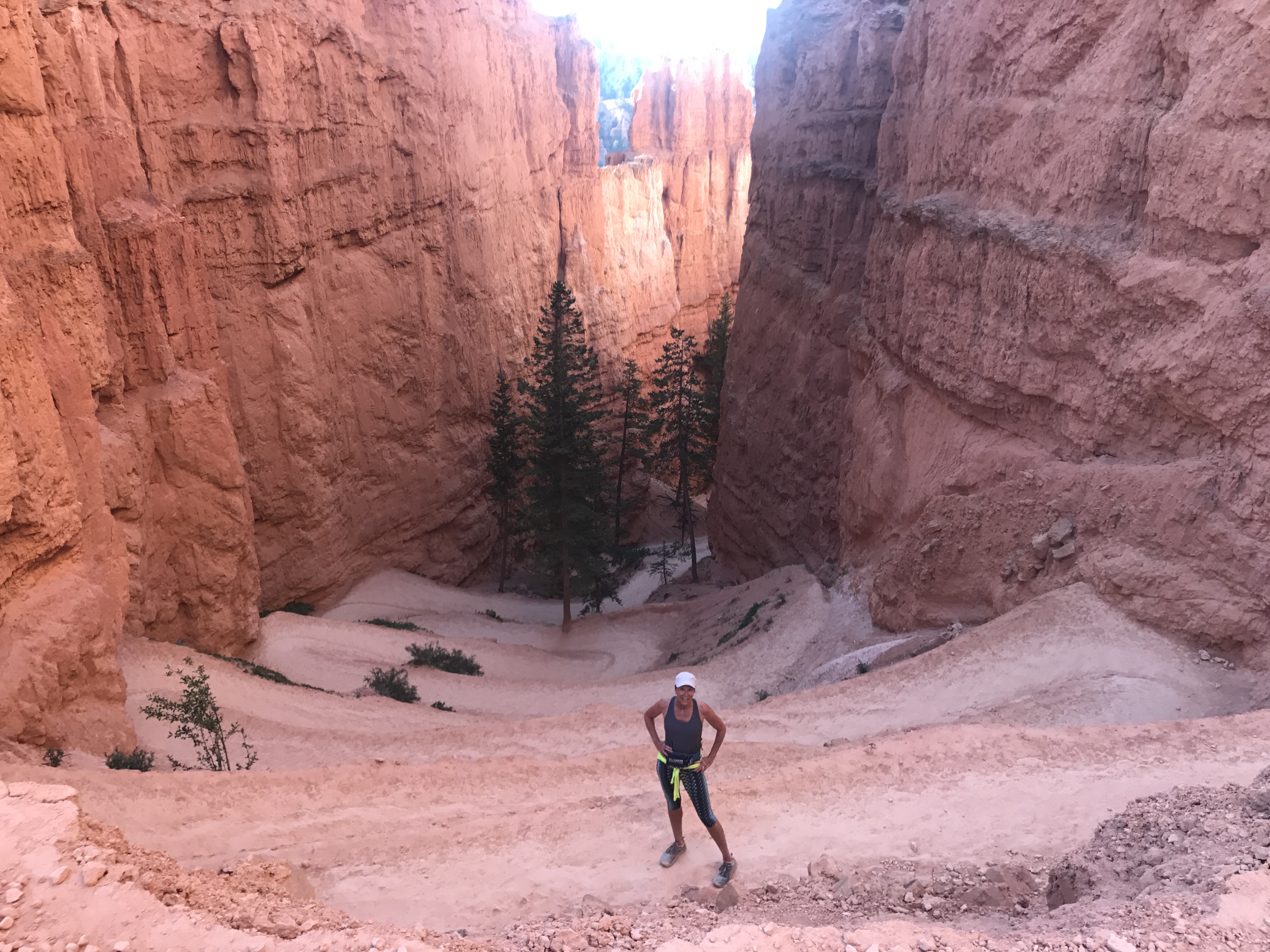
While we were camping at the North Rim of the Grand Canyon Jeff and I wanted to do a shakedown trip to Bryce Canyon before we moved the RV there for the Bryce 100.
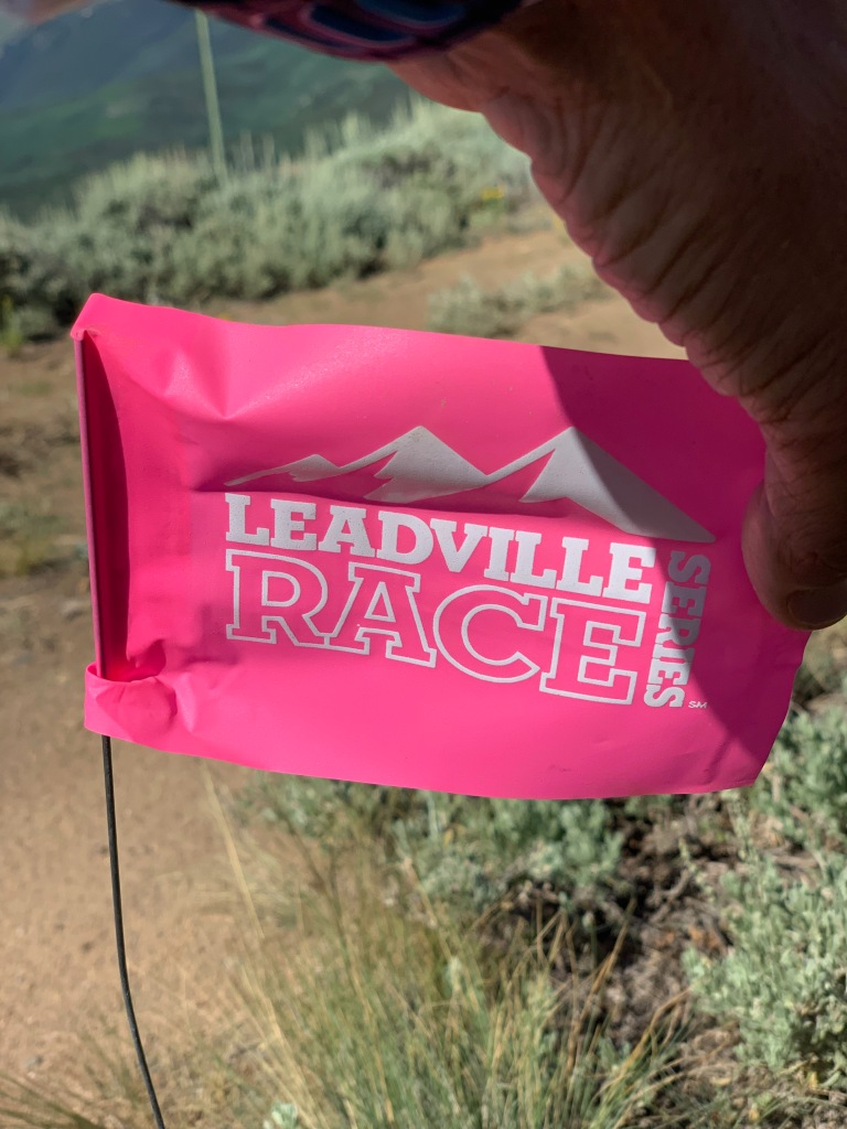
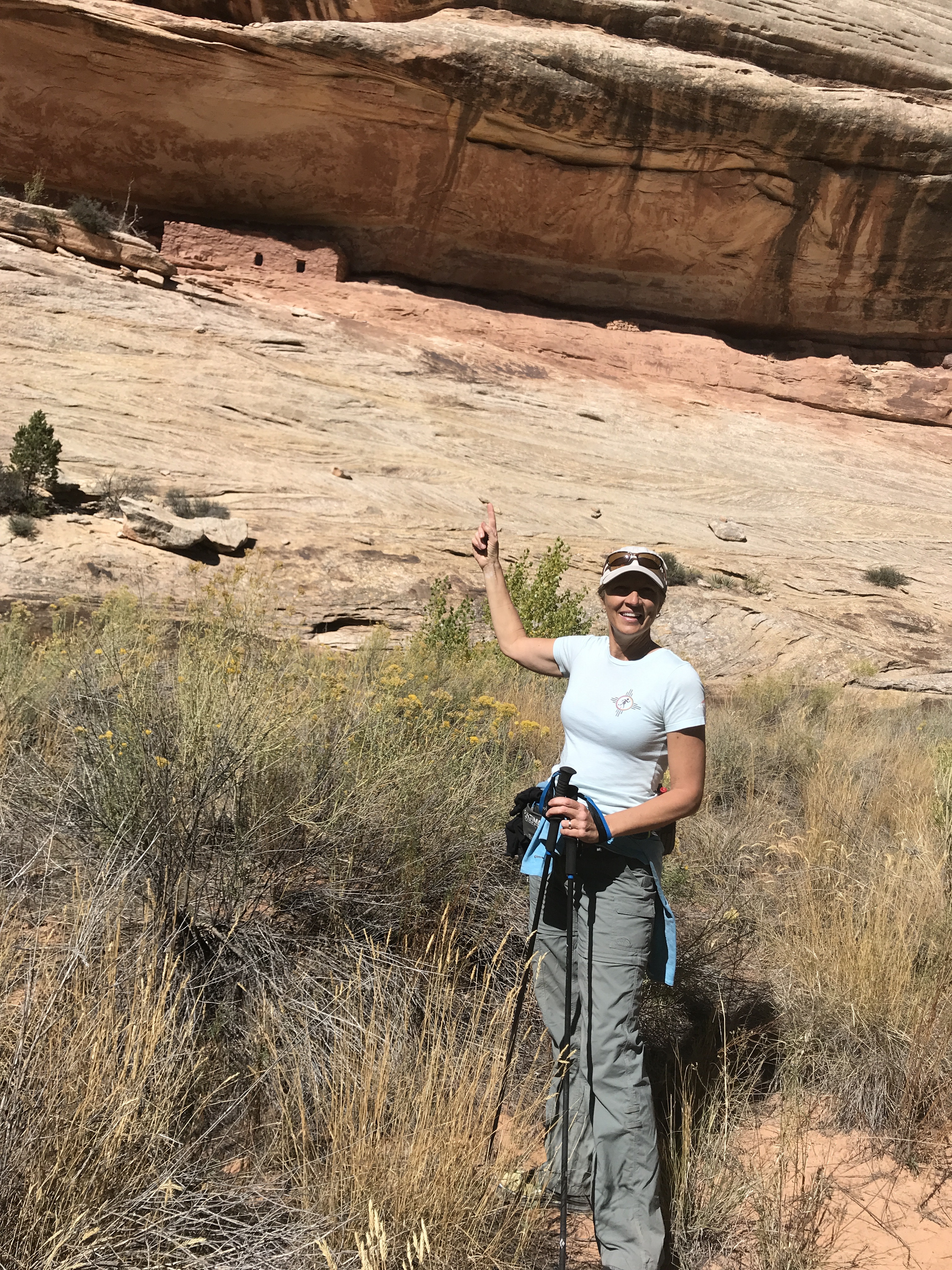
I had researched boondocking sites near the Bryce Canyon National Park. We drove down a couple of dirt roads and through the Red Canyon Campground but none of them had any connectivity. After passing through the two arches on Hwy 12 with a 13’6” height restriction, we found an incredible boondocking area on Toms Best Spring Rd, just across the street from the start of the Bryce 100 at Coyote Hollow.
And with excellent connectivity it was the winning location.
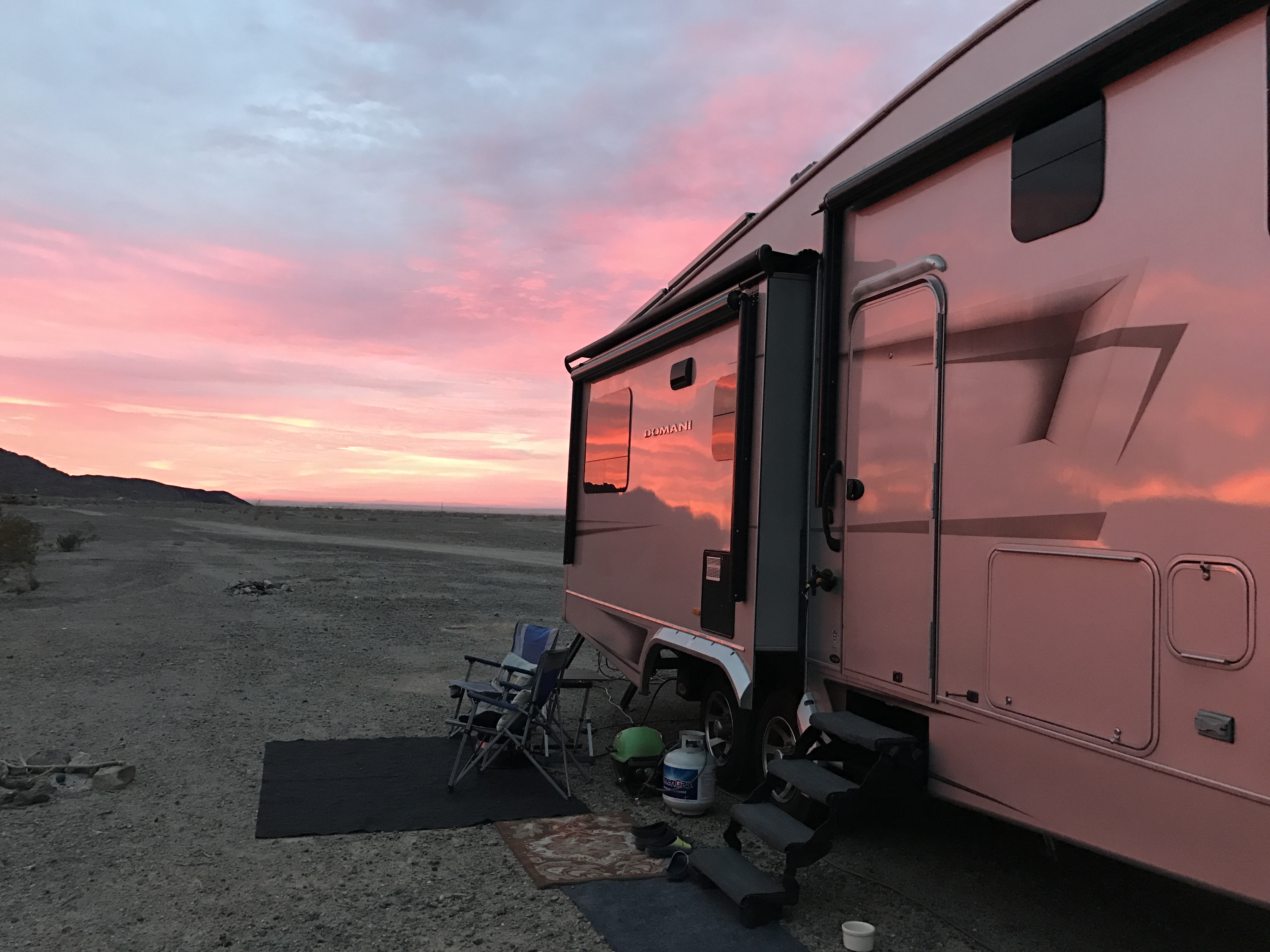
Our only apprehension was the height restriction through the arches. Our girl is tall like Jeff and I, so squeezing her through 13’6” was about 6” short of her Amazonian stature. Jeff devised a plan on how we could measure the height. With his 8’ overhead arm reach while holding our 5’ truck bed bike rack we could tell that the arch still had 5-6’ of clearance. As long as we stuck to the center of the lane we were golden!
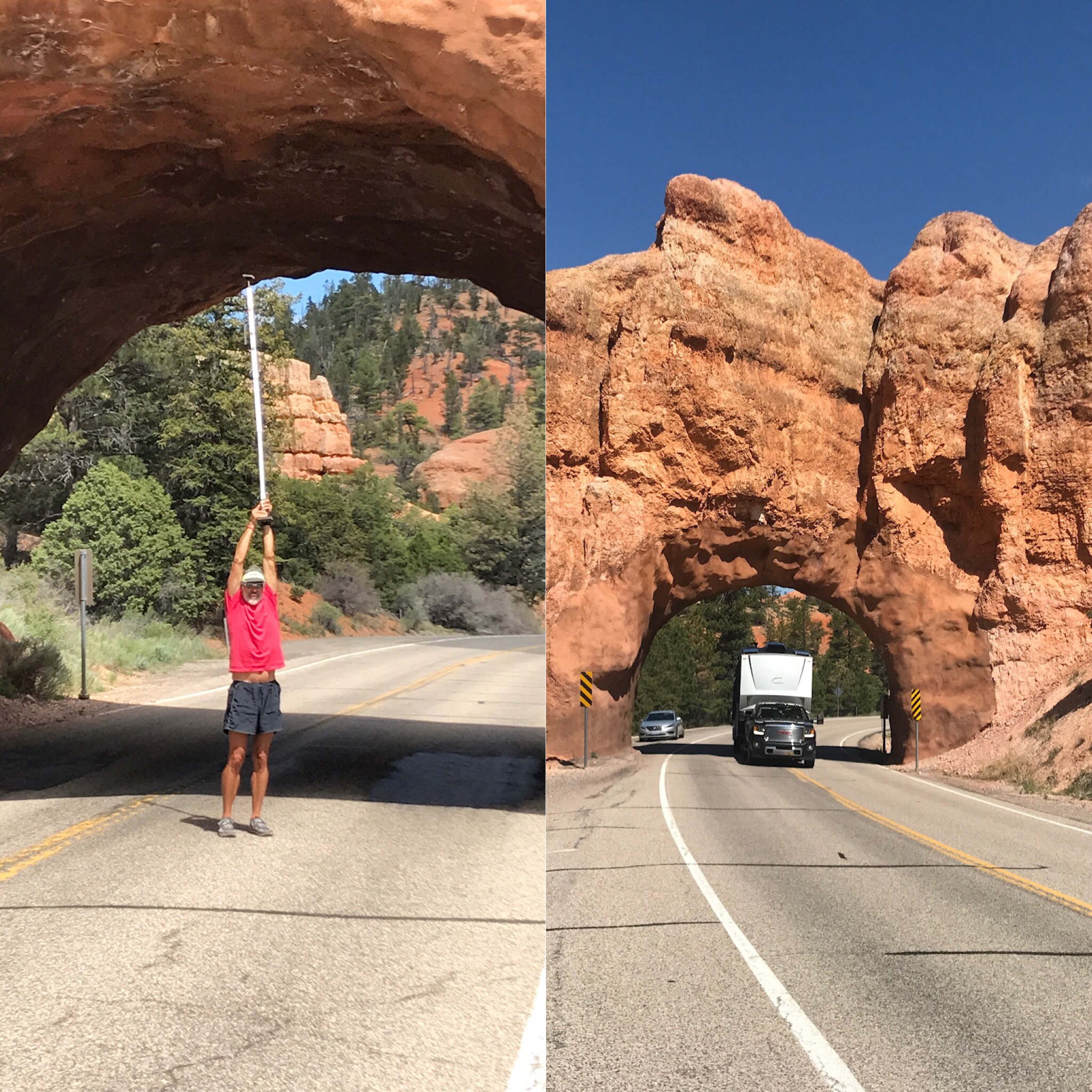
Plenty of headroom for the Domani
A couple days later we packed up camp at the North Rim and made the two-hour trek to Bryce.
We left early in the morning and dumped our tanks at a gas station in Kanab. We wanted to get an early start so that we could avoid too much traffic while trying to fit our square peg of an RV through a round hole of the arches. All went smoothly with plenty of clearance and we picked an awesome boondocking spot to spend the next two weeks.
We used these two weeks to scout out trailheads and aid station checkpoints for the Bryce 100. Our campsite happened to be in the perfect location for hitting two different checkpoints on opposite sides of the course. This would allow me to swing by the RV to catch a quick nap and make Jeff a couple of smoothies during the 36-hour race.
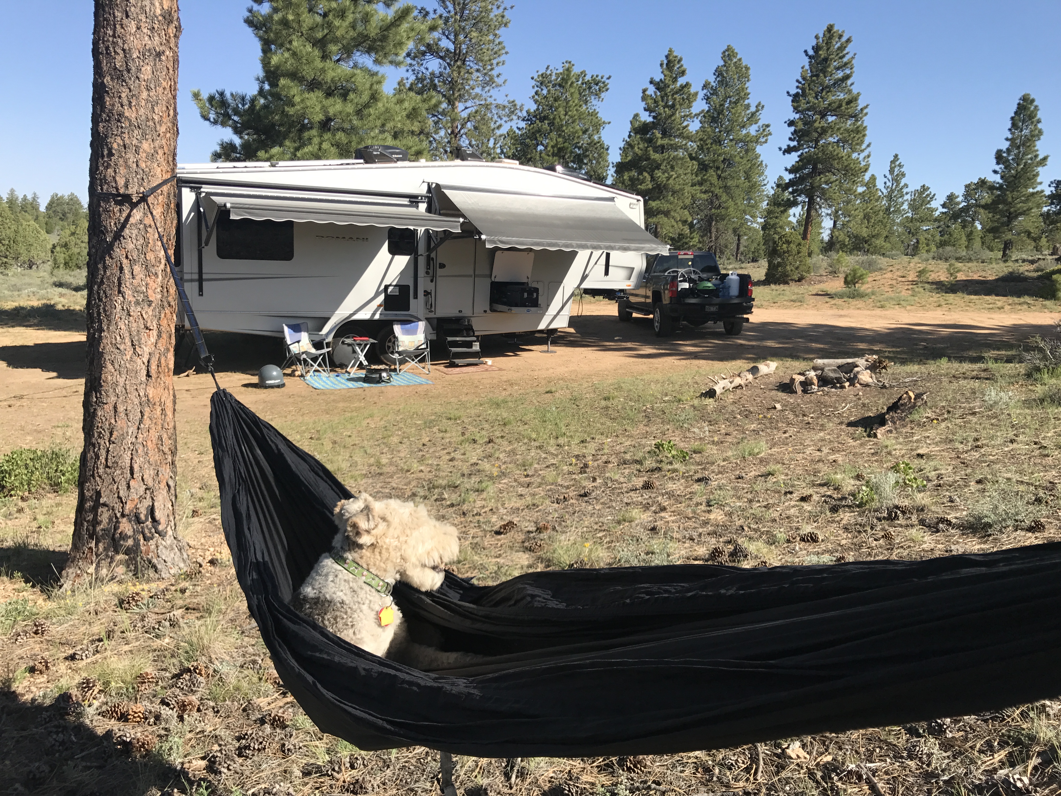
Sweet Bryce campsite..Sam approved!
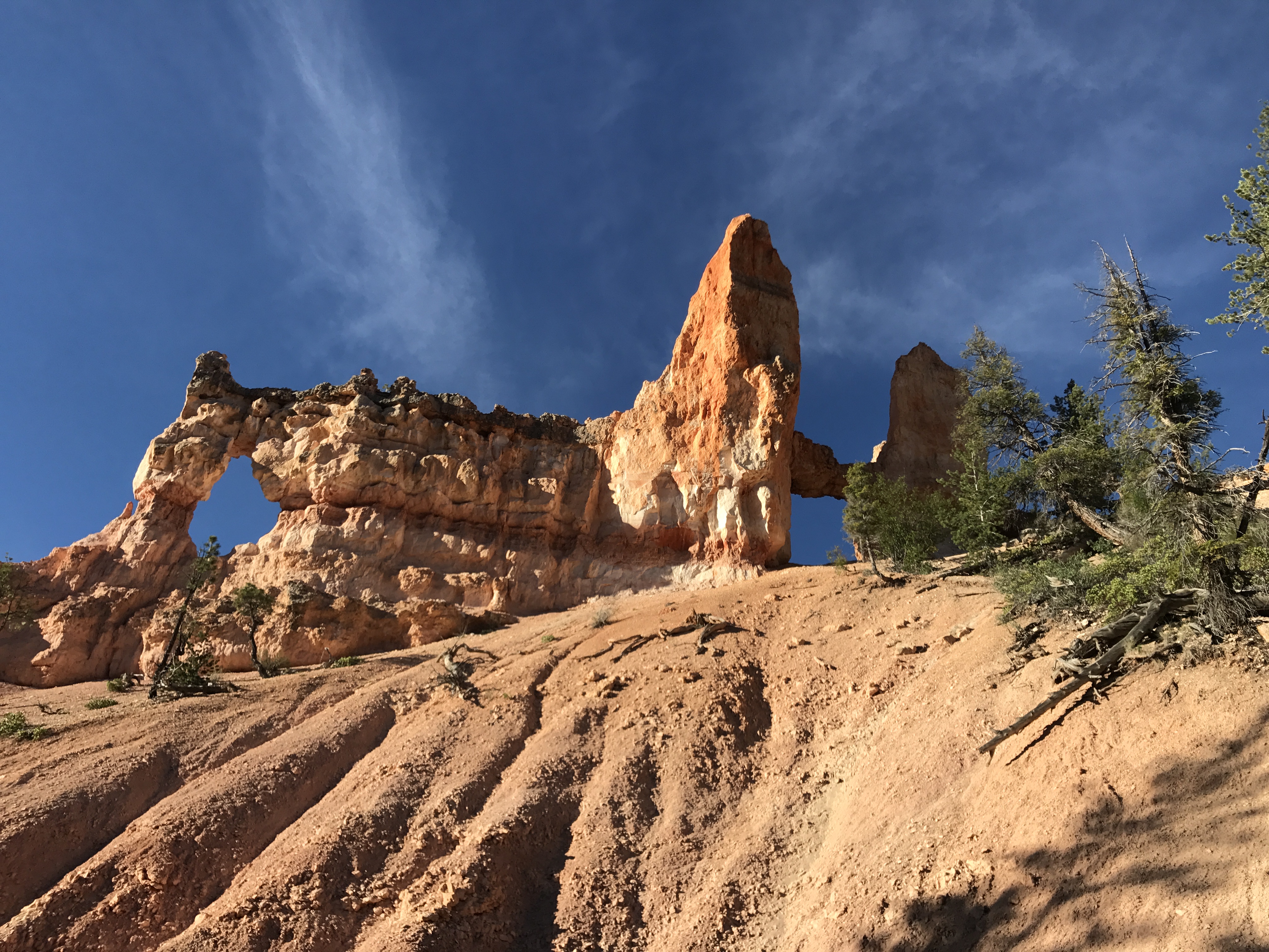
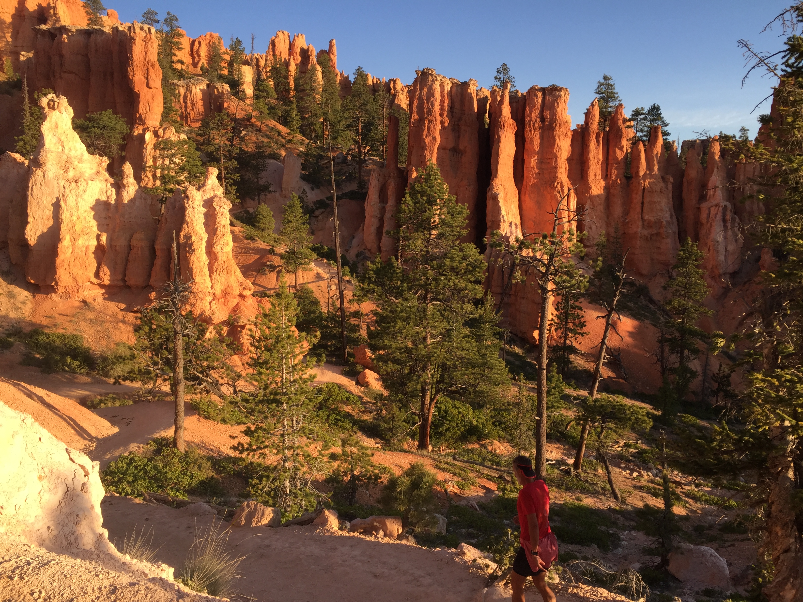
We took the opportunity to do a couple of training runs in Bryce National Park. Our first sunrise hike was on the Rim Trail that connected to the Navajo Loop Trail. The trip down the canyon was steep with switchback after switchback to make the grade more manageable. What was dynamic about this hike is that the initial trail takes you up close and personal with tall hoodoos and slots that appear to be held up by the smallest of pebbles of crumbling dirt. Just one flick of a finger would appear to bring it all tumbling down.
Switchback City
Nature at it’s finest
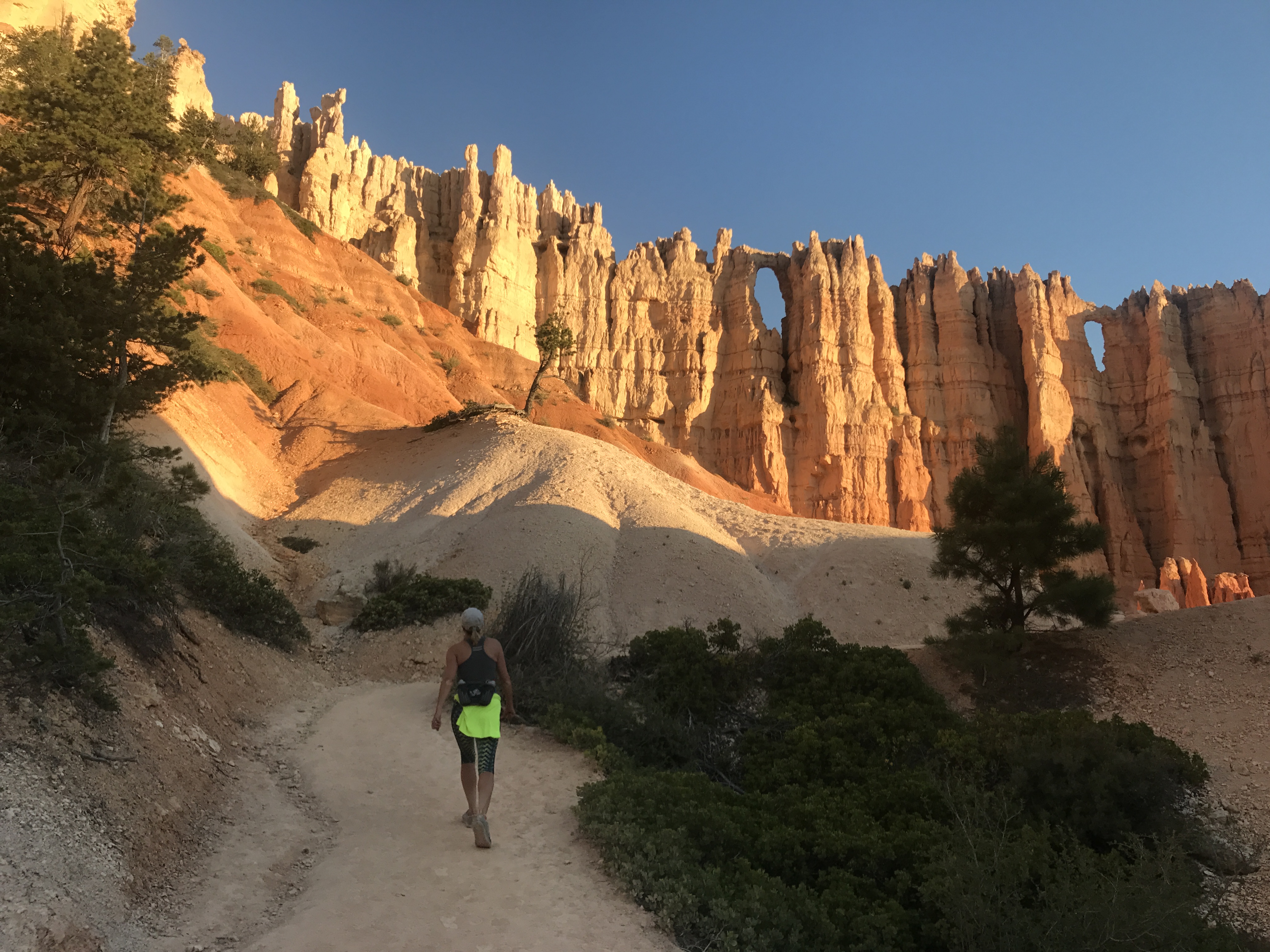
Another favorite is the Fairyland Loop. Eight miles of dusty dirt to kick up while taking in the sites!
Hoodoos standing at attention
As the sun came up it set the rocks on fire, heating up the canyon with a warm radiant heat. Every turn gives a fresh vantage point of endless hoodoos that speak straight to my soul. “Come and explore so that I may show you a whole other world”.
This is why I love Bryce
Holy smokes I love this guy
God’s creation moves me. It speaks to me. And I am whole again.
After such a moving experience we went to breakfast and did laundry at the Bryce Canyon Inn. Hey, that’s the reality of life on the road. One minute you are basking in the glory of nature, the next you are buying propane and dumping your poop at the local gas station.
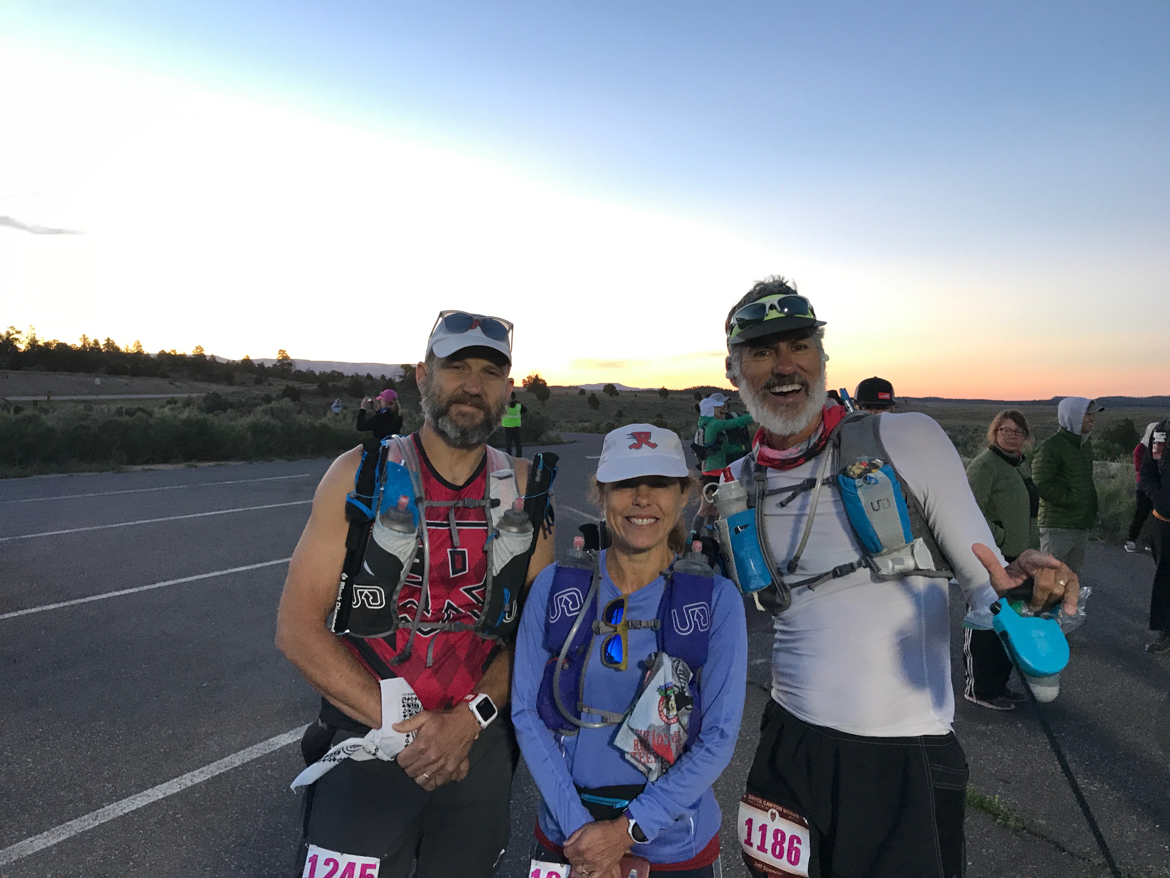
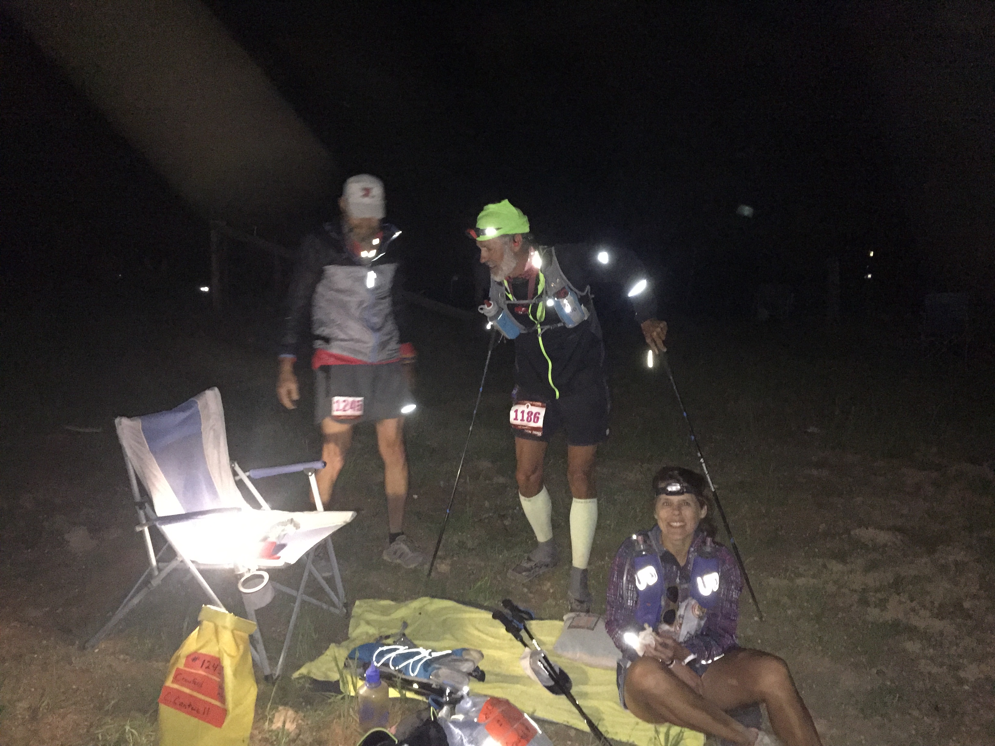
As the race quickly approached we met up with two friends from our Arkansas running group who also had entered Bryce 100. Janet and Chris are the ones who encouraged Jeff to run this race with them. Strategies were talked about, meals were eaten and all checked in for the race. The pain fest was about to begin!
Yup…crazy people!
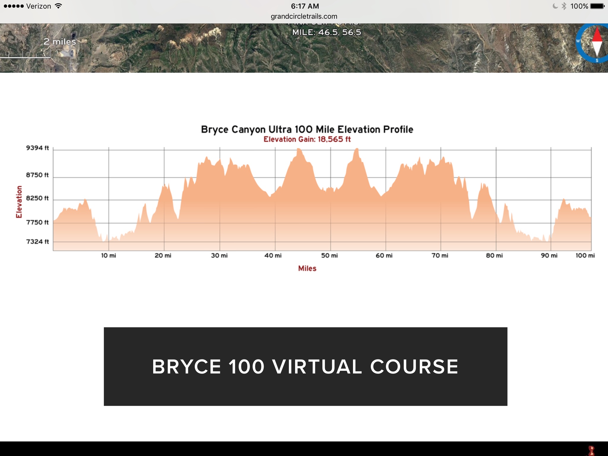
On June 16 the gun went off and the crowd of 250 shuffled off with high hopes for the next 24-36 hours of 18,565’ of vertical climb.
6AM start
I stopped at the RV for a quick nap and made Jeff a smoothie before heading off to the first check point about 19 miles out. The tough part of being a spectator at these types of events is that it can be challenging to spectate. Check points can be spread out over 100’s of driving miles down poorly maintained roads.
Proctor Canyon aid station was no exception.
Support crews had to park miles away and wait in long lines to hitch a ride on the back of a pickup truck who then made the 40 minute rock crawl to our destination. Thinking I had left a couple of hours gap before seeing the “Arkansas Travelers” (AT-team) they showed up 30 minutes after my arrival. They were making great time!
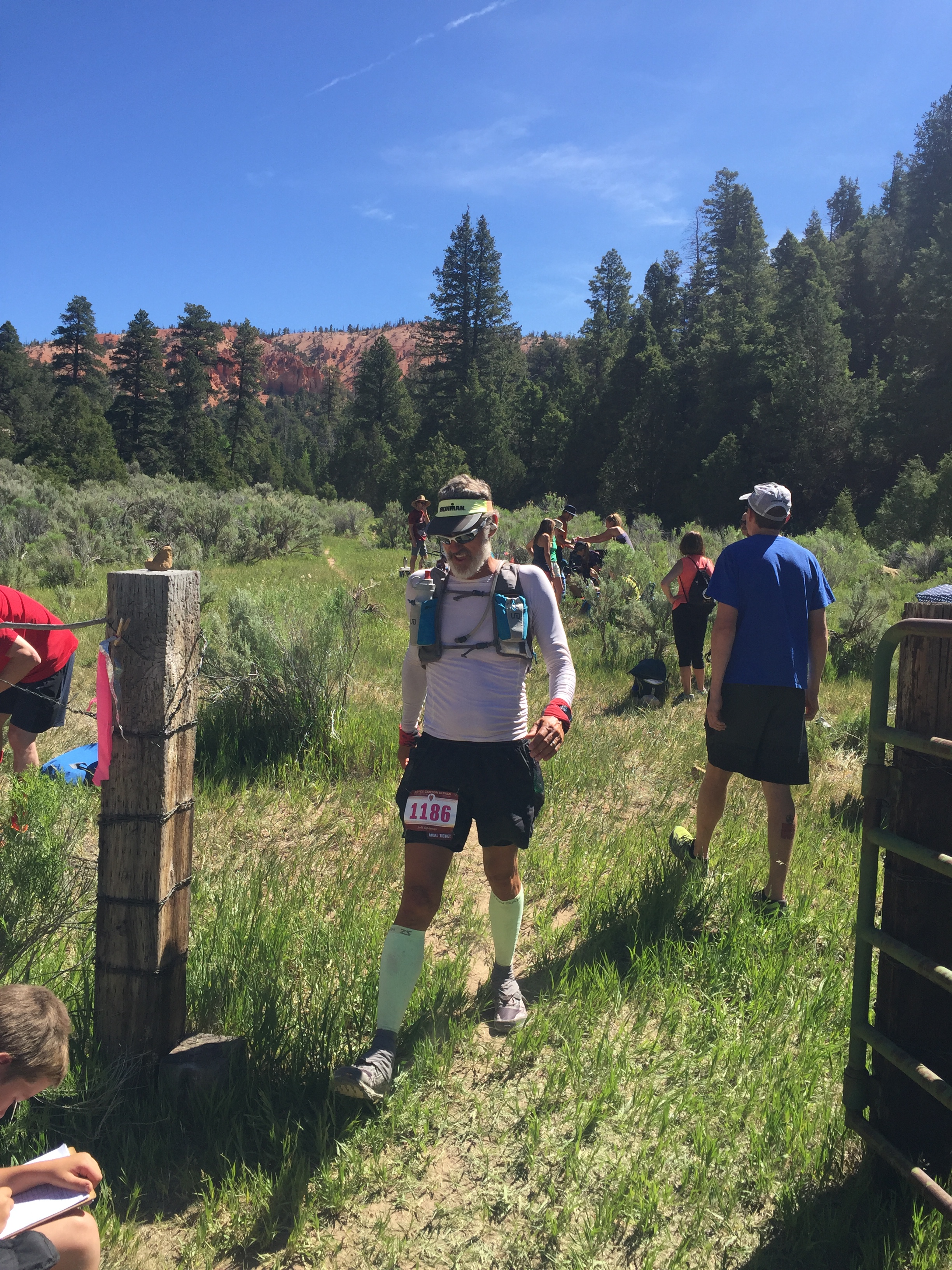
Walking it in to mile 19
Who is racing 100 miles? This guy!
All systems were a go and Jeff, Janet and Chris quickly moved on. I made the rock crawl back to my vehicle and drove back to the RV to reload for the next aid station at Straight Canyon, mile 41.
Another interesting thing that happens during these races is that you start questioning your timing. You do the math over and over again to insure you arrive at the aid stations when you “think” your athlete will be there. But then they show up early to the first location and throw off all your projected times for the day.
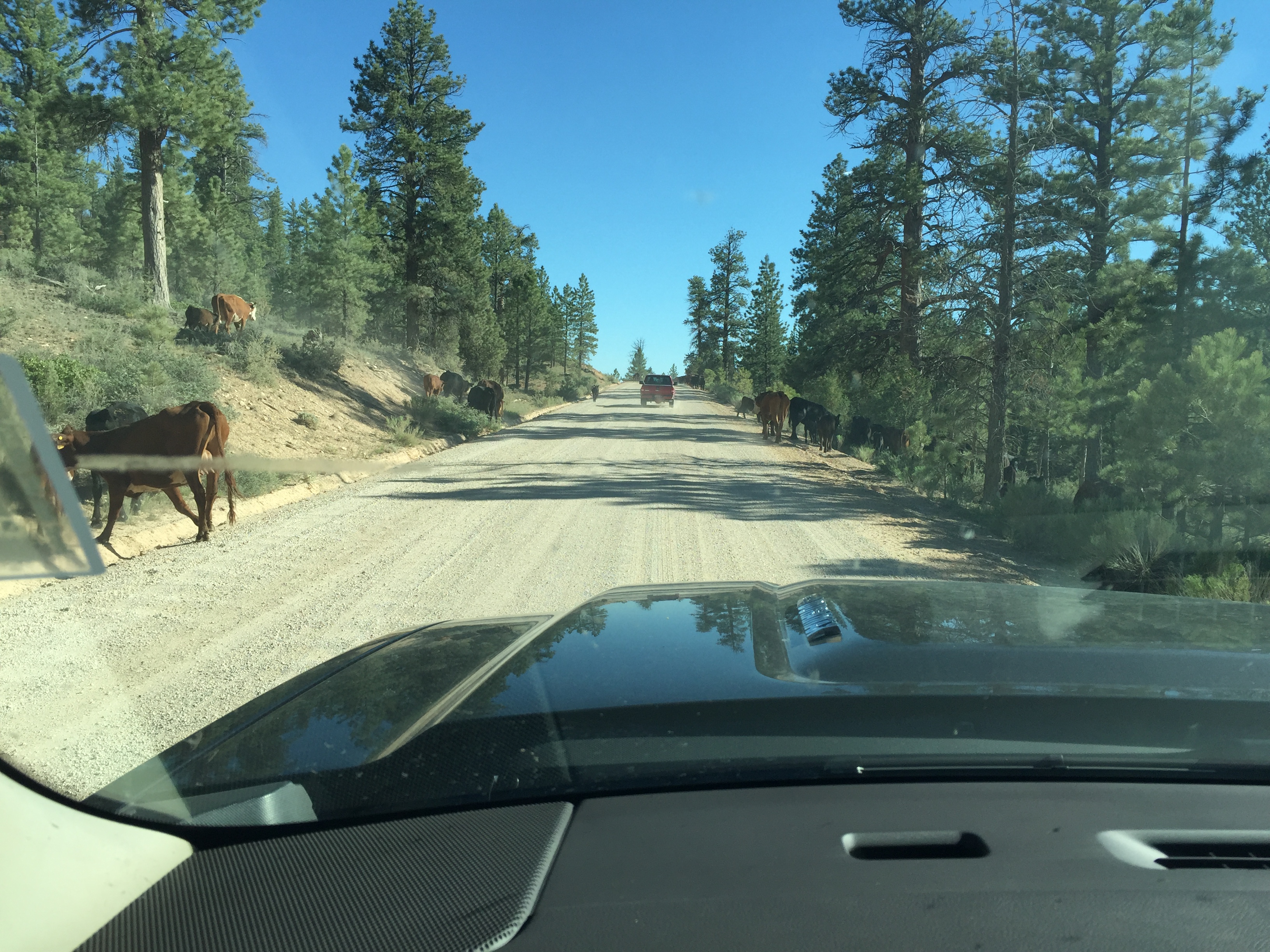
Got caught in a cattle traffic jam
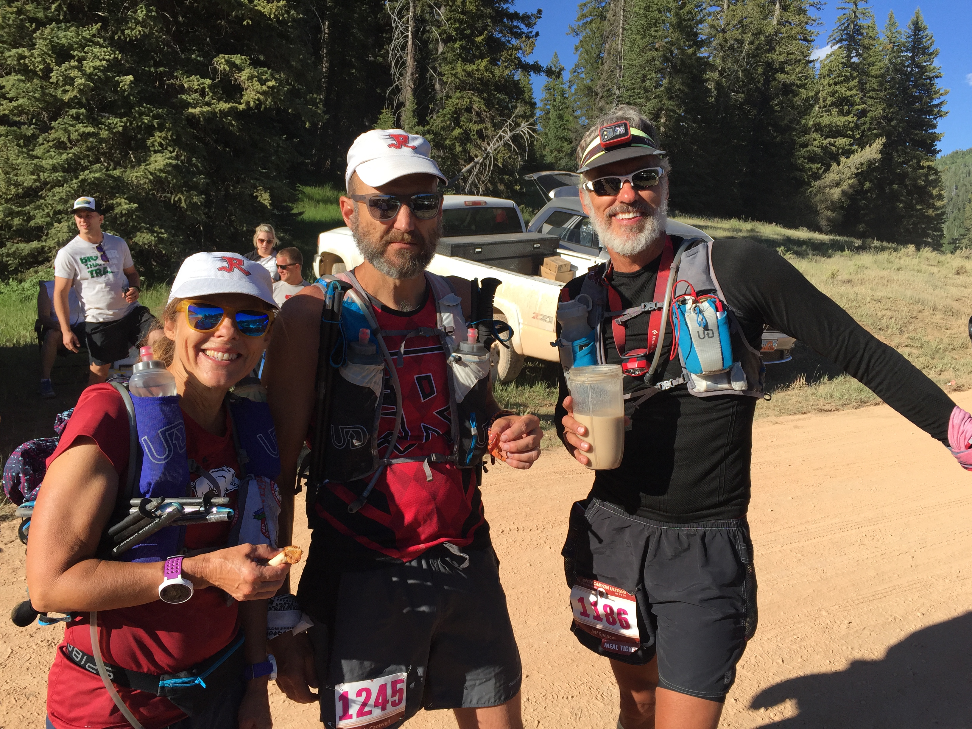
Discussing the next leg over a smoothie
So when I made it to Straight Canyon the AT-team was already heading down the road to the next location. I managed to see Jeff for a few minutes, and then we were all off to the next spectator aid station at the turn around…mile 51.
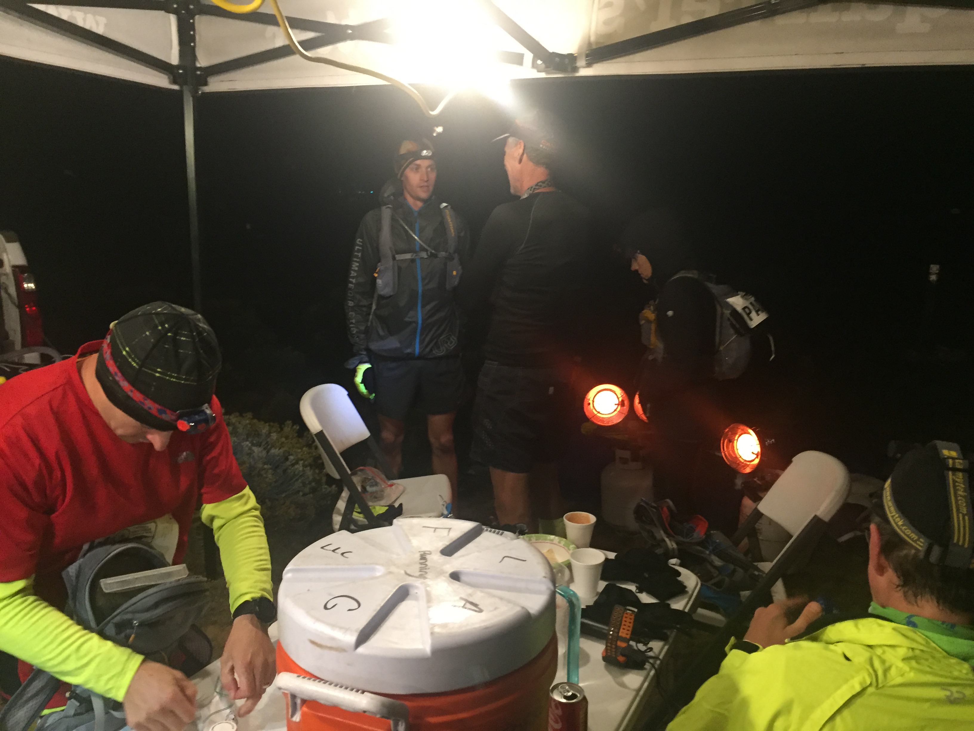
Crawford Pass was 10 miles away for the runners, but only 3 miles for the crew. So I settled in for a bit of a wait. The sun was going down by this time and the temps were beginning to drop. I tried to nap in the truck but I wasn’t able to sleep. So I put on warmer clothes and decided to help the athletes coming in by picking out their needs bags and getting them food.
By mile 51, everyone is getting pretty tired and I saw quite of few people decide to call it quits. Jeff and I had a strategy in place, that if he came into an aid station and wanted to quit I would encourage him to wait to make the decision at the next aid station. These races are as much mental as physical and if you can delay a decision until the next stop, sometimes that’s enough time to get the athletes out of their own head and back on the trail.
Mile 51
Taking a break at the turn around
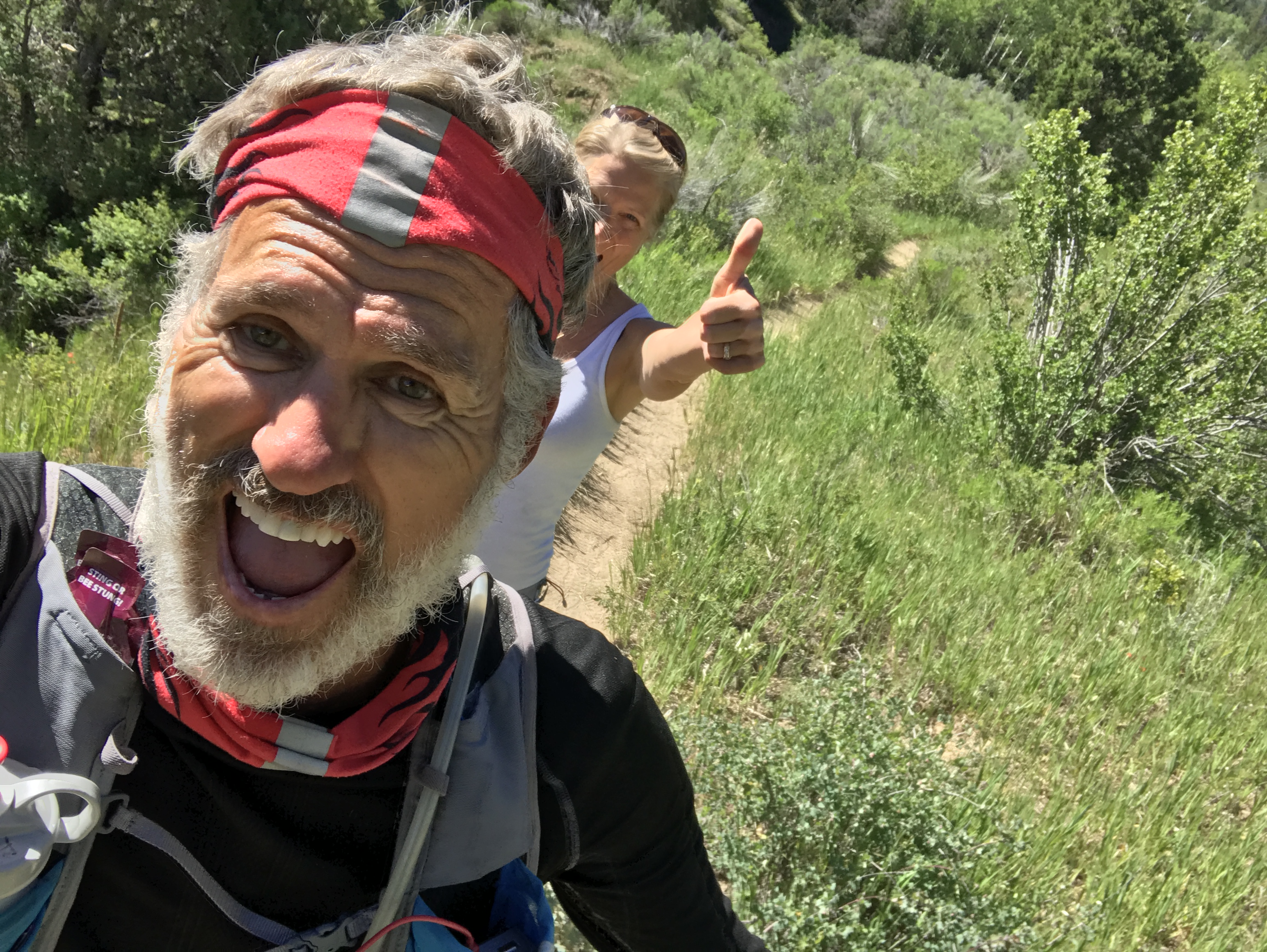
Jeff came into Crawford pass about 10pm and the rest of AT about 40 min later. Jeff used this aid station to take a 30 min nap while I took his shoes and socks off, washed his feet and put on new, fresh socks. Jeff didn’t have a single blister in sight and was feeling pretty good after his nap.
Jeff has always been a VERY optimistic guy and to see him with his happy-go-lucky attitude at this stage amazed me to say the least. There was no hint of not making it to the finish and I knew then that he would accomplish this race!
Our other teammates were not having the same experience. Chris had such an upset stomach that he wanted to drop out. While the rest of us tried to encourage him to delay his decision he walked into the woods to throw up, then announced that he was out!
By this time Jeff had already left the aid station.
Janet wanted to continue on but did not want to run in the dark by herself. She was going to drop out as well until a pacer for another runner (that had dropped out) offered to run with Janet through the night. This wonderful gal ran with Janet until the finish of the race…50 miles away. What a super hero!!!
Since this race was an out-and-back, Chris and I drove back to Straight Canyon, now mile 62. We fell asleep in the truck and woke up just as Jeff was leaving the aid station. He made awesome time again and was still feeling good. Janet followed a bit later and Chris and I headed back to the RV where his car was parked.
I’m not going to lie. By now it was 3am and I was exhausted. The 45-minute drive was pure torture in sleep depravation. Chris went back to his hotel and I slept for a couple hours at the RV before making one more smoothie for Jeff. Our last spectator aid station was back at Proctor Canyon, mile 84. This time Chris and I drove my truck to the aid station and offered up rides to others waiting in the long line again.
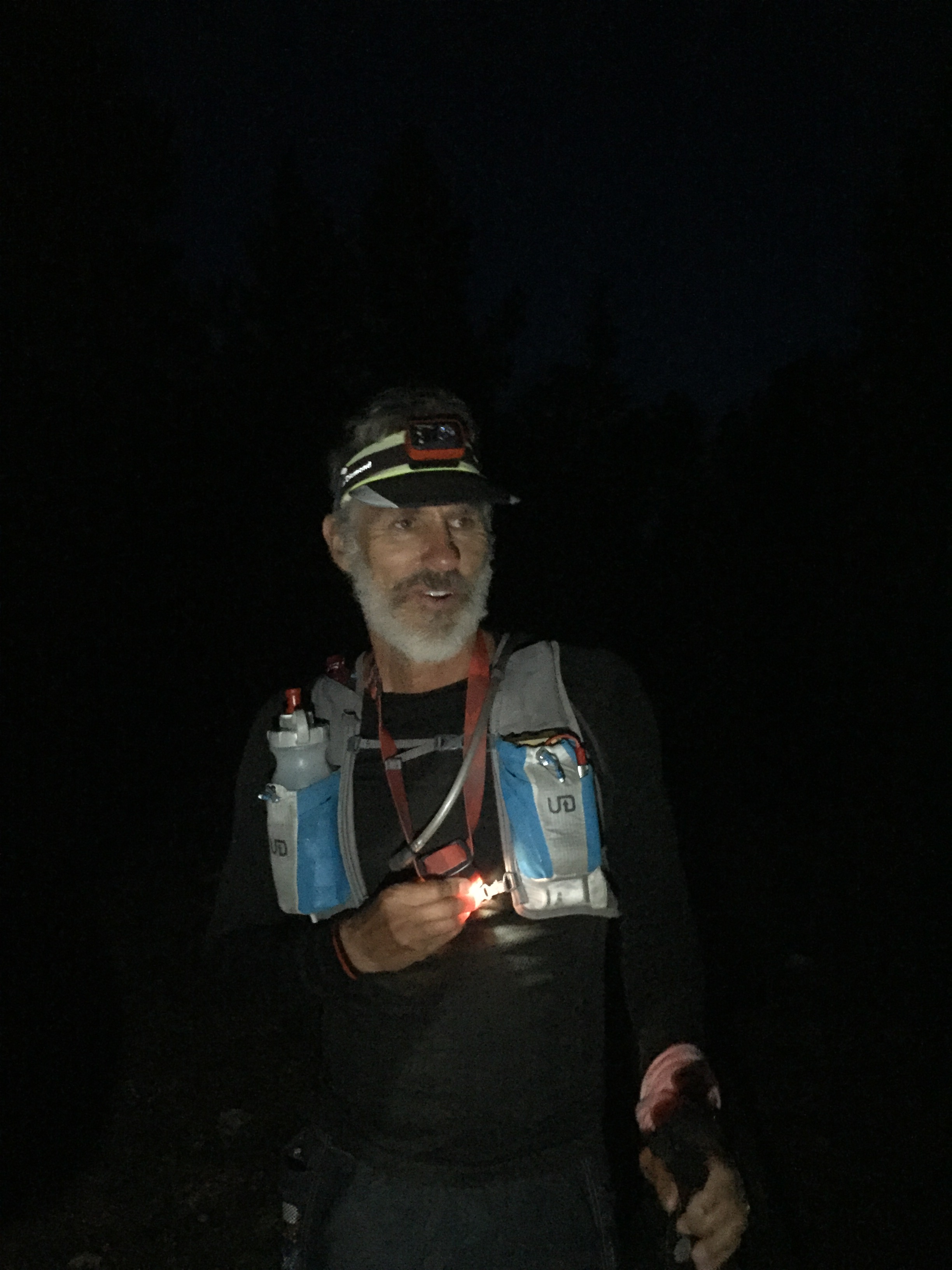
Jeff was able to get a text message every once in a while to let me know what time/mile he was at. I knew that he was within 4 miles of Proctor, so I set out back tracking the course to pace him into the aid station. I ran into him with two miles to Proctor and he filled me in on the perils of night running and things that go bump in the night. With sleep depravation, exhaustion and a bit of hallucinations there is quite a story to tell!
On the trail to Proctor Aid Station for the last time
By now it was getting very hot and the rest of the course was in full sun.
At Proctor we did one last foot cleaning and clean socks and Jeff made a quick exit. His cut off times were starting to get tight and he didn’t want to run the risk of not finishing under 36 hours.
I watched as other runners came into the aid station. Some looking fresh. Some looking terrible. It is scary when an athlete stumbles into an aid station not knowing who they are or babbling something incoherent. It was sad to see one runner who was pulled off the course by the medical team with just 16 miles to go. It was definitely warranted, but sad just the same.
By this mileage there are plenty of runners crying due to pain, skinned knees from falls, blisters on top of blisters and those who just want to stop. I admire all these runners for the perseverance it takes to finish a 100-mile race. My respect goes to each and every one of them…those who start and those who finish! Who does such a thing????
With 16 miles left Jeff pushed his legs further than he ever has and had a kick to the finish with an hour to spare.
Jeff completed his first 100!!!!
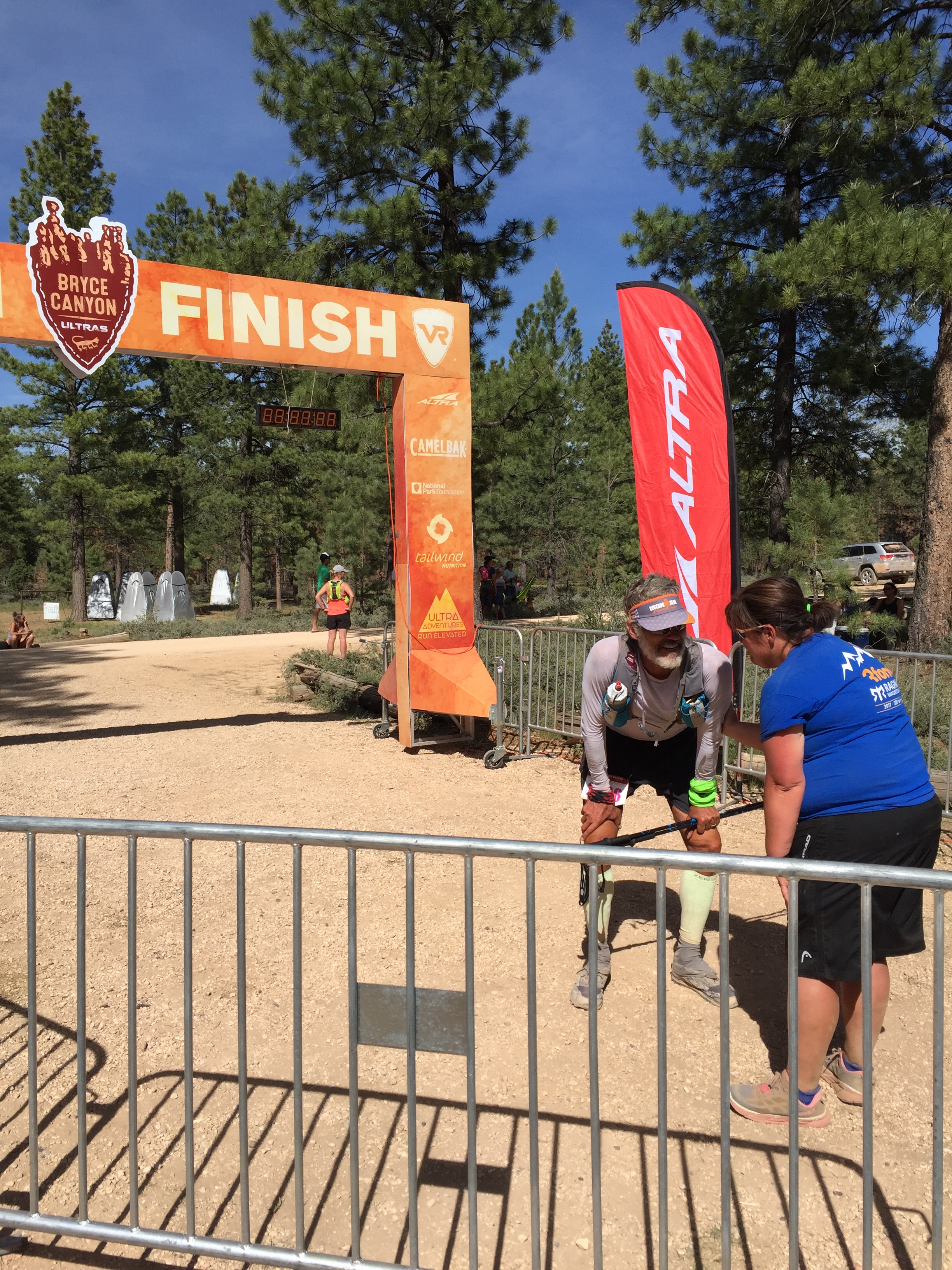
Bryce 100 in the books!
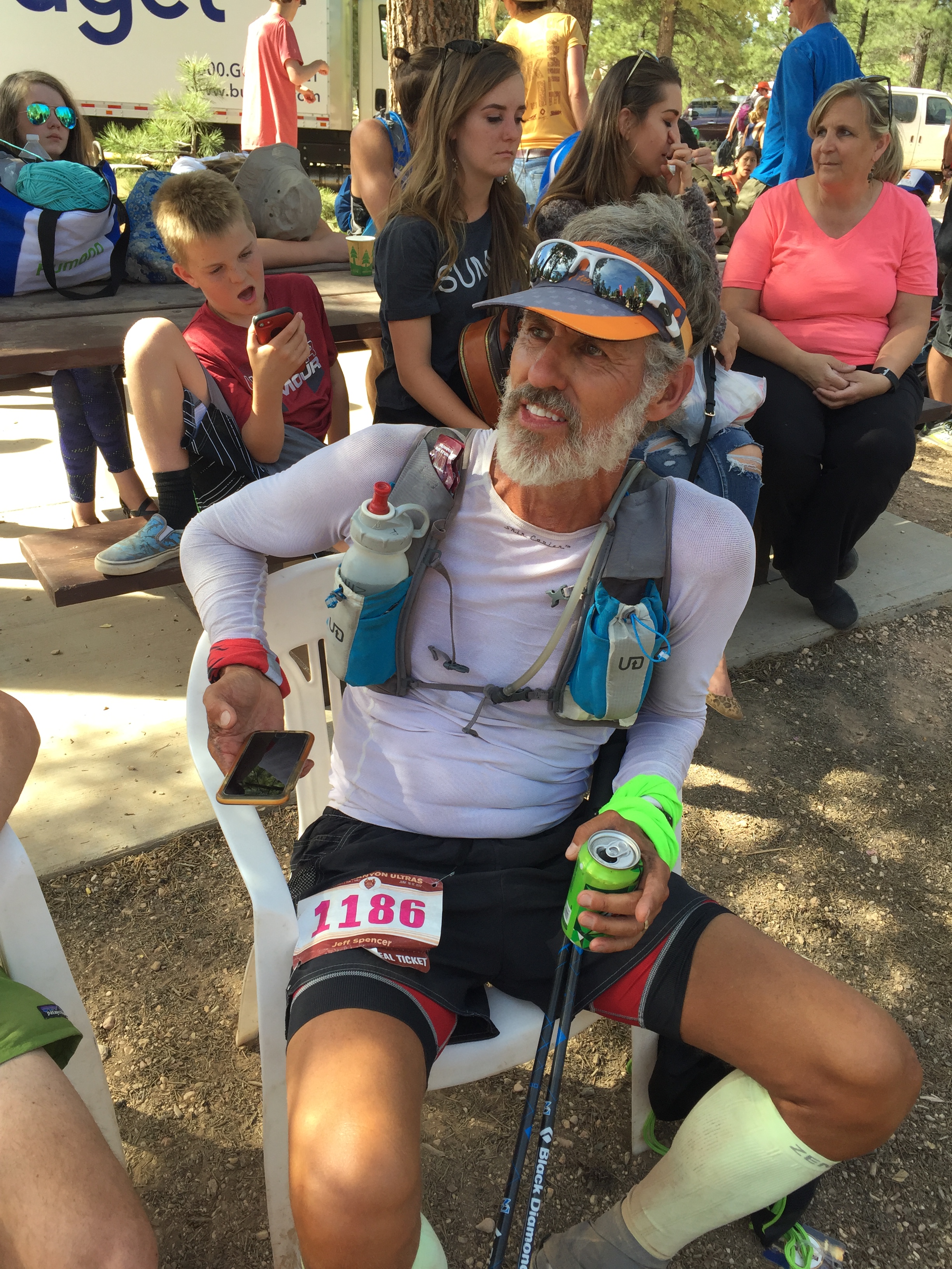
A well deserved seat!
I cant tell you how proud I am to see Jeff cross that finish line. All the long training runs, all the mounds of food consumed to fuel that training, all the head games to convince himself it can be done, all the research and conversations from those who have gone before. It all came together for a perfect race!
Janet showed up with her pacer about 20 minutes after the cutoff. Anyone that finishes a 100 mile race is a “finisher” in my book.
Jeff and Janet received their belt buckles!
Way to go Janet!
48% of the field dropped out of the race that weekend…48%! There were ambulances at the finish to escort some weary runners to the hospital. Jeff got some food at the finisher’s tent, and then we made the short drive back to the RV.
We had a quick travel turn around to make it to Denver. With a flight scheduled to Elkhart IN for meetings within a couple days my plan was to load up Jeff and the RV right after his finish and head down the road. But we were both too exhausted. It wasn’t going to be safe for me to drive so we decided to wait until the next morning to leave Bryce.
After a VERY long day of driving to Frisco, CO we stopped at a campground before making the last push to Colorado Springs where we parked the RV in a friends driveway for our Indiana trip.
Since Jeff’s race 4 months ago (I know…I am waaay behind on this blog) we have been stationary for the most part in the mid-west. We have been hit with some life events back home so I will fill you in on the excitement next time!
Goodbye for now Utah!
Sammy Scare But Back On The Move
Posted by Deb in Boondocking, Full Time RV, Hiking, Moab, Running, RV Parks, Trail Run, Utah on April 18, 2017
Arches National Park
March-April 2017
If you have never smelled the South or Southwest when grapefruits, lemons, limes and oranges are blooming, you are in for a treat. The smell is fragrant, sweet and a bit intoxicating. It’s another reason we love the Southwest, especially because the blooming happens while the rest of the country is still experience arctic blasts.
We left the blossoms and Sam dog with the sitter while we flew back to Bentonville, Arkansas.
I had to delay my trip a bit because Sam was in bad shape. While we were in Tucson for the Escapees Rally, Sam started to act strangely. He couldn’t keep up with me on a simple walk around the RV Park. When we picked him up he would cry out in pain and he became lethargic.
Too tired to hold his head up 😦
He was holding up his left front paw and I found an enlarged lymph node on his left chest. We immediately started thinking the worst and scheduled a visit to the vet. It was such an odd feeling to have such a healthy dog who was still running up to 11-miles one day, but was so incapacitated the next.
I’m not going to lie. We thought his lymph node was a sign of cancer and we cried all the way to Phoenix on the way to the vet. We even stopped at his favorite canal trail and carried him to the ducks for one last chase. We were saying goodbye to the best boy we have ever had. We really thought we were going to be putting our beloved Sam down that day.
After blood work and an X-ray the vet assured us that Sam’s demeanor was NOT cancer, but more spinal related and he was prescribes pain killers, muscle relaxers and anti-inflammatories. The vet then called a day later to let us know that the radiologist described two degenerated discs in his neck and what appeared to be bilateral ear infections. Antibiotics were added to his long list of meds.
This was all two days before we were supposed to fly to Arkansas. So I rescheduled my flight to later in the week so that Sam was more stable before taking him to the sitter.
It took a couple days, but Sam started to perk up day after day. By the time I left he still was not himself. All that medication made him loopy, shaky and sleepy. But at least his pain was finally under control and I felt OK enough to leave him in good hands.
You know Sam feels better when the squirrel gets it!
By the time we got back, Sam was more spunky…but completely deaf! After a follow-up visit to the vet he was taken off all pain meds, but left on antibiotics for his ears. Currently, he has regained only a minimal amount of hearing. He is back to short runs and longer walks and now charges the door when we put our running shoes on. A sure sign that he is back!
It’s been a hard 4 weeks for Sam. At 11-12 years old he is finally starting to act his age I guess. We are just so happy he is still with us for a little longer. He is going to be a hard one to replace when the time comes for sure!


I did make it to Arkansas in time for the Bentonville Half Marathon.
Jeff and I and his two sisters, brother-in-love and nephew had all been training since mid-December for this race. We had a lot of fun texting and emailing accountability to the training program and talking about pain points on our bodies. This would be the first time our sisters, nephew and brother-in-love ever did a half!
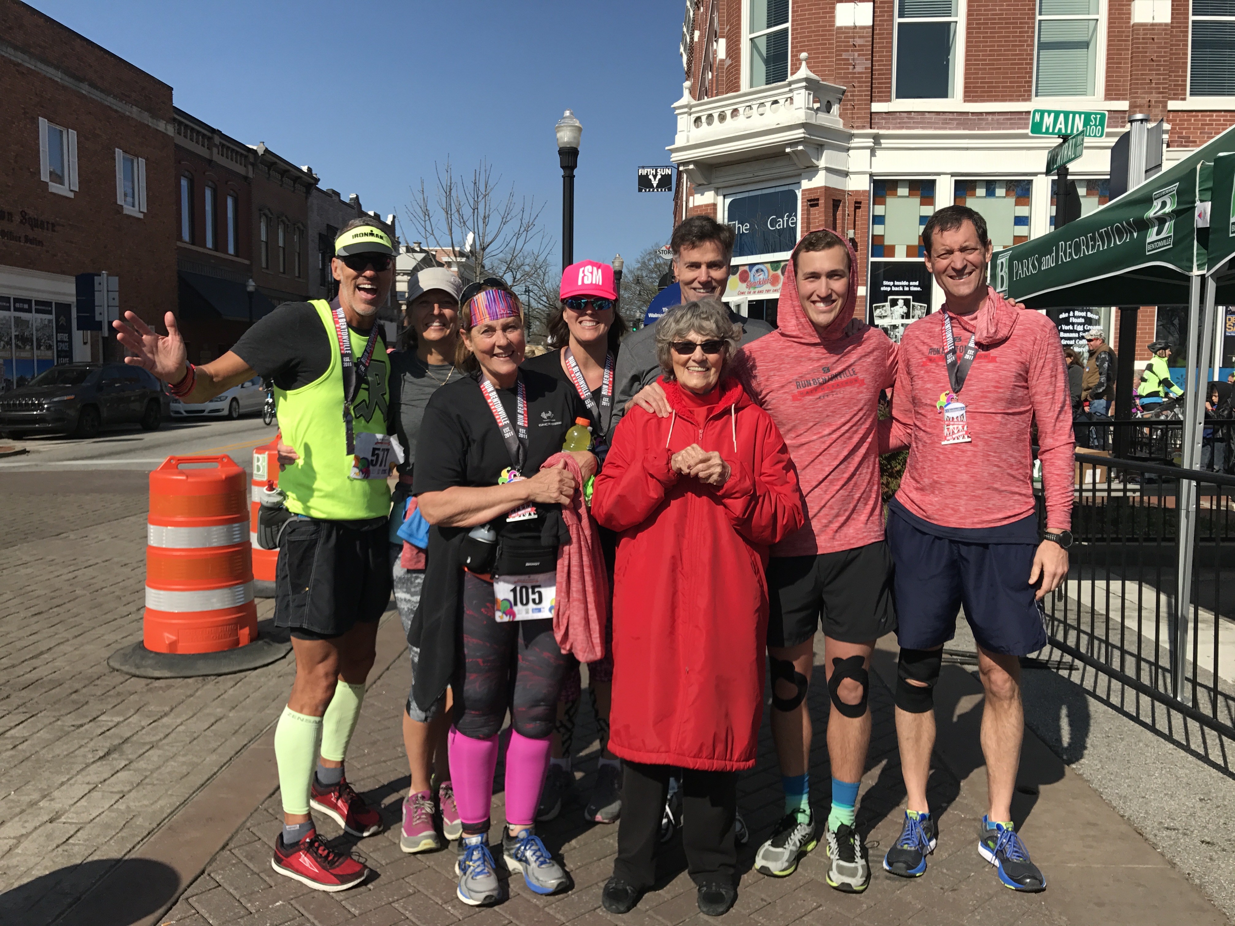
Mom so proud of her family of finishers!
In the end we all completed the race! It was a proud and emotional moment for all of us! This trip was about a family reunion, overcoming physical challenges and coming together to support their Mom who we had just moved into a local assisted living facility a couple week prior.
Jeff’s brother had their Mom at the finish line to cheer us all on. Though she has lost her ability to communicate, the pride of a mother over her kids was still evident on her face!
Sibling spin around the block…Jeff, Jerry, Jan & Jackie!
It was a special time for sure as we spent precious time with our families.
After checking on our lake cabin we flew back to Phoenix, picked up our dog and headed for Moab.
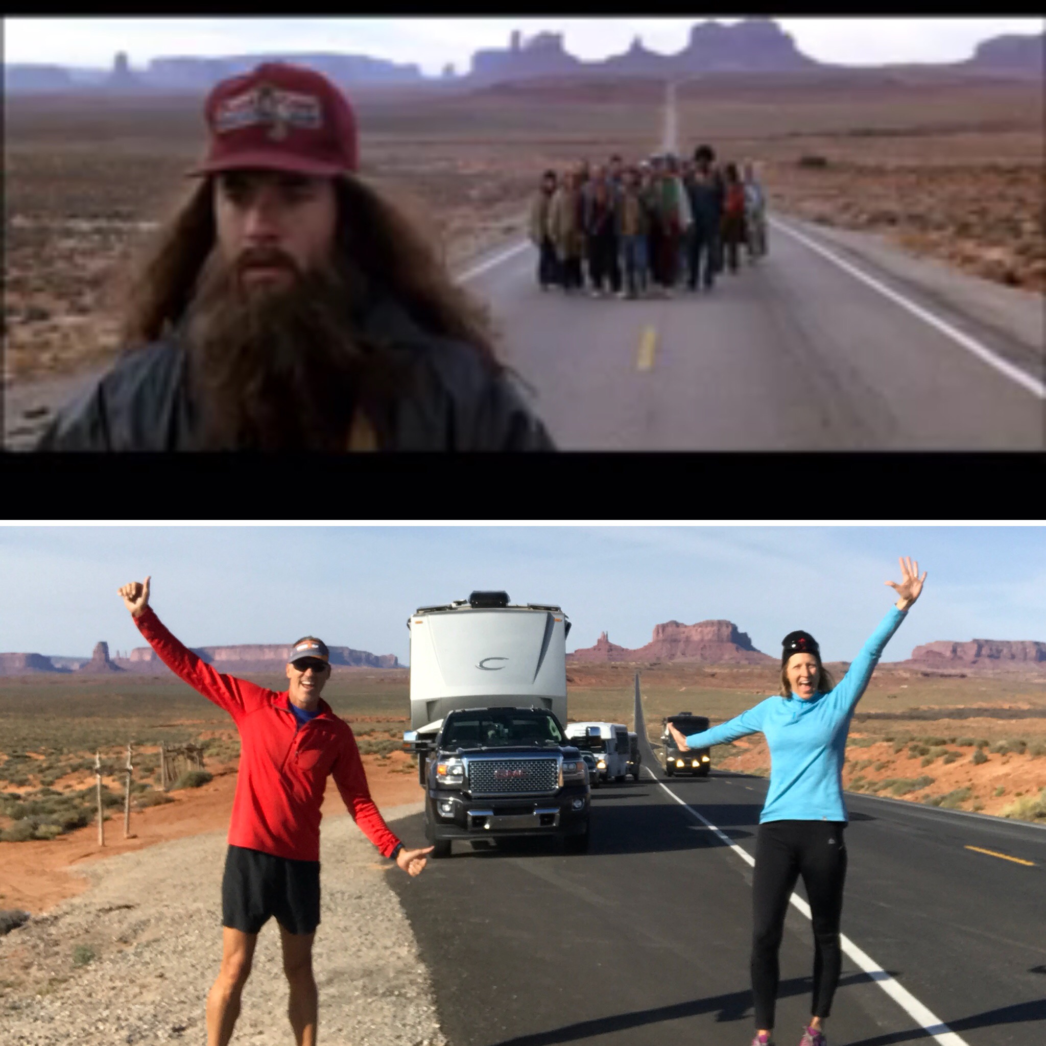
We split the drive into two days and stopped this time at Goulding Lodge and Campground at Monument Valley.
Wow. What a little gem of a campground! It is an RV Park so spacing is closer that a state park. But the sites are laid out very nicely so just about everyone has an amazing view of the monuments off in the distance. It is also on a hillside, so some sites are a little bit challenging to level. They have a nice short hiking trail from the park with perfect viewpoints for taking some awesome sunset pictures.
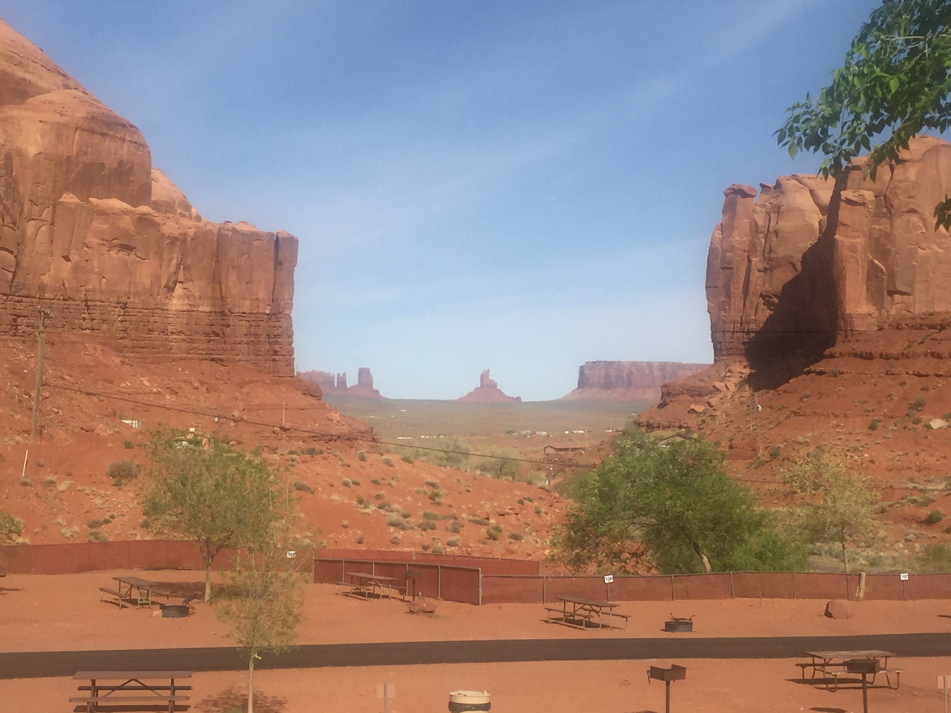
Impressive view from the Goulding Lodge and Campground
And if you want to schedule a hiking or jeeping tour, they will schedule your “Goulding” tour right from the campground. Or if you need groceries, stop at Goulding Market. Goulding has everything covered right from their grounds.
Jeff and I took a 5-mile sunrise trail run before we left and it did not disappoint. The red glow of the morning sun set the red rock formations on fire. We followed a horse path up the side of a mountain and hugged a fairly level trail once we got to it. We jumped on a jeep trail and looped us back around to the RV Park through sand dunes. We were chased by a few dogs in the distance on this run. But they quickly gave up the effort and retreated to their respected porches.
A sunrise to remember! I love this picture!
Glowing red rocks
Sand dunes aid station
On day two we made it to Moab by lunch time.
We were at Moab again this year for the for the Easter Jeep Safari (EJS).
From the EJS website…
“The Jeep Safari was started in 1967 by the Moab Chamber of Commerce. The very 1st trail was “Behind the Rocks Trail” (according to what has been told to the club President, the road was made or improved with a BLM employee and equipment.) The “Moab Rim” was then added the next year. In those days, individual ice cream packages were dropped by airplane to the trails at lunch. All the leaders were Chamber members, there was no charge or entry fee, and only a Saturday trail. To register you showed up Saturday morning and signed up for the trail you wanted. The Safari was run this way through 1982 at which point the BLM required a permit and insurance. The Chamber was no longer able to run the safari and approached the club to run this event.
The Jeep Safari itself, and participation in the event has grown since the club officially formed in the early 80s. Once the event was coordinated by the Red Rock 4-Wheelers, the registration moved from the Chamber building north of town, to Lion’s Park, and on to what was called “the Barn” which is where McStiff’s is currently located near Center and Main. Over the years the increase in participation grew to expand the trail riding to more days until it finally reached a nine day event. “Big Saturday” still remains the culmination of the event on the Saturday of Easter weekend. With the increase in numbers, the registration was moved to the Spanish Trail Arena where it is located today four miles south of the city of Moab on highway 191. This also became the location for the gigantic safari raffle, Boy Scout BBQ dinner, and a vendor exposition featuring over 130 national 4×4 manufacturers”.
When we were in Moab last year I have to say that I was not that overly impressed with the area. The views are beautiful, but the area felt worn and a bit junky. I suspect my view of the area was a bit tarnished by the overwhelming amount of ATV’s, motorcycles, Razors and Jeeps that were streaming by our campsite at all hours of the day and night.
But this visit was different.
Our Forrest Gump Moment
Scenes on the road to Moab
Last year we arrived a couple of weeks early to get a campsite at Slick Rock, which is a first come first serve campground…right in the middle of all the action.
This year we stayed at the KOA just a block away from the EJS expo, thanks to some creative finagling by fellow Xscapers who work camp here. We didn’t have a reservation anywhere in Moab! (NEVER come to Moab during Jeep week without a reservation!). This KOA is one of the nicer, well laid out KOA’s that we have been to. And compared to last year, made for a quiet relaxed location to enjoy the Moab Brewery and Quesadilla Mobilia Food Truck in town.
Trail running near the KOA is not nearly as convenient as Slick Rock, so we had to be a bit more strategic to get our runs in. My favorite is the greenway that runs through Moab, within a block of the Laundromat. I put in a wash load while I ran two miles. Then put it in the dryer for three more miles. How is that for multitasking!
Jeff and I worked the 2-day EJS expo. Our fellow Xscaper friends Finding Marshall, RV Chickadee and Mamasaysnamaste stopped by to say hello! They were all staying on BLM just north of Moab at Willow Springs.


Willow Springs is a very popular boondocking area, especially during jeep week. Jeff decided to do his long run from our KOA site 25-miles to Willow Springs. His route took him through The Arches National Park. He didn’t exactly take a trail, but a wash that turned into some bushwhacking and creek crossings. I picked him up at Willow Springs where I was visiting our friends.
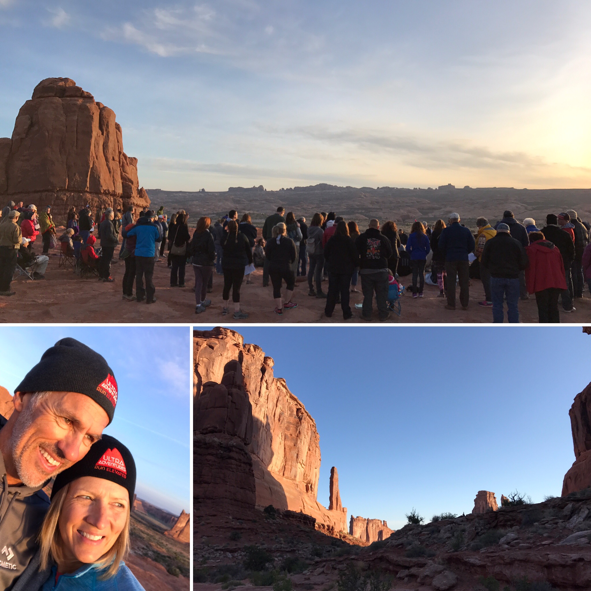
Before we left on Sunday we attended the Easter sunrise service at Arches. We started with a short 2-mile hike on the Park Avenue Trail by moonlight and finished at the La Sal Mountains Viewpoint, where there has been an Easter church service for more than 30 years.
We definitely had a much better experience with Moab this time. It is a stunning town with plenty of outdoor activities to last a lifetime. I look forward to coming back again.
After church we packed up the RV and headed to Salt Lake City. Sam and I are currently staying at the KOA while Jeff travels to Elkhart Indiana for meetings. Our next big show is the National Hardware Show in Vegas in about 3 weeks.
Until then, we are going to bounce around Utah and hit up some beautiful BLM sites to continue our training for the Bryce 100 (Jeff) and Half Marathon (Deb) trail run scheduled for June.
Look forward to seeing ya’ll down the road!
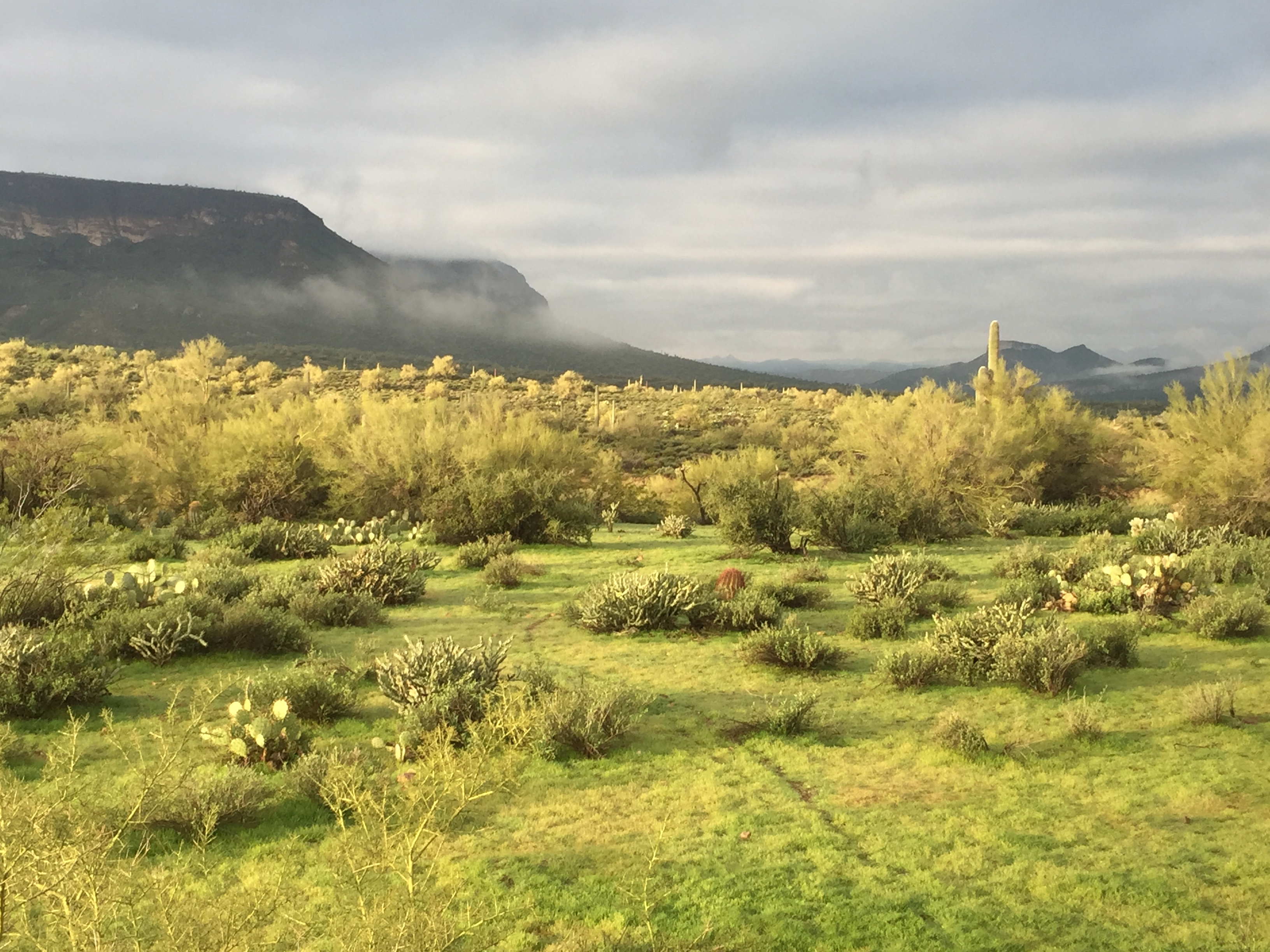
More Arizona Love
Posted by Deb in Arizona, Boondocking, Full Time RV, Hiking, Quartzsite, Running, RV Shows, Trail Run on March 16, 2017
After leaving Yuma Jeff and I headed to Quartzsite Arizona for the big RV, Rock and Gem show held every January.
Quartzsite is a sleepy little town that explodes in population in the month of January as RV’ers from all over North American swallows it up. The draw is the largest gathering of RV’ers in the world (so the legend goes).
The city of Quartzsite embraces us as best it can, but the town struggles during the weeks leading up to and after the big show.
It’s a sight to behold and one you need to experience at least once. I wrote about the show highlights here from last year. Nothing about the show changes much from one year to the next, so I’m going to focus on other things this time.
We showed up at the big tent a few days early to check on the shipped items for the Dometic booth that we would be working for nine days. We wanted to make our way to Dome Rock where our RV’ing group, the Xscapers, were having events for two weeks. We made it for a dog hike one morning with the group and then stopped to say hi to our friends John & Becky and Kurt & Toni.
Xscapers Dog Walk…its a hairy bunch!
Xscapers is a sub-group of the Escapees RV Club, but focused on full time RV’ers who are still working full time. Whenever there is a “converge”, events are planned for late afternoon or evenings so not to interfere with our workday. It’s a fun group and we have such a wonderful network of fellow RV’ers. We support, offer advice and just plain hang out with each other as our travels ebb, flow and intertwine.
When Jeff and I started FT RV’ing we would have never dreamed that it would be so social. But thanks to social media we all stay tightly connected despite being miles apart.
We had hoped to join the group in the evenings during the show, but after working the booth all day in a very cold tent we just wanted to isolate ourselves to our warm RV. As an introvert, I only have so many words for the day. By nighttime, I’ve got nothing left.
We never did make it back to Dome Rock.
Booth setup at Q
While at the show, we manage to get in some trail runs. There are lots of jeeping roads up, over and around Q-Mountain. We managed 5-11 miles just by taking any number of intertwining trails. One got the best of me and I tripped over a rock and fell hard. Skinned knees and palms, bruised hips, elbows and shoulders are all a part of the trail running experience. The trick is to not break something in the process.
Wind is always a factor here so expect a good coating of dust in and on everything you own. And expect to catch the “Quartzsite Crud” while you are here…everyone does.
Besides visiting the laundromat, the only other highlight was getting Silly Al’s Pizza. It is one of just a few restaurants in Q and actually had really good pizza. If you want to go to dinner any time during the week of Q, be sure to get there before 5pm to avoid long lines for a table.
Q Trails
Sam checks out the views
After Q we made our way back to Mesa for a couple of weeks. Jeff had to fly to South Bend, IN for business while I tried to vacuum dirt that had coated every surface in the RV.
The weather was amazing in Mesa. Mid-70’s during the day, mid-50’s at night. We stayed in our friend’s driveway again just a ½ miles walk from the canal system. It’s so nice to run on gravel right in town. Since we are training for the Bentonville Half Marathon we got right back into the routine.
While in Mesa we had a sales conference to attend. We pulled our rig to the Westin Resort in Scottsdale. We didn’t bring the RV to stay in it, but to make a quick departure for the Black Canyon after the conference. This is a very nice pet friendly hotel. Sam got the special pet treatment with dog bowls and special bed just for himself.
The Black Canyon is just 40-miles north of Scottsdale on the way to Flagstaff. We have never stopped here, so we wanted to get to some solitude before we had to be back in Phoenix for the Good Sam Rally. That and the Black Canyon Ultra Trail Run was scheduled the same weekend we were there.
Black Canyon Views
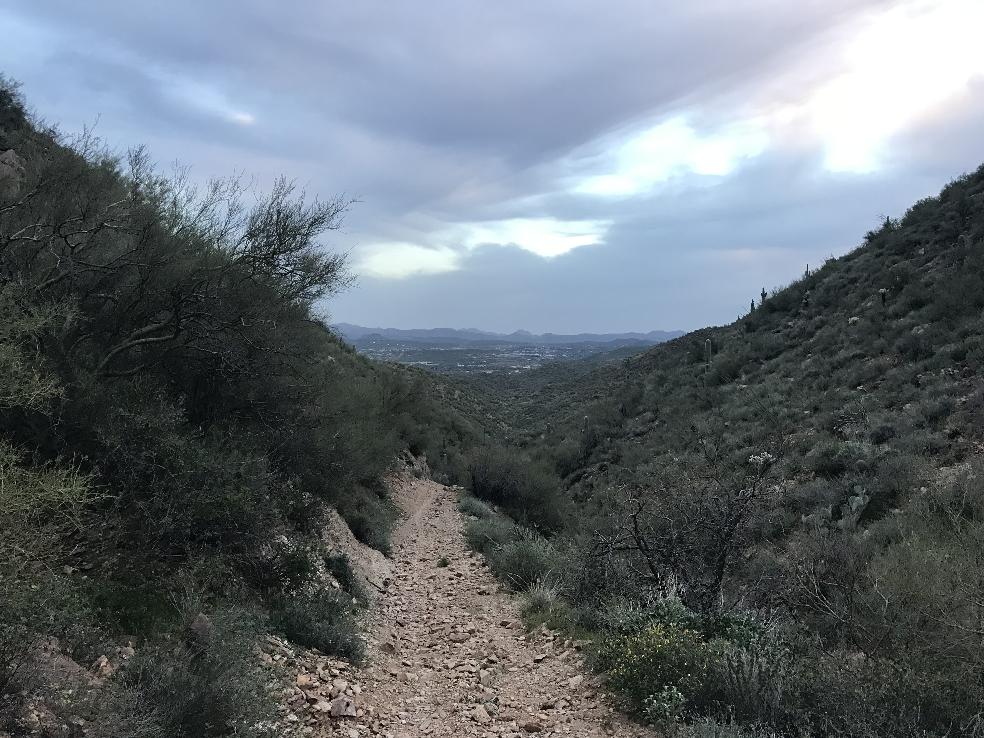
We pulled off Hwy 17 at Table Mesa Rd, just south of Black Canyon City. We set up the RV on BLM land at the Black Canyon Trailhead. This area is STUNNING! Gorgeous mountains, lush green foliage and miles of rugged trails and jeep roads. The only downfall to this area is that it is a mecca for gun enthusiasts who come here to shoot. All. Day. Long!
Thankfully shooting is only allowed in specific areas, so we had a couple of hills between the ranges and us. We still heard the gunfire, but at least it wasn’t right next door.
Jeff and I did not sign up for the Black Canyon Ultra, but we did want to run on the coarse. So we set off the day before the projected rain to get our long training runs in. I had 10 miles to run while Jeff thought he would try for a 50K.
We drove north about 20-miles to the starting line and followed the very well marked route that the race crew had already put out. It started as maintained hard packed dirt road, turned onto a cattle road then to a very rocky rugged single track. It was a test for the sturdiest of ankles, but we both managed to stay upright!
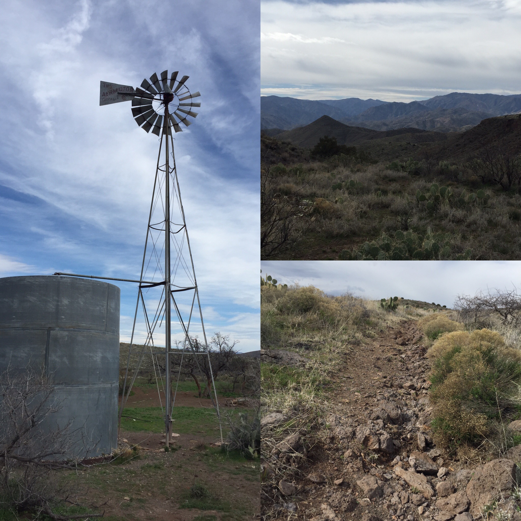
Scenes from the trail
Black Canyon Trail Ultra Route
We got a late start so Jeff ended up running in the dark to mile 27 before calling me to pick him up. He was getting cold and hungry. I on the other hand got my 10 miles out and back in, drove back to the RV, took a hot shower, made an early dinner then had coffee and dessert.
Ultimately the racecourse had to be altered due to the forecasted flash flooding. There were numerous river crossing that became virtually impassable with the rising waters. This is one race I am so glad we were not a part of. After mudageddon in Zion last spring, I’ve had enough of terrible weather conditions on race day.
It was a weekend of the most rain we have ever seen in Arizona, which made access roads to this area pretty soupy. We were becoming a bit concerned about our departure, especially since ATV’s and 4-wheel drive trucks decided the mud was the perfect consistency for donuts. But we had two full days of sunshine to dry out the road just enough to get us back to the highway.
It really was a beautiful area. But between the endless gunshots and ATV’s rolling by, we have crossed Black Canyon off our list of places to return to.
We hitched up and headed back to Phoenix for our next show.
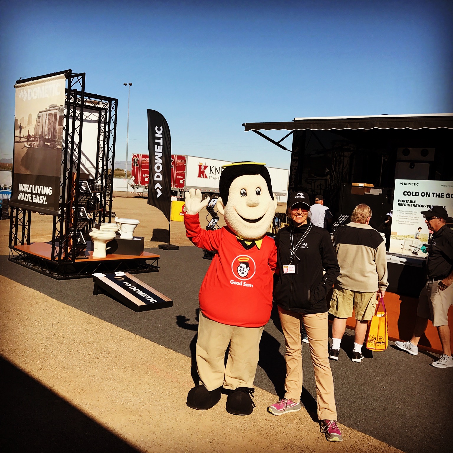
A date with Good Sam
On a sad note, we got a call from one of our Xscaper friends that let us know that another Xscaper had suddenly and unexpectedly passed away right here in Phoenix. She was in her 50’s and full of life. One of those ladies who made you feel welcome from the moment you met her. We met Kurt and Toni at the Albuquerque Balloon Fiesta over a year ago and developed an instant friendship.
We went to Toni’s funeral and as family talked about her, it was evident that full time RV’ing was the best time of her life! They spoke of her deliberate choice to have experiences over stuff as she and Kurt sold everything to move in and travel full time in their RV.
We left feeling privileged having made that same choice ourselves. You never know how long we have on this earth before we are called home. Our time here is but a brief moment on a spectrum of time. Toni reminded us to make the most of it!
We will miss you around the campfire Toni!
Remembering Toni!
2017! A New Year to Travel
Posted by Deb in Arizona, Boondocking, Full Time RV, Hiking, Running, Trail Run on March 2, 2017
A hardy cactus hello!
Jeff and I spent Christmas and New Years in Why, Arizona. After being in the big city of Mesa for 6 weeks it was time to get to some desolation, isolation and motivation of the desert.
Why Why, Arizona?
It was supposed to be our launch site to travel to Rocky Point, Mexico just 80 miles to the south. Beachside living, endless shrimp dining and the sound of waves lulling us to sleep. It would be our first Mexico crossing in the RV and we had our dog health certificate and passports ready.
But when we went online to get our insurance, we were shocked to say the least! $600 for a two-week stay in Mexico! OUCH!!!
Why go to Mexico when you can have the international experience here in Why?
As much as we were looking forward to spending New Years in Mexico, the $600 spend was just too much for us to justify. The waves. The sand. The shrimp. They would all have to wait for another time. We were spending NYE in Why, Arizona.
Don’t feel bad though. Once we got over our visions of beachside grandeur we settled in nicely to our new surroundings while free camping on Bureau of Land Management property.
This is our third winter in the desert southwest and we love it here.
Not many years ago, I would be on a flight over the Southwest and think, “Why would anyone want to live there”? Brown. Dull. Dusty. Void of any green. It always seemed to lack any beauty or color.
There is something special about the desert
Good night
But what I’ve learned the last three winters is if you spend a little time in the desert she will show you her true colors.
You see. The beauty of the desert is cast low in those few minutes of sunrise and sunset. When the sun is making itself known and when it finishes its day. It casts a glowing spell on the desert, turning it into the beautiful creature that she is. Texture. Dimension. Color. It’s all there if you are patient!
Our BLM spot is just north of Organ Pipe Cactus National Monument. Organ Pipe is a UNESCO biosphere reserve that stretches 517 square miles along the boarder of Mexico. It is the only place in the US where the Organ Pipe Cactus grows wild. It got its name due to its shape that looks similar to the pipes of an organ.
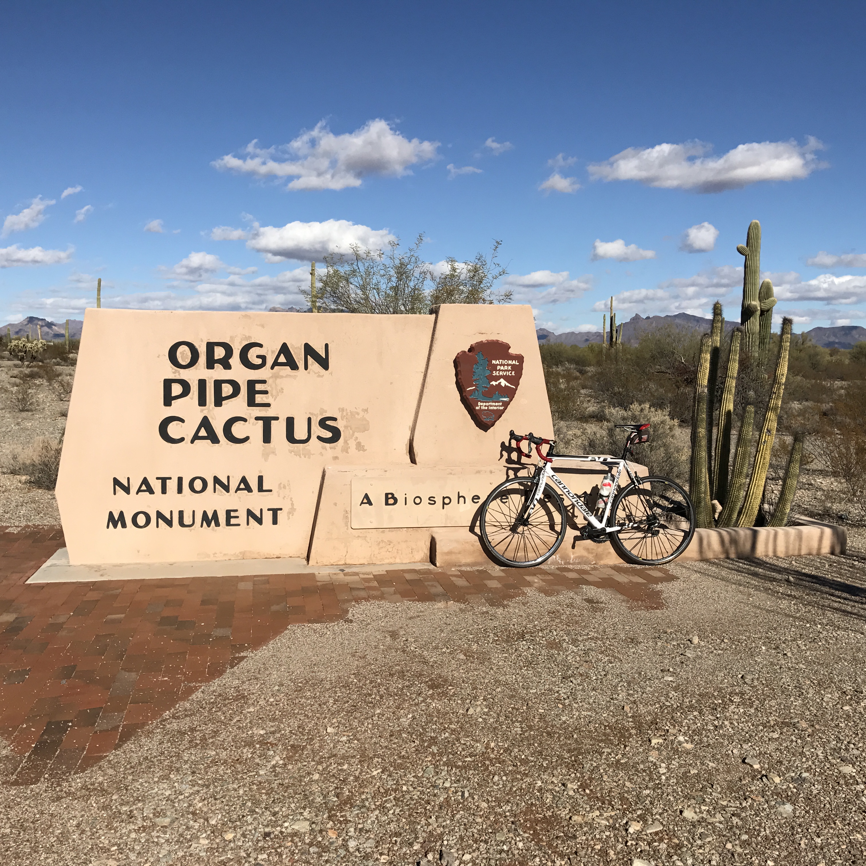
Organ Pipe Cactus National Monument
Right at the perimeter of the reserve there is a distinct change in the landscape.
What’s flat, barren and brown suddenly turns to rolling hills, black volcanic rock and a lush green. Well…as “lush” as a desert can be. But it is beautiful and very different than the mid-west landscape that I grew up seeing.
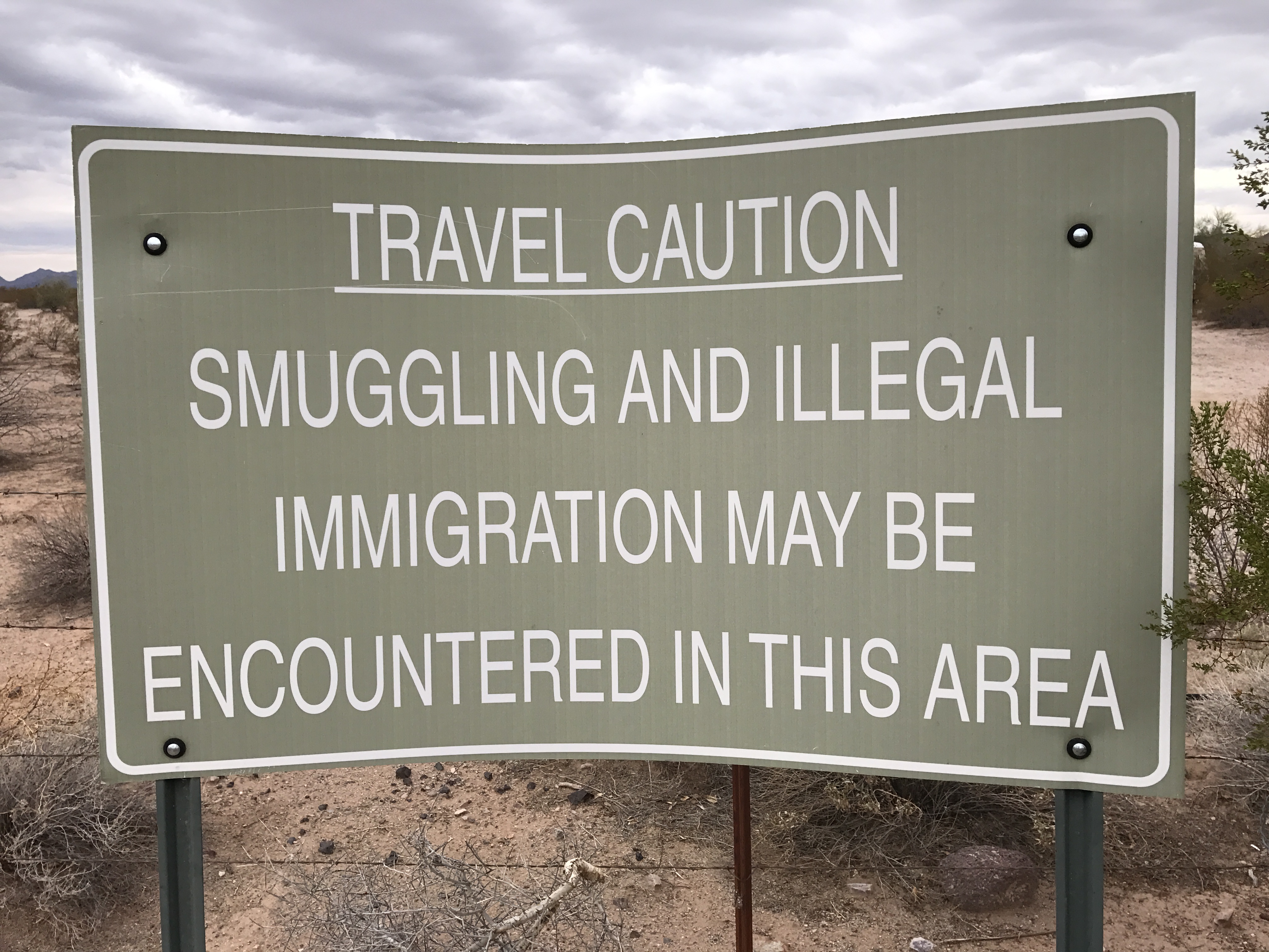
Our camping area is in a hotbed of illegal border crossings, drug trade and human trafficking. For the most part, they leave us campers alone. Unless you happen to leave out a water bottle or leave bicycles unlocked. You may wake up to some things missing. The dessert is scattered with rusty bike skeletons that didn’t hold up the rigors of a rugged desert crossing.
There are endless ATV roads scattered all over this place that are under the watchful eye of the Border Patrol via helicopters, trucks and 4-wheelers. Their presence is felt, seen and heard at all times. I had a helicopter swoop down over my head while out on a run…just to say, “I know you are there”.
Endless ATV trails under the watchful eye of border patrol
The trail running was great and Jeff decided to ride his bike 27-miles to the Mexico border on Christmas Day where I picked him up in the truck. Then he had to outdo himself by running from the border to our campsite on New Years Day. His run was a bit eventful. Four drug smugglers darting across the road mere steps from him in broad daylight. All five of them were startled! Jeff later looked at his Strava from his run and saw the spike in his heart rate at that moment. Everyone went their own ways and we called the incident into the border patrol.
The community of Why has a Christmas day potluck at the local community center. For $5 each, the town provided the turkey and ham, while the attendees brought in the side dishes. It was a great deal, super food and a lot of fun visiting with the winter locals of this tiny community.


Though the desert here was nice, we never quite felt settled. We would check and double check if things were locked and we turned on a few more lights to take the dog out after dark. Even Sam was on edge since coyotes would run right through our campsite.
After two weeks we finally pulled up stakes and made our way to Yuma.
We stayed in Yuma 2 years ago and didn’t particularly enjoy our stay at Mitrey Lake. Between mosquitoes and mice we weren’t sure we would ever come back. But cooler heads prevailed and we decided to give it another go.
This time we headed to BLM at American Girl Mine off of Olgilby and boy were we so glad we gave this town another go. That location turned into one of our favorite campsites ever!
It might be a bit barren for some folks, but for us it was boondocking perfection. Full exposure to sun for solar charging. Well-groomed wide roads. As much or as little privacy as you want. ENDLESS and I mean ENDLESS trails to run. No worry about coyotes for Sam or drug runners for us. Lightening fast Internet. And those sunsets!
We just could not get enough of this place!
Yuma is the closest city to the Los Algodones border crossings. We crossed the border two years ago and found a delightful restaurant that we wanted to go back to. And since we didn’t make it to Rocky Point the previous week we decided to walk to Los Algodones for a dental cleaning and some lunch.
This was our first experience with Mexico dental. I say “our”, but Jeff was the guinea pig.
It was an AMAZING experience, and we will not longer be hesitant at taking the plunge. We picked a dentist that was highly recommended by other FT RV’ers that we personally know and decided to walk to the office a couple days before his appointment to make sure we knew where she was. And if you have any hesitation about walking there yourself, the dental office will send someone to meet you at the border to escort you to their door.
One thing you have to be prepared for when crossing the border is the bombardment of sales folks trying to sell you the exact same thing the guy right across the street is selling. Pharmaceuticals, dentists, eyeglasses and your typical assortments of trinkets, jewelry, blankets and cowboy hats are about it for this small town. A polite “no thank you” is enough to put a stop to it, until you hit the next booth.
A special anniversary lunch
Plentiful Viagra and…ah…pinatas
While at lunch one day a nice lady from a local “spa” stopped by and gave me a free 1-minute shoulder massage while I drank my margarita. Her skills were impressive, and we actually went to her shop a couple days’ later and got $13 pedicures.
Our original intent was to stay in Yuma for a week before heading to Quartzsite, where our fellow Xscapers RV club was having a convergence. But Olgilby Road was just too perfect a spot to breeze through and we stayed for two weeks.
We did get to see our RV buddies Flying the Koop, Mike and Donna. It had been a while and they were blowing through town on their way from San Diego to Phoenix. Our time was short, but oh so sweet. We will get to see them a bit more after Q.
Well, onward to Q for the largest gathering RV’ers on earth!
This is why I love the desert! (Zero filters)
Ultra Mania and Utah Bliss
Posted by Deb in Arizona, Boondocking, Bucket List, Full Time RV, Grand Canyon, Hiking, Running, Trail Run, Utah on December 26, 2016
Words to live by
September 23-October 31
Last year just after the Arizona Ironman, I asked Jeff if he was ready to take a break from full Ironman competitions. It’s a huge time commitment to train for, which is especially challenging during RV show season.That, and it is a very expensive sport. To my delight shock he decided to take a break from long distance triathlons. At least until he ages up into a new age group in a couple years!
But as an athlete, when one goal or bucket item is crossed off, there are dozens more to follow. For Jeff, the next challenge is a 100-mile ultra trail run.
I know. I know. There is a collective “whaaaaaat?” whenever he shares his goal.
To think that a 100-miler is any less training time is a mistake. But when you can train on beautiful wooded trails and forestry roads around pristine alpine lakes, it does provide “get lost in the scenery” moments that you just don’t get riding your bike on life threatening city streets or swimming laps at a local pool.
So when Jeff heard about the Stagecoach 100 race from an Arkansas friend, he thought it would be a perfect race to enter.
The Stagecoach 100 is a 100-mile trail run from Flagstaff to the South rim of the Grand Canyon, two of our favorite places! It is run on the Arizona trail and follows the historic stagecoach line that tourists took to reach the Grand Canyon in the 1890’s.
Out for a practice run on the Arizona Trail
The course starts in Flagstaff around 7,500’ of elevation and climbs to nearly 9,000’ before descending into Tusayan at 6,600’. There is about 7,000’ of climbing overall and must be completed within 31-hours.
Since this was Jeff’s first year to attempt a 100-miler he opted for a two-man relay, putting Jeff’s leg at 55 miles and friend Jason’s leg at 45 miles.If this went well, then he was going to sign up for the Javelina Jundred in Fountain Hills, Arizona the following month.
After a week of rain and snow on Humphreys peek, race-day could not have been more perfect weather conditions. An abundance of sunshine, cool temps and golden aspens kicked off the race.
All smiles at the start…Sam thinks he gets to go too!
Beautiful run through Aspens
I don’t compete in these long distance races, preferring half marathon trail runs. As a spectator I get to witness the days journey for a lot of athletes. The excitement and nervous energy at the start followed by the real struggle, pain and doubt somewhere in the middle of the race. And at the finish, total elation, outpouring of emotion and collapse.
It’s so inspirational that it makes the laziest of couch potatoes start to think that they too could attempt such a race! Me included!
After seeing Jeff off at the start, I loaded up the RV and drove to Forestry Road 688 just south of Tusayan. What I really LOVE about the West is that there is no lack of free camping spots around great locations. This FR is within 6 miles of Grand Canyon Village on the South rim. The road was amazingly groomed with plenty of private camping spots for big rigs and decent cell coverage.
A pot of gold campsite…for free!
The Stagecoach 100 is not a spectator friendly course, so there was nothing I could do but stuff my face with chocolate and take a nap wait 15 hours in eager anticipation, imagining Jeff’s struggle and drudging out 55 miles with him in spirit!
The heartburn for Jason and I was trying to find the transition point on a spider web of unmarked forestry roads after dark. After 2 ½ hours of driving we somehow managed to find the transition 30 minutes after Jeff had checked in.
Found an aid station…just not the right one!
Finally!
It was 10:30pm, and after 15 hours Jeff was ready to be done. He handed off the last 45 miles to his friend and we made the 2-½ hour drive back to the RV. Jason finished the race the following day. I’m so proud of Jeff and Jason. After the pain has worn off they both are ready to challenge themselves to run a full 100-miler.
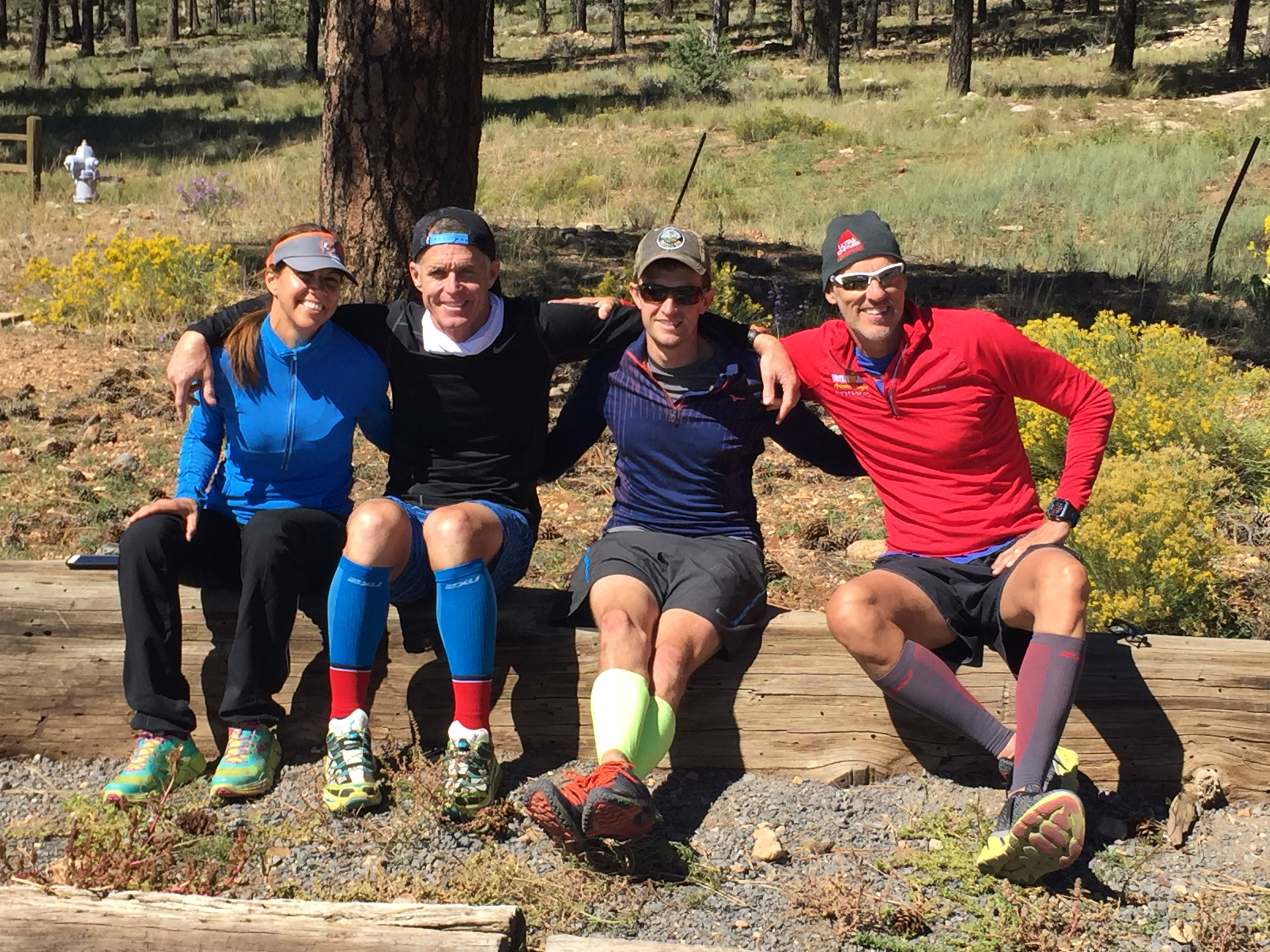
The Arkansas Travelers
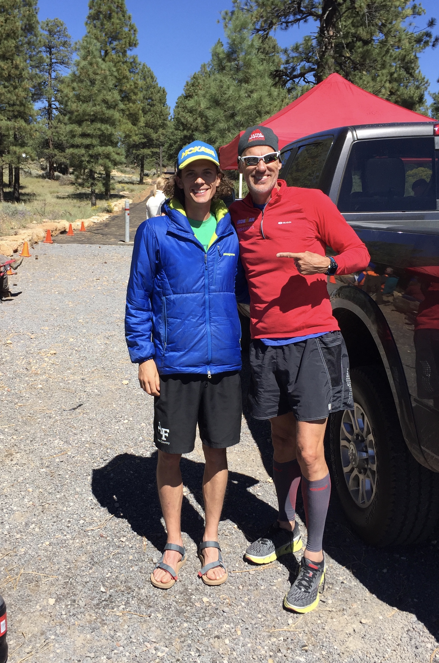
The legendary Jim Walmsley
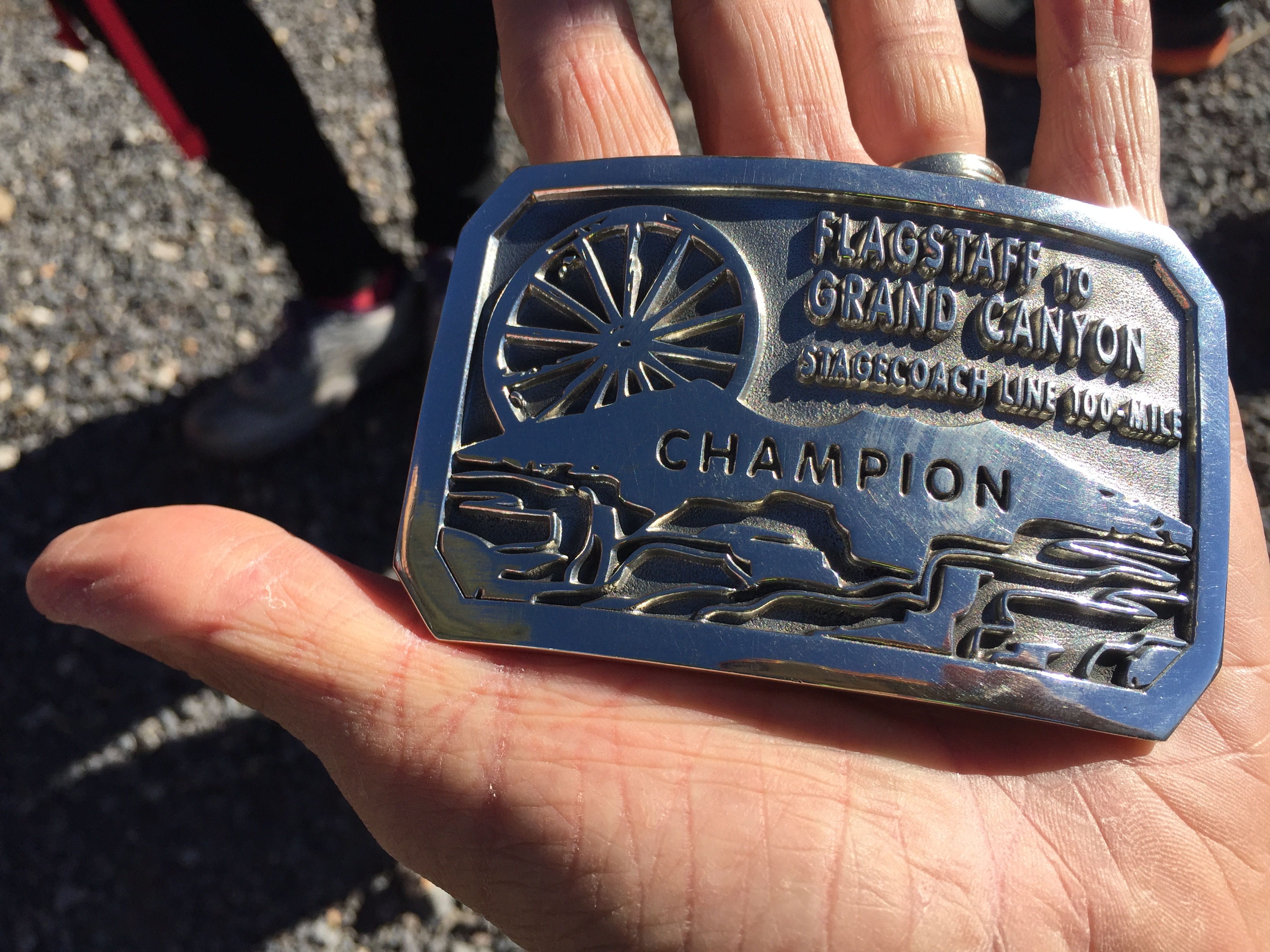
Got the buckle!
We stuck around the South Rim for another week, and just for grins, Jeff decided he wanted to do another double crossing of the Grand Canyon before we left.This was partly a test to see how his legs felt for the Javelina.
With tired legs from his Ultra just 6 days before, he headed down the South Kaibab Trail, summited the North Kaibab to turn around and head back to SK. He was so exhausted on the return trip that he lay on slabs of rocks three different times to sleep. He did persevere but pushed his body to its limit casting doubts on his goal of Javelina.
Before we left the South rim we stopped into the Bright Angel Lodge for dinner. When we were finishing up we noticed an odd glow coming from the Canyon. I grabbed the phone and ran outside to witness the most spectacular rainbow. When we saw waiters and cooks running outside with cameras we knew we were witnessing something special.
The rainbow illuminated the clouds to a fiery red glow. Just about every spectator there was crying, including me. It’s one of those moments you realize you will only see once in a lifetime! It was stunning!

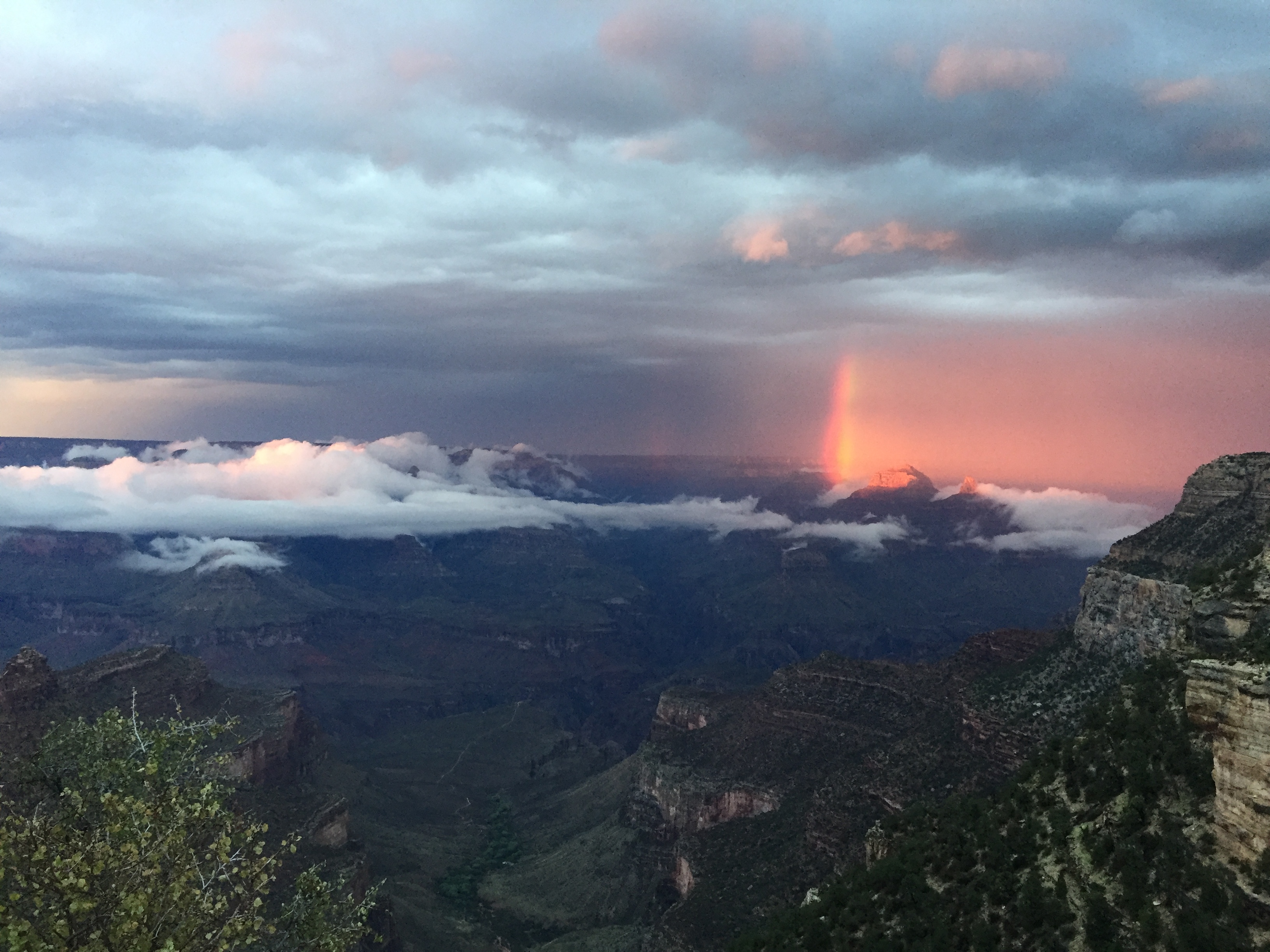
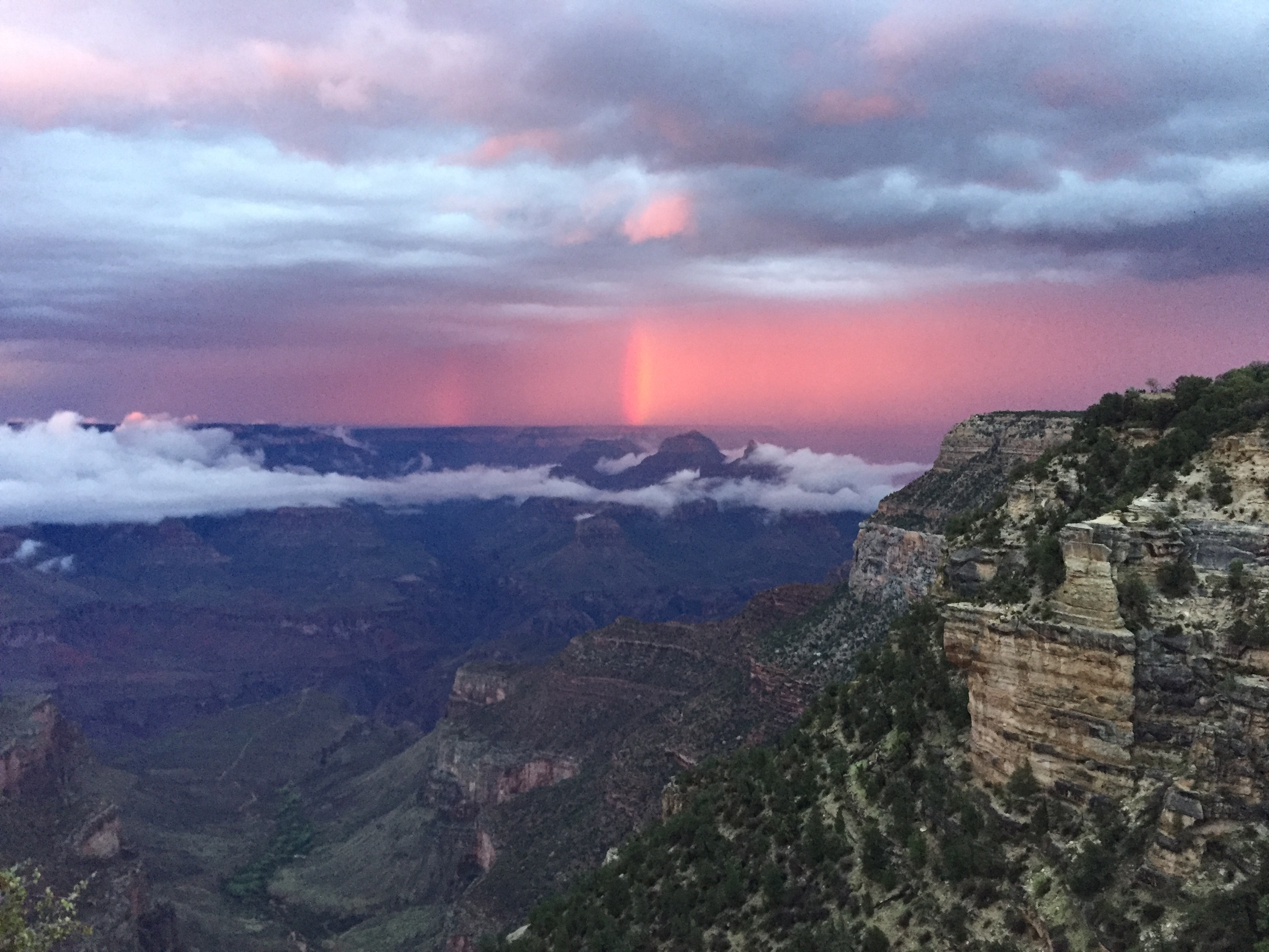
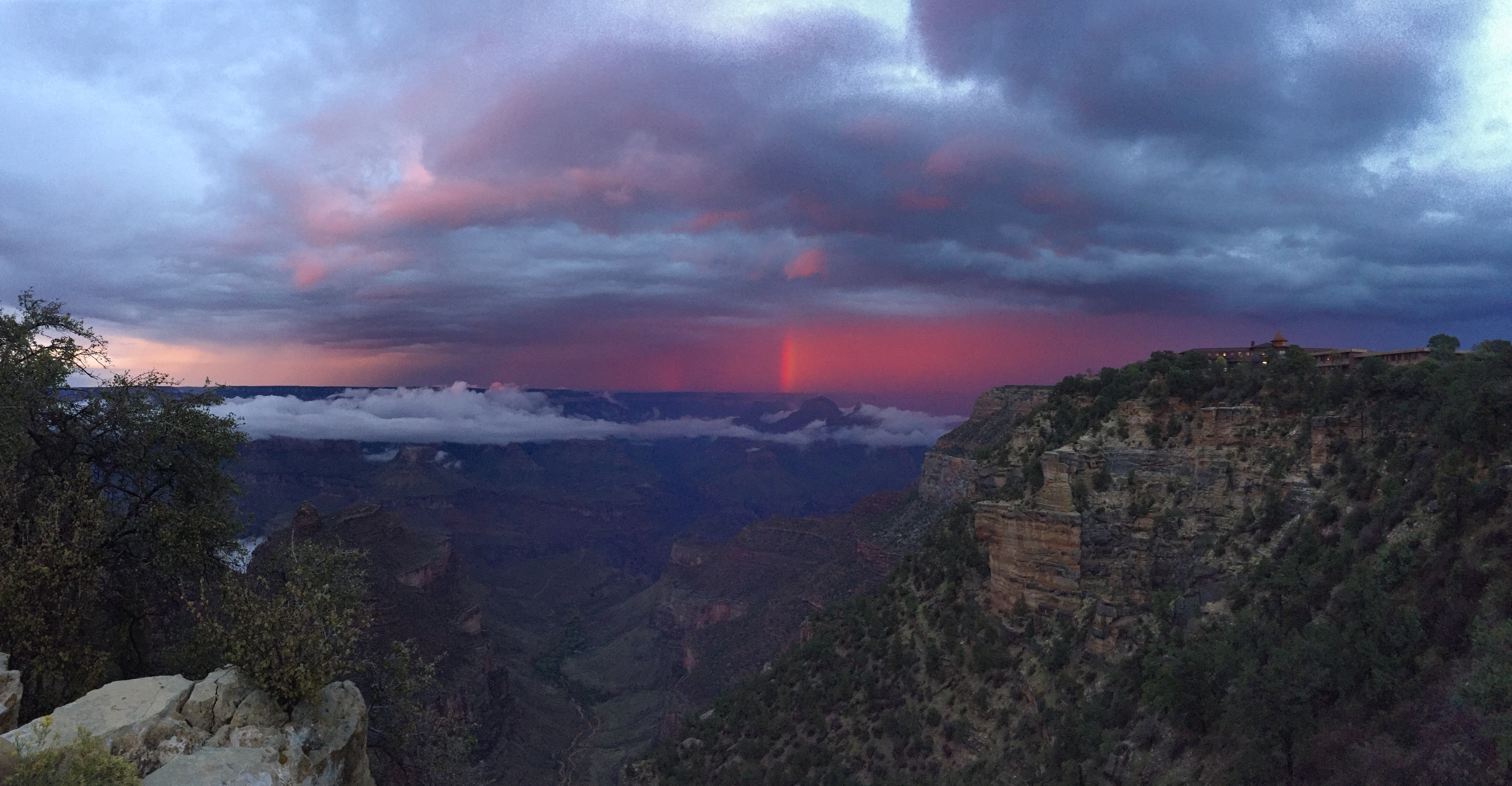
After enjoying the South Rim we drove to Las Vegas where Jeff had to fly to Louisville on business while I stayed with the RV at the Oasis RV Resort.
Once he returned we hitched up and headed to Kanab, Utah for Trail Fest. Trail Fest is a three-day trail running festival. Day 1-Zion. Day 2-Bryce. Day 3-North Rim of the Grand Canyon. Once back at camp you are free to participate in seminars, movies, food trucks and music.
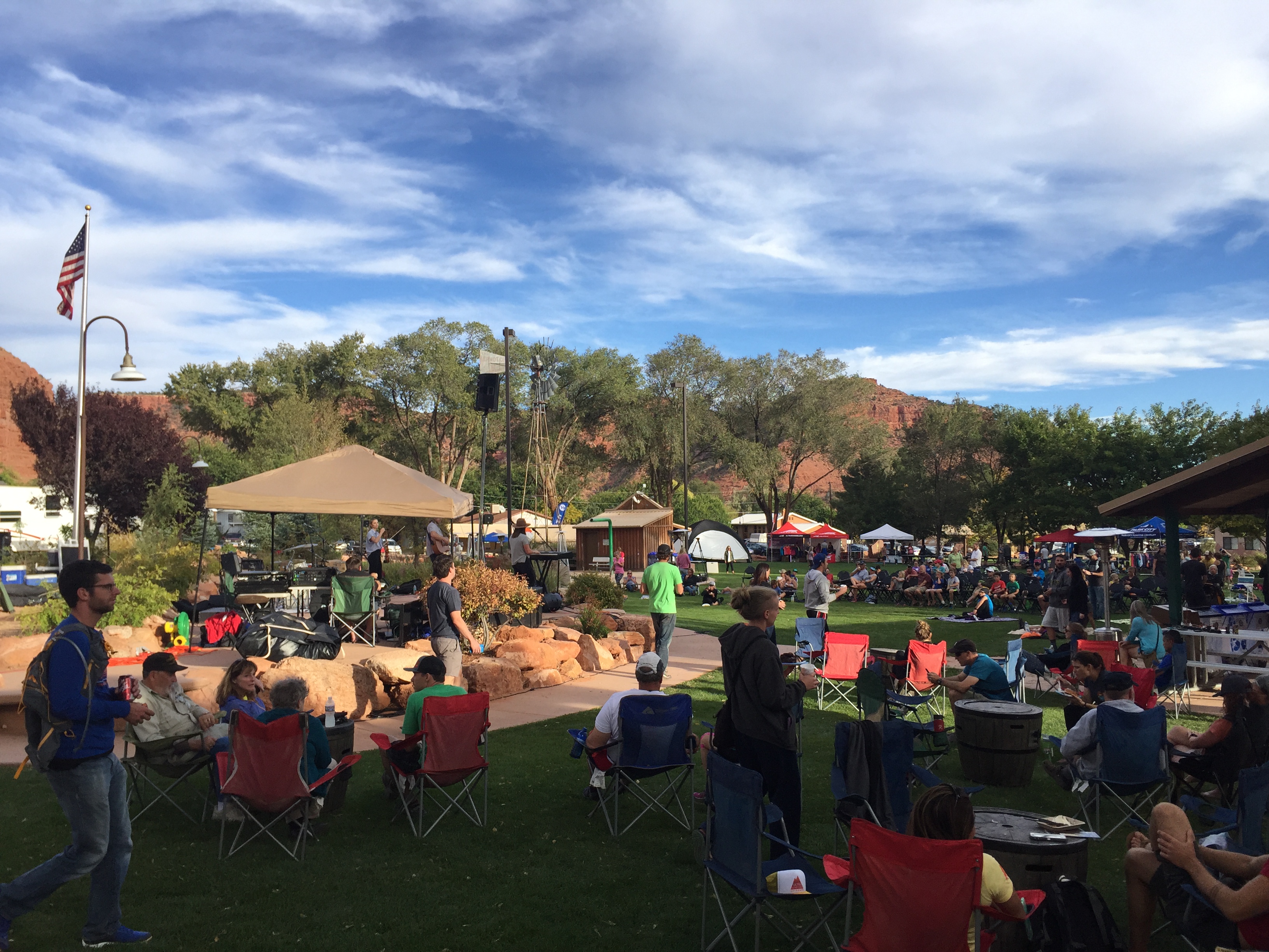
Trailfest 2016, Kanab Utah
This was the first year of this event, with home base out of Kanab. Tents are provided or park your RV on site. Showers are available at the community center. Shuttles picked up 400 runners each morning and dropped them off at the days designated trailhead.
Jeff and I were too late to register for this wonderful event, so we volunteered to help set up and direct parking. Because we volunteered we got credits towards a future trail event.
While runners were out on their trails, Jeff and I hiked in Bryce Canyon. Our favorite hike was the 8-mile Fairyland Trail Loop. This is a moderate hike with hoodoos galore. It’s one of those hikes that you have to force yourself to stop taking pictures to get through. I love this place and can’t wait to spend more time here!

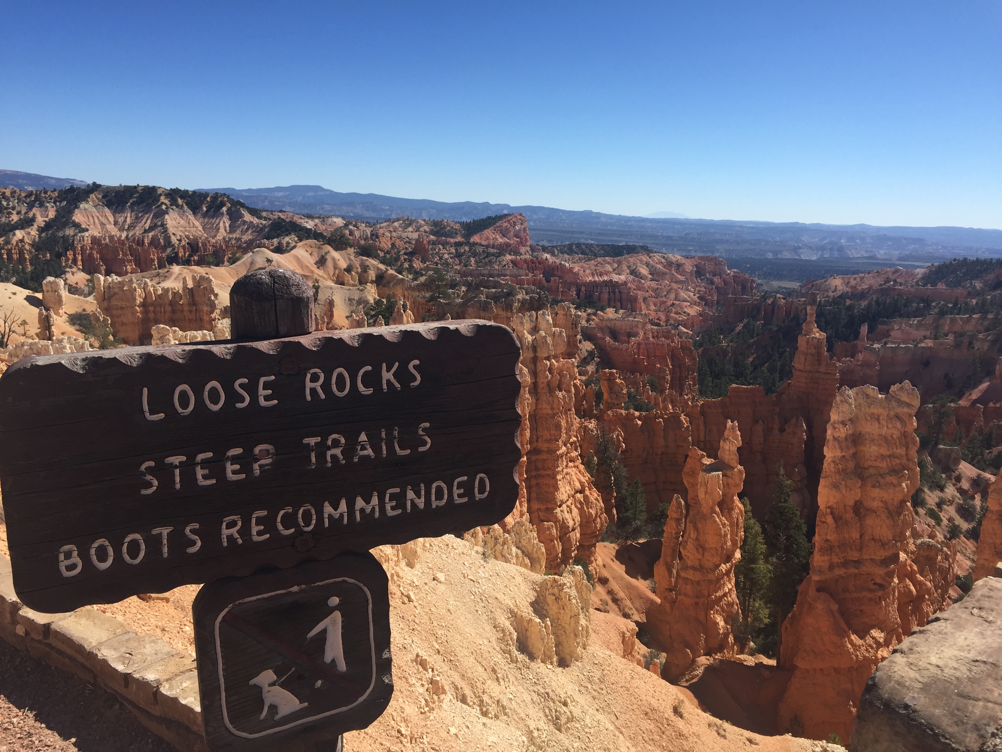
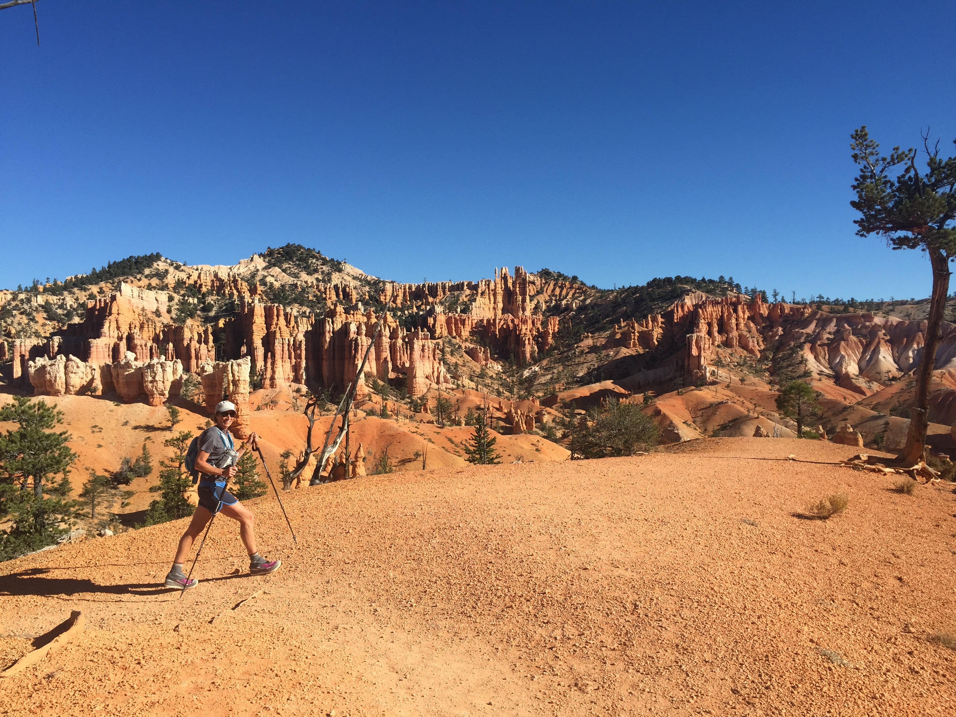
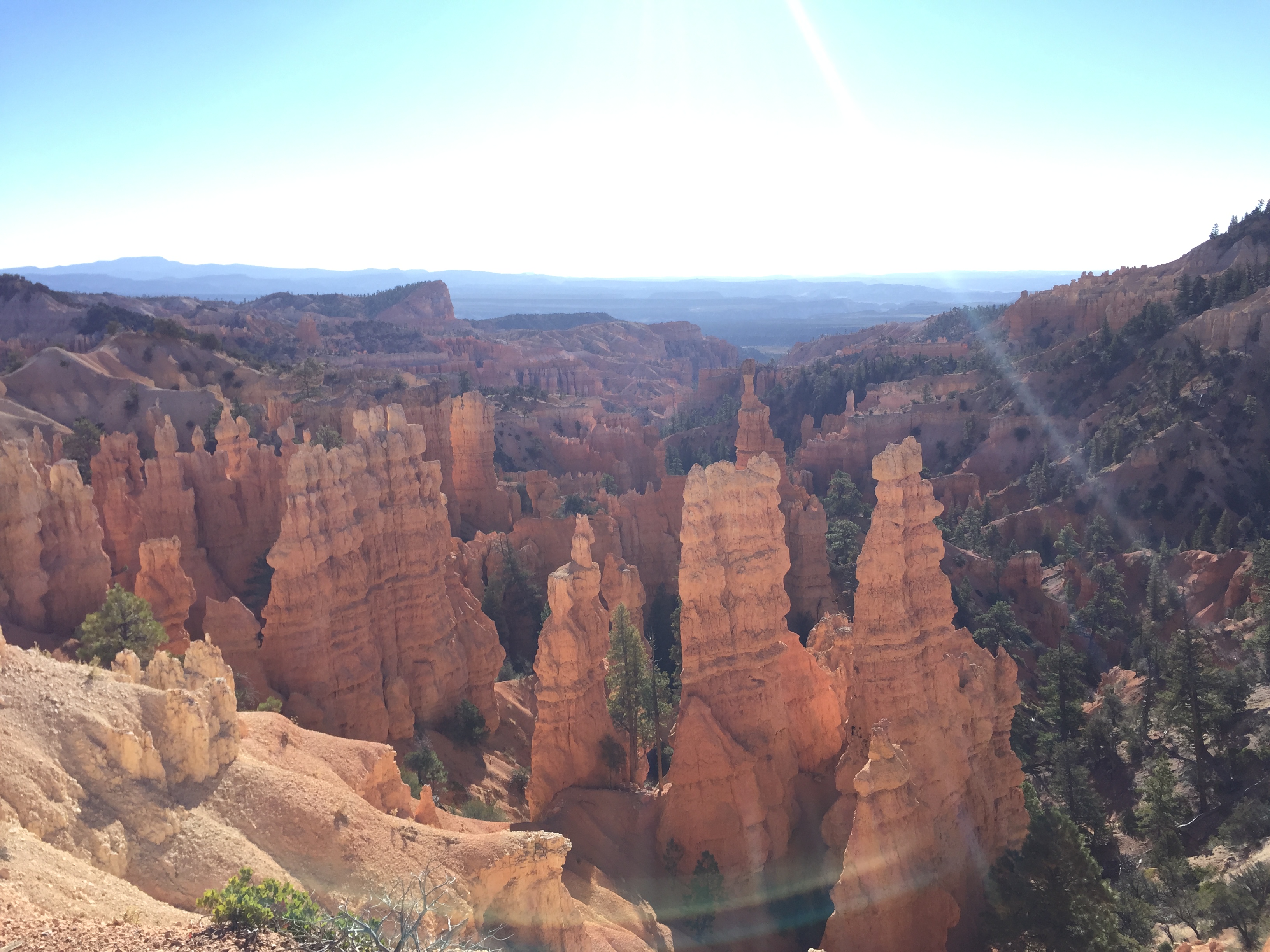
After Trail Fest we headed to the North Rim of the Grand Canyon. Actually, we boondocked on National Forestry land in the town of Fredonia, Arizona 45 miles north of the North Rim. Besides hiking the Rim2Rim, we have never explored the North rim. We really enjoyed our stay. Nights were in the 30’s with daytime highs in the 50’s.
The only draw back was that it was hunting season, so we had to be careful where we got our runs in.
I had read about the pancakes at the little gas station in Fredonia, so we stopped and had breakfast before driving to the North rim. The pancakes lived up to the hype, but our waitress was…odd. We got to talk to several hikers that were either getting ready to start their Grand Canyon Rim2Rim crossing, or had just finished it.
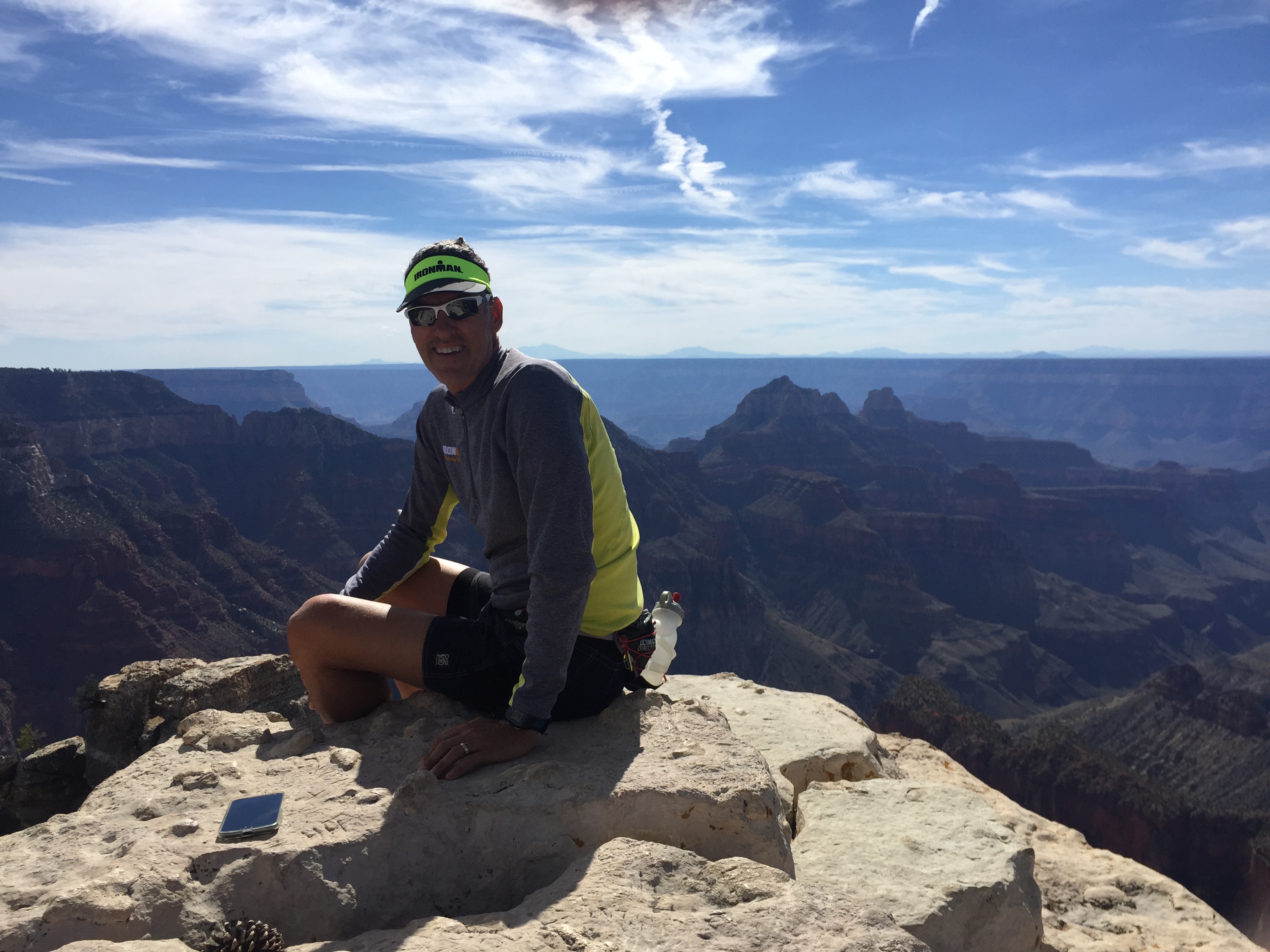
After breakfast we drove to the North rim to check out the views. The lodge was already closed for the season so we didn’t get to look around there. But what a wonderful little cabin community! Compared to the South Rim there are less amenities and less people.
A couple days later Jeff heard from his twin brother that he and our sister-in-love were on vacation at the South Rim. So what does a guy do when his best friend is across the big ditch? Why he hikes the Grand Canyon overnight to have breakfast with him.
While Jeff was hiking in the dark down the North side he stubbed his big toe. Actually, he broke it at mile 7 and then hit it a couple more times just to add to the misery. Kind of hits you in the crouch don’t it?
He finished the 15 miles across, had breakfast and jumped on the 8am shuttle back to the North Rim. His broken toe made the decision to not enter the Javelina Jundred.
We were hoping to leave the North rim and hike the Narrows at Zion National Park, but we lingered too long and had to drive straight back to Las Vegas to work the SEMA Automotive Show.
Utah is stunning and it left us wanting A LOT more.
We will have to catch you next spring Utah!
Flagstaff and The Fearsome Four
Posted by Deb in Arizona, Arkansas, Boondocking, Destinations, Full Time RV, Highest Peaks, Hiking, Running, Trail Run on October 21, 2016
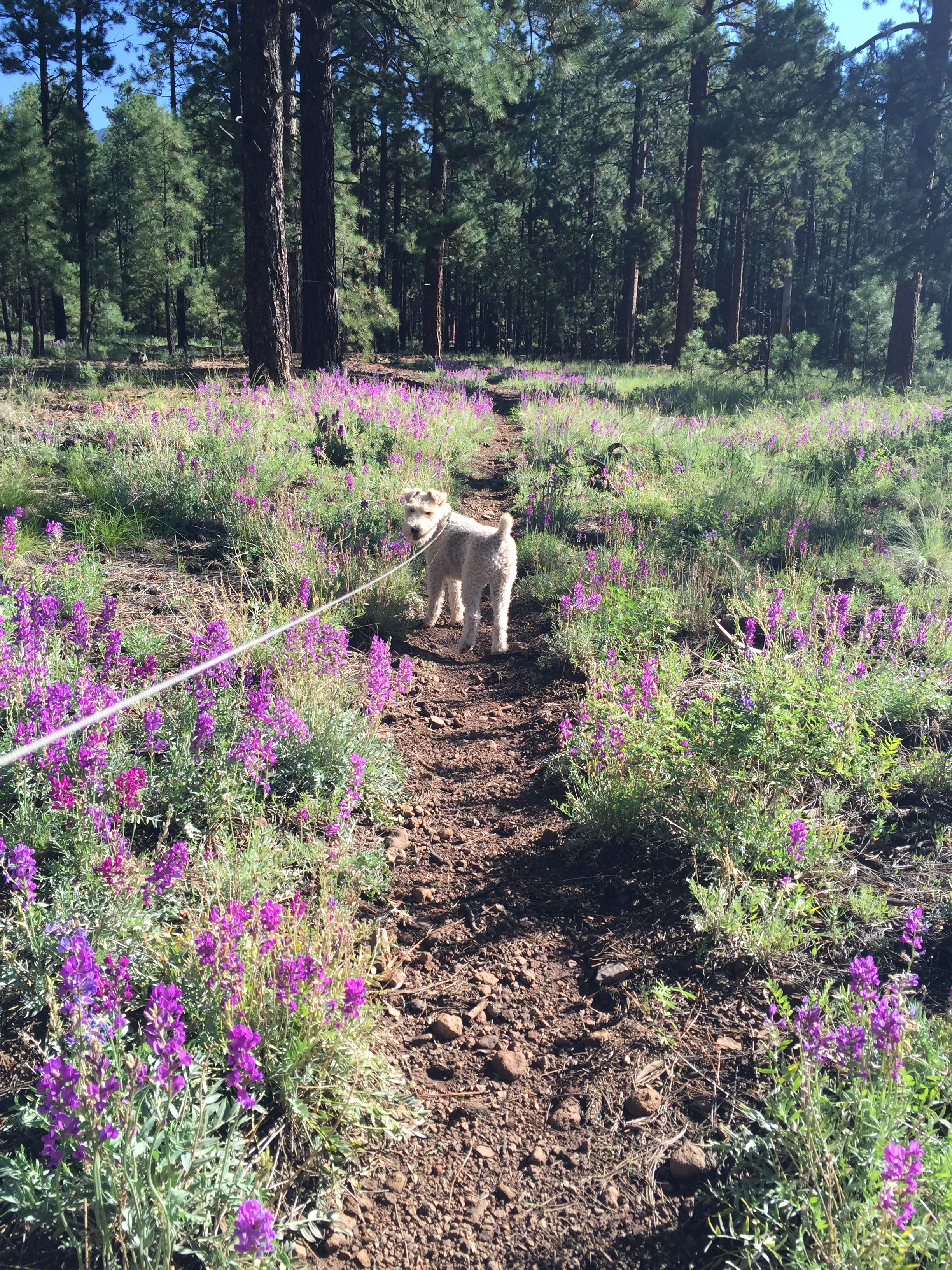
Sam back on the Arizona Trail
August 21-September 21, 2016
After climbing to new heights at Mt. Whitney Jeff and I had about a week before needing to be in steamy Phoenix for business travel. We wanted to camp where we could get a break from the heat just a little longer, so we headed straight for Flagstaff, Arizona.
We’ve been camping in Flag off and on for the past year, one of our favorite locations. There is an abundance of free forestry land to camp in with endless trails to run, hike or mountain bike just outside your door. This and being close to town makes us feel like we live in the community. Flag is definitely familiar to us now and there is no need for GPS to get around town any more.
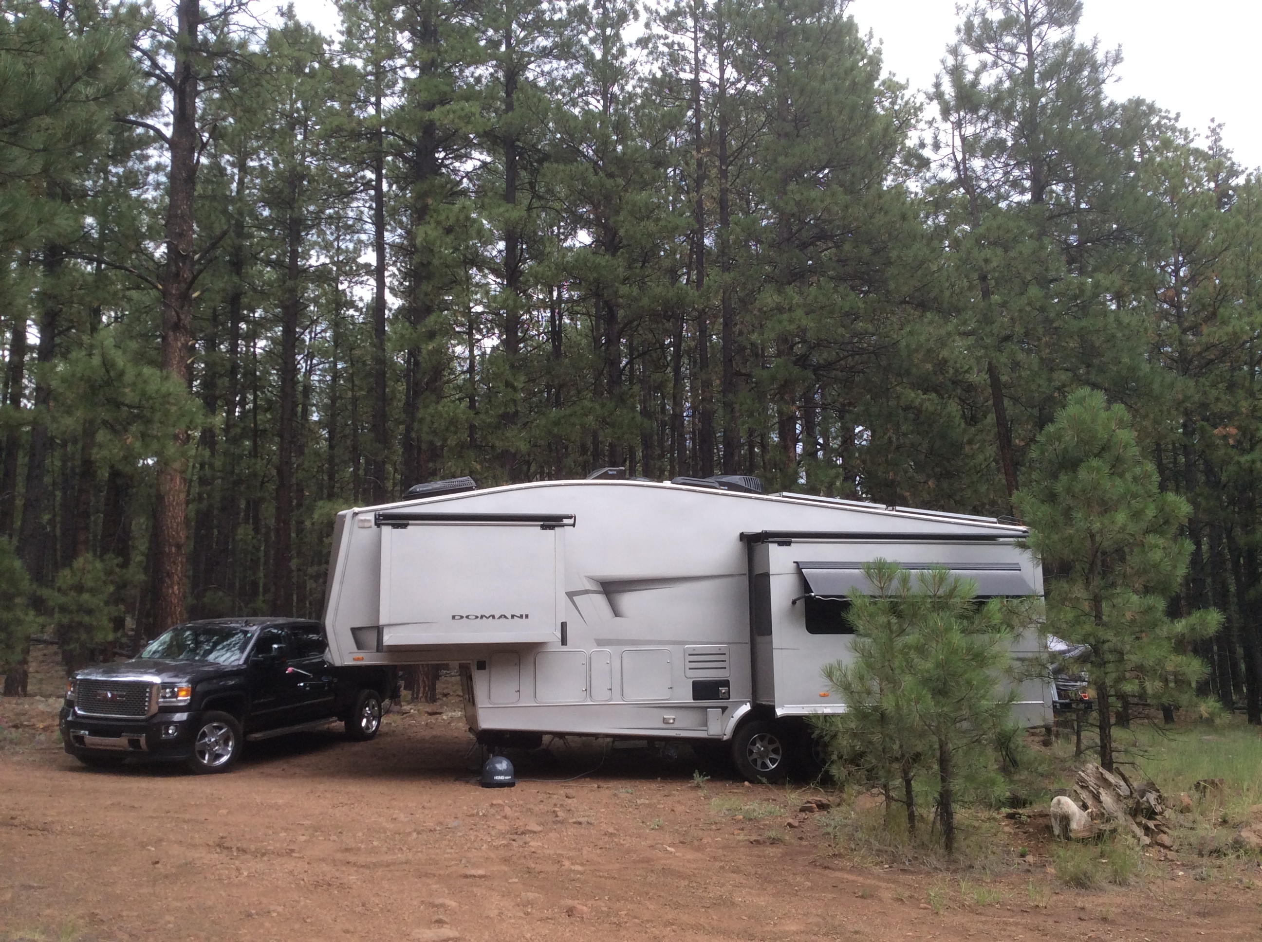
A delightful sunny spot amongst the trees
Not only was the 70 degree temps sublime, but Jeff has been training for the Stagecoach 100. Stagecoach is a 100 mile ultra trail run that starts in Flag and ends at the IMAX theater at the Grand Canyon. Jeff is running a relay with a buddy. 55 miles for Jeff and his friend Jason running 45. Since the race was just 4 weeks away some high altitude trail training was in order.
We camped at a new boondocking site on FR6051 near Snow Bowl on the North side of town. The road was a bit rough, but we were able to wedge our modest 32’ into a nice spot for maximum solar gain. There are endless forestry roads here with several short spurs that connect directly to the Arizona Trail. So getting in our trail runs was a piece of single track cake!
Oh Arizona Trail, how I love thee!
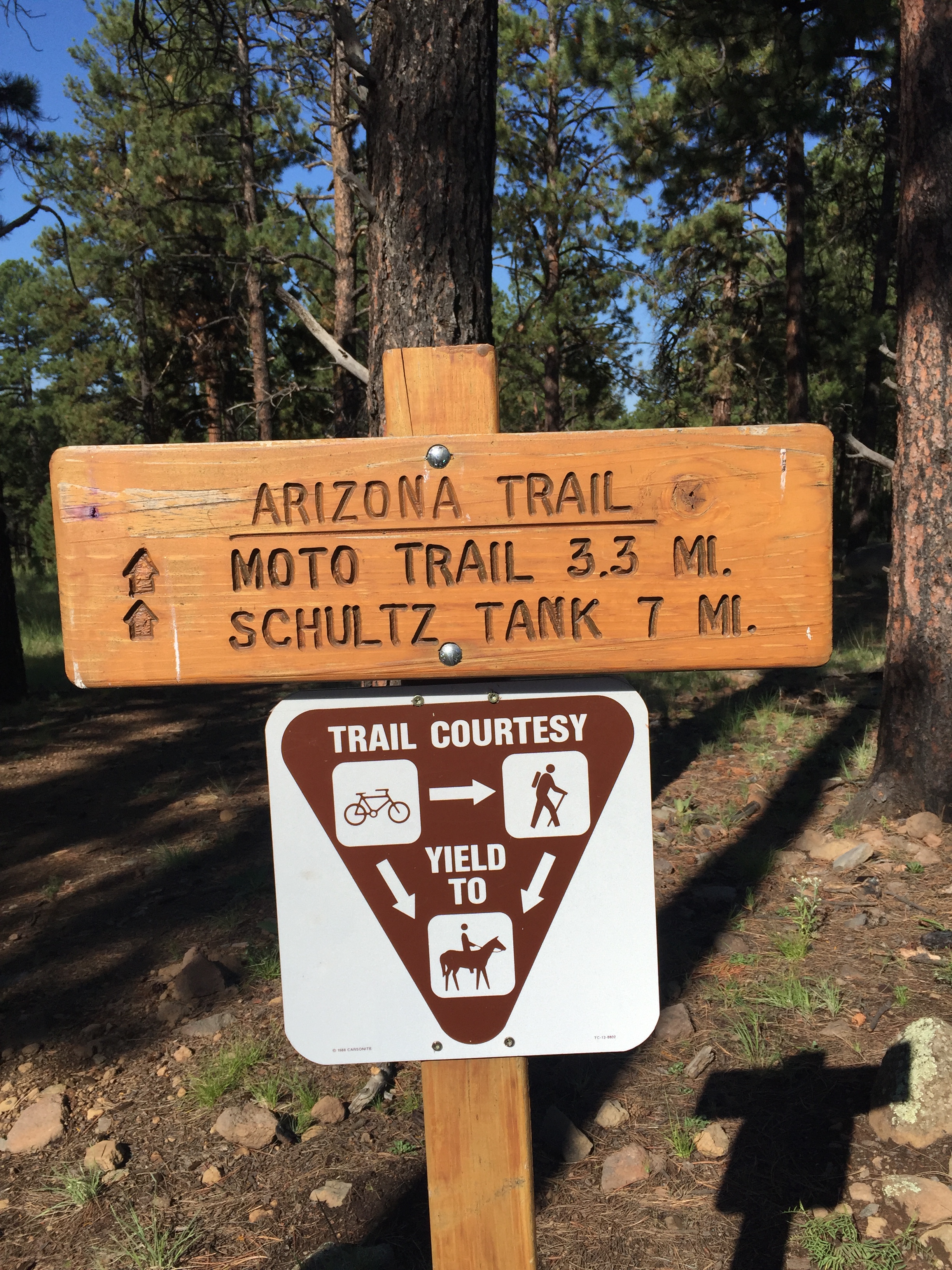
One of the first things we usually do when getting to a new location is to see if there are any running events happening during our stay. We have done this in Moab, Chico and Whistler among others, and it keeps us motivated to get out and exercise on a consistent basis. Without the motivation I would struggle with the RV-15 (think freshman-15) and bedsores!
One of the things we learned about is the Flagstaff Fearsome Four Challenge. Four peaks, 34 miles, 10,307 of elevation over 2 days. Sure…why not! As part of Jeff’s ultra training this challenge was right up his ally.
Here is how the challenge works. Hike or run Humphreys Peak, Kendrick Peak, Mount Elden and O’Leary Peak in any order. If you accomplish this challenge under 15 hours (not including driving time) in a 24hr period you are honored with the status of “Ultra” runner. Well then. Lets get to it!

Things that go bump in the night…what was that noise?
Jeff started at 1am at Kendrick Peak. Besides being scared by some sort of large animal in the woods, this was pretty uneventful. Humphreys Peak, the highest peak in Arizona and most challenging of the four, was next. Jeff ran into a couple of trail runners that run Humphrey’s 9 miles in under 3hrs, twice as fast as I hiked this beast! It had snowed on this peak the day before, so some of the trail was still covered.
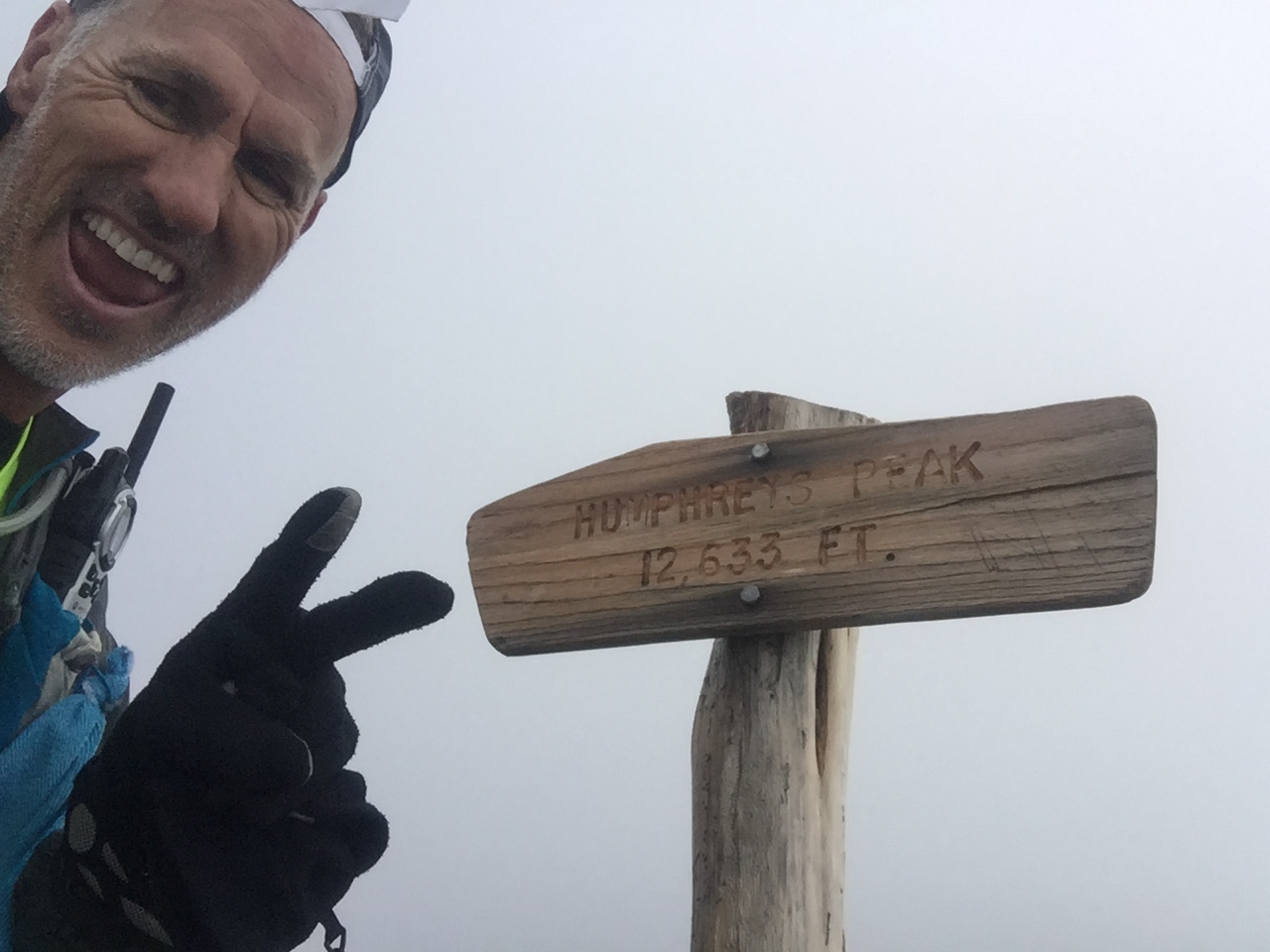
Summit of Humphrey’s Peak
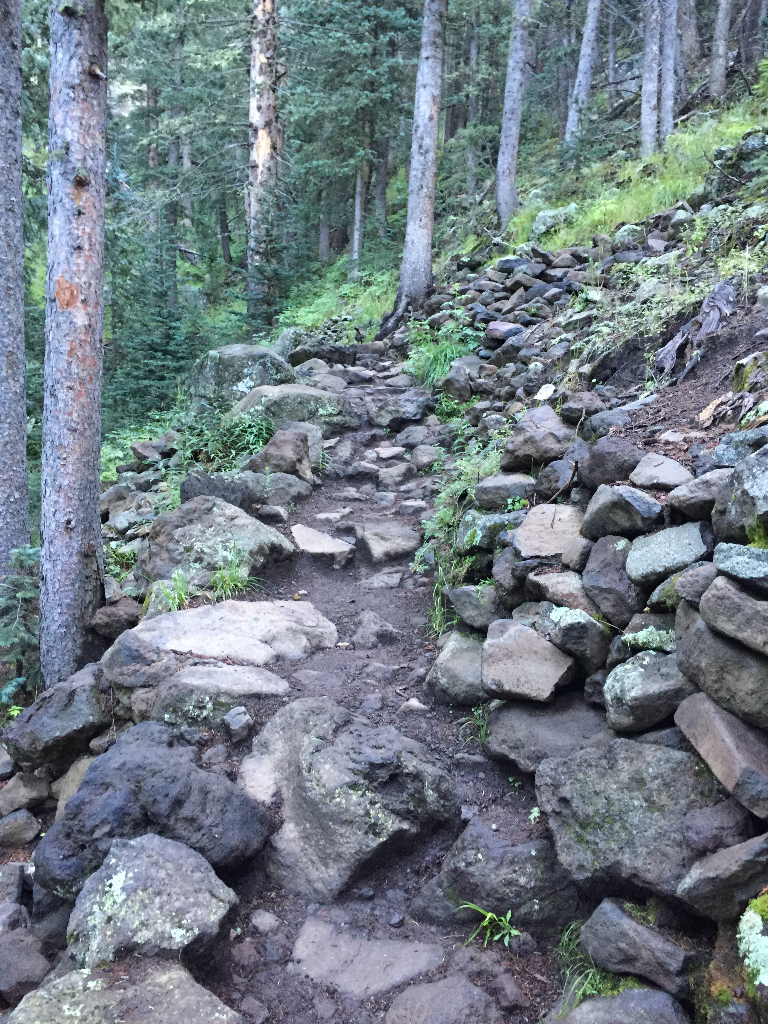
Rugged trail
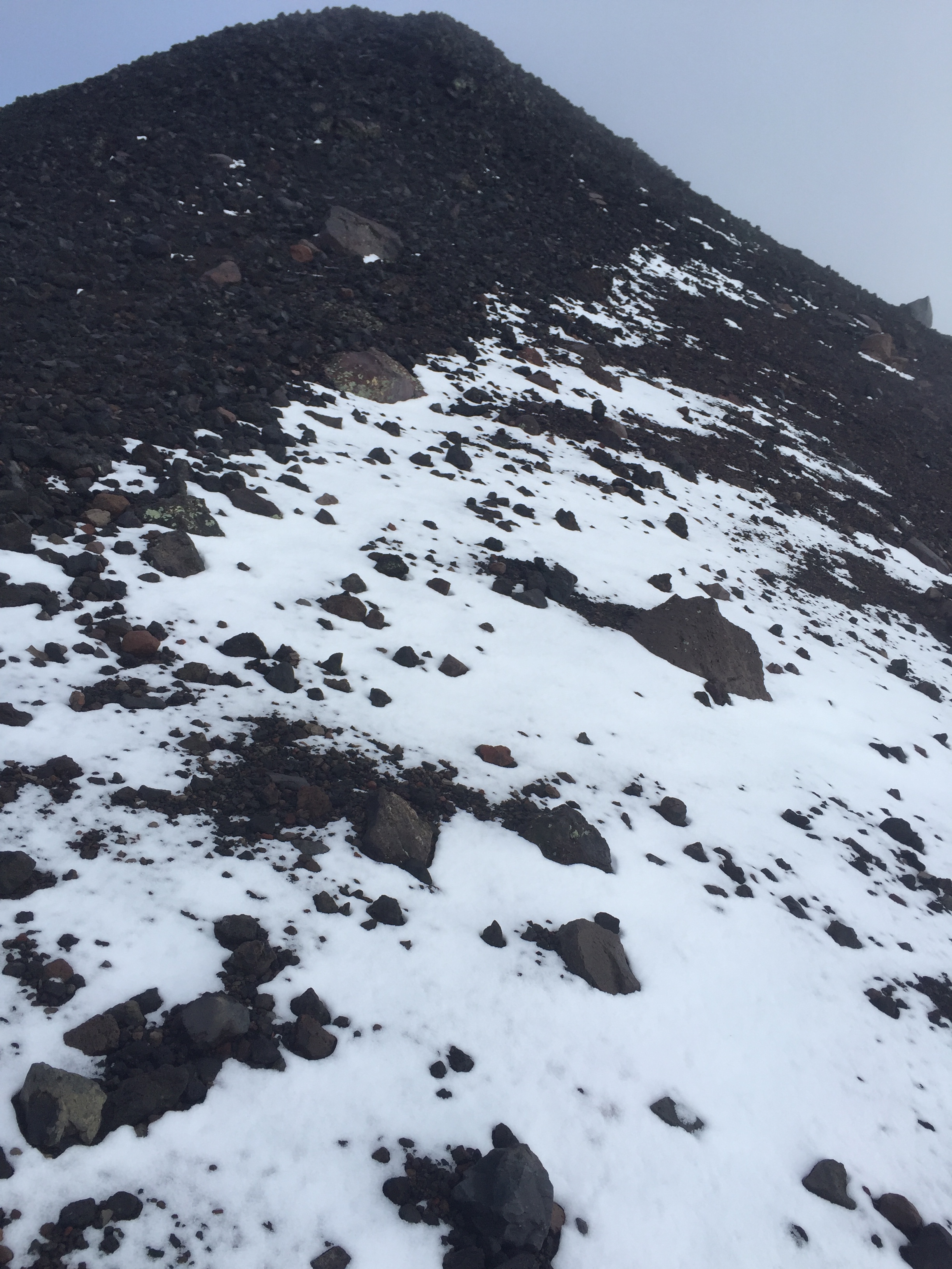
Snow covered trail
After a brief refueling of bacon and a nap at the RV it was on to Elden and O’Leary’s peak. Sam and I joined Jeff for the final two hikes. Though Elden is a short 4-5 miles round-trip, it is very rocky, technical and steep. We were glad to be hiking this one in the daylight!
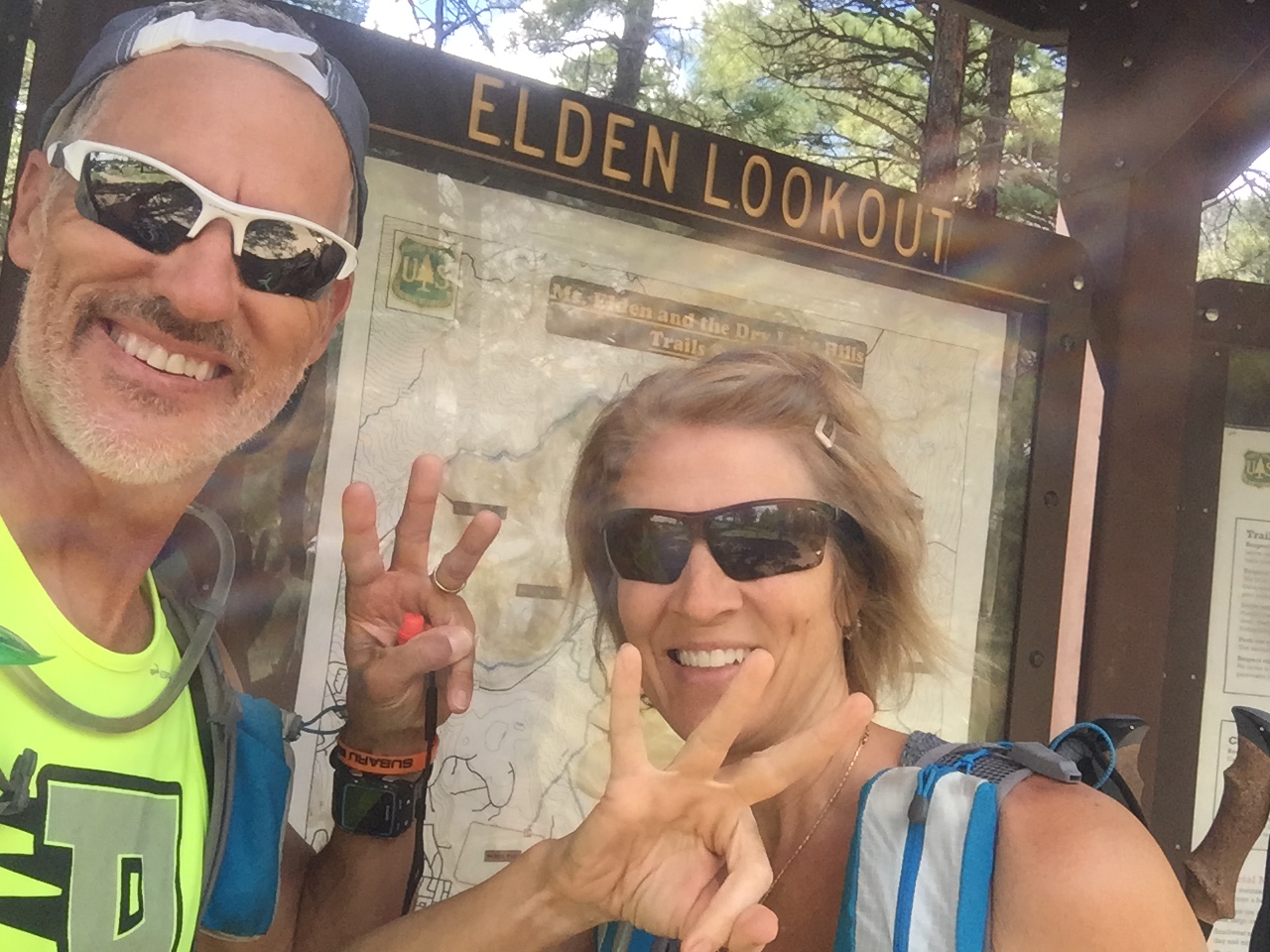
Third peak in the bank!
Heading further north we finished with O’Leary’s. This trail was a well-groomed forestry road all the way to O’Leary’s lookout, where we took in sunset views before racing back down the mountain to finished after dark.
Jeff did an amazing job coming in under 15 hours for the Fearsome Four and we celebrated with some late night BBQ!
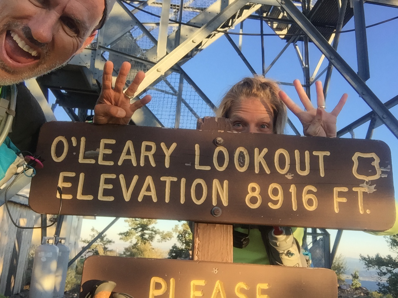
Number four…O’Leary Lookout!
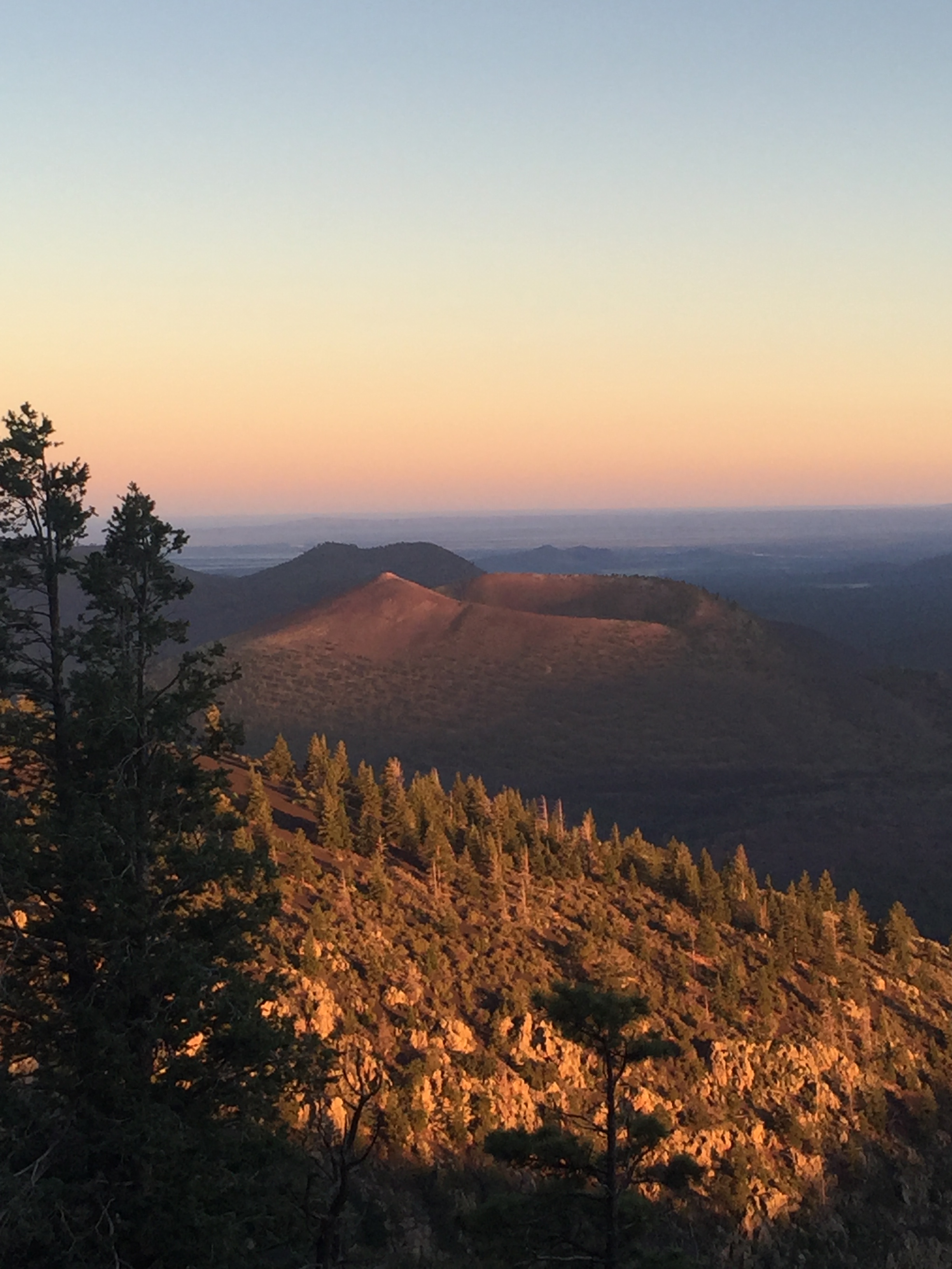
Racing the sun
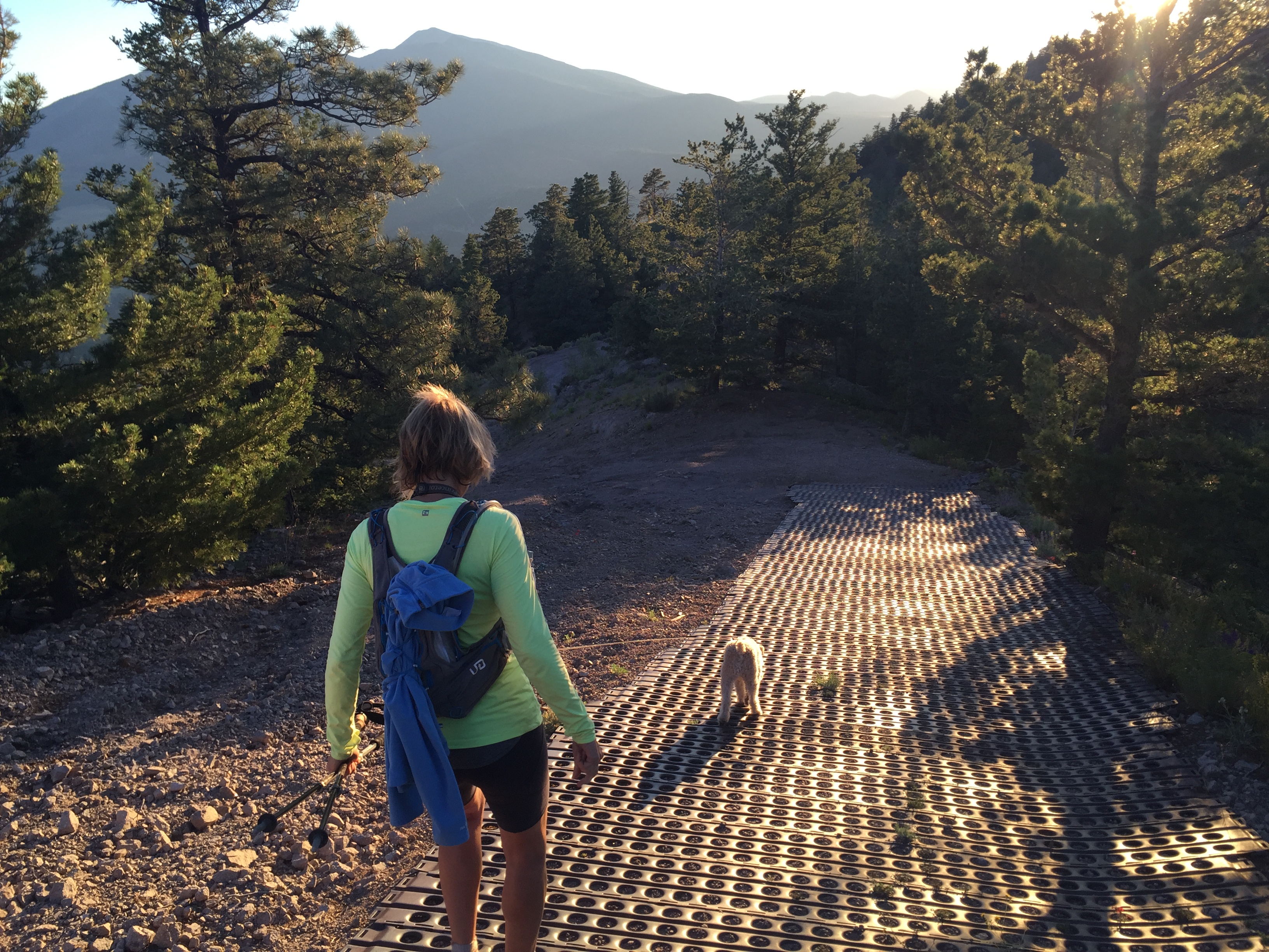
Steapest section at O’Leary Lookout
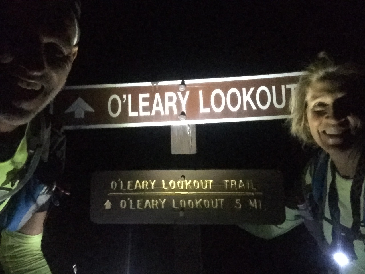
After dark finish!
The next day we packed up and headed for Phoenix where we jumped on a plane and flew to Dallas. The Dometic show vehicle needed to be transported to Elkhart, Indiana for the RV industries open house.
A stop over in Bentonville, Arkansas was in order and we stayed for two weeks. This gave us a chance to check on family and our beloved Beaver Lake cabin.
I tell ya, when I sit on that porch swing overlooking the Lake, it’s hard to think of ever leaving! I love the smell of fresh lake water, hearing fish flopping in the early morning hours, swimming in water so clear you can scuba dive. I love that I can lace up my shoes and go for a run on lake roads that only a few locals travel. I ended up with 5 of the neighborhood dogs on one of my runs, which helped with missing Sam on our trip.
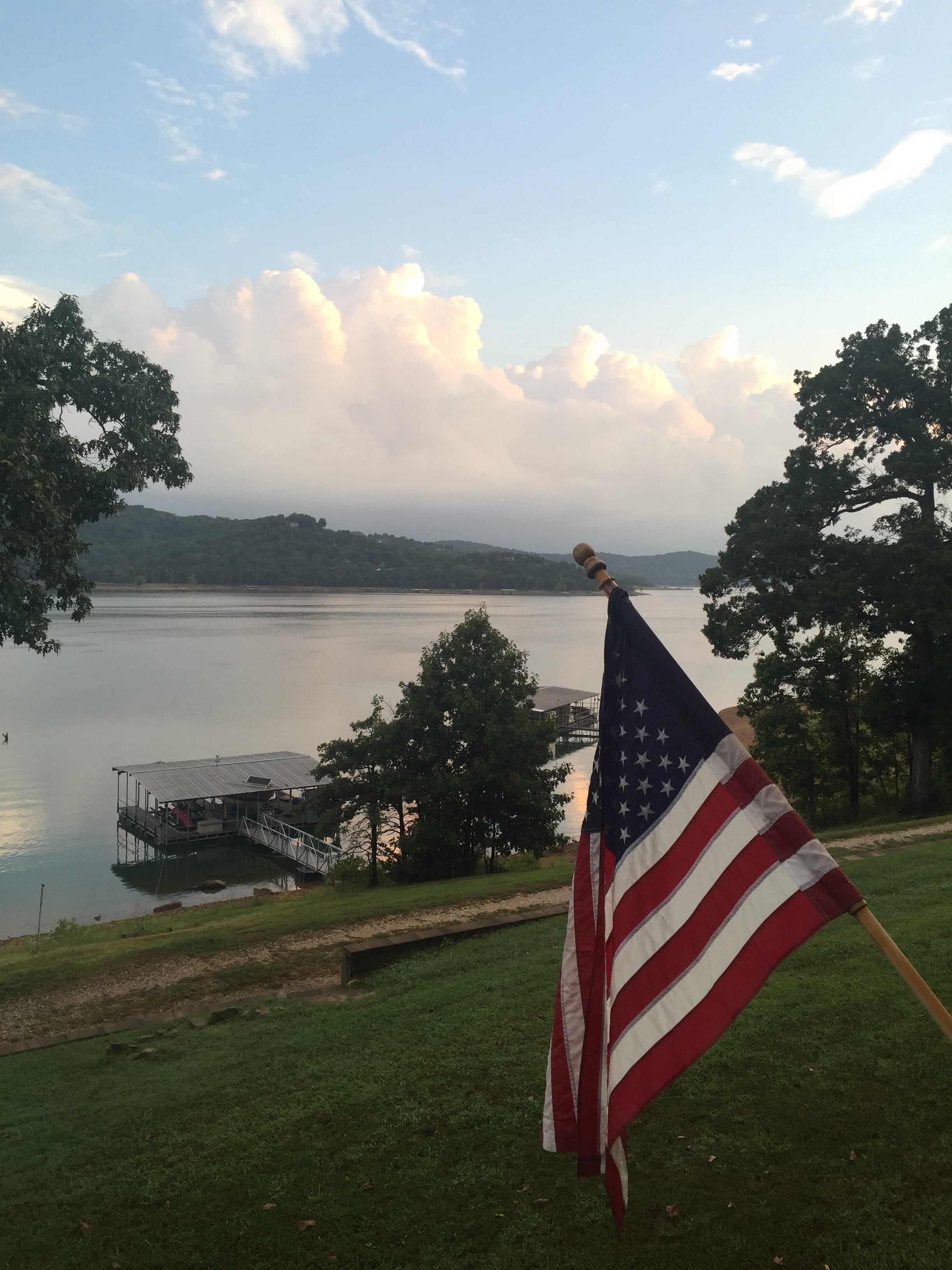
The view from our deck
Well hello humidity! Where have you been?
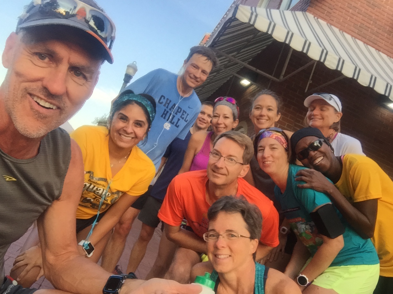
Getting in a Saturday morning run with friends
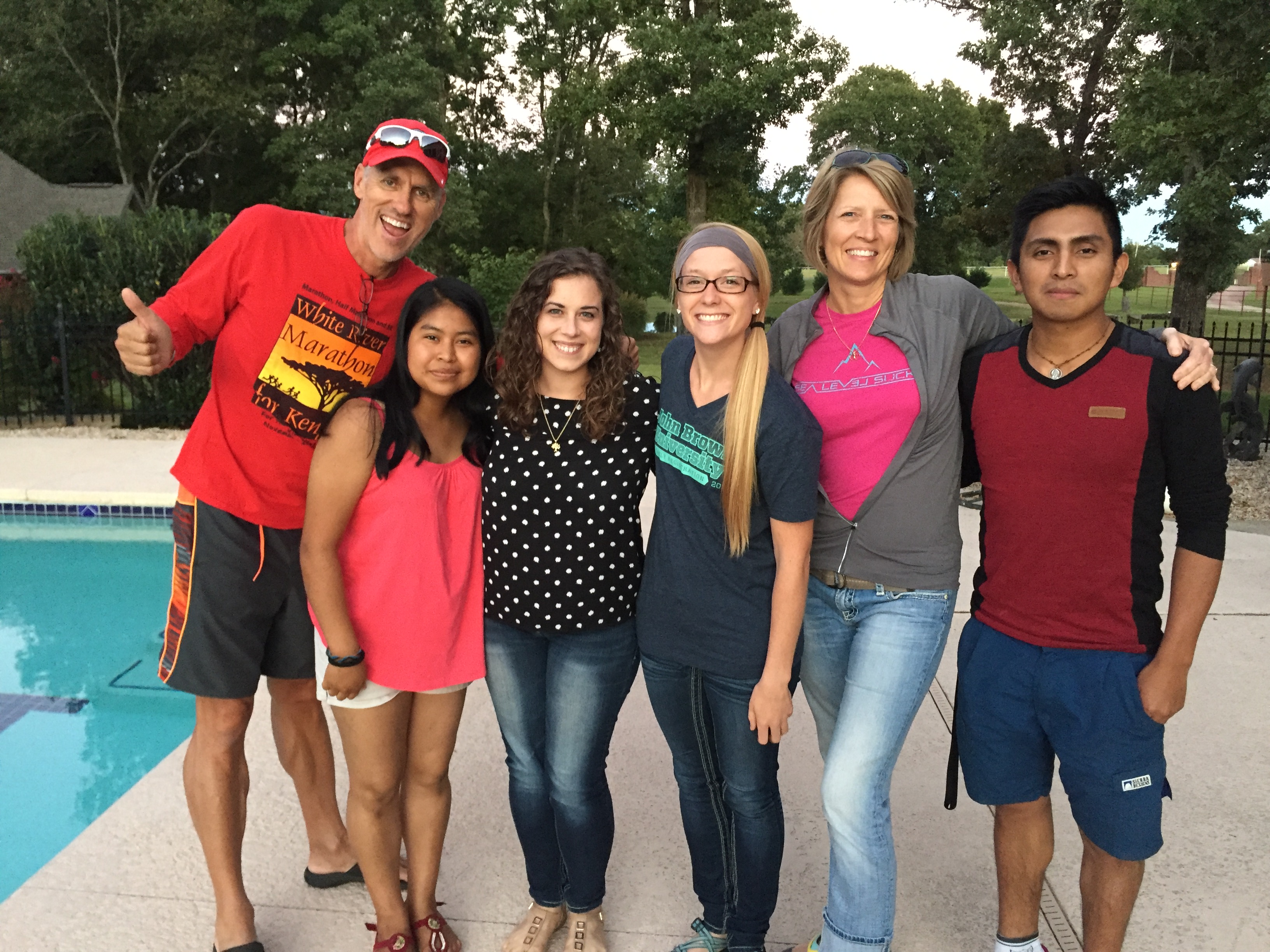
Quick visit with two of our Guatemalan students in AR on Walton Scholarships to John Brown University…so proud of them!
Arkansas is a beautiful place to call home for sure and I always shed a tear when we leave. But the road calls, and we must go and off to Elkhart we went.
We arrived over the weekend so that we could visit with some wonderful friends. The open house went well and we headed south with the RV to Louisville before flying back to Phoenix. It was a hard pressed 3 week trip and we were glad to get back to our dog and our RV.
With only 3 days before the Stagecoach 100, we were rushing again to get back to Flag for the race. So after landing at 6:45am, we picked up our dog and were on the road with the RV by 9am, and parked in the woods by that afternoon.
Holly moly…that was a tiring trip!