Posts Tagged Natural Bridges
Adventures in Car Camping
Posted by Deb in Boondocking, Full Time RV, Hiking, Moab, Running, Trail Run, Ultra Running, Utah on January 1, 2018
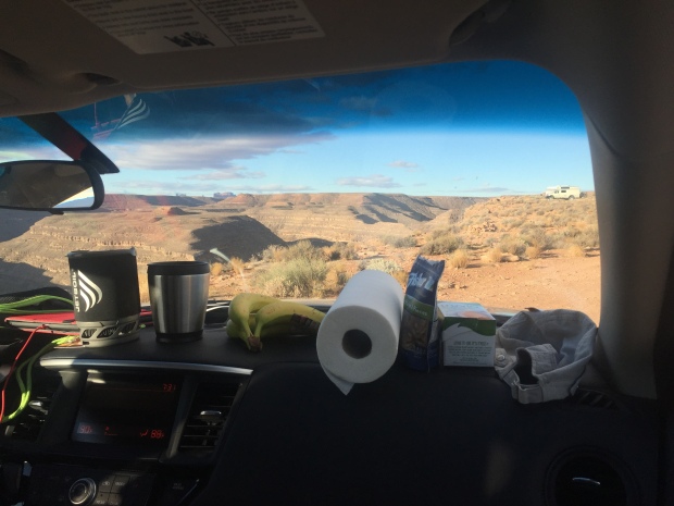
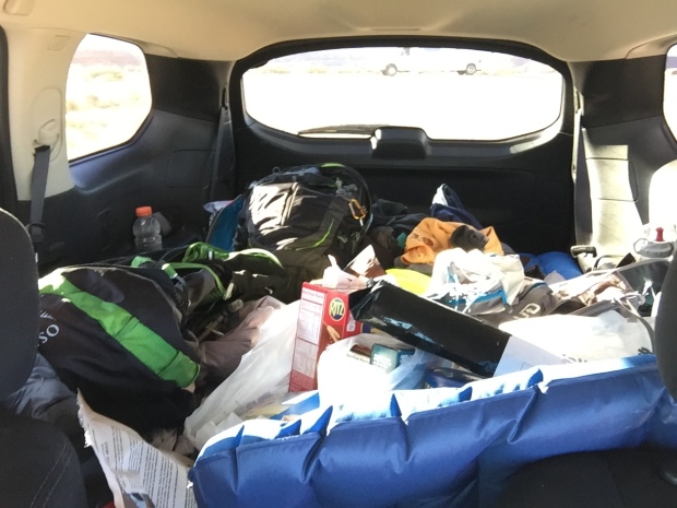
Dashboard Kitchen
After finishing our backpacking trip to Havasupai Falls here and here we planned an additional six days to car camp in Southern Utah.
Since we had purchased all this camping gear for the falls we decided to give car camping a try instead of getting hotels. And after sleeping on a picnic table for 3 nights, the car felt like a five star hotel (she laughs hysterically)!
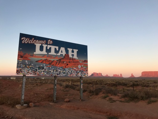
Welcome Back to Utah
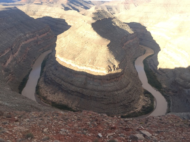
We drove from Havasu Falls trailhead past monument valley to find a nice campsite on the rim of Gooseneck State Park. The sun was going down by the time we got there and the temps were a very comfortable 70-ish. We set up our camp mattresses and sleeping bags in the back of our Nissan Pathfinder and left the tailgate open for ventilation.
It was such a beautiful night and the stars were fully visible with the lack of city lights. The rim of Gooseneck is barren rocky land completely void of any scrub or trees, which translates to magnificent sunset viewing. We set up our camp stove on the picnic table and kicked off our sandals just outside the tailgate and piled into the back of the SUV for a great night sleep under the stars.
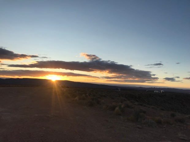
Camping along the rim
Car camping was pretty awesome…until about midnight.
I woke to some jostling of the car and the gritty taste of dirt and sand in my mouth. When I finally came too I realized that we were in the middle of a windstorm that had kicked up so much grit in the air that the clear full moon from two hours earlier was a blurred hazy glow.
I had to jump out of the car to shut the tailgate but my sandals were nowhere to be found. I got the gate down and climbed into the side door to find our sleeping bags covered in sand. By now Jeff had barely woken up and wanted to know what I was doing. I swear that guy could sleep through a parade of fireworks.
I settled back in and asked Jeff if there was anything else left outside. When he said that the Jetboil was out on the picnic table, all I could see was hundred dollar bills flying over the edge of the canyon.
The wind was so fierce that I could hardly get the car door open to retrieve the camp stove and to look for both sets of sandals…all of which were teetering on the edge of oblivion. One more little puff and we would have been shoe & coffee-less the rest of the trip.
Has anyone seen my sandals?
The temperatures were dropping quickly and I forced the car door back open to crawl back into my grit filled sleeping bag. A challenge for a 6’ tall gal with back problems. The car was being battered by the wind. The decline of the rear seats that we were sleeping on made it feel like we were angled down hill. All I could think about was rolling right over the edge of Gooseneck and crashing to a firry death in our rental car. Our remains permanently entombed in the canyon and memorialized with a jetfoil tombstone.
After surviving the night, we woke to 31 degrees. Jeff started the car to get the heater going. The wind had settled down a bit and we made coffee while I shared the story about how we barely survived being lifted in midair by the wind and discarded in the Land of Oz. If it weren’t for our rubber sandals that had wedged under the tires we would surely have been lost forever! (Jeff inserts eye roll here)
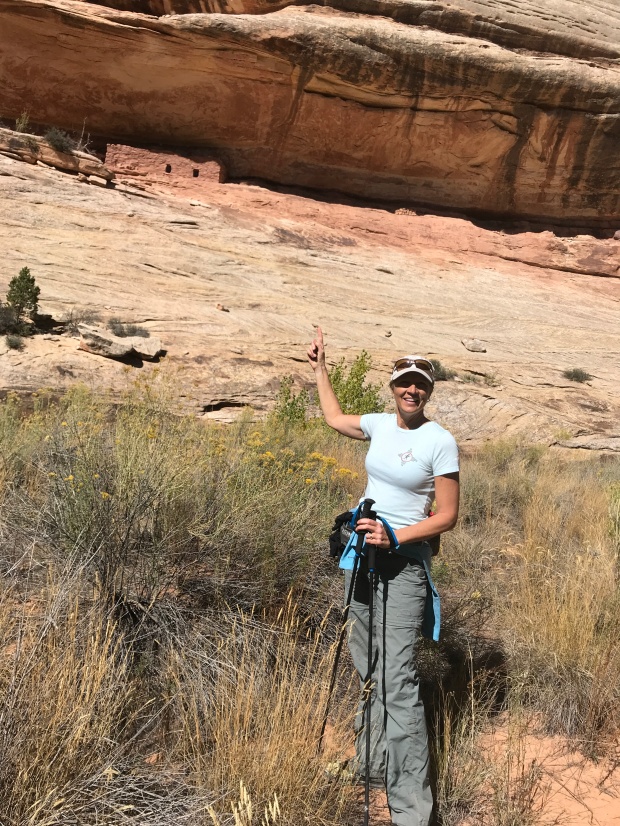
We would have done some hiking here but we wanted to reach the Kane Gulch Visitor Center just as they opened. We had read about several Anasazi cliff dwellings in Cedar Mesa and wanted to get more information about a hike to Moon House.
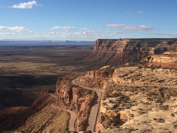
The stunning Trail of the Ancients Road
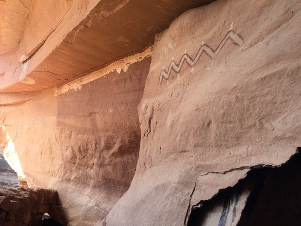
Moon House is a multi-room cliff dwelling named for its celestial pictograph depicting the moon in its different phases. It dates to the early 1200’s and is limited to 20 visitors per day via a first come permit system. It’s a rare cliff dwelling as you are allowed access to some interior rooms. Special instructions are given with the permit on how to enter the rooms without damaging the structures.
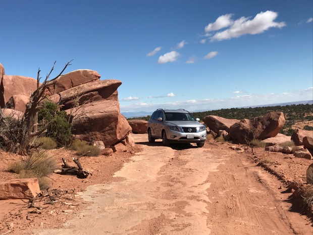
With permit in hand we headed towards McCloyd Canyon. We traveled about 8 miles down Snow Flat Road, a rough dirt road over rock slabs and rutted sections of sand and dirt. It was slow going and we were glad we had an all-wheel-drive SUV to get to the Trailhead parking area.
We started our hike and headed north on another road. After a mile we came a second parking area at the Moon House trailhead. Getting to this parking lot requires a true 4-wheel drive vehicle and we were glad we didn’t attempt it in our rental.
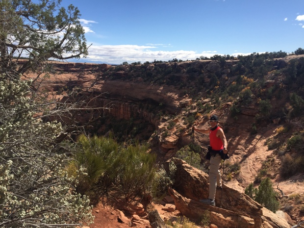
We are heading down there
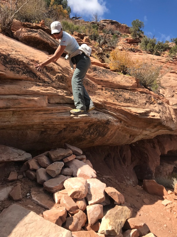
One giant step for mankind
The trail started over sandstone slabs only visible by Cairns before it quickly starts a rocky decent. We took our time since the slope was steep and the rocks loose. At one point we had to slide down the lip of an overhung ledge to a rock pile down below.
We quickly dropped down into the canyon and reached the sandy floor before ascending the other side to Moon House.
Now you see me. Now you don’t!
Still standing after hundreds of years
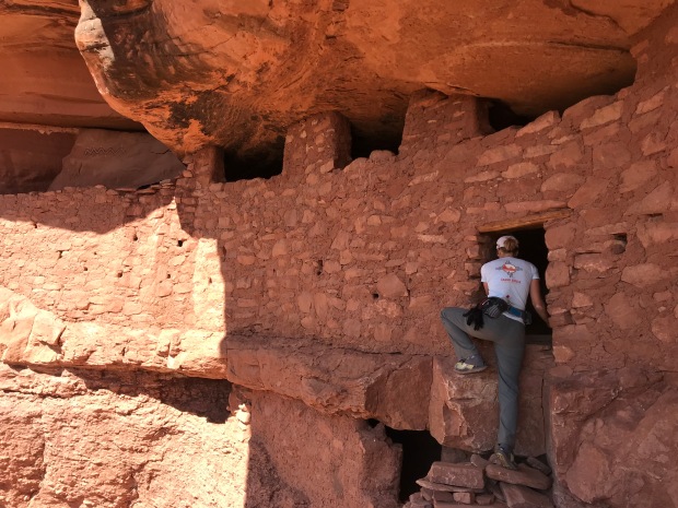
Enter with care
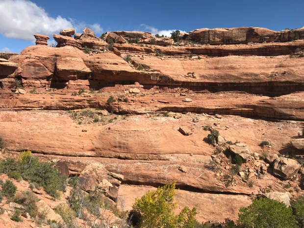
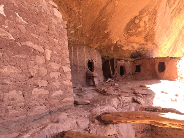
Cliff dwellings are amazing structures as they are built into the sides of raised ledges on the side of cliffs. They are very undetectable when you are not looking and sometimes when you are. We didn’t notice the dwelling until we were right up on it!
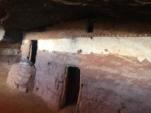
We explored the ruins and were glad we brought along our headlamps to shine into protected rooms. It was interesting to see the construction of vertical tree limbs smeared in mud to form small interior rooms or apartments.
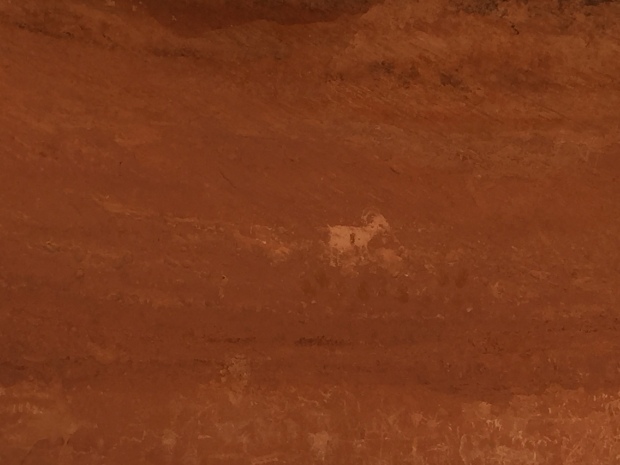
The ancient pigment that created a long white band of Moon House was still vibrant and corncobs still lie on the floors in some of the rooms.
Pictograph giving Moon House its name
We followed more trails around the ledge that led to more buildings. After we started hiking back we turned around to take one last look and realized that we missed a whole other section of dwellings perfectly hidden in the side of the ledge where we sat to have lunch!
It was a nice 4.5-mile round trip hike. We like these destination hikes with history to research and a challenge to get to.
The rocky road to someplace special
By now it was late afternoon and we started to look for a place to camp overnight. The area is mostly BLM (Bureau of Land Management), which offers free camping off random dirt roads. Right off the corner of Hwy 95 and 261 was one of those dirt roads. We found a spot with the perfect amount of slope to make our bed level for the night.
Night two of car camping was not as volatile as night one, but dang it was freezing cold. The temperature dropped to 21 degrees and we had to run the car a good part of the night to stay warm. Of course I laid awake worrying about running out of gas and I had to get out of the car to pee behind a bush in the freezing cold while stepping through land mines of bull head stickers.
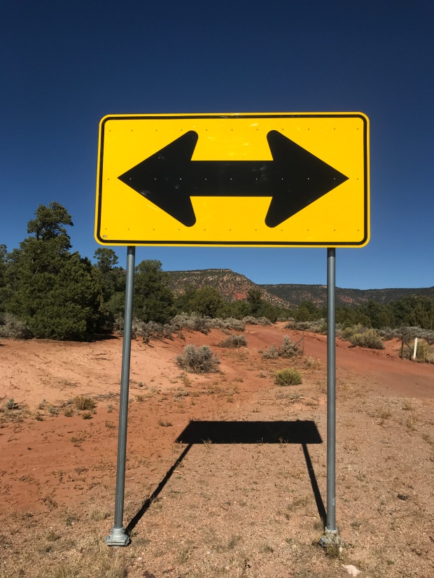
Come morning at the corner of Hwy 95 and 261 we needed to decide to turn left or right. To the left, at the risk of running out of gas, Natural Bridges National Monument. Turn right to Blanding for a service station and on to Moab.
Natural Bridges it is!
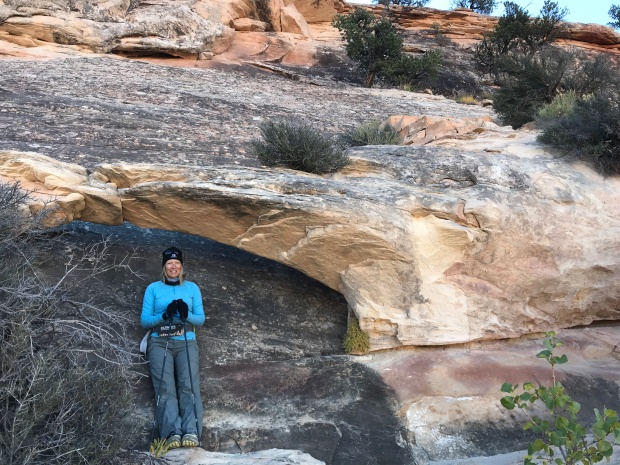
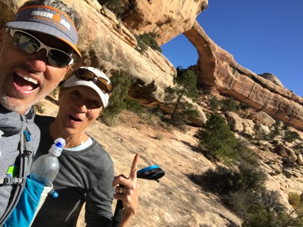
Unnamed tiny arch!
We didn’t know much about this National Monument so we drove through a beautiful little campground within the park for future RVing reference before heading to the visitor center.
It was too early to go inside, so we used the outdoor restrooms and made coffee with our recently rescued Jetboil.
We read about taking the scenic 9-mile Bridge View Drive. The drive takes you to scenic viewpoints that overlook three spectacular arches. Sipapu (place of emergence), Kachina (dancer) and Owachomo (rock mound).
We wanted to do some hiking so we saw that there was an 8-mile loop along the canyon floor to each Bridge…up close and personal.
We started at the Kachina trailhead and descended down a staircase carved into the sandstone. We took the loop counter-clockwise since we thought we would be in the sun on this cold morning.
Chilly start
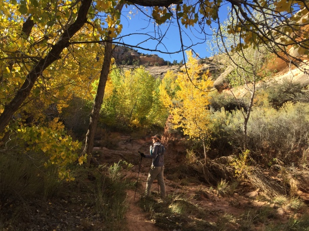
Aspens in October
Once we descending down to the riverbed the trail was flat and serpentine. Each rounded corner revealed new cliff views. We were keeping our eyes peel for petroglyphs and cliff dwellings that we heard were along the trail.
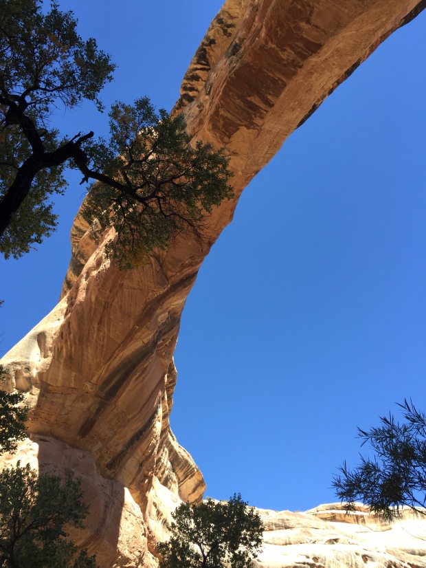
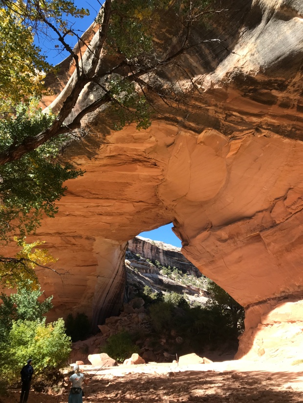
After a couple of miles the trail took a sharp left over slabs and ledges and there stood the magnificent Owachomo Bridge. It was so vast. So tall. The pure blue sky was the perfect backdrop for the white sandstone bridge.
There she is!
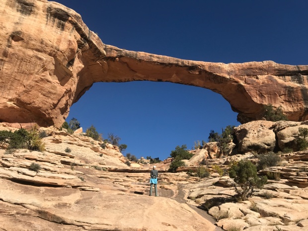
Owachomo Bridge
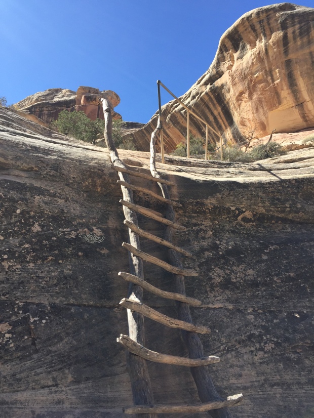
The trail traversed out of the canyon and crossed the inner circle of the Bridge View loop over to the Sipapu trailhead. This part of the trail is known for its dramatic vertical drop via sections of ladders and staircases to the base of Sipapu Bridge.
Just our kind of trail!
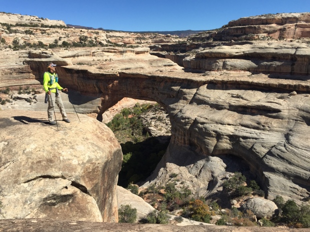
Sipapu from above
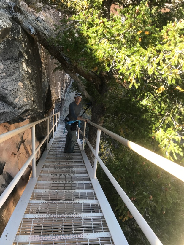
Staircase down the cliff edge
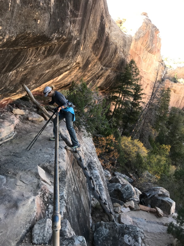
Descending ladders
Sipapu from below
The ladders were a bit intimidating as first but we were back down in the canyon along the dried riverbed before we knew it. After spending some time at Sipapu Bridge we followed the trail along the cliff walls to Kachina Bridge. We finally found Horse Collar Ruins and came across Petroglyphs along the walls of Kachina.
Petroglyphs are really quite amazing to have stood the test of time. They tell a story of life our modern day selves have never known. Hunting and gathering. Conflicts and battles. Everyday life lived amongst the walls.
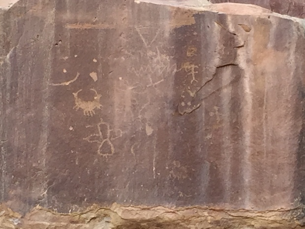
Horse Collar Ruins
Kachina Bridge
We hiked out of the canyon and back to the car. This was such an enjoyable hike and I would recommend it if ever in the area. I would like to come back and hike it in the opposite direction for another perspective of its walls, bridges and stairs.
After Natural Bridges Jeff and I made our way to Moab. By now it had been 6 days without modern conveniences. After looking at the freezing temps forecasted I cried UNCLE and made a reservation at a hotel. By now my back was killing me from trying to climb around in the back of an SUV and my fingernails were telling the truth about how badly I needed a shower. I couldn’t stand the smell of my own hair another day!
Ya…I had enough of this!
I can’t tell you how awesome that shower felt! And after that first night in a room and being able to stand up to put my pants on I begged Jeff for another night…then a couple more. We both had to admit at this point that we (ok, maybe me more than Jeff) were not the car camping sorts.
We never did spend another night in that car!
While in Moab we visited the local Laundromat, ate real food in restaurants and Jeff went to watch the start of the Moab Ultra 200 trail race. Being the Ultra runner he is he wanted to see what the next level of crazy looks like. Apparently, once you’ve finished a 100 race, you begin to wonder if you could do 200 (or so I’ve heard).
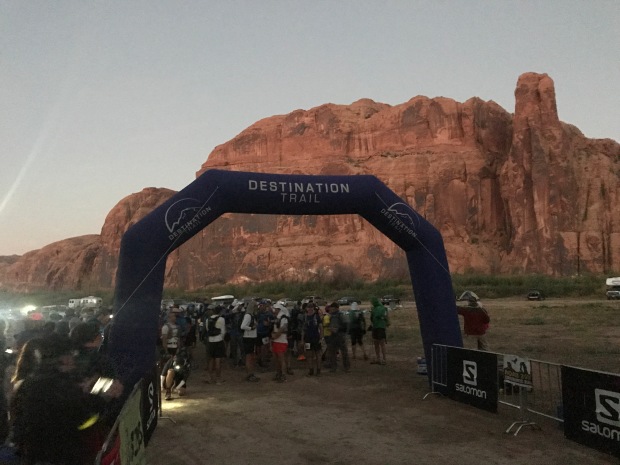
Crazy runners!
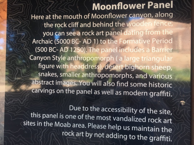
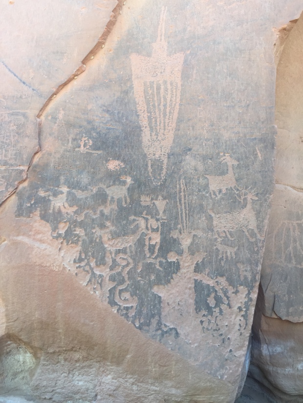
We took a drive out on the course and then stopped to look for the Moonflower Panel Petroglyph nearby. We took a trail a couple miles back without seeing a single Petroglyph but once back at the trailhead we realized the slab of ancient art was right at the parking lot.
It was very interesting to see the similarities of art from one location to the other.
While we were in Moab we hooked up with some friends from our RVing group, The Xscapers. We had burgers at Milts Stop & Eat. Milts is well known for their awesome burgers that totally lived up to the hype! It was a great time meeting new friends and getting reacquainted with some that we hadn’t seen in two years.
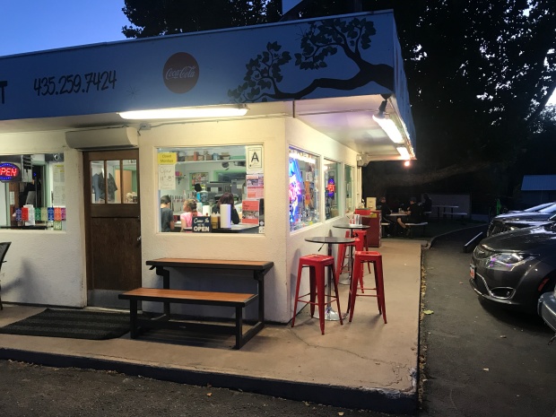
Milts Stop & Eat
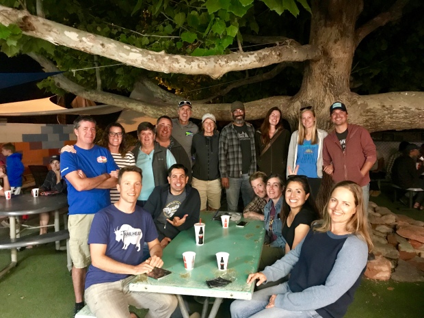
Crazy Xscapers friends
After Moab we drove to Park City, Utah for a quick overnight before flying out of Salt Lake City back to Arkansas.
Despite the challenges of car camping, this was an amazing trip. To be nimble in a small vehicle instead of a 32’ RV was refreshing to say the least and we found ourselves exploring/considering other routes and locations that we would not normally have the luxury of considering.
I’m certain we will keep that in mind when we pick our next RV!
Where to next?
