Posts Tagged Grand Canyon
Havasupai Falls. Leaving the RV Behind. Part I
Posted by Deb in Full Time RV, Hiking, Running, Trail Run, Ultra Running on December 26, 2017
Hualapai Hilltop Trailhead
There are some beautiful places in this world that can be difficult to get to.
Mount Whitney. Yosemite Half Dome. Crossing the Grand Canyon.
I realize these places are no comparison to the difficulty of reaching Mount Everest. But they are some of the most beautiful and difficult places I have personally dragged myself to.
One place that has been on our “list” is Havasupai Falls. Pictures of it’s incredible blue green waters set against the red rocks of the Grand Canyon created a longing and curiosity, despite the challenges to getting there.
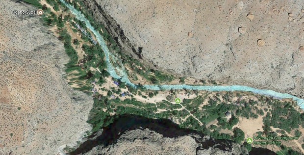
Satellite View of Havasu Creek and Campground
Havasupai Falls is located on the Havasupai Indian Reservation. The Reservation consists of 188,077 acres that makes up the West side of the South rim of the Grand Canyon. The remote village of Supai, Arizona is an 8-mile hike below the rim and is home to Havasu Baaia, “people of the blue green waters”. Two additional miles past the village is the Havasupai primitive campground nestled along the Havasu creek.
There are no roads to Havasu Falls. Access to this Garden of Eden is strictly by your own two feet or pre-reserved helicopter ride that will drop patrons at the village.
There is a 2,000’ drop in elevation within the first mile. But once you hike the switchbacks the remaining 9 miles is mostly a gentle decline to the campground. However, the trail to the village is completely void of trees so temps can sore at the bottom of the canyon. And during monsoon season you must be aware of potential flash floods, as you will be hiking down the gut of the canyon.
Probably the biggest challenge to Havasupai Falls is getting a permit. There are only 300 permits issued per day via a very antiquated phone system; that for the most part, goes unanswered. I’ve read stories of people spending hours/days dialing over and over to get a busy signal. With large organized groups scooping up blocks of permits, it leaves very few to those individuals from around the world clamoring to get the rest.
After researching the falls, I didn’t think we would ever make the hike to this special place. We are RV’ers after all. Our camping supplies consist of holding tanks, fully equipped kitchen and queen sized tempurpedic mattress. We don’t own backpacks, sleeping bags or a tent nor do we have the space in the RV to store such items. And then, how would we ever get a permit?
But my attitude changed earlier this year when we noticed an invitation to go to the falls on the Grand Canyon Hikers Facebook page. They had 260 permits available for a 4-day/3-night trip in October of 2017. The permits were snatched up quickly and we put our names on a waiting list if others decided they couldn’t go after all.
Sure enough, as the date approached, people started cancelling and we were able to reserve permits for the trip! We just could not pass up an opportunity to see Havasu Falls.
After purchasing backpacking gear (that I hope to God we use again) we laid out 4 days worth of minimal food, clothing and gear, which came to 35lbs for Jeff and 25lbs for myself.
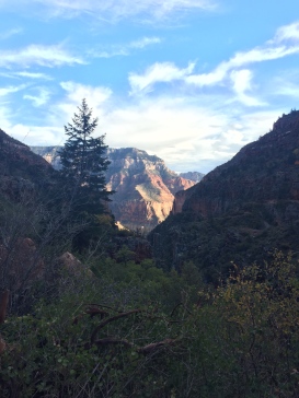
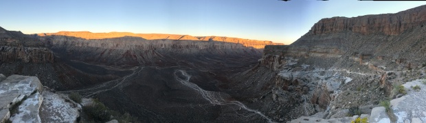
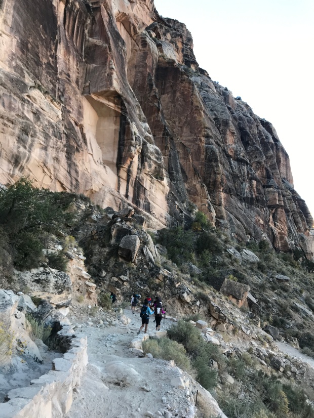
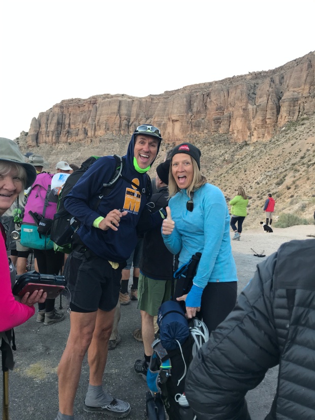
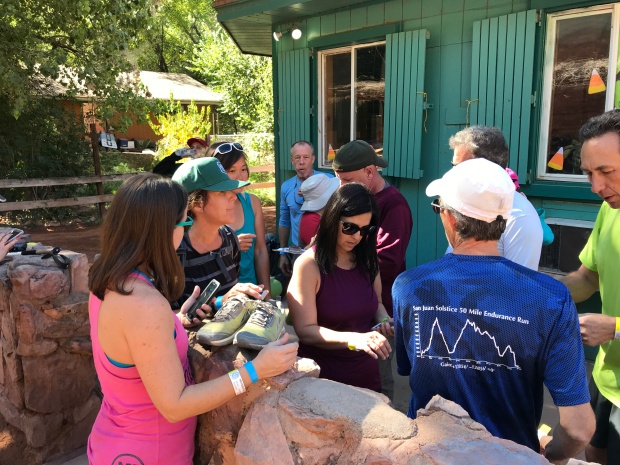
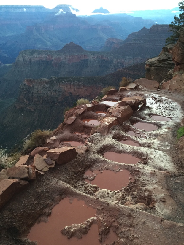
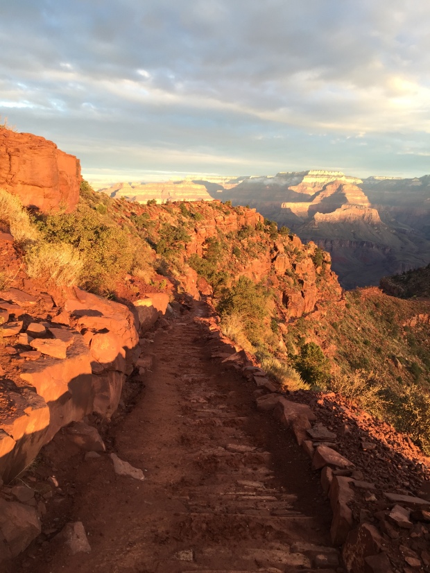
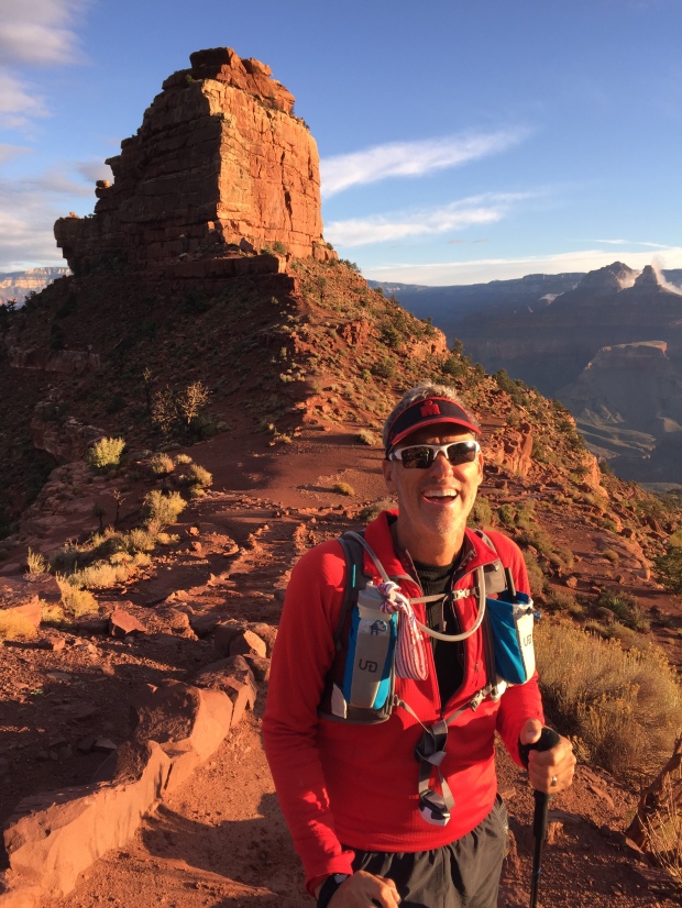
We met up with our group at the Haulapai Hilltop Trailhead at 6am to receive our group wristband and dropped down the tight switchbacks along the steep walls of the canyon. The view was vast with the sunrise waking up the treeless valley below.
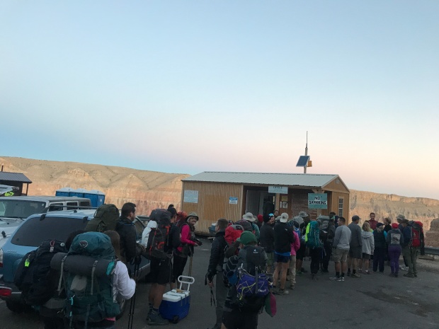
Waiting in line to pick up permits
So exciting!
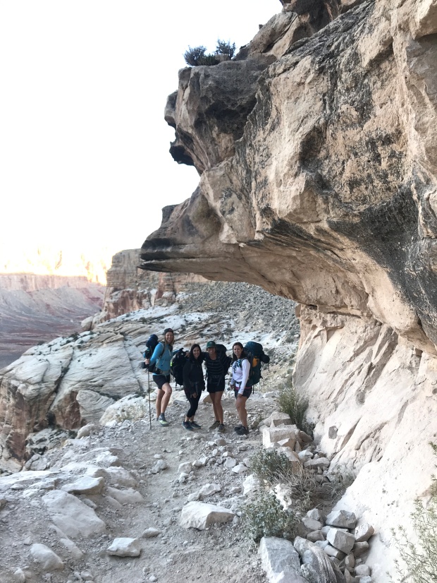
We quickly made it down the first mile and picked one of many trails that spread over a wide-open area. There are no trail markers here and everyone seemed to be on a different trail. But they all led to the same place so if you hike here pick a trail and go with it.
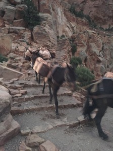
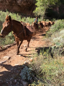
We eventually reached the wash that guided us directly through the canyon. The trail is rocky here but the views of the canyon walls were glowing red from the sun. We started to run into mule trains that were carrying hikers packs up to the trailhead. We also ran into other hikers who had left the campground at 3am to beat the heat.
Im such a giant
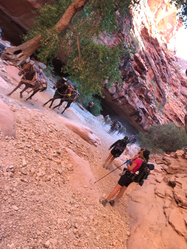
Running mule train
Once we entered the Supai Village we had to check in to receive a second wristband that allowed access to the campground. By the time we hiked 8 miles and made it to the Village, Jeff and I were miserable. Our legs were doing fine but our shoulders were screaming from the weight of our packs. We are trail runners after all and being newbies to backpacking, we hadn’t quite figured out how to distribute the weight of our packs to our hips.
Village checkin for CG permits
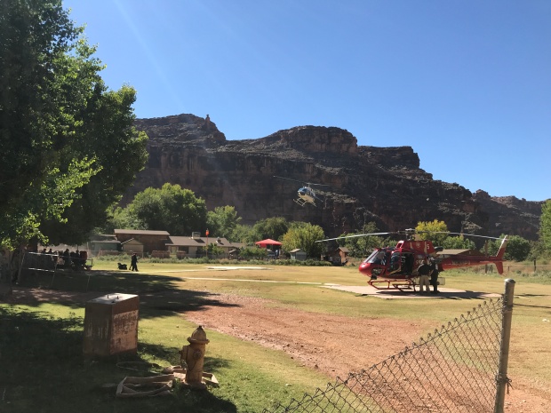
Heli pad
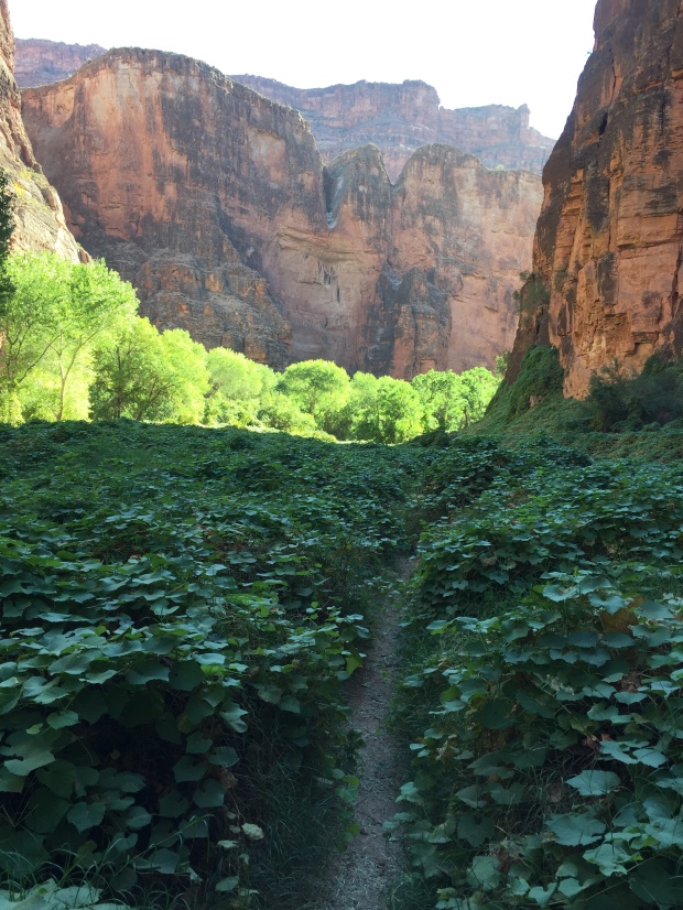
We left the village quickly and headed down the last 2 miles to the campground. Thankfully this steeper section was more wooded offering nice shade on the dusty trail.
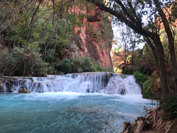
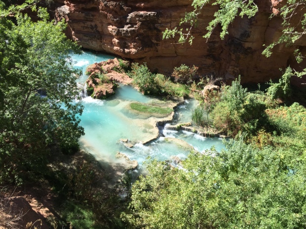
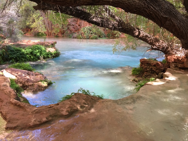
We started getting glimpses of Havasu Creek and its stunning blue green waters along the trail before reaching Navajo Falls. The water is like nothing we have ever seen before. What the eye sees looks fake. The lime content that cakes the bottom of the creek somehow reflects the blue sky through is perfectly clear water.
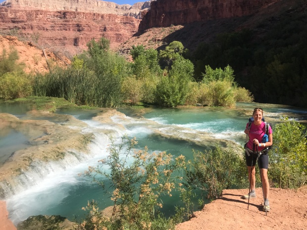
Our first look at Navajo Falls
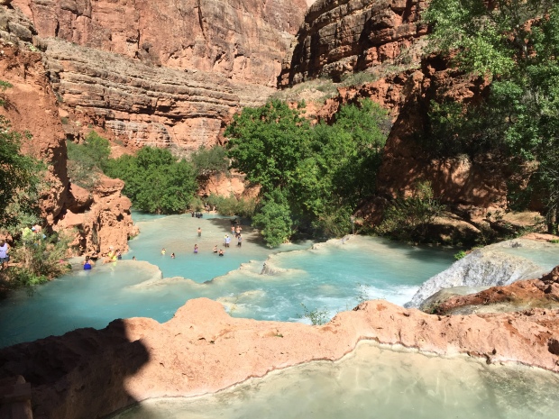
Further down the trail we got our first glimpse of Havasu Falls. One large fall that spilled into a beautiful blue green reservoir made up of tiny pools of waterfalls. People were already swimming far below. They looked like tiny specs in a vast wall of blue.
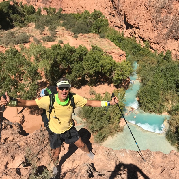
The top of Havasu Falls
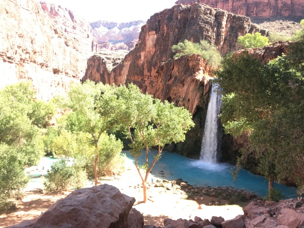
Havasu Falls
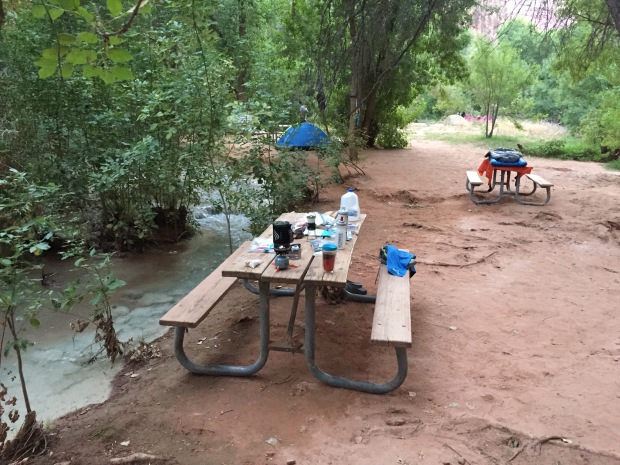
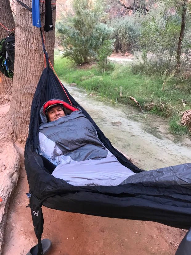
By 11:30AM we reached the campground and found a wonderful narrow peninsula wedged between the creek on either side to make camp. If you plan on hammock camping there are plenty of trees in the campground to stretch between. And the creek offers the perfect volume of babbling brook as background noise to shut out other campers.
Creek on one side
Creek on the other side
We took a quick nap before we explored the campground and met with our group for a meeting. We were instructed to be respectful, tidy and have a good time at one of North America’s most beautiful treasures.
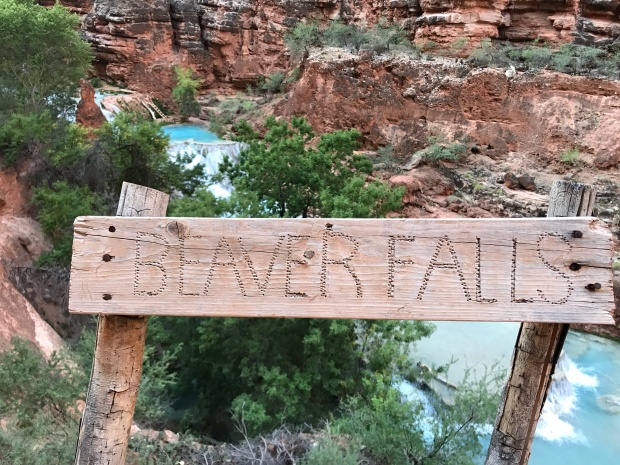
Day two was Jeff’s birthday. And like any good camper without a calendar or reference for what day it was…I completely forgot!! (BAD WIFE!) Jeff and some friends made the 18-mile round trip hike to the confluence of Havasu Creek and the Colorado River while I made the 8-mile round trip to Beaver Falls. Both hikes follow the same trail that starts at the far end of the campground at Mooney Falls.
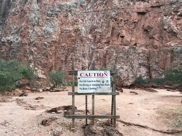
Take your caution seriously
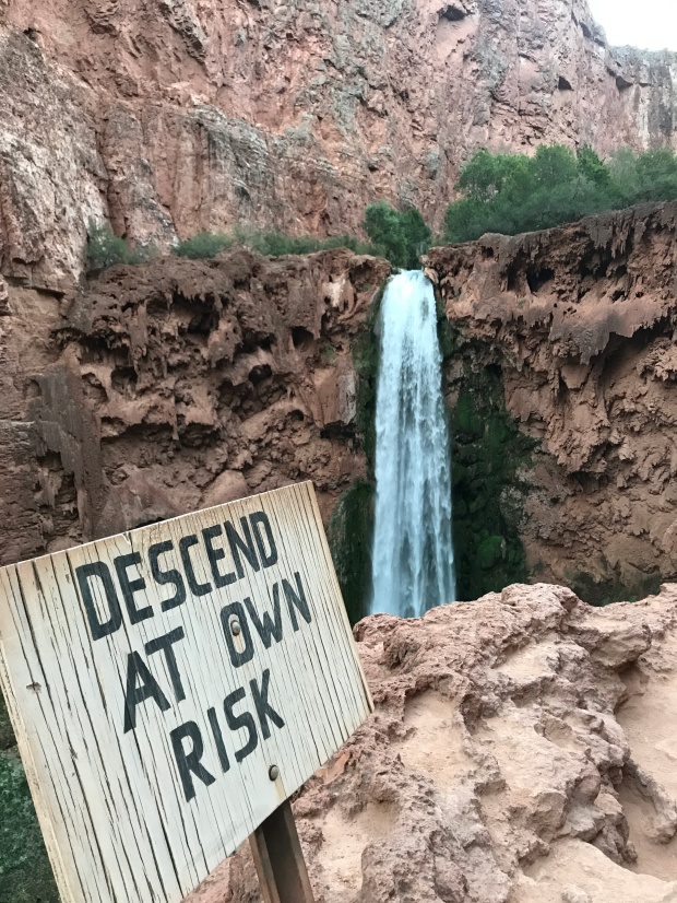
Mooney Falls
You HEAR Mooney Falls before you SEE Mooney Falls. There are excellent vantage points to see the falls and take pictures. From there, several of us were looking for the trail to head to the bottom of the falls. There was a small cave formed by large boulders, but none of use considered it the trail until I walked back to the area and finally saw a faint arrow pointing into the hole.
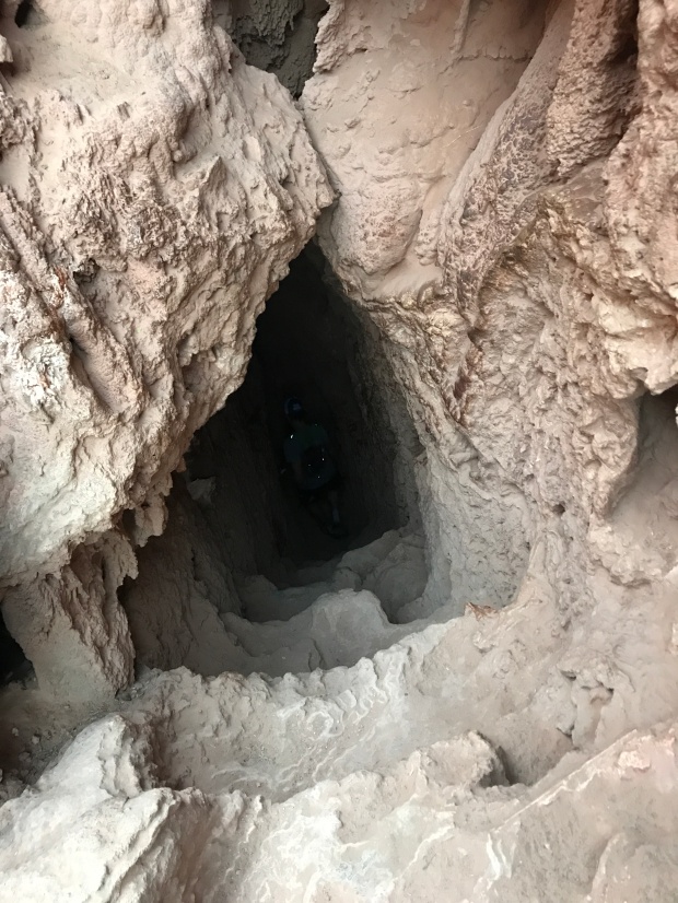
You want me to go down where?
The trail stepped down through the cave and poked out the side of a cliff with an amazing view of the falls. Chains led you a few steps to another cave that stepped down to another opening in the cliff. Visually I lost the trail here only to discover that it drops right over the edge by staggered indentations meant to be stairs, then chains and then a system of slick wooden ladders.
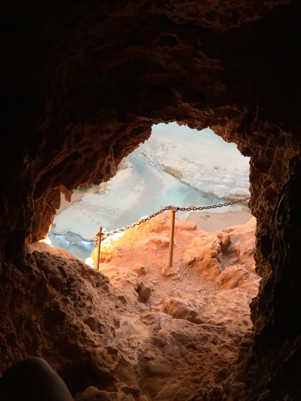
Coming out of the tunnel
The trail drops over the edge
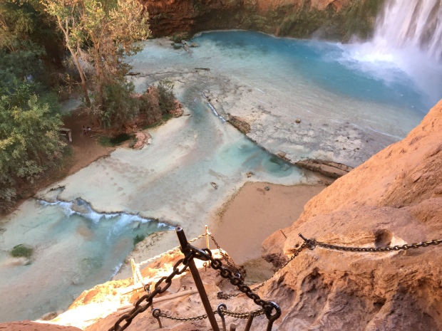
My heart was pumping out of my chest! At our group meeting the advise for Mooney Falls was to maintain 3 points of contact at all times. Two hands-one foot. Two feet-one hand. Take your time and be intentional with every movement.
When I finally reached the bottom my head thought, “that wasn’t so bad”. But then I went to take a couple of steps and almost collapsed from my scared s*%tless wobbly legs.
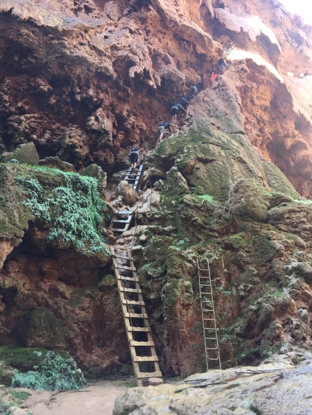
But as soon as I turned around and saw Mooney Falls up close, equilibrium was restored! IT. WAS. STUNNING!
There are a few picnic tables scattered about and beautiful natural pools of hallucinogenic colors. A rainbow forms from the mist given off by the falls in the sun that was just peaking over the canyon walls. It truly is a Garden of Eden.
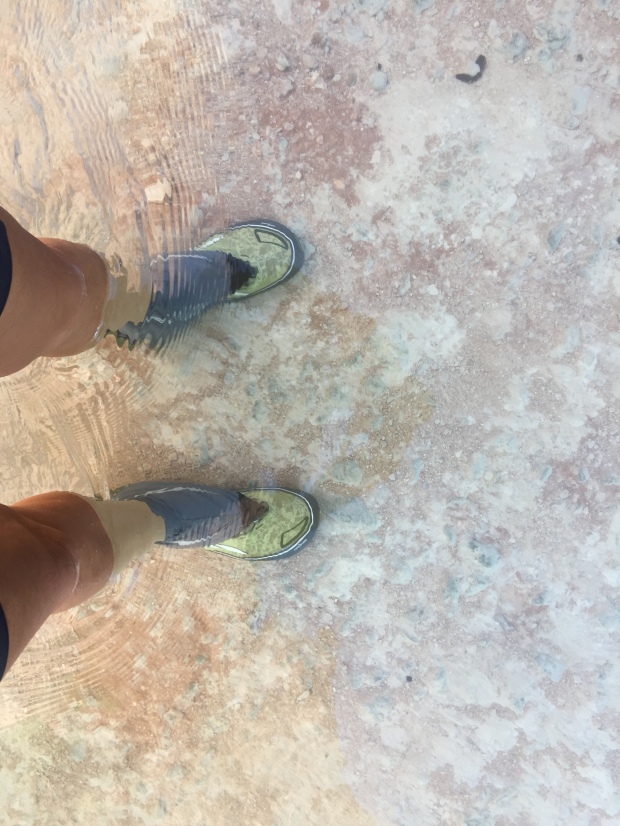
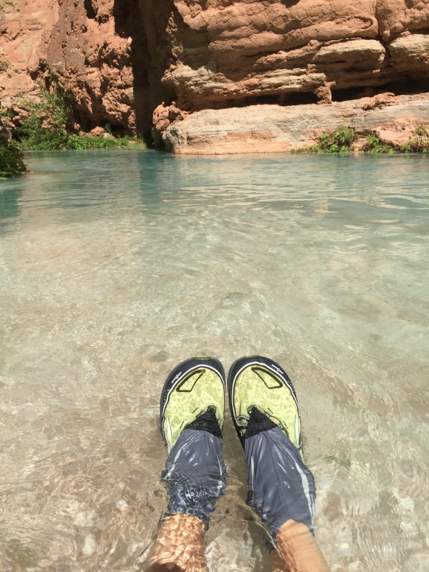
I followed the trail along Havasu Creek. The trail crossed the creek several times and I left my hiking shoes on to protect my feet from the lime coated creek bed. The trail veered away from the creek into what looks like a mangrove of foliage, then back to the creek again.
It was an easy hike and I reached another set of ladders that climbed up a cliff face and then along a bluff. The views were incredible with more of the same blue green waters along the red rock canyon until I reached Beaver Falls. And WOW!
There were people swimming in the falls and jumping off of rocks. The sun was fully over the canyon. The waters were crystal clear and not overly cold. Just the right temp in full sun and a bit cold in the shade. There are layers of waterfalls that are created by dammed up lime covered logs and branches. The logs are so covered that the surface is fully rounded over creating very nice places to sit and soak.
It was pretty crowded at the falls and I decided to hike back on the trail just a bit to find a private pool to soak in. It was such an interesting but easy hike (once you are past the ladders) that was a relief from my sore muscles from the day before.
Can you see the water? Me neither!
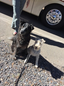
Cooling the dogs
I returned to camp and rinsed out the lime and sand from my shoes and swimsuit.
Part II Next Time
Real or Fake?
The Wave
Posted by Deb in Arizona, Bucket List, Destinations, Full Time RV, Grand Canyon, Hiking, Running, RV Shows, Trail Run, Utah on June 12, 2017
The first time I visited Flagstaff was about 10-15 years ago when Jeff worked for Scotts Miracle Grow. They had their annual sales conference in Scottsdale. We stayed a few extra days to explore Arizona, and Flagstaff was merely a place to overnight so we could see Sedona and the Grand Canyon.
It was such a memorable trip. Cresting the hill driving into Sedona and seeing those red rock formations for the first time. It was like nothing I had ever seen before. Then standing on the south rim of the Grand Canyon looking over its edge. I couldn’t open my eyes wide enough to take it all in.
We had a retirement dream way back then to travel in a 5th Wheel. But I don’t think we ever could have pictured the life that we now have!
On May 11 Jeff and I rolled into Flagstaff for the ? time. We have been here so many times now we no longer need a GPS to get around. It’s familiar, beautiful and one of our favorite places to be.
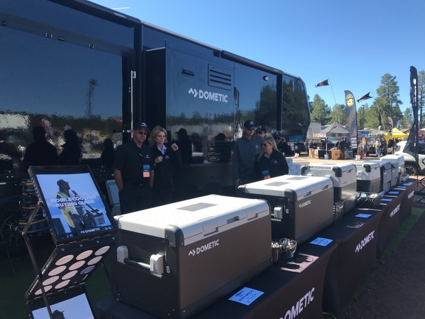
OVERLAND WEST
We were at Flagstaff this time to work the Overland West Expo being held at the Fort Tuthill County Park. We stayed onsite with thousands of Overlanders who were there to…
“Get outfitted, get trained, get inspired—get going.
The world is waiting.”
With that kind of inspiration it’s no wonder this is our very favorite show to work!
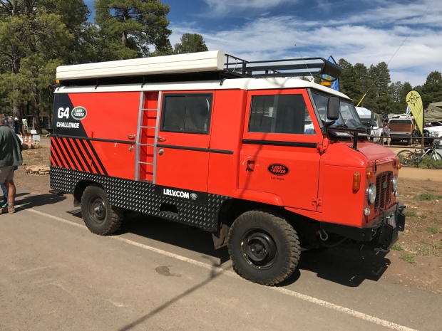
Another kind of camping
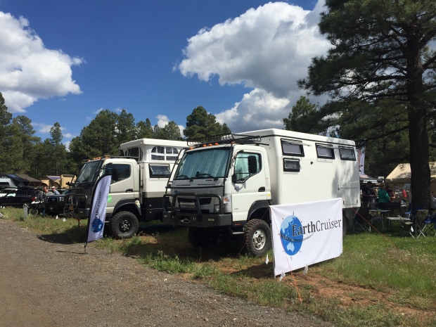
Off road luxury
What makes this event so special is the location (nestled amongst the fragrant, wispy pines), the dogs (all well behaved non-yappers) and the adventurous people who tend to be a younger demographic than RV’ers.
As an RV’er we tend to think we have a sense of exploration and adventure. But Overlanders? Well, they take adventure to a whole other level. Where (most) RV’ers are limited by the boarders of North America, Overlanders are limited by the globe!
There were no satellite or surge protectors companies represented here. I didn’t see any tempurpedic mattresses or meat smokers either. They are more interest in products that will allow them to access off road places with the minimal amount of stuff. The smaller you can go, the better.
We were there to showcase Dometic’s mobile cooling line of CFX portable refrigerator freezers. They can operate off of 12V or 110 and be powered by solar. This appeals to many Overlanders and the products flew off the shelf! Best of all, I didn’t have to talk to a single person about the use of their RV toilet…and their ensuing bathroom habits.
It was a great show with a great team and it was our last show to work until the fall.
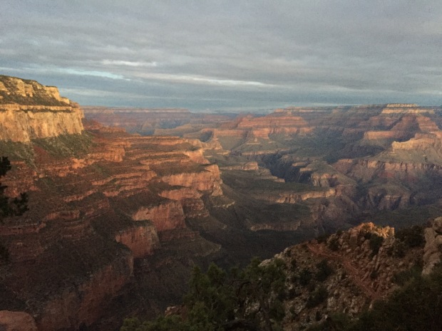
SOUTH RIM GRAND CANYON
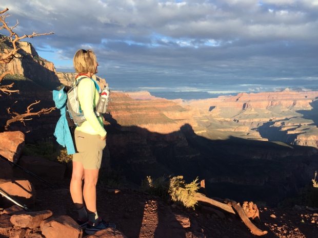
After Flag we moved on to another favorite location, the south rim of the Grand Canyon. We had some friends that were driving up from Phoenix to do a double-crossing of the Canyon and we were invited to go.
Since I prefer a single crossing rather than a double and we have to be responsible fur parents, I sent Jeff across the big ditch with the group while I stayed back with Sam. My plan was to go a couple days later.
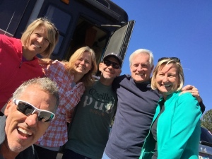
This was the 4th trip across the canyon for Jeff and it never gets old. It’s a heart pounding challenge that he used as training for his Bryce 100 race coming up. At 3am we picked up our three friends at the village and I dropped them all off at the South Kaibab trailhead to start their 15-20 hour journey. I picked them up at 10pm with a couple of pizzas. They were exhausted, cold and hungry!
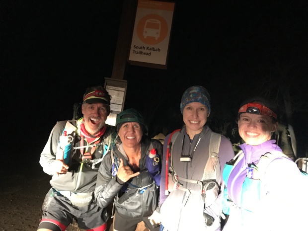
Jeff, Laurie, Lavinia & Kathi
Trip down the South Kaibab
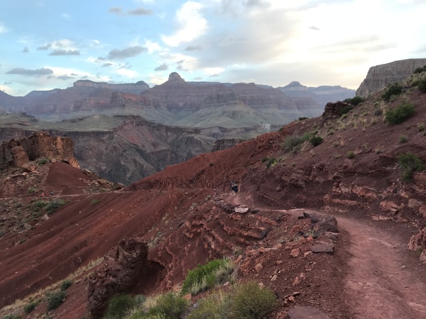
A couple days later I headed down South Kaibab myself. I wanted to take a different route this time and decided to jump onto the Tonto trail at Tip Off Point. Tonto runs east/west between South Kaibab and the Bright Angel trail at Indian Gardens. This cuts off 1000ft of elevation and 6 miles of the traditional Rim to River to Rim route.
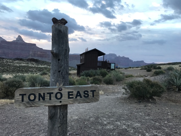
I REALLY enjoyed this route. The views are not nearly as stunning crossing the Tonto trail. But what I enjoyed was that I was done within 6 hours, rather than 10-12 hours. The thirteen miles was still a challenge, but I finished in time for a hot lunch at Bright Angel Lodge.
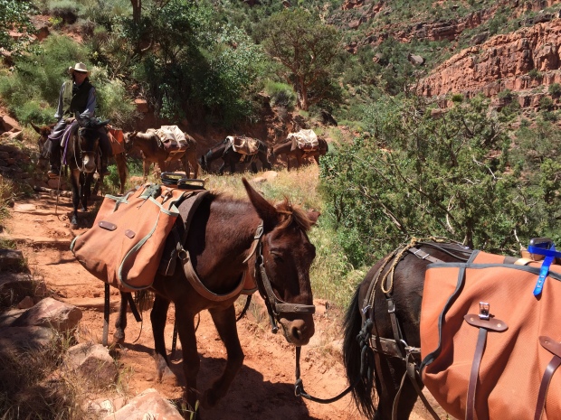
Mule train traffic jam
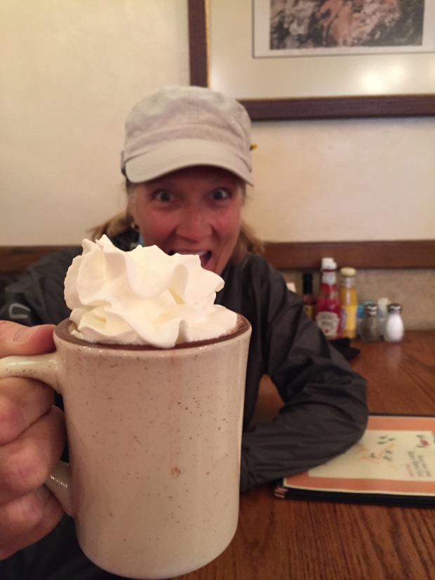
Hot chocolate finish
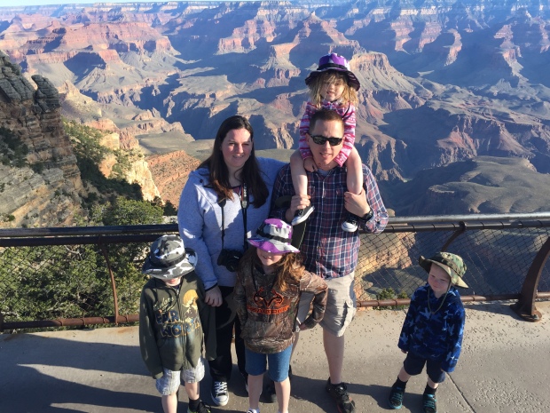
While camping there we had a quick overnight visit from our niece and her family of 4 little’s. They were making a two-week trip from northern California to Arkansas and back and just happened to be passing through. We invited them to spend the night and see the Canyon at sunrise.
Since our RV is not really set up for overnight guests, we spread out yoga mats on the floor to try and make their sleeping bags a bit more comfortable. The next morning we headed to the south rim for sunrise, then took the kids to a café for a pancake breakfast. It was fun watching the kids and their dad seeing the Canyon for the first time. Standing on the rim in awe.
They were on their way after breakfast while Jeff and I headed to the North rim.
NORTH RIM GRAND CANYON
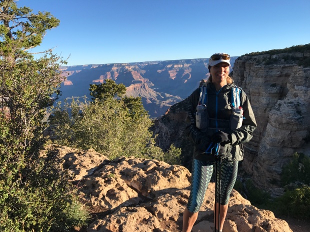
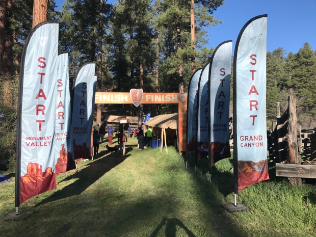
The reason for the North Rim was that I had signed up for the North Rim half marathon trail run. I was originally going to do the Bryce Half (of the Grand Circle Trail series) while Jeff was signed up for the Bryce 100. But after thinking about logistics and caring for Sam dog, we decided to split our races.
The thing that we have found about these trail races is that the packet pickup and start/finish tend to be in remote locations down poorly maintained and unmarked forestry roads. GPS is usually not your friend in these instances and connectivity to digital maps does not exist. At one point we had 7 cars behind us following our lead as we tried to find the check-in. Two hours and two flat tires (not us) later we all made it to the start.
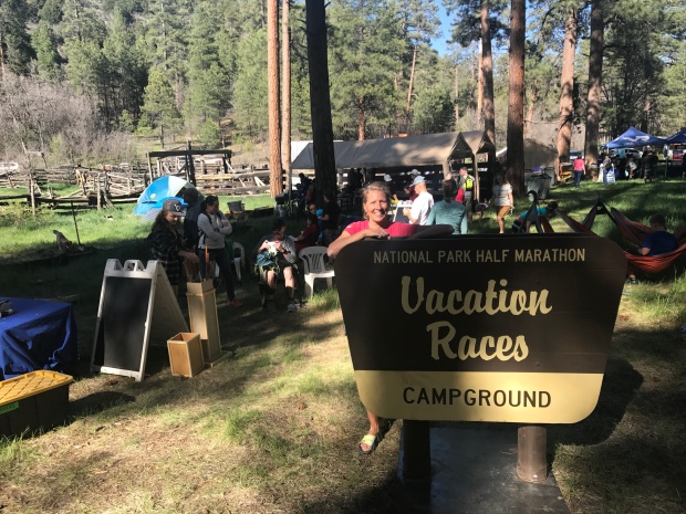
We did discover that our GPS took us on a terrible route…sorry everyone! Our trip back to the RV was on better roads and only took 75 minutes.
Race day was beautiful and fun. But with the 9,000’ elevation breathing was HARD! The route took us on forestry roads and freshly made single-track trails. Up and down hills and along the north rim of the Grand Canyon. It was so amazing runners, including myself, stopped frequently to take pictures during the race. That is one of my favorite things about trail running…stopping for a pretty view regardless of your time is to be expected.
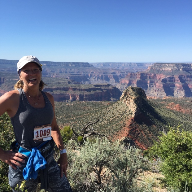
Always stop for views even during a race
It was a great time and I enjoyed a long hard nap once we got back to the RV.
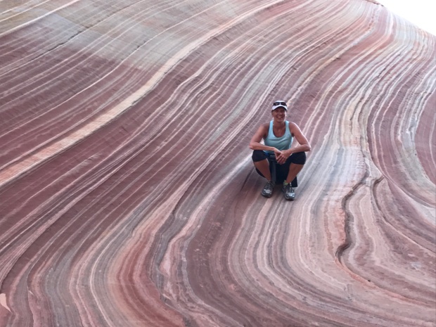
THE WAVE
One of the tools I like to use when we go to a new area is Pinterest. I type in our location to the search and see what others have pinned for the area. For Kanab the search pulled up The Wave.
Most of you have seen The Wave, which was made popular by Microsoft as a screen saver. It was a little known treasure that only locals knew about. But once it appeared on computer screens EVERYWHERE, tourists swallowed up the Wave.
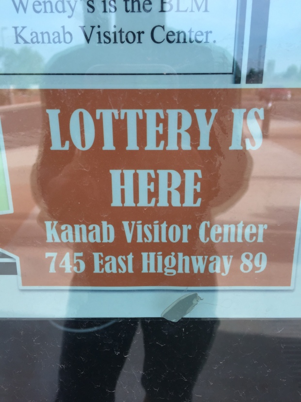
As a result, the Bureau of Land Management had to quickly put some restrictions in place to preserve this treasure.
The Wave is such a small area the BLM limit permits to 10-online lottery entries (6 months in advance) and 10-in person lottery (for the following day) per day. We have always had luck getting permits to other popular hikes by entering in person. Yosemite and Whitney Mountain.
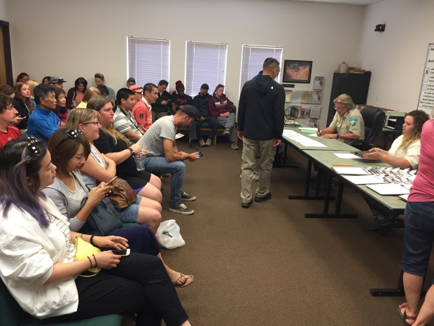
A room full of hope
But the Wave is different with only 20 permits available per day. Any given day you only have a 4-8% chance at getting a permit. Yosemite allows 300 people per day.
Since the odds are closer to 8% on a weekday, Jeff and I left the north rim early enough to get to the Kanab visitor center by 8:30AM to fill out a permit request. Each request allows for up to 6 people to go. However, if a request is drawn with 6 people, then there are only 4 permits left. Permits are handed out per person, NOT per group.
And if there are only 2 permits left and you have a group of 5, then three people must get left behind. NO EXCEPTIONS. All applications are given a number and you must be present during the drawing. Numbered balls are put in a Bingo tumbler and at 9AM sharp, if your number is called, your party is counted until all the permits are issued.
It’s all over in a matter of minutes and the majority of the room leaves disappointed.
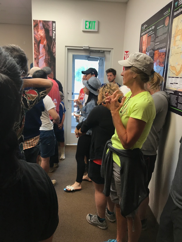
Pick ME!
We found out that one of our running friends from Bentonville was in Kanab with her family. We asked Whitney if she would like to join us IF we happen to get a permit and we put her name on the application. After going through the drawing process we were one of those who left disappointed. It wasn’t meant to be.
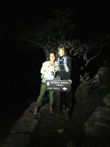
But one of the beauties of being a full time RV’er is that we are flexible, and we decided to make the 45-minute drive to try our luck the next day. And JACKPOT…we were the first number called!
OMG…WE WERE GOING TO THE WAVE!!!
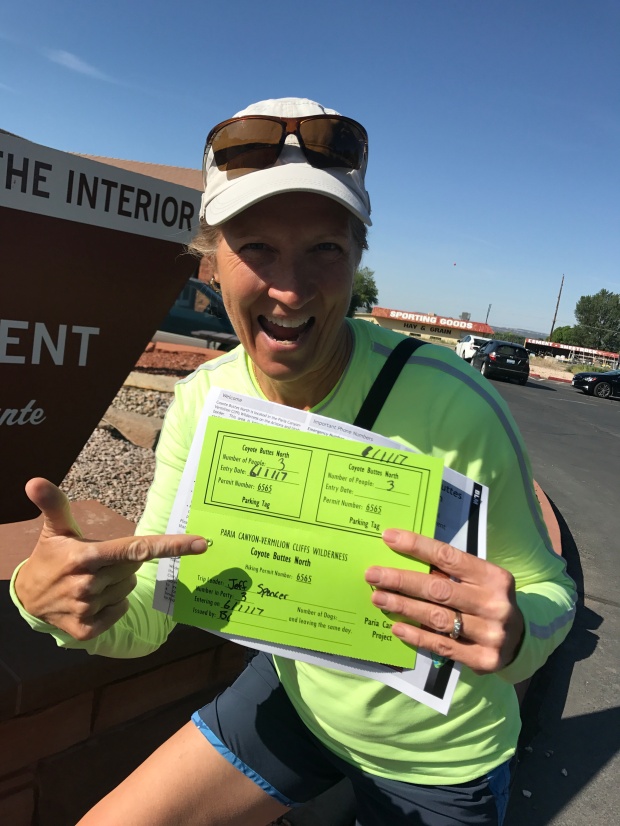
Its official!
Once our number was called the others were dismissed (sorry folks) and permit holders were educated on the rules and given instructions on how to reach the wave. The trail there is so unworn and so unmarked that you are given paper instructions with pictures of landmarks.
You are warned about paying attention to your surroundings, don’t follow others footprints and taking enough water, food and warm clothing to sustain yourself for 24 hours. People have been known to get lost or injured out there, and connectivity/help is slow or non-existent.
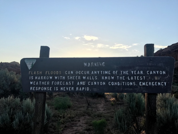
They put the fear of God in me and I took detailed notes of things to be aware of.
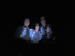
Our friend Whitney spent the night with us at our RV so that we could get a very early start. Jeff had an 11am conference call (we are not on vacation after all) and we needed to give ourselves enough time to explore and get back to cell coverage.
We left at 4am and made the 1.5-hour drive on 35 miles of washboard forestry roads and started our hike at sunrise. This trail is fairly easy, but the written directions with pictures are no joke. We could see quickly how people could get lost. We would have never found it without those instructions.
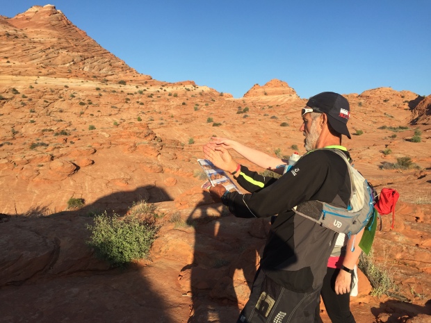
Stopping to consult the map
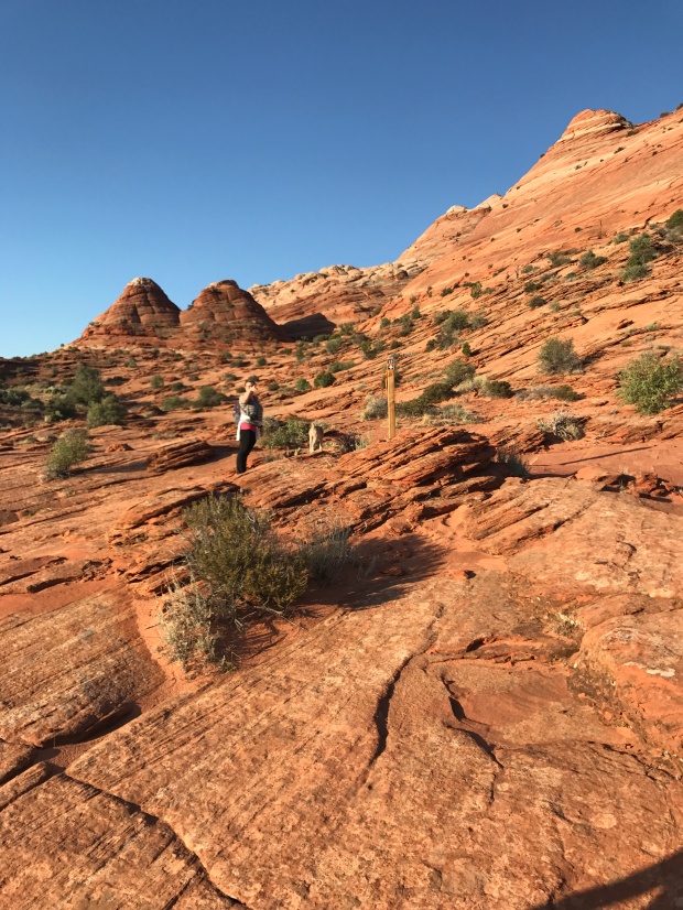
Stay to the right of the twin buttes
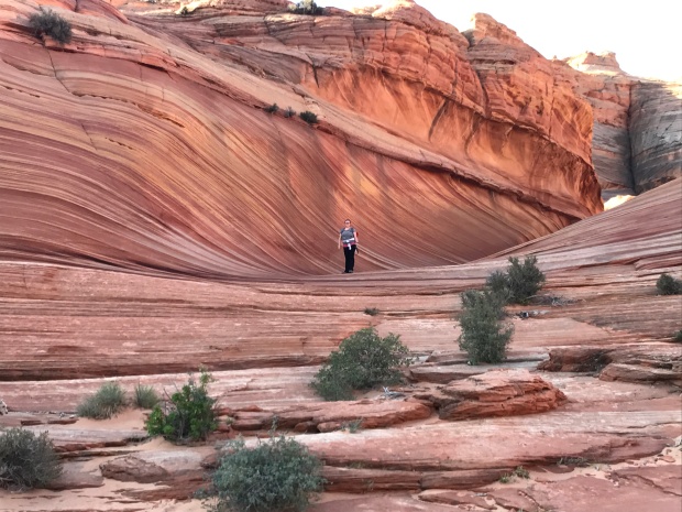
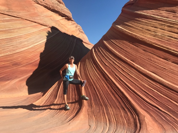
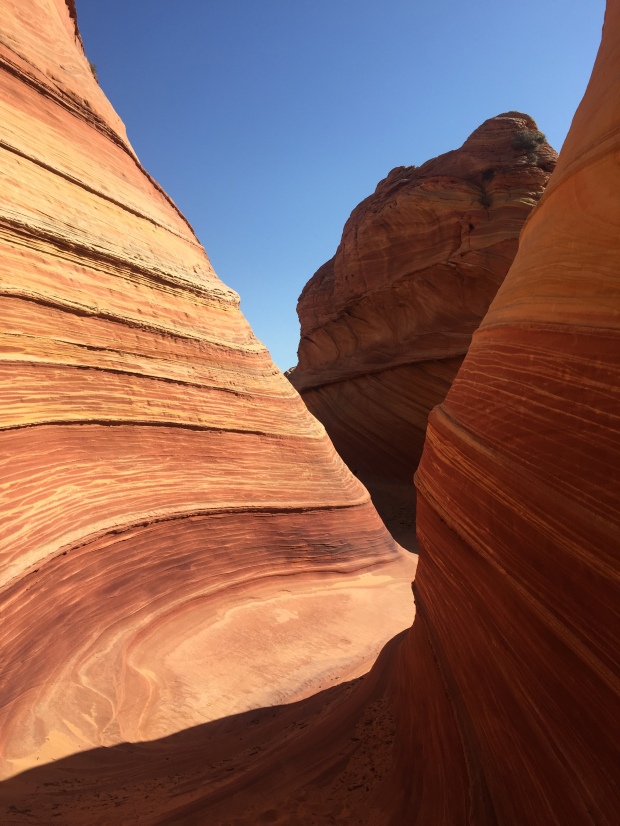
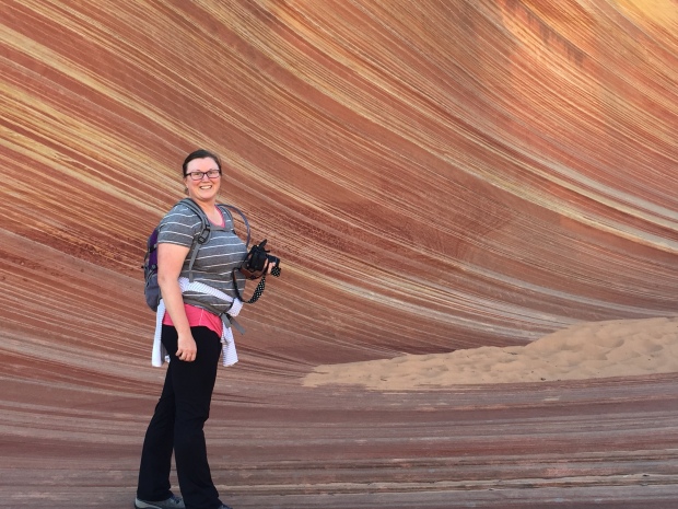
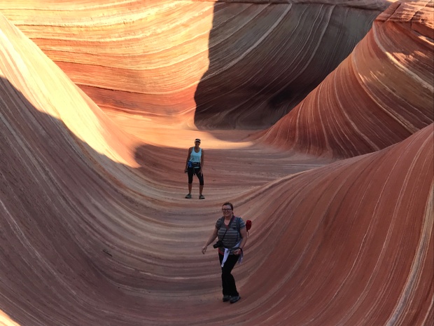
It took us about an hour and a half to reach The Wave… and WOW!
The colors. The textures. The warmth. The contours. All working together to form burning swoops and swirls. We climbed around, on and over this small little jewel and quickly understood why The Wave is limited to 20 people a day. If not the damage would be irreparable and the isolated feel to the experience would be lost.
It was incredible!
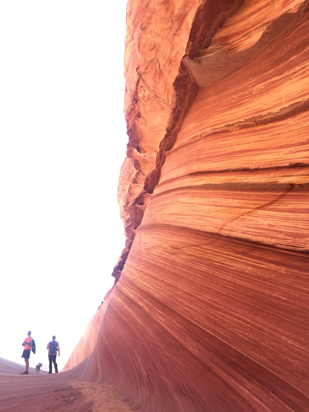
As we headed back to the trailhead, we again followed our paper instructions and landmarks. We did get off course but were able to find our way back to the “trail” with the help of Jeff’s Garman breadcrumbs.
We bid farewell to our friend Whitney and made it back to our RV just in time for Jeff’s call. A few days later I was still reflecting on the beauty of The Wave. It was such a special experience and we feel fortunate to have had the opportunity to go.
I’m not sure how many times we are going to have our name draw for things like these. But we will keep entering our names and keep pursuing the special opportunities in life.
Without the effort there would be no opportunity at all.
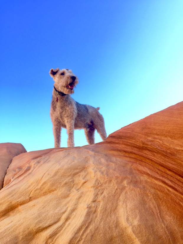
Dogs are welcome at the wave
Epic Hiking and Majestic Views All At the Grand Canyon
Posted by Deb in Arizona, Bucket List, Full Time RV, Grand Canyon, Hiking on October 28, 2015

I made reservations at Trailer Village at the Grand Canyon a couple of months ago so we pressed on after 3 nights in Flagstaff.
This is the third time Jeff and I have been to the Grand Canyon. Our first trip was after a sales conference in Scottsdale about 7-8 years ago. It was December and we only had a few hours to explore. So we hit the South Rim and the restaurant in the Village at Bright Angel Lodge.
Our table was overlooking the rim with spectacular views. Our brief time was enough to create a longing to come back to spend more time at one of the Wonders of the World.

Jeff catching his shadow during sunrise hiking the Canyon
And that’s exactly what we did last year (2014). A group of us from Arkansas trained for about a year in order to do the Rim2Rim (And Rim2Rim2Rim), crossing the Canyon from South Rim to North Rim via the Bright Angel trail and the North Kaibab trail. You can read all about the experience here.
After completing such a hike we were left with wanting more. So here we are. At the Grand Canyon. Planning another epic hike into the bowels of the canyon.
This time we wanted to start and finish on the South Rim so we chose to go down the South Kaibab trail to the Colorado River and up Bright Angel…for me (Rim2River2Rim). Jeff on the other hand wanted to do a double, so he started at Bright Angel down to the river then up South Kaibab. Then, turn around and head back. (Rim2River2Rim2River2Rim)

Rain and rainbows delaying our hike
The plan was for Jeff to leave at 1am and get to the South Kaibab TH by the time I was starting my hike at 6am.
We arrived at the GC on Thursday hoping to do our hike on Saturday. But thunderstorms were predicted and the hike was called off for the day. Then Sunday…Monday…Tuesday…Wednesday. We had rain, rain and more rain, hail and wind gusts until the weather finally broke the day before we were to leave.
There is a lot of preparation that goes into a 10-15 hour hike, especially when the canyon had some of its water sites shut off
due to repairs. Water, nutrition, extra socks, moleskins, headlamps, electrolytes filled our slim running packs.

Stuffing our running packs full of supplies
We had prepared as best we could and the hike was finally on!
Jeff left at 1am sharing that at some points in the hike he stopped on the trail, turned his headlamp off and just took in the stillness, the quietness, the moon and stars in the canyon. Not another soul around. Totally unplugged. Just him and the trail.
I met Jeff about 7:30am halfway down the South Kaibab. What a refreshing face to see! We got to share our experiences up to that point and enjoy a snack before heading our separate ways…him going up…me going down.
The day before the hike I wasn’t feeling up to doing the 18 miles of Rim2River2Rim. So my plan was to hit the Tonto Trail off the South Kaibab which heads west to the Bright Angel trail…cutting off 1000’ elevation drop/gain and 5 miles. But I took my first 10 steps on SK and I new I had to make the full journey down.
I am so glad I chose the longer route. The dramatic cliff views made green and lush from the week of rain. Trickles of water were flowing out of the rocks. Such a fresh smell in the air. It’s all too grand, broad, high, and vast to take in. I couldn’t open my eyes wide enough!
-
- Starting the descent at sunrise
-
- Taking in the view on the South Kaibab Trail
-
- Navigating puddles and mud
-
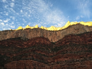
- Beautiful sunrise setting the red rocks on fire
-
- Meeting Jeff half way down/up…fully alive!
While hiking down I heard a clop, clop, clop sound up in the hills above me only to see my first mule train carrying supplies down to Phantom Ranch. The mules are bred for their solid disposition and sure footing to take packs and people below the rim. Though they had moved out of sight, I could still hear the clopping down below as they continued on.
The SK trail is narrower than BA trail and a little more worse for ware. The mules have worn a steady path into the trail, sometimes 12” deep. And with the recent rains had created a couple miles of deep puddles and sticky mud to navigate.
-
- Pack mules heading down South Kaibab 6:30am
-
- Saw those same Cowboys and mules heading back up from Phantom Ranch
After 4 hours I made it to Phantom Ranch, 4600’ below the South Rim, to rest, eat and fill up my water bottles. An hour later Jeff had made it back down and joined me there.
I stayed long enough to dip my feet into the Bright Angel Creek before starting the steady climb back up and up and up.
-
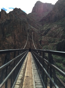
- Jeff crossing the Colorado River on the “black” bridge
-
- Me crossing the “grey” bridge over the Colorado
The BA trail is the least steep of trails out of the canyon. From last year I knew that I was in for a hike at the Devils Switchbacks. I was dreading them from the moment I left Phantom Ranch. I remembered them to be numerous, steep and grand. But Jeff and I arrived at Indian Gardens to realize that we had already hiked them. My mind had made them dramatically different than it actually was…to my great relief!

Monumental swithbacks on the SK trail
Things look incredibly different when you hike the trails from a different direction. Last year I hiked down the BA trail. This year I was hiking it up and I couldn’t remember most of the trail. Everything looked new. Like I had never hiked this trail before. It was a completely different perspective!

Views of the Colorado River
For 4.5 hours we hiked switchbacks with heavy legs and heaving chests as we climbed to higher elevations until we finally crested the top. The glorious, level, finally stop moving, TOP!
The Grand Canyon is one tough hike. But I think the majestic views; the grandness of it all feeds the senses to a point of a natural high that carries you along the trail, one foot in front of the other.
I’m not going to lie…my legs and chest hurt for days. But my memories of this epic hike will last me a lifetime, which should more than cover my momentary pain.
Grand Canyon. I WILL be back!

We did it!
PS…We were once again camping with our friends John and Becky and also Paul and Nina of WheelingIt. We had fun with Happy Hour and a grilled pizza night…in the rain…which will make for good story telling in the future.
While we were hiking Paul and Nina were gracious enough to keep Sam for us. It was hysterical to see Sam and Polly together. They were like two long lost pals who where on their first date. I’ve never seen two dogs kiss each other. No, really. They were actually kissing each other. Polly giving Sam sideway glances. Sam sitting as close as he possible could to Polly. It was all so amusing!
-
- Mini Xscapers Converge with friends!
-
- Puppy love…Polly and Sam
Sam had a great time with the WheelingIt crew. I hope we can return the favor sometime soon!

EPIC. CHALLENGING. DREAMY.
Posted by Deb in Arizona, Boondocking, Bucket List, Hiking on October 20, 2014
In 2013 and epic throw down was dreamed up by a few friends in Arkansas. The task? Hike the Grand Canyon…South rim to North rim…in a day(R2R). For 3 in our group, it was to hike the south to north, to south(R2R2R).
For me, this was a 25 year old dream that was hatched as a college girl pact. Back in 1980-something, my friend Sherry and I decided that we would hike the Grand Canyon together before we turned 50. To this day we still don’t know how the Grand Canyon came about, but we never forgot the pact. So, fresh on the 50 train and experiencing mutual hot flashes, Sherry and I decided it had to be done.
After a year of training on meager hills in Arkansas, 17 of us made the trip to “The Big Ditch”. For most, if not all, we were crossing a major item off our bucket list.
We split into 3 groups for the challenge.
First Group (Now that’s just crazy)…Jeff and friends Bill and wife Kendra were doing the R2R2R and left at 1AM. Their plan was to run as much as possible.
Second Group (Damaged but not defeated)…Myself, Sherry and Paul. We were speed hiking the R2R and left at 5:45AM. We were the damaged group that had experienced some sort of injury just prior to the event.
Third Group (Mildly insane)…The remainder of the group whose plan was to run the R2R. They left at 7AM.
My experience was one that I will never forget. Starting off just before dawn, we descended down the Bright Angel trail with headlamps on. As we looked further down we could see other headlamps of hikers who got up earlier than we did.
We had a sliver of moon and an abundance of stars which kept us captivated and company for the first hour. We stopped often to take in the silent and the simple beauty of the moment.
As the sun started to rise, sides of the canyon started to glow, changing colors with every step. Each elevation of the GC has different layers of rock. A new color spectrum to reveal. Everywhere we looked the view was breathtaking. It was hard to watch our footing while taking in the site of it all.
The GC is a unique hike in that you start at 6860 ft of elevation and descend down to 2480 ft. As we headed down to the depths of the canyon, breathing became easier. At the bottom of canyon is Phantom Ranch. It was a welcome sight after 4 1/2 hours of hiking. We refueled and headed out across the bottom of the canyon that traversed tributary rivers the feed into the Colorado river.
Then…the assent climbing back up to 8241 ft elevation to the North Rim Trailhead. As the sun sets it created another kaleidoscope of color on the canyon walls. It was a sight to behold and one I will never forget. The last 4 1/2-5 hours was a steady uphill climb of switch backs and cliff gripping trails.
I was in awe every step from the south rim to north. It is not a view everyone gets to see and we consider ourselves blessed to have the health, strength and desire to take on the challenge.
I’m happy that I got to do this experience with my husband and my friends.
What can I say about this hike? It was epic. The hardest thing I have ever done. The fulfillment of a couple of college schoolgirls dreams.