Archive for category Bucket List
Havasupai Falls. Leaving the RV Behind. Part II
Posted by Deb in Bucket List, Full Time RV, Grand Canyon, Hiking, Running, Trail Run, Ultra Running on December 28, 2017
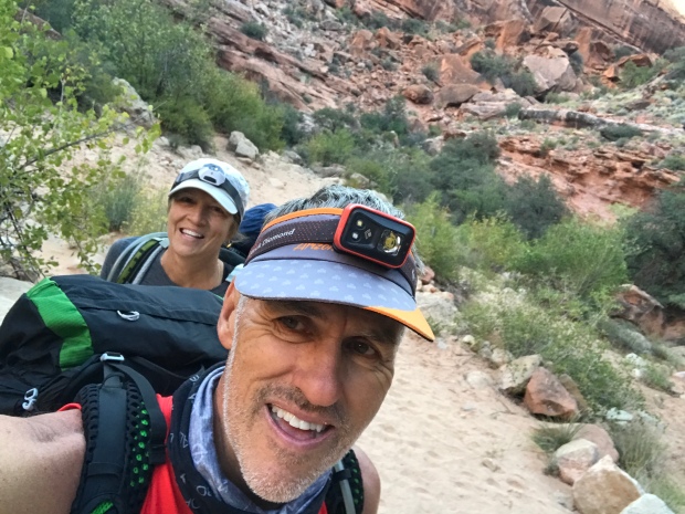
Before we came on this trip, we had heard about Native American frybread. We passed the bread tent on our hike into the campground the day before, but it wasn’t opened. And after seeing the posted sign about its hours, I wasn’t sure it would open while we were there.
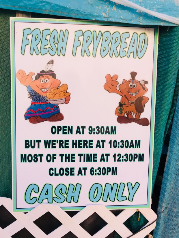
Non-committed business hours
After my hike to Beaver Falls I made the 1-mile hike through the campground to see if they were open. And sure enough, they were! After placing my order I was handed a ticket with a number. About an hour later this one-women show announced that my Navajo Taco was ready. Frybread is very similar to funnel cake topped but not as sweet. The taco was topped with seasoned hamburger, cheese and salsa. Just what the trail doctor ordered! It was REALLY good and I was kicking myself to for not ordering a sweet bread at the same time.
By the time I made it back to camp Jeff was back from his hike to the Confluence and sleeping soundly in his hammock.
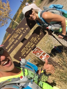
“The Confluence”…Havasu Creek meets Colorado River
Day three we decided to stay closer to the campground. We started the morning with a picnic table birthday massage for Jeff. I could have made a pretty penny by those passing by ready to be next. Then we packed some snacks and made about a 1-½ mile hike up the campground to Havasu Falls.
The mist off the falls was pretty chilly, especially since the area was still shaded. We made it just in time to see a very large yoga class finishing up. One of the tour groups offers yoga and massages at the falls.
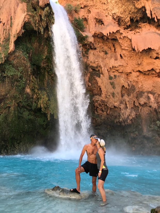
Havasu Falls Smooch
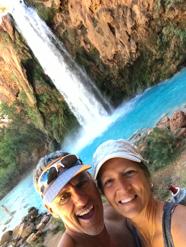
I still can’t believe this water!
We didn’t have much ground cover so we found ourselves sitting in sand and powdered dirt. We sunned ourselves and explored the falls before heading to the bread tent to place an order. This time we got a 3-layer sweat bread treat (aka Jeff’s Birthday Cake) and a Navajo taco. The sweet bread is topped with nutella, jelly, honey and/or powdered sugar to build your confection as you please. The bread is soft, doughy and the perfect amount of sweetness to go sweet or salty.
This was a special treat especially since we were going on day 3 of nut bars and dehydrated packaged meals.
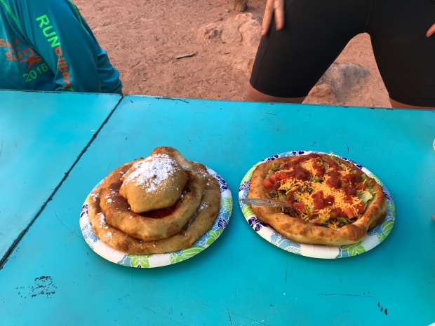
So yummy!
After our snack we decided to join some friends and hike up the hill further to explore Navajo Falls. We spent a couple of hours taking a bath splashing around the pools before heading back to camp.
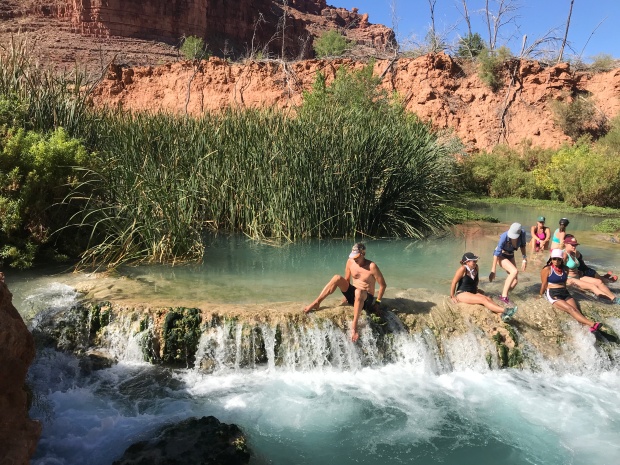
Navajo Falls
Each night as the sun went down about 6:30 the temperatures plummeted into the 40’s. Campfires are not allowed so all that was left to do to stay warm was go to bed. Surprisingly I slept very well on my camp mattress on top of the picnic table all bundled up in my mummy sack while Jeff slept well in his hammock. Note to self…spring for the tent!
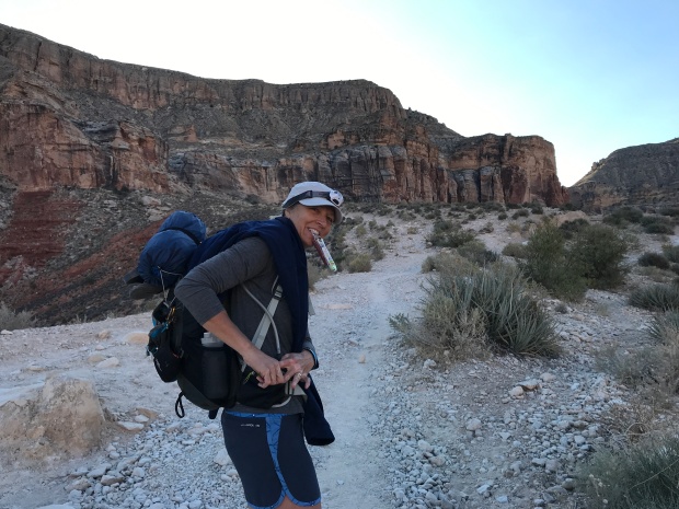
Day four we planned to pack up quite early to beat the sun/heat on the hike back to the trailhead. We had that last mile of climb that we were thinking about. We knew that it would difficult with our heavy packs and didn’t want to add canyon heat to it.
It took us 4 ½ hours to hike down so we thought it would take us an extra hour to hike back up. We left camp at 4:30am to a full moon and made a quick stop for water at the campground spring before starting the two-mile steep incline to the village.
At the village we saw a long line already forming for those taking the helicopter out. The helicopter is pre-reserved, but the seats are first-come first-serve and can take all day. They still had hours to wait until the helicopter even fired up for the day.
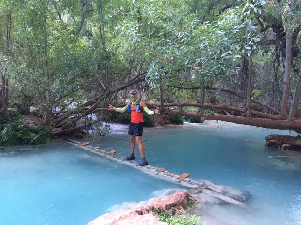
We hiked through the village while it was still dark and followed posted signs directing us to the trail. Things sure look a lot different in the dark and before we knew it we were standing at a creek crossing that neither of us remembered from before. Realizing that we missed the trail somewhere we backtracked about a quarter mile and were led astray by mule poop that followed some miscellaneous path in the woods.
After reaching a dead end we backtracked to the main trail and started back towards the creek again. This time we saw the clear trail that led to a bridge (just steps away) to cross the creek.
The trail was easy from here as the sun started to rise. Jeff and I were booking it and we found ourselves at the base of the last 1-mile canyon climb before we knew it. I have often said on hikes like this that my mind takes a seemingly mundane molehill and turns it into an impossible mountain. I was dreading this section for days! But after about 40 minutes we were cresting the cliff and snapping pictures of our completed task.
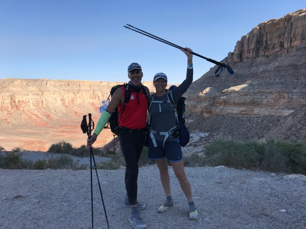
We made it!
It really wasn’t a big deal and we made the entire trip in 4 hours. The thing that helped A LOT was that we figured out how to cinch up our packs to distribute the weight more to our hips than our shoulders. This made a HUGE difference!
Back at the SUV we offloaded our packs, refilled our water bottles from the gallon jug we stashed in the car and started to drive towards Moab for round two of our RV-less vacation.
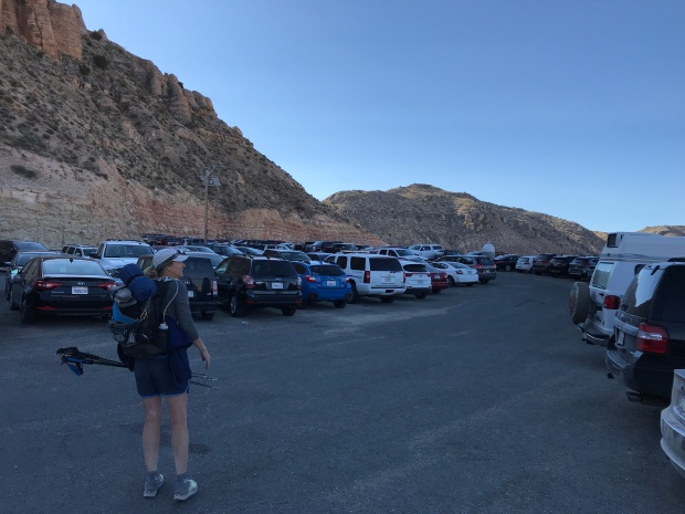
Now where did we park the car?
Next stop…Gooseneck State Park!
Havasupai Falls Trip Tips:
- Get to the Trailhead early morning to find a somewhat close place to park. Some vehicles were parked a mile and a half away.
- Fuel up in Peach Springs or Flagstaff. From where we stayed in Peach Springs it was about 70 miles to the trailhead. There are neither service stations nor stores along the way, so be sure to plan ahead.
- Keep a gallon of water and some food/snacks in your car for your return trip.
- Keep your bathroom expectations low…REALLY LOW! They are kept clean, but the smell of ammonia literally made our eyes water. Use the outer bathrooms (not the center) for additional ventilation.
- Be sure to have a “rat sack” to store all of your food and suspend it from a rope. Use it to hold your trash as well. Our first night we had a raccoon shred our trash and make a mess.
- Pack-In Pack-Out. There are ZERO trashcans at the campground so be prepared to take every ounce of trash back with you.
- On your hike out pick up at least one piece of someone else’s trash. You will see trash littered everywhere along the trail either by the locals or by hikers. Treat the land respectfully and do your part to keep this treasure beautiful despite who made the mess.
- Get reservations through a group (Check out Grand Canyon Hikers Facebook page). Rumor has it that reservations were moving towards giving large lots of permits to organized groups rather than individuals. This way the Indian Reservation can manage one person responsible for the group rather than trying to police 300 individuals each day. However, these decisions are made season-to-season, so what may be true one year may not be true for the next!
- Do not bring drugs or alcohol. We saw one group get busted while we were there.
- Do not go to the campground without your reservation wristband. They do check and you will be removed and fined heavily for not following the rules.
- DO NOT leave valuables in your vehicle. The day after we left several cars were broken in to at the trailhead parking lot.
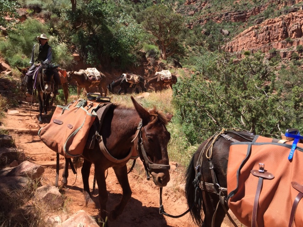
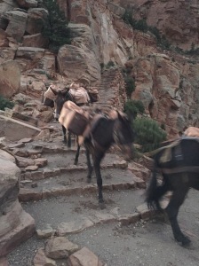
- You do have the option of mules (Up to 130lbs/mule for $80) taking your gear to/from the campground that needs to be arranged ahead of time. Some hikers split a mule with others to share the cost. There is concern on some forums regarding the treatment of the mules here. So depending on your level of concern this may or may not be an option for you. Also, it takes a long time before your gear reaches the campground and the trailhead. And when it does it is put on the ground where the local dogs love to hike a leg on it.
- The helicopter ride in/out (pre-reserved) can take all day to get a seat. Go VERY early to get in line for first come first serve (the local villagers have first right). When we hiked out there was already a long line at 4:30am and we were back in our car before the helicopter even started to run.
- Take a couple of empty 1-gallon milk jugs to fill up with water at the natural spring in the campground. Our campsite was 1 miles downhill from the spring. Our gallon jug of water was used for hydrating meals and we filled our water bottles for drinking.
- According to the Havasupai website, the spring water at camp is safe, but they leave the responsibility up to you. We did not treat our water and had no issues what so ever.
- If you are packing camp fuel to cook meals remember that airlines will not allow fuel canisters anywhere on the plane…not even checked bags. Plan on making a stop at REI in Las Vegas, Phoenix or Flag to pick up fuel if you are flying in for this hike.
The Wave
Posted by Deb in Arizona, Bucket List, Destinations, Full Time RV, Grand Canyon, Hiking, Running, RV Shows, Trail Run, Utah on June 12, 2017
The first time I visited Flagstaff was about 10-15 years ago when Jeff worked for Scotts Miracle Grow. They had their annual sales conference in Scottsdale. We stayed a few extra days to explore Arizona, and Flagstaff was merely a place to overnight so we could see Sedona and the Grand Canyon.
It was such a memorable trip. Cresting the hill driving into Sedona and seeing those red rock formations for the first time. It was like nothing I had ever seen before. Then standing on the south rim of the Grand Canyon looking over its edge. I couldn’t open my eyes wide enough to take it all in.
We had a retirement dream way back then to travel in a 5th Wheel. But I don’t think we ever could have pictured the life that we now have!
On May 11 Jeff and I rolled into Flagstaff for the ? time. We have been here so many times now we no longer need a GPS to get around. It’s familiar, beautiful and one of our favorite places to be.
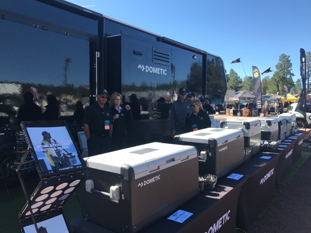
OVERLAND WEST
We were at Flagstaff this time to work the Overland West Expo being held at the Fort Tuthill County Park. We stayed onsite with thousands of Overlanders who were there to…
“Get outfitted, get trained, get inspired—get going.
The world is waiting.”
With that kind of inspiration it’s no wonder this is our very favorite show to work!
Another kind of camping
Off road luxury
What makes this event so special is the location (nestled amongst the fragrant, wispy pines), the dogs (all well behaved non-yappers) and the adventurous people who tend to be a younger demographic than RV’ers.
As an RV’er we tend to think we have a sense of exploration and adventure. But Overlanders? Well, they take adventure to a whole other level. Where (most) RV’ers are limited by the boarders of North America, Overlanders are limited by the globe!
There were no satellite or surge protectors companies represented here. I didn’t see any tempurpedic mattresses or meat smokers either. They are more interest in products that will allow them to access off road places with the minimal amount of stuff. The smaller you can go, the better.
We were there to showcase Dometic’s mobile cooling line of CFX portable refrigerator freezers. They can operate off of 12V or 110 and be powered by solar. This appeals to many Overlanders and the products flew off the shelf! Best of all, I didn’t have to talk to a single person about the use of their RV toilet…and their ensuing bathroom habits.
It was a great show with a great team and it was our last show to work until the fall.
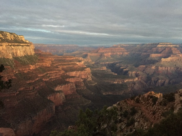
SOUTH RIM GRAND CANYON
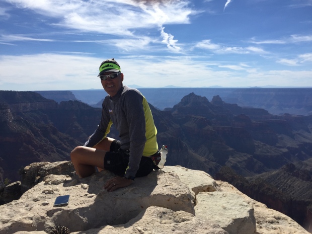
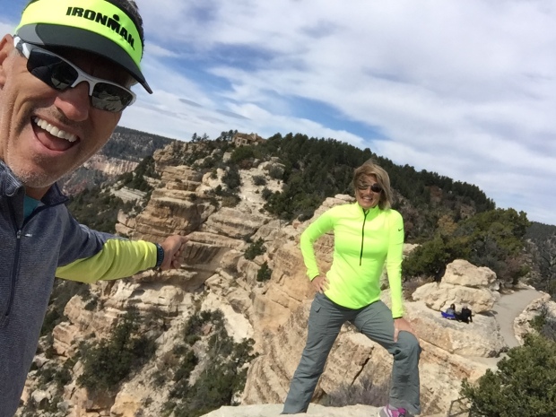
After Flag we moved on to another favorite location, the south rim of the Grand Canyon. We had some friends that were driving up from Phoenix to do a double-crossing of the Canyon and we were invited to go.
Since I prefer a single crossing rather than a double and we have to be responsible fur parents, I sent Jeff across the big ditch with the group while I stayed back with Sam. My plan was to go a couple days later.
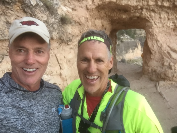
This was the 4th trip across the canyon for Jeff and it never gets old. It’s a heart pounding challenge that he used as training for his Bryce 100 race coming up. At 3am we picked up our three friends at the village and I dropped them all off at the South Kaibab trailhead to start their 15-20 hour journey. I picked them up at 10pm with a couple of pizzas. They were exhausted, cold and hungry!
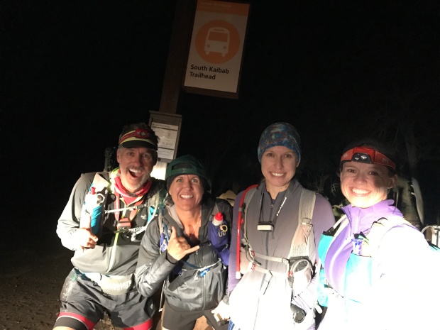
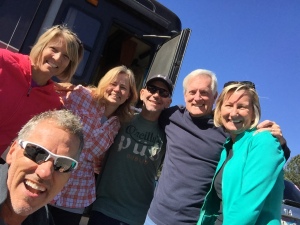
Jeff, Laurie, Lavinia & Kathi
Trip down the South Kaibab
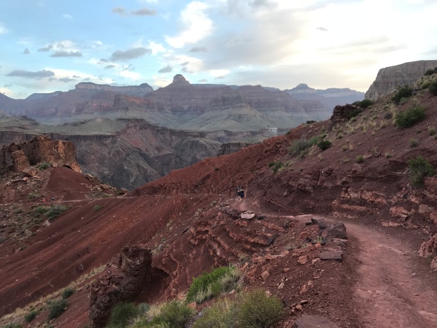
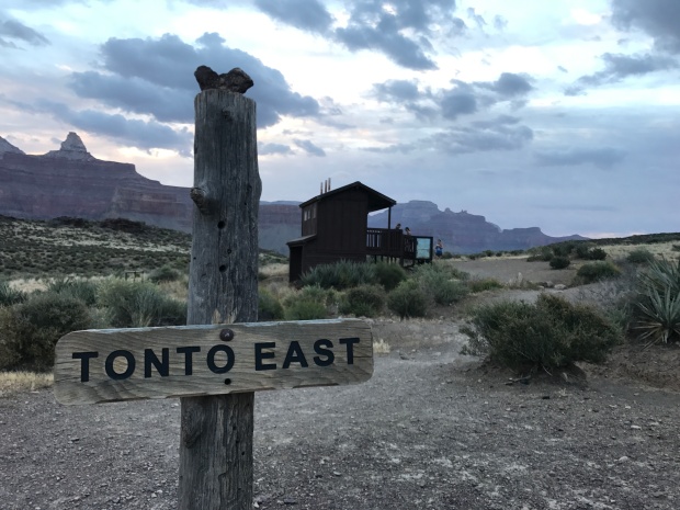
A couple days later I headed down South Kaibab myself. I wanted to take a different route this time and decided to jump onto the Tonto trail at Tip Off Point. Tonto runs east/west between South Kaibab and the Bright Angel trail at Indian Gardens. This cuts off 1000ft of elevation and 6 miles of the traditional Rim to River to Rim route.
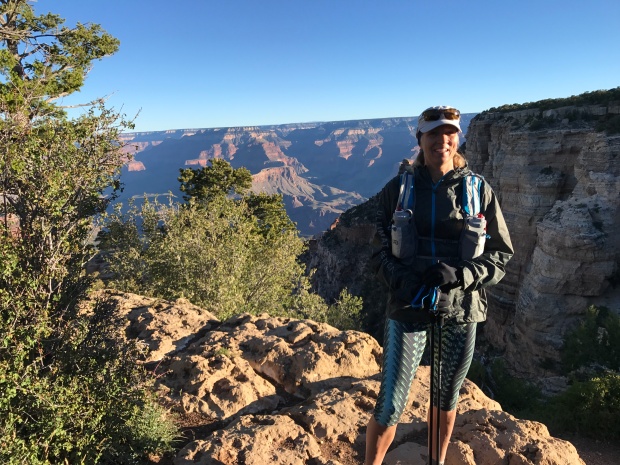
I REALLY enjoyed this route. The views are not nearly as stunning crossing the Tonto trail. But what I enjoyed was that I was done within 6 hours, rather than 10-12 hours. The thirteen miles was still a challenge, but I finished in time for a hot lunch at Bright Angel Lodge.
Mule train traffic jam
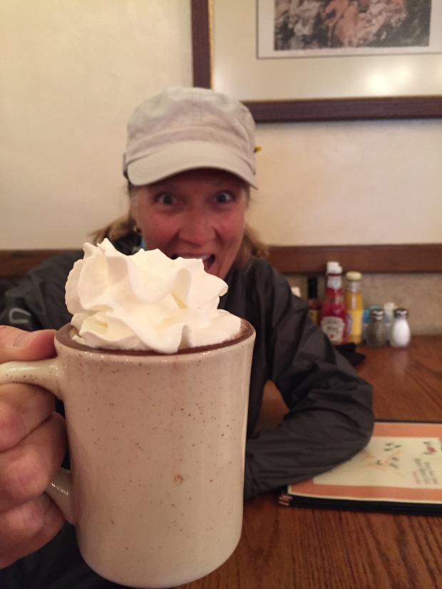
Hot chocolate finish
While camping there we had a quick overnight visit from our niece and her family of 4 little’s. They were making a two-week trip from northern California to Arkansas and back and just happened to be passing through. We invited them to spend the night and see the Canyon at sunrise.
Since our RV is not really set up for overnight guests, we spread out yoga mats on the floor to try and make their sleeping bags a bit more comfortable. The next morning we headed to the south rim for sunrise, then took the kids to a café for a pancake breakfast. It was fun watching the kids and their dad seeing the Canyon for the first time. Standing on the rim in awe.
They were on their way after breakfast while Jeff and I headed to the North rim.
NORTH RIM GRAND CANYON
The reason for the North Rim was that I had signed up for the North Rim half marathon trail run. I was originally going to do the Bryce Half (of the Grand Circle Trail series) while Jeff was signed up for the Bryce 100. But after thinking about logistics and caring for Sam dog, we decided to split our races.
The thing that we have found about these trail races is that the packet pickup and start/finish tend to be in remote locations down poorly maintained and unmarked forestry roads. GPS is usually not your friend in these instances and connectivity to digital maps does not exist. At one point we had 7 cars behind us following our lead as we tried to find the check-in. Two hours and two flat tires (not us) later we all made it to the start.
We did discover that our GPS took us on a terrible route…sorry everyone! Our trip back to the RV was on better roads and only took 75 minutes.
Race day was beautiful and fun. But with the 9,000’ elevation breathing was HARD! The route took us on forestry roads and freshly made single-track trails. Up and down hills and along the north rim of the Grand Canyon. It was so amazing runners, including myself, stopped frequently to take pictures during the race. That is one of my favorite things about trail running…stopping for a pretty view regardless of your time is to be expected.
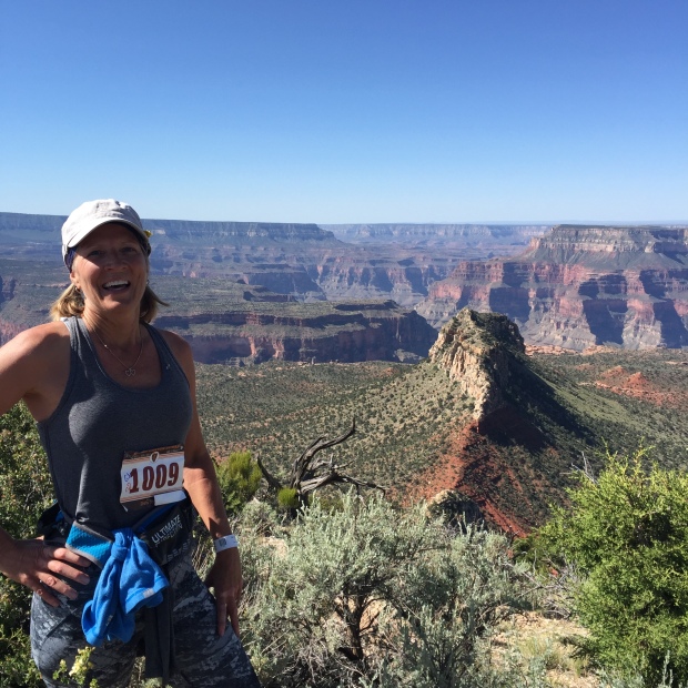
Always stop for views even during a race
It was a great time and I enjoyed a long hard nap once we got back to the RV.
THE WAVE
One of the tools I like to use when we go to a new area is Pinterest. I type in our location to the search and see what others have pinned for the area. For Kanab the search pulled up The Wave.
Most of you have seen The Wave, which was made popular by Microsoft as a screen saver. It was a little known treasure that only locals knew about. But once it appeared on computer screens EVERYWHERE, tourists swallowed up the Wave.
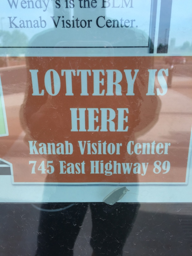
As a result, the Bureau of Land Management had to quickly put some restrictions in place to preserve this treasure.
The Wave is such a small area the BLM limit permits to 10-online lottery entries (6 months in advance) and 10-in person lottery (for the following day) per day. We have always had luck getting permits to other popular hikes by entering in person. Yosemite and Whitney Mountain.
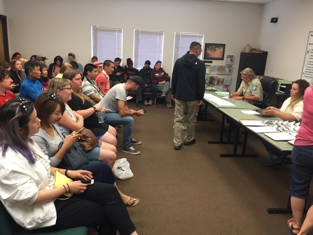
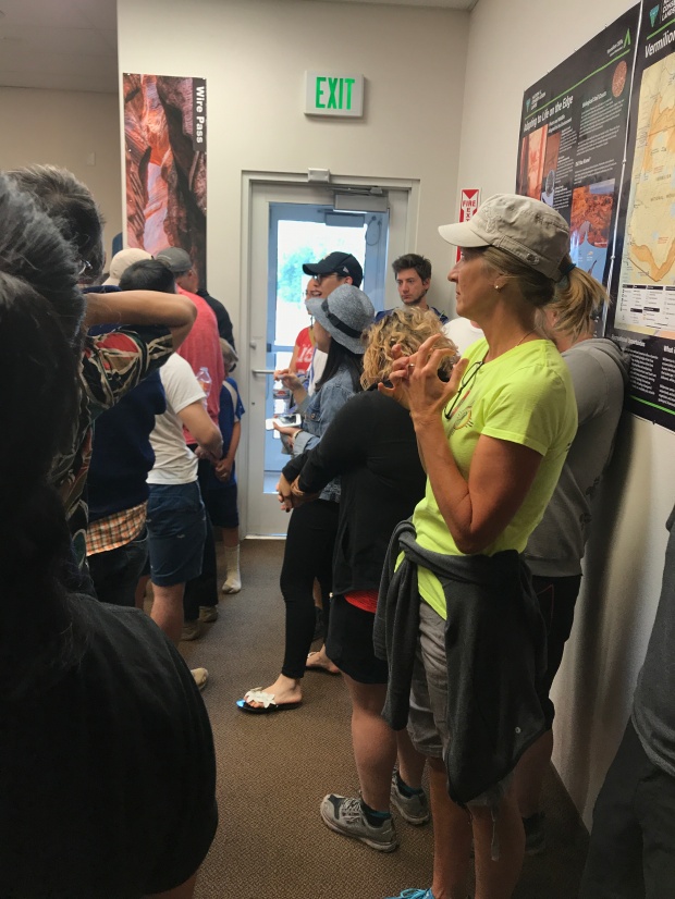
A room full of hope
But the Wave is different with only 20 permits available per day. Any given day you only have a 4-8% chance at getting a permit. Yosemite allows 300 people per day.
Since the odds are closer to 8% on a weekday, Jeff and I left the north rim early enough to get to the Kanab visitor center by 8:30AM to fill out a permit request. Each request allows for up to 6 people to go. However, if a request is drawn with 6 people, then there are only 4 permits left. Permits are handed out per person, NOT per group.
And if there are only 2 permits left and you have a group of 5, then three people must get left behind. NO EXCEPTIONS. All applications are given a number and you must be present during the drawing. Numbered balls are put in a Bingo tumbler and at 9AM sharp, if your number is called, your party is counted until all the permits are issued.
It’s all over in a matter of minutes and the majority of the room leaves disappointed.
Pick ME!
We found out that one of our running friends from Bentonville was in Kanab with her family. We asked Whitney if she would like to join us IF we happen to get a permit and we put her name on the application. After going through the drawing process we were one of those who left disappointed. It wasn’t meant to be.
But one of the beauties of being a full time RV’er is that we are flexible, and we decided to make the 45-minute drive to try our luck the next day. And JACKPOT…we were the first number called!
OMG…WE WERE GOING TO THE WAVE!!!
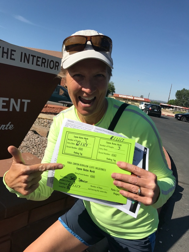
Its official!
Once our number was called the others were dismissed (sorry folks) and permit holders were educated on the rules and given instructions on how to reach the wave. The trail there is so unworn and so unmarked that you are given paper instructions with pictures of landmarks.
You are warned about paying attention to your surroundings, don’t follow others footprints and taking enough water, food and warm clothing to sustain yourself for 24 hours. People have been known to get lost or injured out there, and connectivity/help is slow or non-existent.
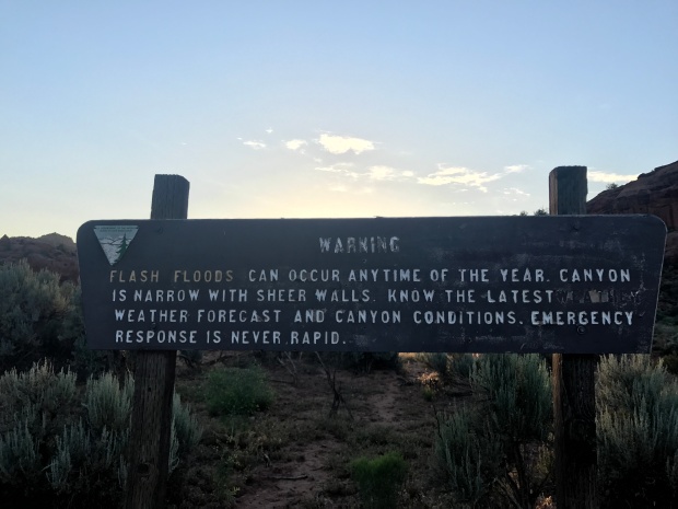
They put the fear of God in me and I took detailed notes of things to be aware of.
Our friend Whitney spent the night with us at our RV so that we could get a very early start. Jeff had an 11am conference call (we are not on vacation after all) and we needed to give ourselves enough time to explore and get back to cell coverage.
We left at 4am and made the 1.5-hour drive on 35 miles of washboard forestry roads and started our hike at sunrise. This trail is fairly easy, but the written directions with pictures are no joke. We could see quickly how people could get lost. We would have never found it without those instructions.
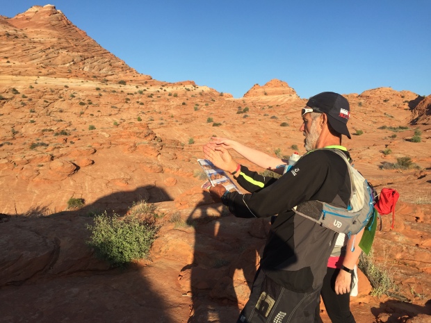
Stopping to consult the map
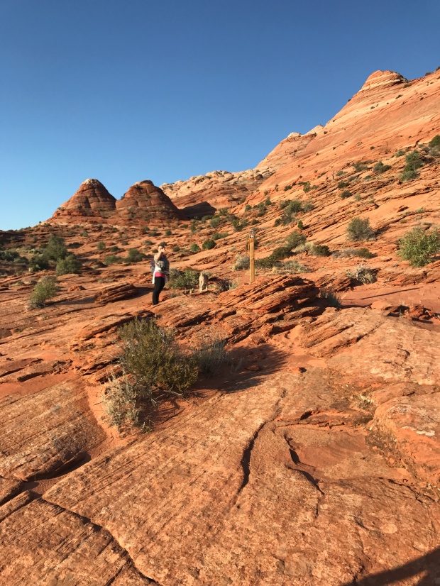
Stay to the right of the twin buttes
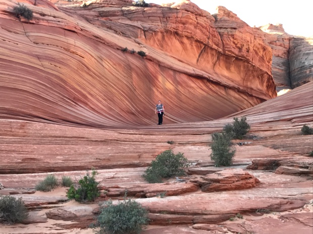
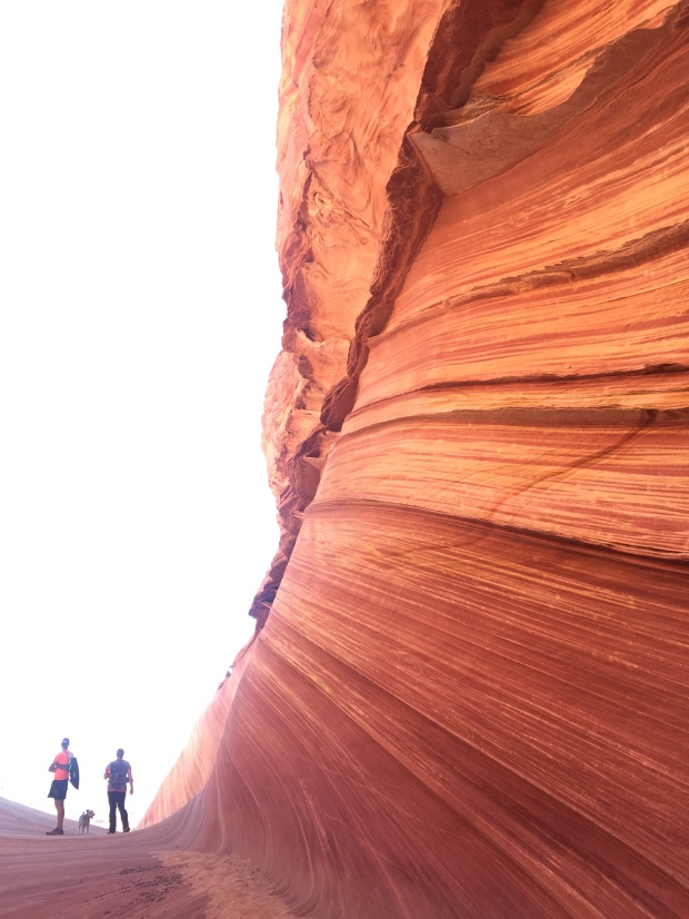
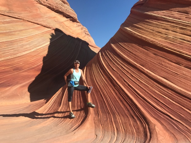
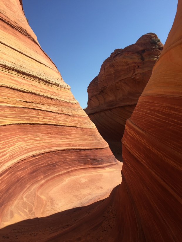
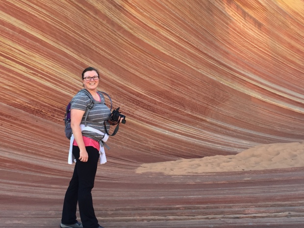
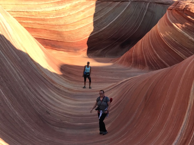
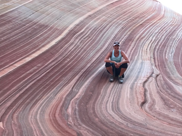
It took us about an hour and a half to reach The Wave… and WOW!
The colors. The textures. The warmth. The contours. All working together to form burning swoops and swirls. We climbed around, on and over this small little jewel and quickly understood why The Wave is limited to 20 people a day. If not the damage would be irreparable and the isolated feel to the experience would be lost.
It was incredible!
As we headed back to the trailhead, we again followed our paper instructions and landmarks. We did get off course but were able to find our way back to the “trail” with the help of Jeff’s Garman breadcrumbs.
We bid farewell to our friend Whitney and made it back to our RV just in time for Jeff’s call. A few days later I was still reflecting on the beauty of The Wave. It was such a special experience and we feel fortunate to have had the opportunity to go.
I’m not sure how many times we are going to have our name draw for things like these. But we will keep entering our names and keep pursuing the special opportunities in life.
Without the effort there would be no opportunity at all.
Dogs are welcome at the wave
Ultra Mania and Utah Bliss
Posted by Deb in Arizona, Boondocking, Bucket List, Full Time RV, Grand Canyon, Hiking, Running, Trail Run, Utah on December 26, 2016
Words to live by
September 23-October 31
Last year just after the Arizona Ironman, I asked Jeff if he was ready to take a break from full Ironman competitions. It’s a huge time commitment to train for, which is especially challenging during RV show season.That, and it is a very expensive sport. To my delight shock he decided to take a break from long distance triathlons. At least until he ages up into a new age group in a couple years!
But as an athlete, when one goal or bucket item is crossed off, there are dozens more to follow. For Jeff, the next challenge is a 100-mile ultra trail run.
I know. I know. There is a collective “whaaaaaat?” whenever he shares his goal.
To think that a 100-miler is any less training time is a mistake. But when you can train on beautiful wooded trails and forestry roads around pristine alpine lakes, it does provide “get lost in the scenery” moments that you just don’t get riding your bike on life threatening city streets or swimming laps at a local pool.
So when Jeff heard about the Stagecoach 100 race from an Arkansas friend, he thought it would be a perfect race to enter.
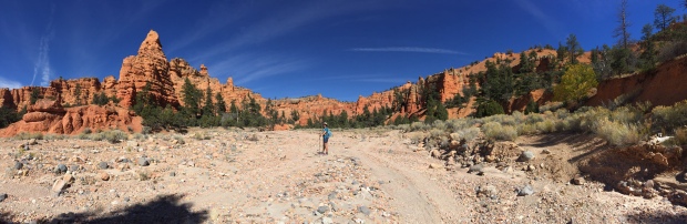
The Stagecoach 100 is a 100-mile trail run from Flagstaff to the South rim of the Grand Canyon, two of our favorite places! It is run on the Arizona trail and follows the historic stagecoach line that tourists took to reach the Grand Canyon in the 1890’s.
Out for a practice run on the Arizona Trail
The course starts in Flagstaff around 7,500’ of elevation and climbs to nearly 9,000’ before descending into Tusayan at 6,600’. There is about 7,000’ of climbing overall and must be completed within 31-hours.
Since this was Jeff’s first year to attempt a 100-miler he opted for a two-man relay, putting Jeff’s leg at 55 miles and friend Jason’s leg at 45 miles.If this went well, then he was going to sign up for the Javelina Jundred in Fountain Hills, Arizona the following month.
After a week of rain and snow on Humphreys peek, race-day could not have been more perfect weather conditions. An abundance of sunshine, cool temps and golden aspens kicked off the race.
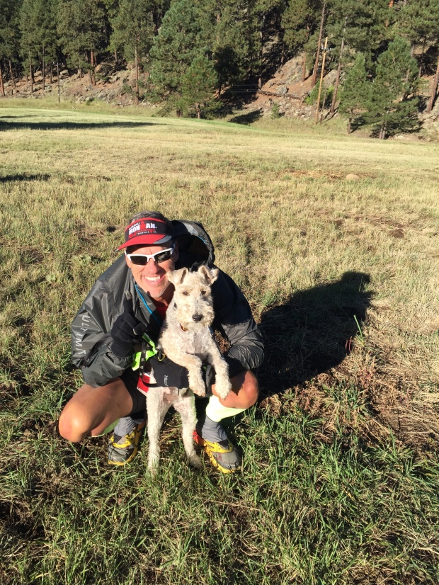
All smiles at the start…Sam thinks he gets to go too!
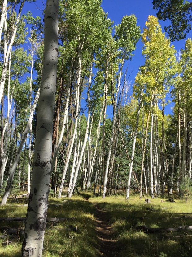
Beautiful run through Aspens
I don’t compete in these long distance races, preferring half marathon trail runs. As a spectator I get to witness the days journey for a lot of athletes. The excitement and nervous energy at the start followed by the real struggle, pain and doubt somewhere in the middle of the race. And at the finish, total elation, outpouring of emotion and collapse.
It’s so inspirational that it makes the laziest of couch potatoes start to think that they too could attempt such a race! Me included!
After seeing Jeff off at the start, I loaded up the RV and drove to Forestry Road 688 just south of Tusayan. What I really LOVE about the West is that there is no lack of free camping spots around great locations. This FR is within 6 miles of Grand Canyon Village on the South rim. The road was amazingly groomed with plenty of private camping spots for big rigs and decent cell coverage.
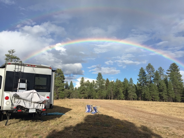
A pot of gold campsite…for free!
The Stagecoach 100 is not a spectator friendly course, so there was nothing I could do but stuff my face with chocolate and take a nap wait 15 hours in eager anticipation, imagining Jeff’s struggle and drudging out 55 miles with him in spirit!
The heartburn for Jason and I was trying to find the transition point on a spider web of unmarked forestry roads after dark. After 2 ½ hours of driving we somehow managed to find the transition 30 minutes after Jeff had checked in.
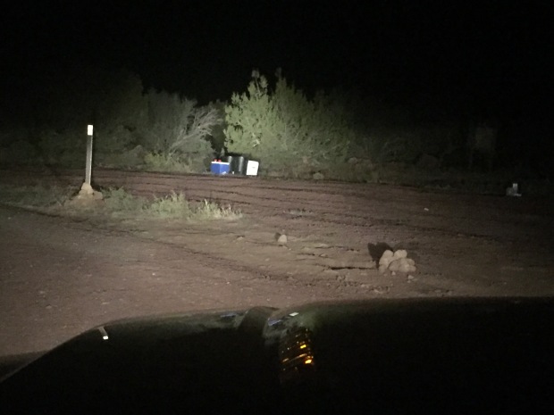
Found an aid station…just not the right one!
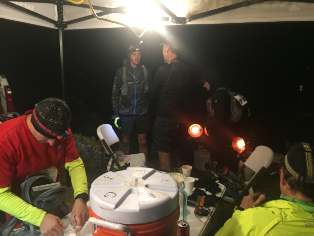
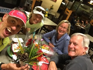
Finally!
It was 10:30pm, and after 15 hours Jeff was ready to be done. He handed off the last 45 miles to his friend and we made the 2-½ hour drive back to the RV. Jason finished the race the following day. I’m so proud of Jeff and Jason. After the pain has worn off they both are ready to challenge themselves to run a full 100-miler.
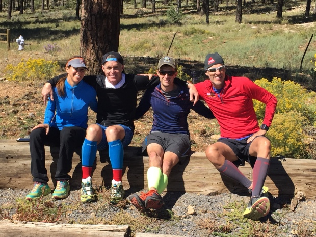
The Arkansas Travelers
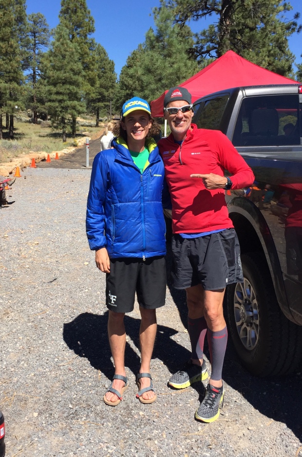
The legendary Jim Walmsley
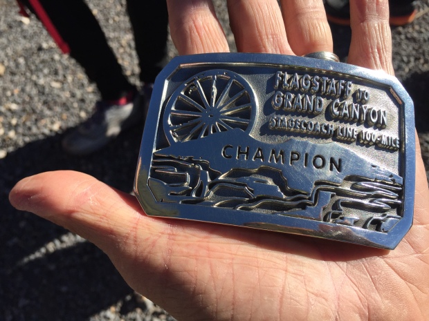
Got the buckle!
We stuck around the South Rim for another week, and just for grins, Jeff decided he wanted to do another double crossing of the Grand Canyon before we left.This was partly a test to see how his legs felt for the Javelina.
With tired legs from his Ultra just 6 days before, he headed down the South Kaibab Trail, summited the North Kaibab to turn around and head back to SK. He was so exhausted on the return trip that he lay on slabs of rocks three different times to sleep. He did persevere but pushed his body to its limit casting doubts on his goal of Javelina.
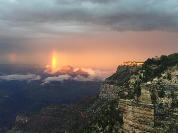
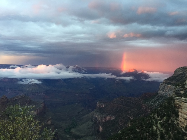
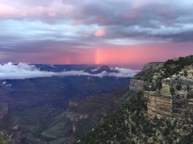
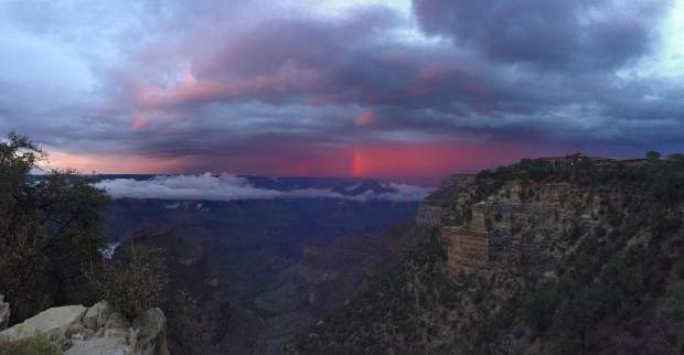
Before we left the South rim we stopped into the Bright Angel Lodge for dinner. When we were finishing up we noticed an odd glow coming from the Canyon. I grabbed the phone and ran outside to witness the most spectacular rainbow. When we saw waiters and cooks running outside with cameras we knew we were witnessing something special.
The rainbow illuminated the clouds to a fiery red glow. Just about every spectator there was crying, including me. It’s one of those moments you realize you will only see once in a lifetime! It was stunning!
After enjoying the South Rim we drove to Las Vegas where Jeff had to fly to Louisville on business while I stayed with the RV at the Oasis RV Resort.
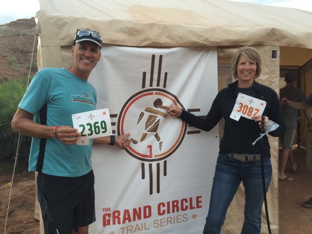
Once he returned we hitched up and headed to Kanab, Utah for Trail Fest. Trail Fest is a three-day trail running festival. Day 1-Zion. Day 2-Bryce. Day 3-North Rim of the Grand Canyon. Once back at camp you are free to participate in seminars, movies, food trucks and music.
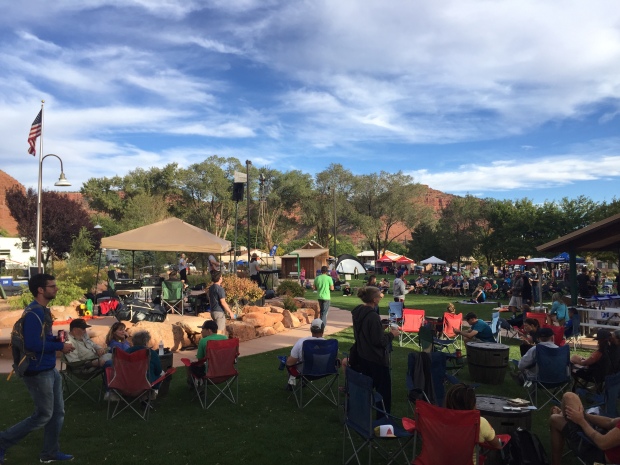
Trailfest 2016, Kanab Utah
This was the first year of this event, with home base out of Kanab. Tents are provided or park your RV on site. Showers are available at the community center. Shuttles picked up 400 runners each morning and dropped them off at the days designated trailhead.
Jeff and I were too late to register for this wonderful event, so we volunteered to help set up and direct parking. Because we volunteered we got credits towards a future trail event.
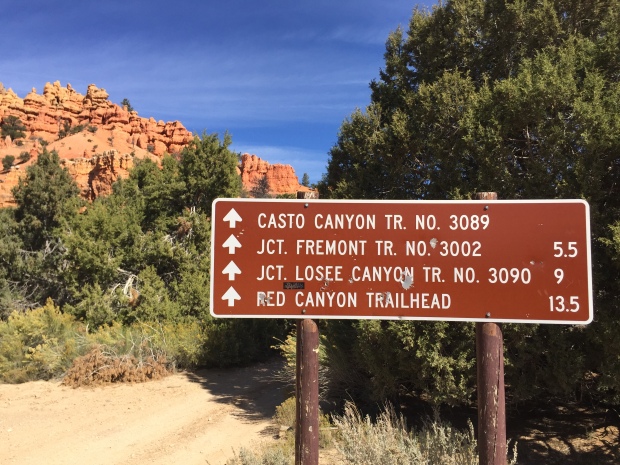
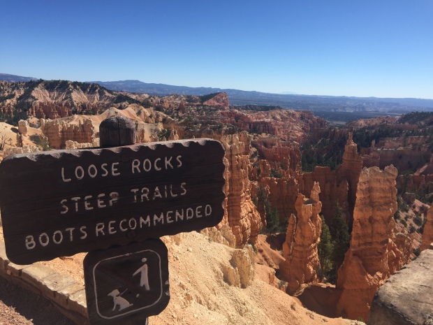
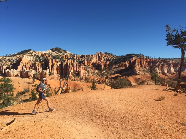
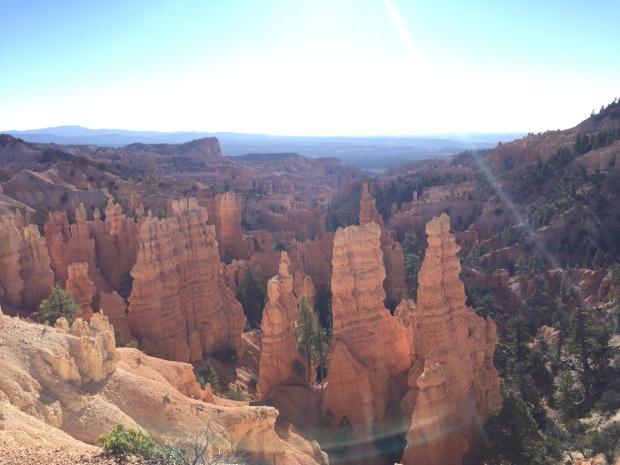
While runners were out on their trails, Jeff and I hiked in Bryce Canyon. Our favorite hike was the 8-mile Fairyland Trail Loop. This is a moderate hike with hoodoos galore. It’s one of those hikes that you have to force yourself to stop taking pictures to get through. I love this place and can’t wait to spend more time here!
After Trail Fest we headed to the North Rim of the Grand Canyon. Actually, we boondocked on National Forestry land in the town of Fredonia, Arizona 45 miles north of the North Rim. Besides hiking the Rim2Rim, we have never explored the North rim. We really enjoyed our stay. Nights were in the 30’s with daytime highs in the 50’s.
The only draw back was that it was hunting season, so we had to be careful where we got our runs in.
I had read about the pancakes at the little gas station in Fredonia, so we stopped and had breakfast before driving to the North rim. The pancakes lived up to the hype, but our waitress was…odd. We got to talk to several hikers that were either getting ready to start their Grand Canyon Rim2Rim crossing, or had just finished it.
After breakfast we drove to the North rim to check out the views. The lodge was already closed for the season so we didn’t get to look around there. But what a wonderful little cabin community! Compared to the South Rim there are less amenities and less people.
A couple days later Jeff heard from his twin brother that he and our sister-in-love were on vacation at the South Rim. So what does a guy do when his best friend is across the big ditch? Why he hikes the Grand Canyon overnight to have breakfast with him.
While Jeff was hiking in the dark down the North side he stubbed his big toe. Actually, he broke it at mile 7 and then hit it a couple more times just to add to the misery. Kind of hits you in the crouch don’t it?
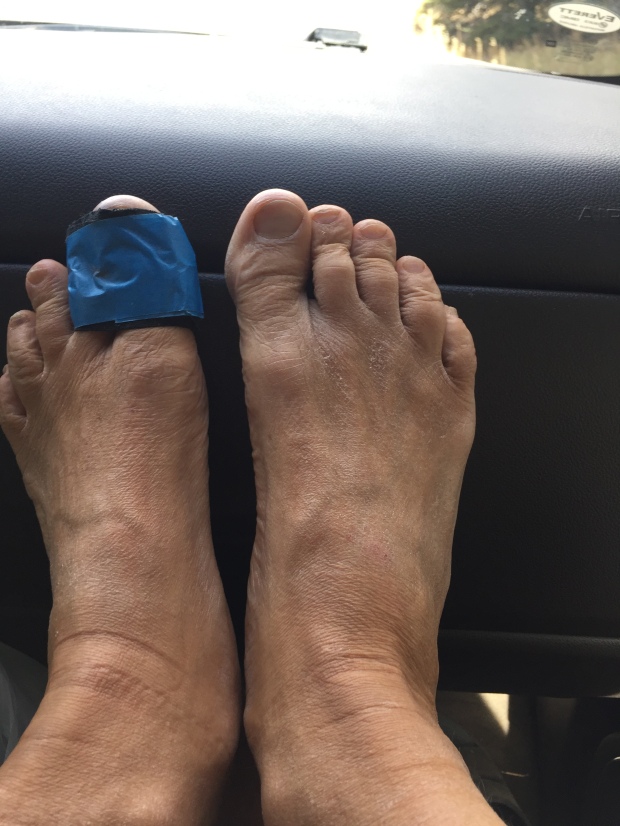
He finished the 15 miles across, had breakfast and jumped on the 8am shuttle back to the North Rim. His broken toe made the decision to not enter the Javelina Jundred.
We were hoping to leave the North rim and hike the Narrows at Zion National Park, but we lingered too long and had to drive straight back to Las Vegas to work the SEMA Automotive Show.
Utah is stunning and it left us wanting A LOT more.
We will have to catch you next spring Utah!
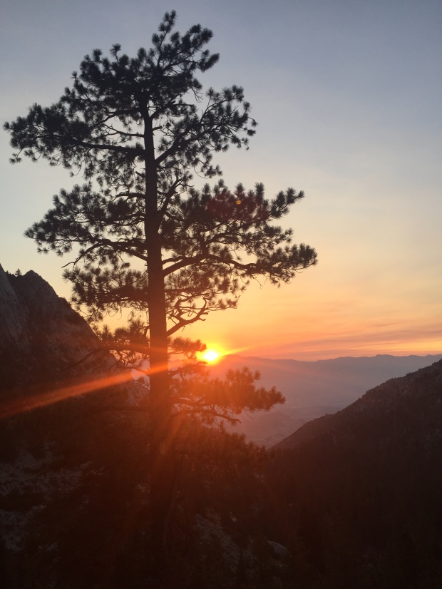
Getting High on Mt. Whitney
Posted by Deb in Boondocking, Bucket List, California, Full Time RV, Highest Peaks, Hiking, Uncategorized on October 3, 2016
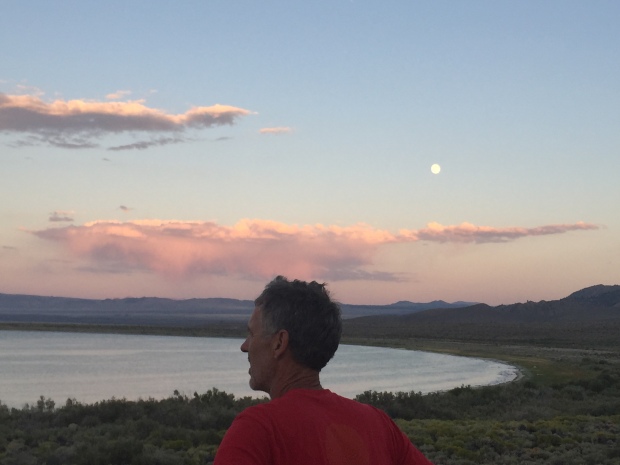
Full moon rising over Mono Lake
After leaving Seattle we had three weeks to make our way to Phoenix. Our working travel schedule gave us a deadline and unfortunately we were headed into the belly of the hot molten volcano in the middle of summer. 106 degrees here we come!
We made quick stops in Eugene and Ashland, Oregon, Redding, CA and Reno, Nevada on our way to Mono Lake, CA.
I had read about some great boondocking at Mono Lake on the eastern side of Yosemite. This really would be our last stop at any elevation (6,378’) in order to avoid the southwest heat. Also, when we were in Yosemite in May, we never made it to Tioga Pass. So stopping at Mono Lake would give us that opportunity.
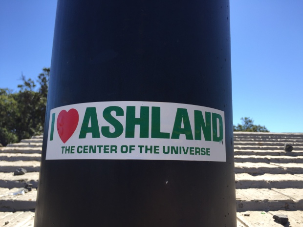
Quick stopover in Ashland, OR
Well, that was the plan anyway…
Last year about this time, Jeff asked me a question about doing something epic, challenging or scary and I blurted out that I would like to hike the highest peaks in each state. A week later I had bagged my first…Mt. Humphreys in Flagstaff, AZ. at 12,633ft.
Ever since then I have been researching the highest peak of each state that we traveled in 2016. Unfortunately, we have been traveling the states with the highest peaks overall that have been snow covered and required ice axes, crampons, repelling equipment, permits, guides, tents, backpacks, etc. MUCH more equipment than what we have.
So when I read about hiking California’s massive Mt. Whitney at 14,505ft, the highest peak in the contiguous US and it’s accessibility in late summer, I knew California was an attainable peak.
And look. It just happens to be down the road from Mono Lake! Change of plans…we are hiking Mt. Whitney!
Getting an early start…just not early enough!
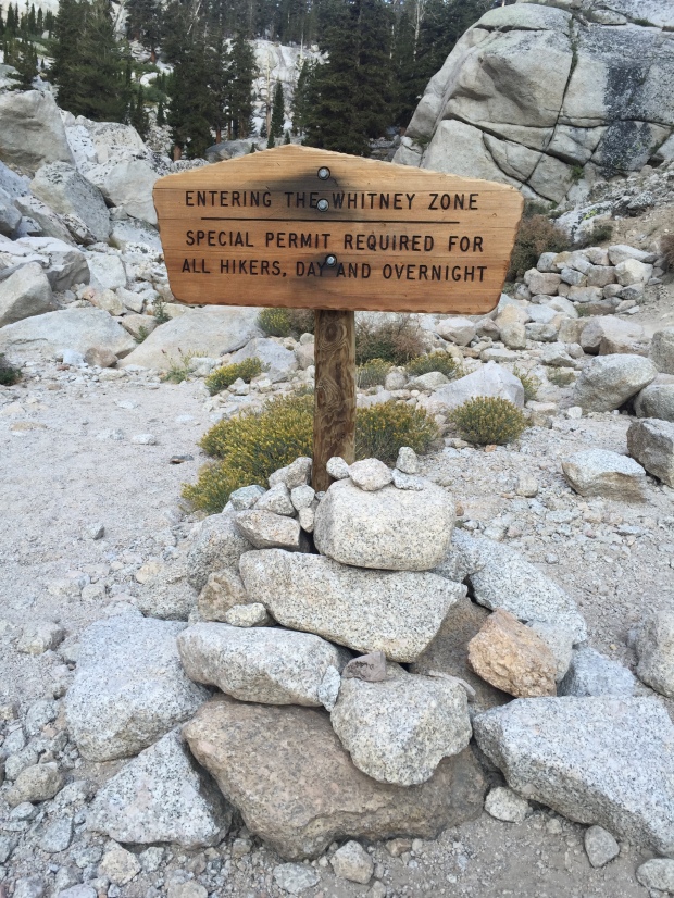
The Mt. Whitney Trail Head starts at Whitney Portal at 8,360ft via the small town of Lone Pine, CA. A permit is required for this hike and the online permit system said that there were no permits available. Learning from our experience at Yosemite we stopped in at the Forest Service center just south of Lone Pine and easily picked up a permit and mandatory “WAG Bag” (Waste Alleviation and Gelling-Bag) for the next day.
Everything I read about this hike said that this VERY STRENUOUS hike could be bagged in one very long day (12-18 hours), although most people take two. Its 22 miles round trip with 6,100ft of elevation gain, topping out at 14,505ft.
Since Jeff and I had spent the better part of the past month at Sea Level, we knew that this was going to be quite a challenge in elevation and distance. One I was not completely confident in completing. But I knew that what goes up must come down and I could turn around at any point in the hike if it got to be too much for this land lubber.
Walk this way!
The morning of our hike we got off to a late start, leaving the Whitney Portal TH at 6:30AM instead of our planned 5AM. Apparently we didn’t do enough research because most hikers leave around 1-3AM for this hike. For me, this was mistake #1!
Jeff tends to futz with his equipment, shoes, GPS and phone A LOT longer than I have patience for (sigh) and I headed off on the trail to get a jump. Jeff hikes much faster than I and I knew it wouldn’t take long before he would catch up with me.
What is really hilarious now is that Jeff had read that some folks were getting Verizon Cell coverage on the top of Mt Whitney, so his plan was to get to the top by 10AM for a conference call.
GEEZ! WHAT ON EARTH WERE WE THINKING?!?
I started at the TH and quickly passed the 6-10 informational boards that described the tenacity needed for such a hike. No need to read those of course…we have a conference call to make!
Immediately the trail started with a moderate incline. The sun was up just enough that no headlamp was needed and I made mistake #2 by leaving it in the truck. After an hour on the trail there was a beautiful sunrise that was enhanced by the smoke from the San Bernardino fires that were burning out of control at the time.
Lone Pine Lake
After about 3 miles I reached Lone Pine Lake. At this point Jeff still had not caught up with me and I grew a bit concerned. Come to find out he took a wrong turn at the beginning of the trail and got on the rugged Mountaineer’s route to Mt. Whitney. He noticed his mistake after about a ½ mile and turned around. That does tend to happen when you hike and post selfies on facebook at the same time!
Jeff finally caught up with me and it was clear that it was going to be a challenge to get to the top before the 10AM conference call. So I sent him ahead to try and make it without me holding him back…with our water filter. Mistake #3 (at least for me).
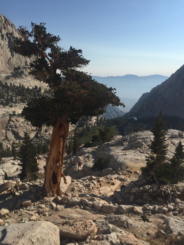
After Lone Pine Lake the nice smooth trail quickly changed over to a rockier surface. Footing became a bit more of a challenge as trees thinned out. I passed Outpost Camp with its gorgeous waterfall at a little over 10,000ft. There were a lot of backpackers here stopping to acclimatize on their 2-3 day summit push.
“Gee…Maybe I aught to look into some overnight equipment, scratching my head!
I hit a long patch of switchbacks after Outpost Camp.
In my quick glance lengthy research of this hike I remembered reading about a section of the trail called “the 99 switchbacks” that came after a campground.
The trail turns rugged
I got pretty excited because I new that the 99 were around mile 7. “Wow, I’m making great time”! I asked a fellow hiker coming down if I was on the infamous 99. Imagine my surprise when she told me, “ Oh no. You have quite a way to go before you get to the 99”.
About this time I saw a trail marker that said Mile 4! I. WAS. CRUSHED!
By now my heart had been pounding in my ears for almost 3 hours. The elevation had reduced my hiking to 45min miles. THIS WAS GOING TO BE A LOOOONG DAY.
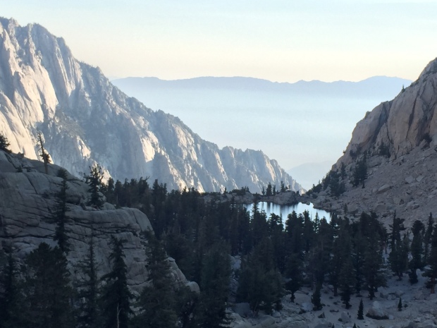
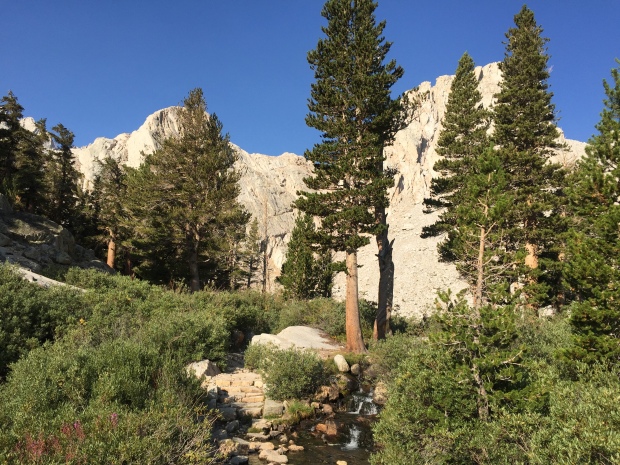
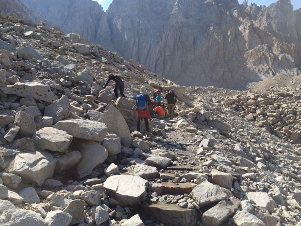
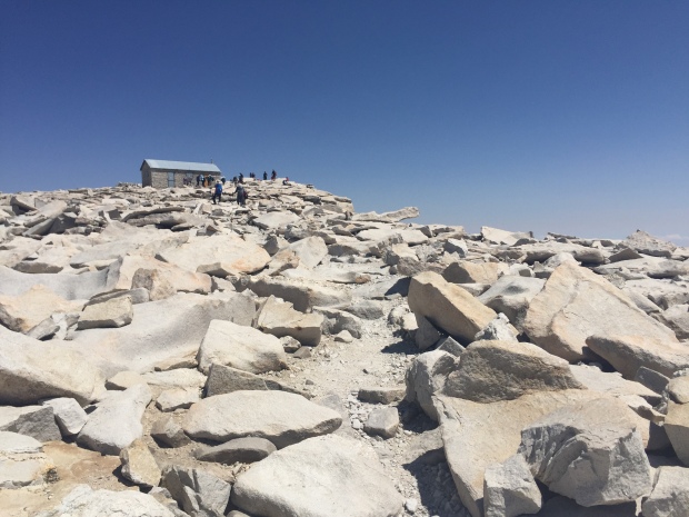
The trail switched from dirt and rocks to granite stair steps. I rose high above pretty Mirror Lake and Meadow. After another 1 ½-2 hours I finally reached Trail Camp at 12,039’.
Trail Camp is located on the shore of Consultation Lake. It could have been on the moon as far as I was concerned due to its barren landscape and granite spires. The camp was full of backpackers as well and by now I’m thinking these people are geniuses for breaking this hike up into several days!
I stopped here for a snack and contemplated the 99 switchbacks that were now staring me in the face. That’s 2.2 miles of switchbacks climbing 1,738’ to Trail Crest. I’m not going to lie…I thought long and hard about stopping here and just calling it a day. But after eating some food and catching my breath I decided to give the 99 a shot.
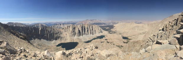
Surprisingly, the switchbacks were set at a low grade, which was much appreciated at this altitude. After what seemed like 999 switchbacks I finally rounded a corner and was hit with an amazing view to the west. Granite rising up, alpine forests and lakes below. My eyes had trouble taking it all in. I get teary-eyed just thinking about it now.
Reaching Trail Crest at 13,600′
What’s around that granite spire?
I made it to Trail Crest at 13, 800’!
The Mt. Whitney summit is 2.5 miles from here and a mere 845’ of elevation. But these are the most difficult and most draining 2.5 miles of your life…so I’ve heard.
Once I reached Trail Crest I was for sure going to turn around. But after I sat for about 20 minutes and ate some food and got inspired by the beautiful views I started wondering what was just around the corner.
The trail from here took a dip and I really thought hard about having to make up the elevation I had already climbed. But the trail drew me in and I pressed on, “just a little further”.
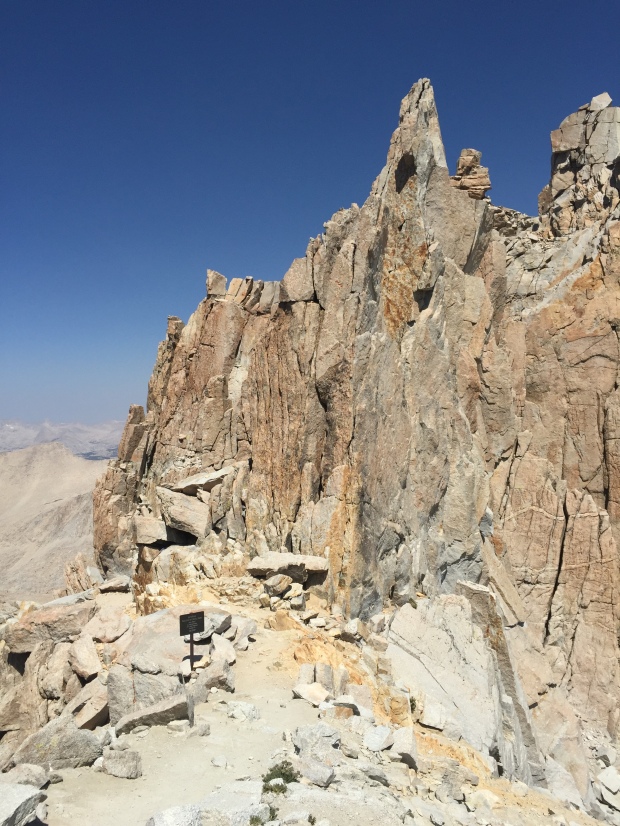
The trail from Trail Crest is brutal. BRU.TAL!!!
The trail is in there somewhere
I scrambled for the next mile over unstable rocks, angular slabs, shear drops and technical boulders. After an hour I sat down for a break and saw the Smithsonian hut on the summit off in the distance. By now I was exhausted. The narrow single track trail was closing in. I was having moments of panic as my mind flashed back to my broken wrist less than a year ago.
I asked another hiker how much longer until the summit. When they responded, “about 2 hours” I was finished!
By now it was 12:30pm. I had been hiking 6 hours with 2 more hours to go. I did the math and figured it would take me 4 hours just to get back to this point on the trail. My heart sank realizing I was going to run out of water and day-light, without a filter that was with Jeff and headlamp that was securely back in the truck.
It killed me to be this close and have to call the hike. Just 1.5 miles left to the summit. For me, it had to be over!
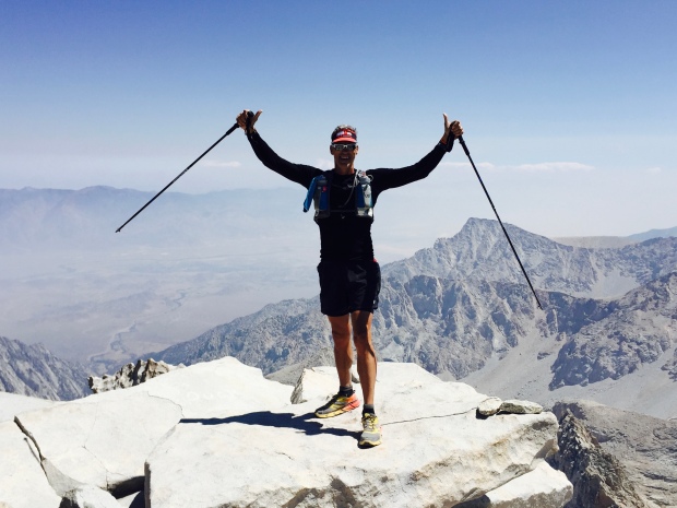
Jeff perseveres! Highest point in the lower 48!
About this time I met Esther. She was making her way back down the mountain after summiting. Wisely, she had left with her husband at 3am.
They had started this hike a few days before, but her husband Joe wasn’t feeling well and they turned around. This morning they started off at 3am again and again Joe didn’t feel well. He encouraged his wife to carry on so that one of them would make it. And that she did!
We started hiking together from here, retracing the technical trail back to Trail Crest. We both moaned at the section where we had to climb in elevation to get there, commenting about our pounding heads.
Down the 99 we went, past camps, meadow, lakes and waterfalls. All the while talking about our lives of adventure and travel. I learned about her amazing two daughters and could hear the affection she had for her husband of many years.
Second half of the battle is getting back down!
Our knees and quads were wearing down, but our time together made the trip so much better. I learned she and Joe take off their real estate business months at a time to travel. Check out their very well written blog here.
We arrived at the TH not a step too soon at 5:30pm, as the sun was going down. I got to meet Joe and instantly noticed they have a relationship like Jeff and I. Those rare relationships when a husband and wife actually like each other, have the same life pursuits and miss each other when we are not together. I can appreciate a happy couple!
I had gotten a text from Jeff that said that he had summited around 2pm, four hours after his missed conference call.
Joe and Esther were kind enough to give me a ride back to my RV Park in Lone Pine, knowing that Jeff would not be down for another 3 hours. I left the keys hidden in the truck so he could drive himself home.
Even though I missed reaching the summit I couldn’t be more proud for reaching 13,000+ feet and hiking 20 miles.
Thanks Esther for getting me down that mountain!
Mt. Whitney, I will be back! But next time I will leave earlier and not plan on making any calls!
Westerly view from Trail Crest 13,600′
New Level of Crazy
Posted by Deb in Bucket List, California on July 8, 2016
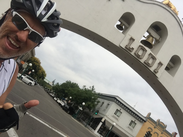
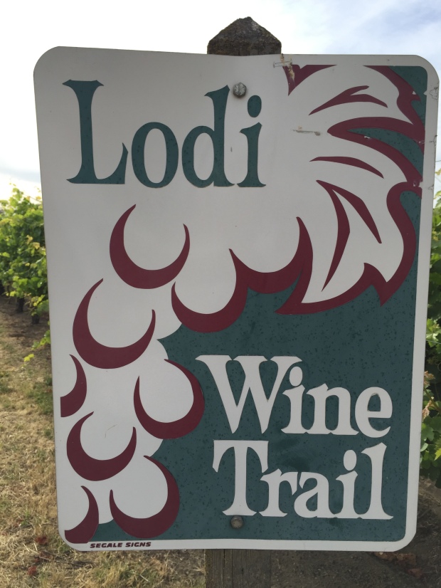
Welcome to Lodi California
Jeff and I left the magnificent beauty of Yosemite behind to become city dwellers again. After a week of cell & wifi isolation we were ready to get back to some connectivity for work. The temps were rising over 100* so we decided to head to Lodi early to be plugged in before the heat of the day.
We planned a week in Lodi to visit with family and to get caught up on business, so I made reservations at Flag City RV Resort. This is a very nice RV park with nicely spaced, level, concrete sites with a pool and hot tub. We used our Passport America membership for discounts that made our site quite reasonable for the week.
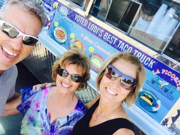
Lunch with sweet Aunt Shirley at Lodi’s best taco truck, La Picosita!
While we were innocently sitting in the back yard of Jeff’s aunt and uncle we couldn’t help but hear the overhead buzz of a prop plane climbing in elevation. Uncle Don made mention that we were hearing a parachuting plane making its assent. He also mentioned that Lodi has one of the countries most popular sky diving centers and if we ever thought of skydiving, this was the place to do it!
Of course this was all the words Jeff needed to hear to get the Spencer, “gee, that sounds like fun; wouldn’t that be awesome; I am going to drag my wife along to scare the living crap out of her but she will love it” wheels turning.
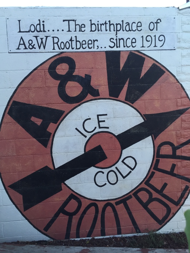
Lodi is home to the very first A&W Rootbeer
To be fair, last year when I turned 50 I decided that I needed to do something monumental to celebrate such a big milestone! I’m really not a big risk taker and I consider myself very conservative when it comes to… well, anything!
So when the words, “I want to skydive” came out of my mouth I looked around to see who said it! But it was too late. I said it out loud and sort of committed myself to doing something completely out of character. But if George Bush could skydive when he turned 80, then I had some serious motivation to not be outdone by an elderly former president who has no real bearing on my life!
When Jeff checked into sky diving in Arkansas last year fortunately unfortunately the jump appointments didn’t fit into our schedule and I felt a bit relieved that it just wasn’t going to work out.
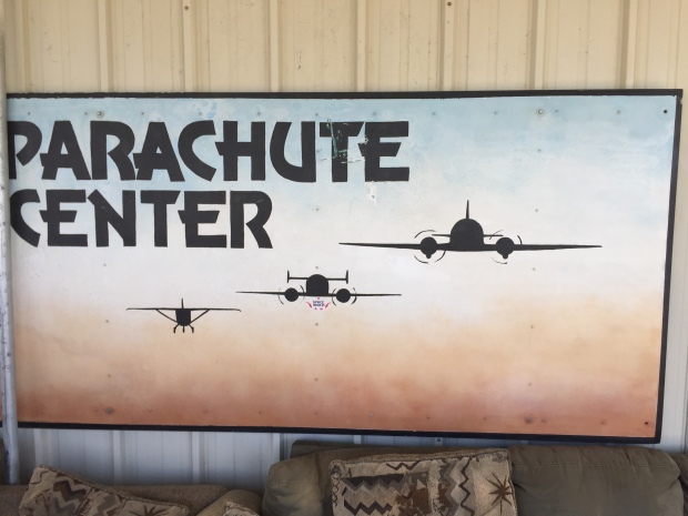
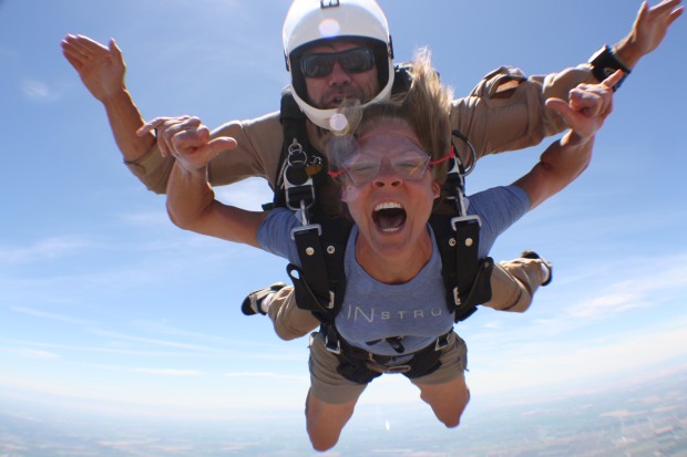
But here we are over a year later, standing in line at The Parachute Center in Lodi California handing them hard earned money for the most terrifying experience thrill of a lifetime!
So this is how this whole experience went down.
The day before we were supposed to move on from Lodi, I woke up from a nap to see Jeff chewing on his fingernails. Fingernail chewing is my husbands tell that he is conjuring up something in that pretty head of his.
Asking what was up he said he wanted to surprise me with something but didn’t know how to spring it on his “give me at least 2 days to process something” wife. Poor fella! So he let me know that if we ever wanted to skydive, now was the time to do it.
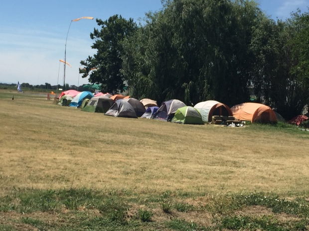
Summer housing at its finest at the Parachute Center
The Parachuting Center draws skydivers from all over the world, most of whom spend their vacations or entire summers living in a tent city right on airport property. They jump from 9AM to 3PM every day of the week, no appointment necessary, just show up, pay your money and jump!
So while I was experiencing a post-nap euphoria I agreed to go skydiving.
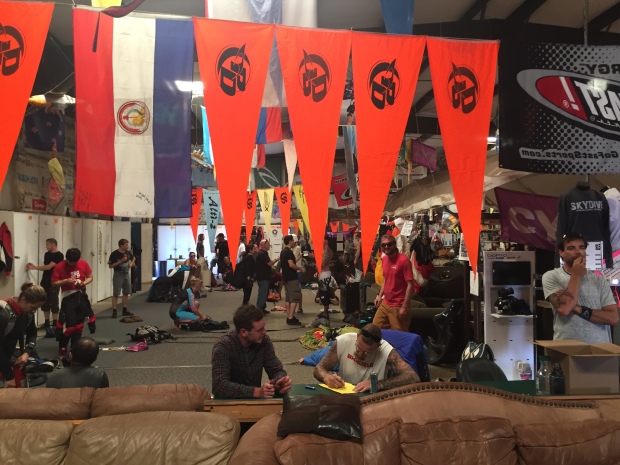
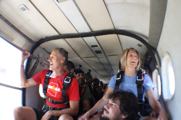
We arrived at the Parachuting Center in a big hanger that smelled of parachuting junkies who hadn’t taken a bath in a good week. There were old couches that filled the center of the building with lockers that surrounded the perimeter. Old parachutes, Tibetan and country flags hung from the ceiling and dogs roamed freely.
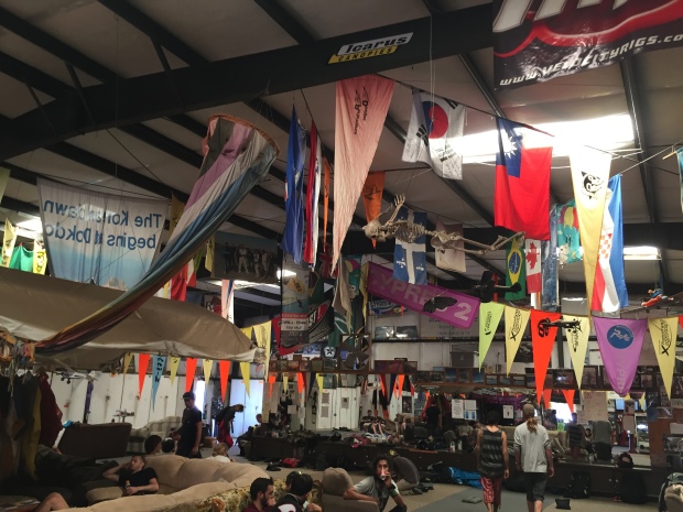
Get your stank on at the Parachute Center
The waiver you sign that says if you die they can come and get your couch!
We were handed a clip board of wavers to sign while watching an old VHS video that had been used so many times that the only thing visible was a faint outline of a long hair/bearded man from 1970-something sharing very important safety tips that I couldn’t hear.
After the informative video we were escorted to the fitting room where they sized us up and put on our harnesses, then introduced us to our jumping buddy. Our brief instruction of assuming the position of a banana was given and we were quickly loaded up into a stripped down airplane.
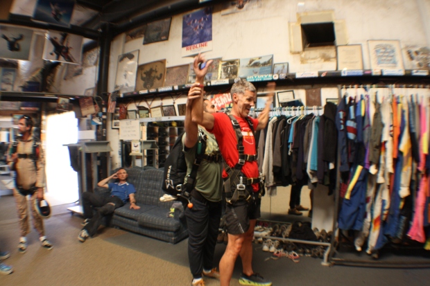
Jeff learning to embrace the banana!
The plane climbed to 3,000 feet and a small group of hippies with helmets rolled up the side of the plane and jumped out. My jump buddy informed me that if you jump out at 3,000 feet with your own equipment it only costs $5 a jump. Good to know!
La, La, La…having so much fun!
Once we reached 13,500 feet the side door of the plane opened up again, more hippies jumped out and all that was left was Jeff and I. We received our last bit of instruction to embrace the banana and remember to breath. And before we could contemplate what we were about to do or if we wanted to change our minds, we were being hurled out the airplane door.
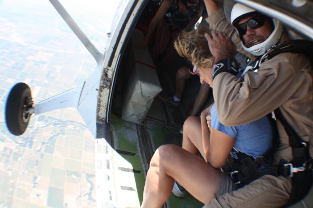
I didn’t even get a one, two or three!
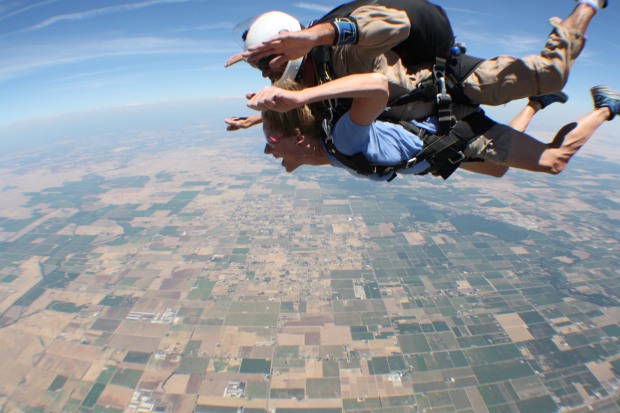
The initial tumble was disorientating and dizzying and all I could do was close my eyes and wait for the spinning to stop. My ears were instantly feeling pressure and I felt myself unable to breath. But then we finally got into the belly down position and I remembered to assume the tomato… or was it bacon?
The photographer was zooming in and out trying to get me to smile. I’m pretty sure at this point I drooled all over my jump buddy as I forced myself to flash my pearly whites at the camera. The photographer was waved off and we pulled the cord to deploy the chute.
Holy Crap
After adjusting the biggest wedgie of my life, we floated around making a series of turns to take in some of the vineyard views that consume Lodi. My jump buddy decided it was time to give me instruction on how to land and before I knew it I was lifting my legs and coming in for an amazingly soft butt landing. The jump was over!
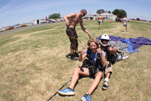
Slide in for a landing. Thank you Jesus!
THAT. WAS. TERRIFYING! WHAT. A. RUSH!
Jeff was walking towards me and I noticed that he was sweating profusely and white as a sheet. He said his jump buddy took him on a series of turns that gave him so much motion sickness that he just about lost his cookies!
On our drive home we just kept looking at one another wondering out loud, “what just happened”? From the time we left the RV, drove to the parachuting center, received instruction, flew to elevation, jumped out of the plane, landed, waited for our disc of pictures/videos and got back in the truck it was a total of 1 hour.
The only thing I remember from the rest of the day was that I had grass in my underwear and I was still panting and my heart was still racing 2 hours later.
Time of my life or look of terror?
So the lingering questions are…
Q: Are you glad you skydived?
A: Yes!
Q: Do you think you will ever do it again?
A: No!
Q: Are you sure? You didn’t say never!
A: I’ll answer that definitively when I turn 80!
We followed this home!
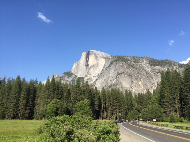
Yosemite National Park-Part I
Posted by Deb in Bucket List, California, Destinations, Full Time RV, Hiking, Yosemite NP on June 26, 2016
Let the hiking commence!
Jeff was a Californian for the first 23 years of his life and one of his most shocking statements was that he has never been to Yosemite. Being a mid-west girl myself, I have a much better excuse why my eyes have never gazed upon El Capitan, Yosemite Falls or Half Dome. But to live within 90 miles of this National treasure and never to have seen it. Well, that’s just plane hard to believe!
Yet here we are, California surfer dude and Illinoisan tomboy, taking in this place together for the very first time. It was spectacular! That first view of Half Dome and El Capitan will forever be engrained in my mind. It’s emotional and spiritual and amazingly beautiful!
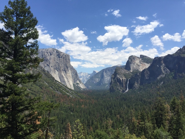
WOWZA!
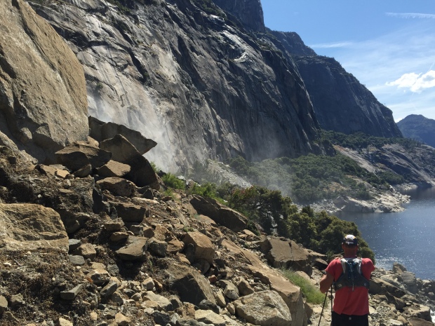
Being in Yosemite this year is especially spectacular since El Nino’ dumped abundant snow. Its spring and the snowmelt has added volumes of water to all of the falls in the park making for waterfall-palooza everywhere you look. Even the parking lots have incredible views!
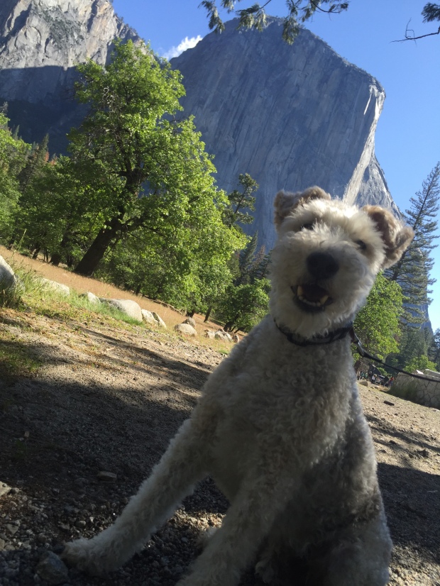
Sams loves El Capitan!
It being Memorial Day weekend, I had made a weeks reservation at Yosemite Ridge RV Resort a couple of months in advance. Though the National Park entrance is just 13 miles from the RV Resort, it was still another 30-some miles to Yosemite Valley floor making our commute 45-60 minutes one-way.
We spent our first day (Friday) taking a drive to the Valley floor to get the lay of the land and get information for hiking Half Dome. Then we purposed to avoid the valley floor Memorial Weekend. What a good decision that was! By the time we were driving back to the RV Park each day the lines into the park were backed up for 3 miles.
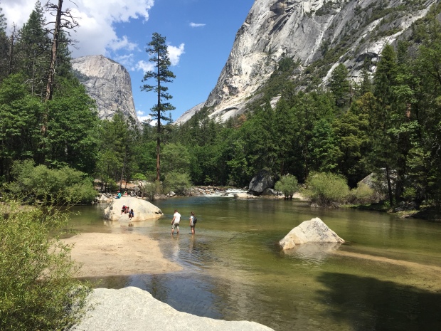
Hike to Mirror Lake
We stuck to perimeter hikes out Hetch Hetchy to Tueeulala and Wapama Falls (5 miles round trip). The Hetch Hetchy Reservoir provides water to the Bay area and is so pure, no filtration is required. A ranger told us that they cannot tell you its ok to drink out of it without filtration, however, it exceeds EPA standards. The spray from the waterfalls over boardwalk trails were a real treat since it was getting really warm that day.
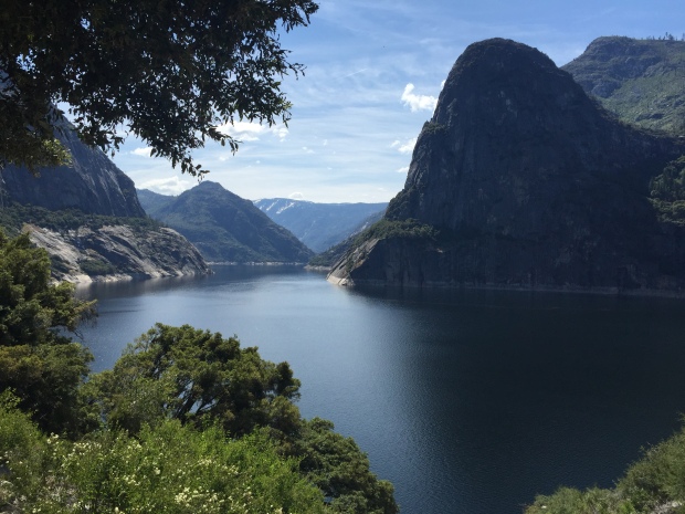
Hetch Hetchy Reservoir
These falls are big!
We are about to get wet
The next day we hiked to the Toulumne Grove from Hodgdon Meadows (10 miles). This is where a grove of Sequoia Redwoods stand. We were virtually alone until we reached the grove on this trail, which was on an old paved logging road and part of the original road into the valley.
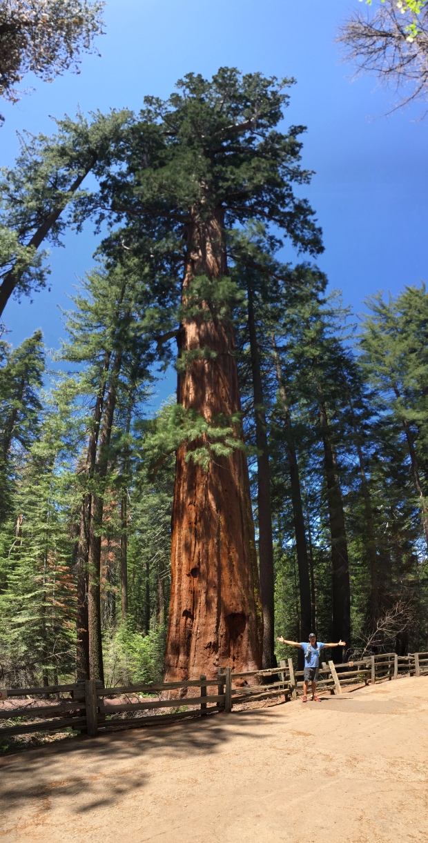
Tree Giants
The really cool part of this hike was seeing the Tunnel Tree that was carved out of a fallen sequoia around 1881 as a tourist attraction. The park entrance road drove right through this tree and a toll was collected! Things like this triggered the National Parks ranger program to prevent future destruction of the majestic redwoods and park resources. Because of the discovered Sequoia grove, the park entrance road was later re-routed to where it is today.
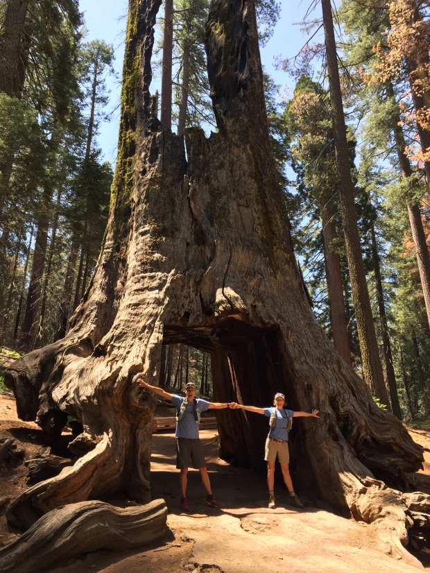
Tunnel Tree at Tuolumne Grove
One of our bucket list hikes, second to The Grand Canyon, has been Half Dome. It’s a long day hike (16-18 miles RT depending on where you park) with the last 500 feet of climb up “the cables” to reach the summit.
A permit is required from Sub-Dome and above. There are only 300 permits issued per day with 60% of them available via online lottery up to 6 months in advance. The other 40% are issued via lottery a day in advance.
Since the 60% permits were already issued during our time there, we took a chance and tried the other 40% permits by diligently applying online DAILY at a $4.50 fee with each try…only to receive our Dear John letter every night at midnight.
Since that wasn’t working we found out that there are additional Half Dome permits available, but only if you apply for a backcountry camping permit. These are very limited also and are given out at 11AM on a first come first serve basis for hiking the following day.
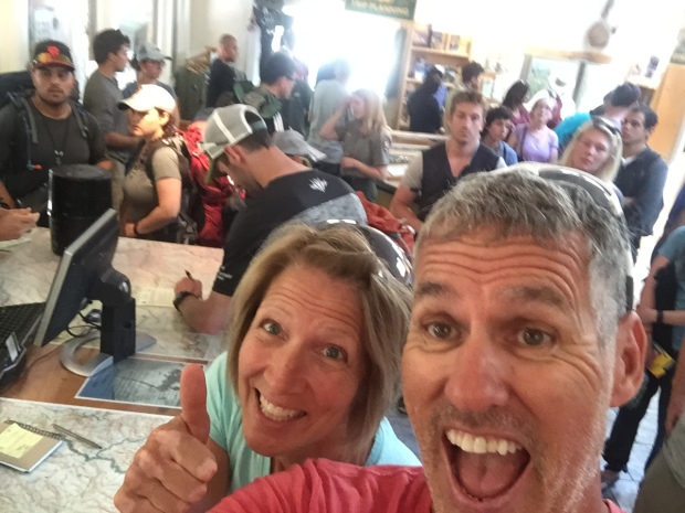
In order to have a chance with this strategy we arrived at the backcountry office at 6AM to claim our spot in line and hope they had permits left by the time we reached the desk. Even at 6AM we had 12 others ahead of us and it wasn’t looking good.
But fortunately we had two groups ahead of us that were offered to start their hike THAT DAY which freed up 6 spots for the following day…and we got the last two permits!
SCORE! We got the last two permits. Sorry folks!
WE GET TO HIKE HALF DOME BABY!!!!
Hello beautiful!
Ramping Up and Winding Down
Posted by Deb in Bucket List, Destinations, RV Parks, Trail Run, Utah on May 20, 2016
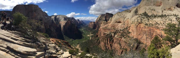
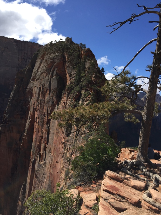
Angels Landing, Zion National Park
Ooooof! More excuses why I have been very tardy in keeping up with my blog!
Working with an RV company, the full-on RV season has arrived and our show responsibilities have ramped up.
So instead of trying to catch up with multiple posts I’m going to cheat and summarize the last two months of travel in one. That’s the way we catch up around here!
Zion National Park…A Thing of Beauty
Continuing our visit to the Canyonlands we headed over to Zion National Park. I thought since we were visiting during the early season we wouldn’t have any trouble finding camping around the National Park. After checking the recreation.gov website for camping within the park I found 1 campsite left for 3 nights at the Watchman Campground. Not the week stay I was hoping for but we had to take what we could get.
With our Zion Ultra trail run scheduled we needed some additional reservations closer to the venue. I got reservations at the Zion Canyon Campground behind the Quality Inn Hotel in Springdale. It was literally just across the Virgin River from the Watchman…for double the price.
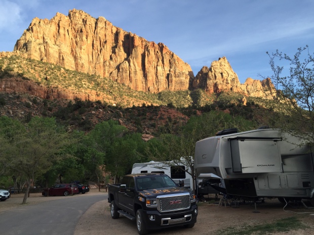
Tight quarters but great views at Zion Canyon Campground
The picturesque Watchman Campground
Our first day at Zion we decided to take a drive through the park traveling through the tunnel on 89A. I’m so glad we did this because we had planned on going out this way on our way out of town. We didn’t realize there was a tunnel for one thing. Secondly, they have a height restriction of 13’2″. Thirdly, if we could have fit (we are 13’ 8”) we would have needed a park escort in order to drive down the middle of the tunnel while traffic was blocked. Lastly, they charge a $15 fee to do so.
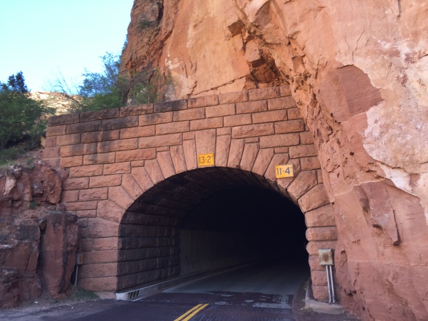
Not enough headroom for us tall folks
Despite all that, it was a beautiful drive and gave us a little taste of what was to come during our weeks stay.
Two days before our race we decided to take in an easy hike and headed to the Emerald Pools. There is a high, medium and low pool and we hiked to all three. This is an easy hike and we purposed to leave before 8 AM to avoid any crowds. This time of year you can only access the Trailheads via the shuttle system that we picked up at the visitors center.
There are flashing signs all over town about the National Park parking being completely full by 10AM until 3PM, so we wanted to be sure to get an early start. We waited for the shuttle with 4 other people to head to the TH’s. But when we returned around 10:30 the lines just to get on a shuttle were about a ¼ mile long. It was crazy!
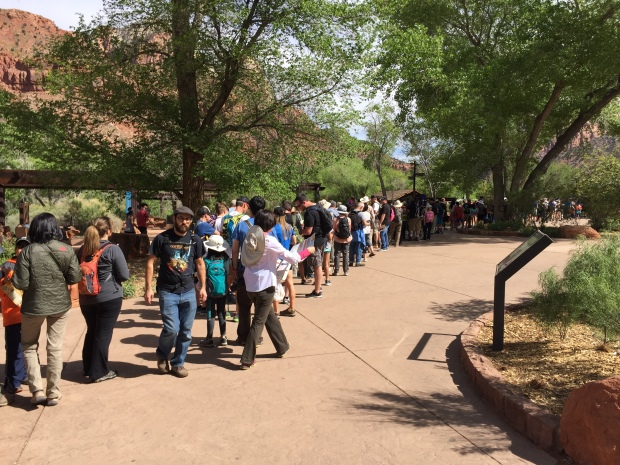
Boy oh boy…go really early or prepare to wait!
Angels Landing
If you have ever seen pictures of Zion you more than likely have seen Angels Landing. This hike’s iconic knife edge assent with the aid of chains and the infamous Walter’s Wiggles were enough to make this one of our most unique and exciting hikes we have ever done.
And the view from the top… Simply amazing! It’s a great place to have a mid morning snack or a picnic lunch with plenty of room to move around (mild crowds). But if you are scared of heights this hike is not for you!
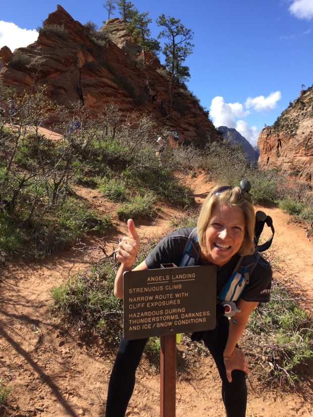
WARNING…You are crazy doing this hike!
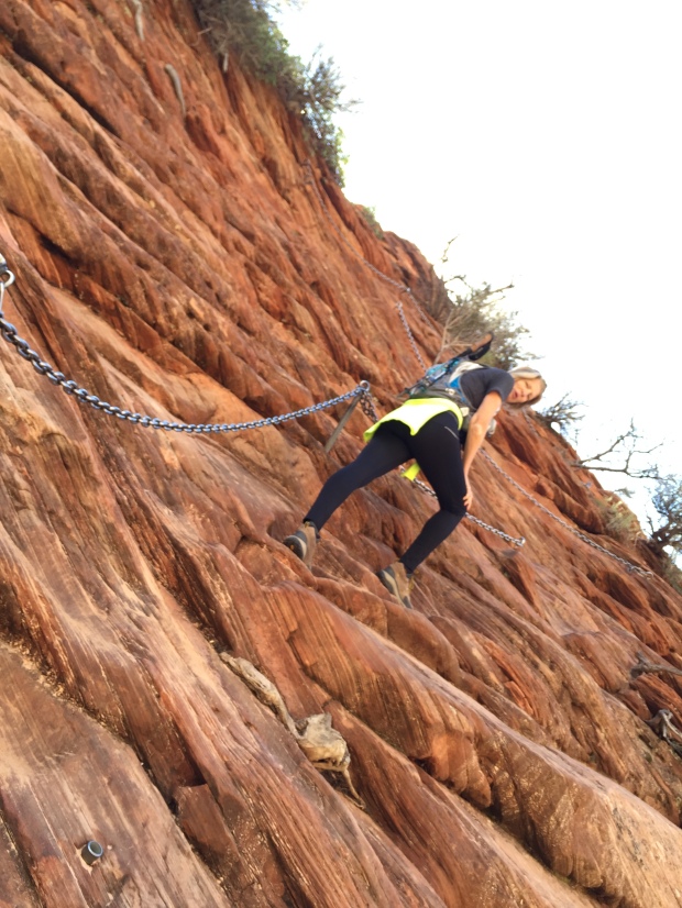
Be sure to do this hike early morning before the crowds kick in. The chain section is for one rear end at a time and even early we had to share the road with A LOT of people including small children and terrified adults. There aren’t too many spots to just pull over and let someone pass, so expect to hang out on the side of a cliff waiting for your turn.
Zion 100 Ultra
The Zion 100 Ultra offered a 100-mile, 100k, 50 mile, 55k and half marathon distance. Jeff signed up for the 55K while I signed up for the half marathon.
We were watching the weather closely the week leading up to the race and as the race got closer the chance of rain increased. So much so that the race director offered the option to back out of the race even though they were going to have it rain or shine.
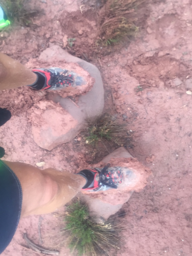
But nothing could prepare us for…mudageddon!
5lbs extra weight right there!
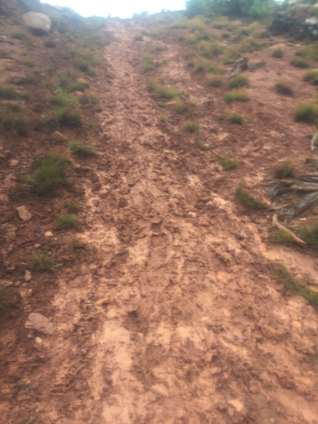
Super slop…just no way around it!
It started to rain about 1AM and rained off and on through the entire race. The rain made the trails a soupy sloppy mess and the course had to be altered at the last minute. I finished my half while Jeff pulled out at mile 22 of his 55k. The mud was relentless and we were both exhausted!
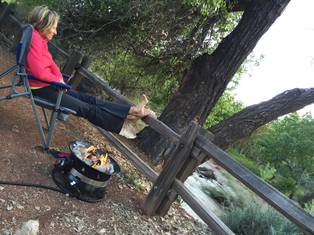
We took a rest day and walked to town for lunch the day after our race. Sam was glad to get outside.Though we love our National Parks we hate that you cannot take your dog with you on the trails. We understand the safety concerns and the trails are really too crowded for both people and dogs. Zion does offer one paved walking trail that pets are allowed on and we were thankful for it.
We really wanted to hike The Narrows which is water/river hiking. But spring runoff had the river running too high and wild to do this trip. We hope to come back in the fall for this one.
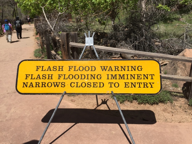
The Narrows…not assessable this trip
The little town of Springdale is within walking distance of the Zion campgrounds and a delightful place to grab lunch, ice-cream or coffee. It’s quaint and friendly, but I can only imagine what it would be like to get around in the height of summer tourism. Springdale is bracing itself for the estimated 5 million visitors expected to Zion this year, so if you are planning a trip pack your patience.
Lee’s Ferry, AZ
After leaving Zion we stopped over at Lee’s Ferry campground in Utah. What a gem of a find!
Lee’s Ferry is the only place for hundreds of miles where you have easy access to cross the Colorado River. Back in the mid 19th century it was the site of Lees ferry that provided a way to cross the Colorado River for those making their trek out west.
The water is smooth and calm here and is where all Grand Canyon rafting trips start their journey.
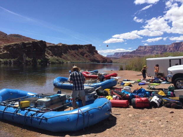
Grand Canyon float trips getting ready for 18-21 day trips. Look at those skies!
The little first come first serve campground is situated on a bluff overlooking the Colorado River. As with all the Canyonlands, the full beauty of Glen Canyon is revealed in the sunrise and sunsets and boy did it put on a show!
The rock formations glowed with the dawn and dusk sun so be sure to set up your chairs and take in the view!
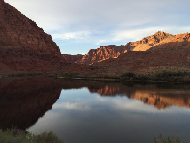
The beautiful Colorado River at Lees Ferry
Phoenix, KY, IL, MO, AR, OK, TX, NM, AZ, NV
Yup…in a matter of 9 days we crossed 9 states and 3 time zones. We flew to Louisville to pick up the Dometic show RV and drove it to National Hardware Show in Las Vegas.
This kicked off 5 weeks of non-stop driving and we are almost finished with our show responsibilities for this round. It has been a whirlwind for sure but next week we will be taking a weeks vacation in the majestic Yosemite National Park.
Stay tuned!
Zion 100…you kicked our butts!
Epic Hiking and Majestic Views All At the Grand Canyon
Posted by Deb in Arizona, Bucket List, Full Time RV, Grand Canyon, Hiking on October 28, 2015

I made reservations at Trailer Village at the Grand Canyon a couple of months ago so we pressed on after 3 nights in Flagstaff.
This is the third time Jeff and I have been to the Grand Canyon. Our first trip was after a sales conference in Scottsdale about 7-8 years ago. It was December and we only had a few hours to explore. So we hit the South Rim and the restaurant in the Village at Bright Angel Lodge.
Our table was overlooking the rim with spectacular views. Our brief time was enough to create a longing to come back to spend more time at one of the Wonders of the World.

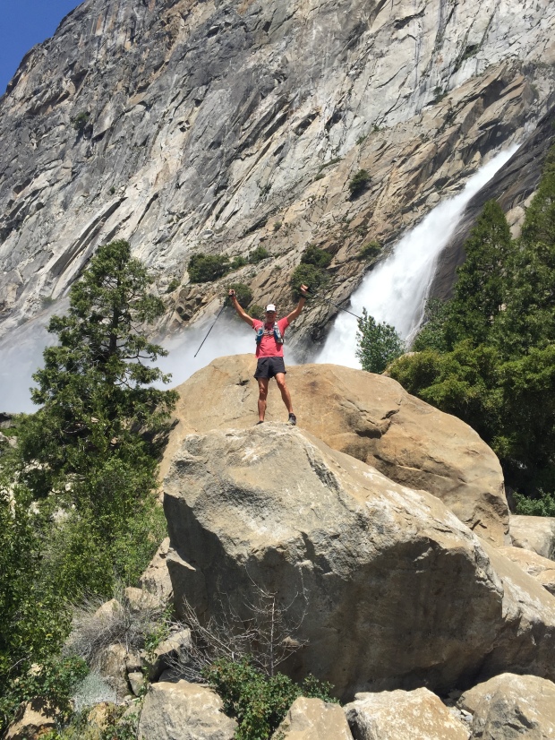
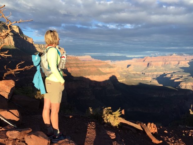
Jeff catching his shadow during sunrise hiking the Canyon
And that’s exactly what we did last year (2014). A group of us from Arkansas trained for about a year in order to do the Rim2Rim (And Rim2Rim2Rim), crossing the Canyon from South Rim to North Rim via the Bright Angel trail and the North Kaibab trail. You can read all about the experience here.
After completing such a hike we were left with wanting more. So here we are. At the Grand Canyon. Planning another epic hike into the bowels of the canyon.
This time we wanted to start and finish on the South Rim so we chose to go down the South Kaibab trail to the Colorado River and up Bright Angel…for me (Rim2River2Rim). Jeff on the other hand wanted to do a double, so he started at Bright Angel down to the river then up South Kaibab. Then, turn around and head back. (Rim2River2Rim2River2Rim)

Rain and rainbows delaying our hike
The plan was for Jeff to leave at 1am and get to the South Kaibab TH by the time I was starting my hike at 6am.
We arrived at the GC on Thursday hoping to do our hike on Saturday. But thunderstorms were predicted and the hike was called off for the day. Then Sunday…Monday…Tuesday…Wednesday. We had rain, rain and more rain, hail and wind gusts until the weather finally broke the day before we were to leave.
There is a lot of preparation that goes into a 10-15 hour hike, especially when the canyon had some of its water sites shut off
due to repairs. Water, nutrition, extra socks, moleskins, headlamps, electrolytes filled our slim running packs.

Stuffing our running packs full of supplies
We had prepared as best we could and the hike was finally on!
Jeff left at 1am sharing that at some points in the hike he stopped on the trail, turned his headlamp off and just took in the stillness, the quietness, the moon and stars in the canyon. Not another soul around. Totally unplugged. Just him and the trail.
I met Jeff about 7:30am halfway down the South Kaibab. What a refreshing face to see! We got to share our experiences up to that point and enjoy a snack before heading our separate ways…him going up…me going down.
The day before the hike I wasn’t feeling up to doing the 18 miles of Rim2River2Rim. So my plan was to hit the Tonto Trail off the South Kaibab which heads west to the Bright Angel trail…cutting off 1000’ elevation drop/gain and 5 miles. But I took my first 10 steps on SK and I new I had to make the full journey down.
I am so glad I chose the longer route. The dramatic cliff views made green and lush from the week of rain. Trickles of water were flowing out of the rocks. Such a fresh smell in the air. It’s all too grand, broad, high, and vast to take in. I couldn’t open my eyes wide enough!
-
- Starting the descent at sunrise
-
- Taking in the view on the South Kaibab Trail
-
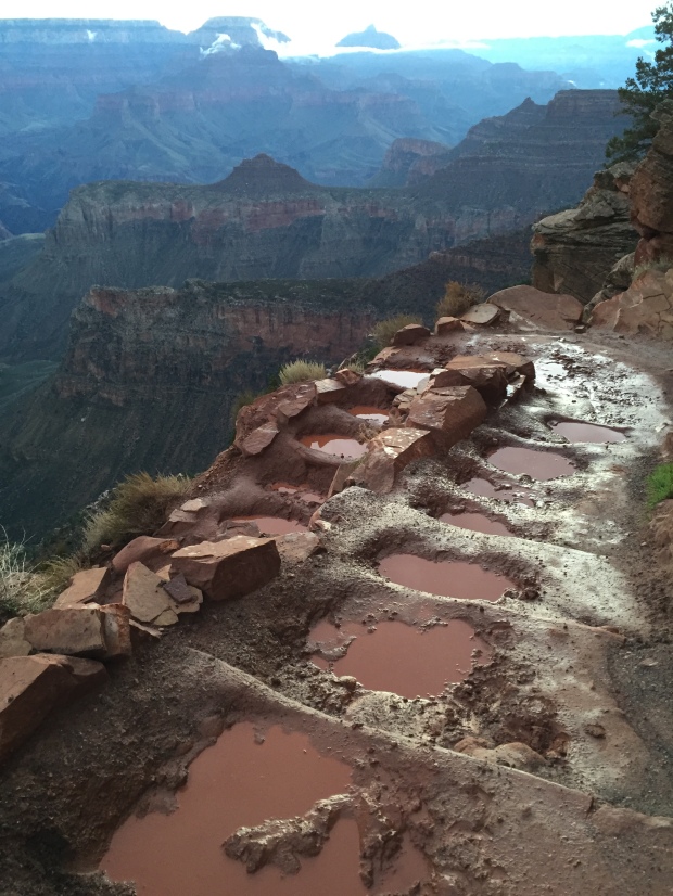
- Navigating puddles and mud
-
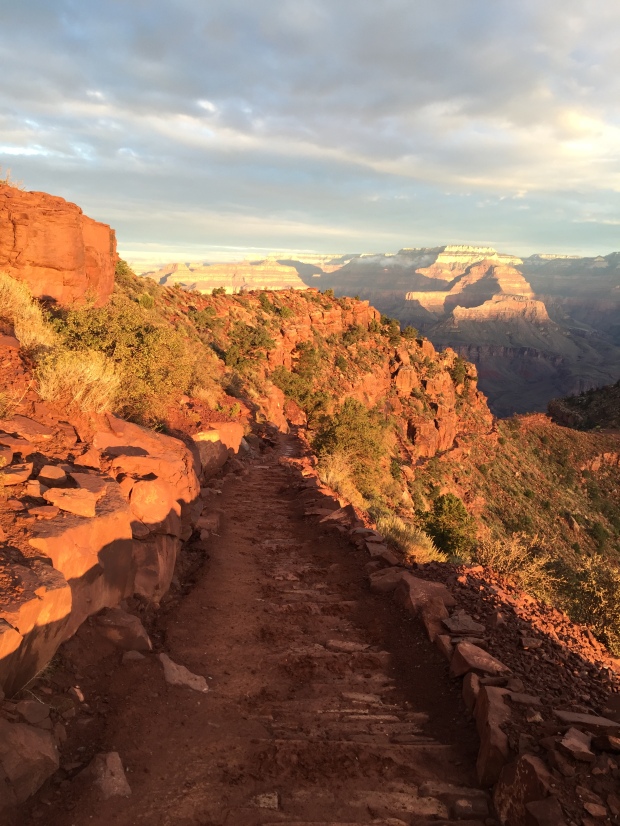
- Beautiful sunrise setting the red rocks on fire
-
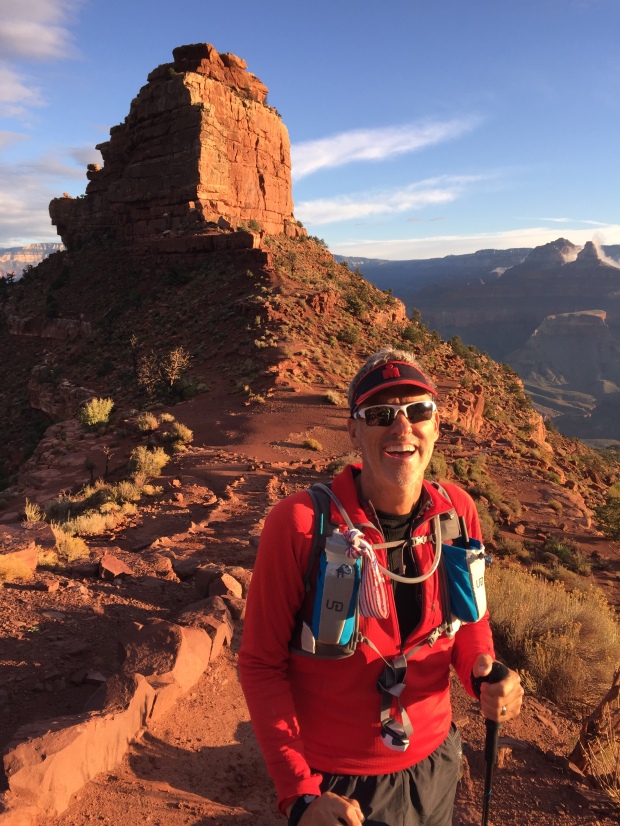
- Meeting Jeff half way down/up…fully alive!
While hiking down I heard a clop, clop, clop sound up in the hills above me only to see my first mule train carrying supplies down to Phantom Ranch. The mules are bred for their solid disposition and sure footing to take packs and people below the rim. Though they had moved out of sight, I could still hear the clopping down below as they continued on.
The SK trail is narrower than BA trail and a little more worse for ware. The mules have worn a steady path into the trail, sometimes 12” deep. And with the recent rains had created a couple miles of deep puddles and sticky mud to navigate.
-
- Pack mules heading down South Kaibab 6:30am
-
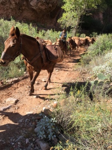
- Saw those same Cowboys and mules heading back up from Phantom Ranch
After 4 hours I made it to Phantom Ranch, 4600’ below the South Rim, to rest, eat and fill up my water bottles. An hour later Jeff had made it back down and joined me there.
I stayed long enough to dip my feet into the Bright Angel Creek before starting the steady climb back up and up and up.
-
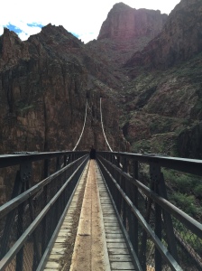
- Jeff crossing the Colorado River on the “black” bridge
-
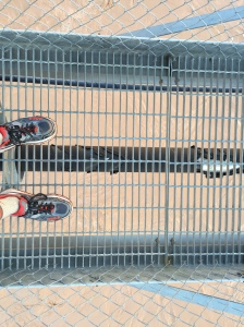
- Me crossing the “grey” bridge over the Colorado
The BA trail is the least steep of trails out of the canyon. From last year I knew that I was in for a hike at the Devils Switchbacks. I was dreading them from the moment I left Phantom Ranch. I remembered them to be numerous, steep and grand. But Jeff and I arrived at Indian Gardens to realize that we had already hiked them. My mind had made them dramatically different than it actually was…to my great relief!

Monumental swithbacks on the SK trail
Things look incredibly different when you hike the trails from a different direction. Last year I hiked down the BA trail. This year I was hiking it up and I couldn’t remember most of the trail. Everything looked new. Like I had never hiked this trail before. It was a completely different perspective!

Views of the Colorado River
For 4.5 hours we hiked switchbacks with heavy legs and heaving chests as we climbed to higher elevations until we finally crested the top. The glorious, level, finally stop moving, TOP!
The Grand Canyon is one tough hike. But I think the majestic views; the grandness of it all feeds the senses to a point of a natural high that carries you along the trail, one foot in front of the other.
I’m not going to lie…my legs and chest hurt for days. But my memories of this epic hike will last me a lifetime, which should more than cover my momentary pain.
Grand Canyon. I WILL be back!

We did it!
PS…We were once again camping with our friends John and Becky and also Paul and Nina of WheelingIt. We had fun with Happy Hour and a grilled pizza night…in the rain…which will make for good story telling in the future.
While we were hiking Paul and Nina were gracious enough to keep Sam for us. It was hysterical to see Sam and Polly together. They were like two long lost pals who where on their first date. I’ve never seen two dogs kiss each other. No, really. They were actually kissing each other. Polly giving Sam sideway glances. Sam sitting as close as he possible could to Polly. It was all so amusing!
-
- Mini Xscapers Converge with friends!
-
- Puppy love…Polly and Sam
Sam had a great time with the WheelingIt crew. I hope we can return the favor sometime soon!

Flagstaff Boonies and Peaks
Posted by Deb in Arizona, Boondocking, Bucket List, Full Time RV, Highest Peaks, Hiking, Uncategorized on October 25, 2015

Welcome to 7,000 ft…catch your breath!
-
- Clingers in the nicest way!
-
- Dinner with friends…we really like these two

The trail calls and I must go!

Agassiz Peak from Humphreys Peak Trail. San Francisco Mountains.
-
- Humphreys Peak Trailhead…here we go!
-
- Aspens in full glow!
Jeff, Sam and I left Humphreys Peak TH from the Arizona Snow Bowl following a smooth trail that took us through a field of glowing aspens. But the smooth trail was short lived as we quickly entered a hole in the tree line and the trail quickly turned rugged and rocky. It was an ankle turner almost the entire way and Jeff rolled his and launched himself over the side of the trail, only to be stopped by a small tree. That. Was. Close!

Navigating the rough trail

View from Mt. Humphreys with aspens far below and controlled burn in the distance!

Sunset from Mt Humphreys TH set off by a controlled burn in the distance

This is how we roll…me driving and the boys sleeping!
Nearing the End…Only the Beginning
Posted by Deb in Bucket List, Buying A RV, Full Time RV on August 24, 2015

Dreams Do Come True!
For 21 years Jeff and I have been dreaming and planning on buying a 5th Wheel RV. Our thoughts of camping were seeds that were planted by our Grandparents. All those trips we took as kids made a major impression on our souls.
My family started camping when I was just a baby (so the story goes) after my Grandpa converted an old, very small, school bus to a camper. He worked as a mechanic at Ford for 40 years and had some serious skills! He built it with his grandkids in mind with bunk beds for my two brothers and a crib for me. The earliest memory I have in my life was in that old school bus!

Grandpa’s Converted School Bus (1965)
I’m not sure how long it was until my Grandpa got rid of the school bus and bought a Jayco popup camper with all the “modern” convenience. Mom and Dad slept on one end and my brothers were on the other end. Grandma and I slept on one of the tables that converted into a bed and my Grandpa slept on the other.
It was certainly cozy quarters, especially when my Grandpa’s snoring could scrape the bark off a tree. But I didn’t care. WE WERE CAMPIMG!
My Grandpa loved to fish, so most of our camping was done around lakes. One of the first things I would do when we got to a campground was to walk the shoreline looking for a straight stick and old fishing line that some poor fisherman had gotten tangled up in some brush. I would proudly run back to Grandpa who would tie on a brand new shiny hook.
I caught so many fish with that primitive setup. It didn’t matter how small the fish was, Grandpa would clean it and fry it up as if it were the catch of the day.
I could go on for days about camping stories like melting styrofoam cups in the campfire, skunks hanging out under our camp chairs…while we were sitting in them, tornados and grandpa stepping in the pee bucket (were we the only ones who had a bucket to pee in during the night?).
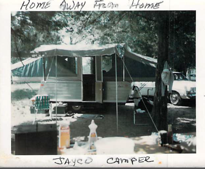
Moving on to the “modern” Jayco pop up
I saw my first mountain in that camper when we took an epic trip out west. We started in St. Louis and headed north to see Mount Rushmore. Then traveling west we stopped at Yellowstone and watched Old Faithful shoot her water high in the air.
Somewhere on that trip a ranger gave me a piece of petrified wood, we ran into a band of gypsies at a campground. Grandpa thought our tires would be stolen by morning so we quickly left. And, I saw Casper the Friendly Ghost.
After seeing the West, my wanderlust was born!
Though Jeff and I started out with tent camping after we were first married, we didn’t buy our first RV until 3 years ago. We bought a 2010 Heartland Edge 21’ travel trailer. It wasn’t the 5th wheel we had been dreaming of, but it was something to dip our toe into the lifestyle. In the last three years we have been all over the mid-west, New Orleans and on our own epic trip out west.

Camping in the back of our truck…those were the days!

Hanging with Yogi the Bear at one of many RV shows
For us, the last three years has been about gaining confidence and affirming that we were committed to the RV lifestyle with plans to live full time on the road.
That brings us to our Carriage Domani 5th Wheel. Now that we have made it to the other side of some major heartburn of renovations, we are just so thrilled with our new-to-us Domani.
But what is even more exciting is that this 5th wheel is the fulfillment of a 21-year dream of ours. It has been our single vision all these years that we have based our major decisions on. With that single vision, we have asked ourselves through the years whether or not a major purchase, a job change, even a lifestyle would take us closer to our vision or take us away from it.
Pinch me…we are finally here!
Now that our RV renovations and upgrades are nearing the end, we are excited about our new beginning. The beginning of our life on the road in the “home” of our dreams.
We couldn’t be more thrilled!

