Running can sometimes be mundane. Especially when it is confined to concrete, stop signs and busy streets. But when you take running to the trails everything changes.
Changing scenery. Adventure and exploration of surroundings. Sights, sounds and smells of the wilderness. The crunch of dirt under your feet. AHHHHH!
Trail running requires an ever presence of mind and focus. One drifting thought about a work project can land you flat on your face with dirt permanently embedded in your palms.
I have scars to prove my love of the trails…each one has been totally worth it!
Man down…just another day in the park!
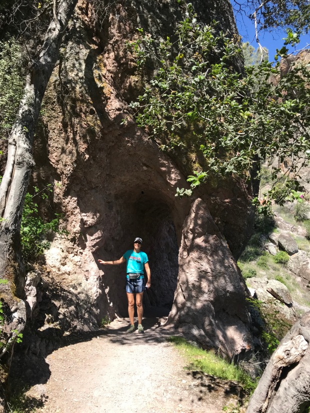
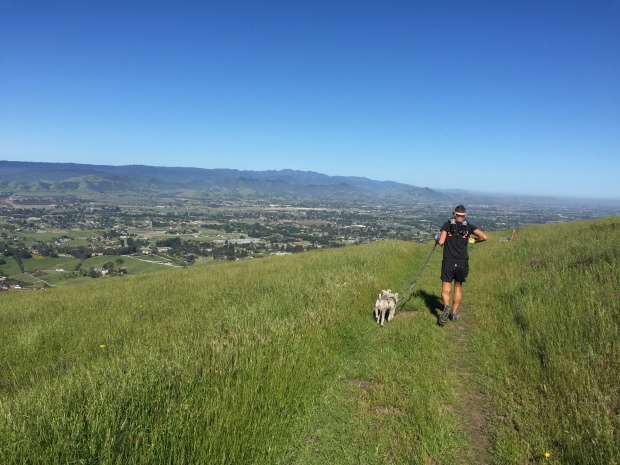
PINNACLES NATIONAL PARK
Jeff and I spent a month in Hollister, CA while having an upgrade to our holding tank valves. I saw a sign on the highway for Pinnacles National Park. Doing some research I discovered that PNP is the second newest National Park made so in 2012. (The newest being the St Louis Gateway Arch in 2018)
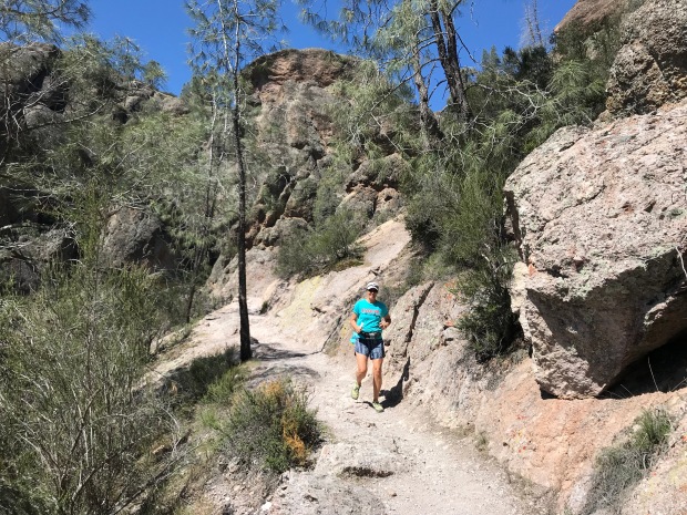
The Pinnacles are the remnants of the western half of an extinct volcano along the San Andreas Fault. It offers 30 miles of trails, pinnacles for rock climbers and is home to 13 species of bats, prairie falcons and is a release site for California condors that have hatched in captivity.
We started early as usual to avoid crowds and found the last parking spot at the Condor Gulch trailhead. We wanted to do a loop that took in the Bear Gulch Cave Trail. Starting on the Condor Gulch Trail we headed west on High Peaks Trail. Then we jumped on Tunnel Trail, Juniper Canyon and then back on the High Peaks Trail. This was a little over 5 miles.
This was a wonderful route with lots of diverse landscape. We were looking forward to exploring some tunnels and caves. But the tunnels were super short and we managed to miss Bear Gulch Cave completely. It was still totally worth the effort.
When we got back to the parking lot the traffic coming into the park was backed up for a couple miles. The parking situation did not hold up to the popularity of this place and rangers would not allow traffic to progress forward until someone left. So if you go to Pinnacles go early or on a weekday!
HENRY W. COE STATE PARK Hollister, CA
Another great trail running area near Hollister is the Henry W. Coe State Park. The trails are smooth with just enough hills to get the heart pumping. The park contains over 87,000 acres of rolling pastures for free range cattle to roam. With 200 miles of dirt roads and trails, it’s an outdoor paradise for hikers, runners and mountain bikers.
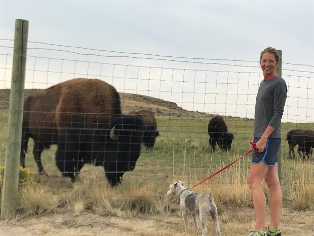
The stubborn cattle that tend to claim these trails can be a bit intimidating. As a chiropractor in the Midwest, I’ve seen my fair share of injured farmers that had been trampled by temperamental bovine…and it wasn’t pretty. But if you yell loud enough and wave your arms like a crazy person they slowly moved on.
The Katy Trail
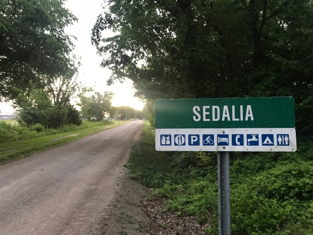
Jeff and I went to Sedalia Missouri for the Escapees annual Escapade. The event was held right along the Katy trail which was perfect to get our runs in each morning. I talked about the Katy trail here and its on our bucket list to bicycle one day. Previously we have run the Katy trail from Munson to St. Charles Missouri, the eastern most terminuses.
The wide packed gravel trail was consistent with what we saw in St Charles with lots of shade.
This was our first run back in humidity and we were both exasperated with our run performance until it dawned on us both…”Ooohhh ya. Humidity.”
Starved Rock State Park Oglesby, IL
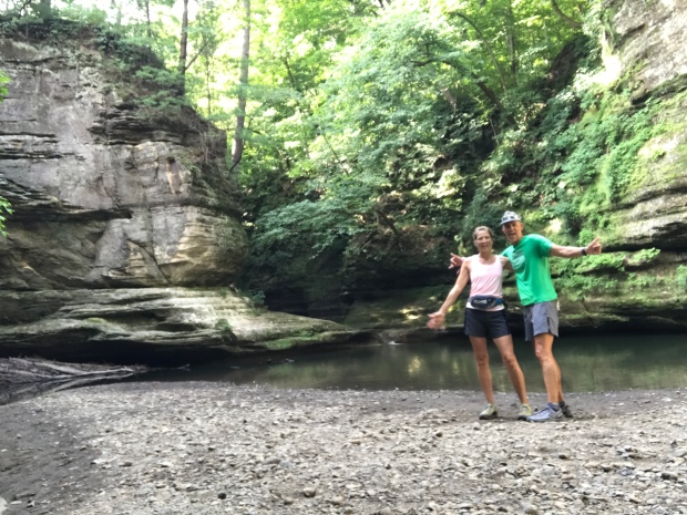
St Louis Canyon
Starved Rock is 2630 acres located along the south bank of the Illinois River. In 1683 the French had established Fort St. Louis on a large sandstone butte overlooking the river they called Le Rocher(the Rock). Legend has it, that in 1769 the French had moved on the Native American group called Illiniwek or Illini claimed the butte. The Ottawa and Potowatomi Native Americans besieged the butte until all the Illiniweb had starved and the butte became known as “Starved Rock”.
Starved Rock is known for its 13 miles of trails, 18 deep canyons, many waterfalls and sandstone outcrops. Jeff and I hit the trails early morning to try and beat the crowds and the heat. Nice strategy until you are the first one to catch all the spider webs in this heavily wooded forest. Jeff ran with a vale of webs trailing behind. We ran to the furthest distance to the St Louis Canyon waterfall and back.
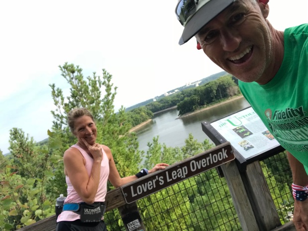
There are many scenic viewpoints including Lovers Leap Overlook where apparently two Native American forbidden lovers from different tribes hurled themselves off this point. Too bad they didn’t just run off to Vegas like the rest of us.
St. Vrain State Park
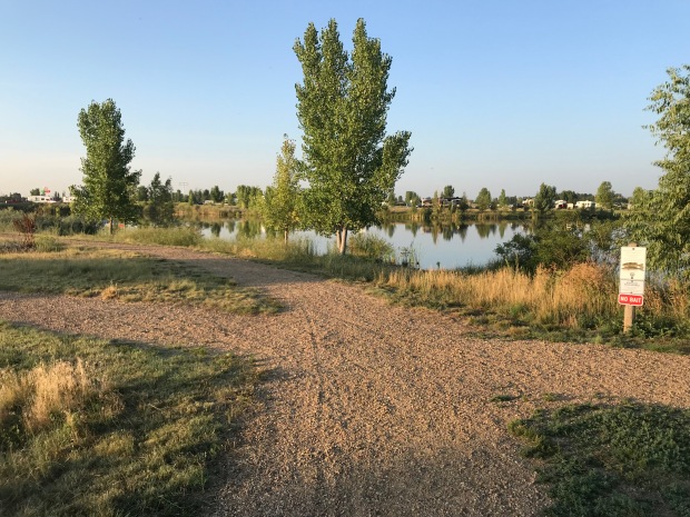
Lots of little ponds to run around
St Vrain was one of the very first state parks that we stayed at on our 3-week trip to Colorado in 2013. From reading reviews of other RV parks and campgrounds in the Denver/Boulder area this is the nicest, most cost affective place to stay. The campsites are well spaced with trails that wrap around multiple small ponds/lakes.
The trails are flat and dusty and good for a 5 miler. Any longer and you would have to keep repeating loops.
Tie City Campground Laramie, WY
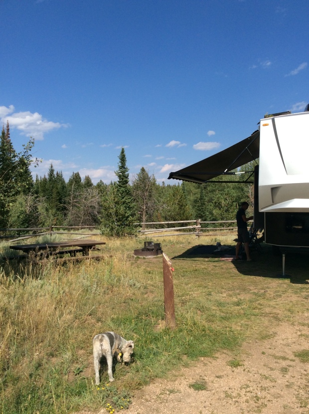
Tin City campground with trails on the other side of the fence
After an exhausting pushing to drive from Arkansas to Denver we made a last minute decision to stop for 4 days at the Tie City Campground just east of Laramie, WY. Oh what an amazing find this was!
Tie City was named for the railroad men who cut the ties for the union Pacific Railroad from the Lincoln National Forest.
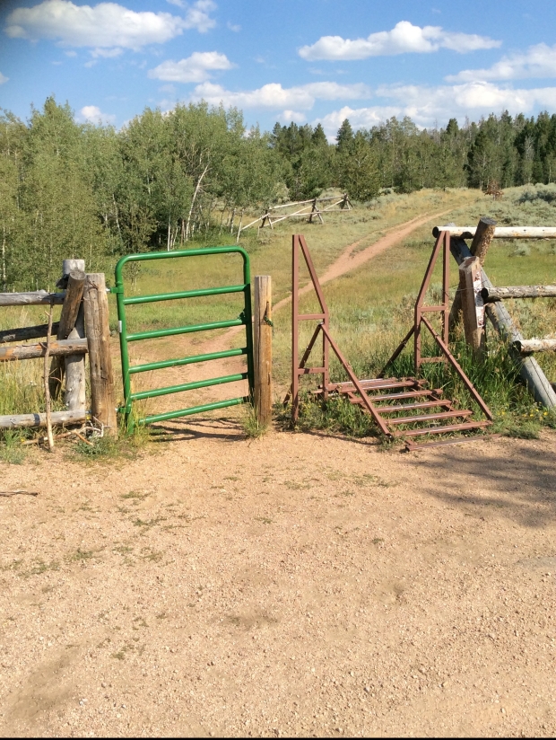
This campground is a popular spot to take in 30 miles of trails that web itself all over these mountains. The trails are clearly marked by name and ski difficulty. Winter brings cross-country skiing and snowshoeing while summer offers trail running, horseback riding, mountain biking and hiking.
Trails right from our campsite
A place to turn around for 8 miles
Some rugged steep trails are considered black diamond while other wide and rolling trails were considered blue. It’s easy to get turned around on these trails (then again it could just be me) so bring a map if you want any hope of finding your way back to the trailhead.
Weekday or weekend these trails are used hard by some of the friendliest people we’ve met!
LOVE. LOVE. LOVE THIS PLACE!
Mt Emily Recreation Area (MERA) LaGrande, OR
MERA is located in the Blue Mountains of NE Oregon and has 40 miles of motorized and 45 miles of non-motorized trails.
I started at the Owsley Trailhead where there is plenty of parking for cars, horse trailers and pit toilets. Maps were available at the Kiosk so if you are not familiar with the area TAKE A MAP!
I started on Red Apple trail and ran Upper Hotshot to the Mera Loop. From there I’m not quite sure where I went, but by some miracle I ended up back at the parking lot for 7 miles. I promise you I did take a map. But what I didn’t bring was my reading glasses for the miniature print on those wonderful trail maps!
There are so many crazy offshoots of trails that it was easy to get off course. The trails range from single track to forestry roads. Some a bit more overgrown than others. The rolling hills and elevation ranging from 2900-5600’ made for a good challenging run.
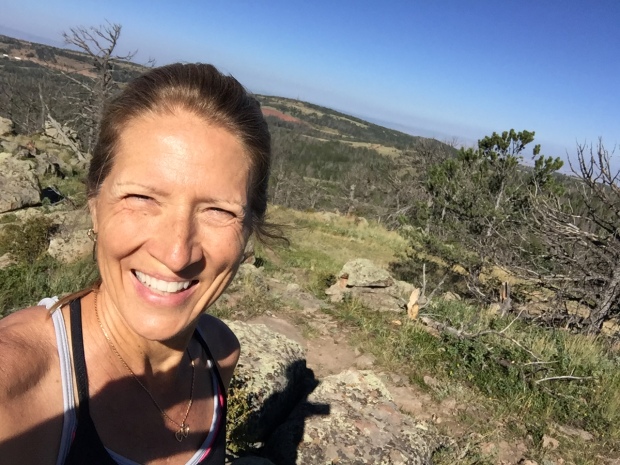
South Lake Tahoe 100k
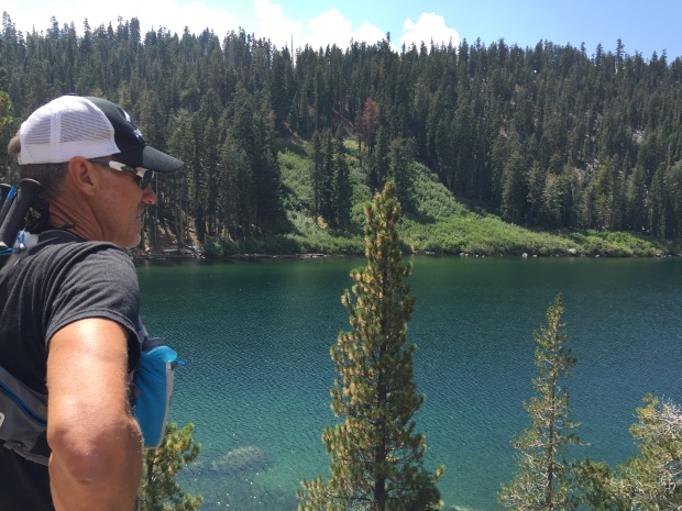
Run to Echo Lake
We had a friend that had signed up for the Tahoe 200. Jeff decided that he would pace his friend for the last 40 miles. Since this friend had never ran longer than a marathon we were not confident this race would go down. Sure enough, two weeks before the race our friend decided to back down to the 100k. Since 100k runners cant have a pacer, Jeff decided to sign up for the 100k so that he could run with his friend, who in the end pulled out altogether 2 days before the race.
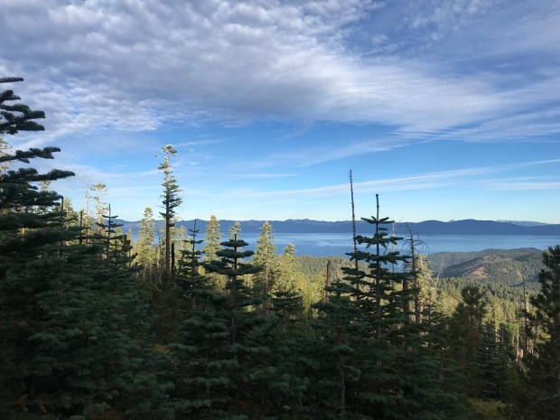
Views from Tahoe Rim Trail
Tahoe is in our top 5 places that we have been to. In case you are wondering, the others are Flagstaff, Sedona, Bend and south rim of the Grand Canyon.
What we really liked about this race is it was on the Tahoe Rim Trail with easily accessible aid stations for spectators. The views were spectacular. The weather was perfectly cool. Tahoe never disappoints…except when you misinterpret a “100k” tail sign for “look” and take a wrong turn during the race. At mile 48 Jeff missed the cutoff by 3 minutes and his race was over. Selfishly it was nice that Jeff was done at 9pm rather than midnight since we planned on pulling out the next day.
These are just a few of our fun trail runs/hikes as we made our way from Arkansas, Iowa, Indian, Colorado, Wyoming, Oregon and California. We finally stopped in Dana Point CA for our 3-month workkamping gig at Doheny State Beach.
More from our little beach community soon.
Honorable mention hikes & trail runs
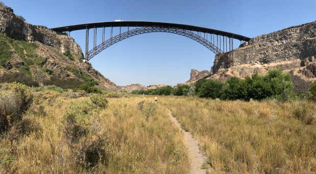
Twin Falls Idaho
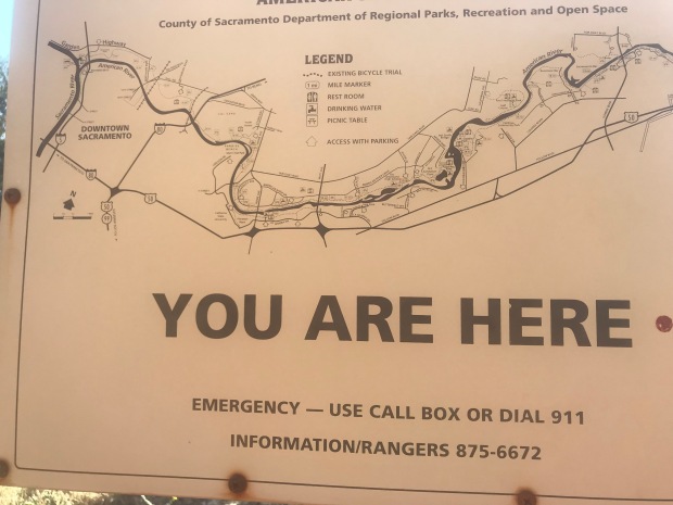
The American River Trail Folsom, CA
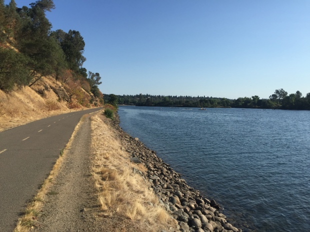
The American River Trail
Route 66 Newberry Springs, CA
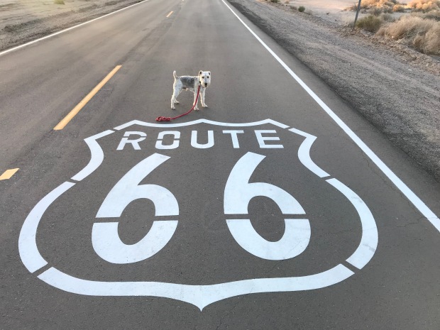
Sam getting his kicks on Route 66

#1 by chapter3travels on December 28, 2018 - 6:55 pm
These trails are all lovely and you’ve absolutely convinced me that trail running is a great way to explore your surroundings… but you lost me at ‘running face first into spider webs’ and having them trailing along as you run…. Nope, nope, nope…. Guess I’ll be checking these trails out slowly, carefully, methodically, and with Kevin taking the lead…. 😂 Seriously though, you’ve identified some really pretty spots, and as we cross the country next year, we’ll definitely try to check some of them out. Lake Tahoe has evaded us thus far, but it’s definitely on the list! What a beautiful place!
LikeLike
#2 by Deb on January 9, 2019 - 6:21 pm
LOL…thats why Jeff ALWAYS goes first!
LikeLike
#3 by Joe on January 7, 2019 - 2:59 am
Hey Deb, Es and I hope you and Jeff find many more happy trails in 2019!
LikeLike
#4 by Deb on January 9, 2019 - 6:22 pm
Thanks Joe. Same to you and Es!
LikeLiked by 1 person