Archive for category Uncategorized
A 2020 Epic Adventure…Hiking the Colorado Trail PART I
Posted by Deb in Uncategorized on September 30, 2020
Part I
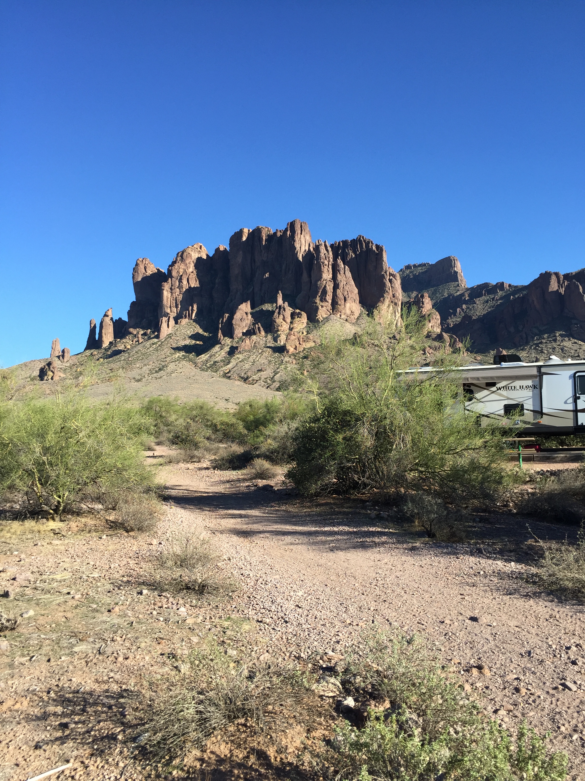
The year 2020 has been an odd one. When the pandemic hit we were in Mesa Arizona trying to decide what to do. We had a spring, summer and fall worth of plans all lined out to keep us moving from Baja to Banff.
But in March, everything changed!
Once we heard that campgrounds, National Forests and RV parks were shutting down we made the decision to high tail it back to our cabin in Arkansas to wait out the pandemic.
After 5 years on the road our life of travel was now on hold and we became home dwellers once again.
In reality I welcomed being home.
Traveling in an RV has many, many positive aspects. Any negatives are quickly forgotten as soon as you peer over the rim of the Grand Canyon or summit the highest peak in Colorado.
However, living in an RV is an everyday mental game.
Is there enough power to run the microwave? How long can I stand the noise of the AC before I want to pull my hair out? Is there enough water to take a shower today? How will I get out of the gas station parking lot? Is some idiot on the freeway going to cut me off?
Living in a house is sooooo mindlessly easy.
With all that mental free space created, we started to think about our next adventure. With most races cancelled or converted to “virtual”, we decided to look for a challenge to get our butts motivated to stay in shape.
We needed something epic. We needed something in a cooler climate for July-September. We needed something RV friendly.
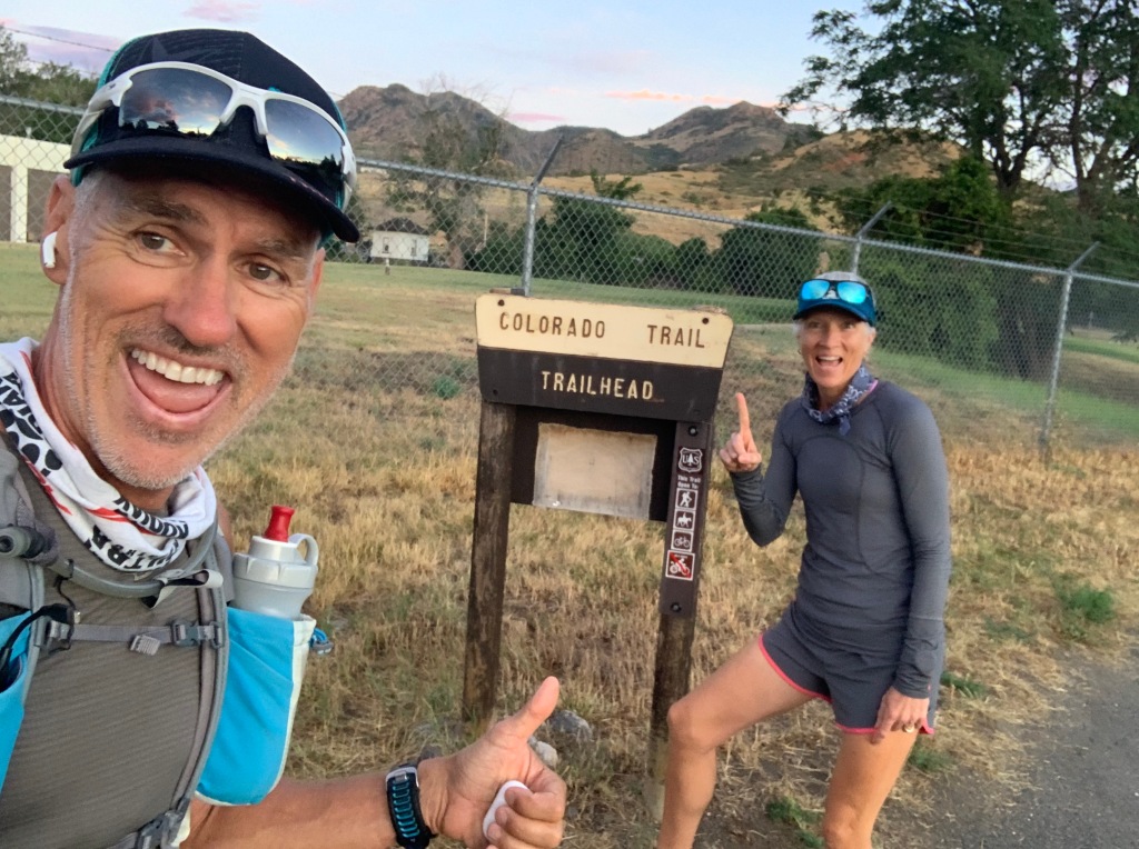
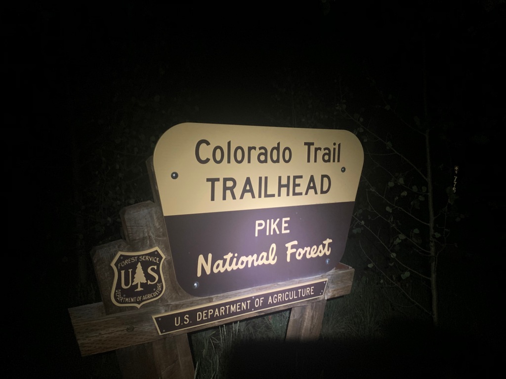
And that’s how we decided we would take on the Colorado Trail.
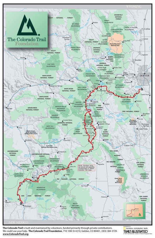
485 Miles
90,000’ of Elevation
Most of the trail is above 10,000’
The Colorado Trail (CT) was constructed by volunteers between 1973 and 1987.
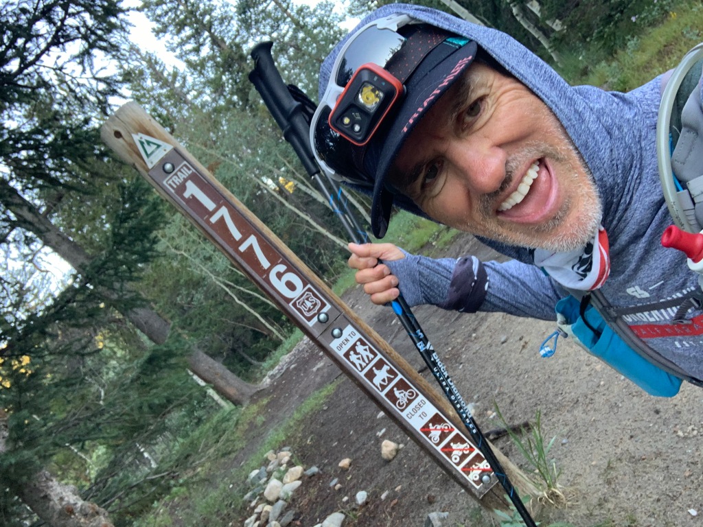
The trail is broken into 28 segments stretching from Denver to Durango. Most people backpack the trail by either “through hiking” or “segment hiking”. While through hikers take 30-45 days in one shot averaging 13 miles a day, segment hikers cover a segment or two over a long weekend, go home, then plan another weekend to knock out another section.
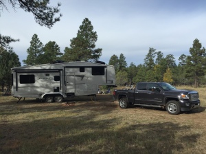
Since we were not backpacking we had to figure out the logistics based on where we could park the RV, then drive to start and finish trailheads for the day.
Segments were anywhere from 9 miles to 32 miles with lots of 20 milers in between.
We decided the best approach for the two of us would be to leapfrog the trail. Jeff would do a segment, and then I would do a segment. That way I could drop Jeff off at the start of Segment 1, then drive around and park at the start of Segment 2. I would then hike Segment 2. Jeff would then pick up the truck at his finish (my start), then drive around and pick me up at the finish of #2. Easy peasy!
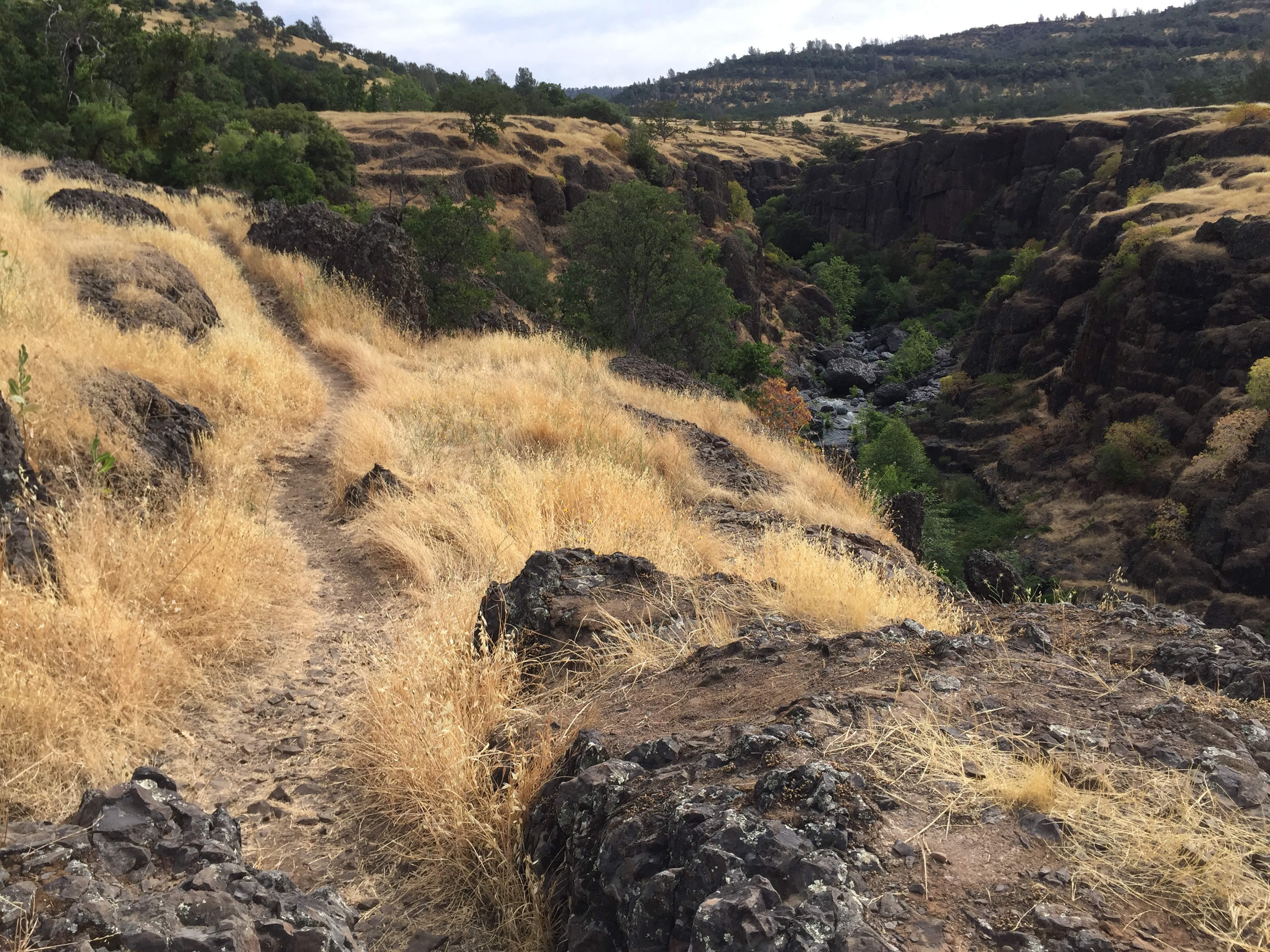
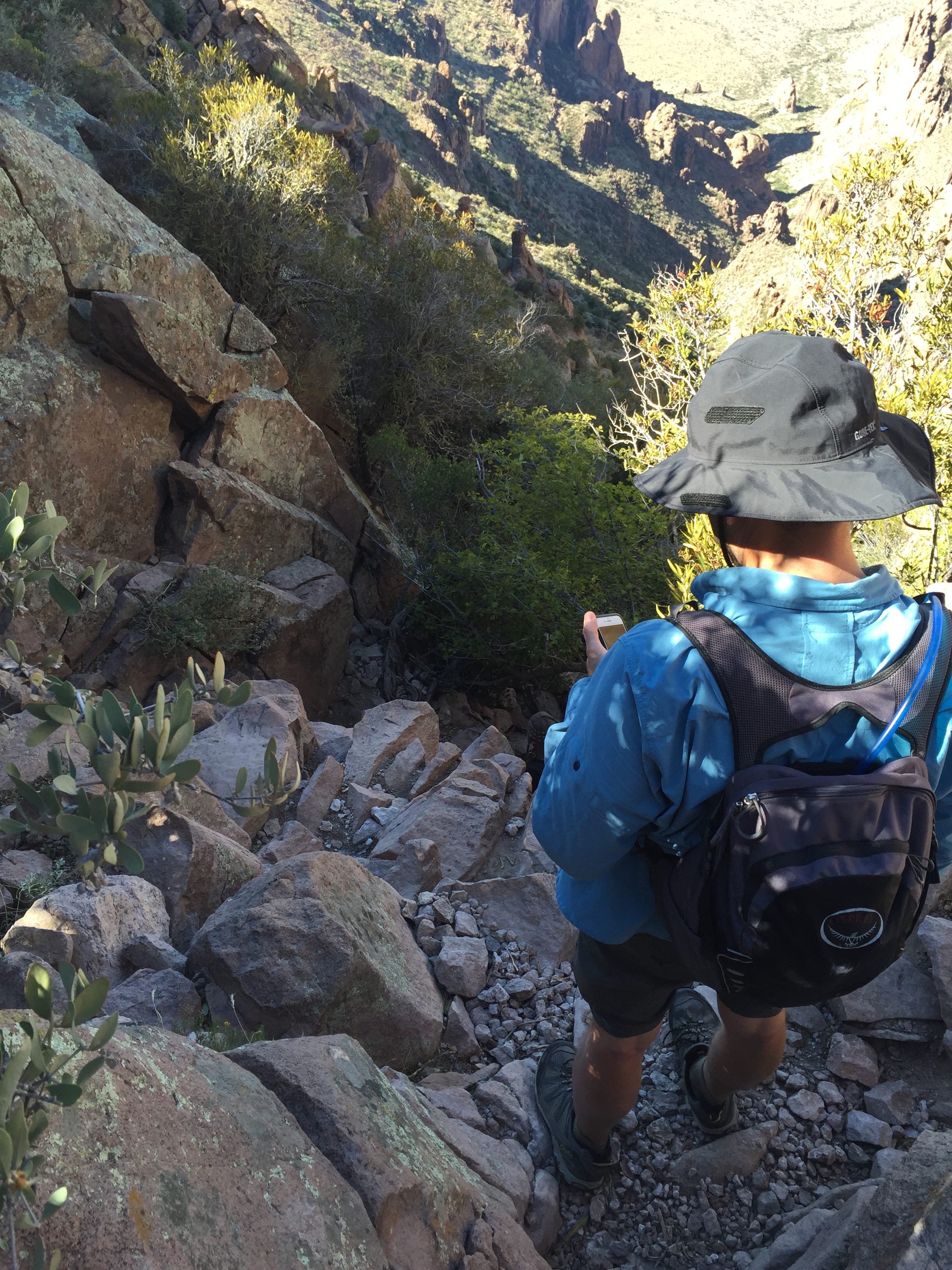
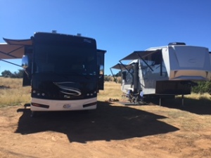
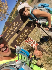
July 25, 2020 CT Segment 1 & 2
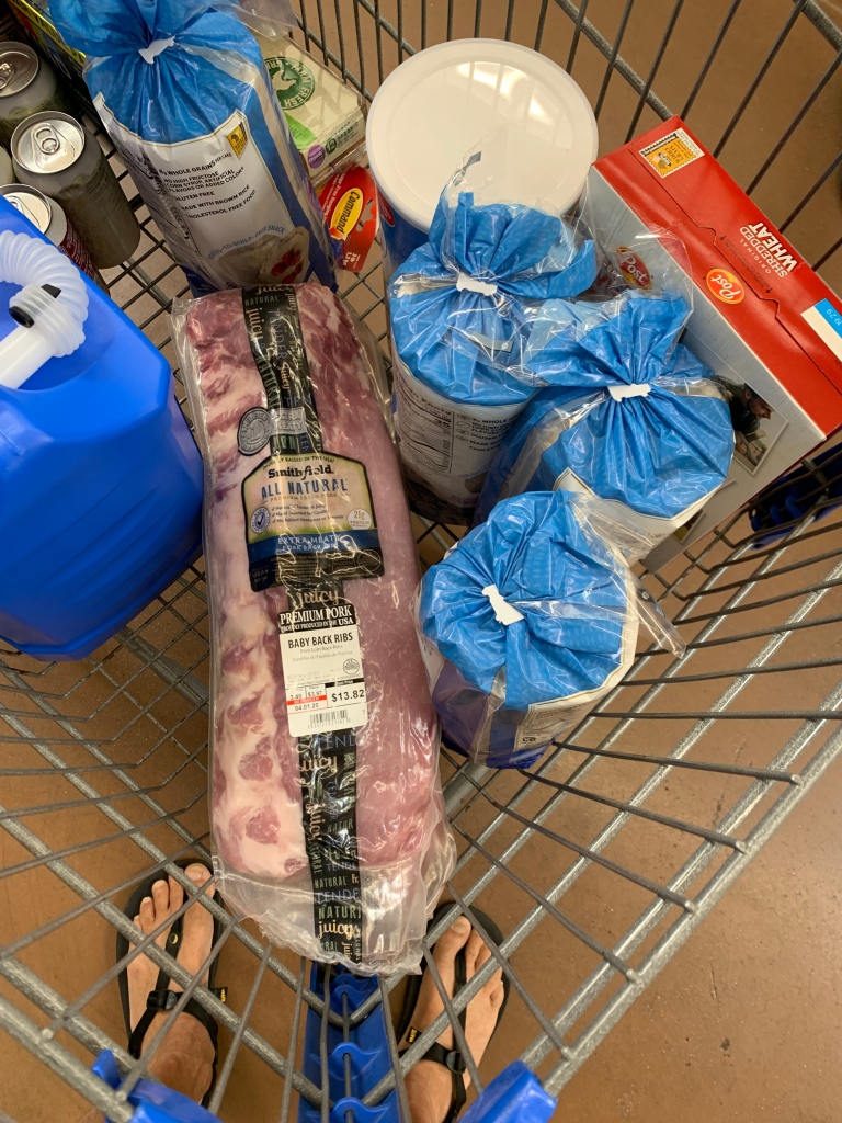
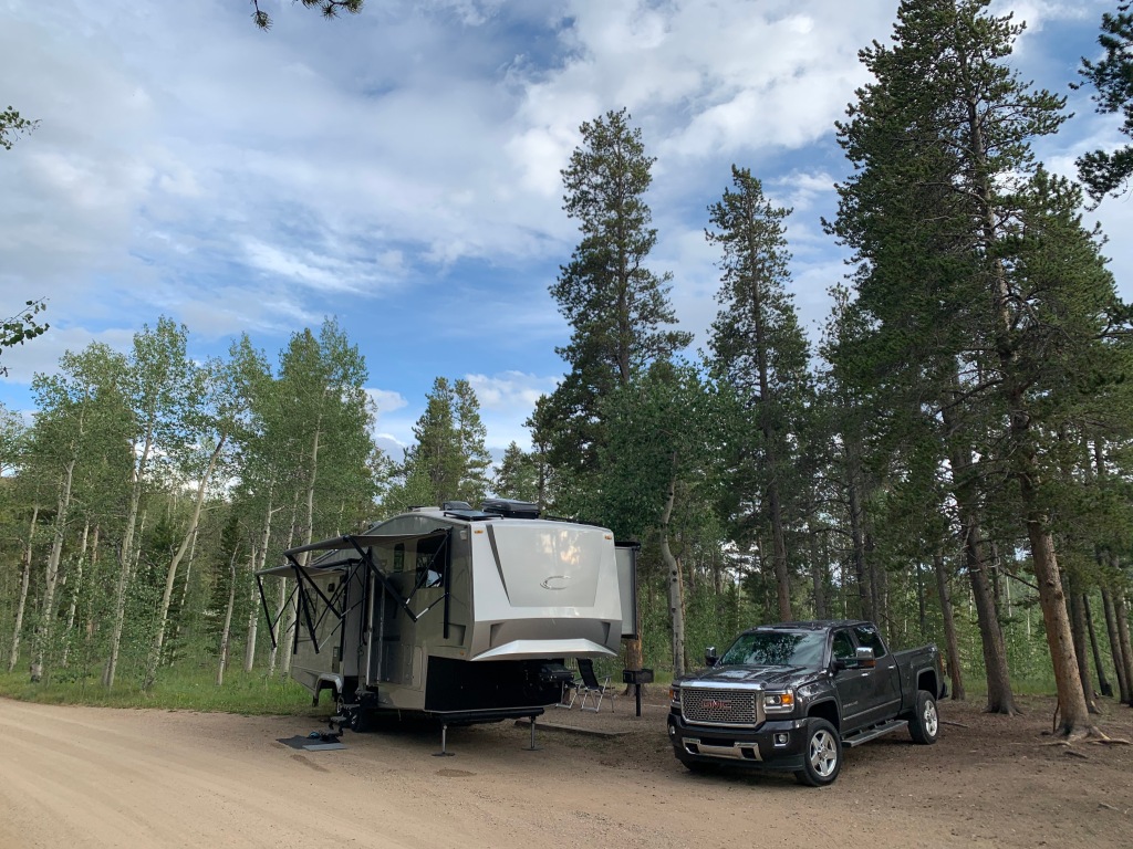
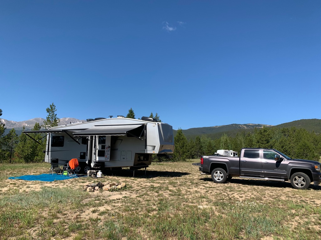
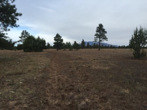
We base camped at Kenosha Pass East campground and commuted back to Denver to start the CT. It was an hour and forty-minute drive to the Waterton Canyon Trailhead to drop Jeff to begin his 16.8-mile trek. I then drove another hour to reach the South Platte River TH, the start of Segment 2 for a distance of 11.5 miles.
It was really exciting to get started and the trails did not disappoint! Within the first couple miles of S1, Jeff noticed another hiker looking up into the hillside. He pointed out bighorn sheep clinging to the rugged rock formations.
The sun was coming up over the mountains casting a warm glow on the trail, which were forestry roads for the first 5 or so miles until it jumped onto single track.
S2 started with low hanging clouds. The trail was cool and damp from the afternoon showers from the day before.
Taking that first step on the trail can be a bit overwhelming, especially since we had been at sea level since October 2019. Last summer we were in Colorado for 3 months and never really felt like we caught our breath at that elevation. Now here we were starting at around 6,000’ and expected to top out at 13,259’ within a month.
But to both of our surprise we handled the elevation with no issues whatsoever. It was as if we had never left! I guess all that humidity training in Arkansas for 4 months somehow helped us acclimate!
It was good to be on the tail!
By the time Jeff was done with Segment 1 and drove the truck around to the finish of Segment 2, I was walking off the trail for a perfectly timed pick up.
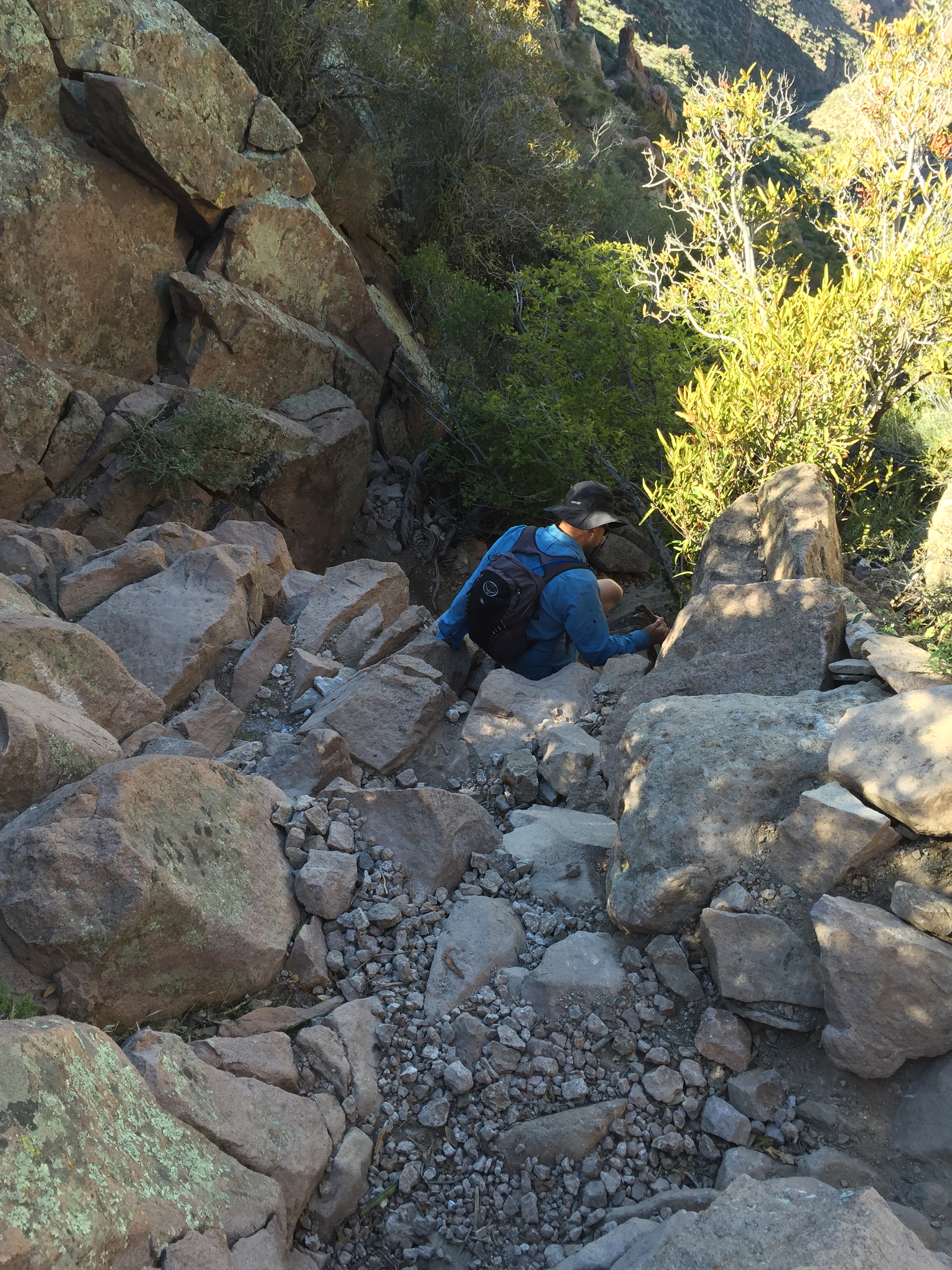
July 26, 2020 CT Segments 3 & 4
The next day we thought we would rest up from our long hikes. But as the morning pushed on we both felt really good and decided to bust out Segments 3 & 4.
S3 left from the Little Scraggy TH for 12.2 miles while S4 was from Wellington Lake Road TH for 16.6 miles.
Since S4 was a longer hike (taking more time) we did these two segments in reverse. I dropped Jeff off at the end of S4 to start hiking while I drove around to the finish of S3 and hiked to where I finished the day before at the end of S2.
By the time I started on the trail it was already late morning and I could already hear thunder off in the distance. So instead of hiking I picked up the pace for some trail running. I could see the line of clouds moving closer, but it appeared I was hovering on the edge of the front with minimal sprinkles of rain.
I have to say this trail was one of my favorite sections. The elevation was mostly a descent from west to east with minimal rollers. It made for an easy and exhilarating run! There were stream crossings and pine needle covered trails. It was well traveled and at times a bit crowded with it being so close to Denver on a weekend.
By the time I finished my segment it was misting and breezy. I was getting text updates from Jeff about terrible Sunday traffic heading back towards Denver. His ETA to pick me up kept getting pushed back further and further. After being sweaty and damp the cool breeze was downright cold and I had to resort to pulling out my emergency blanket to stay warm. An hour after I finished Jeff finally pulled in with the heater blowing.
We drove home in the rain stopping at a restaurant to pick up lunch/dinner. It was a great day!
July 28-29, 2020 CT Segments 5 & 6
Hiking the CT has been easy so far. The trail is marked extremely well. But two tools we used were the Guthook and Gaia Apps for mapping. Also, we signed up on the Colorado Trail Through Hikers and Colorado Segment Hikers Facebook pages.
We were able to get the latest conditions, bear sightings, and water stops for every segment on the CT. And of course, you run into through and segment hikers and bikers every day on the trail.
With all these resources we had to learn a whole new dialogue to understand some of the communication within posts.
NoBo=Northbound
SoBo=Southbound
Zero=A no hiking day
We took a Zero on our third day. While we planned our next segments.
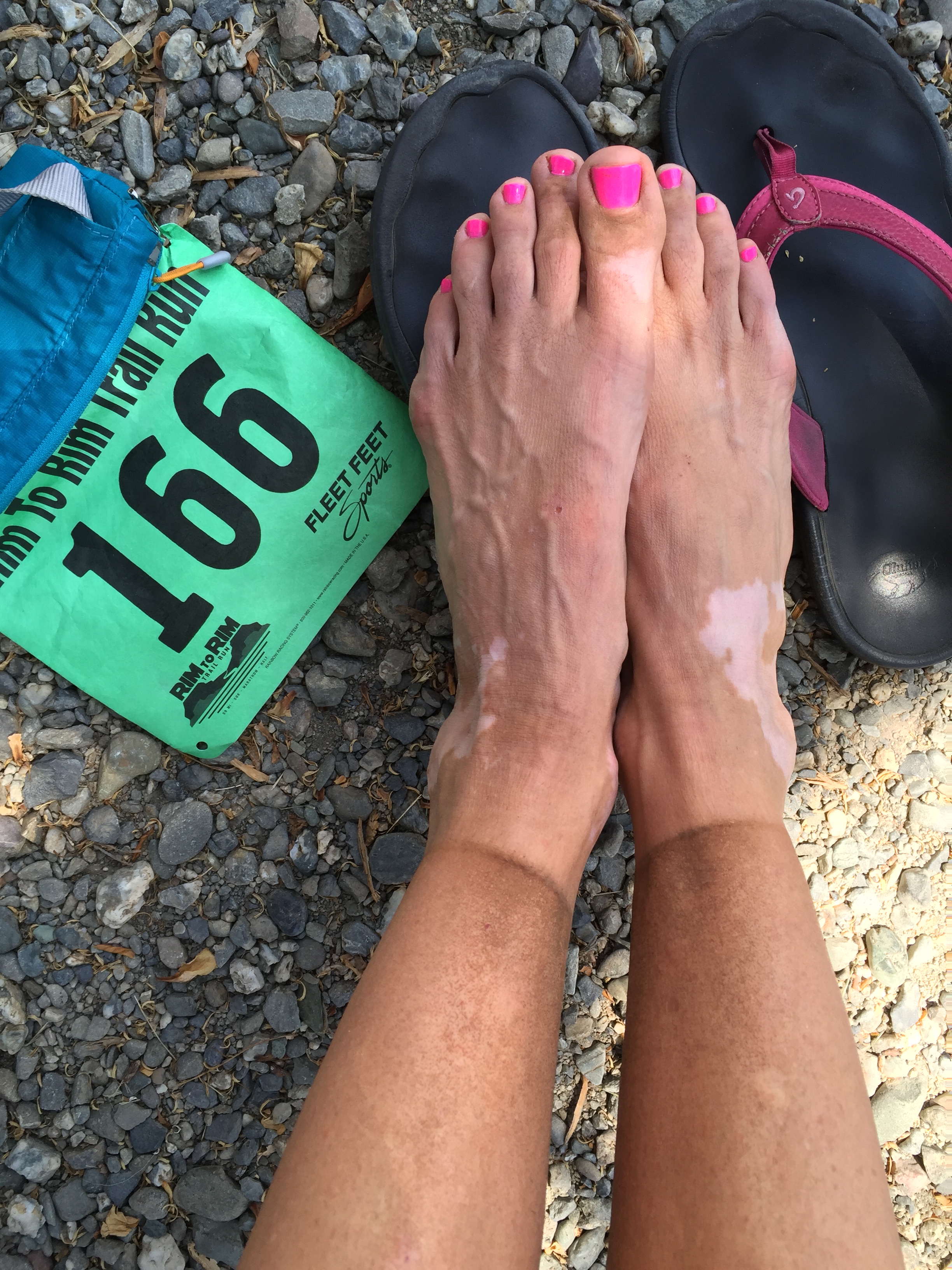
S6 was going to be a long 32.9 segment from Kenosha Pass to Breckenridge. Jeff, being the Ultra runner in the group, decided to cover this segment in one day. This put me covering S5 for 14.6 miles from Long Gulch to Kenosha Pass.
Logistically we could not pull off these two segments of hiking on the same day. So on day four Jeff dropped me off at the S5 TH not too far from our campground. Segment 5 finished right at our campground making for an easy logistics day.
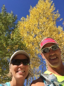
Kenosha Pass was a beautiful trail with only 1,858’ of elevation. It took me through Aspen groves and pretty meadows. I even ran into a few herds of cows. It was nice to see Jeff and Sam at the end of the trail waiting for me.
This put Jeff with two zero days in a row in order to rest up for his 33 miler. Since his pickup location would be Breckenridge and take him about 10 hours, I planned to relocate the RV to our new base camp in Leadville.
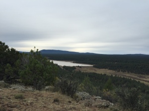
Day 5, Jeff headed out at 5am from S6 TH right from our campsite while I prepared the RV to move. All went smoothly on my trip to Leadville with a quick stop to dump our tanks and refill our water on the RV. I pulled into a favorite boondocking site from last year on the south side of Turquoise Lake.
I had enough time to set up the RV before leaving for Breckenridge to do some grocery shopping at Walmart, grab a burger for Jeff and then pick him up at the finish. The timing was once again perfect for the pick up, but the forecast for 100% sunshine was a bit off. I picked up Jeff in a torrential downpour. Cold and hungry, the triple cheeseburgers, fries and frosty hit the spot!
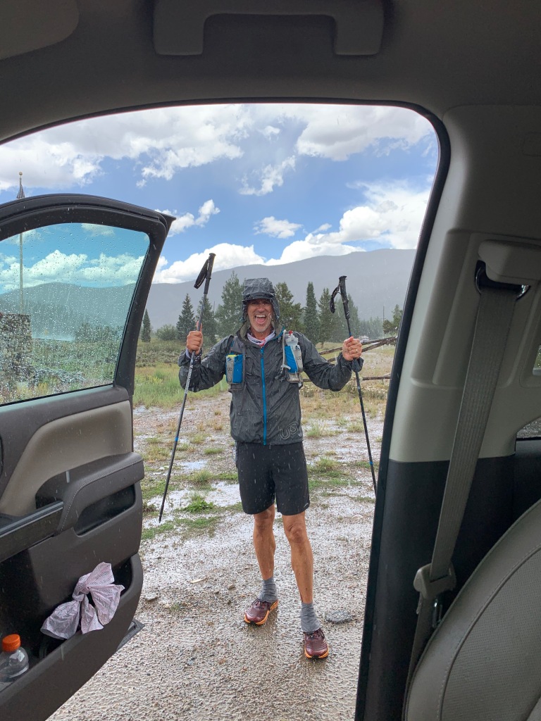
Jeff was beat after 32.9 miles and 5,200’ of elevation.
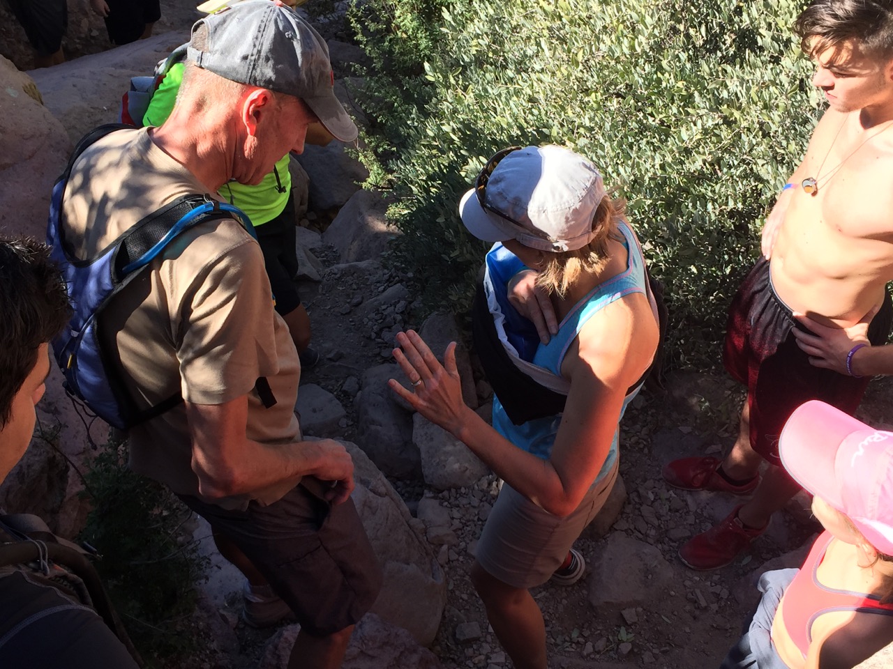
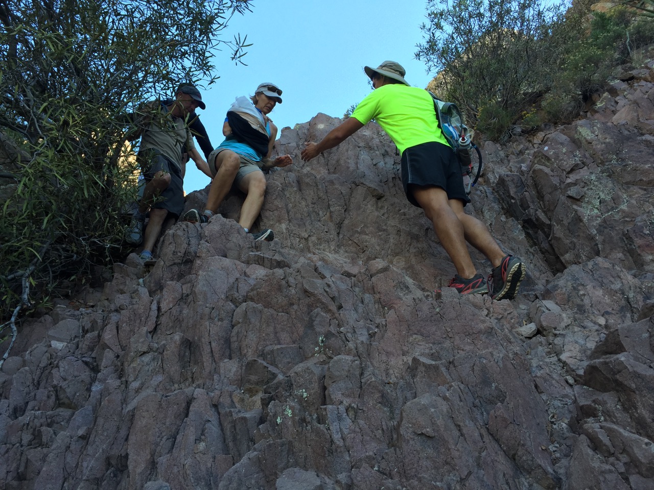
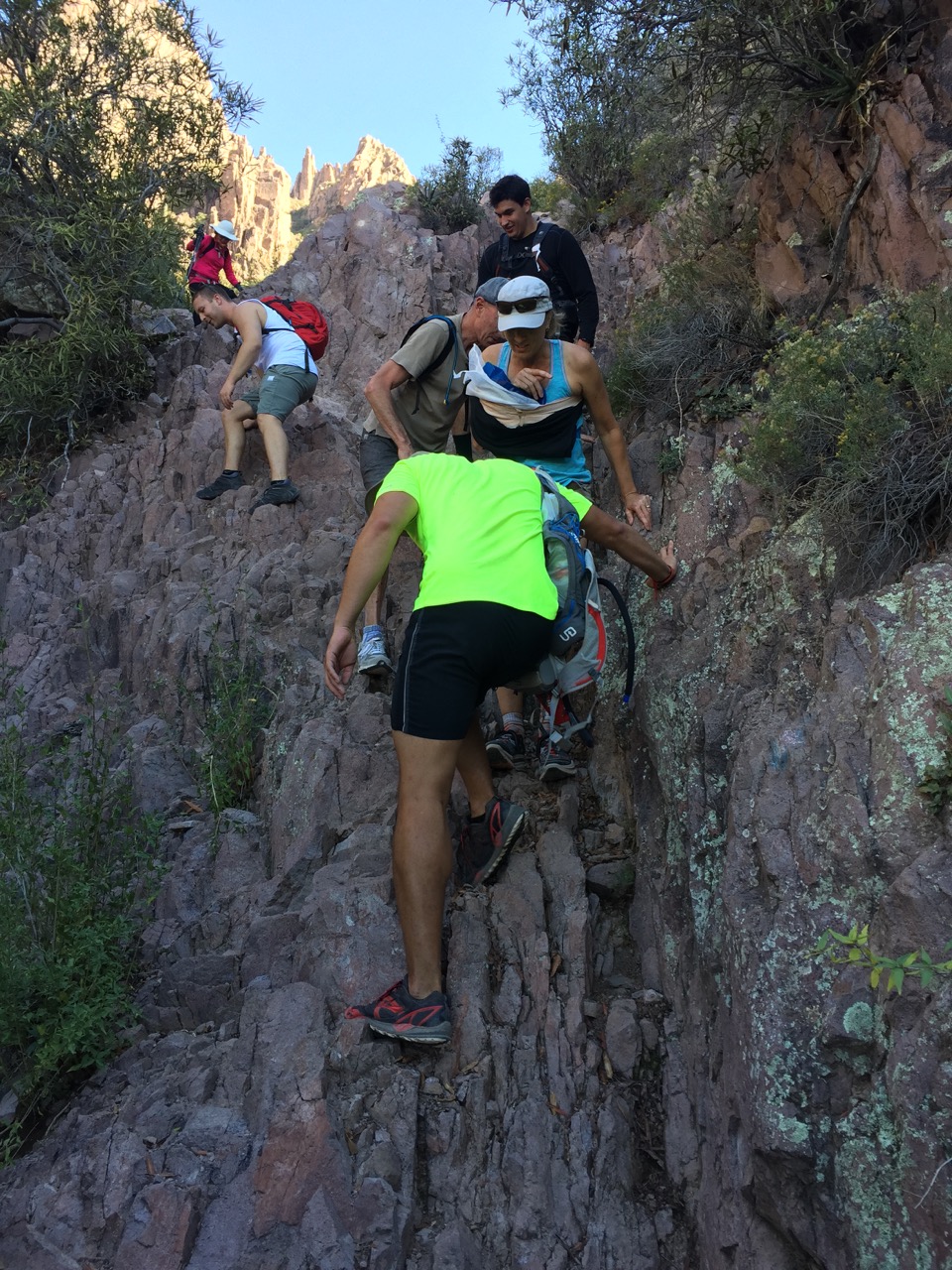
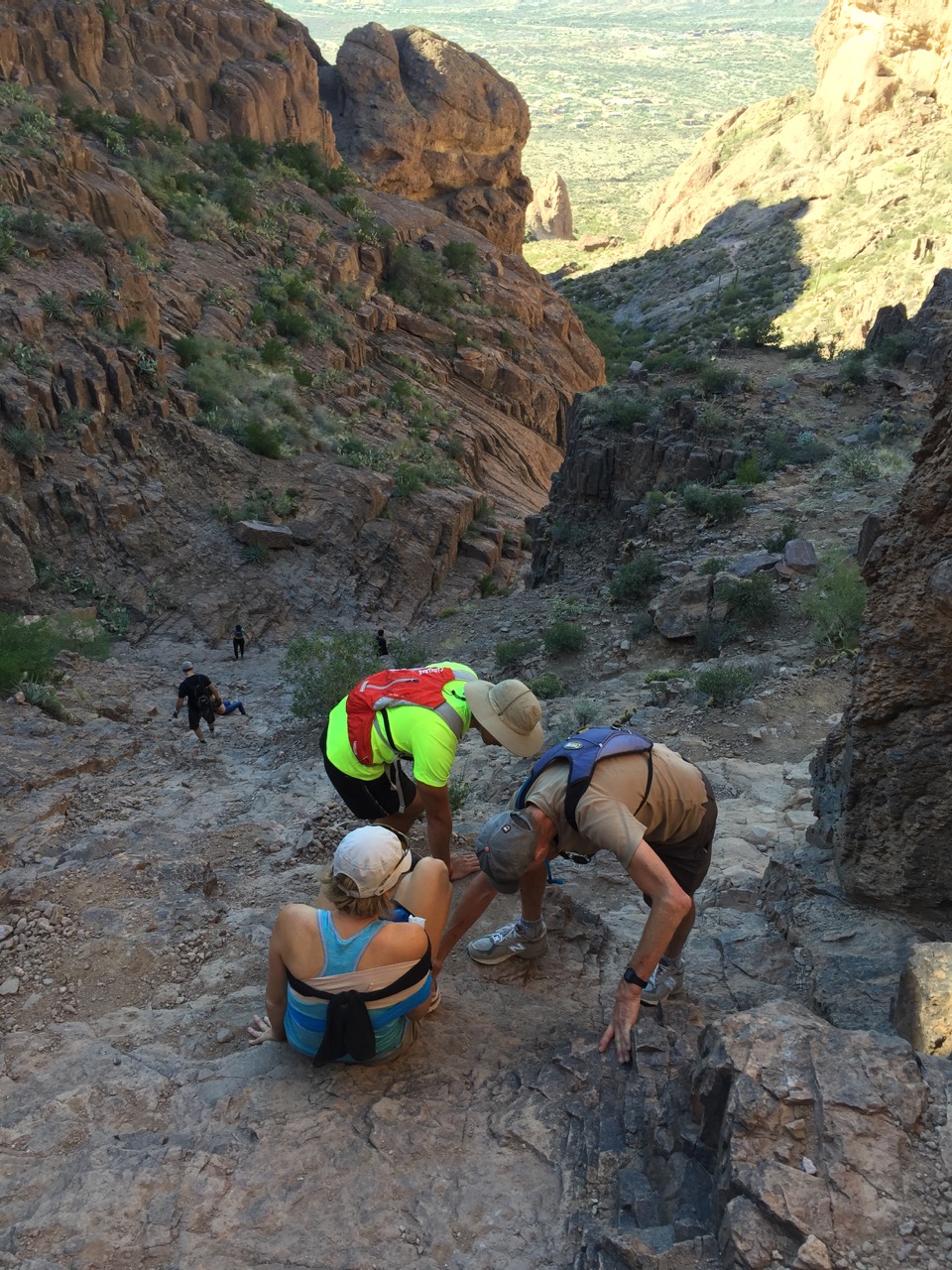
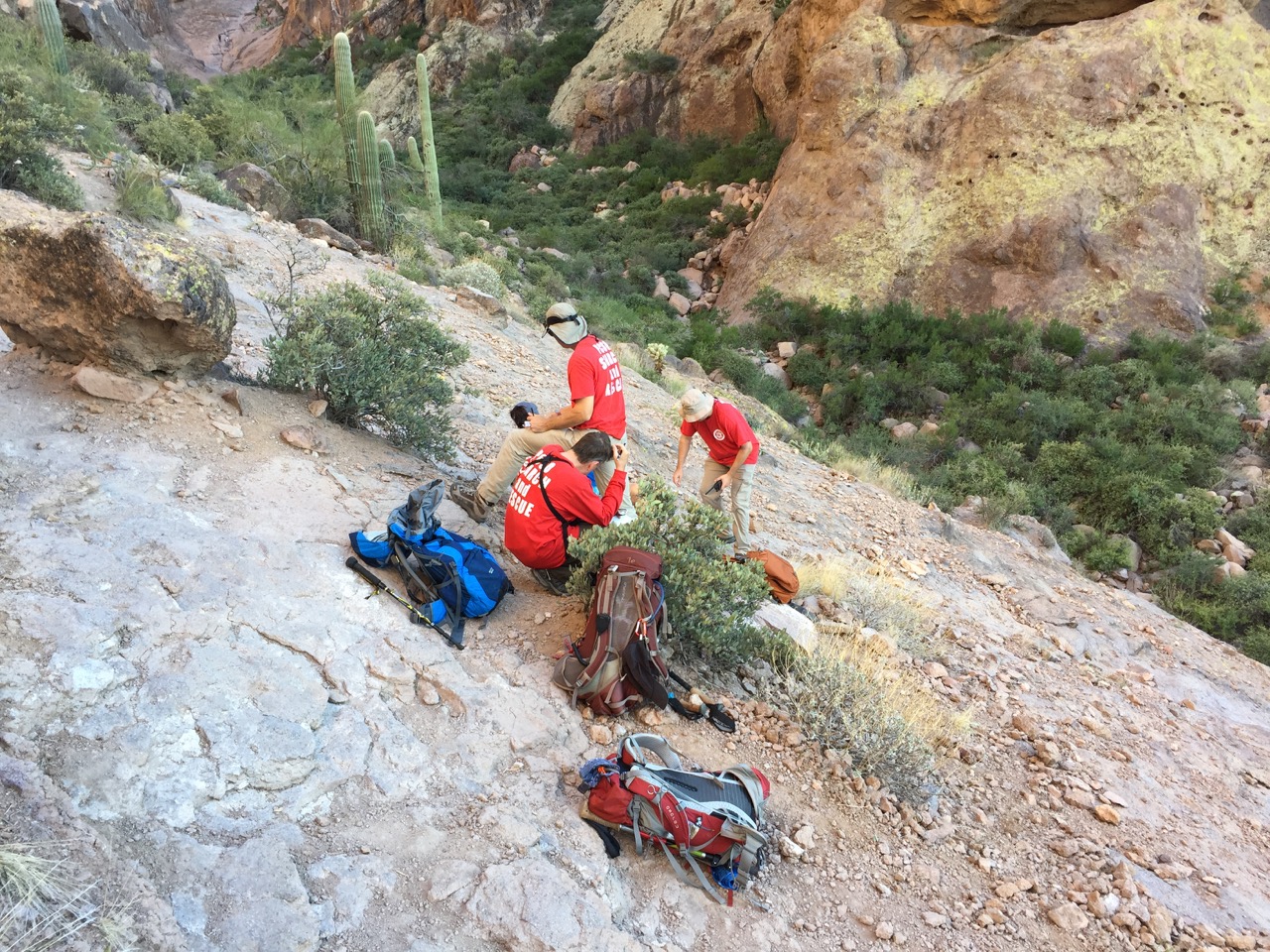
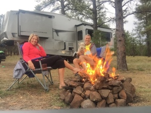
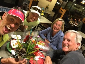
Once back at our Leadville base camp we hung out for a couple of days waiting for our friends Marge and Michael to arrive from Arizona. Marge would be joining the hiking fun for the rest of the CT while Michael would be helping with some pretty complicated Logistics to come.
Stay tuned for Part II
Getting High on Mt. Whitney
Posted by Deb in Boondocking, Bucket List, California, Full Time RV, Highest Peaks, Hiking, Uncategorized on October 3, 2016
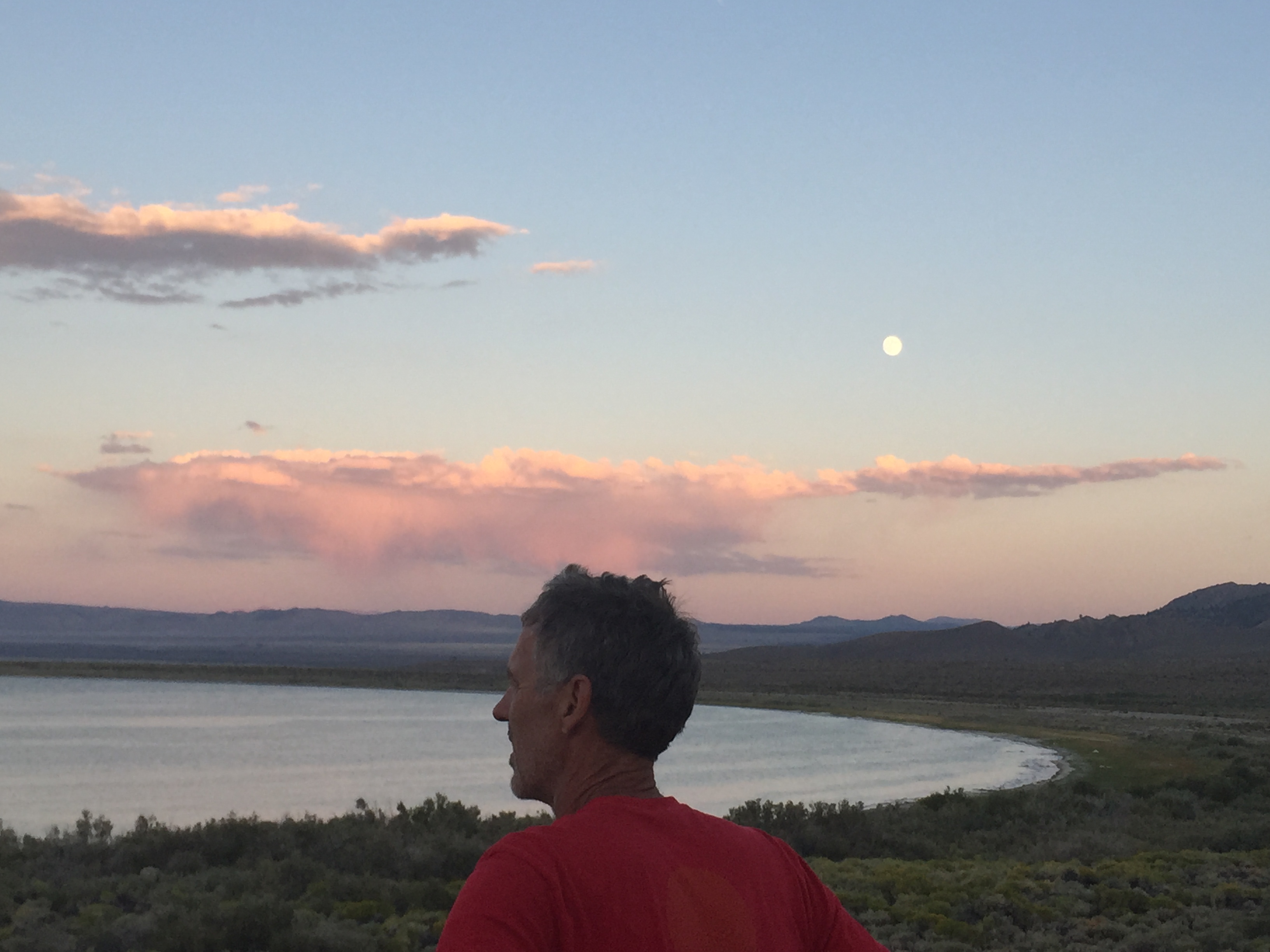
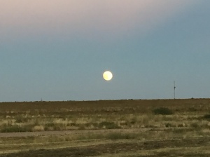
Full moon rising over Mono Lake
After leaving Seattle we had three weeks to make our way to Phoenix. Our working travel schedule gave us a deadline and unfortunately we were headed into the belly of the hot molten volcano in the middle of summer. 106 degrees here we come!
We made quick stops in Eugene and Ashland, Oregon, Redding, CA and Reno, Nevada on our way to Mono Lake, CA.
I had read about some great boondocking at Mono Lake on the eastern side of Yosemite. This really would be our last stop at any elevation (6,378’) in order to avoid the southwest heat. Also, when we were in Yosemite in May, we never made it to Tioga Pass. So stopping at Mono Lake would give us that opportunity.
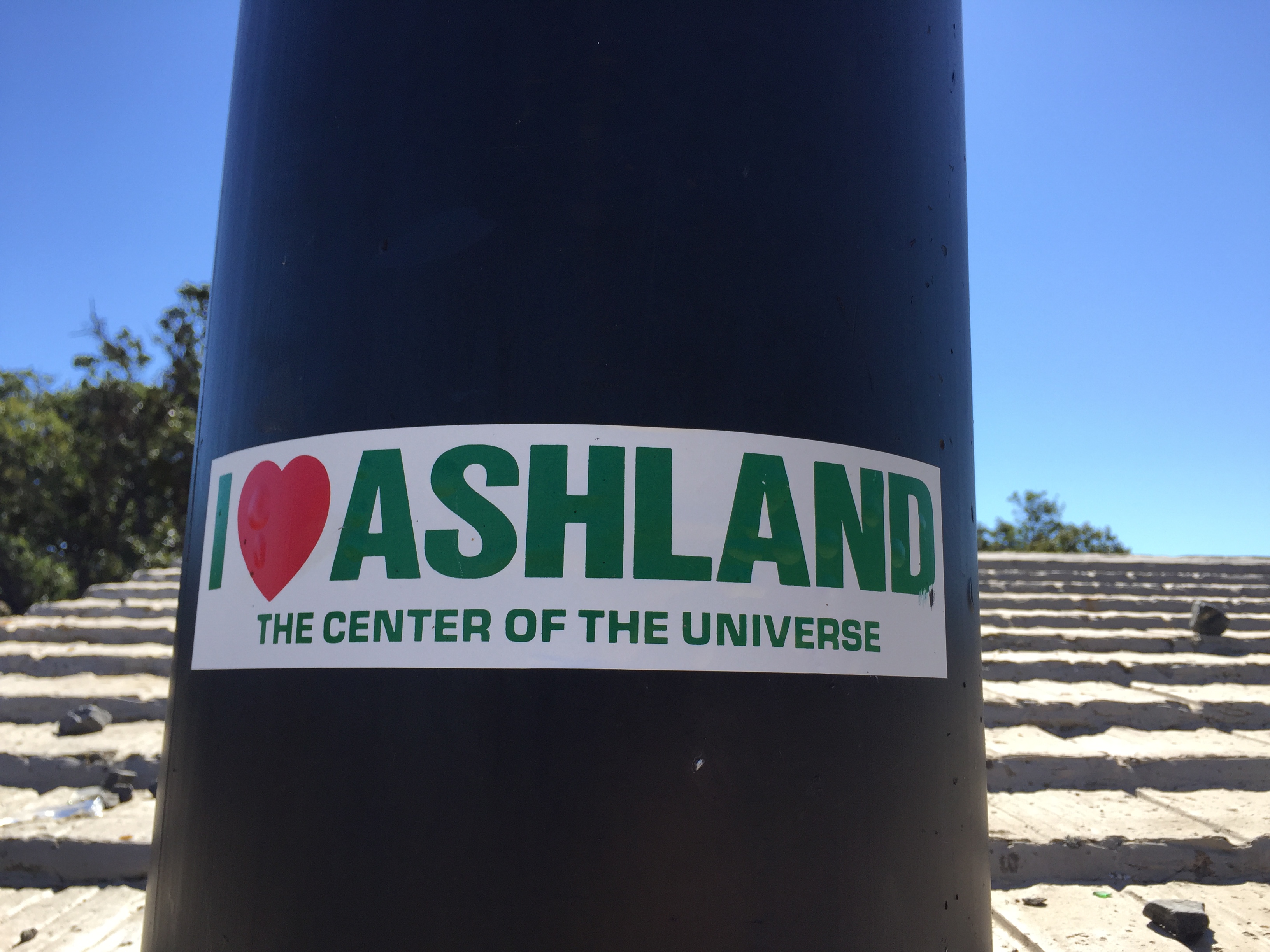
Quick stopover in Ashland, OR
Well, that was the plan anyway…
Last year about this time, Jeff asked me a question about doing something epic, challenging or scary and I blurted out that I would like to hike the highest peaks in each state. A week later I had bagged my first…Mt. Humphreys in Flagstaff, AZ. at 12,633ft.
Ever since then I have been researching the highest peak of each state that we traveled in 2016. Unfortunately, we have been traveling the states with the highest peaks overall that have been snow covered and required ice axes, crampons, repelling equipment, permits, guides, tents, backpacks, etc. MUCH more equipment than what we have.
So when I read about hiking California’s massive Mt. Whitney at 14,505ft, the highest peak in the contiguous US and it’s accessibility in late summer, I knew California was an attainable peak.
And look. It just happens to be down the road from Mono Lake! Change of plans…we are hiking Mt. Whitney!
Getting an early start…just not early enough!
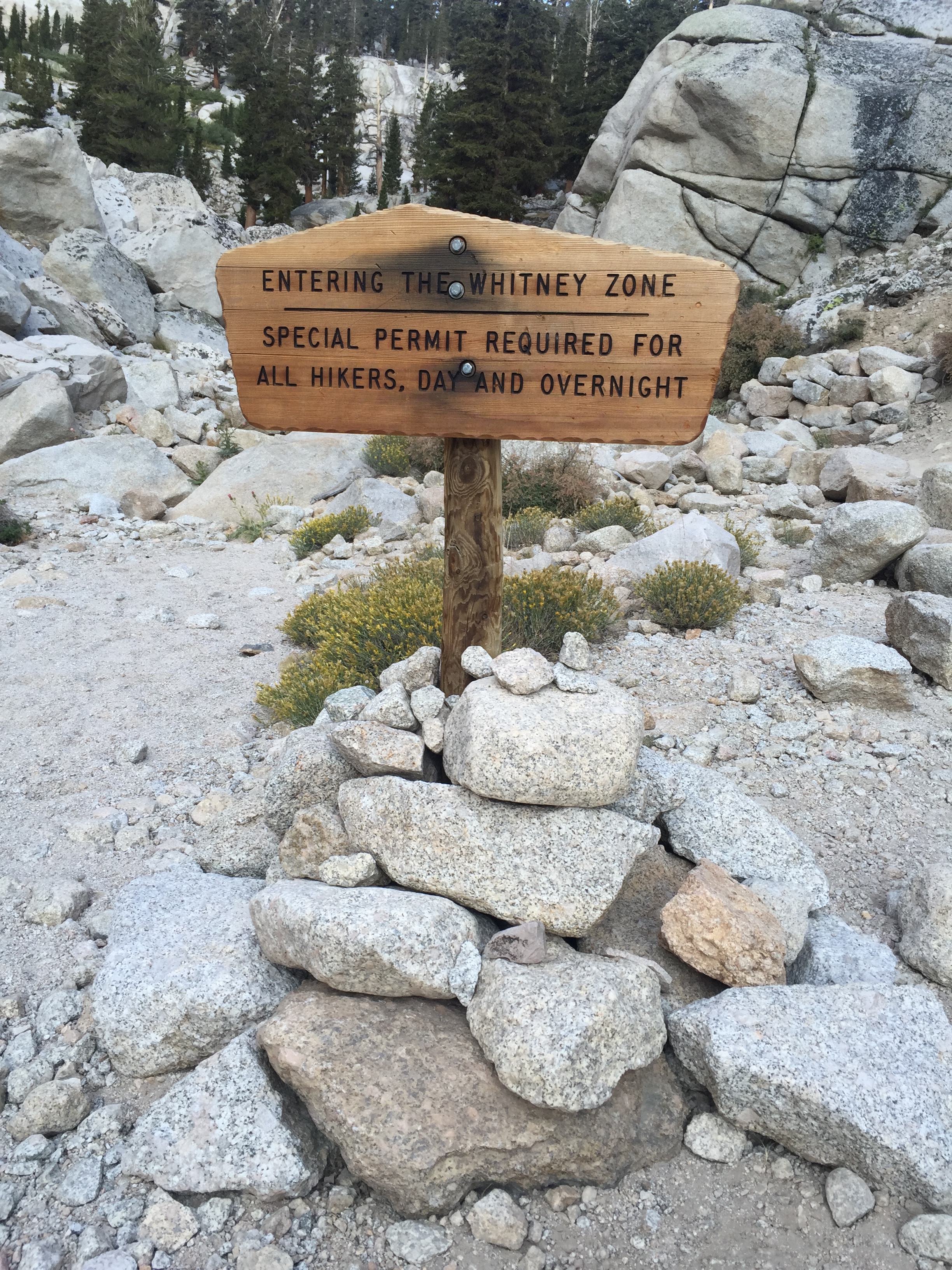
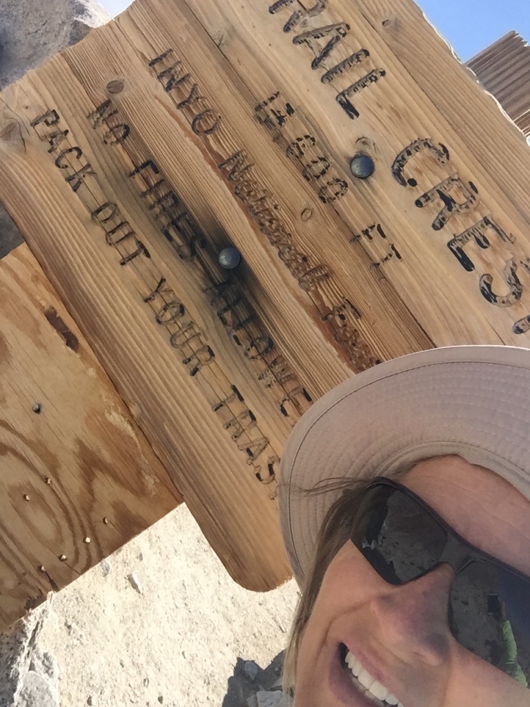
The Mt. Whitney Trail Head starts at Whitney Portal at 8,360ft via the small town of Lone Pine, CA. A permit is required for this hike and the online permit system said that there were no permits available. Learning from our experience at Yosemite we stopped in at the Forest Service center just south of Lone Pine and easily picked up a permit and mandatory “WAG Bag” (Waste Alleviation and Gelling-Bag) for the next day.
Everything I read about this hike said that this VERY STRENUOUS hike could be bagged in one very long day (12-18 hours), although most people take two. Its 22 miles round trip with 6,100ft of elevation gain, topping out at 14,505ft.
Since Jeff and I had spent the better part of the past month at Sea Level, we knew that this was going to be quite a challenge in elevation and distance. One I was not completely confident in completing. But I knew that what goes up must come down and I could turn around at any point in the hike if it got to be too much for this land lubber.
Walk this way!
The morning of our hike we got off to a late start, leaving the Whitney Portal TH at 6:30AM instead of our planned 5AM. Apparently we didn’t do enough research because most hikers leave around 1-3AM for this hike. For me, this was mistake #1!
Jeff tends to futz with his equipment, shoes, GPS and phone A LOT longer than I have patience for (sigh) and I headed off on the trail to get a jump. Jeff hikes much faster than I and I knew it wouldn’t take long before he would catch up with me.
What is really hilarious now is that Jeff had read that some folks were getting Verizon Cell coverage on the top of Mt Whitney, so his plan was to get to the top by 10AM for a conference call.
GEEZ! WHAT ON EARTH WERE WE THINKING?!?
I started at the TH and quickly passed the 6-10 informational boards that described the tenacity needed for such a hike. No need to read those of course…we have a conference call to make!
Immediately the trail started with a moderate incline. The sun was up just enough that no headlamp was needed and I made mistake #2 by leaving it in the truck. After an hour on the trail there was a beautiful sunrise that was enhanced by the smoke from the San Bernardino fires that were burning out of control at the time.
Lone Pine Lake
After about 3 miles I reached Lone Pine Lake. At this point Jeff still had not caught up with me and I grew a bit concerned. Come to find out he took a wrong turn at the beginning of the trail and got on the rugged Mountaineer’s route to Mt. Whitney. He noticed his mistake after about a ½ mile and turned around. That does tend to happen when you hike and post selfies on facebook at the same time!
Jeff finally caught up with me and it was clear that it was going to be a challenge to get to the top before the 10AM conference call. So I sent him ahead to try and make it without me holding him back…with our water filter. Mistake #3 (at least for me).
After Lone Pine Lake the nice smooth trail quickly changed over to a rockier surface. Footing became a bit more of a challenge as trees thinned out. I passed Outpost Camp with its gorgeous waterfall at a little over 10,000ft. There were a lot of backpackers here stopping to acclimatize on their 2-3 day summit push.
“Gee…Maybe I aught to look into some overnight equipment, scratching my head!
I hit a long patch of switchbacks after Outpost Camp.
In my quick glance lengthy research of this hike I remembered reading about a section of the trail called “the 99 switchbacks” that came after a campground.
The trail turns rugged
I got pretty excited because I new that the 99 were around mile 7. “Wow, I’m making great time”! I asked a fellow hiker coming down if I was on the infamous 99. Imagine my surprise when she told me, “ Oh no. You have quite a way to go before you get to the 99”.
About this time I saw a trail marker that said Mile 4! I. WAS. CRUSHED!
By now my heart had been pounding in my ears for almost 3 hours. The elevation had reduced my hiking to 45min miles. THIS WAS GOING TO BE A LOOOONG DAY.
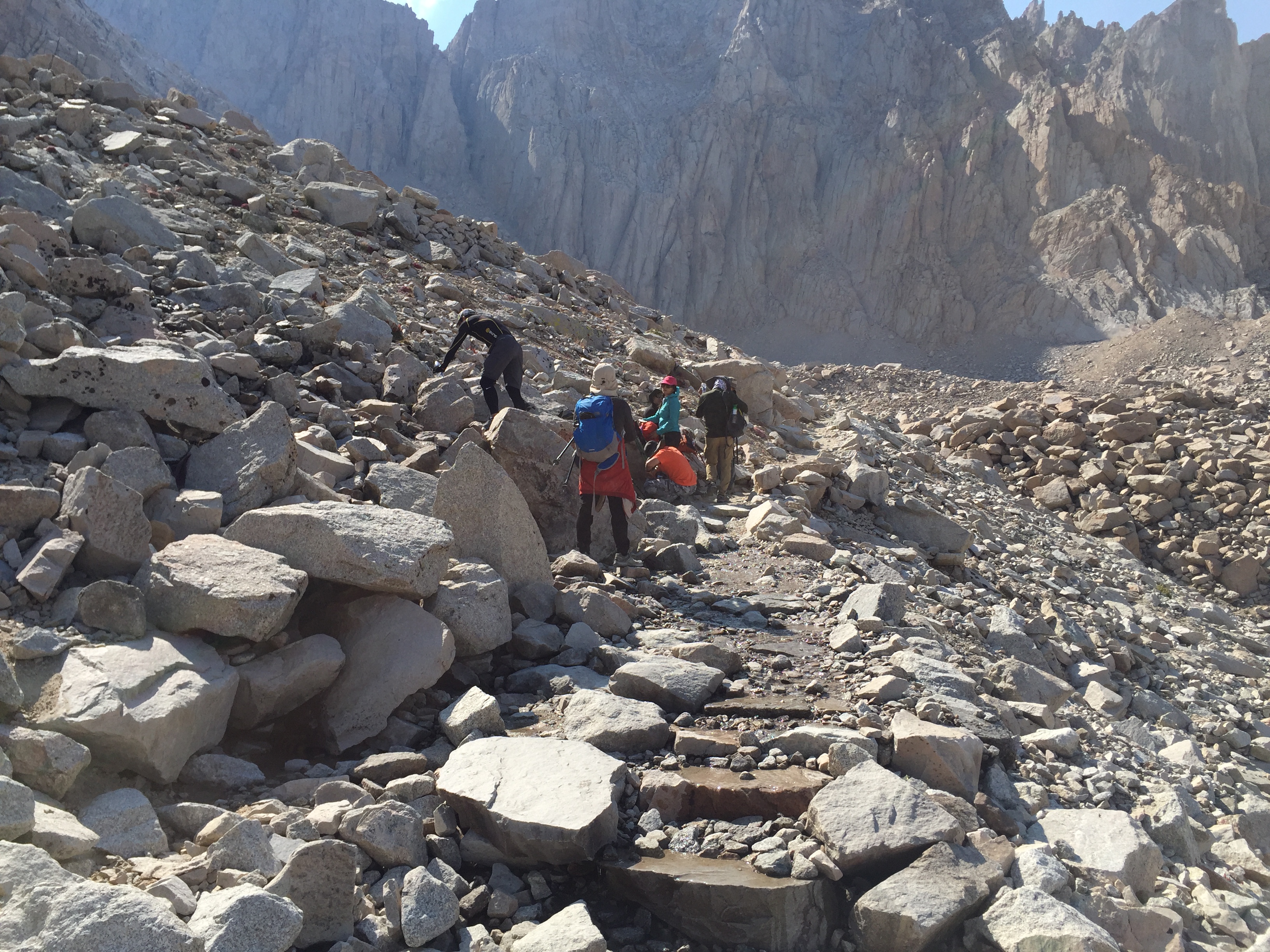
The trail switched from dirt and rocks to granite stair steps. I rose high above pretty Mirror Lake and Meadow. After another 1 ½-2 hours I finally reached Trail Camp at 12,039’.
Trail Camp is located on the shore of Consultation Lake. It could have been on the moon as far as I was concerned due to its barren landscape and granite spires. The camp was full of backpackers as well and by now I’m thinking these people are geniuses for breaking this hike up into several days!
I stopped here for a snack and contemplated the 99 switchbacks that were now staring me in the face. That’s 2.2 miles of switchbacks climbing 1,738’ to Trail Crest. I’m not going to lie…I thought long and hard about stopping here and just calling it a day. But after eating some food and catching my breath I decided to give the 99 a shot.
Surprisingly, the switchbacks were set at a low grade, which was much appreciated at this altitude. After what seemed like 999 switchbacks I finally rounded a corner and was hit with an amazing view to the west. Granite rising up, alpine forests and lakes below. My eyes had trouble taking it all in. I get teary-eyed just thinking about it now.
Reaching Trail Crest at 13,600′
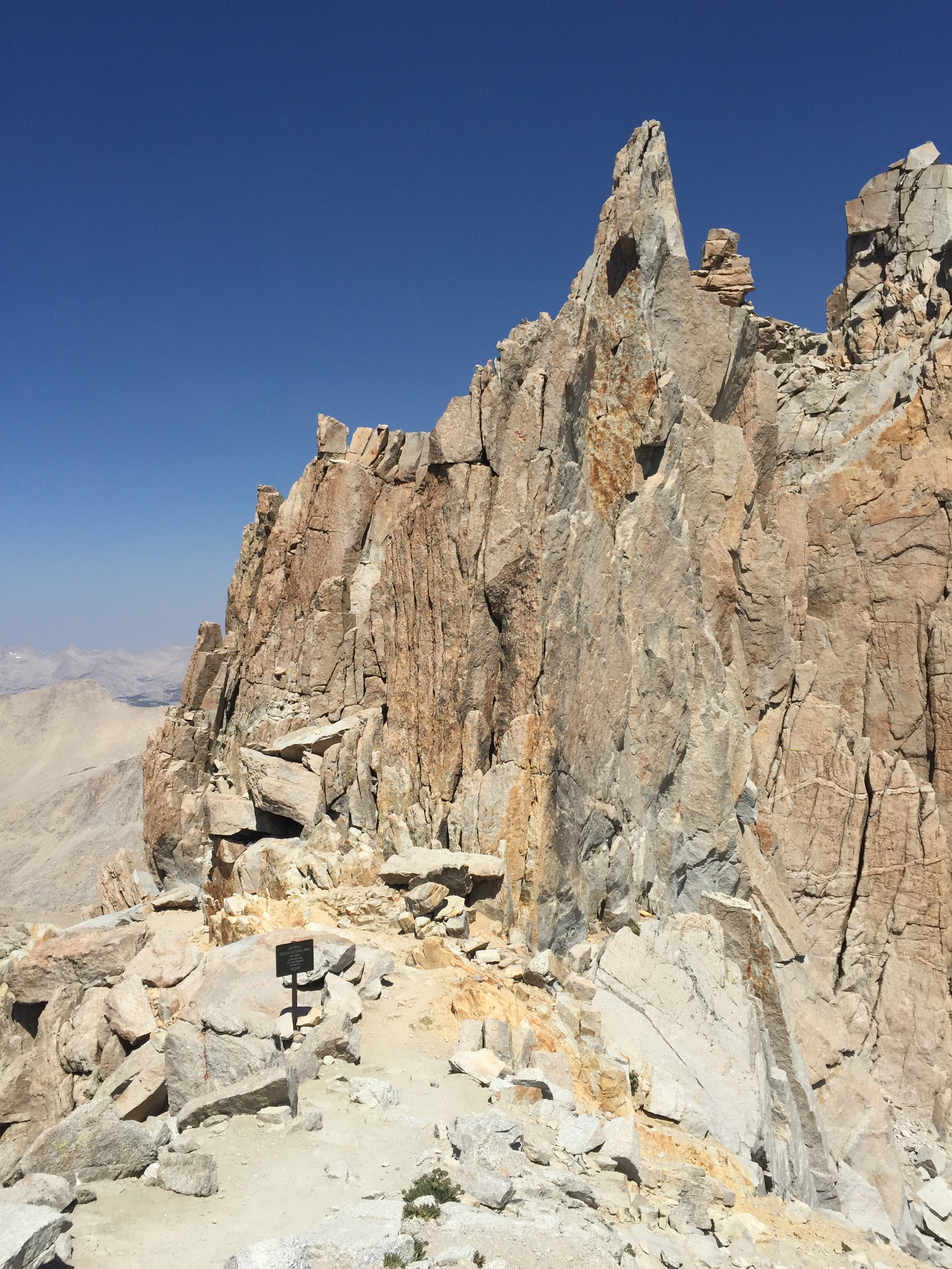
What’s around that granite spire?
I made it to Trail Crest at 13, 800’!
The Mt. Whitney summit is 2.5 miles from here and a mere 845’ of elevation. But these are the most difficult and most draining 2.5 miles of your life…so I’ve heard.
Once I reached Trail Crest I was for sure going to turn around. But after I sat for about 20 minutes and ate some food and got inspired by the beautiful views I started wondering what was just around the corner.
The trail from here took a dip and I really thought hard about having to make up the elevation I had already climbed. But the trail drew me in and I pressed on, “just a little further”.
The trail from Trail Crest is brutal. BRU.TAL!!!
The trail is in there somewhere
I scrambled for the next mile over unstable rocks, angular slabs, shear drops and technical boulders. After an hour I sat down for a break and saw the Smithsonian hut on the summit off in the distance. By now I was exhausted. The narrow single track trail was closing in. I was having moments of panic as my mind flashed back to my broken wrist less than a year ago.
I asked another hiker how much longer until the summit. When they responded, “about 2 hours” I was finished!
By now it was 12:30pm. I had been hiking 6 hours with 2 more hours to go. I did the math and figured it would take me 4 hours just to get back to this point on the trail. My heart sank realizing I was going to run out of water and day-light, without a filter that was with Jeff and headlamp that was securely back in the truck.
It killed me to be this close and have to call the hike. Just 1.5 miles left to the summit. For me, it had to be over!
Jeff perseveres! Highest point in the lower 48!
About this time I met Esther. She was making her way back down the mountain after summiting. Wisely, she had left with her husband at 3am.
They had started this hike a few days before, but her husband Joe wasn’t feeling well and they turned around. This morning they started off at 3am again and again Joe didn’t feel well. He encouraged his wife to carry on so that one of them would make it. And that she did!
We started hiking together from here, retracing the technical trail back to Trail Crest. We both moaned at the section where we had to climb in elevation to get there, commenting about our pounding heads.
Down the 99 we went, past camps, meadow, lakes and waterfalls. All the while talking about our lives of adventure and travel. I learned about her amazing two daughters and could hear the affection she had for her husband of many years.
Second half of the battle is getting back down!
Our knees and quads were wearing down, but our time together made the trip so much better. I learned she and Joe take off their real estate business months at a time to travel. Check out their very well written blog here.
We arrived at the TH not a step too soon at 5:30pm, as the sun was going down. I got to meet Joe and instantly noticed they have a relationship like Jeff and I. Those rare relationships when a husband and wife actually like each other, have the same life pursuits and miss each other when we are not together. I can appreciate a happy couple!
I had gotten a text from Jeff that said that he had summited around 2pm, four hours after his missed conference call.
Joe and Esther were kind enough to give me a ride back to my RV Park in Lone Pine, knowing that Jeff would not be down for another 3 hours. I left the keys hidden in the truck so he could drive himself home.
Even though I missed reaching the summit I couldn’t be more proud for reaching 13,000+ feet and hiking 20 miles.
Thanks Esther for getting me down that mountain!
Mt. Whitney, I will be back! But next time I will leave earlier and not plan on making any calls!
Westerly view from Trail Crest 13,600′
Running on Sunshine
Posted by Deb in Uncategorized on August 21, 2016
Welcome to Chico, CA
I am here again playing catch-up with my blog posts so hold on to your wigs while I do a quick recap of our stays since our skydiving adventure in Lodi CA.
Chico, CA
Jeff and I had signed up for the Rim2Rim Ultra 50K (Jeff) and Half Marathon (Deb) at Upper Tidwell Park.
I made reservations at the Almond Tree RV Park just 6 miles from the event. This was a small but very nice RV park with a beautiful pool and shower facilities. Long term residence are not allowed (except camp hosts) and the pride of ownership really showed here. It was just off of Hwy 99 and couldn’t have been more perfect for our needs.
Nice pool all to myself at the Almond Tree RV Park
Jeff and I hadn’t run a race since mudageddon in Zion. We were looking forward to dry conditions and for Jeff, a chance at redemption after his Zion DNF!
The Chico Rim2Rim is held at Bidwell Park, a municipal park on the western edge of Chico. Annie Bidwell donated 2,500 acres to the city of Chico in 1905. The city purchased additional land in 1922 and 1995 making Bidwell the third largest municipal park in California and one of the 25 largest parks in the US. At 3,670 acres, Bidwell Park is a lot of hiking, biking and trail running goodness.
Ankle turner of a trail
Jeff redeems himself at the 50K finish
Hot and dry conditions
NOTHING feels better than kicking off your shoes after a long race!
Our race started out as nice powdery double track trail but quickly turned into lava rocks, boulders and roots that were a challenge for the strongest of ankles. After the first half mile I was hoping that the trail would smooth over, but it never did. This was a 13.1-mile exercise in concentration for sure and I ended up walking a lot more than I had planned. Overall it was a great race in a beautiful park.
Oh ya! Jeff did redeemed himself and finished his 50K. By the time he was done it was very hot and he completed his race by soaking in the river.
Redding, CA
Though Jeff grew up in Sacramento he spent his summers in Red Bluff on his grandparents walnut orchard. He has so many fond memories of this area. My hubby is very mechanically inclined due in part to his time spent with his Granddad in the orchard. Fixing tractors, moving irrigation pipes and learning how to graft trees was the norm for the day, teaching Jeff to be a well-rounded guy. I LOVE how handy he is!
We driveway surfed at Jeff’s sisters house right next to her perfectly ripe blueberry field. The first day we were there we ate so many blueberries that I had a bellyache!
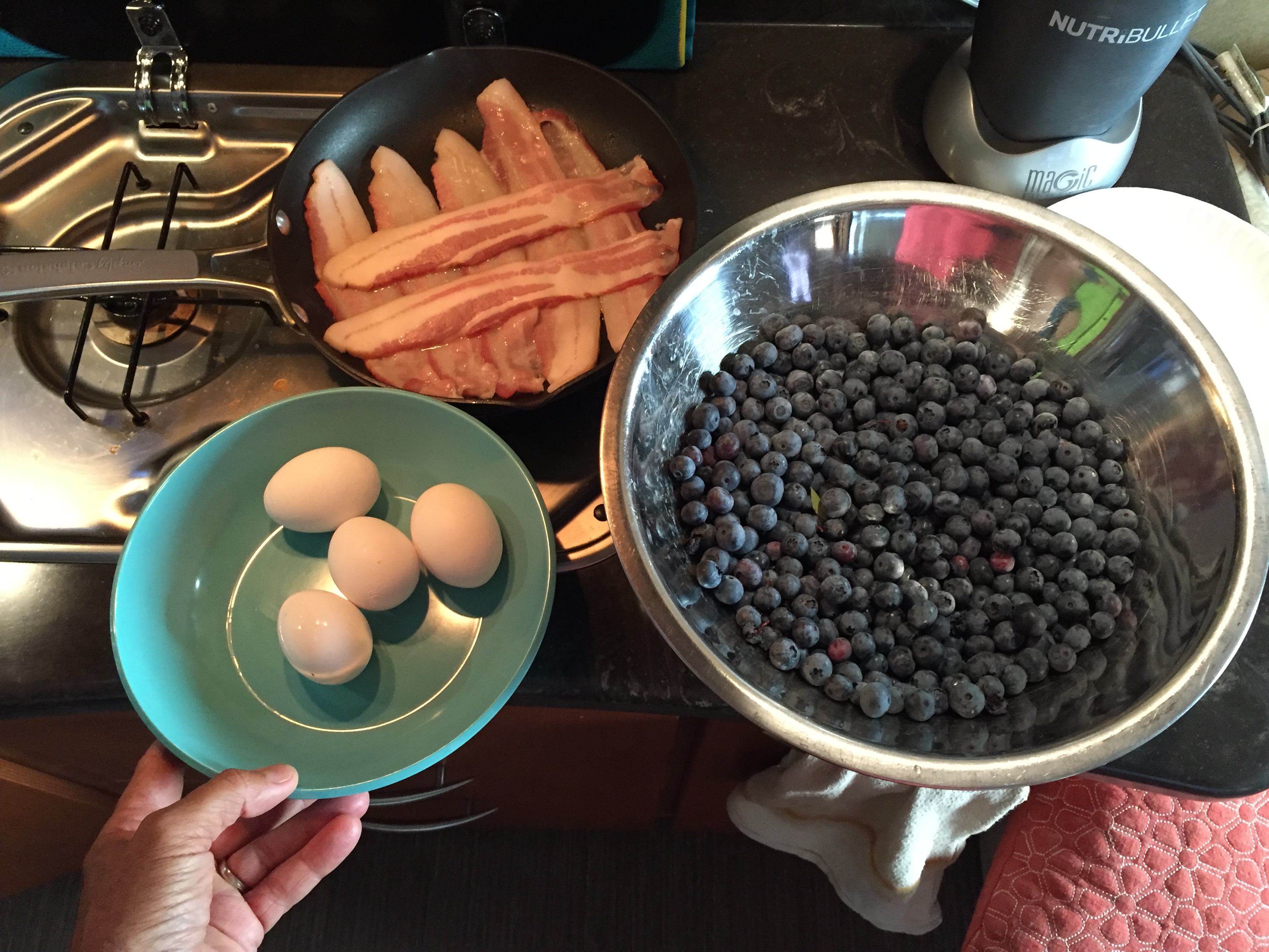
Fresh blueberries, eggs and home grown bacon! YUM!!!
We were having such a nice time with the family that we extended our stay to two weeks. We saw nieces and nephews and their children, cousins and Auntie Bon.
While in Redding we made a day trip to Lassen Volcanic National Park. We learned a new summer travel strategy…go to the lesser known National Parks during the summer to avoid the crowds!
Lassen was beautiful; snow covered and practically void of people and our intent was to hike to the summit of Mt. Lassen. But the trails were closed due to snow pack. Jeff and I decided to hike Lower Twin Lake instead which passed Summit Lake, Echo Lake and Upper Twin Lake as well. This was a wonderful 9-10 mile hike with water views and creek crossings.
Snow coverage is still deep in June at Mt. Lassen
Pretty Alpine Lakes
Exploring the lava tubes at Mt. Lassen…The Subway
While we were in Redding the Western States 100 Trail Run was going on. This is a brutal 100 mile trail run from Lake Tahoe to Auburn CA. Jeff had a couple of friends from Arkansas that were either running it or crewing for it. So he took an overnight trip to join the crews.
Interestingly, the runner who was in first for majority of the race and on course to kill the record got swept away by strong currents on a river crossing. He rescued himself and burned up a lot of energy doing it, but still maintained his lead. But with 5 miles left in the race he took a wrong turn and ended up 2 miles off course. By then he was spent and couldn’t recover and lost the race to another runner.
Jeff is planning his first 100-mile race at the Javelina Jundred later this year, so the experience was great training for what’s to come.
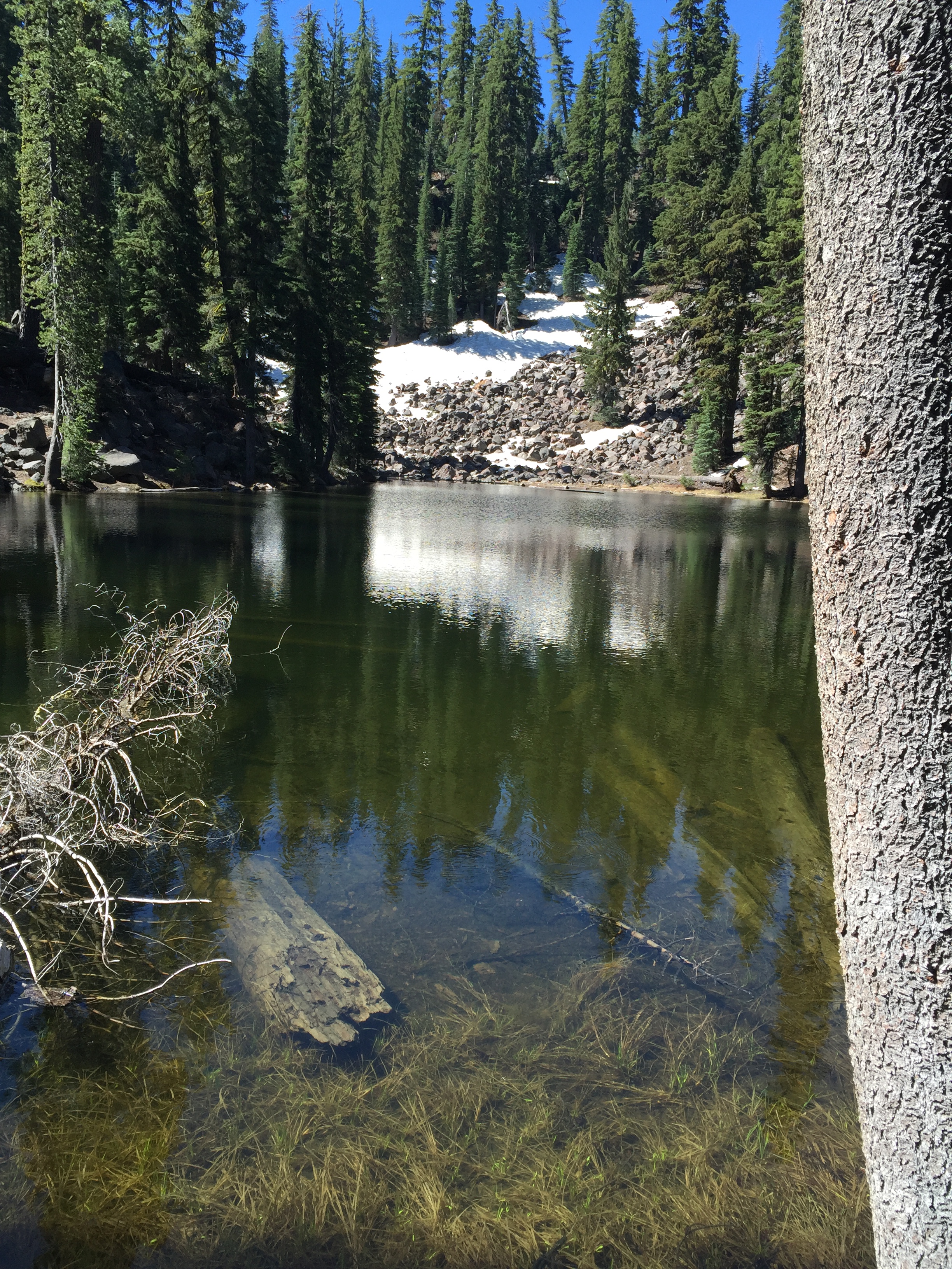
Crater Lake National Park
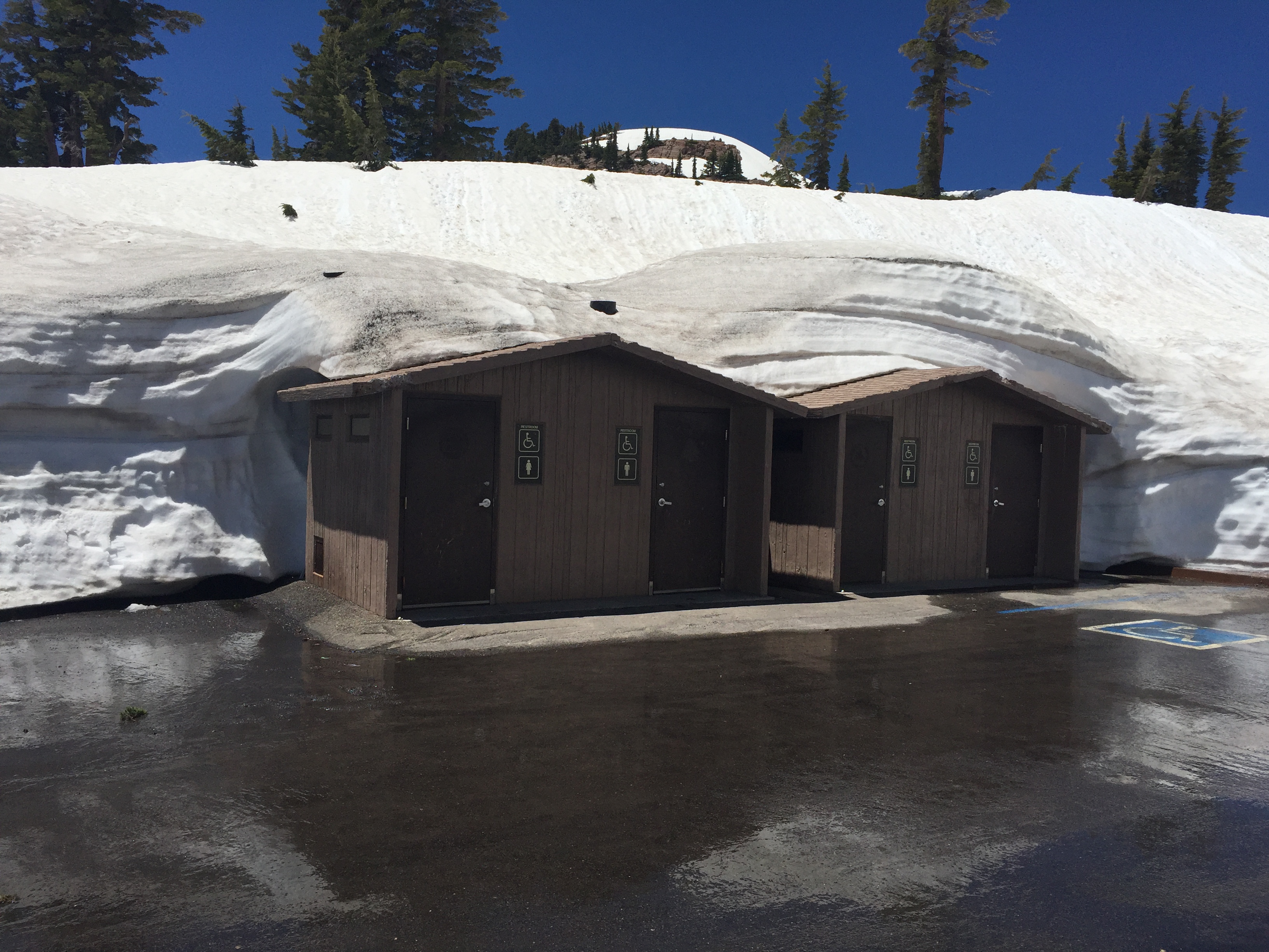
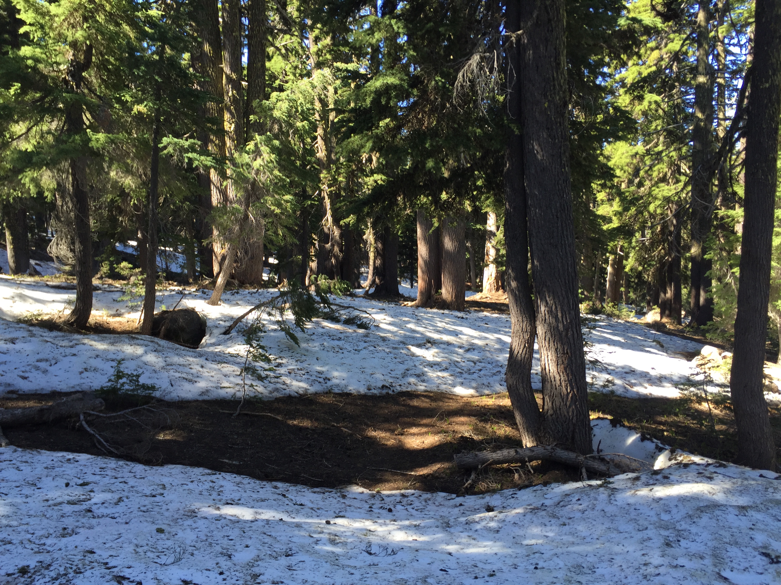
We had planned to stay at Crater Lake about a week, but since we extended our time in Redding we only stayed 3 nights at the Mazama Campground. In the end it ended up being a sufficient amount of time.
Though it was June it is still early season for Crater Lake. Snow covered parts of the campground and the road around the lake had not been completely open.
Dipping our toes on the PCT
Where did the trail go?
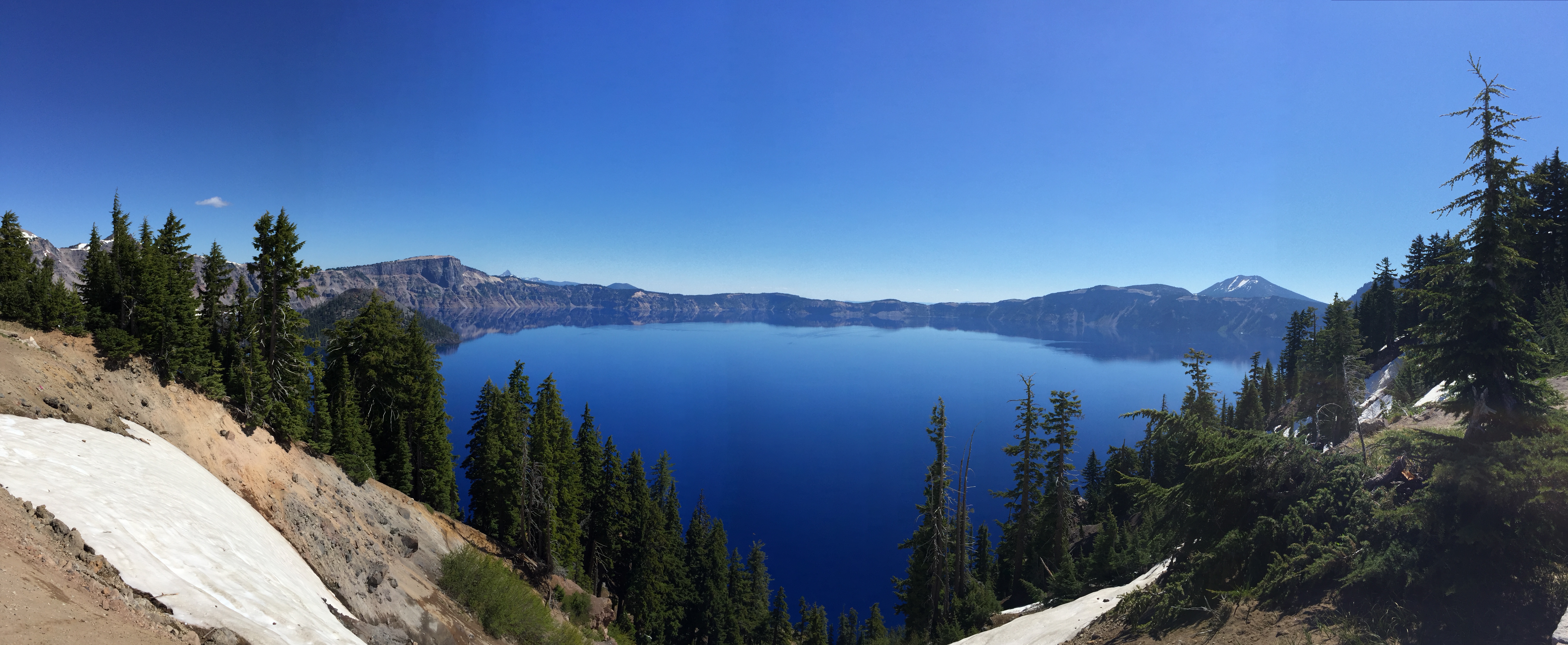
The stunning Crater Lake
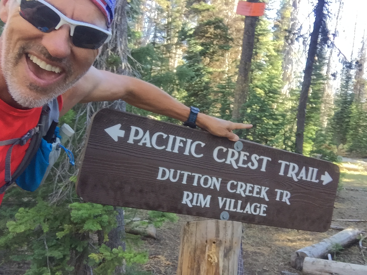
Connectivity was non-existent and the mosquitos were relentless. We did manage one hike on the Pacific Crest Trail that runs through this National Park. After a super snowy stretch of trail and swarms of mosquitos I turned back while Jeff continued on. The snow coverage on the trail continued and gave Jeff’s Navigation skills a run for their money!
Crater Lake really is a beautiful place. The blue of the water is mind-boggling! Early morning brought smooth as glass reflections of the surrounding mountains. There are boat tours offered and we certainly would have taken one if we had been there longer.
Bend, OR
Oh Bend! How I love thee!
If someone forced me to say where I would like to live if we ever came off the road and couldn’t go back to Bentonville Arkansas, I would choose Bend.
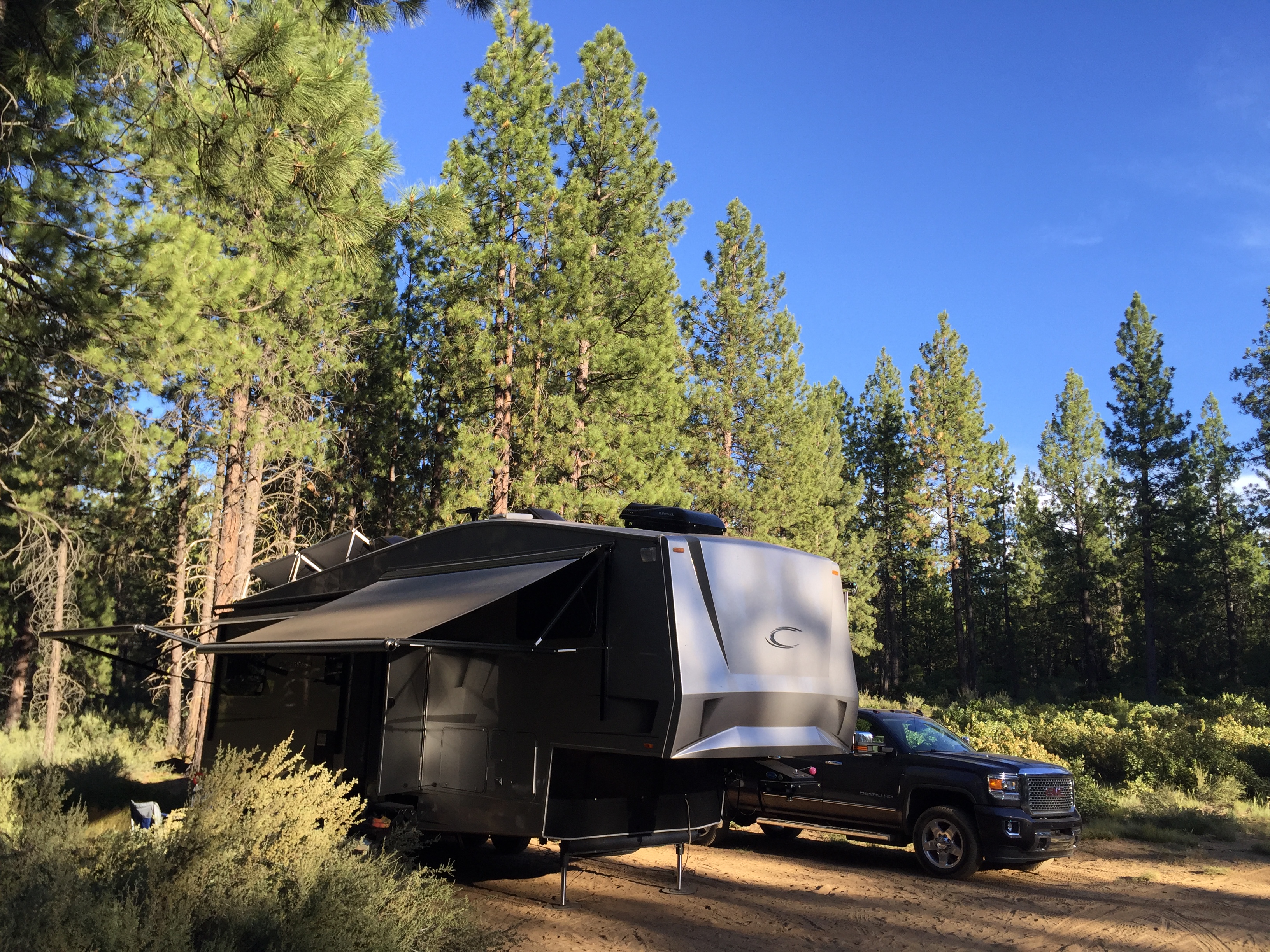
Our free campsite on National Forestry Land
Bend is a super hip happening place with something going on all the time. The locals are fit and active, restaurants are pet friendly with outdoor seating. Cycling, mountain biking, trail running, floating, breweries, shopping…. I love this place!
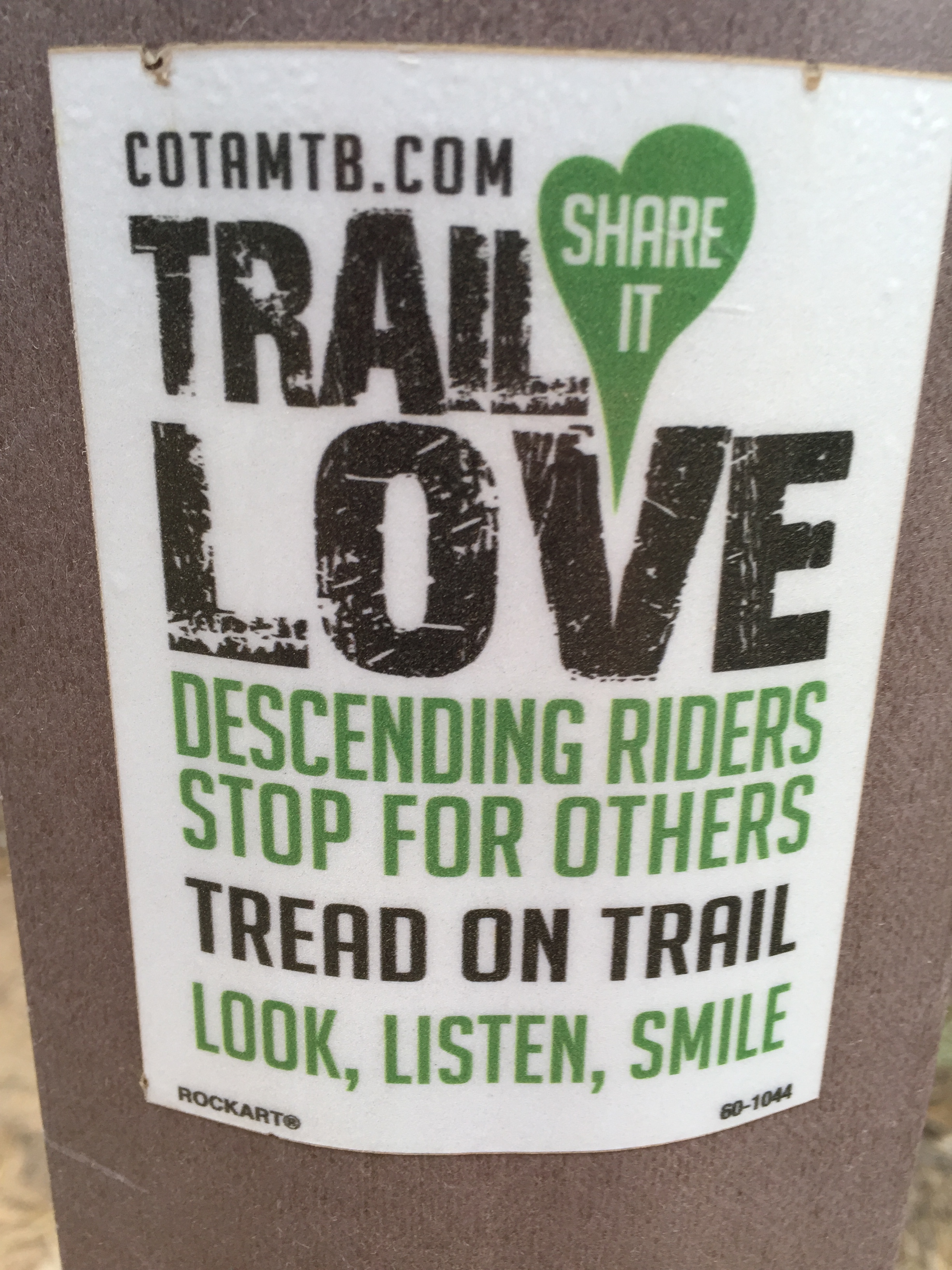
Look, Listen, Smile
We met up with our RVing buddies, John and Becky in the Willamette National Forest just west of town. Free camping in the woods with good friends is always preferred over an RV park, especially when there is good connectivity!
We had running & mountain bike trails just outside our door under the cool coverage of native trees and it was easy to get our fitness in before we started our workday.
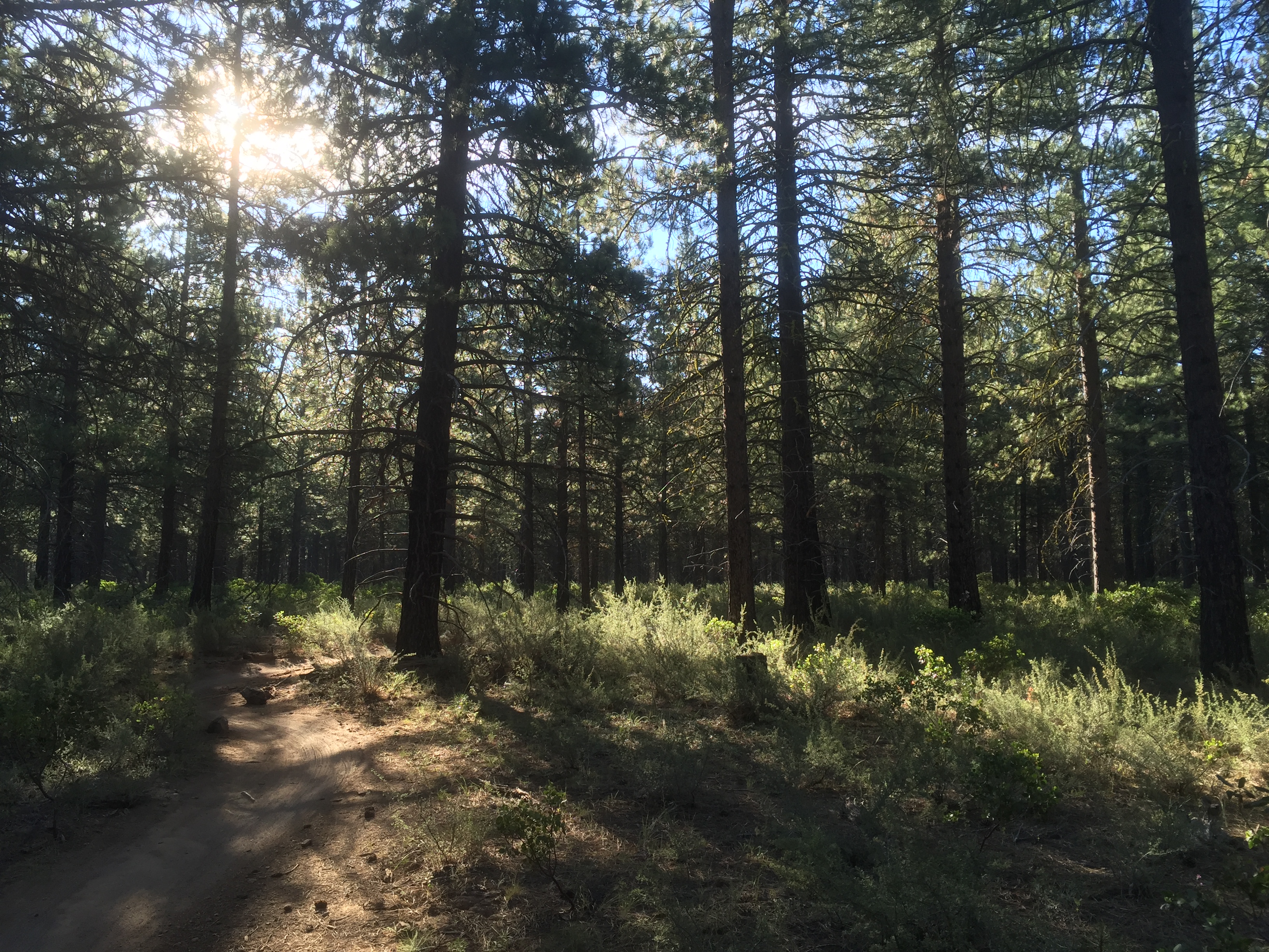
Tree filtered sunlight…running Bend
It was the 4th of July weekend so we headed to town for the annual pet parade and downtown festivities. Dogs, cats, snakes, horses and a chicken drew large crowds to the parade.
We also rented tubes for $15 to float the Deschutes River through the middle of town with a lot of other people. The water was cool and refreshing and the views of quaint cottages and homes along the river was entertaining.
Floating the Deschutes River
While Jeff was working, Becky, John and I went out for a hike. Good grief…it’s been so long ago I can’t remember the name of the place we went. We did manage to hike 12 miles and saw a bald eagle, snow, babbling streams and alpine lakes. The scenery was outstanding!
Dinner with RVing friends and fellow Xscapers
After a very quick weeks stay we bid farewell (until we meet again!) to our dear friends and moved on to Eugene, OR.
Stay tuned!

Hiking Mesa
Posted by Deb in Uncategorized on February 21, 2016
Views on top of Camelback Mountain
Jeff and I are about to wrap things up in beautiful Mesa, Arizona. We pulled into Mesa on November 6 and will be heading out by March 10.
With the exception of two weeks in Quartzsite, that put us in one spot for four whole months! How is that possible?
It’s been a fabulous stay and Mesa in the winter could not have left us wanting anything more. Pleasant daytime temperatures for ANYTHING sport/outside related, daily sunshine to give a healthy glow, cool nights for snuggle and sleeping perfection. Winter is more than tolerable here in the Grand Canyon State!
Unlimited citrus this time of year right off the tree!
Endless blue skies
Ah…sunrise euphoria
Another special thing about this place is that you have some amazing hikes all within 30 minutes of home base. And you can get as easy or as technical as you want.
So here are the hikes Jeff and I did while in the area.
South Mountain
Our very first hike in the Mesa area was at South Mountain. Jeff and I did a night hike with our buddy Marshall and wrote about our hike here.
South Mountain is the largest municipal park in the US. It boasts 16,283 acres of desert goodness dating back to the Calvin Coolidge presidency (1924) with original Civilian Conservation Corps infrastructure from the early 1930s.
There are 58 miles of trails to mountain bike, horseback ride, trail run or hike…from easy to heart pumping. Whatever tickles your fancy, it can all be done here.
Views here are of the Phoenix. But if you time your hike at dusk you will treat yourself to a fabulous sunset and twinkling horizon as the city settles down for the night.
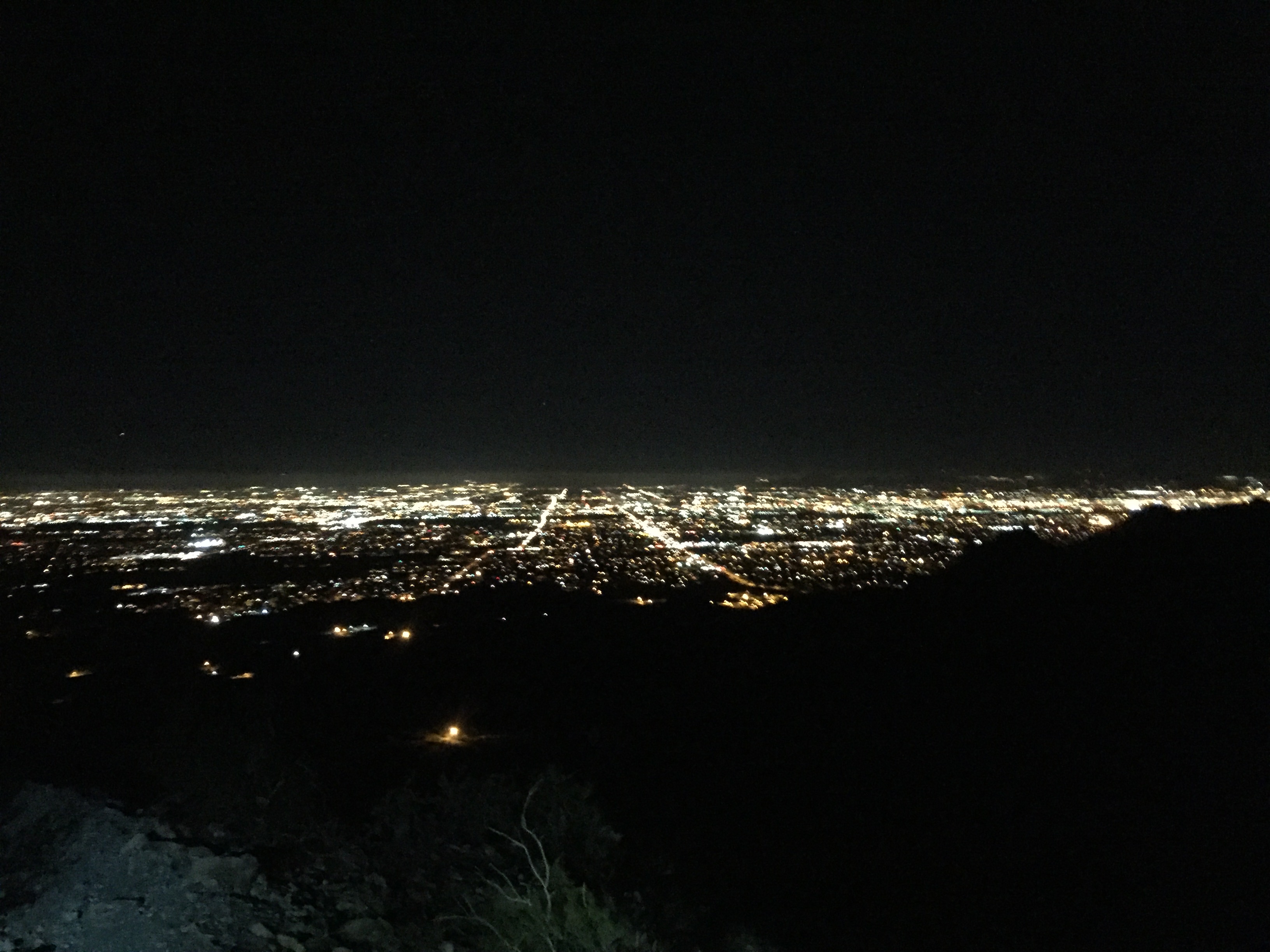
Twinkling downtown lights
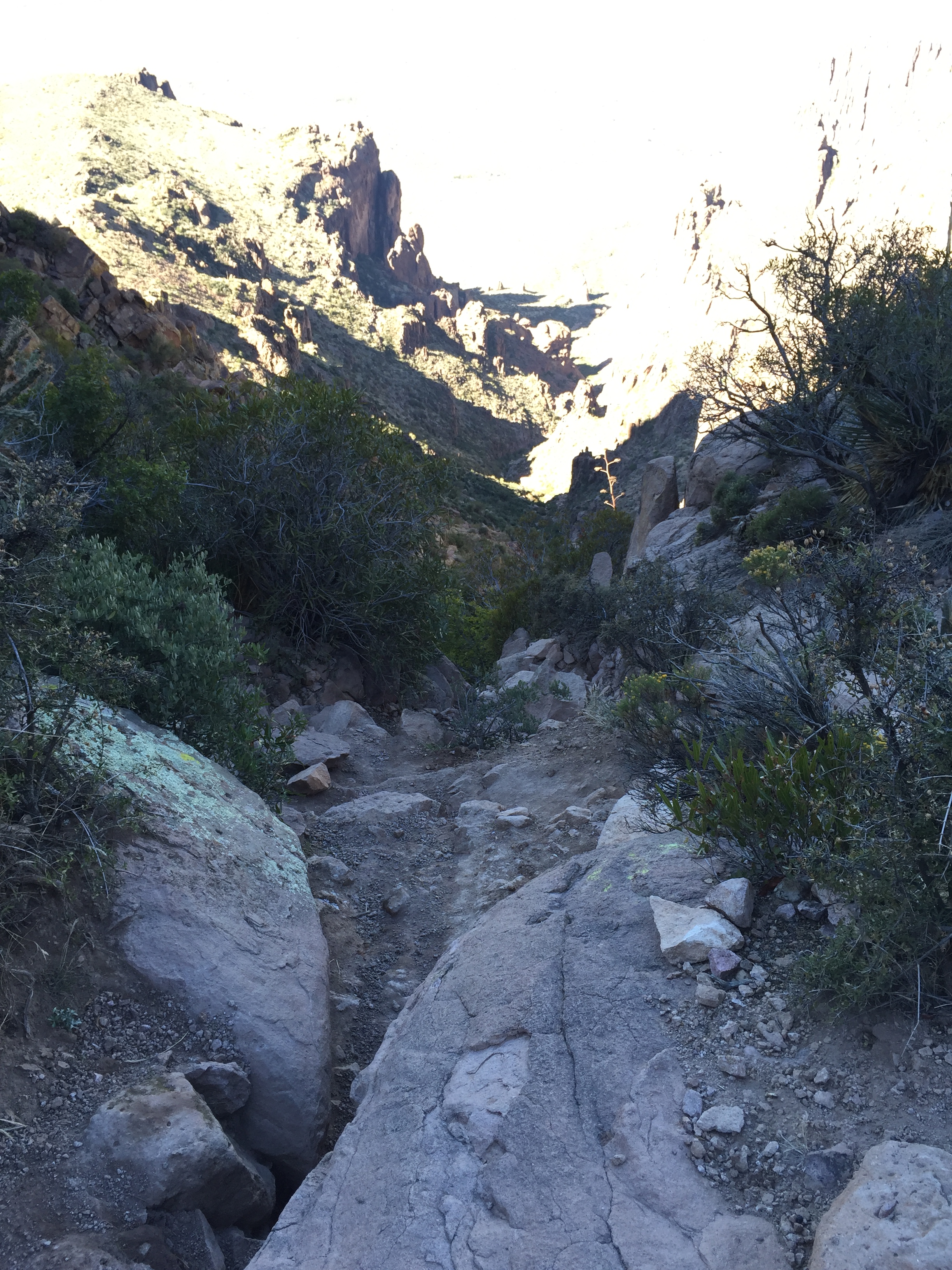
Superstition Mountains-Flat Iron
I wish I could say I have a love/hate relationship with Flat Iron since it was brutal to the demise of our winter plans. But even in spite of breaking my wrist here I still LOVE this hike.
It’s one of the most challenging hikes (outside of the Grand Canyon) I’ve ever done both in elevation and technicality.
The trail starts from the Siphon Draw Trailhead in the Lost Dutchman State Park and lulls you into a false sense of ease for about the first mile. The trail is a pure gentleman here and is conversational grade with easy footing. La, la, la…look at those pretty cacti over there!
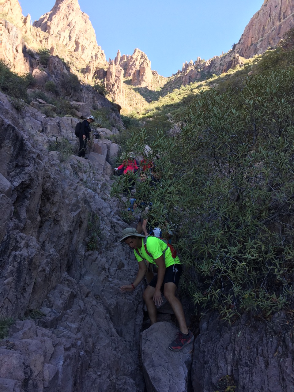
Scramble, boulder, tumble
Then BAM! After making a left turn you are confronted with the realization that this mountain is going to beat you into over 2000’ elevation submission!
Pure vertical. Pure scramble. Pure bouldering. There are no switchbacks here and your gluts, quads and lungs will be screaming for mercy!
I LOVE this hike despite it showing me whose boss on my way down.
Tonto National Forest
We just skirted Tonto National Forest on my first hike after my infamous fall. Jeff and I were hiking again with buddy Marshall on Christmas Day and kept things easy and surefooted.
Tonto is the sixth largest National Forest in the US with almost 3 million acres that stretches from the desert floor (1300’) to ponderosa pines (7,900’). Its uniqueness is evidenced by six separate ecosystems in one forest.
I was unable to find out how many miles of hiking are available here. But with 3 million acres…I’m guessing your could hike for a year and still not explore everything.
Easy to challenging hiking, horseback riding and jeeping are everywhere. We stuck to simple jeep trails that could go on for days in and of itself.
Hiking Tonto with Flat Iron looming in the background
Papago Park
This is a beautiful local park plopped right in the heart of Phoenix.
The park includes two golf courses, the Desert Botanical Garden, Phoenix Zoo and a few miles of red desert trails to explore. It is a popular place for the locals to get their Saturday morning burn on. Nothing too strenuous here and lots of families come for the easy park and hike to “The Hole in the Rock” before hitting the Zoo.


Jeff and I wanting to do some trail running and actually ran around the park twice to get in 6 miles. This place was a bit more crowded and limited than my liking. But for a quick “hike” feel without having to leave the city, it will do in a pinch.
Wind Cave
Jeff and I were really trying to take in some of the top “must see” places in Mesa before moving out of the area and Wind Cave came in as a top destination on our Internet search.
Wind Cave is located in Usery Mountain Regional Park located on the Valley’s east side. Usery has a stunning campground, and once you have hiked up to the cave you take in beautiful views from 2,840’.
I use the term “cave” loosely as Wind Cave is nothing more than an indentation in the side of a small mountain. So inspiring I didn’t even take a picture of it!


The hike is a short 2.9 mile round trip and is pretty popular. Wind Cave is not too challenging and can be hiked with kids. It was a bit steeper than I had been hiking post wrist surgery, so I was a bit unnerved in a couple of spots due to my over sensitivity to falling.
But overall it was a nice morning hike with RV’ing friends that we hadn’t seen in a couple of months.
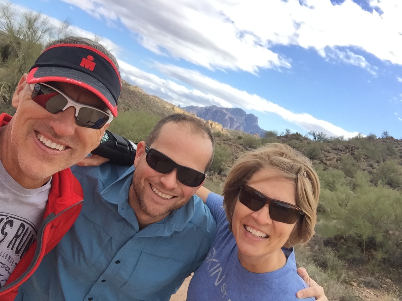
Camelback Mountain
If you come to Phoenix and ask about a hike, undoubtedly Camelback will be mentioned immediately.
It is the mountain that locals and tourists alike come to conquer at 2,706 at its peak.
Camelback gets its name from the shape of the mountain that looks like the humps of a kneeling camel.
Camelback…double black diamond hike…I’m in!
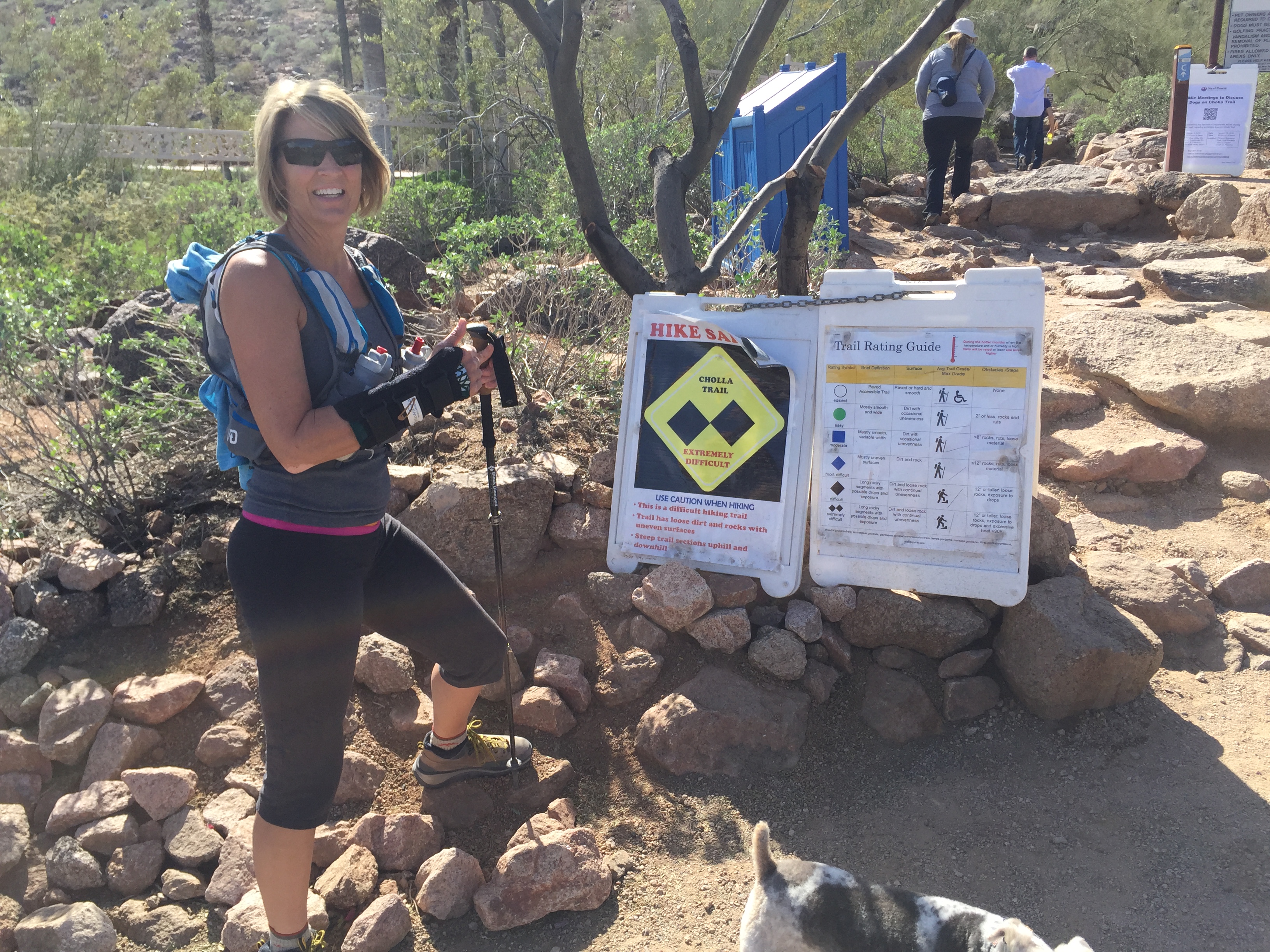
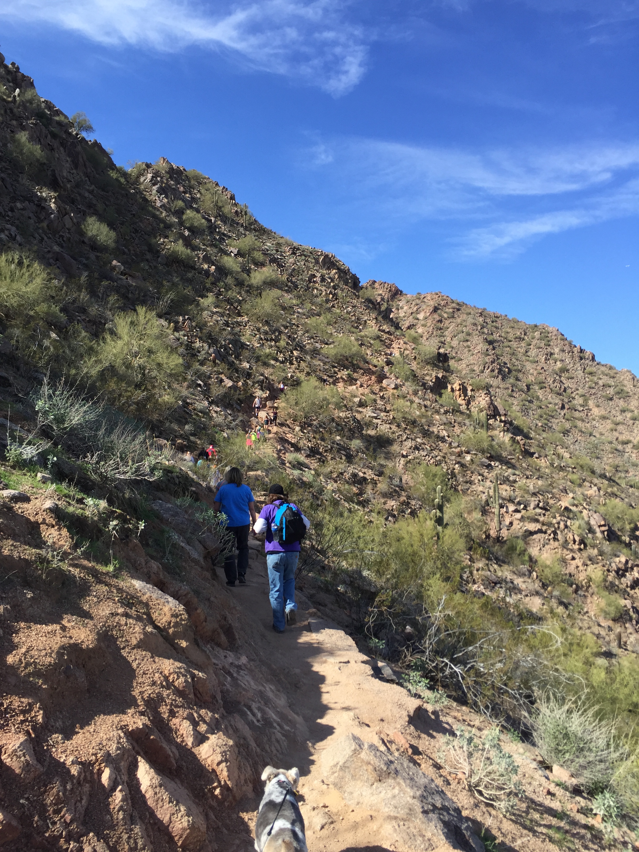
The hike is not that long but it is certainly challenging with an accent of 1,280’. There are two approaches to Camelback. The Echo Canyon Trail will get you up 1,280’ in 1.14 miles verses the Cholla Trail in 1.4 miles.
Jeff and I chose the Cholla Trailhead to ease my post fracture fears of scrambling.
This is an extremely busy trail (as is the Echo Canyon Trail). Street parking is at a premium and will require an additional .5 mile hike uphill just to reach the TH. We were actually there for a Thursday lunch hike and had trouble finding a place to park. There are no other parking options except along the street, so we circled a couple of times before a spot opened up.
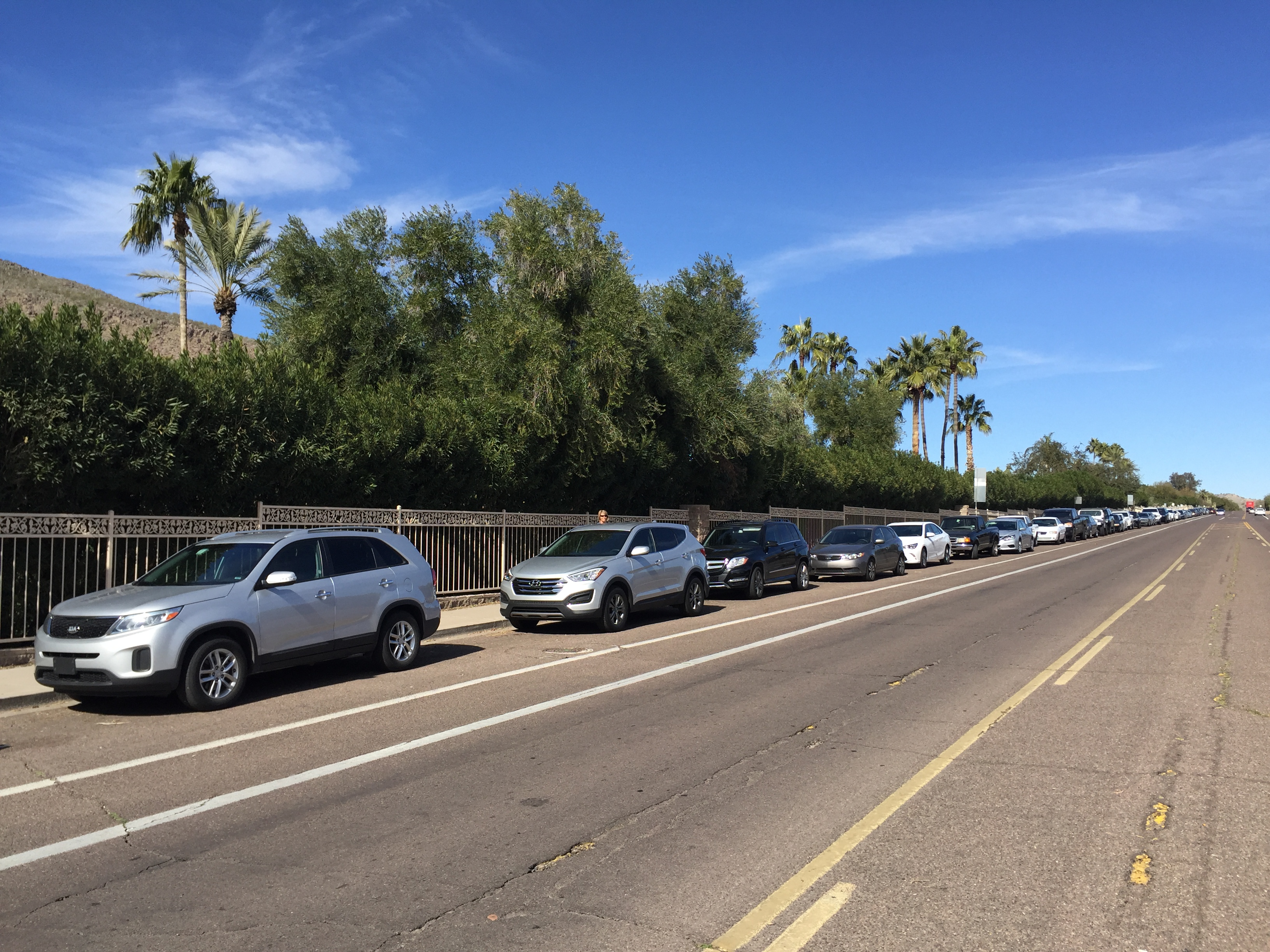
Not the greatest parking options at Camelback Mountain
Though dogs are allowed on this trail, we really should have left Sam at home. I ended up going against the leash laws and let Sam off his leash in order to prevent tripping up other hikers. There was a sign posted at the TH that stated that they were holding meetings to discuss shutting the trail down in the future to dogs. This is one of those rare times I might agree with the “No Dogs Allowed” policy.
Camelback truly is a great hike if you are patient and is a moderate hike until the last .3 miles. It is a pure scramble and bouldering for the last push. It was beyond my ability with a still healing wrist, so Sam and I waited in the saddle while Jeff summited the peak.
Stuck in traffic
View from the top
The city views are amazing and I am glad that we made the effort to do this well-known hike. But it was too crowded for my liking and we will probably stick to the Tonto National Forest in the future to get our hike on.
So that is my hiking summary for the Phoenix/Mesa area for winter of 2015/16. All in all it’s been a wonderful place to burn up a cold winter in the lap of warm sunny luxury.
We have a three-week trip with multi-stop flights to Nashville for a Sales Conference and 2 weeks home in Bentonville, Arkansas before flying back to our home on wheels in Mesa.
March will have us moving north for the Easter Jeep Safari in Moab, Utah to cross another destination off our bucket list. Oh…the tragedy of our life!
Stay tuned!
Words to live by!
What Happened?
Posted by Deb in Uncategorized on December 12, 2015
Superstition Mountains
I really like the Phoenix area.
Not necessarily the traffic, noise or crowds. But I do like the warm winter weather and broad mountain views and tons of hiking right in the heart of the city.
Last year Jeff and I spent a couple of weeks driveway surfing in Mesa leading up to Ironman Arizona. Thanks to a high school buddy from California, we were hooked up with an awesome family who had full RV hookups right in their driveway. The driveway surrounded by orange, grapefruit and pomegranate trees make for a very private RV’ing experience…better than any RV park in the area.
Sweet “camping” spot in Mesa
We contacted our host family again and they were happy to let us stay again this year for the same reason.
We had an invitation by our friend Marshall to a night hike the day we rolled in. Quite frankly, I didn’t want to go after a day of travel. But Jeff talked me into it…and I am so glad he did.
We met a “meet up” group at South Mountain for a 6-7 mile hike just as the sun was setting in the horizon. The views are not your typical forest or fauna but of broad city views that begin to twinkle with each passing minute. Although, I did hear that you WILL experience snakes here in the summer!


The 1000’ elevation gain was tough and the footing tricky, but my first night hiking experience is one that needs to be repeated for sure!
Jeff happened to roll his ankle for the 4th time in a month. So when I started talking to Marshall about hiking the infamous Flat Iron in the Superstition Mountains, Jeff decided it was best to stick to flat land training leading up the his race. Marshall and I made arrangements to meet Sunday for the hike.
So here is where things got very interesting!
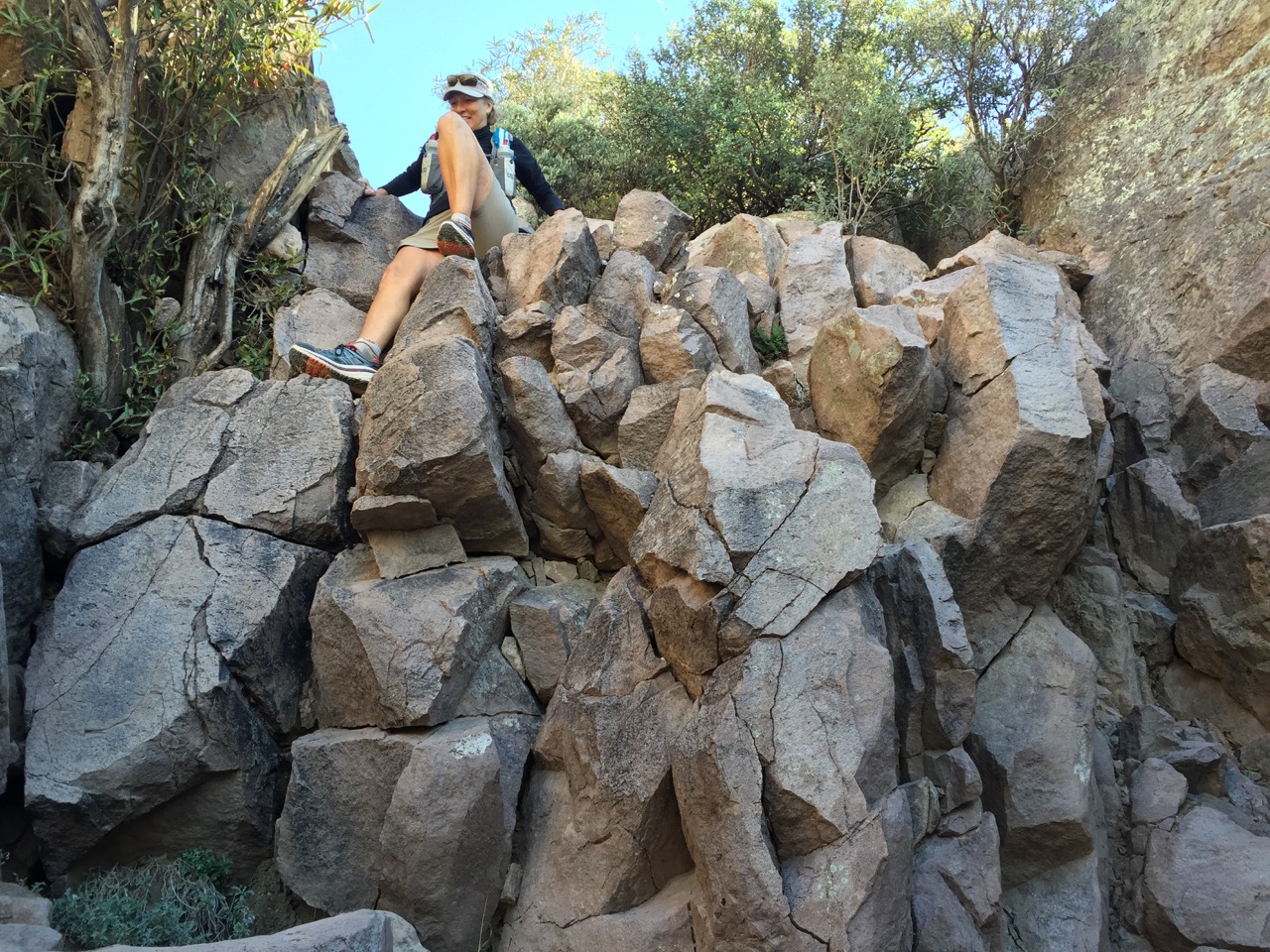
Flat Iron by way of the Siphon Draw trail is about a 6 mile round trip hike that will challenge the best of hikers. Overall elevation gain is around 2600’ and not for the faint of heart. You need strong legs AND arms in order to pull yourself up over boulders, slick slabs and at times, shear vertical climbs. Lots of bouldering and scrambling here and good shoe treads are a must!
The rugged Siphon Draw Trail
It’s very common to see hikers wearing gloves to protect their hands, but hiking poles are of no use…even dangerous (IMHO).
Marshall and I headed out about 9AM with water and snacks. Marshall carries a pretty big pack and when I made fun of him questioned him about what all he carries, he just told me, “stuff I might need”. Well ok then!
We made the hard scramble to the top and appreciated the spectacular 360 views over jerky and trail mix. We were surprised by the amount of people that were on top of the mountain…probably 75-100. All of us enjoying our accomplishment!


But as I have said before, getting to the top is only half the hike. Especially this one! Marshall and I headed back down the trail, carefully choosing our line of descent. I tend to get a little overly cautious at times like these ever since I had back surgery 3 years ago. With screws and rods in my spine there is always a bit of carefulness in the back of my mind.
Marshall studying the best line…or is he looking at his phone?
Starting down the mountain
Scrambling just before…
But as I stepped down on a boulder my feet slid out to the left and I toppled over another boulder on the right and I landed with a thud about 4’ below. My first thought was for my back as I lay there assessing the damage.
Surprised, I didn’t feel pain anywhere! WOW! Could I have just dodged a hiking bullet? I guess I did! Yahoo, yippee, skippy!! But when I told myself to get up…I couldn’t move. As hard as I told my body to get up, something was holding me to the ground.
And then I saw it. My right wrist the shape of a Z.
Now there are a lot of things that can run through one’s head in times like these and my initial thought was that I have to get down this mountain before the pain kicks in! But when I went to stand the pain hit and my wobbly legs lowered me back to the ground. How on earth was I going to get down this mountain?
Within minutes (just after he almost lost his cookies!) Marshall opened up his big backpack and pulled out an enormous First Aid kit and started unpacking everything we would need to stabilize a fracture. We were instantly surrounded by other folks who were asking what they could do to help.
Rallying the troops to strategize how do get down
We tried to get the splint on but I couldn’t stand the pressure to mold it to my arm. So another hiker, Andrés, offered up his ice filled camelback bladder and we wrapped that around my wrist with gauze. I had instant relief from the numbing ice!
Then we wrapped my entire arm around my body to further stabilize it.
Between 3 other hikers I had 1000mg of Ibuprofen in my system and we started hiking down the mountain.
While I was getting bandaged up another hiker called 911. Since the initial word was that I couldn’t walk (due to the pain), the sheriffs department relayed that I had a broken leg AND arm and a helicopter was dispatched.
Andres giving me a hand in front and Harold in back
I have to admit, when I heard about the helicopter I had visions of a $15,000-$20,000 bill landing in my mailbox. So as soon as I was stabilized and able to walk we called off the joy ride! Search And Rescue was dispatched instead.
For 4 more hours, between Marshall, Andrés and another hiker Harold, every line and every foot placement was deliberately chosen. I spent most of the hike scooting on my bum, the trail being too steep for my wobbly legs.
Every step was planned
Finally reaching search and rescue
(Funny side note…after 30 minutes of Harold helping we looked at each other and realized that we had met on La Luz hiking trail in Albuquerque just a few weeks before!)
Three hours into the slow descent we were finally met by search and rescue. They re-bandaged my wrist (OUCH!) and started checking my vitals every 5 minutes. The EMT felt I was going into shock and they called for an Ambulance to be waiting to take me to the hospital. Another hour later we were finally down.
Hallelujah!


Jeff was waiting for me with the Sheriff and ambulance. I didn’t know it but Marshall had called his parents in Apache Junction and made arrangements for them to pick Jeff up and take him to the trailhead. He put on his running shoes when he got there but the Sheriff told him to take them off. He didn’t want another “helper” up there getting in the way.
Also, I asked Marshall to communicate to Jeff on top of the mountain that I would need surgery and to start making some calls to find out who and where we should go.
I had been pretty stoic and tried to be in good humor on our scoot down the mountain. But on the way to the hospital my mind now had nothing else to focus on but the pain. By the time I hit the ER I was crying hysterically from the experience and the pain…all the while apologizing to my caregivers for how bad I must have smelled!
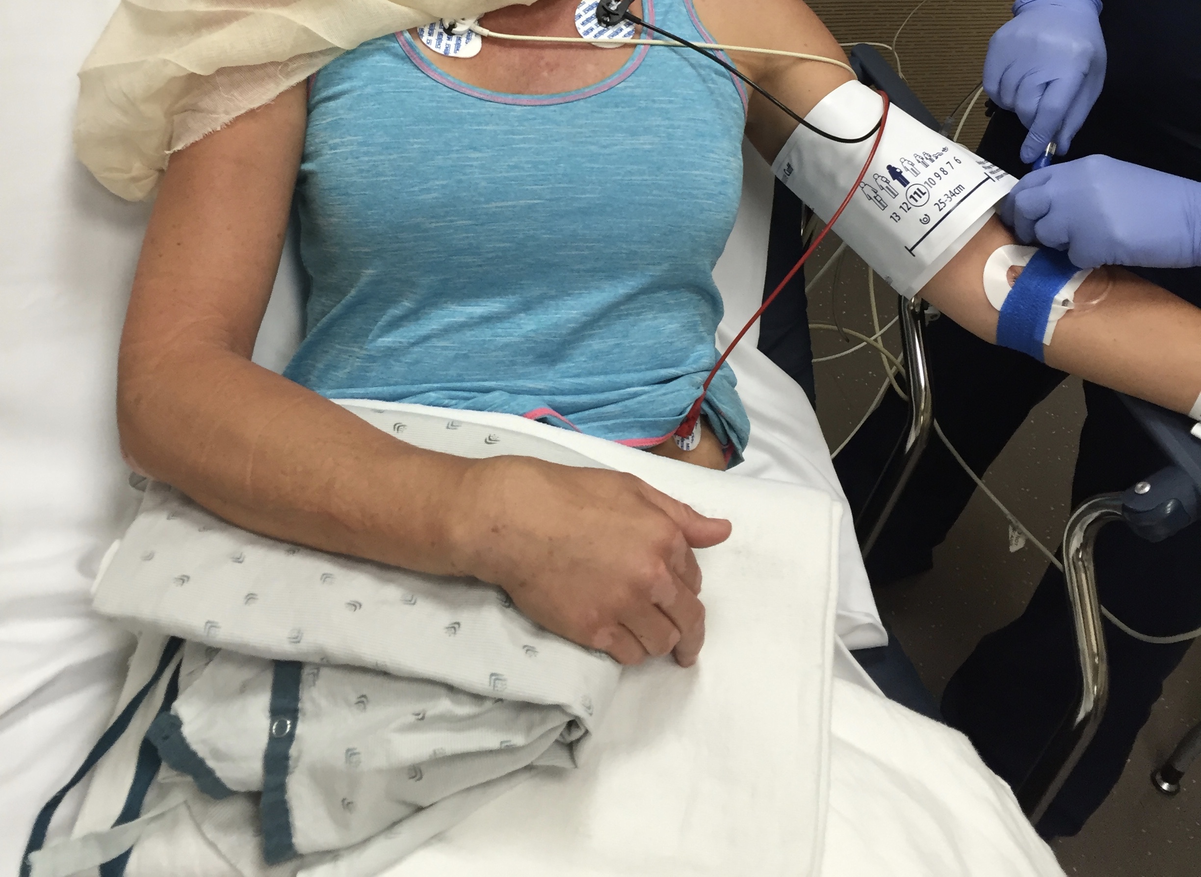
They x-rayed my wrist, knocked me out and reduced the fracture with the help of 4 others holding me down. Thankfully, through local friends, we were scheduled with an incredible hand surgeon the next day for an evaluation…and surgery followed 2 days later.
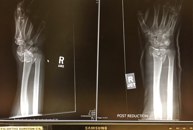
Doc told Jeff I “smoked it”
Since this experienced happened I am in awe and so grateful of others who got me down that mountain (Marshall, Andrés, Harold and the 4 search and rescuers), those who provided transportation for Jeff (Marshall’s parents), friends who made medical connections (Paul and Laura), our host family who made me hot soup and home made bread (the Brooks family), Dr. Spencer Stanberry who has a passion for wrists and the nursing staff at both the hospital and surgery center (all top notch).
We will be stationed here in Mesa for 8-12 weeks of PT, which I started two weeks after surgery. I consider myself blessed to have had such support & prayers during such a tough experience.
I can only hope that I can pay it forward someday!
And Marshall…I will never make fun of your big backpack again!
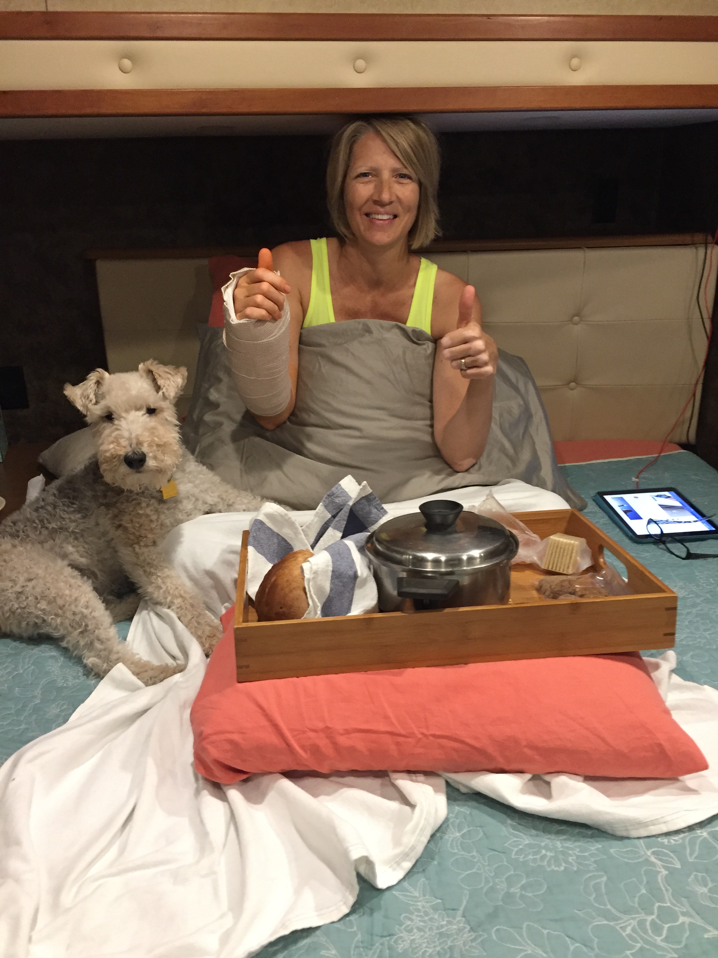
On the mend with soup and puppy therapy
Migration South
Posted by Deb in Arizona, Boondocking, Destinations, Full Time RV, Hiking, Sam-a-lama-ding-dong, Uncategorized on December 9, 2015

It’s been a while since I posted on my blog. My last entry was about our epic hike at the Grand Canyon back in October. I started typing my next post when something went drastically wrong leaving me unable to keep typing!
After Jeff and I left the Grand Canyon we headed back to Flagstaff where we dispersed camped at one of our favorite spots by Lake Mary. The alpine forest, miles of forestry roads to get lost on and hiking on the Arizona trail are some of my favorite reasons to camp here.
We did try a new location just north of Flag after calling the Forestry Department. “There are plenty of camping spots up there”, they said. “Good access”, they said. But after an hour of narrow roads and only two camp spots that were impossible to get in to, we decided to “go with what we know” and pushed on to Lake Mary. Trouble was, we were up a creek without a paddle. Or in RV’ing terms…down a narrow road without a turnout! After carefully backing up a 1/2 mile we finally swung the 5’er into to weeds to get turned around.

Contemplating how to get this thing turned around
I’ve found the most challenging parts of dispersed camping is that you never know what you are getting you and your rig into.
One persons opinion of “plenty of clearance” is usually nowhere close to the reality of our specific rig. If someone has wedged a 30,000lb forty-foot motorhome in a spot, then I have a bit more confidence in their recommendations. But NEVER take the word of a non-RV’er unless you want to find out what serious heartburn is like.
Lake Mary works out well for a Triathlete in training. The pool at the college is an easy 10 miles away and Lake Mary Rd is a major thoroughfare for cyclists and runners. Perfect for Jeff to continue some high altitude training for the Arizona Ironman.

The Arizona trail just steps from our campsite
While Jeff trained, I hiked a portion of the Arizona trail just steps from our camping spot.
The Arizona Trail is a National Scenic Trail that runs from the border of Mexico to the Utah border, traversing the North/ South length of Arizona for 800 miles. It was officially opened December 16, 2011.
The section I hiked was near the Lowell Observatory and Marshall Lake. It was not particularly scenic with primarily flat hiking through cattle fields.
-
- Not much to see here folks
-
- Lake Mary…the only scenic part of my hike
Sam dog is a great little hiker as he follows the trail very well. If I come to a part where I’m not sure where the trail is I just follow him…he knows every time. But he did step off the trail briefly and ended up with a big cholla ball stuck to his front leg. When that happens he tries to keep going because he HATES when I pull those dang things out. He hollers like you wouldn’t believe and comically when I pulled this one out to his great displeasure it flung out and stuck his back leg, doubling the experience. Once we start moving again all is forgiven and Sam stayed on the trail.
-
- Our free alpine camping at Lake Mary
-
- One of the rare moments we actually sit by a campfire
We decided to pull out of Flagstaff a day early since wet weather was coming in and we were on soft ground with low batteries. So we pulled up the jacks and headed to Sedona.
There is free dispersed camping available west of town on Forestry Road 525. We camped here last year and learned if you travel about 5 miles back on the washboard roads you are treated with some spectacular views and close hiking trails. We had some great days of sun and got the batteries charged back up to 100%.

Scene out our front door

Sam tearing it up and turning a nice shade of Sedona red
-
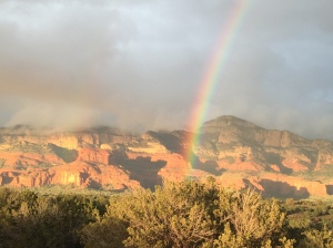
- Rain and rainbows
-
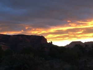
- Sunrises and sunsets
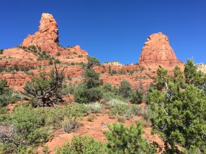
Sedona is incredibly beautiful and is one of my top 5 places to see thus far in our travels.
Hiking is spectacular in Sedona, but it is also very popular. If you are looking for a get away from it all experience you will have to travel a little further out of town. But what I love the most about hiking here is the sandy red soil contrasted with the green scrub bushes, Junipers, Arizona pines and Pinon Pines. Mix that in with the scent of toasted pine needles on the trail, red rock views at every turn and warm sun and you have yourself hiking nirvana!
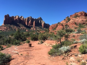
After paying a $5 day use fee Sam and I set off on Soldier Pass Trail. This trail is a great loop with incredible views of the red rock formations, slabs and the city. We hiked the trail counterclockwise; since I have hiked this trail clockwise a couple of times before.

Trail dog Sam leading the way
The initial accent takes to you to some red slabs with wide-open views. It’s a great spot for a picnic and photos before heading up natural stairs towards Brin Mesa. At the top of Soldier pass the trail flattens out and turns from red to a light sand color. I wanted to take the Brin Mesa tail for an out and back, to log some additional miles.
The Brin Mesa trail takes a steep decent back down the other side of the mountain. I always laugh at myself after descents like these because my mind automatically thinks about having to hike back up. Like the Grand Canyon my mind blows up the imagined accent to be much more difficult than it actually is. Then I’m always surprised when I get to the top wondering if I still have “the hill” to go. Silly self!
I mistakenly thought the Brin Mesa trail would actually take me to a mesa. But once I ran into a forestry road, my turn around point, I was informed by other hikers that the actual mesa was off some other offshoot from Soldier Pass. I’ll have to catch that one the next time.
-
- Stunning contrast of color
-
- Slabs near “The Sinkhole”
Back on Soldier pass, Sam and I started down the west side of the mountain back into red soil. It was getting hot by now and my two bottles of water were starting to get low. Thankfully we reached more slabs on this part of the trail. The slabs have some natural pools that form from bowl shaped indentations in the rocks. These pools had collected fresh water from recent rains, which Sam found refreshing for consumption and wading in, leaving the remaining water in the bottles for me.
Closer to the west side Soldier Pass Trailhead near “The Sinkhole” it gets pretty noisy from jeep tours and ATV’s that are allowed on the trail here. We jumped off Soldier Pass at this point and took the Jordon trail heading east back to our parking lot.
Sam found another pool that was pretty murky and large and waded in to cool his dogs. Problem was it was very deep. To both our surprise he disappeared underwater only to bob back up sputtering. He wasn’t too thrilled about going scuba diving but he was super frisky after that. I guess his bath really cooled him down.

Sam cooling down in a shady spot
We ended up hiking 8.5 miles over 3 hours…what a great time!
After a week in Sedona rain and snow moved in. It was stunning to wake up to a ring of white snow on the red rocks at the higher elevations. But to maintain our shorts and flip flop temps we moved on to Phoenix/Mesa…. where things turned very interesting!

What the heck!
Flagstaff Boonies and Peaks
Posted by Deb in Arizona, Boondocking, Bucket List, Full Time RV, Highest Peaks, Hiking, Uncategorized on October 25, 2015

Welcome to 7,000 ft…catch your breath!
-
- Clingers in the nicest way!
-
- Dinner with friends…we really like these two

The trail calls and I must go!

Agassiz Peak from Humphreys Peak Trail. San Francisco Mountains.
-
- Humphreys Peak Trailhead…here we go!
-
- Aspens in full glow!
Jeff, Sam and I left Humphreys Peak TH from the Arizona Snow Bowl following a smooth trail that took us through a field of glowing aspens. But the smooth trail was short lived as we quickly entered a hole in the tree line and the trail quickly turned rugged and rocky. It was an ankle turner almost the entire way and Jeff rolled his and launched himself over the side of the trail, only to be stopped by a small tree. That. Was. Close!

Navigating the rough trail

View from Mt. Humphreys with aspens far below and controlled burn in the distance!

Sunset from Mt Humphreys TH set off by a controlled burn in the distance

This is how we roll…me driving and the boys sleeping!
The Albuquerque Balloon Fiesta 2015
Posted by Deb in Biking, Full Time RV, New Mexico, RV Parks, Uncategorized on October 18, 2015

Beautiful start to the Albuquerque Balloon Fiesta
The internationally known Albuquerque Balloon Fiesta has wrapped up and what a spectacular event it was!
-
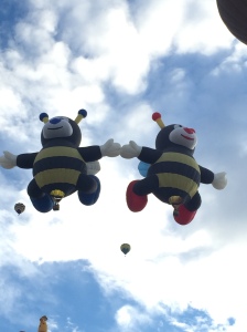
- The Bumble Bees take flight
-
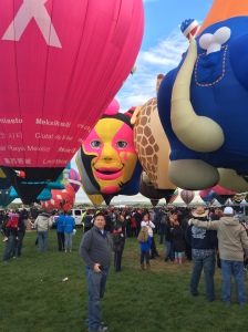
- Stunning 3 faced balloon!
-
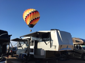
- Balloons floating right over the Domani
-
- Campground landings are a daily event
-
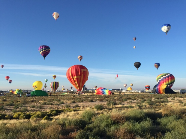
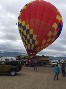
- Field landing right in our campground
-
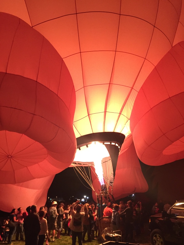
- Night Glow…just fabulous
-
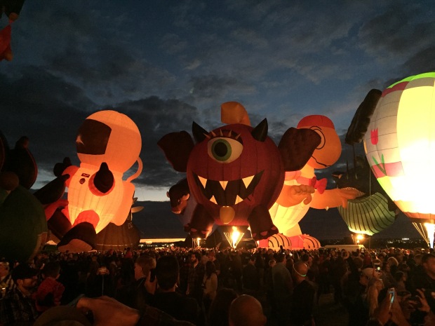
- Special shapes Glowdeo
-
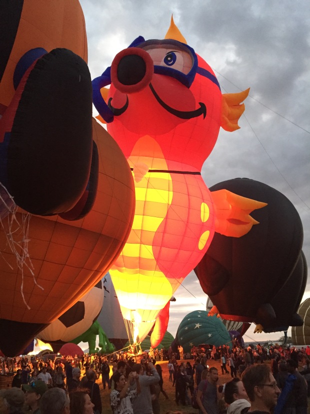
- Glowing Sea Horse

A small group of Xscapers sharing dinner our last night in town
-
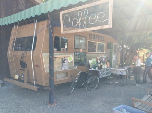
- Bike ride to a ride up coffee bar…in a camper. Now that’s our kind of place!
-
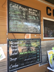
- Nice lunch menu including a “scookie”… scone/cookie…yum!

Heading down the road to Flag!
The B-line to Albuquerque
Posted by Deb in Boondocking, Full Time RV, New Mexico, RV Parks, Solar, Uncategorized on October 10, 2015

Sunset from the road heading west
We made a B-line to Albuquerque to take in the splendor of the Balloon Fiesta and IT IS SPECTACULAR!
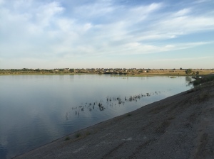
From Dumas Texas we made a 2 hour drive to Ute Lake State Park to camp for two nights. This is a dry, barrow campground overlooking the very nice Ute Lake. Evidently this is a great spot for birders and fisherman alike. The lake is shallow with a lot of reeds and grasses along the banks. What is brown and desolate by day turns to an incredible glow of oranges, yellows, blues, purples and pinks when the sun hangs low.
-
- Ute Lake State Park…great spacing and hookups for $14/night…yes please
-
- Ute Lake
The sites are packed gravel, super long and have great separation. Each site has a covered patio with picnic table, fire pit, grill and lots and lots of goat head stickers. Sam enthusiastically jumped out of the camper ready to explore his new surroundings and was stopped in his tracks with paws full of stickers.
If it were not for the goat heads we would have stayed a bit longer. But after two days we decided to move on.
-
- Perfect site for watching the lunar eclipse
-
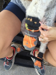
- Dang goat head stickers. Sam was not a happy camper!
Our next stop was just 20 miles down the road in the little town of Tucumcari, New Mexico. Tucumcari mountain is an isolated mountain in a sea of brown dessert that was a landmark back in the 1800s for those traveling west from Arkansas to California.
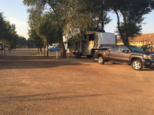
We camped at the nastalgic Cactus RV Park, one of those original destinations back in the hay day of Route 66.

Tucumcari Mountain…a landmark for wary travelers heading West
-
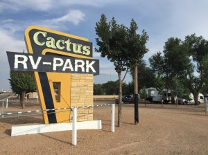
- The nostalgic Cactus RV Park…but don’t expect any frills!
-
- Cactus RV Park. Nicely groomed and offered shade on a hot day.

Sandra’s Mountains from our ABQ campsite
Be sure to check your shoes. You never know what you will find in the desert!
Albuquerque Here We Come
Posted by Deb in Uncategorized on October 5, 2015

FINALLY back on the road…so exciting!
Jeff and I made it back to Arkansas. We had 10 days to attend our nieces wedding and prepare for our long awaited trip out West. We are now on the road to Albuquerque completely exhausted from our final push to get out of town.
Every time I am away from Bentonville for any length of time I go back with a new appreciated for my city. It’s beautiful, it’s clean and it’s familiar.
Jeff and I made a quick run out to the lake to check on our cabin. It’s a place that my soul connects to and I always get a little weepy every time we pull away to drive back to town. Even when we stayed there every weekend it pained me to leave our little Bella Cottage on the shores of Beaver Lake.

We love our time on Beaver Lake
But as much as a I love NW Arkansas I know that our next adventure awaits in the land of burning sunsets. One look at those expansive views and mountain trails and I will be filled to overflowing with food for my soul. I love the West too!
While in Bentonville we received our shipment of Solar Panels from AM Solar. They arrived two days before we were to leave, which didn’t leave us enough time to completely hook up our system. We ordered four 160w panels that Jeff mounted on the roof of the Domani (one arrived broken)and two 100w panels that we will either mount on the roof or use as mobile panels on the ground in shady situations. That’s 840w of juicy power…once we are all hooked up.
-
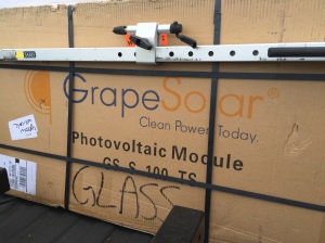
- Picking up the solar panels shipped in from AM Solar
-
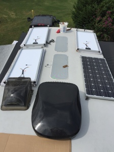
- Four 160w solar panels around two sky lights
Jeff researched batteries and found NorthStar Battery in Springfield Mo that offered to donate two batteries for us to test out on the open road. They were originally designed for marine use and NorthStar is interested in some feedback for RV application. Sure. We will try out your big batteries!
The hardest part of this Solar installation so far was trying to lift the 150lb batteries (each) into the basement of the RV. We used a little ingenuity and backed up the truck right up to the bay door to slide them into place. The batteries can be installed upright or on their side, making installing in the right spot easier.
-
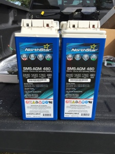
- Two AGM Batteries provided by NorthStar in Springfield, MO.
-
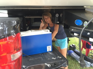
- Using a little ingenuity to get these battery beasts in the bay
Jeff installed our Victron 3000w hybrid inverter graciously donated by Technomadia. Victron is coming out with a new Solar Controller but it is on a slow boat from China (literally). It’s the last piece of equipment we need in order to complete our system, so here’s hoping it arrives soon.
In the mean time, we started our westerly migration. We tried to leave Arkansas by noon on 9/24, but by the time we squeezed in our last family visit and reloaded the RV we pulled out of the driveway about 4pm. We thought we could get through Fayetteville before rush hour hit but we completely forgot about BBBBQ.
Bike Blues and BBQ started this week which is the 3rd larges motorcycle rally in the country. It is held every September to the local non-motorcycle riders frustration. There are around 100,000 motorcycles that crowd our roads and 300,000 spectators that call NW Arkansas home for 5 days. It’s loud, it’s crowded and we were stuck in the middle a sea of motorcycles pulling a RV.
We made it through Fayetteville without running over any hotwheels and headed to Oklahoma City for our first stop over. Jeff’s college swim coach lives there and we parked our rig in front of his house before moving on the next day to Dumas Texas.
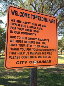
We stayed at the Dumas (Texoma) City Park Campground about 1 ½ hours North of Amarillo. We found this campground on our All Stays App that was an awesome surprise in such a small town. It ‘s free (donations accepted), level, has 30/50 amp hookups, dump station and water available.
-
- Texoma Park…you are welcome for 1 night
-
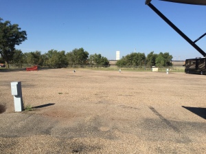
- Your basic parking lot “camping”
It’s your basic chip and seal parking lot adjacent to a nice park with picnic tables, grills and restrooms. There is a train track very close by, but compared to our train experience in Elkhart Indiana the train noise is tolerable. The campground was only meant to be a “quiet” place for travelers to get over night rest, so they ask that you only stay 24 hours. There were two other people here when we arrived around 5pm, but by 9pm there were 12 rigs total. Most all campers had moved on by 10AM.
We normally would not have even gone to Dumas Texas, but Jeff had entered the Texas Tumbleweed 100 Bike Ride that is held in Dumas. It’s part of his Ironman Arizona training before the big day in November.

Texas Tumbleweed 100
Since Jeff’s ride will take around 7 hours our plan is to rest for another night here in Dumas (with the cities permission) before continuing our trip west. We are going to camp somewhere between here and Albuquerque for 4 -5 nights before pulling into the Balloon Fiesta dry camping lot this Friday.
See you next time from Albuquerque!
