Archive for category Destinations
More Mountain Peaks Please
Posted by Deb in Biking, Boondocking, Cycling, Destinations, Full Time RV, Highest Peaks, Hiking, Running, Trail Run, Ultra Running on December 18, 2019
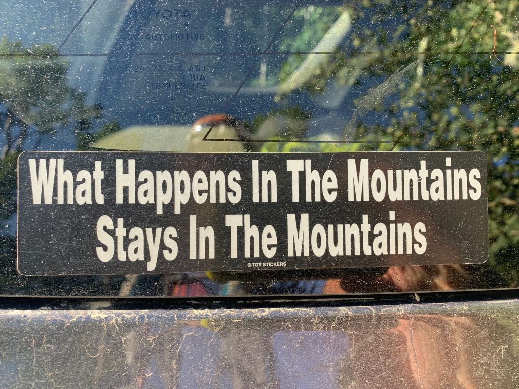
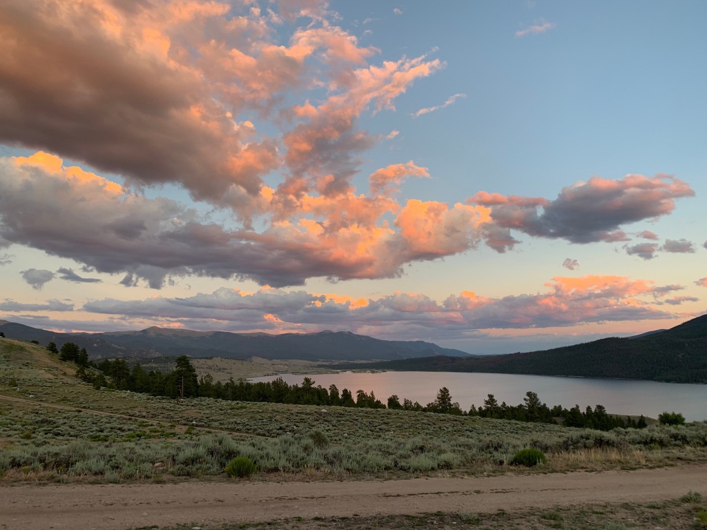
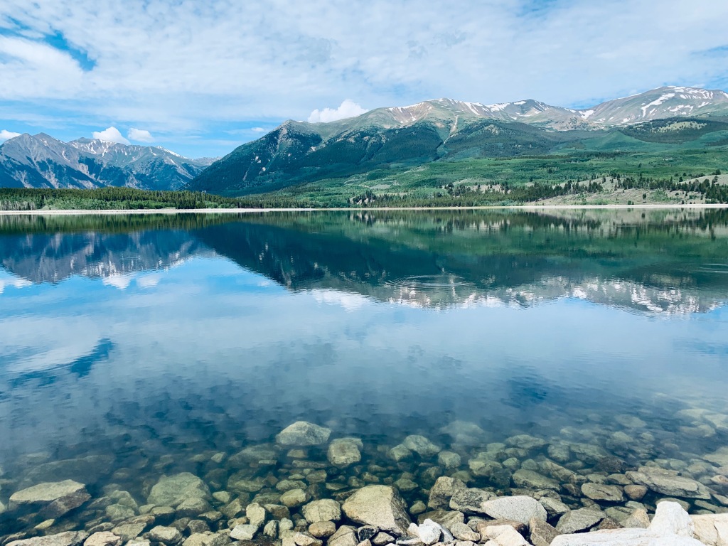
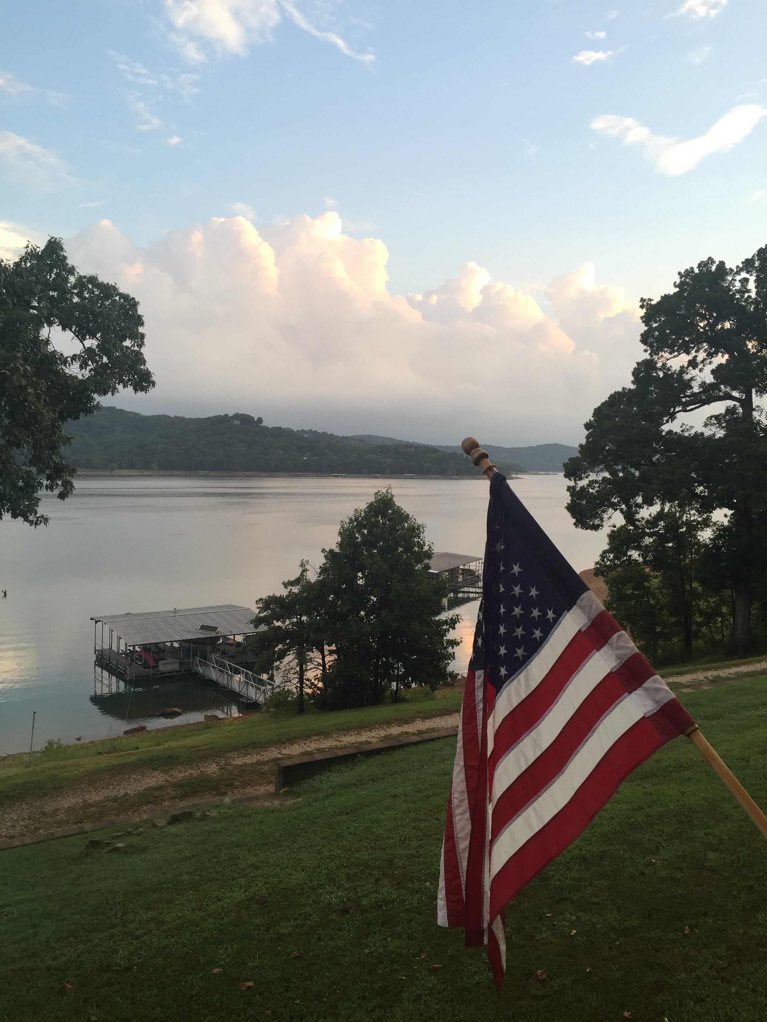
Twin Lakes, CO (Elevation: 9700’)
We would have liked to stay in Salida longer, but the summer temps, even at 7,000’, were starting to climb into the 90’s. So we moved on the Twin Lakes Colorado at 9,700’.
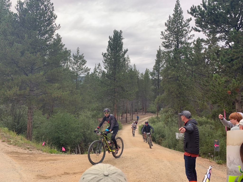
If you are familiar with the notorious Leadville 100 trail run or the Leadville 100 MTB race, then Twin Lakes will be familiar as one of the stops/aid stations runners and bikers resupply before heading over Hope Pass at 12,600’.
We initial boondocked at Lake Creek Dispersed camping area on the west side of Twin Lakes. This was a lovely pull out area with room for 10-12 RV’s with terrible connectivity. What we gave up in connectivity we gained back in proximity to the Willis Gulch trailhead, just 3/10ths of a mile away.
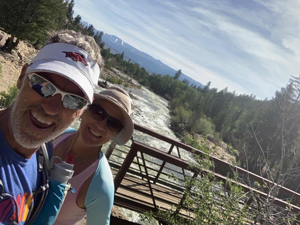
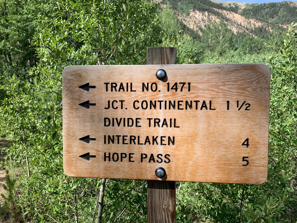
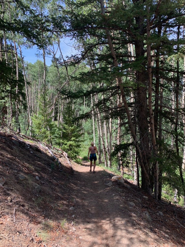
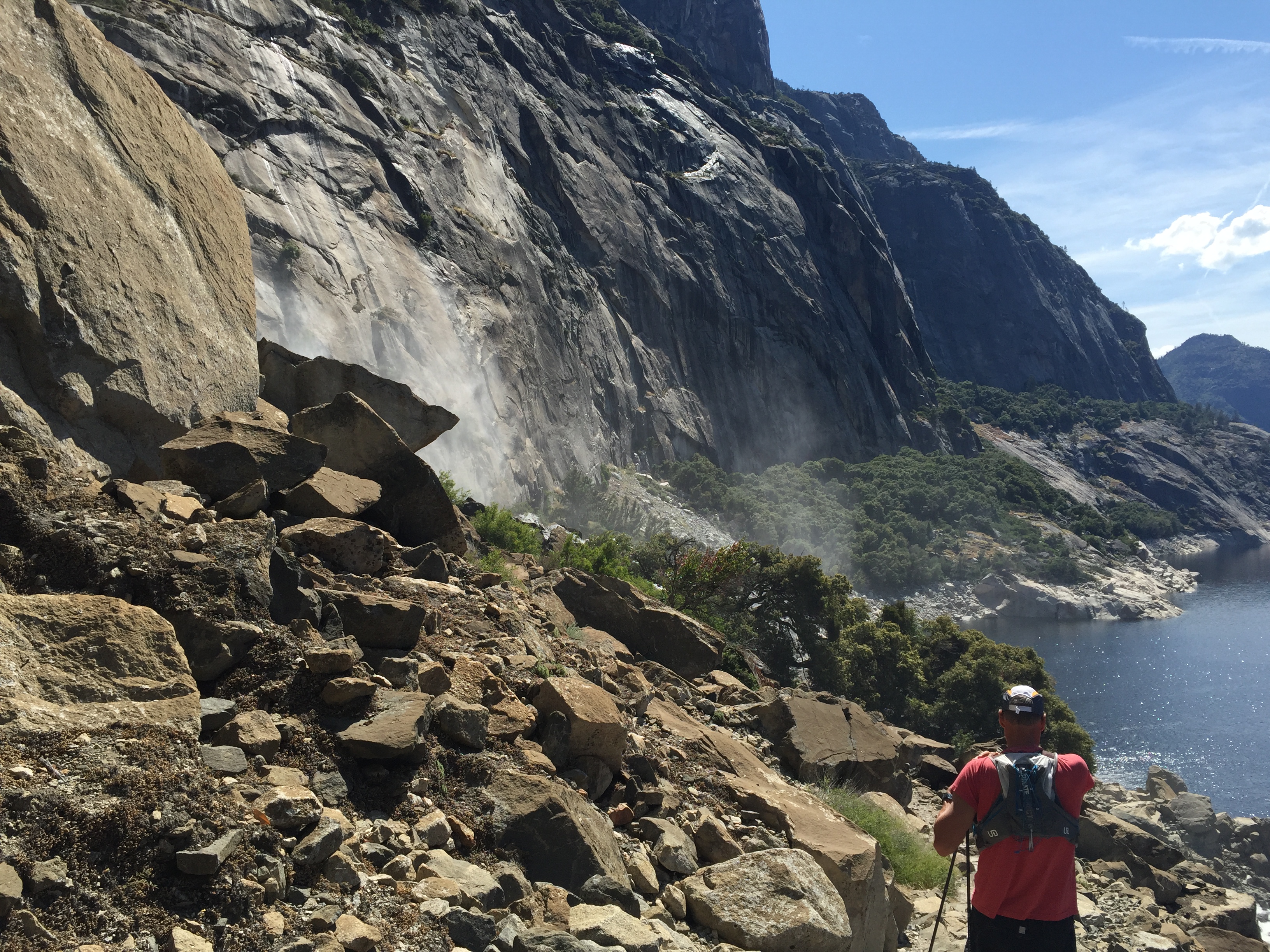
Willis Gulch offered access to the Colorado trail, the Continental Divide trail, Hope Pass and a 9-mile round trip hike to the restored 1880’s community of Interlaken.
The Interlaken Hotel complex was started in 1879 as a lakeside resort. It was considered a top destination in Colorado in its time with tavern, pool hall and a unique 6-sided outhouse.
Unfortunately Interlaken lost its attraction when Twin Lakes was dammed for irrigation purposed around the turn of the century. People considered the shallow waters of the lake a breeding ground for malaria and the hotel fell into disrepair until 1979 when the Bureau of Reclamation recorded and stabilized the community.
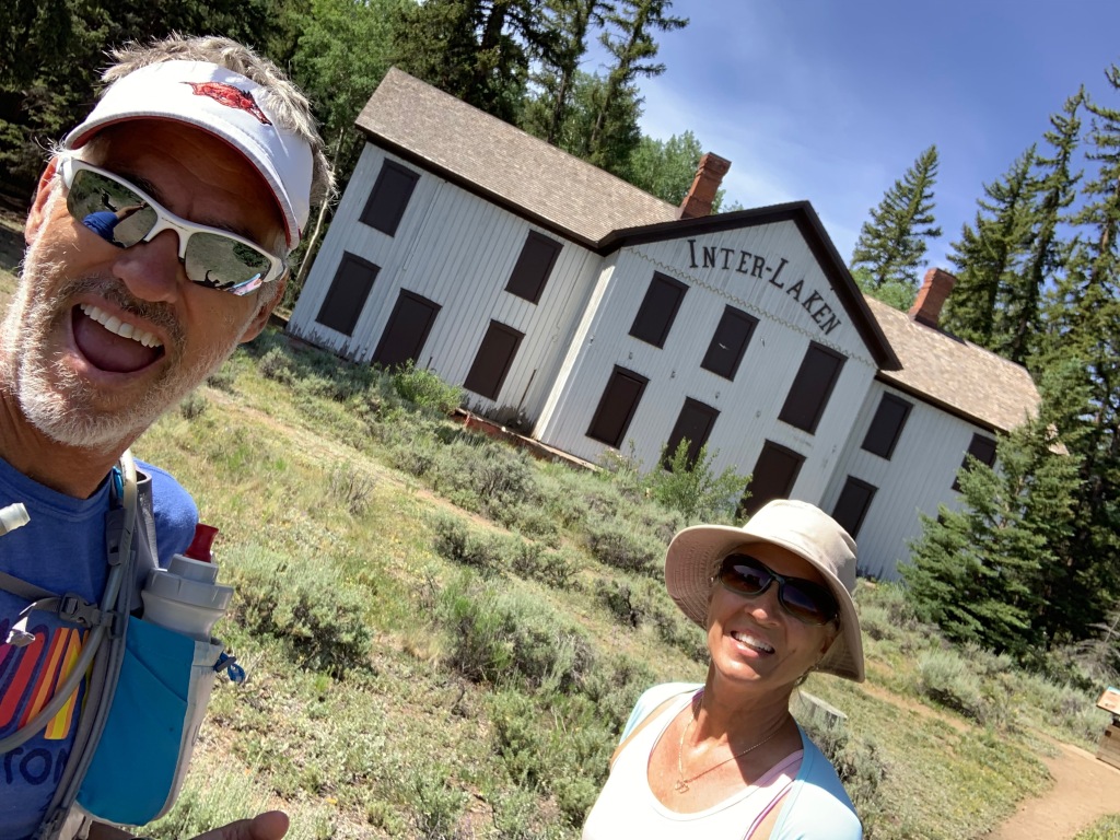
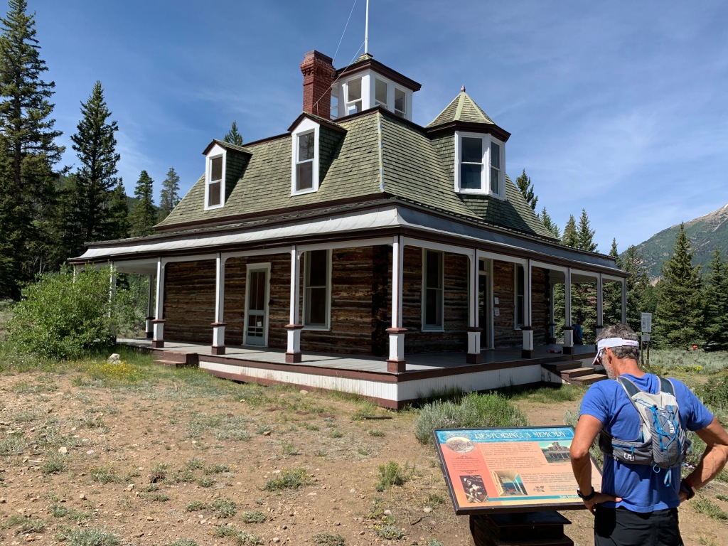
Today you can access Interlaken by hiking trails or boat.
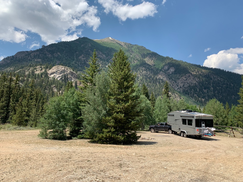
After three days at Lake Creek camping area we jumped in the truck to look for some connectivity and found the most amazing campsite of our 4-½ years on the road.
Twin Lakes View dispersed area is on top of a mountain on the north side of Twin Lakes. There are several areas to camp on this mountain and it’s VERY popular in the summer. Sites are plentiful…if you are small and nimble or tent camping. But larger rigs will find it challenging to find a level, accessible site that isn’t occupied.
The day we were doing recon we took our camping chairs to hold a site in case we found one that would work for our big girl. As luck would have it a camper was packing up in an amazing site. So we left our chairs and raced back to relocate the RV.
WHAT. A. SPOT.
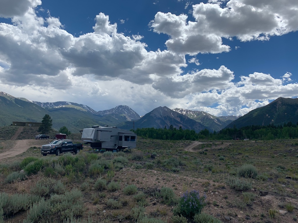
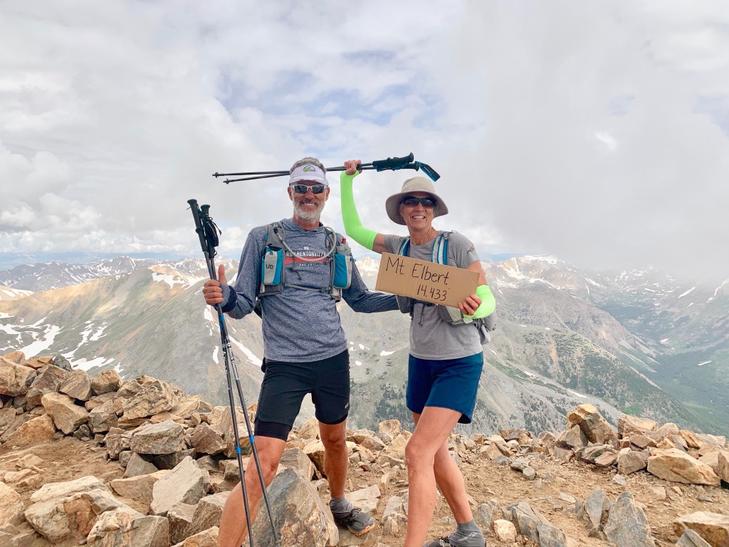
Not only did we have screaming fast Wi-Fi and stunning views, we were at the south trailhead for Mt. Elbert, the highest peak in Colorado.
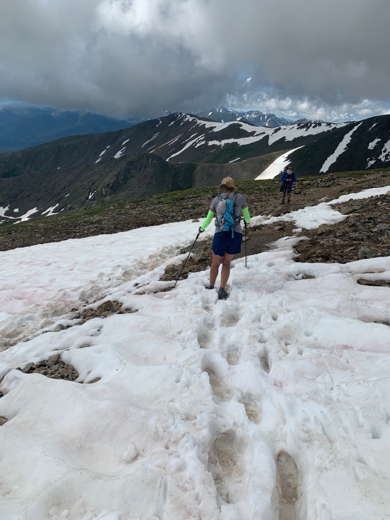
Mt. Elbert (the second highest peak in the continental US) was on our list of peaks to bag at 14,440’. This strenuous 11-mile round-trip hike starts at 9,800’ and climbs 4,600’ to the summit.
There is parking at the trailhead, but if you have a high clearance 4X4 vehicle you can knock off 2 miles by driving to the “Upper” trailhead.
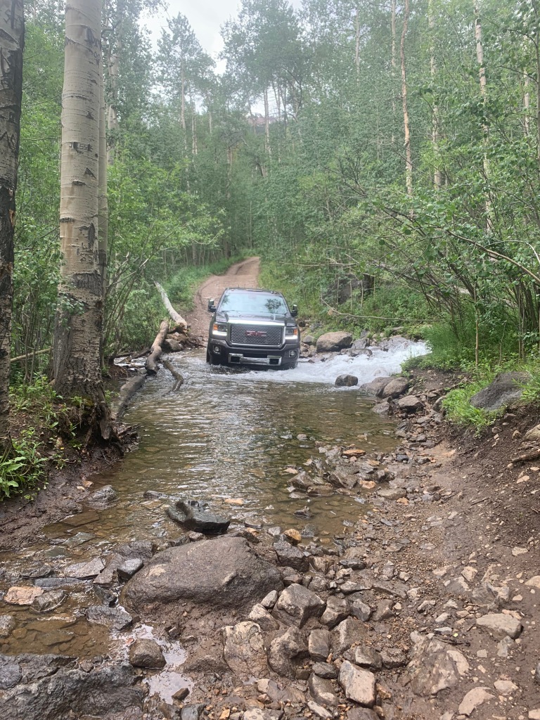
Getting to the upper trailhead was nerve racking, even in our GMC 2500 diesel 4X4 truck. Especially when we accidentally passed the trailhead taking ourselves about a mile too far down a sloppy, narrow, shear drop-off forestry road. Yikes!
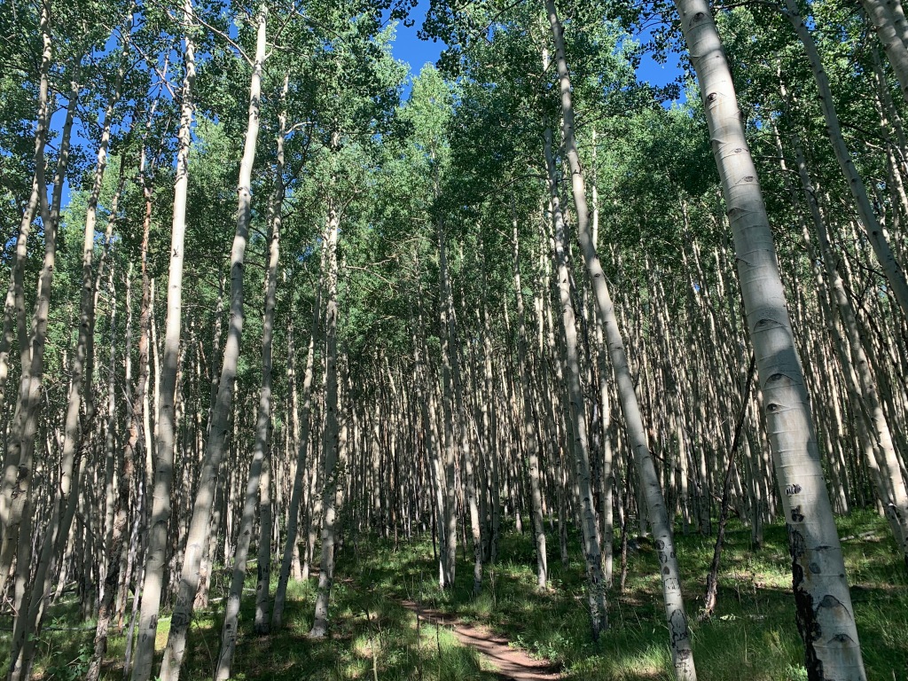
Hiking to Mt Elbert was much more enjoyable that Shavano. The trail was more gradual and less rocky, except for the last mile. Sections were so steep we used our hands in some areas to climb. We crossed snowfields and noticed that new trails are being cut in to make this climb a bit easier.
While camped at Twin Lakes we were situated just across the street from Mt Elbert Forebay. There is a lovely level 3-mile trail around the entire reservoir with an eagle’s nest on the southwest shoreline.
We loved everything about this location and can’t wait to get back there next summer!
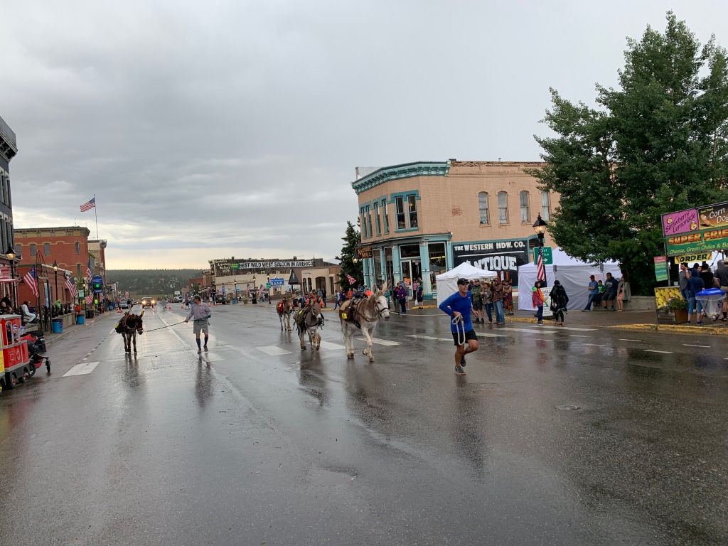
Leadville, CO (Elevation 10,152’)
As the highest incorporated city in the US, Leadville has a rich past in gold, silver, lead, zinc and molybdenum.
And if mining wasn’t enough it had its share of western characters as well.
Dock Holliday spent his lasts days served as a lawman in Leadville. Buffalo Bill died here of pneumonia. The Unsinkable Molly Brown moved to Leadville at the age of 18 and later survived the sinking of the Titanic. Poker Alice learned to play poker in Leadville and was a sought after dealer that liked smoking cigars while wearing pretty dresses.
Un-like a lot of mining towns out west that experienced boom and bust in the 1,800’s, Leadville actually managed to hang on to mining up until 1983, when the Climax Mine was finally closed.
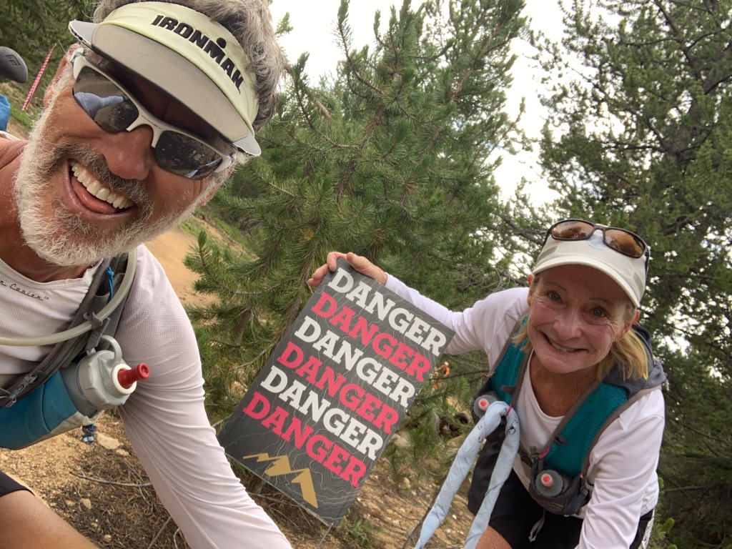
In an attempt to save the town, the Leadville 100 trail run was started in 1983 to boost tourism.
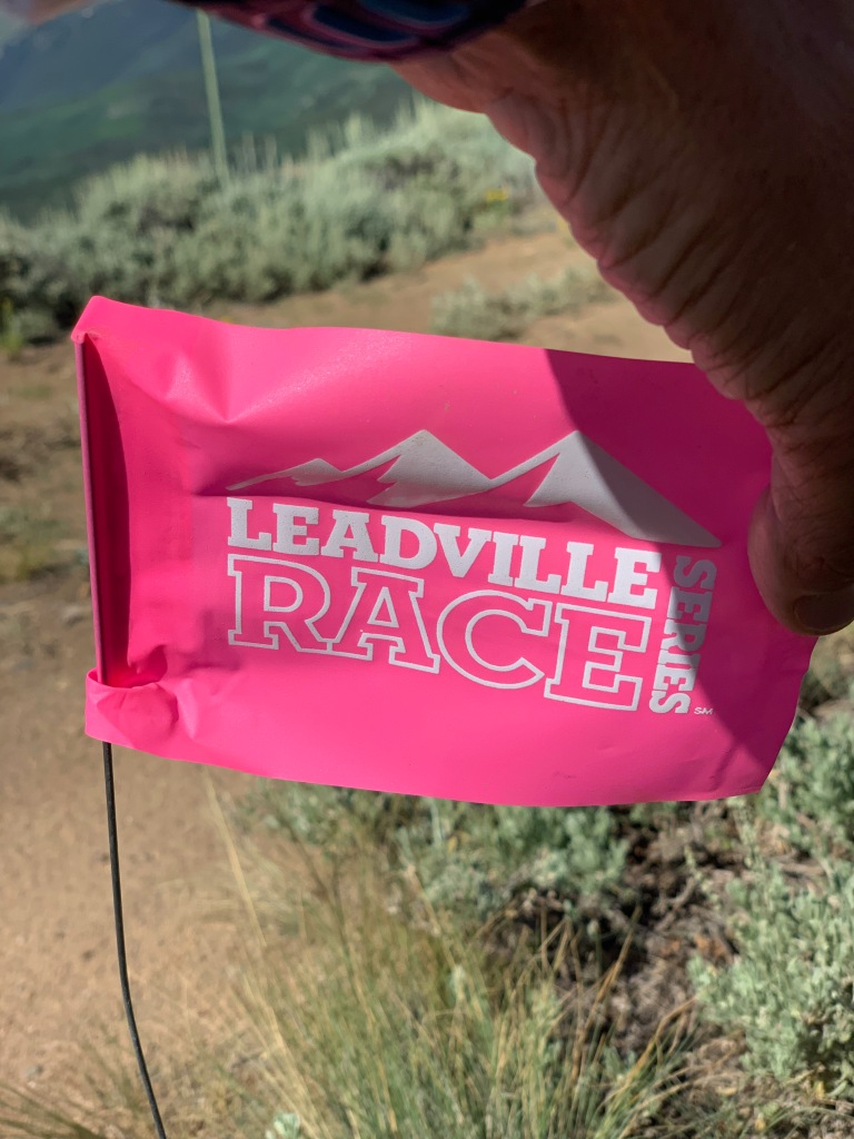
The LT100 or “Race Across the Sky” has a cult following with thousands of irrational runners applying for 1600-ish slots to run a course with 15,600 feet of elevation change, at elevations ranging from 9,200-12,620 feet.
In most years, fewer than half who start the race actually complete it within the 30-hour time limit.
A LT100 MTB mountain bike race was added in 1994.
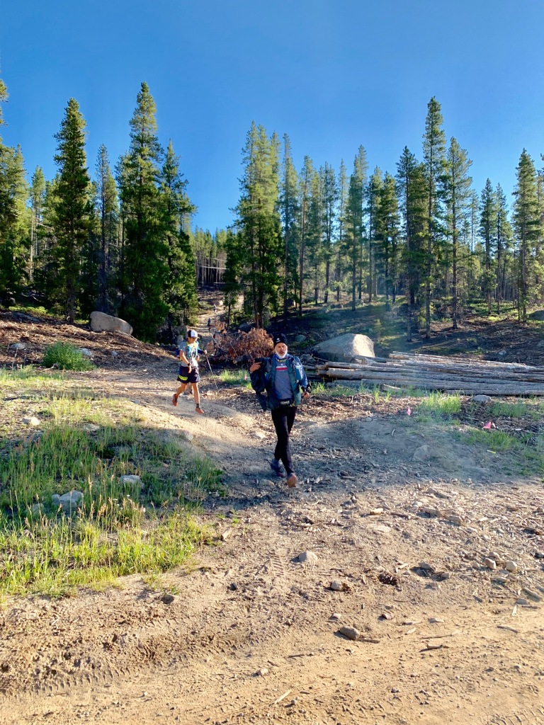
We showed up a week before the LT100 with the hopes of pacing our friend and “Leadville Legend”, Marge Hickman. Marge holds the woman’s record for number of Leadville finishes of fourteen.
Since being in Colorado this summer Jeff ran the entire Leadville 100 course in sections to train for his responsibilities as a pacer. But after Marge published a book about the start of this iconic race that differed from the current race director’s recollection, Marge was dismissed from the race.
Not to be deterred, Jeff jumped into the final 25 miles of the race to pace some random strangers and got a small taste of this iconic race.
We absolutely loved the little town of Leadville and it’s sporty vibe. It’s another place we would like to return to in the future.
Lake Tahoe (Elevation: 6,225’)
After Leadville we allowed ourselves 6 weeks to meander to Southern California for our camp host position at Doheny State Beach at Dana Point, CA.
We raced across western Colorado into Utah in the heat of summer, so we opted to stay at RV parks in order to run the air conditioner.
We made a quick stop in Reno to pick up some new Battle Born lithium batteries on our way to northern California to camp for 2 weeks at Jeff’s sisters house. Our plan was to accomplish two things. Install the new batteries and have the fifth wheels axels aligned at All Wheel in Redding CA.
It’s always a joy to stay at Jeff’s sisters, especially since they have plentiful tools, 50amp service, fresh eggs, blueberries and two Airedales.
Once we had our projects done we headed to the South end of Lake Tahoe for the Tahoe 100k.
Last year Jeff competed in this race and missed a cut off, giving him a DNF for the race. He redeemed himself this year completing this race in 17hours.
Mt Whitney (14,505’)
Two years ago I had a failed attempted of summiting Mt Whitney, the highest peak in the lower 48 and the highest peak in California.
It was a painful lesson in preparation, especially when I had to turn around within 1 ½ mile of the summit.
Since we were passing through the Alabama hills on our way to SoCal I decided to give this beast another shot…pending my ability to snag a permit.
We had left Tahoe early the next morning after Jeff’s race and put in a long day of driving to Lone Pine, CA. Planning a 4-day stay, I had hoped for a couple days rest in preparation to attempt to summit.
Plan A
I had borrowed a tent from a friend and planned to hike the 22-mile round trip with 6,100’ of elevation gain in two days. The first day start a leisure morning and hike 6-miles to Trail Camp, relax, eat and sleep, then head for the summit early the next morning, turn around and hike all the way back down.
Painful lesson #2 in preparation to summit Mt. Whitney…check your equipment well in advance of said hike!
The awesome lightweight tent I had borrowed only included the rain flap… but no tent. YEP! No tent.
Plan B
Forget the tent and camp out and leave on the hike at 3am to summit in one day. Once I got my brain wrapped around a 13-14hr hike I was all in.
But after checking on-line for a permit our first day in Lone Pine there was only one permit available…as long as I could start my hike by midnight…that night.
Plan C
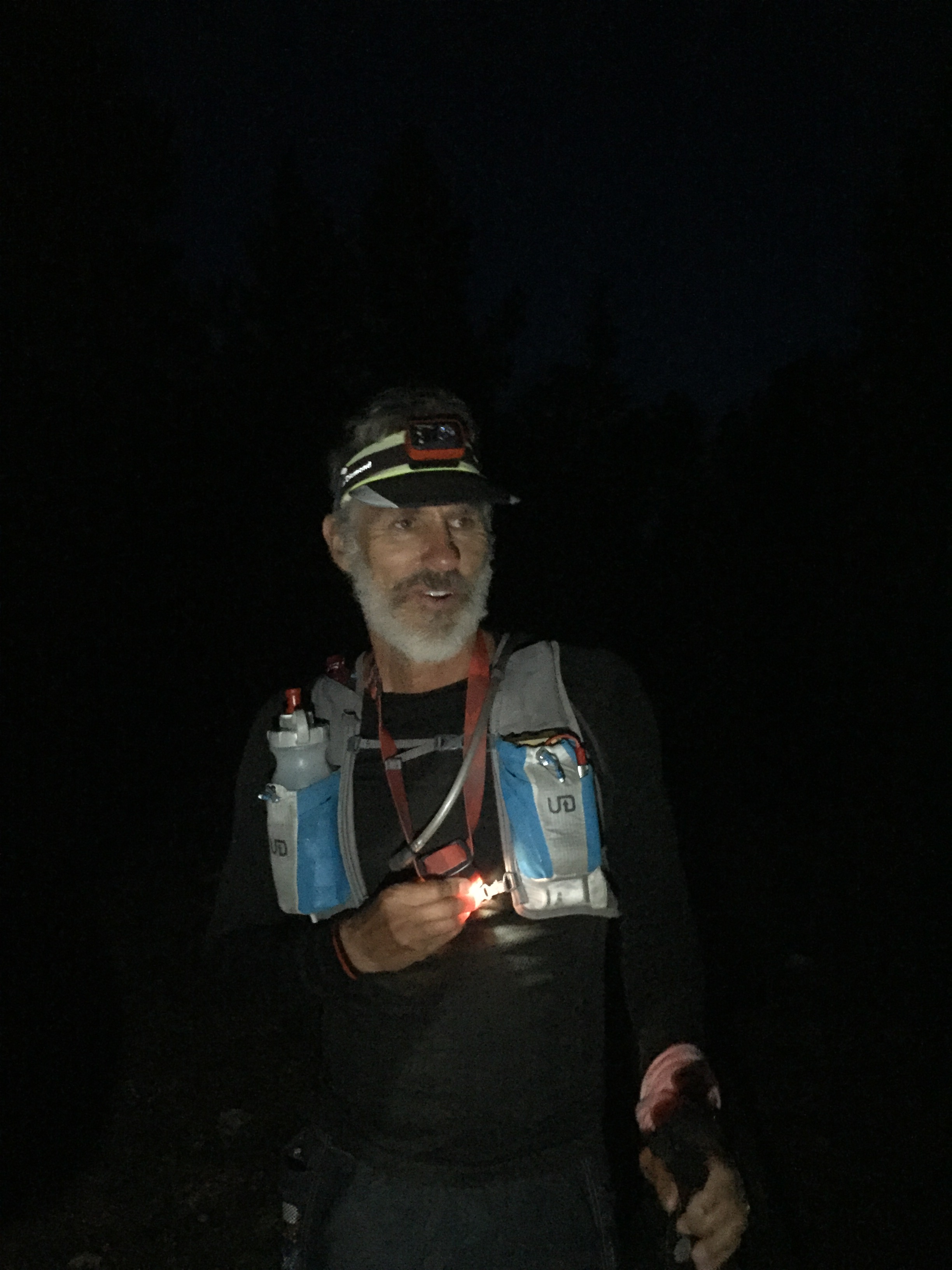
Drive up to Whitney Portal after dinner, sleep in the truck for a few hours then start my hike at 11:59pm and summit in one day.
Next post…Mt. Whitney. Why do you hate me so?
The Gifts of 2017
Posted by Deb in Biking, Cycling, Destinations, Full Time RV, Hiking, Running, RV Shows, Trail Run, Ultra Running on April 17, 2018
What can I say about 2017?
NOTE: I started this blog back in January…dang it! So here we are in April with a whole lot of travel under our belt for 2018 and I’m getting ready to post something about 2017. That is SO last year!
At the risk of feeling like I am writing about a time “back in the day”, I’m going to post it anyway!
What is it about January 1 that resets everything in our brains to start over?
Start a diet to lose weight. Start working out at the gym. Start emptying the inbox by the end of every day. Organize the kitchen cabinets…I got this!
I’ll be the first to admit that I do this myself… Every. Single. Year.
I started using my Lose It app again to take off these stubborn 10lbs. Why I couldn’t make myself do it October 17th is beyond me. But come January 1? I am so excited to track my intake, count every almond, cut out cream in my coffee and kick my evening piece of chocolate to the curb! Easy peasy.
But over time the enthusiasm fades, the rules become more like suggestions and I am once again carrying an extra 10lbs around my midsection.
I think from now on I’m going to declare “JANUARY 1” once a quarter, since that seems to be the longevity to my New Years commitments. WHO’S WITH ME???
Despite my lack of stamina for some things in 2017, Jeff and I had a wonderful year of RV’ing. Not everything went as planned, but we are thankful for a lifestyle that allows us to be nimble enough to take on whatever life throws us.
So here are some of our favorites and some of our surprises from 2017
Favorite Boondocking Location
We started the year thinking we were going to go to Rocky Point Mexico. But after pricing insurance for the rig we went to Yuma, Arizona instead. Specifically, American Girl Mine BLM just across the border of California from Yuma.
It’s probably the most barren landscape we have ever spent time at. But the amount of trail running was endless, the Internet speeds were crazy fast, city conveniences close by and a Mexico experience within a half marathon.
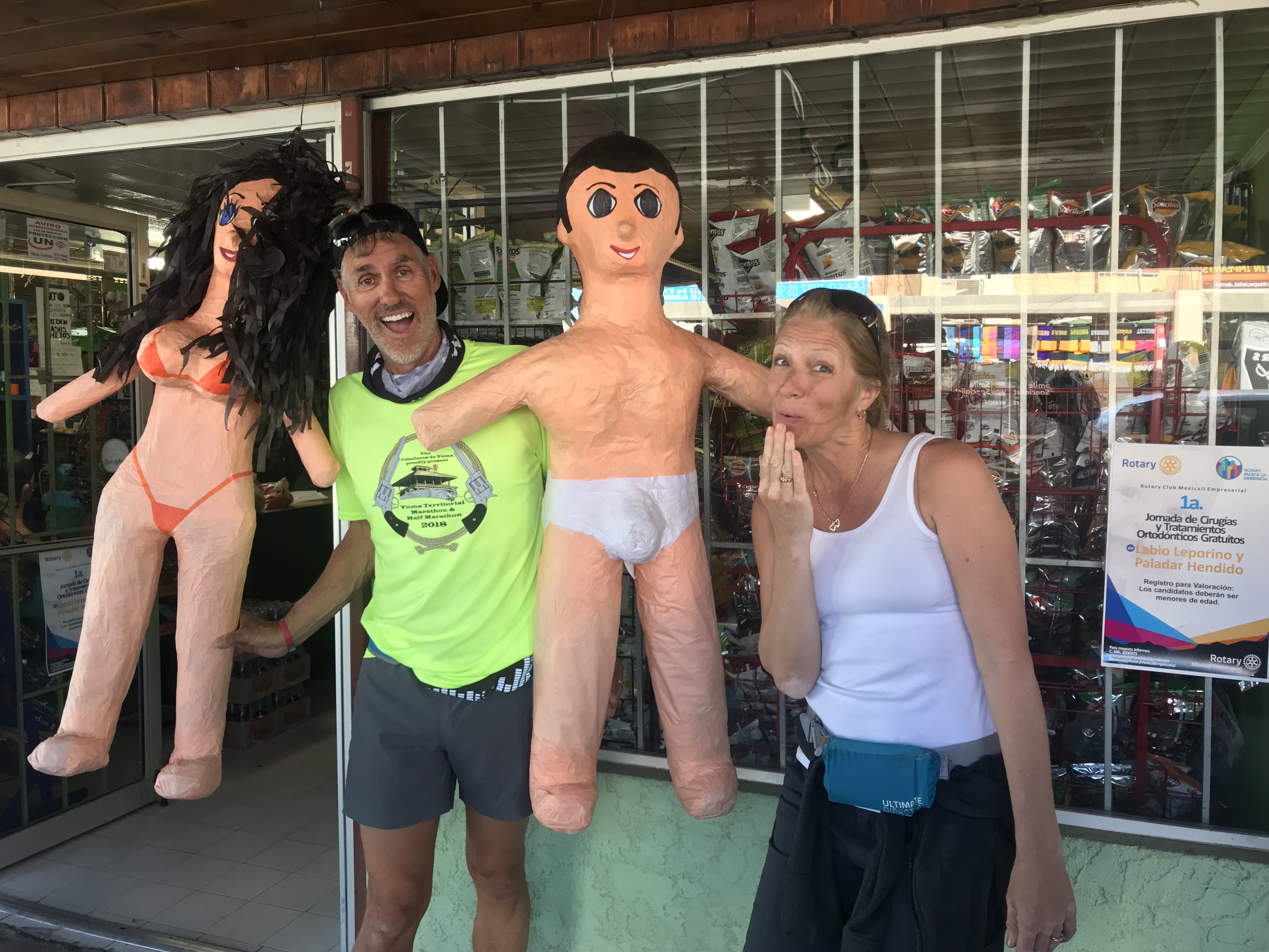
A few “things” you will see in Mexico!
Days are warm. Nights are cold. Unbelievable sunsets. Other RV’s as close or as distant as you please. All free for the taking.
Favorite Work Location
Working in the RV industry we worked plenty of RV shows in 2017.
Quartzsite
Good Sam Rally-Phoenix
The Escapees Rally-Tucson
National Hardware Show-Las Vegas
Overland West Expo-Flagstaff
Easter Jeep Safari-Moab
Overland East Expo-Ashville, NC
By far our favorite show is the Overland West Expo. To start, we love Flagstaff! Camping amongst the pines. The wind creating a very distinct sound through the trees. The smell of pine needles baking in the sun.


Then there are the customers we get to interact with. They are inventive, savvy, astute and creative. They are not only well travelled, but minimalists who travel in modified Land Rovers, Toyotas, Motorcycles and Earth Roamers. They are not confined to USA borders but prefer to explore the backwoods of the world.
Favorite Sporting Event
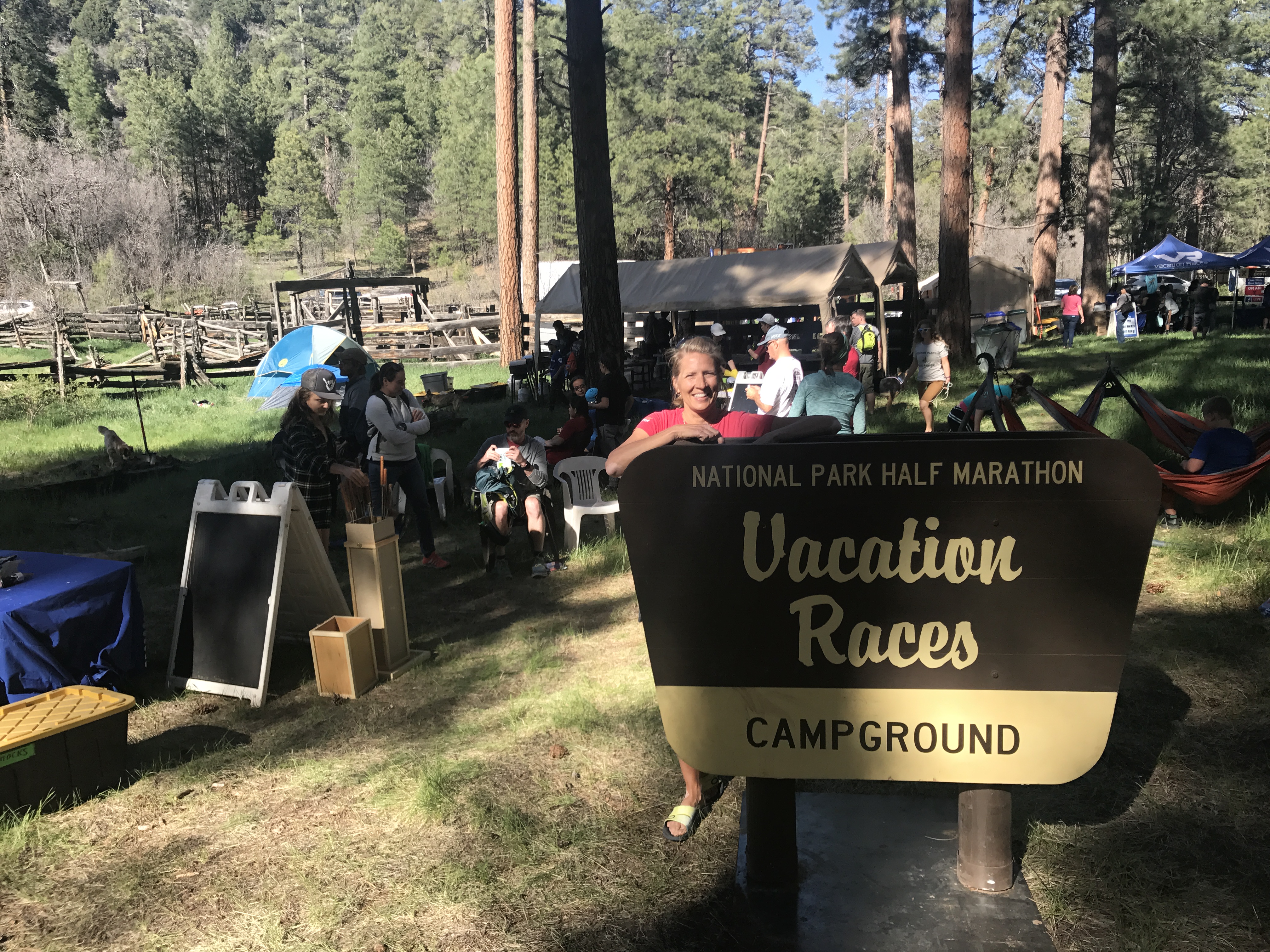
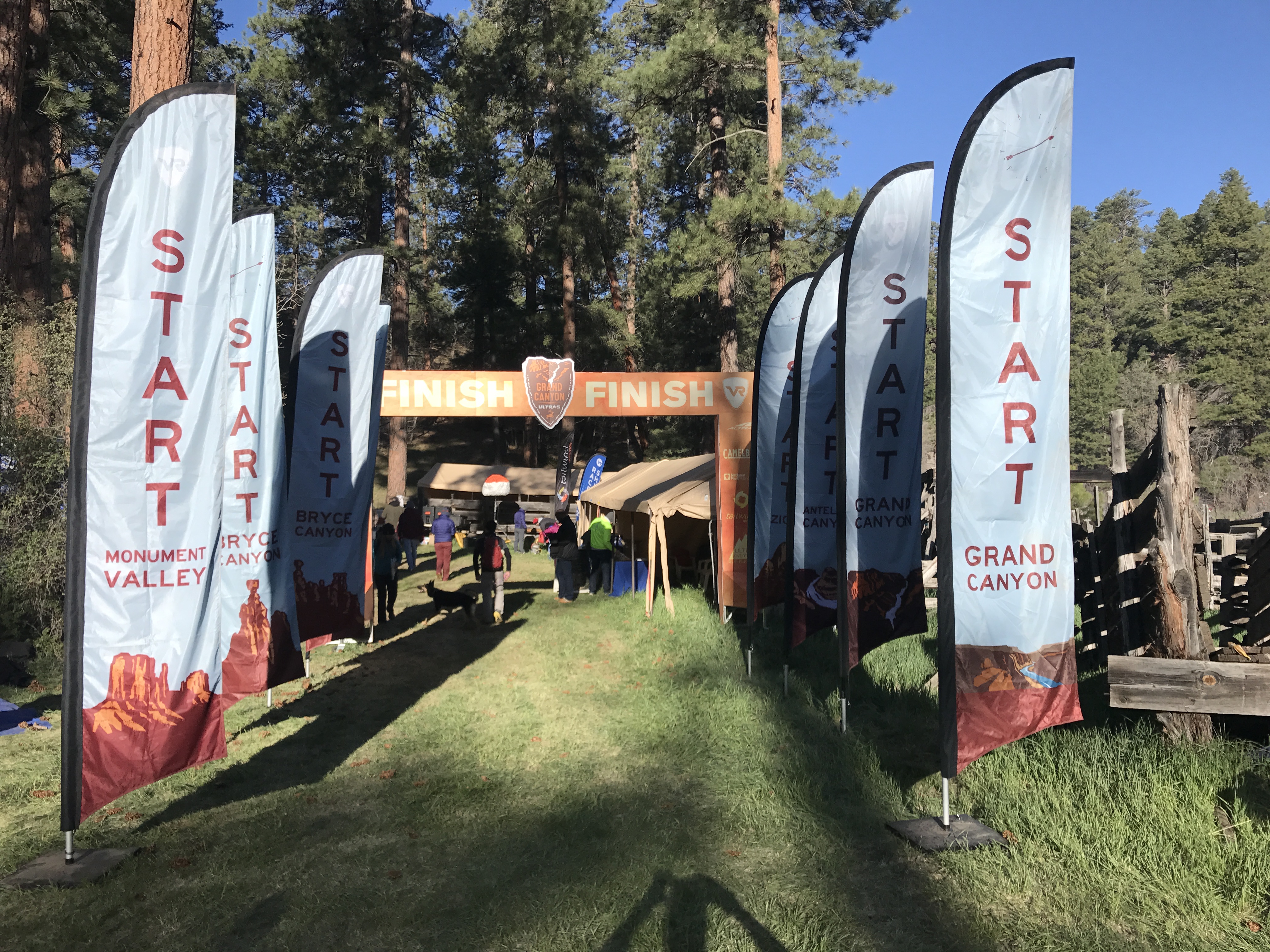
This category is a bit tough to isolate. Trail Runs, Hiking The Grand Canyon, Ultra Runs, The Bentonville Arkansas Half Marathon, and Vacation Race series.
I’m certain that Jeff would consider his very first 100-mile Trail Run at Bryce Canyon the highlight of 2017. Pushing his body not just during the race, but for a year of training was a challenge. All to see if he could actually do it! What an accomplishment.
Mile 51
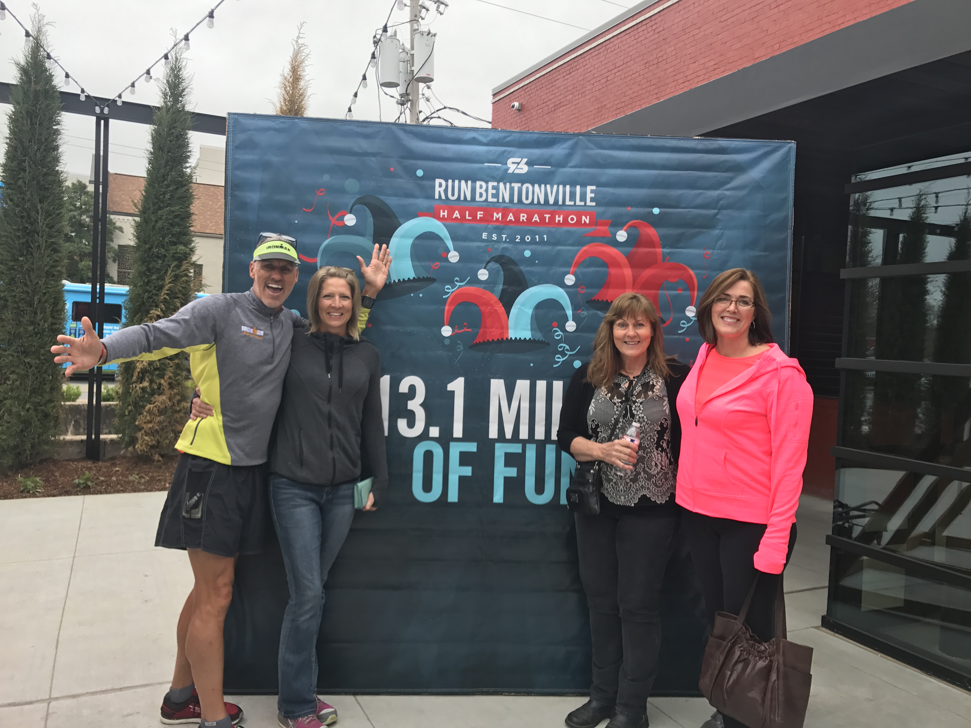
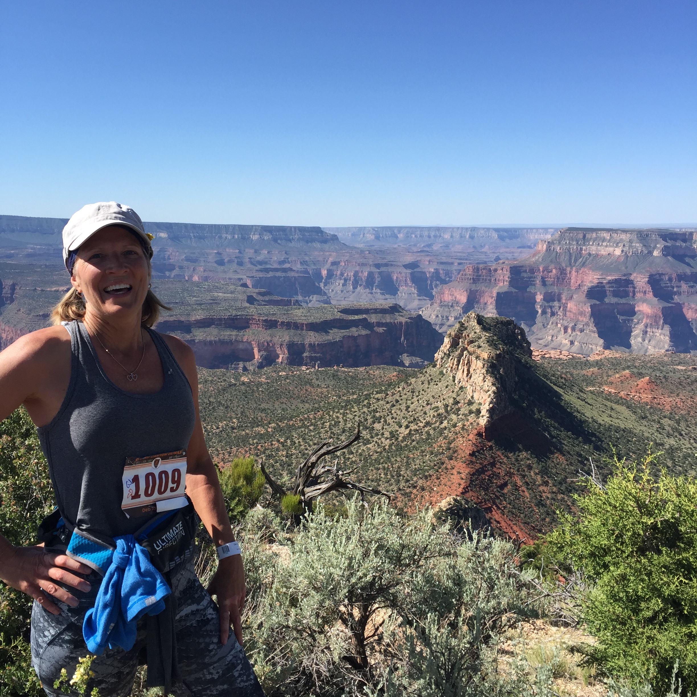
For me was the Bentonville Half Marathon. I ran the race with my sister-in-loves in my hometown surrounded by friends. It was a race and a family reunion that was so special. I ran the Grand Canyon Half too, but Bentonville and family made this one a standout.
Lastly, the bike ride across Iowa during RAGBRAI was special as well. Riding along with our RV’ing buddies with endless laughter and great food made for a memorable time.


Favorite Hikes
We did a lot of hikes in 2017 but the two that stand out the most are two hikes that are hard to get permits for.
The Wave. What a special experience this was! Having our number drawn for a permit, the challenge of finding it, having our dog Sam and friend Whitney along and the isolation from it all made for a memorable experience. The color and texture was unlike anything I have ever seen and I feel so fortunate to have hiked there.
Havasupai Falls Part 1 and Part 2. The hike to the falls was not that incredible, but the falls themselves and day hikes from the campground were stunning. Blue green water that appears fake at times, were unbelievable. This was our first ever backpacking trip without the RV and it gave me confidence that, with the right equipment, I can manage some overnight hiking trips in the future.
Biggest Surprise
Spending 6 months in the mid-west. This was NOT part of the plan for 2017. My Grandmom passed away 7 days before her 100th birthday. So we stayed in St Louis for the memorial. Then I was so thankful that my Mom decided to move closer to my brother. So we sold her house, packed everything up and moved her to a new home.
Then I needed to have two unplanned surgeries. Nothing life threatening. Just necessary. Tests, doctor appointments, surgeries and recovery. All took a better part of June through December.
Second Biggest Surprise
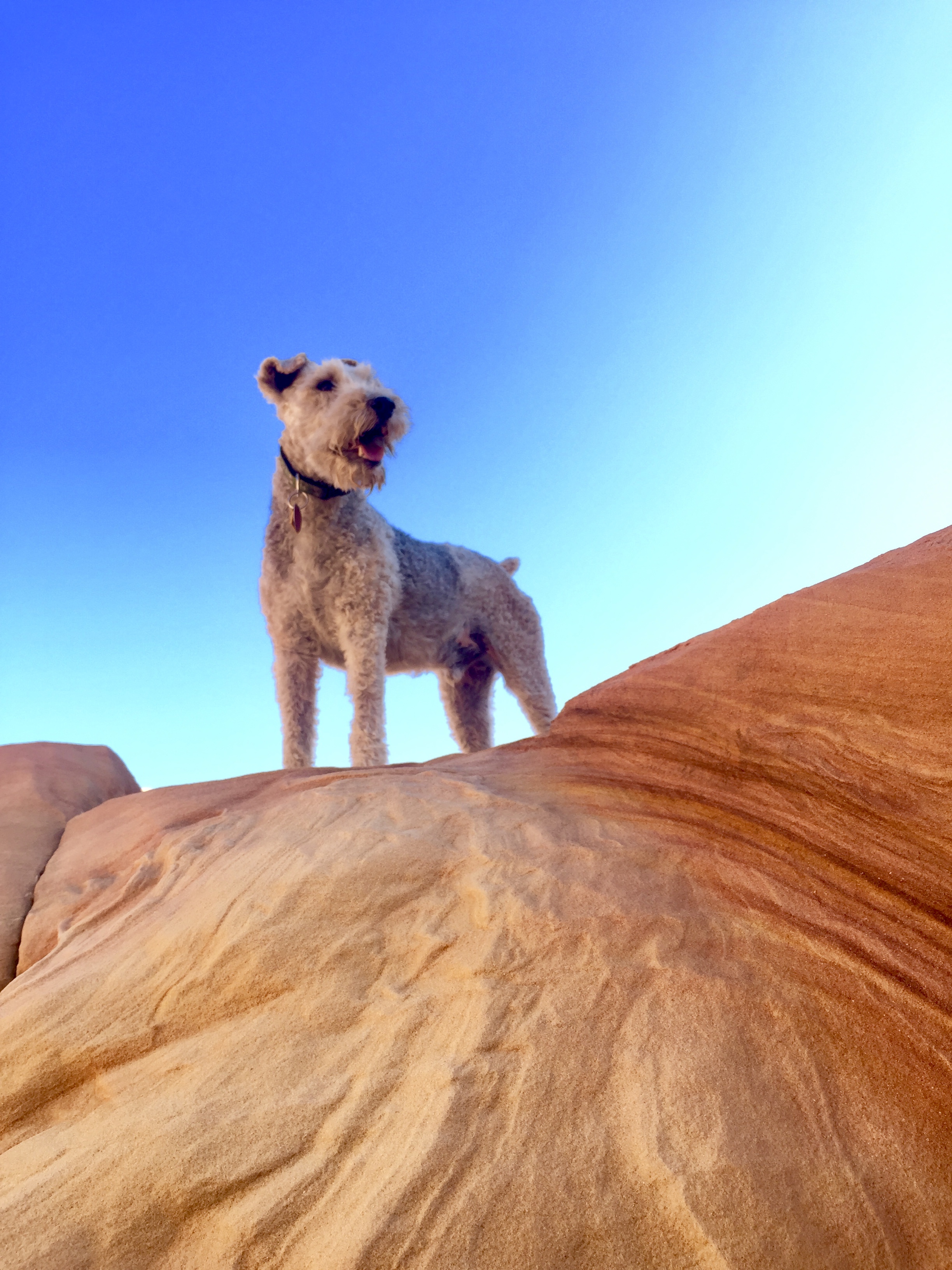
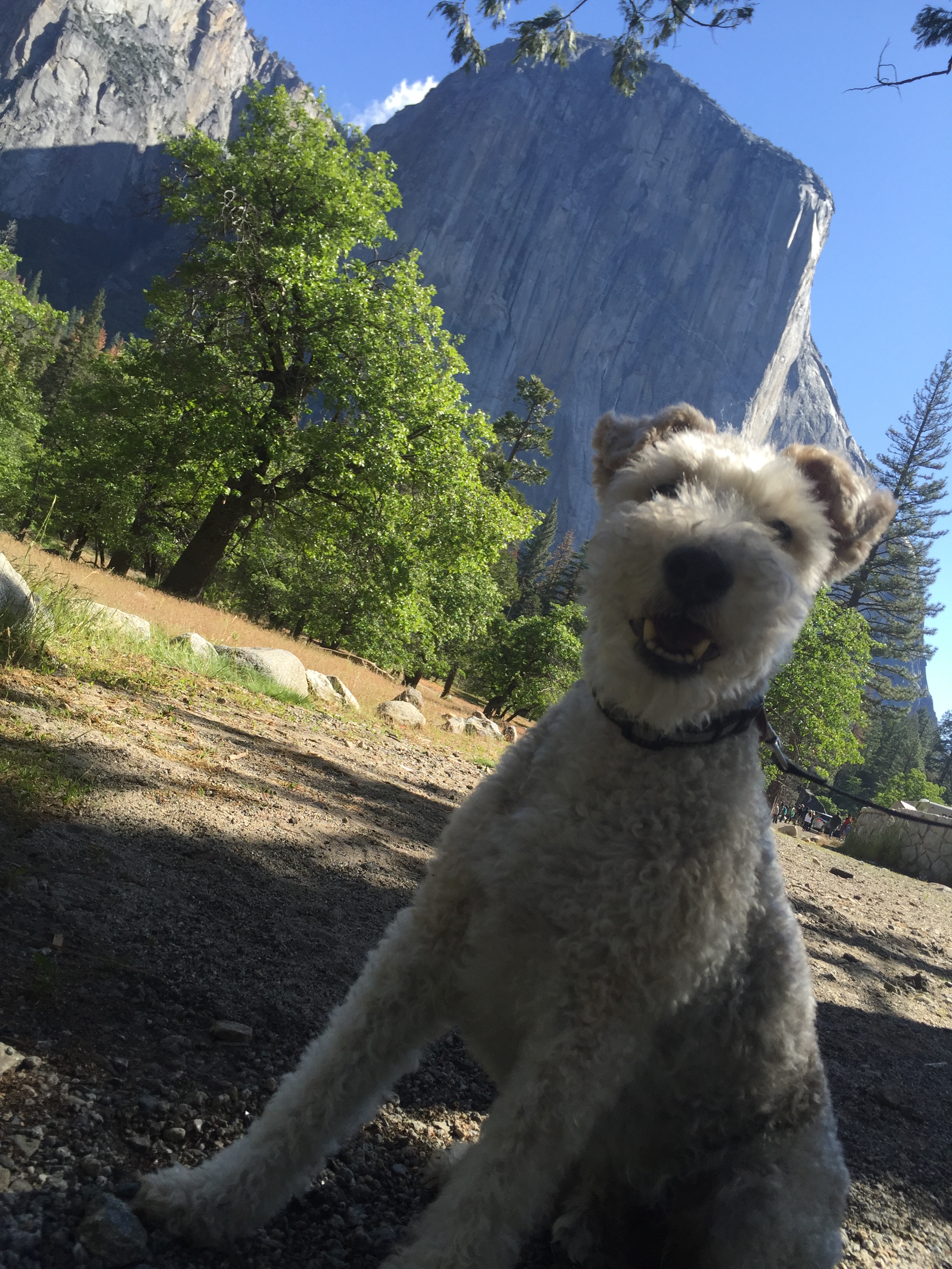
We adopted a new dog. Sammy-do-da is getting up in age (13 years) and we were considering getting a younger dog for Sam to mentor. Sam is an amazing dog and we would love for his good manners to rub off of another dog. We are partial to Wired Fox Terriers and had been keeping an eye out on WFT Rescue Facebook sites.
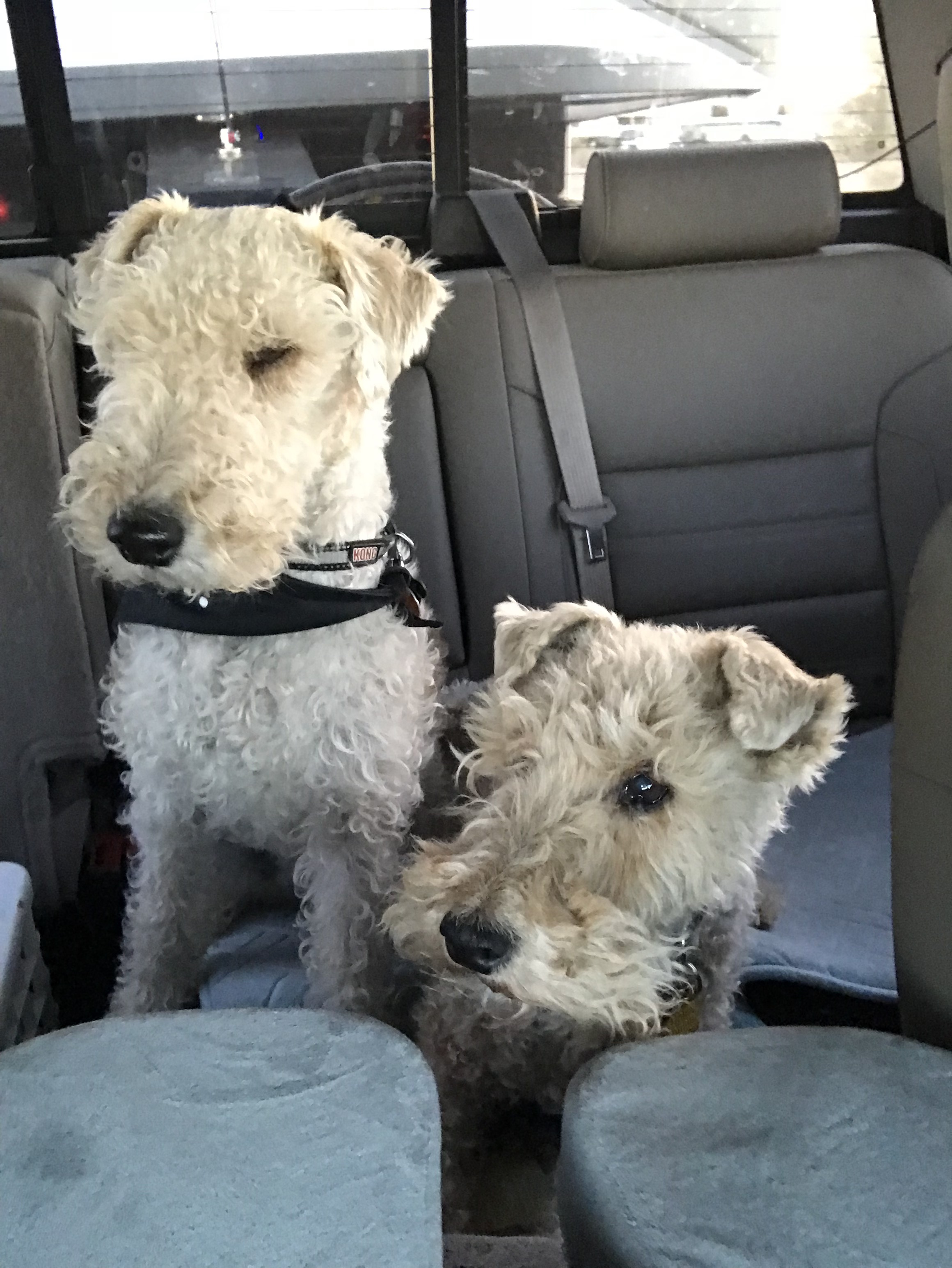
Bullet (L) and Sam (R)
Dogs have come up but Foxies have a certain temperament that doesn’t always mesh with kids or other dogs. We can’t have that with our RV lifestyle so we have taken our time to wait for just the right fit for our family.
One popped up in Tulsa just 2 hours from home. Bullet’s description sounded very similar to Sam’s and we reached out to his Foster. We set up a meeting and Sam and Bullet hit it off. That day we came home with a new dog.
Bullet (B for short) it super sweet just like our Sam with about 10 times more energy and hearing that can detect a wrapper from rooms away. We are having to adjust to having a dog that does not come when we call him or mind his manners. Training has become a new priority which leaves us exasperated at times. But he has a good heart and we will continue to do our part to bring out the best in our sweet B.
Well, thats it for 2017. I will hopefully get caught up on our travels in 2018 very soon. Since January 1 has come and gone and I am 17 days into my second January 1, I am committed to getting my blog back on track.
Now where did I hide that chocolate!
Off to another lame adventure!
Back to the Midwest
Posted by Deb in Biking, Boondocking, Cycling, Destinations, Iowa, RAGBRAI on October 31, 2017
It’s been 2 ½ years since we’ve had the RV in the Midwest. We have visited plenty of times, just by air. But this time we needed the RV. In the humid Midwest. In the middle of summer. Insert whining.
It’s not that we don’t enjoy the Midwest. I grew up there for goodness sake. But after spending the last 2 years out west, beautifully dry and bug free, we were not looking forward to submerging ourselves in the sweat and mosquito, tick, gnat, fly (insert your most hated bug here) buffet.
We have grown accustomed to the dessert lifestyle. And when you can choose where you WANT to be in the summer it seemed odd to me that we were heading to the most avoided summer destination for RV’ers.
It takes something special to get us to leave the west and we had two events that were worthy of turning the truck east. My Grandma’s 100th Birthday and RAGBRAI.
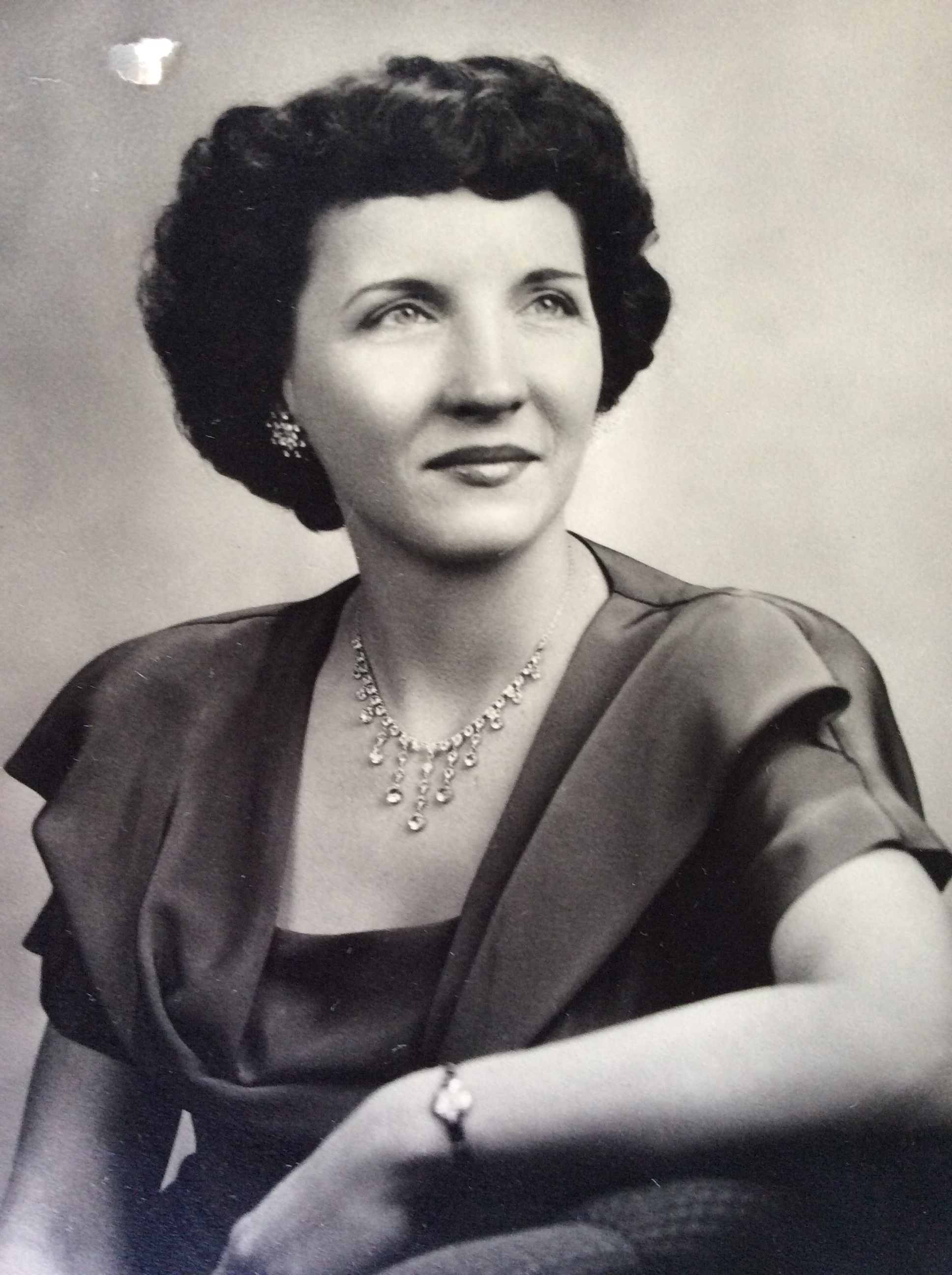
Growing up in Belleville, IL I had the fortune of living next to my Grandparents. Grandma Tess was the built in babysitter and cook extraordinaire that filled our days with homemade pies, jellies and the most delicious cinnamon rolls you ever tasted. The only thing that rivaled Grandma’s roll was her cream puffs!
Grandma was a worker bee her entire life and didn’t see much reason to sit down.
Sometime in grade school she moved an hour away and I begged my mom to spend the night at Grandma’s. I spent 4 days washing and waxing the car, learning how to do laundry and iron shirts and cleaning windows. If it weren’t for Grandpa taking me fishing I’m sure there would have been nothing left of my fingers, being worked all the way down to the bone.
I never did ask to stay overnight there again!
Today I can see the fruits of her influence, tenacity and drive in me and I would not have wanted to grow up any other way!
Grandma had been living in a very nice Assisted Living facility just 1 mile from my Mom in St. Louis. She had had some recent falls and was fading quickly. I’m sad to say that she passed away while we were in route to St. Louis, seven days shy of her 100th birthday!
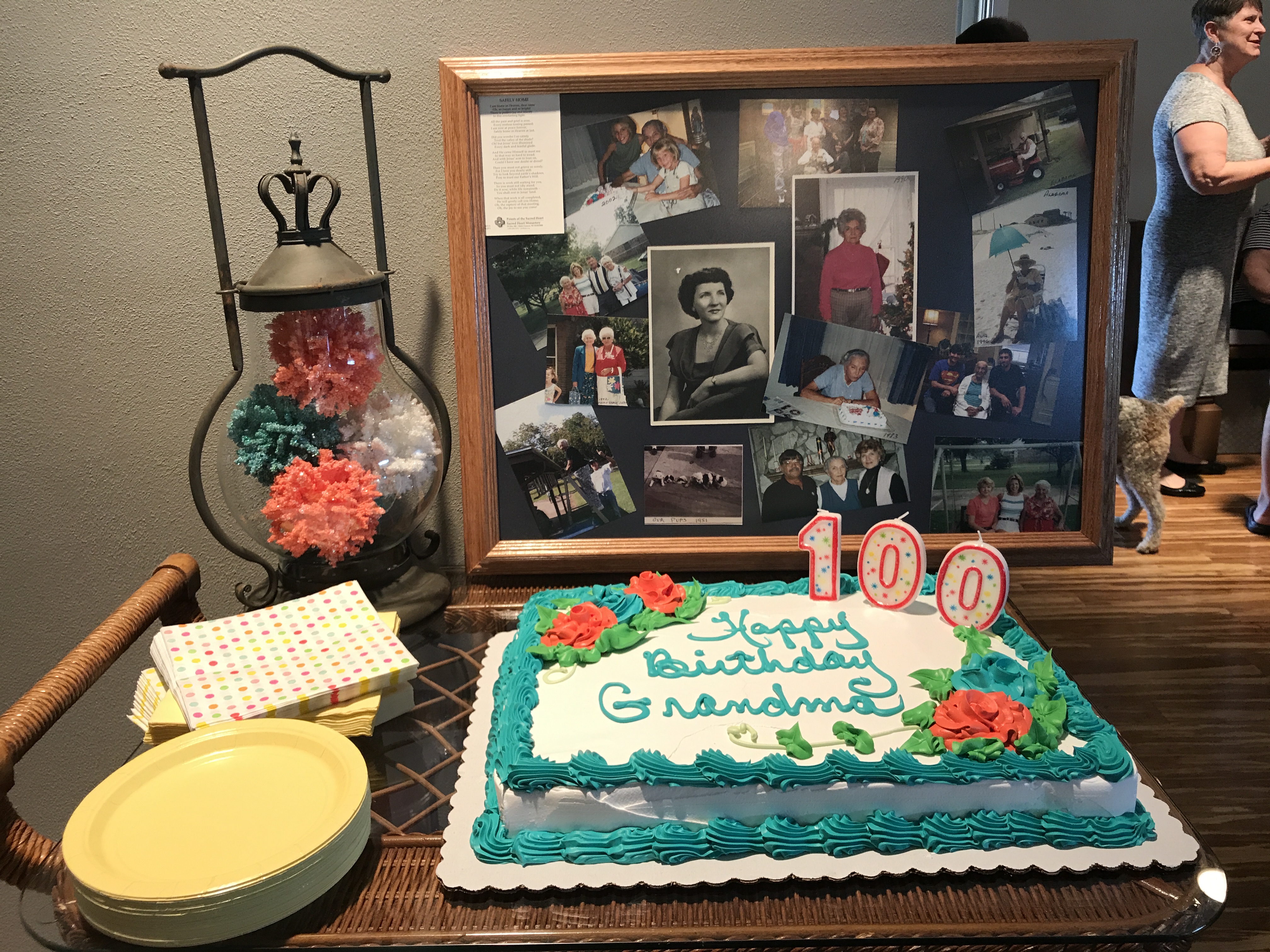
We had a 100th birthday party for her anyway and I’m thankful that we were able to attend. Family and friends celebrated her life, had food, sang Happy Birthday and ate cake and ice cream. How can you be sad about 100 years!?!
I Love you Grandma Tess!
RAGBRAI
The second reason we found ourselves in the Midwest was Jeff and I had committed to RAGBRAI.
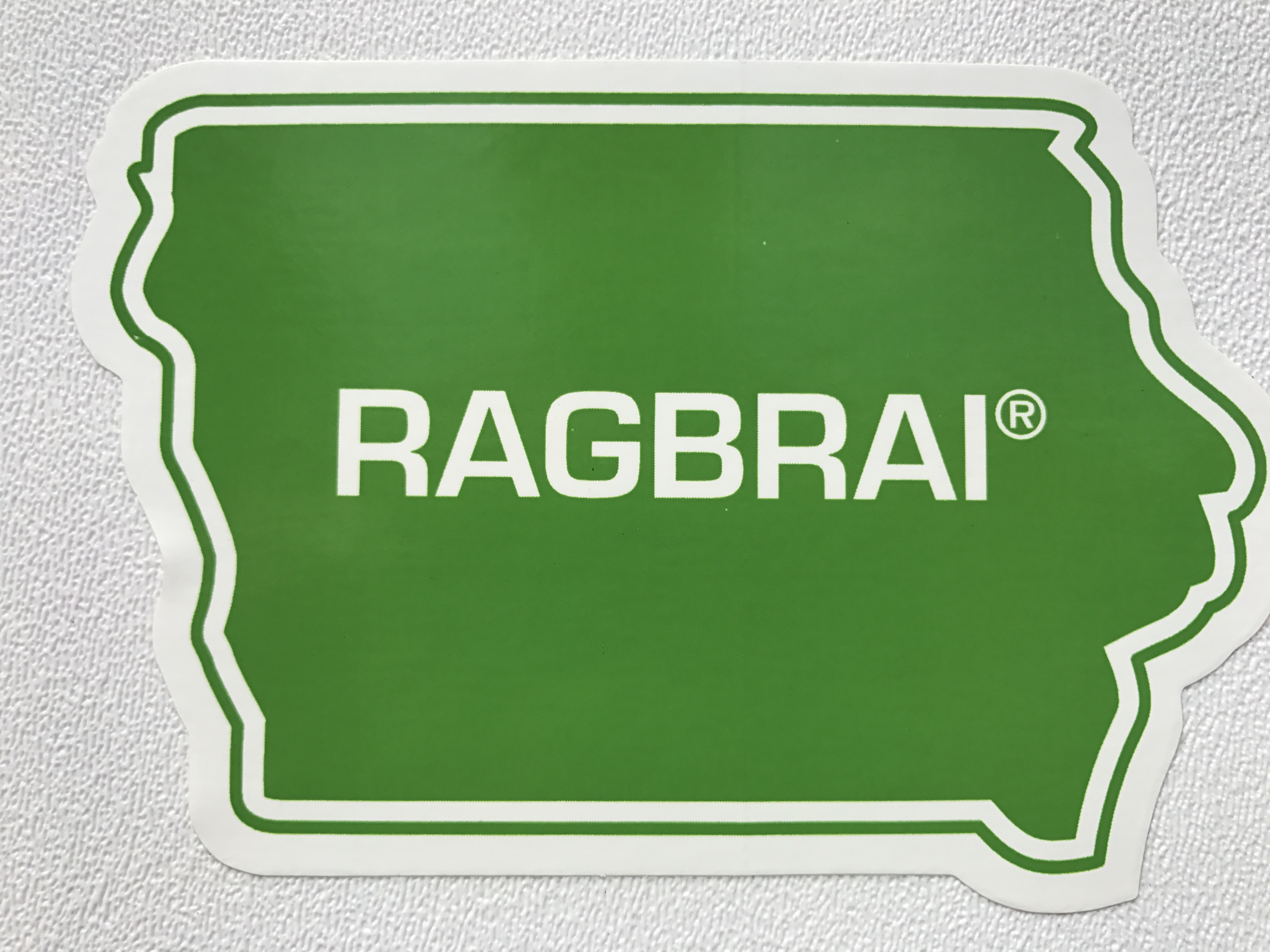
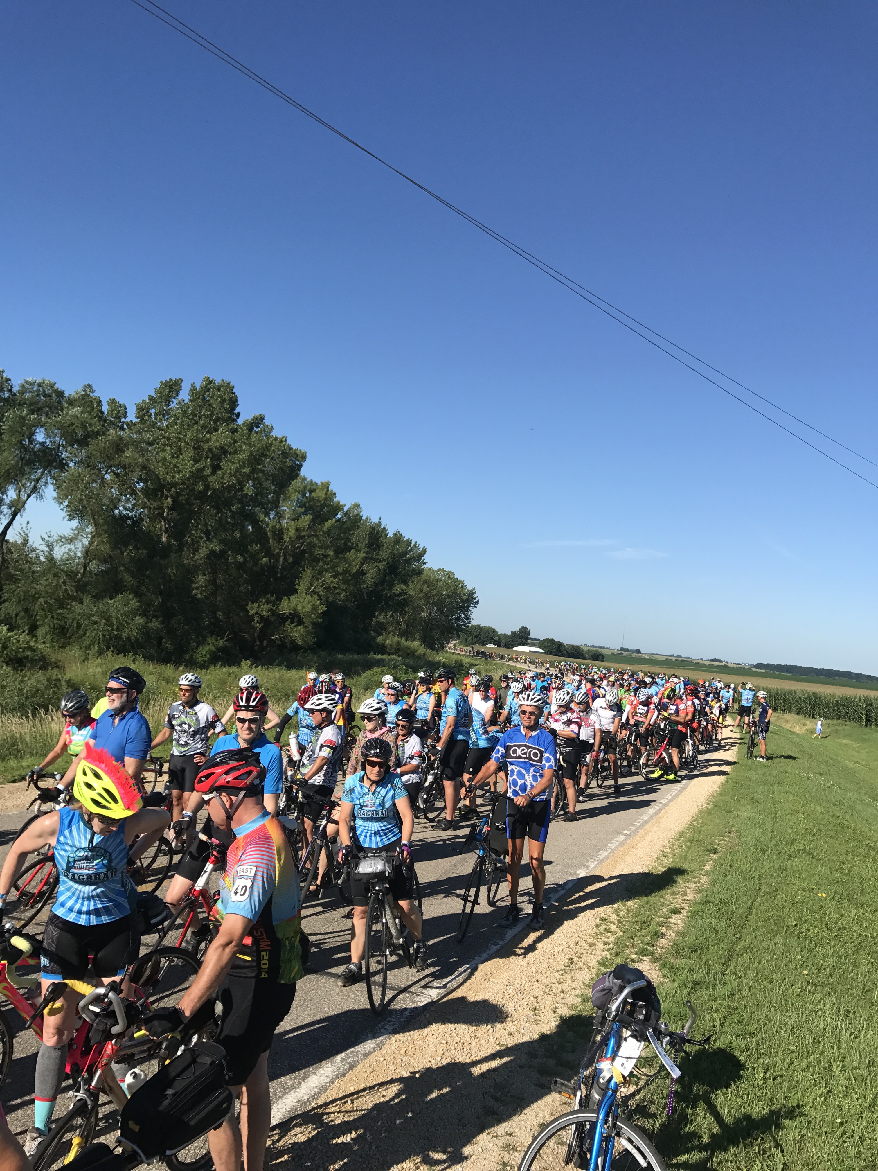
RAGBRAI, the Register’s Annual Great Bike Ride Across Iowa, is an Iowa cycling institution held the third week of July every year. I’m not sure what is bigger in Iowa. The State Fair or RAGBRAI.
From the RAGBRAI website…
“RAGBRAI is a bicycle ride, not a race. It started in 1973 as a six-day ride across the state of Iowa by two Des Moines Register columnists who invited a few friends along. It is held the last full week in July. RAGBRAI is planned and coordinated by The Des Moines Register, and riders who participate in RAGBRAI understand that they do so at their own risk.
The RAGBRAI route averages 468 miles and is not necessarily flat. It begins somewhere along Iowa’s western border on the Missouri River and ends along the eastern border on the Mississippi River. We change the route each year and announce the overnight towns in late January at the RAGBRAI Route Announcement Party, in The Des Moines Register and on our website.
Eight Iowa communities along the RAGBRAI route serve as “host” communities for overnight stays. RAGBRAI is a guest in these communities and we ask our riders to behave as such.”
20,000-30,000 people show up from around the world to ride this event. This would be our third time to do the ride, but this time we had some friends along for their first time.
Don’t blink or you will lose your party
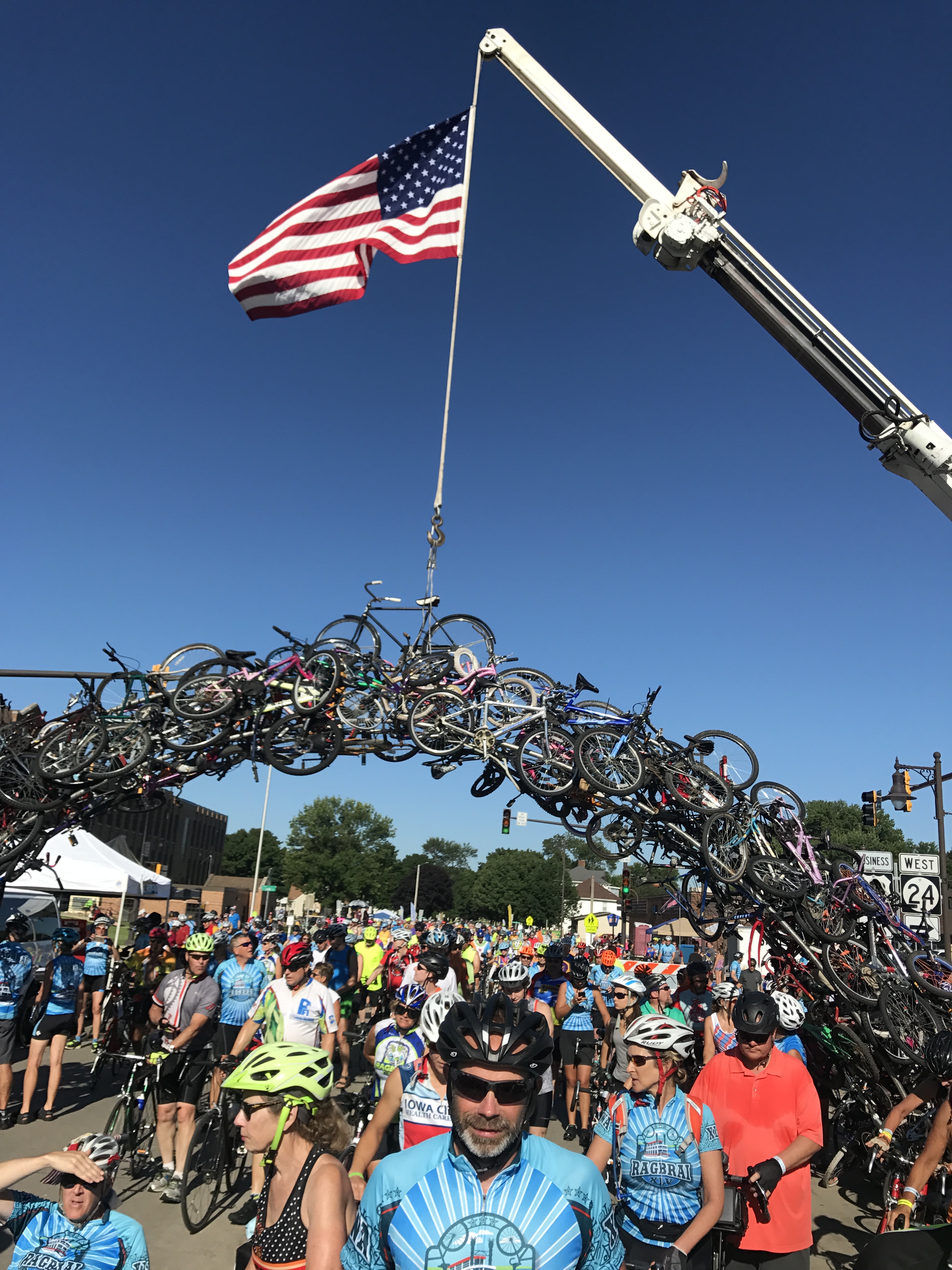
Geoff and Donna under the Bicycle Arch
Mike and Donna of Flying the Koop and Tom and his Father-in-love Fred from Elkhart, Indiana and Geoff from Austin, Texas. Team “RV there yet”!
We had such a great time. Iowans are a super friendly bunch and you get a feel for small town America at this event.
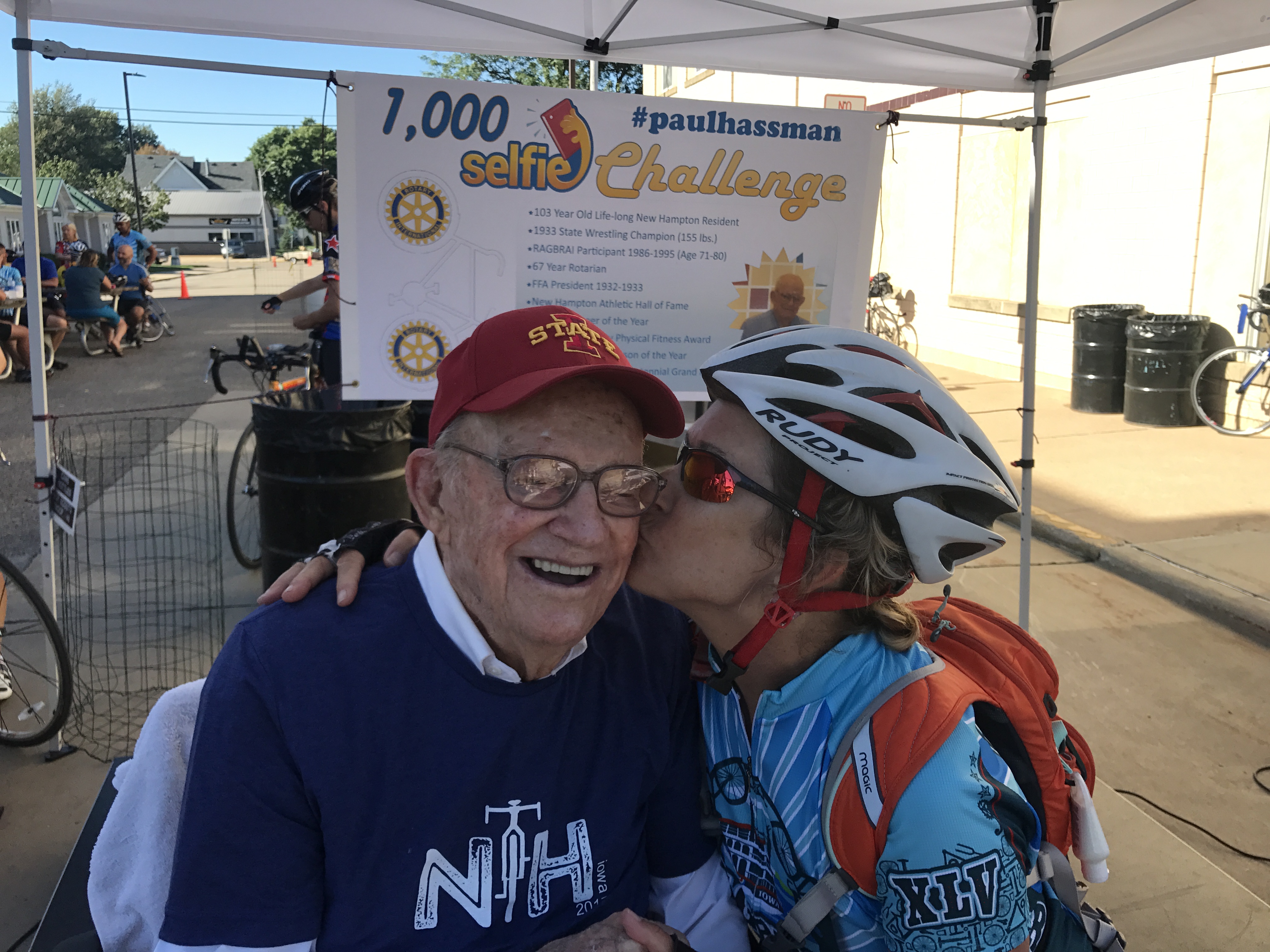
Mr. Hassman going for 1000 selfie kisses
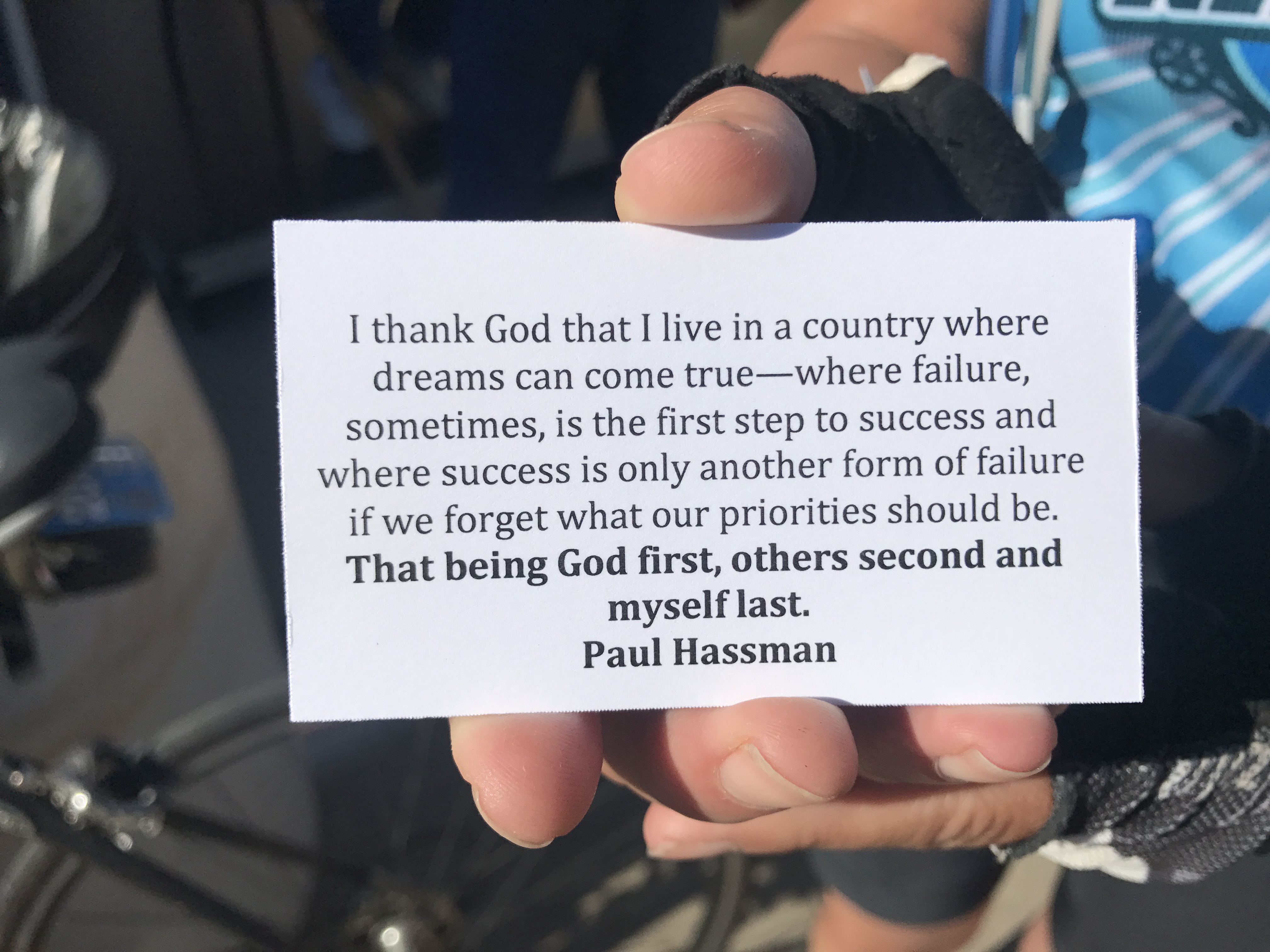
Mr. Hassman mission statement…AMEN!
The RAGRAI route is changed every year and towns bid much like the Olympics to have the event roll through their city. It’s a huge economic boost for RAGBRAI communities lucky enough to be chosen.
Towns are usually very small with populations around 1,500-6,000 that swells with the masses of hungry cyclists ready to purchase as much pie, homemade ice cream, burritos, turkey legs, pork chops, draft beer and brats they can make.
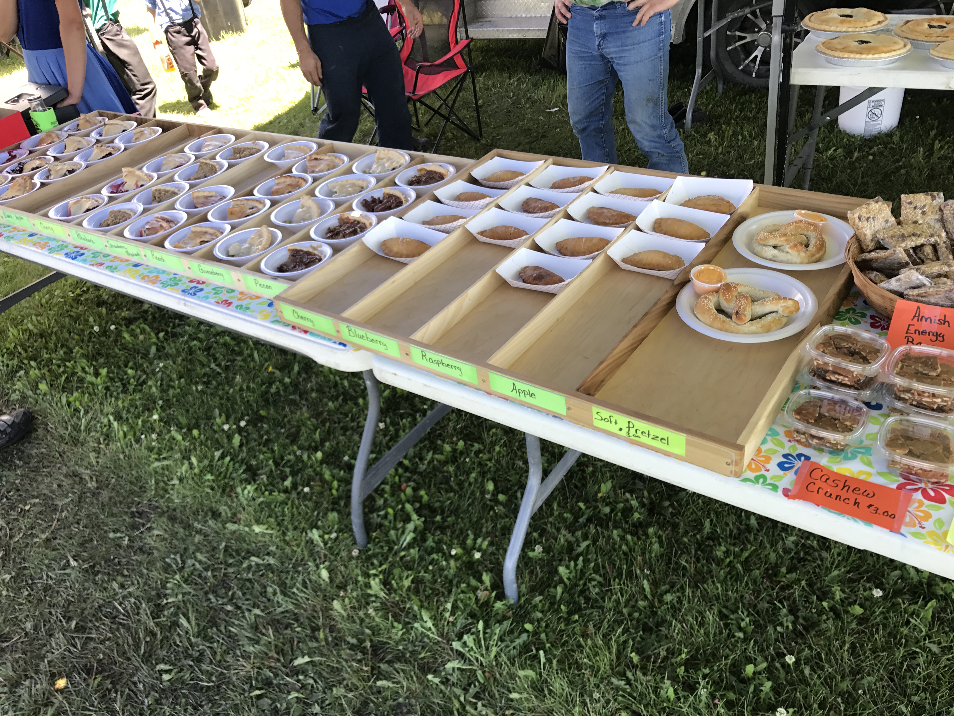
The Lutheran Church wins “Best Pie” award from our group
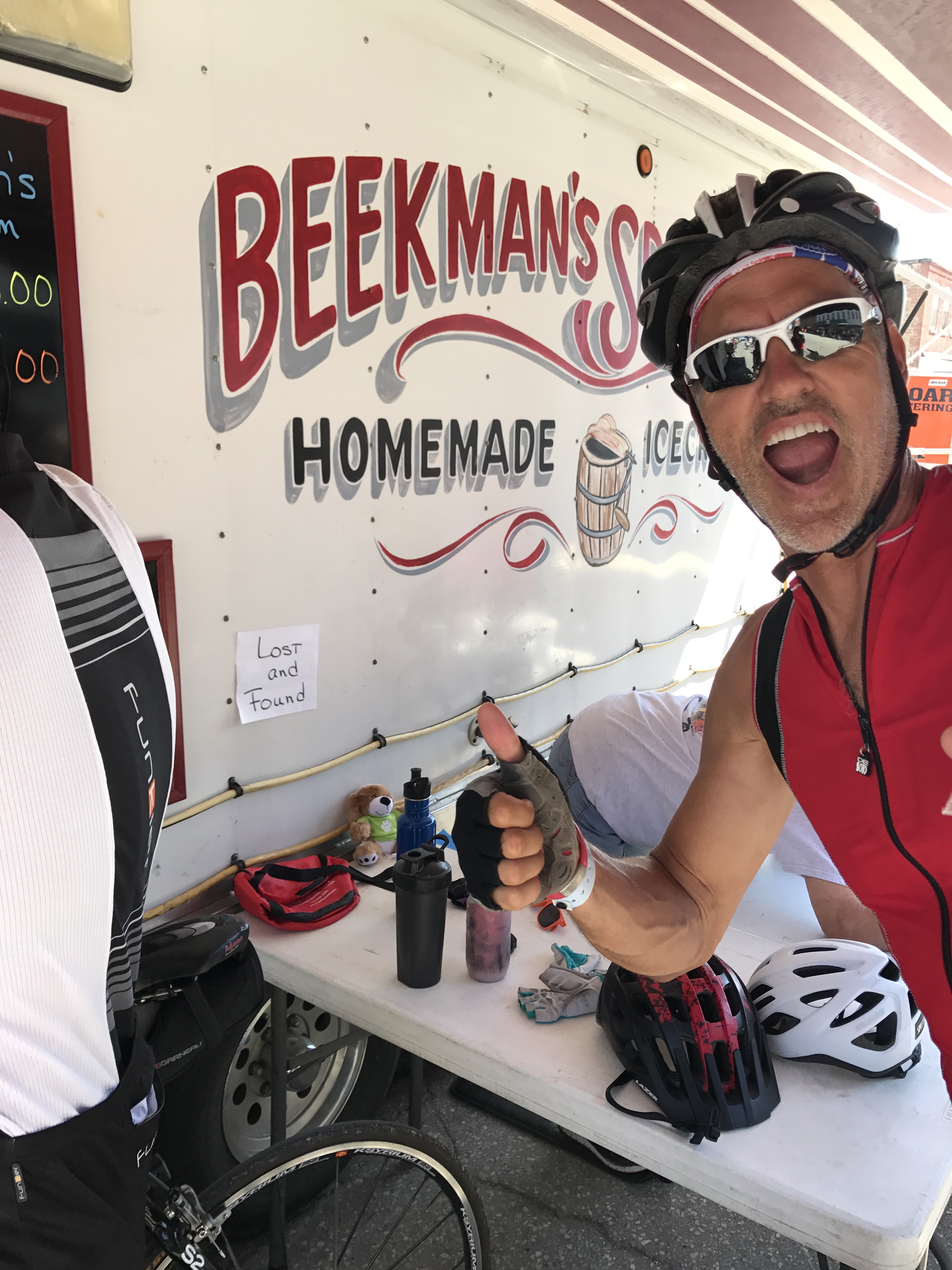
Jeff testing the lick-ability of Beekman’s Ice Cream
The weather was perfect this year! As team “RV There Yet?” head out each morning by 6:30-7:00 AM my job was to get our RV caravan to the next host city before the crowds of other RV’s got there.
Each host town has designated RV campgrounds that are usually located on fairground or school parking lots. The key to getting an easy in, easy out spot is to arrive early and stake your claim and let everyone else figure out how to fit a square peg into a round hole around you.
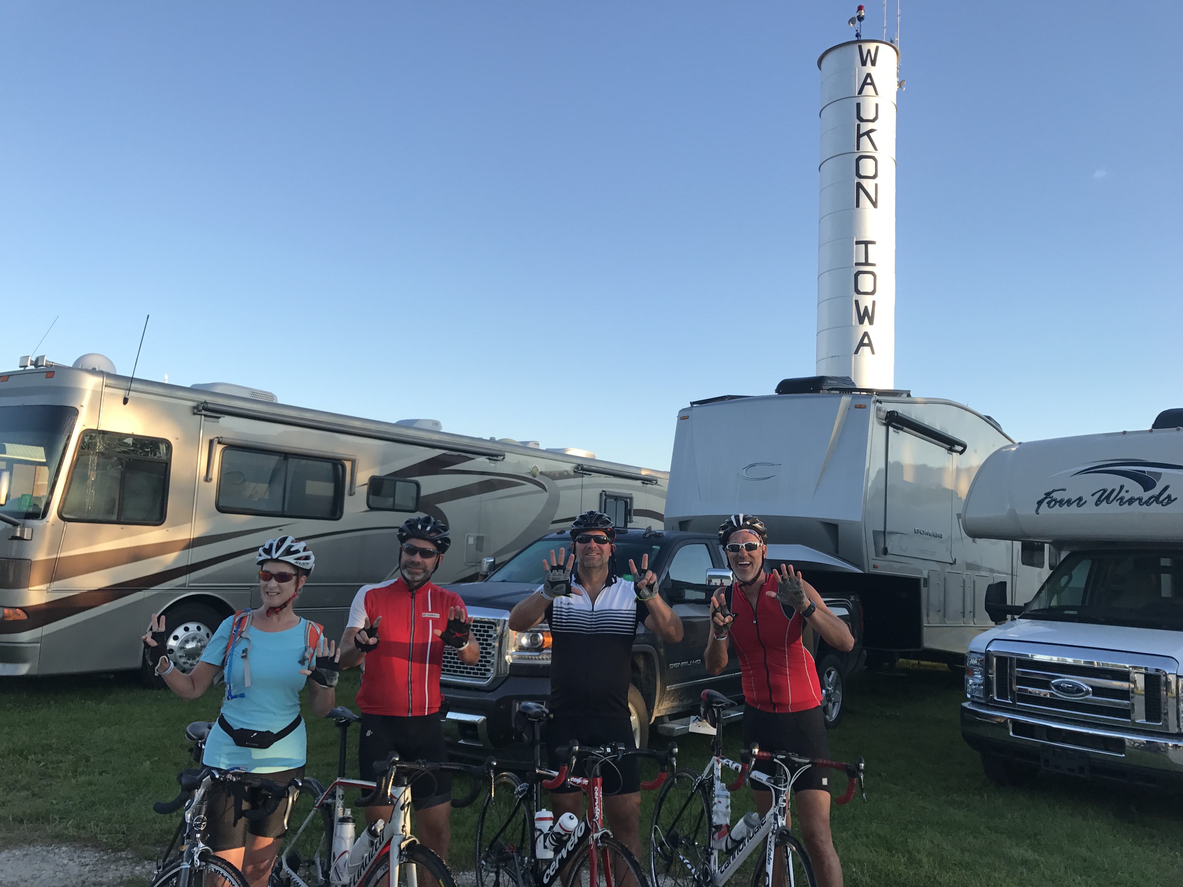
Fairground camping in Waukon IA
Our 7am strategy worked perfectly and all three of us were able to park together each day.
As our cyclists ate pedaled their way across the state Mike, Fred and I set up camp and relaxed a bit before the team rolled in anywhere from 1-3pm. After showers and naps we would all gather together for adult beverages and dinner.
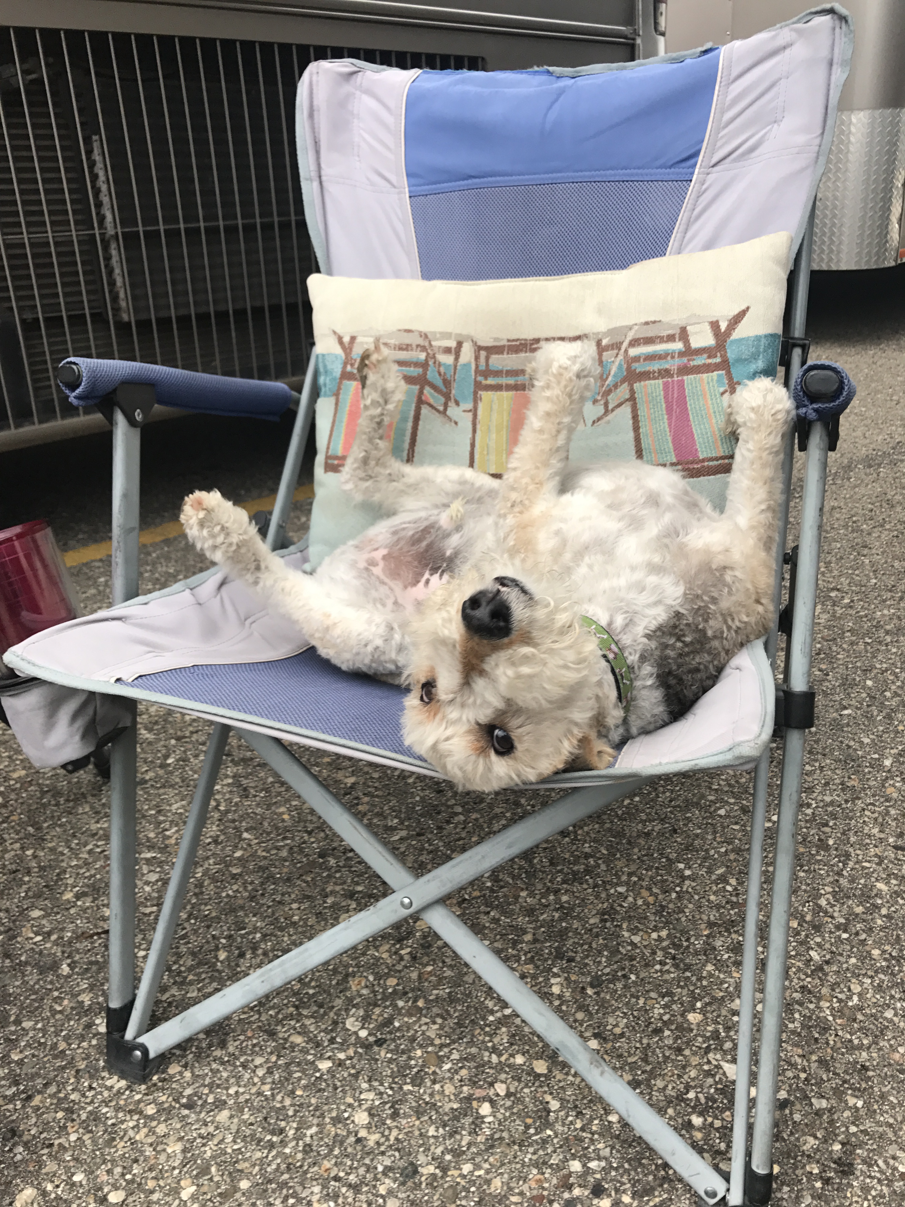
After setting up Sam be like…chill!
The winning food for the week? Mike’s smoked ribs…YUM!!!
About day 6 we noticed that the The Craft Beer tent was about 6 miles from the destination town. So Mike, Fred and I hopped on bikes and back tracked the course to meet up with our team for a cold one. The ride ended up being a bit further than anticipated on a hot day. By the time we reached to tent we were thirsty and hungry.
It was fun pedaling back to the campsite with our team and getting to experience a small part of the cycling event. The energy of this group is off-the-chart and we got to hear all about our groups day.
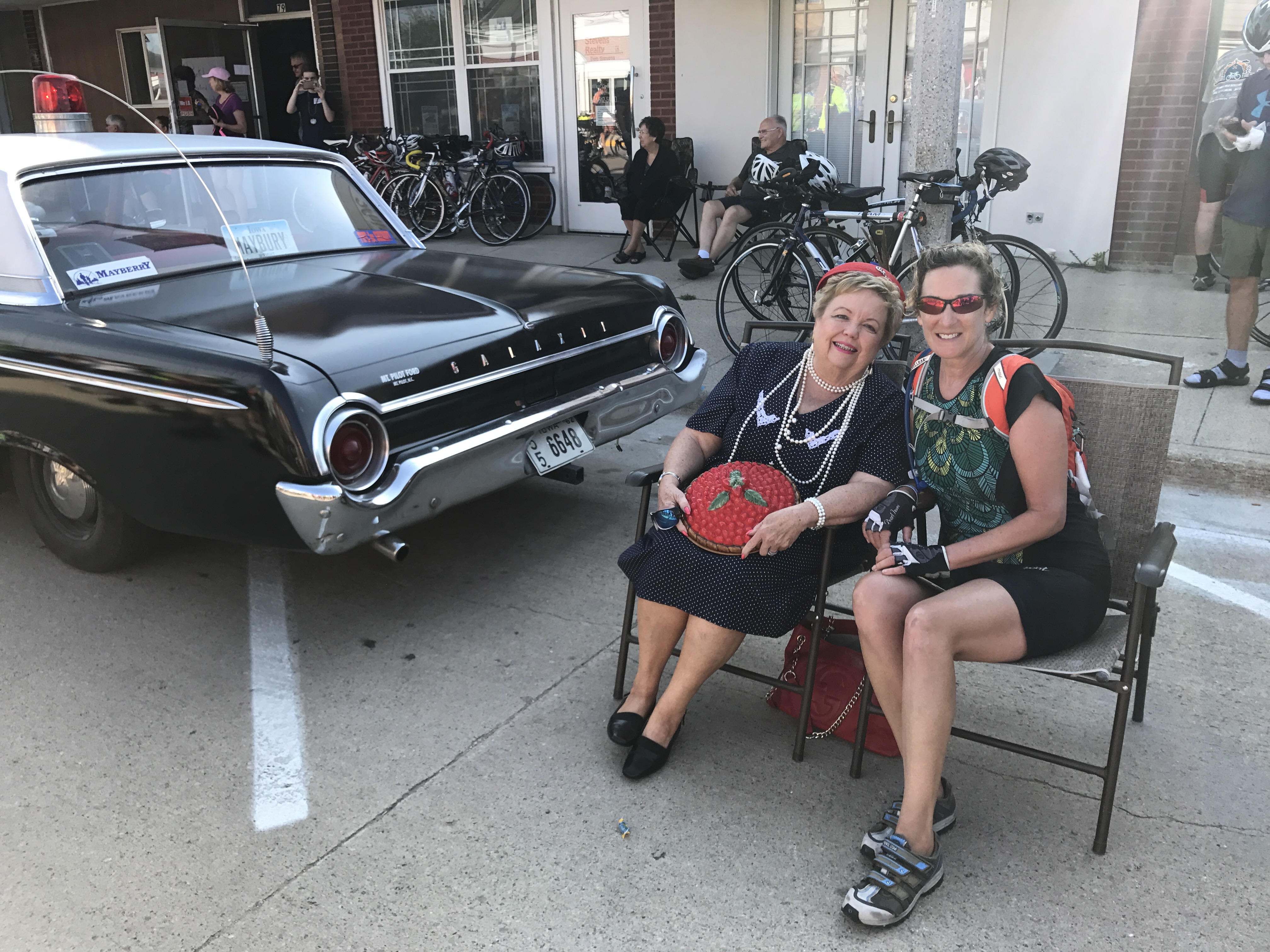
Everyday was like rolling through Mayberry. Donna “sit’n a spell” with Aunt Bea.
A lot of kissing going on at this event!
The last day of RAGBRAI is always a bit crazy. Tiny towns, tight streets and thousands of people trying to pick up their cyclists before heading back to distant corners of the world.
I look back on the pictures from RAGBRAI 2017 and remember what a special event this was, the interesting people we met along the way and all the calories consumed. We were with an amazing group of friends who will now have a story to tell about that time we all went to RAGBRAI.
The Wave
Posted by Deb in Arizona, Bucket List, Destinations, Full Time RV, Grand Canyon, Hiking, Running, RV Shows, Trail Run, Utah on June 12, 2017
The first time I visited Flagstaff was about 10-15 years ago when Jeff worked for Scotts Miracle Grow. They had their annual sales conference in Scottsdale. We stayed a few extra days to explore Arizona, and Flagstaff was merely a place to overnight so we could see Sedona and the Grand Canyon.
It was such a memorable trip. Cresting the hill driving into Sedona and seeing those red rock formations for the first time. It was like nothing I had ever seen before. Then standing on the south rim of the Grand Canyon looking over its edge. I couldn’t open my eyes wide enough to take it all in.
We had a retirement dream way back then to travel in a 5th Wheel. But I don’t think we ever could have pictured the life that we now have!
On May 11 Jeff and I rolled into Flagstaff for the ? time. We have been here so many times now we no longer need a GPS to get around. It’s familiar, beautiful and one of our favorite places to be.
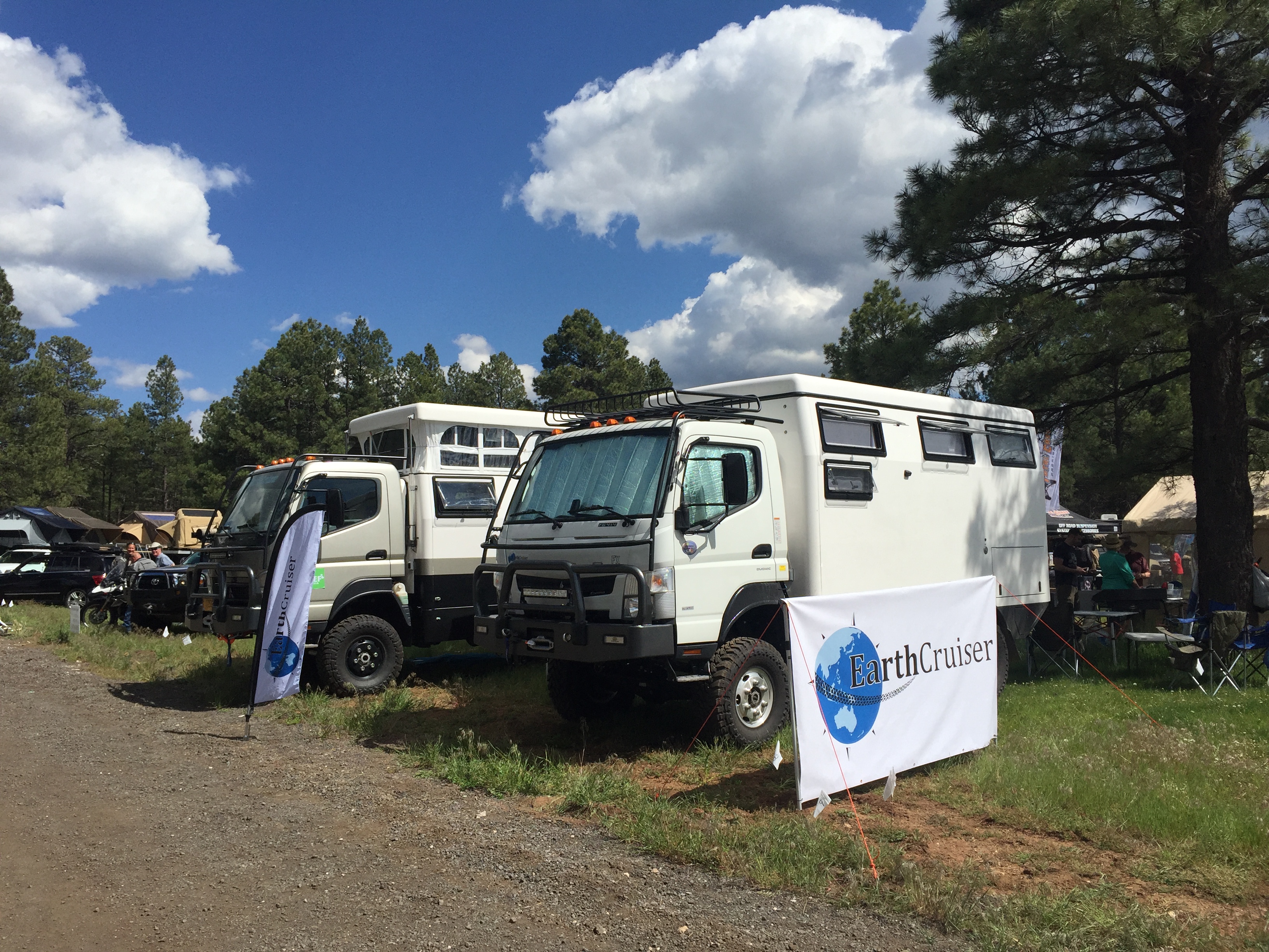
OVERLAND WEST
We were at Flagstaff this time to work the Overland West Expo being held at the Fort Tuthill County Park. We stayed onsite with thousands of Overlanders who were there to…
“Get outfitted, get trained, get inspired—get going.
The world is waiting.”
With that kind of inspiration it’s no wonder this is our very favorite show to work!
Another kind of camping
Off road luxury
What makes this event so special is the location (nestled amongst the fragrant, wispy pines), the dogs (all well behaved non-yappers) and the adventurous people who tend to be a younger demographic than RV’ers.
As an RV’er we tend to think we have a sense of exploration and adventure. But Overlanders? Well, they take adventure to a whole other level. Where (most) RV’ers are limited by the boarders of North America, Overlanders are limited by the globe!
There were no satellite or surge protectors companies represented here. I didn’t see any tempurpedic mattresses or meat smokers either. They are more interest in products that will allow them to access off road places with the minimal amount of stuff. The smaller you can go, the better.
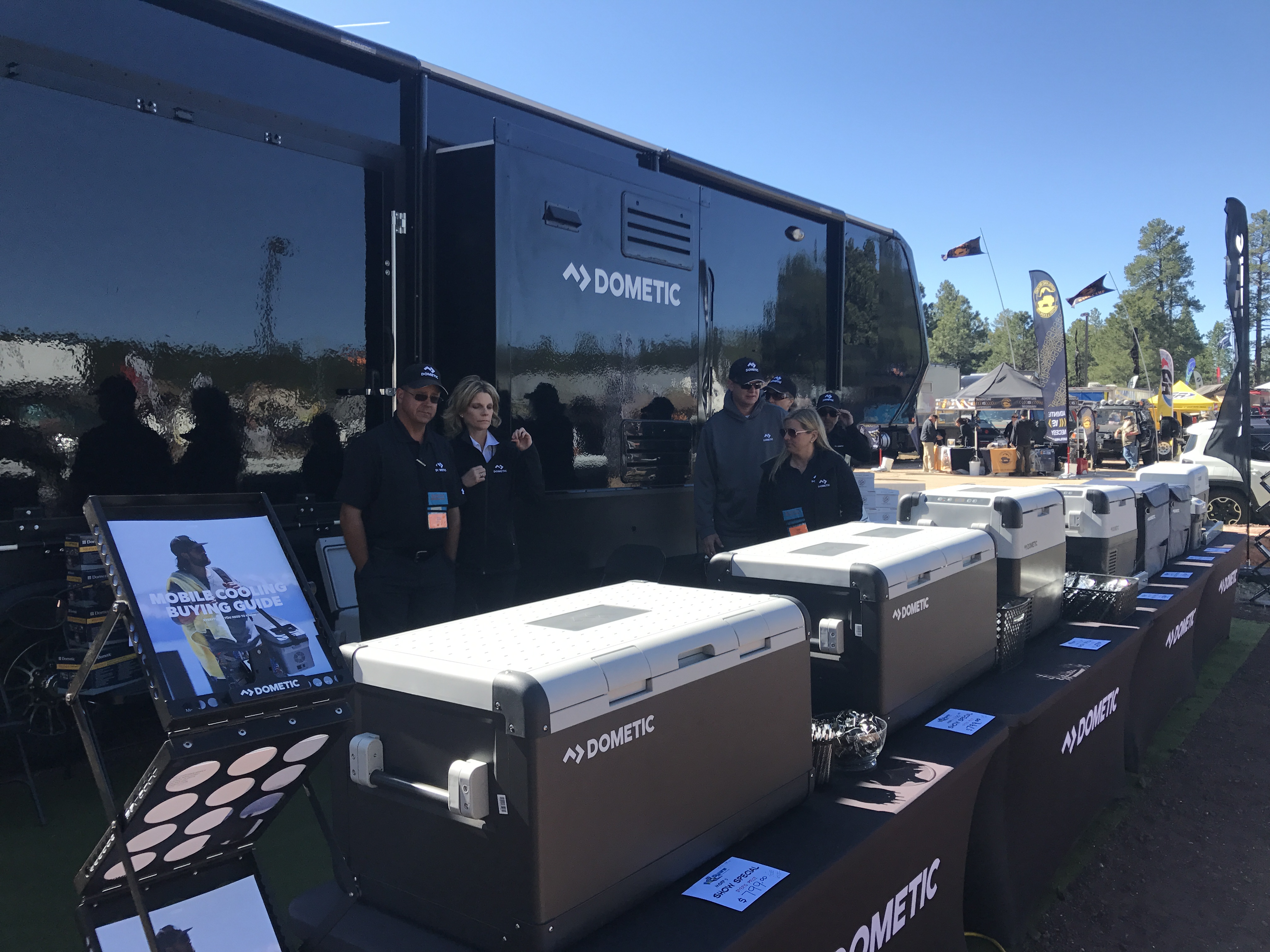
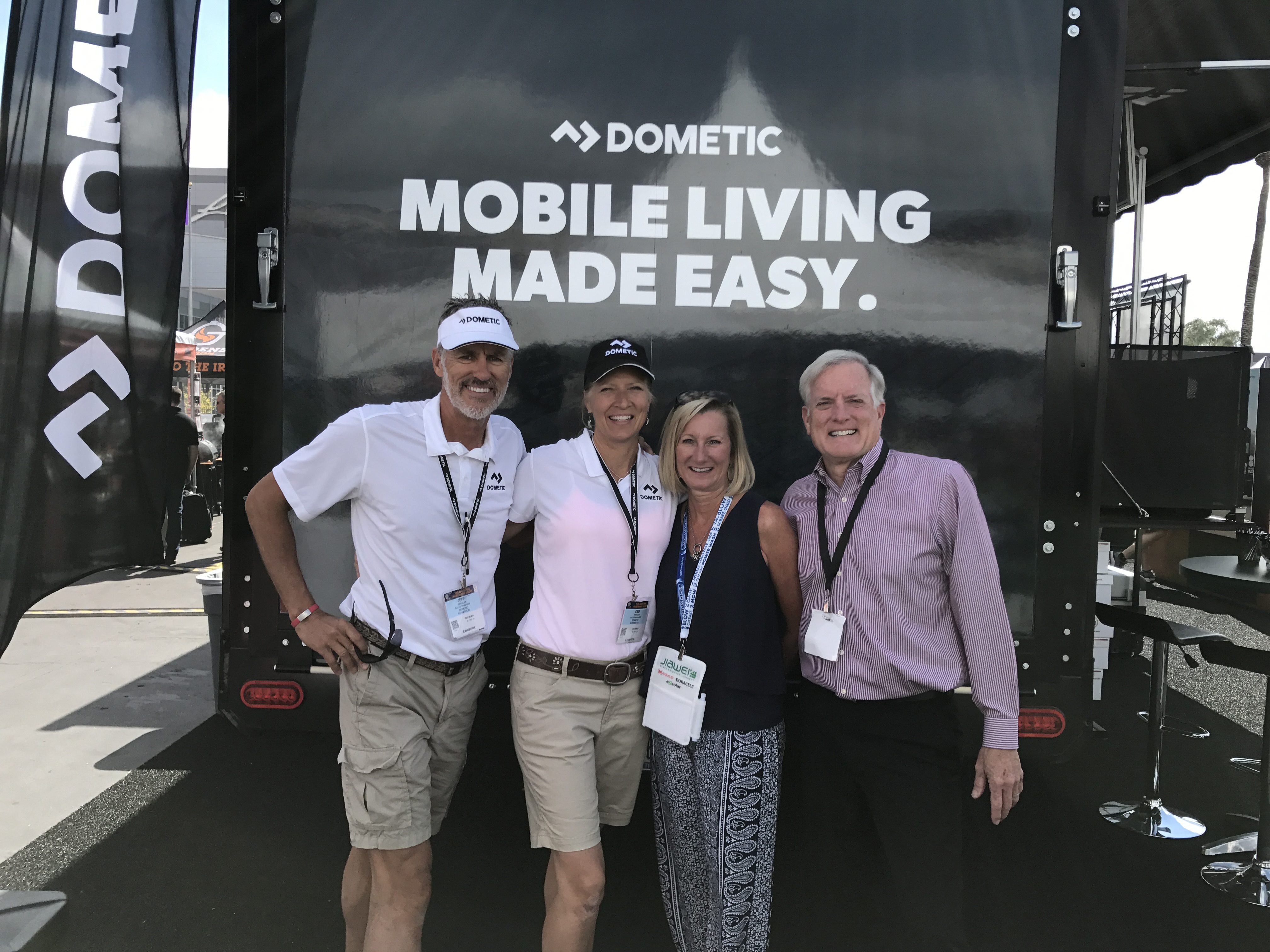
We were there to showcase Dometic’s mobile cooling line of CFX portable refrigerator freezers. They can operate off of 12V or 110 and be powered by solar. This appeals to many Overlanders and the products flew off the shelf! Best of all, I didn’t have to talk to a single person about the use of their RV toilet…and their ensuing bathroom habits.
It was a great show with a great team and it was our last show to work until the fall.
SOUTH RIM GRAND CANYON
After Flag we moved on to another favorite location, the south rim of the Grand Canyon. We had some friends that were driving up from Phoenix to do a double-crossing of the Canyon and we were invited to go.
Since I prefer a single crossing rather than a double and we have to be responsible fur parents, I sent Jeff across the big ditch with the group while I stayed back with Sam. My plan was to go a couple days later.
This was the 4th trip across the canyon for Jeff and it never gets old. It’s a heart pounding challenge that he used as training for his Bryce 100 race coming up. At 3am we picked up our three friends at the village and I dropped them all off at the South Kaibab trailhead to start their 15-20 hour journey. I picked them up at 10pm with a couple of pizzas. They were exhausted, cold and hungry!
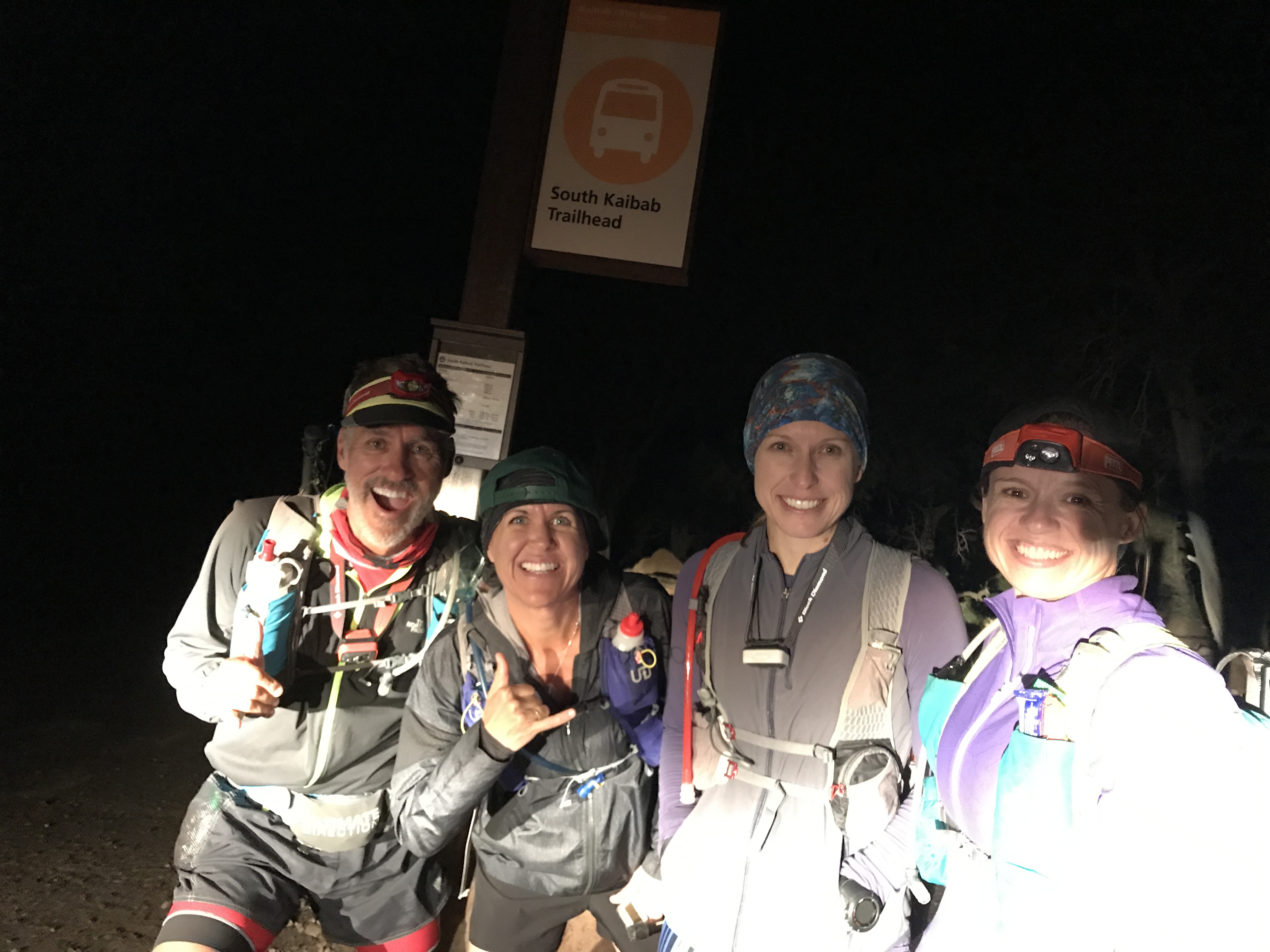
Jeff, Laurie, Lavinia & Kathi
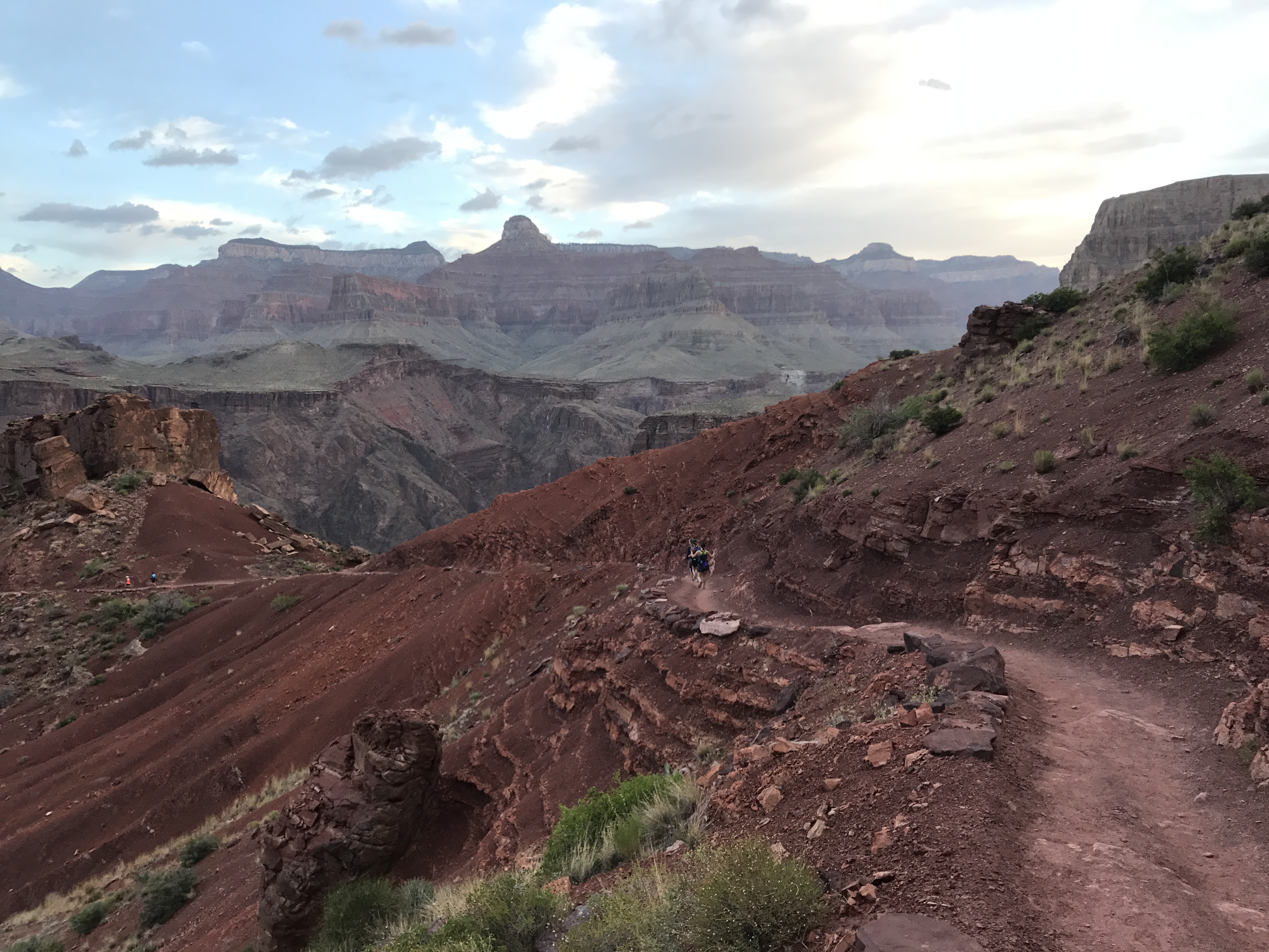
Trip down the South Kaibab
A couple days later I headed down South Kaibab myself. I wanted to take a different route this time and decided to jump onto the Tonto trail at Tip Off Point. Tonto runs east/west between South Kaibab and the Bright Angel trail at Indian Gardens. This cuts off 1000ft of elevation and 6 miles of the traditional Rim to River to Rim route.

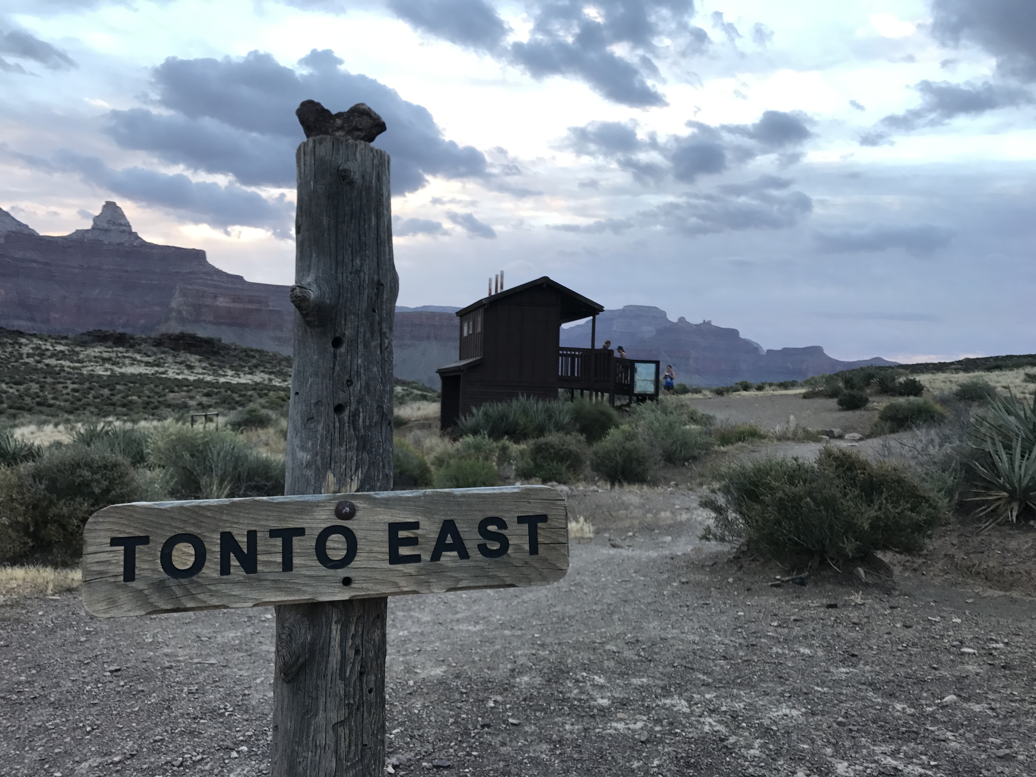
I REALLY enjoyed this route. The views are not nearly as stunning crossing the Tonto trail. But what I enjoyed was that I was done within 6 hours, rather than 10-12 hours. The thirteen miles was still a challenge, but I finished in time for a hot lunch at Bright Angel Lodge.
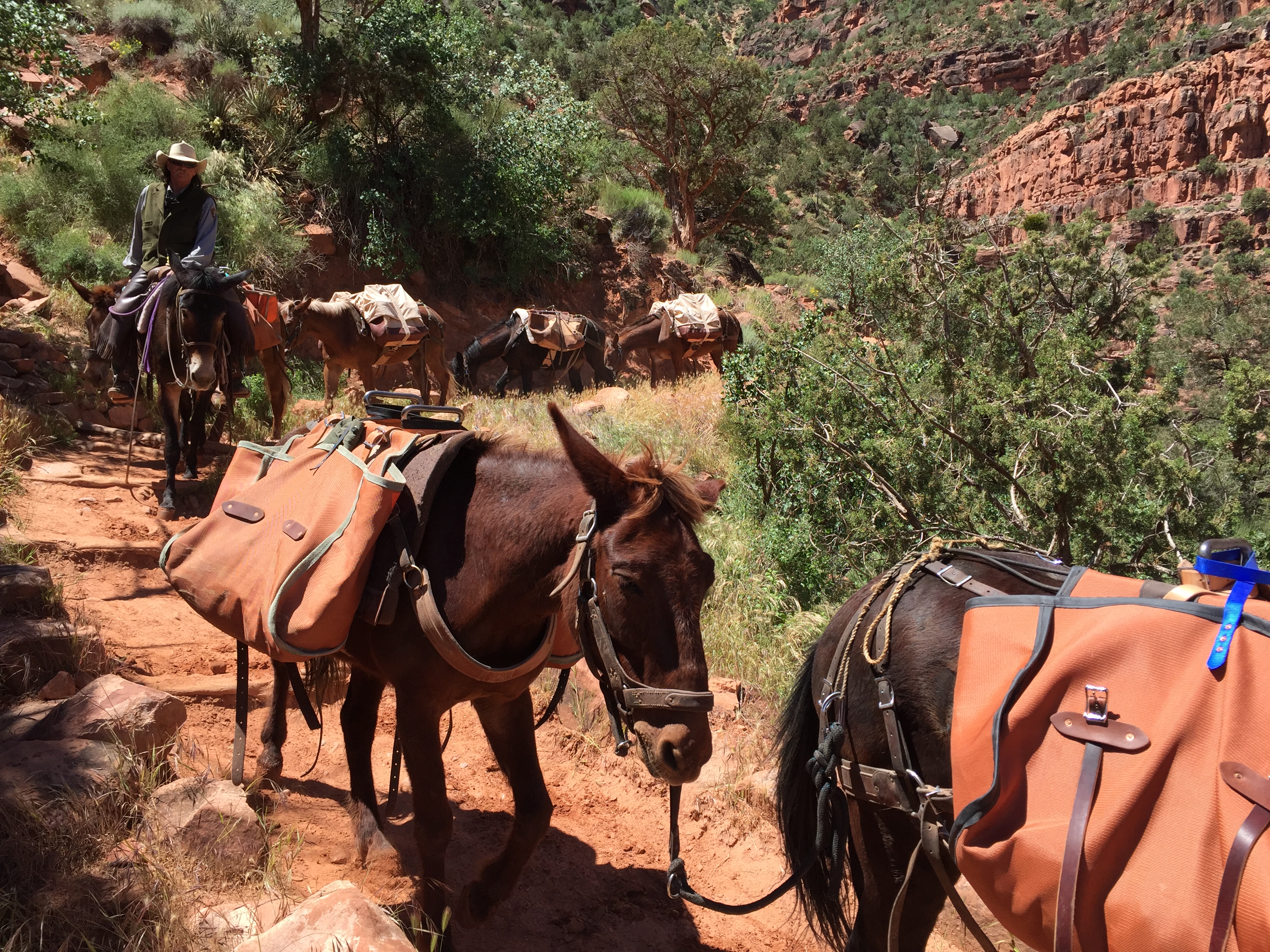
Mule train traffic jam
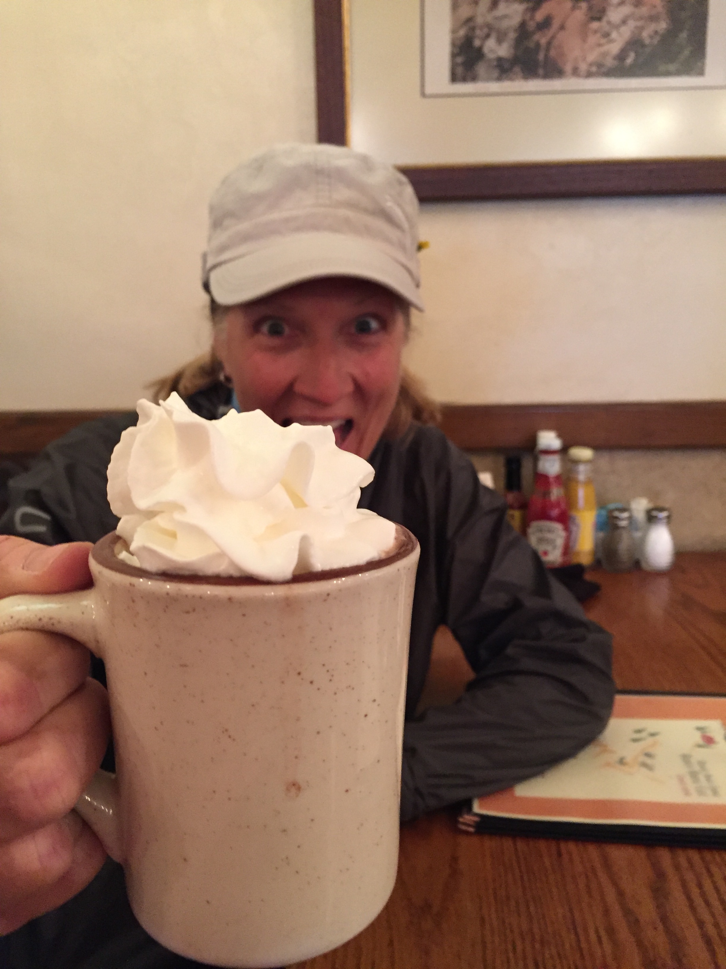
Hot chocolate finish
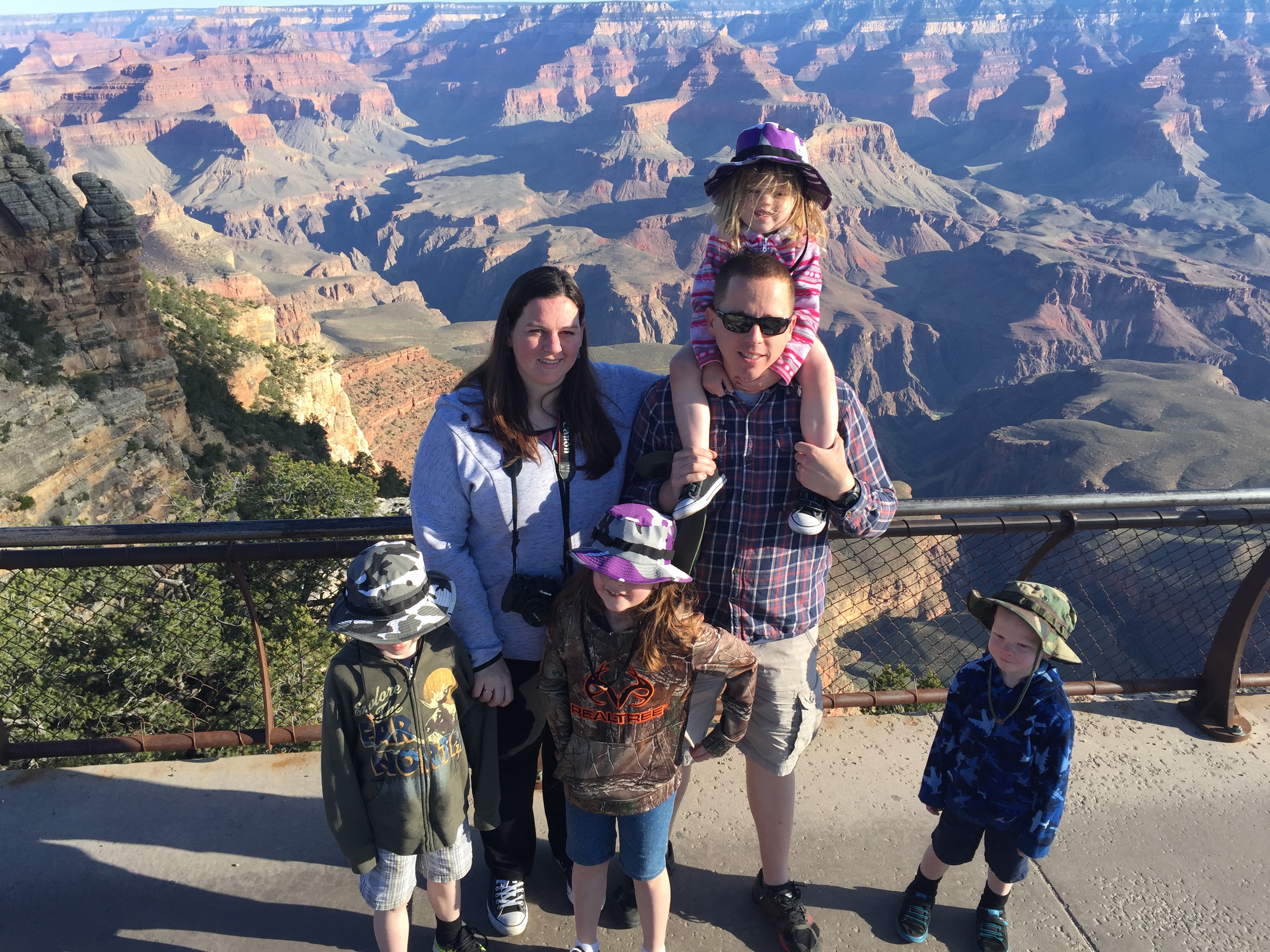
While camping there we had a quick overnight visit from our niece and her family of 4 little’s. They were making a two-week trip from northern California to Arkansas and back and just happened to be passing through. We invited them to spend the night and see the Canyon at sunrise.
Since our RV is not really set up for overnight guests, we spread out yoga mats on the floor to try and make their sleeping bags a bit more comfortable. The next morning we headed to the south rim for sunrise, then took the kids to a café for a pancake breakfast. It was fun watching the kids and their dad seeing the Canyon for the first time. Standing on the rim in awe.
They were on their way after breakfast while Jeff and I headed to the North rim.
NORTH RIM GRAND CANYON
The reason for the North Rim was that I had signed up for the North Rim half marathon trail run. I was originally going to do the Bryce Half (of the Grand Circle Trail series) while Jeff was signed up for the Bryce 100. But after thinking about logistics and caring for Sam dog, we decided to split our races.
The thing that we have found about these trail races is that the packet pickup and start/finish tend to be in remote locations down poorly maintained and unmarked forestry roads. GPS is usually not your friend in these instances and connectivity to digital maps does not exist. At one point we had 7 cars behind us following our lead as we tried to find the check-in. Two hours and two flat tires (not us) later we all made it to the start.
We did discover that our GPS took us on a terrible route…sorry everyone! Our trip back to the RV was on better roads and only took 75 minutes.
Race day was beautiful and fun. But with the 9,000’ elevation breathing was HARD! The route took us on forestry roads and freshly made single-track trails. Up and down hills and along the north rim of the Grand Canyon. It was so amazing runners, including myself, stopped frequently to take pictures during the race. That is one of my favorite things about trail running…stopping for a pretty view regardless of your time is to be expected.
Always stop for views even during a race
It was a great time and I enjoyed a long hard nap once we got back to the RV.
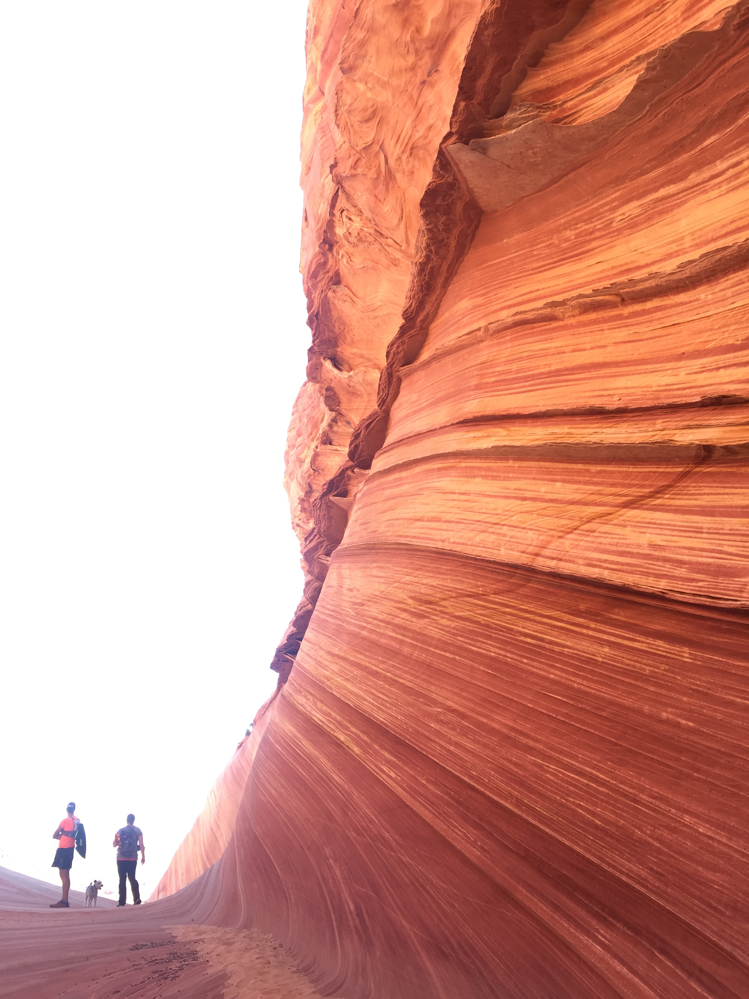
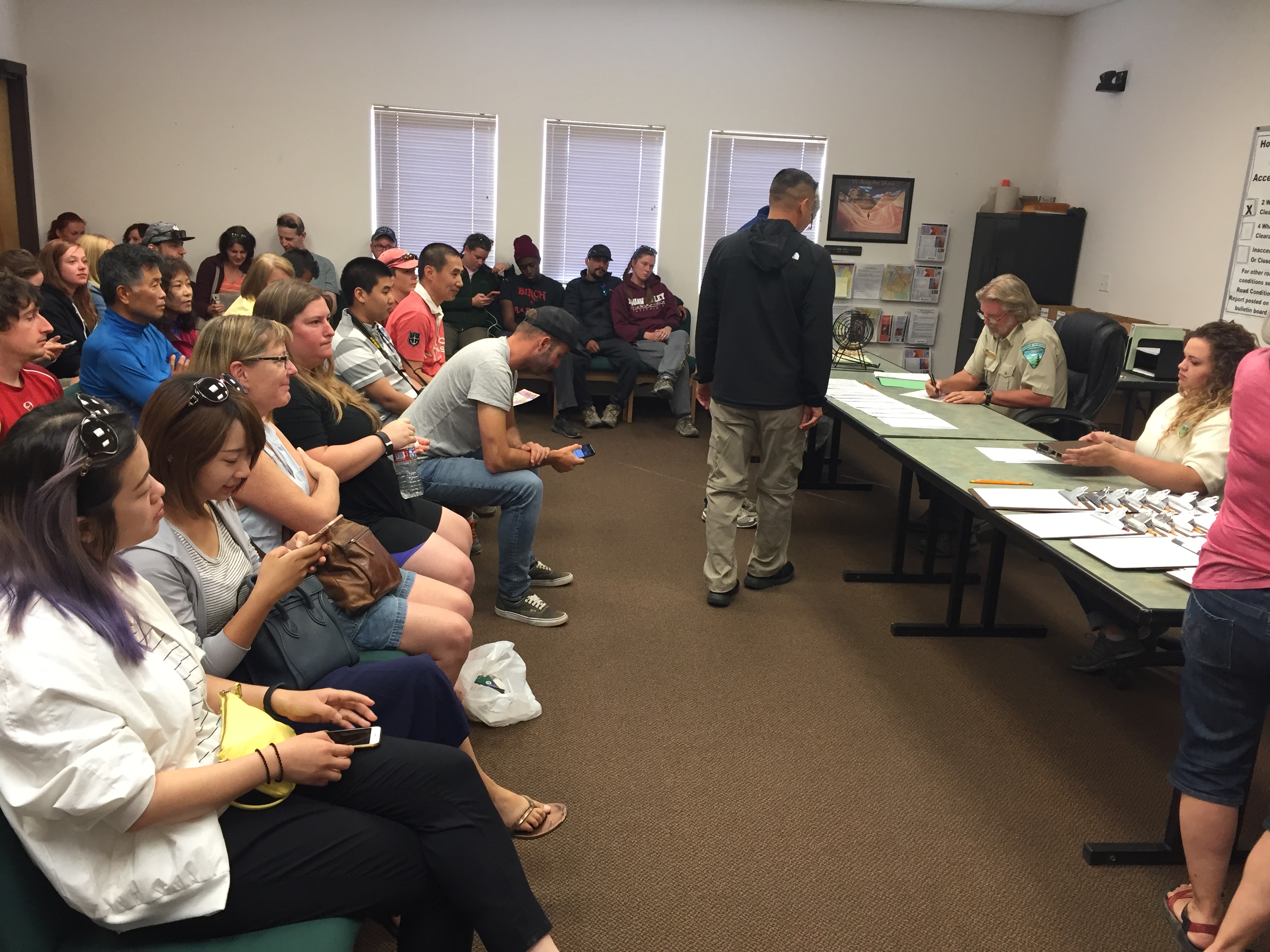
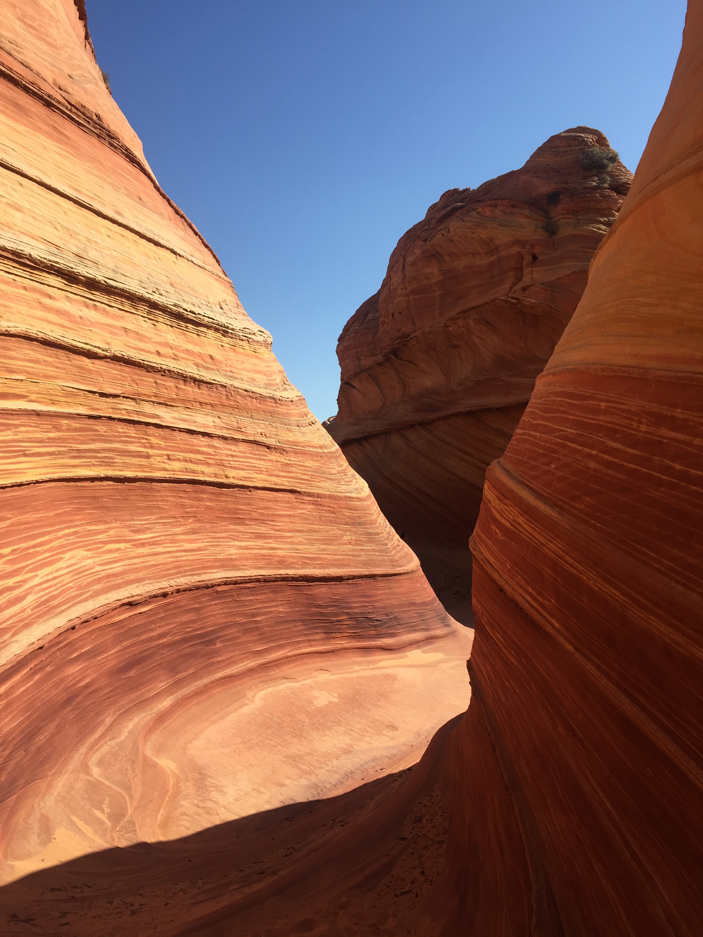
THE WAVE
One of the tools I like to use when we go to a new area is Pinterest. I type in our location to the search and see what others have pinned for the area. For Kanab the search pulled up The Wave.
Most of you have seen The Wave, which was made popular by Microsoft as a screen saver. It was a little known treasure that only locals knew about. But once it appeared on computer screens EVERYWHERE, tourists swallowed up the Wave.
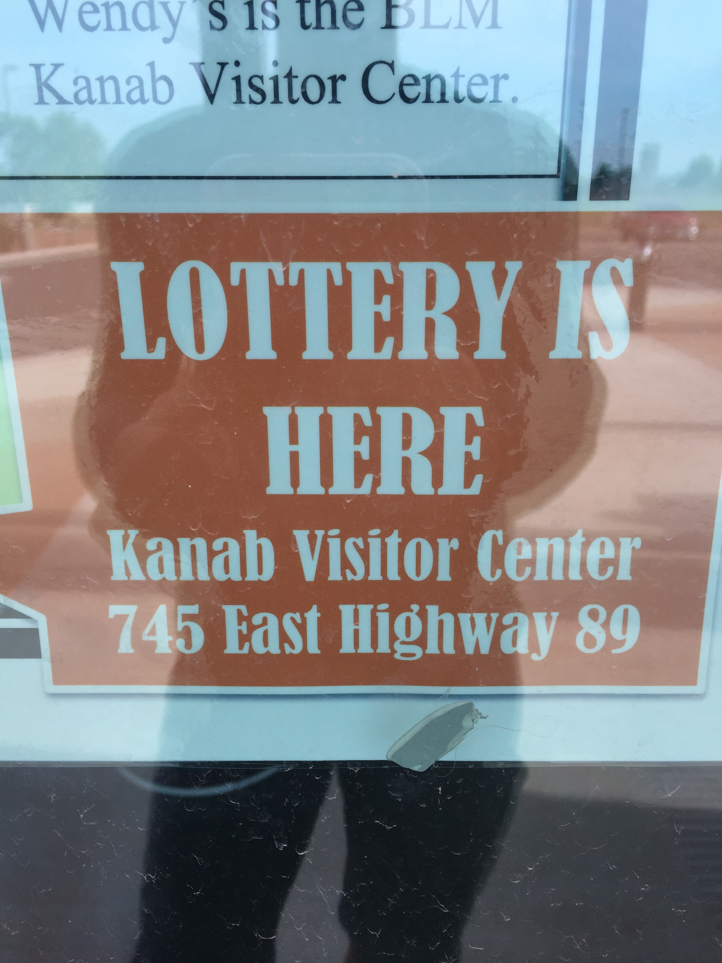
As a result, the Bureau of Land Management had to quickly put some restrictions in place to preserve this treasure.
The Wave is such a small area the BLM limit permits to 10-online lottery entries (6 months in advance) and 10-in person lottery (for the following day) per day. We have always had luck getting permits to other popular hikes by entering in person. Yosemite and Whitney Mountain.
A room full of hope
But the Wave is different with only 20 permits available per day. Any given day you only have a 4-8% chance at getting a permit. Yosemite allows 300 people per day.
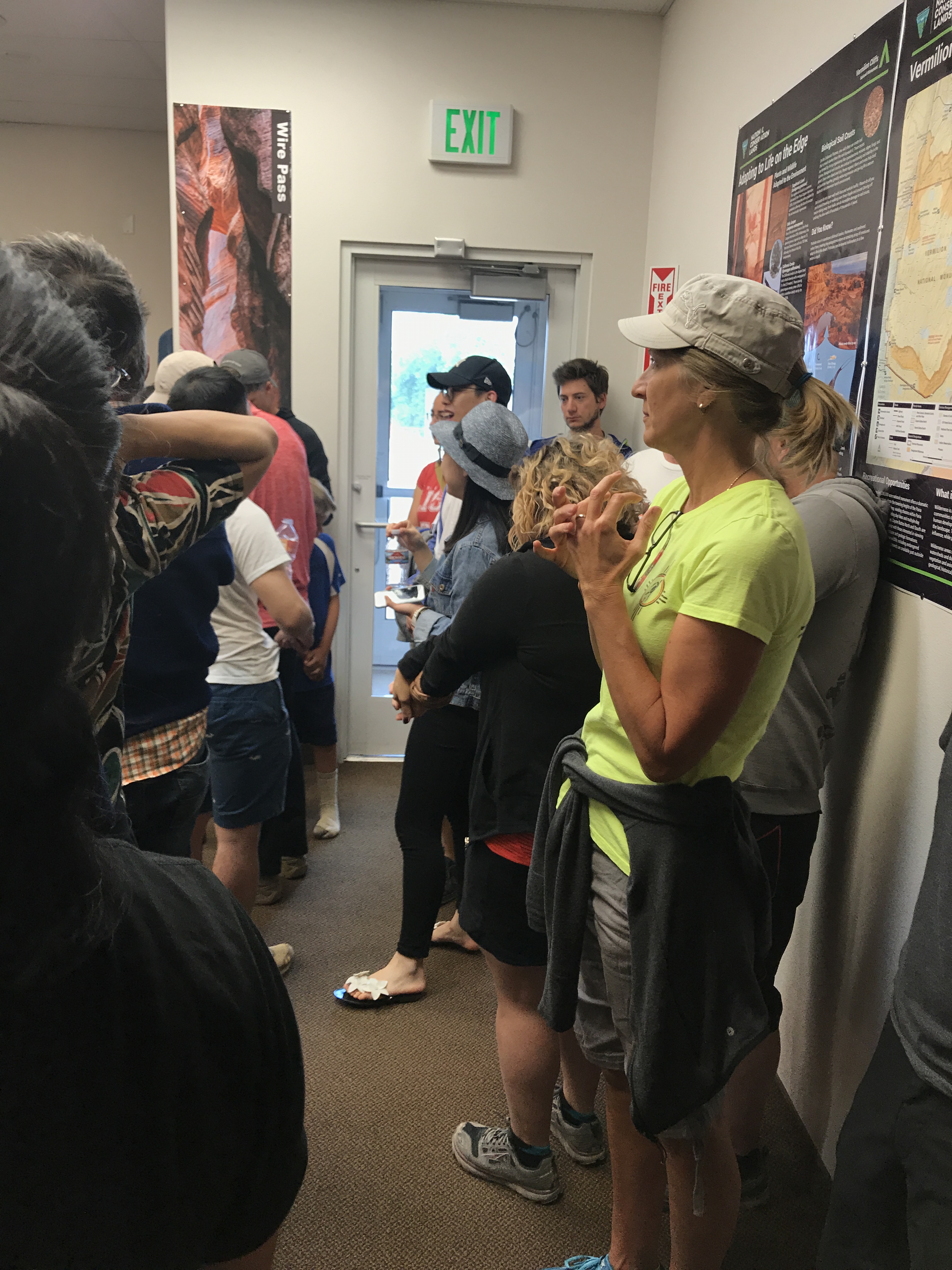
Since the odds are closer to 8% on a weekday, Jeff and I left the north rim early enough to get to the Kanab visitor center by 8:30AM to fill out a permit request. Each request allows for up to 6 people to go. However, if a request is drawn with 6 people, then there are only 4 permits left. Permits are handed out per person, NOT per group.
And if there are only 2 permits left and you have a group of 5, then three people must get left behind. NO EXCEPTIONS. All applications are given a number and you must be present during the drawing. Numbered balls are put in a Bingo tumbler and at 9AM sharp, if your number is called, your party is counted until all the permits are issued.
It’s all over in a matter of minutes and the majority of the room leaves disappointed.
Pick ME!
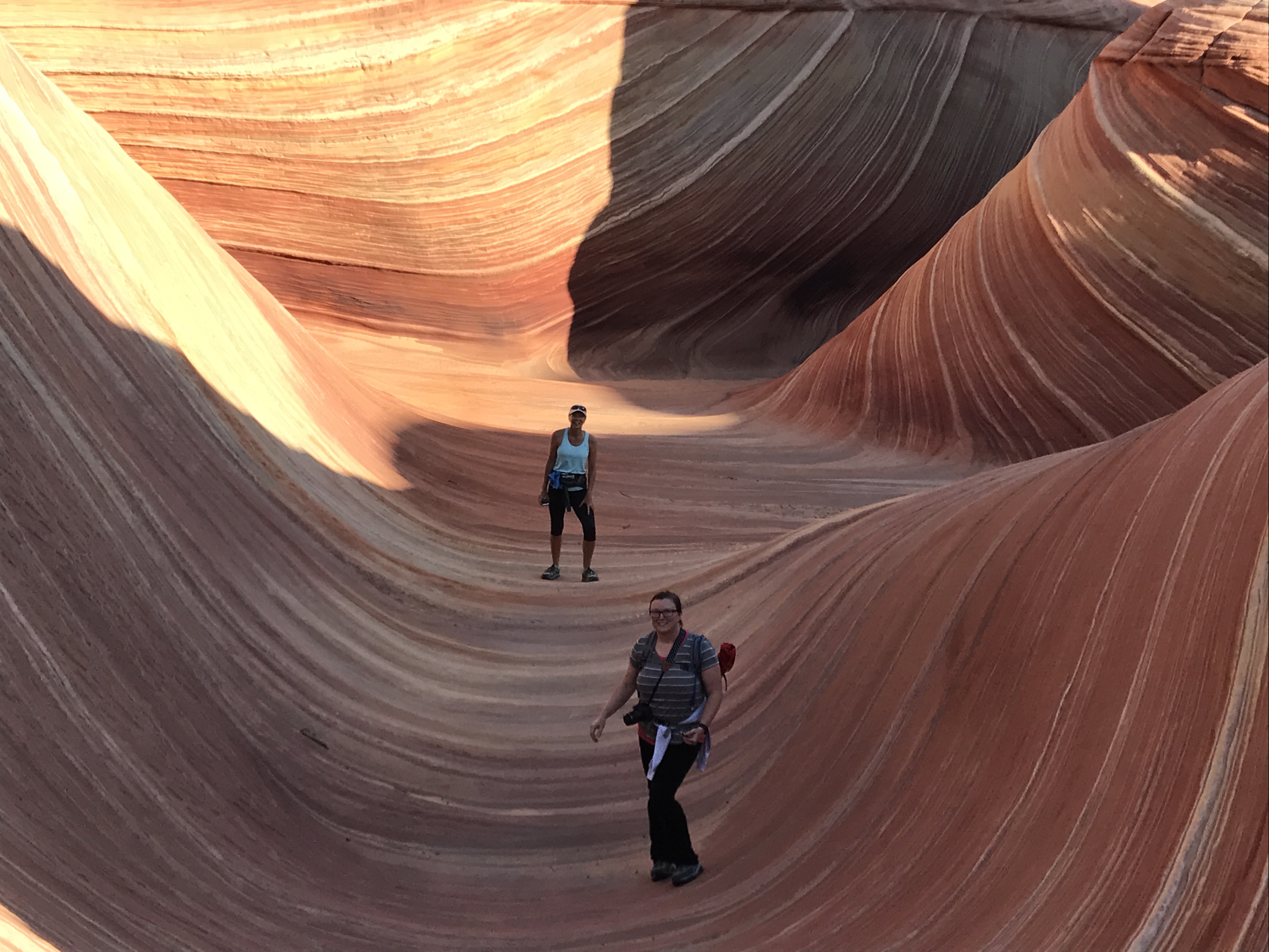
We found out that one of our running friends from Bentonville was in Kanab with her family. We asked Whitney if she would like to join us IF we happen to get a permit and we put her name on the application. After going through the drawing process we were one of those who left disappointed. It wasn’t meant to be.
But one of the beauties of being a full time RV’er is that we are flexible, and we decided to make the 45-minute drive to try our luck the next day. And JACKPOT…we were the first number called!
OMG…WE WERE GOING TO THE WAVE!!!
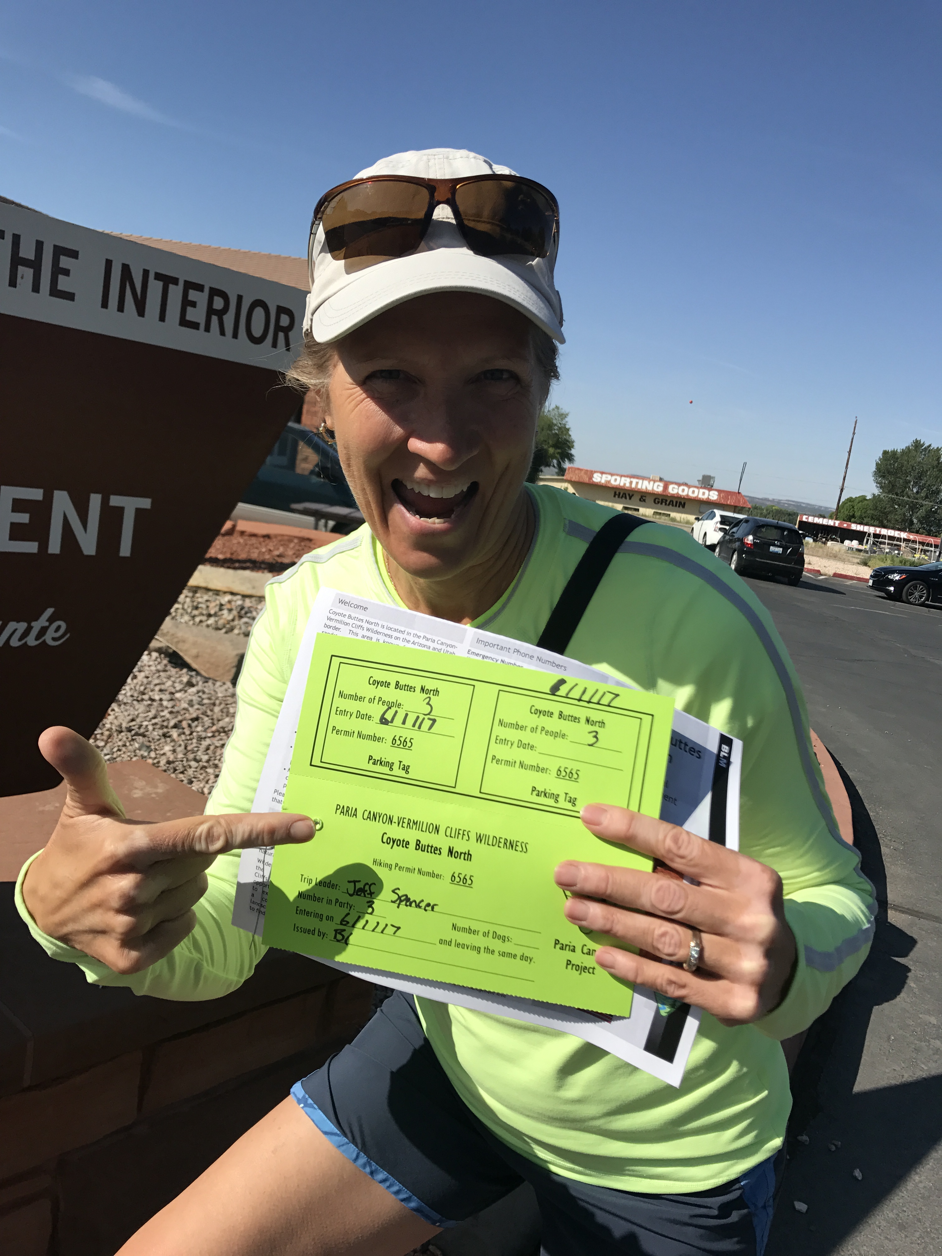
Its official!
Once our number was called the others were dismissed (sorry folks) and permit holders were educated on the rules and given instructions on how to reach the wave. The trail there is so unworn and so unmarked that you are given paper instructions with pictures of landmarks.
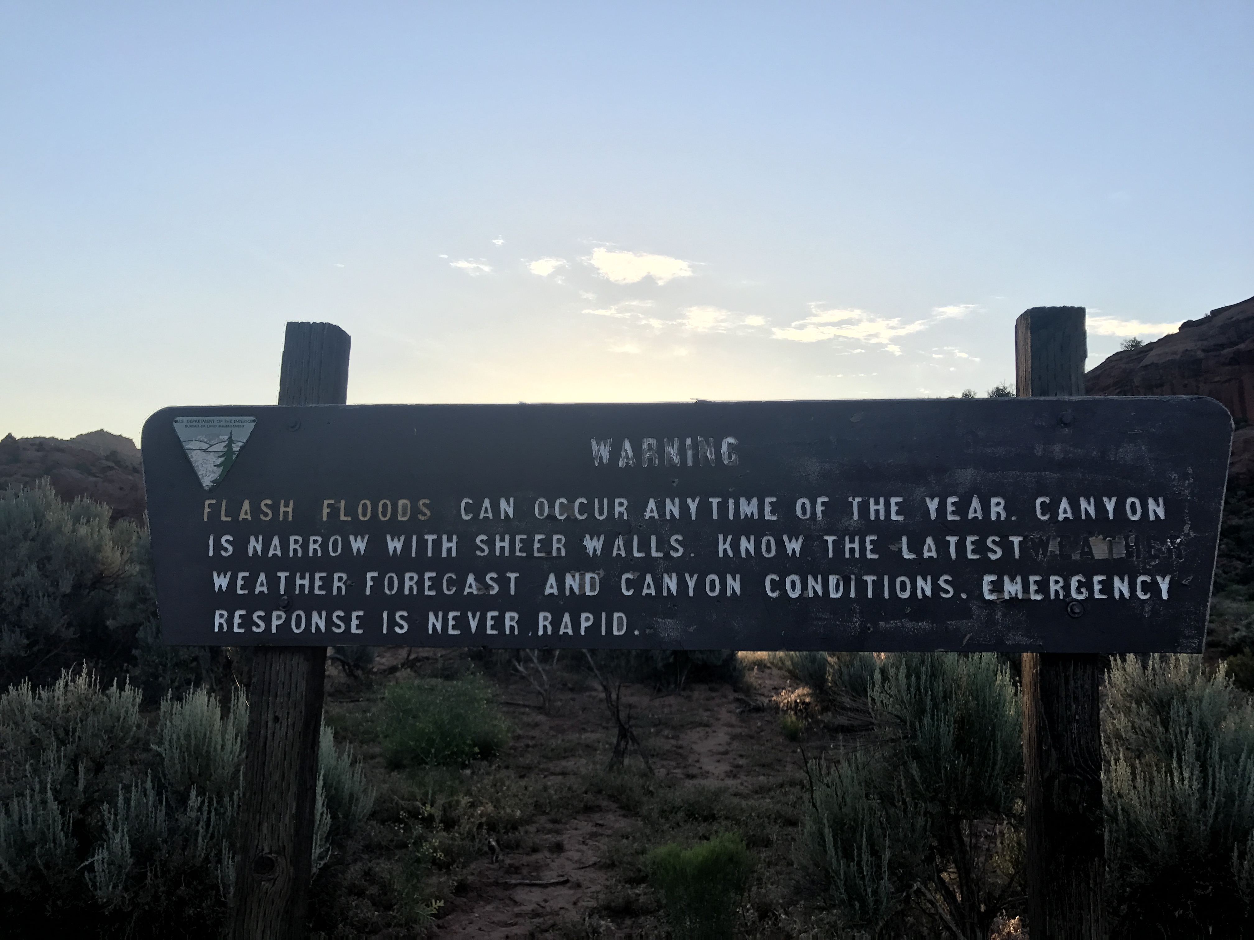
You are warned about paying attention to your surroundings, don’t follow others footprints and taking enough water, food and warm clothing to sustain yourself for 24 hours. People have been known to get lost or injured out there, and connectivity/help is slow or non-existent.
They put the fear of God in me and I took detailed notes of things to be aware of.
Our friend Whitney spent the night with us at our RV so that we could get a very early start. Jeff had an 11am conference call (we are not on vacation after all) and we needed to give ourselves enough time to explore and get back to cell coverage.
We left at 4am and made the 1.5-hour drive on 35 miles of washboard forestry roads and started our hike at sunrise. This trail is fairly easy, but the written directions with pictures are no joke. We could see quickly how people could get lost. We would have never found it without those instructions.
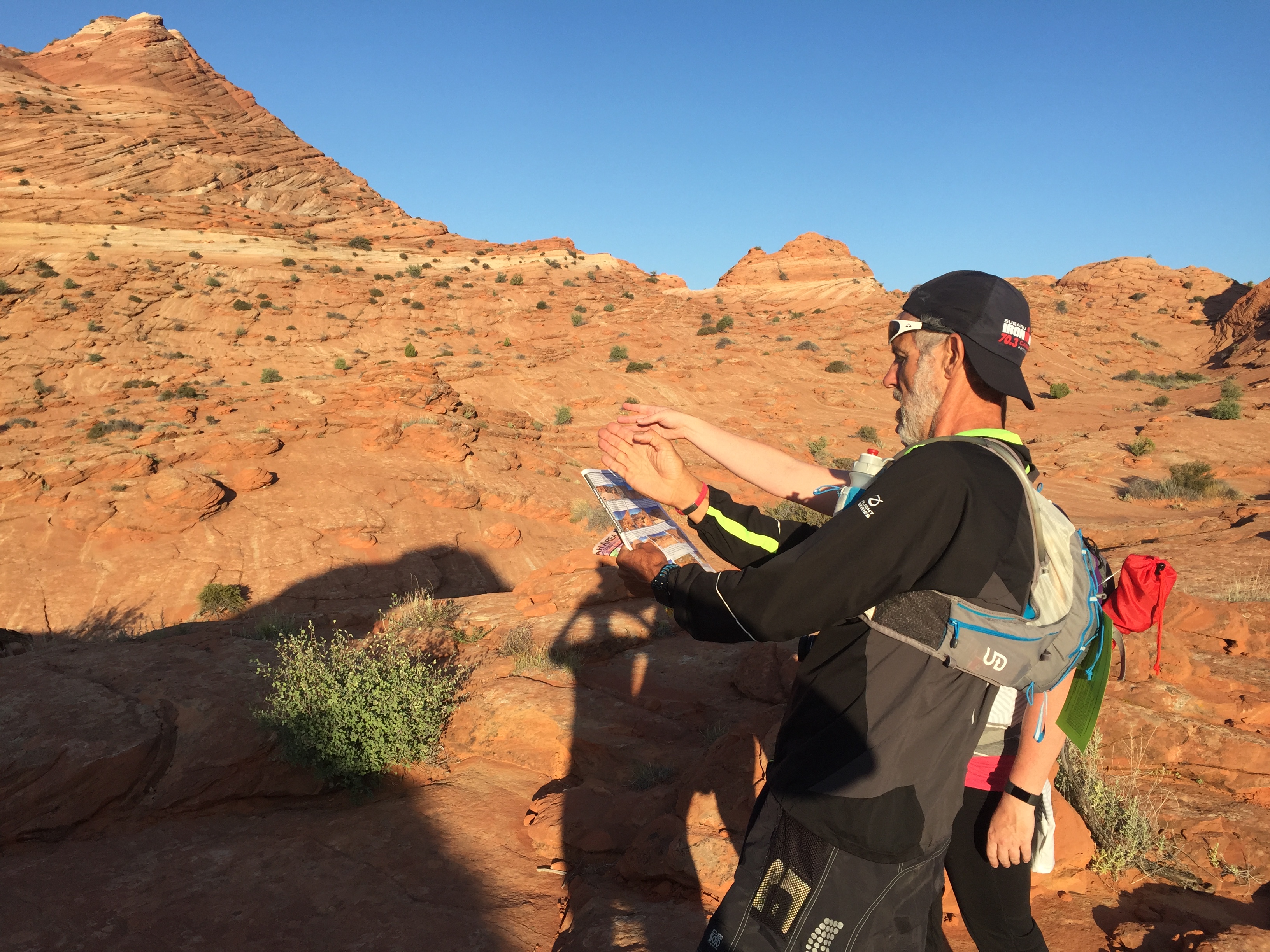
Stopping to consult the map
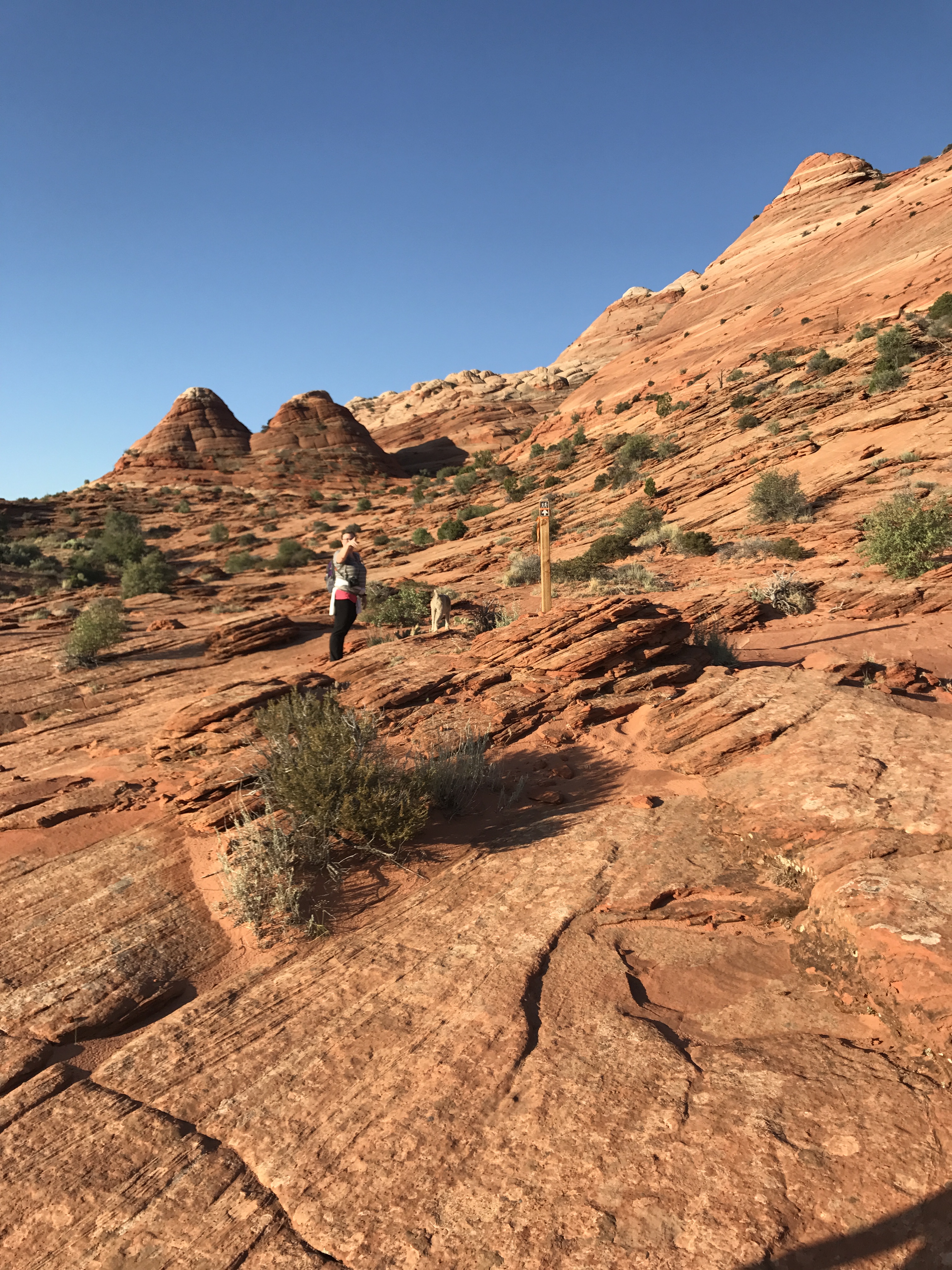
Stay to the right of the twin buttes
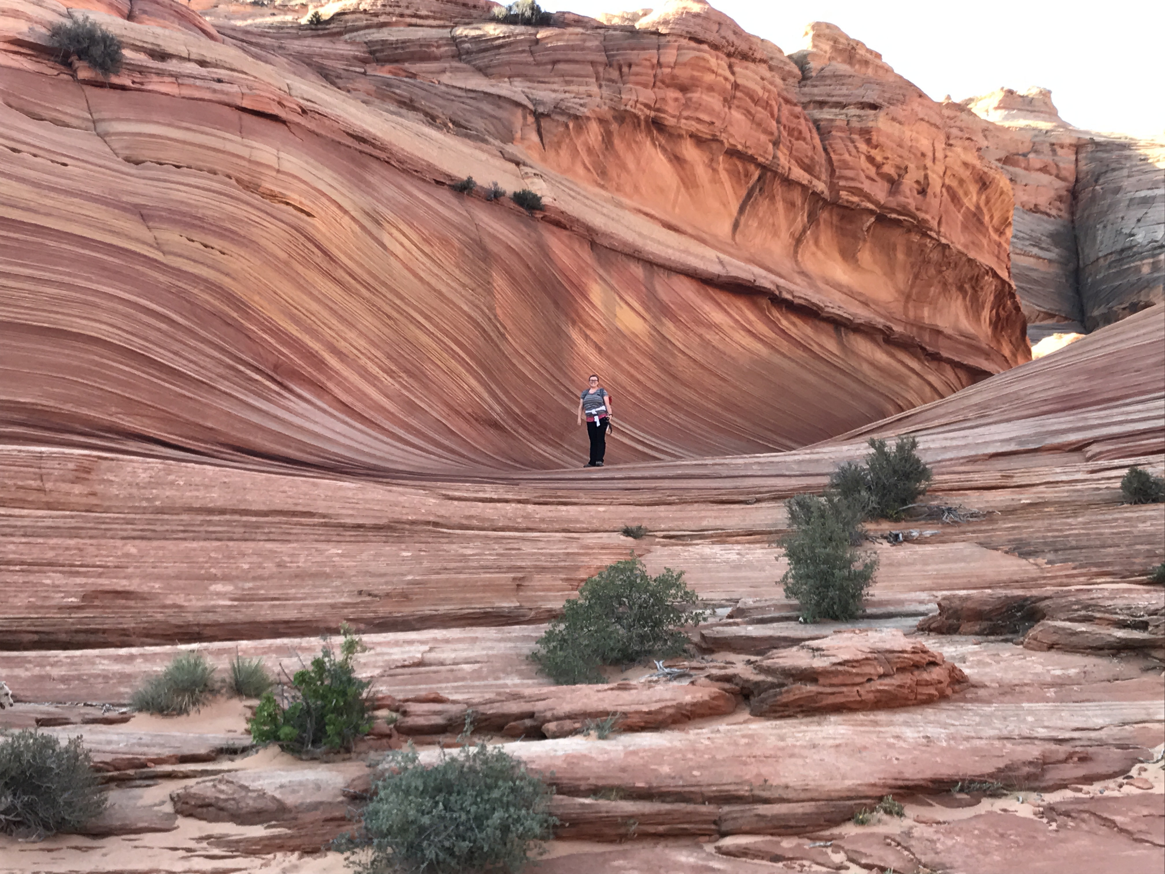
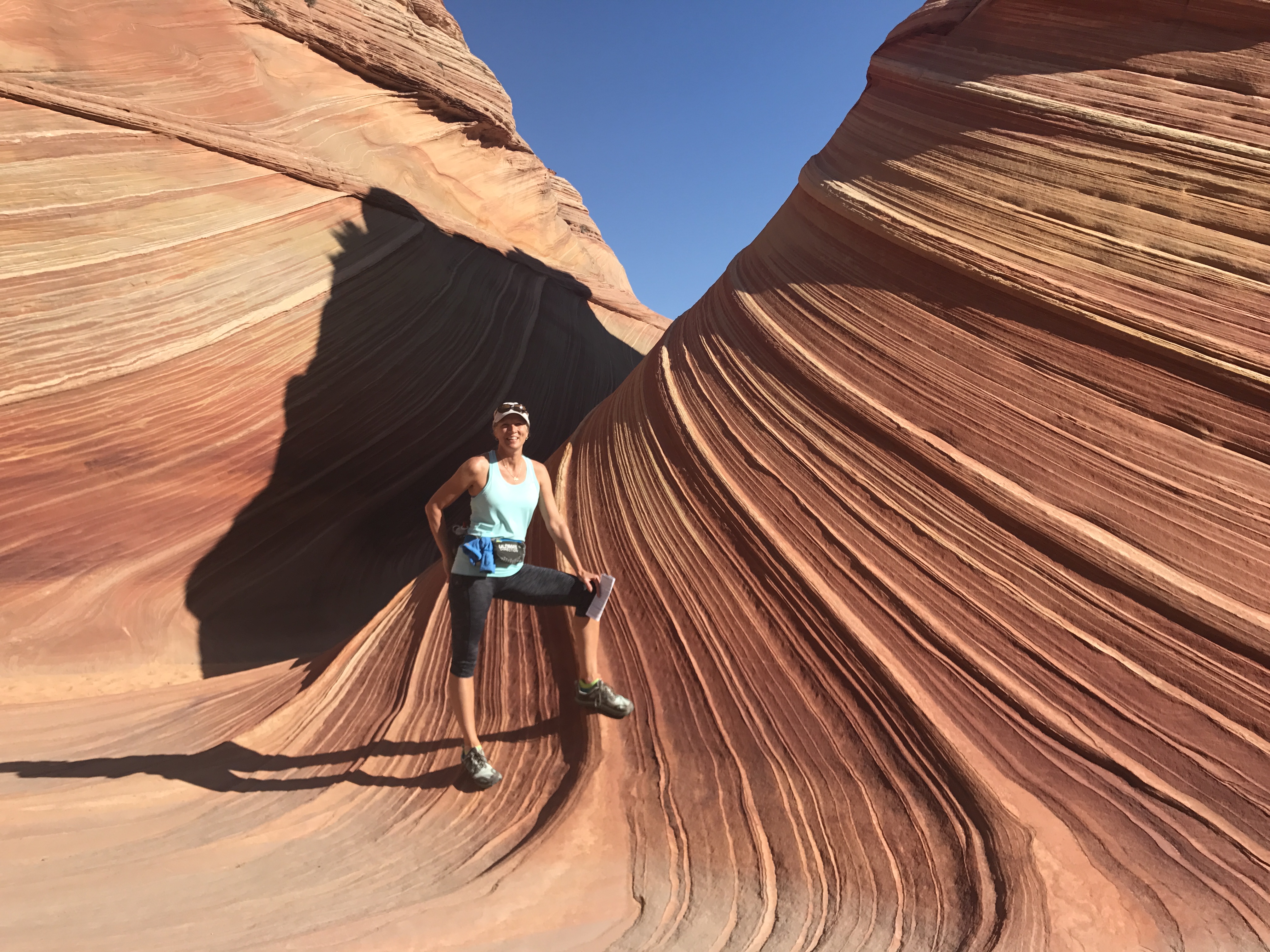
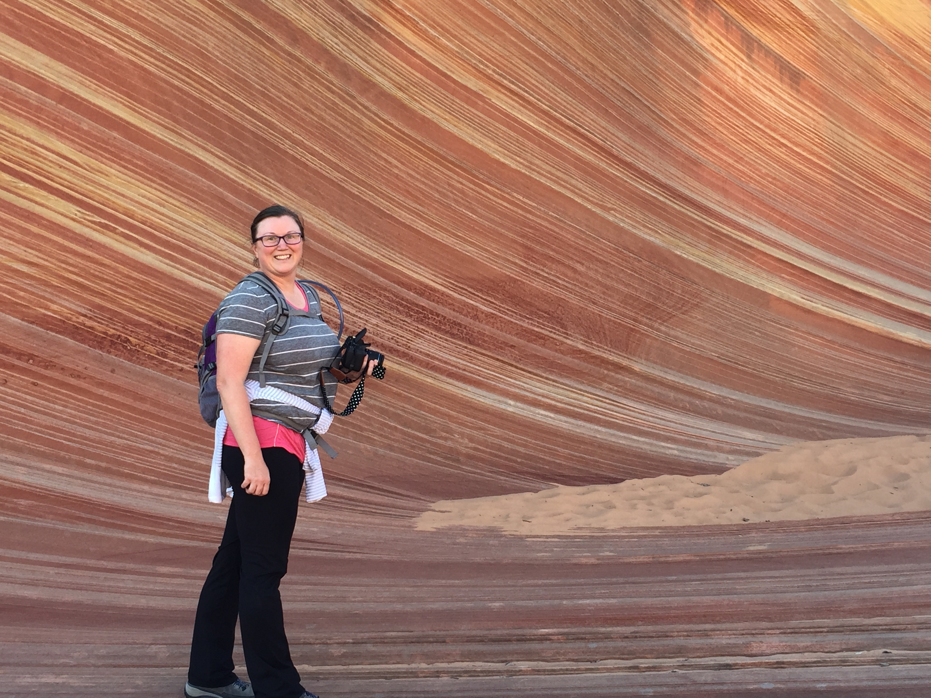
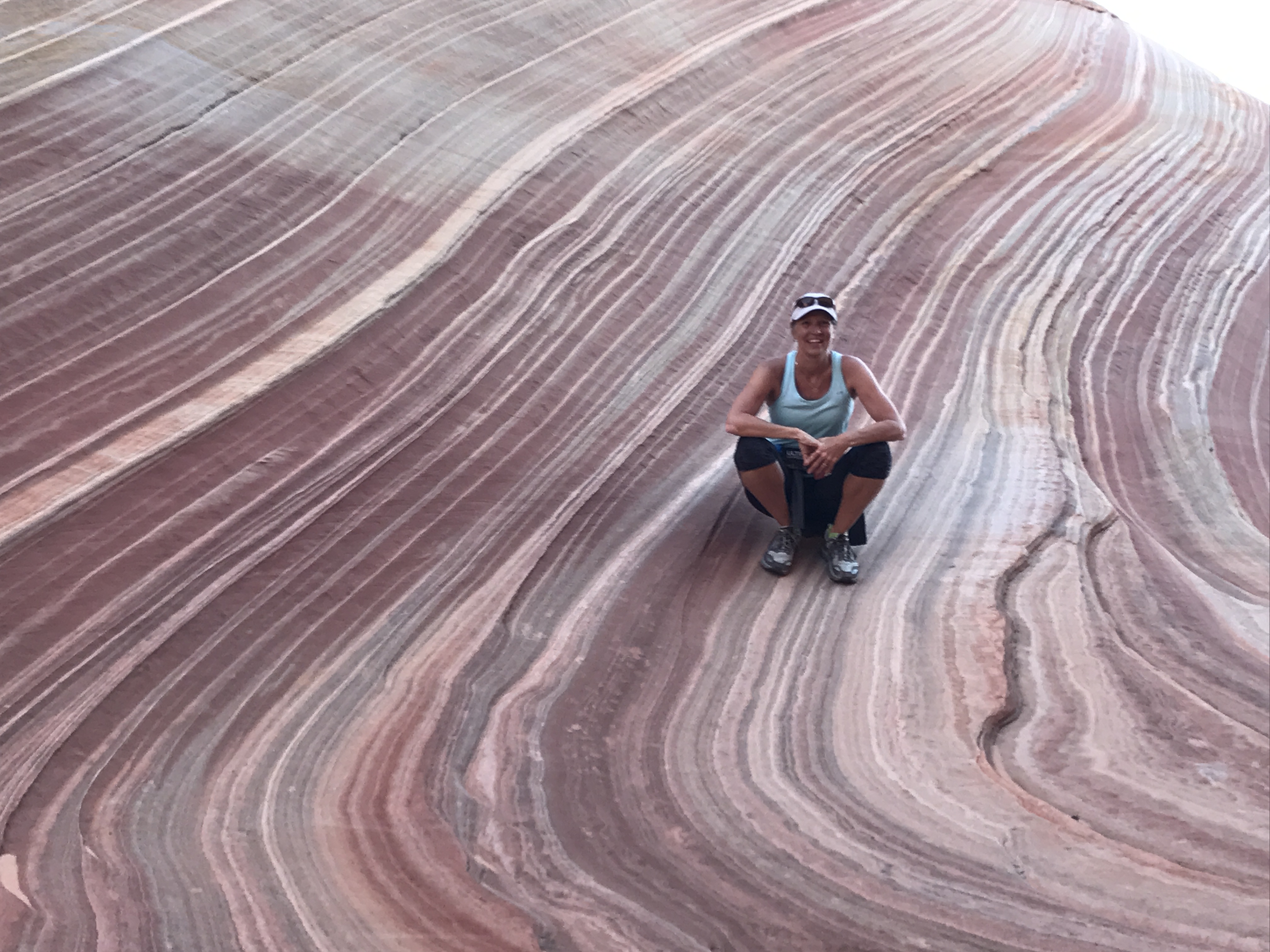
It took us about an hour and a half to reach The Wave… and WOW!
The colors. The textures. The warmth. The contours. All working together to form burning swoops and swirls. We climbed around, on and over this small little jewel and quickly understood why The Wave is limited to 20 people a day. If not the damage would be irreparable and the isolated feel to the experience would be lost.
It was incredible!
As we headed back to the trailhead, we again followed our paper instructions and landmarks. We did get off course but were able to find our way back to the “trail” with the help of Jeff’s Garman breadcrumbs.
We bid farewell to our friend Whitney and made it back to our RV just in time for Jeff’s call. A few days later I was still reflecting on the beauty of The Wave. It was such a special experience and we feel fortunate to have had the opportunity to go.
I’m not sure how many times we are going to have our name draw for things like these. But we will keep entering our names and keep pursuing the special opportunities in life.
Without the effort there would be no opportunity at all.
Dogs are welcome at the wave
Majestic Utah
Posted by Deb in Destinations, Full Time RV, Hiking, Running, Trail Run, Utah on June 4, 2017
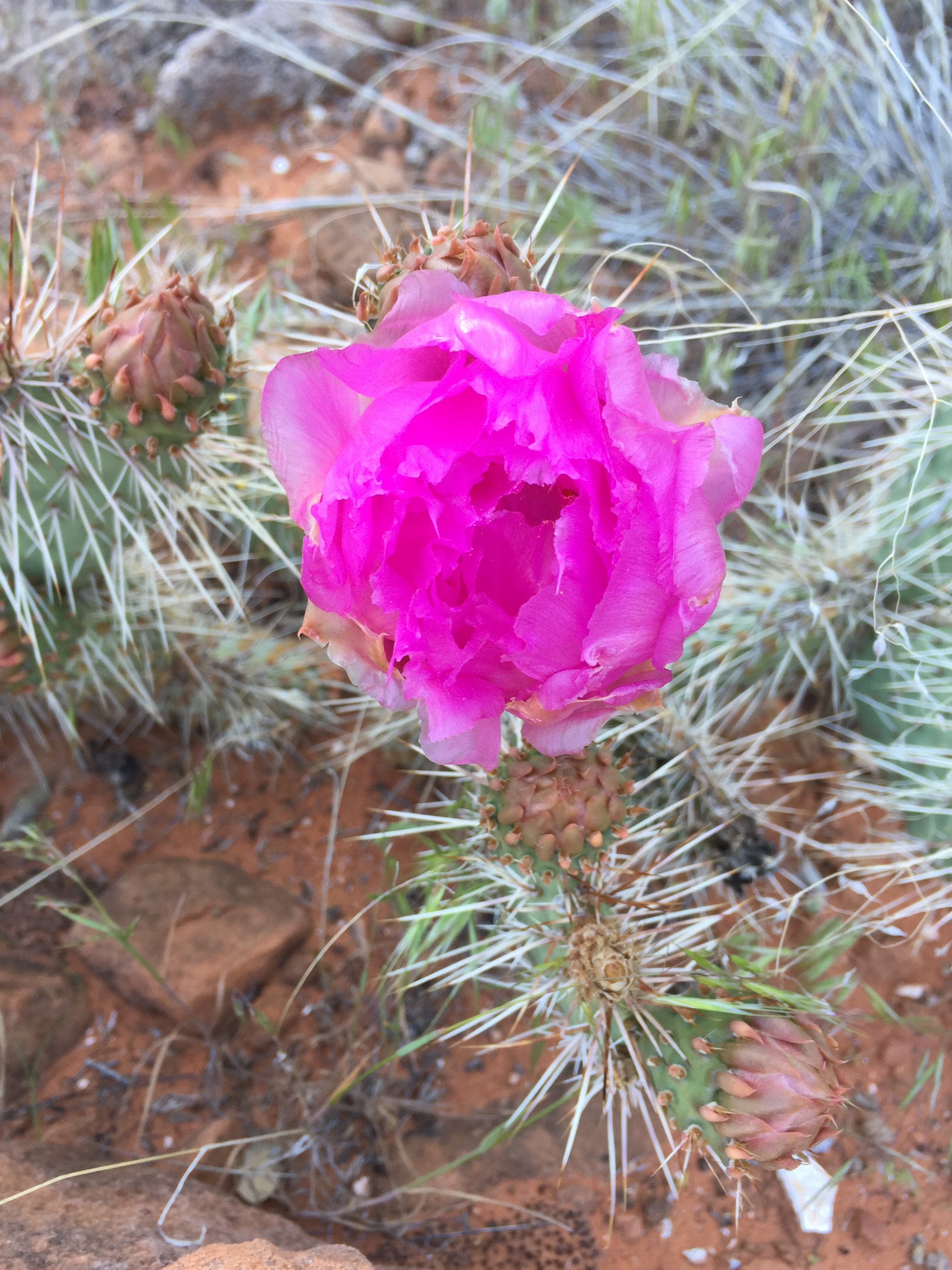
Desert Bloom
After working the Easter Jeep Safari Jeff and I headed to Salt Lake City so Jeff could catch a flight to Elkhart, Indiana.
I made a week long reservation at the Salt Lake City KOA for its close proximity to the airport. We have stayed at this KOA before during the Outdoor Retail Show and had found it to be very comfortable despite it not being in the best part of town.
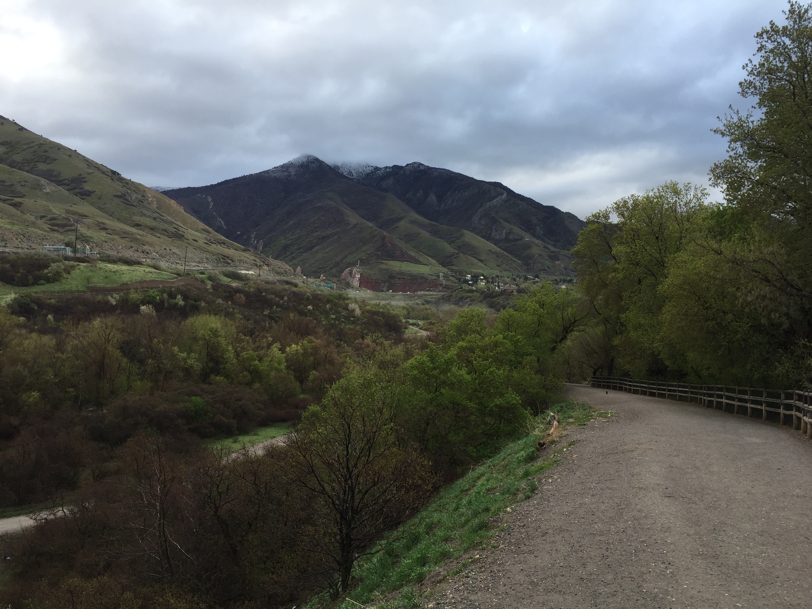
Salt Lake City is surrounded by amazing scenery. Snow capped mountains and lush green foothills that are visible everywhere. And of course Salt Lake is just west of downtown.
I got caught up on expense reports and cleaned up the layer of dust that had accumulated in the RV from windy Moab. Sometimes it’s nice to be parked on concrete just to take a break from the rustic dirt lots we gravitate to. The beauty of living in a tiny home is that it only takes 30 minutes to do a deep clean compared to three hours in my former sticks & bricks life.
While in SLC I wanted to get back on my trail running training plan. Jeff and I are signed up for the Bryce Half marathon (Me) and 100 Mile (Jeff) in June.
Bryce Canyon is one of a six trail races held in the Grand Circle Trail Series. The six races are Antelope Canyon (Feb), Monument Valley (Mar), Zion (April), The Grand Canyon (May), Bryce (June) and Tushars (July).
We have a goal to complete all six races. So far we both have done Zion, while Jeff also completed Monument Valley.
The nice thing about the Salt Lake City KOA is that it backs up to the Jordan River Parkway Trail system. The trail is approximately 40 miles long and for the most part, runs North/South along the Jordan River.
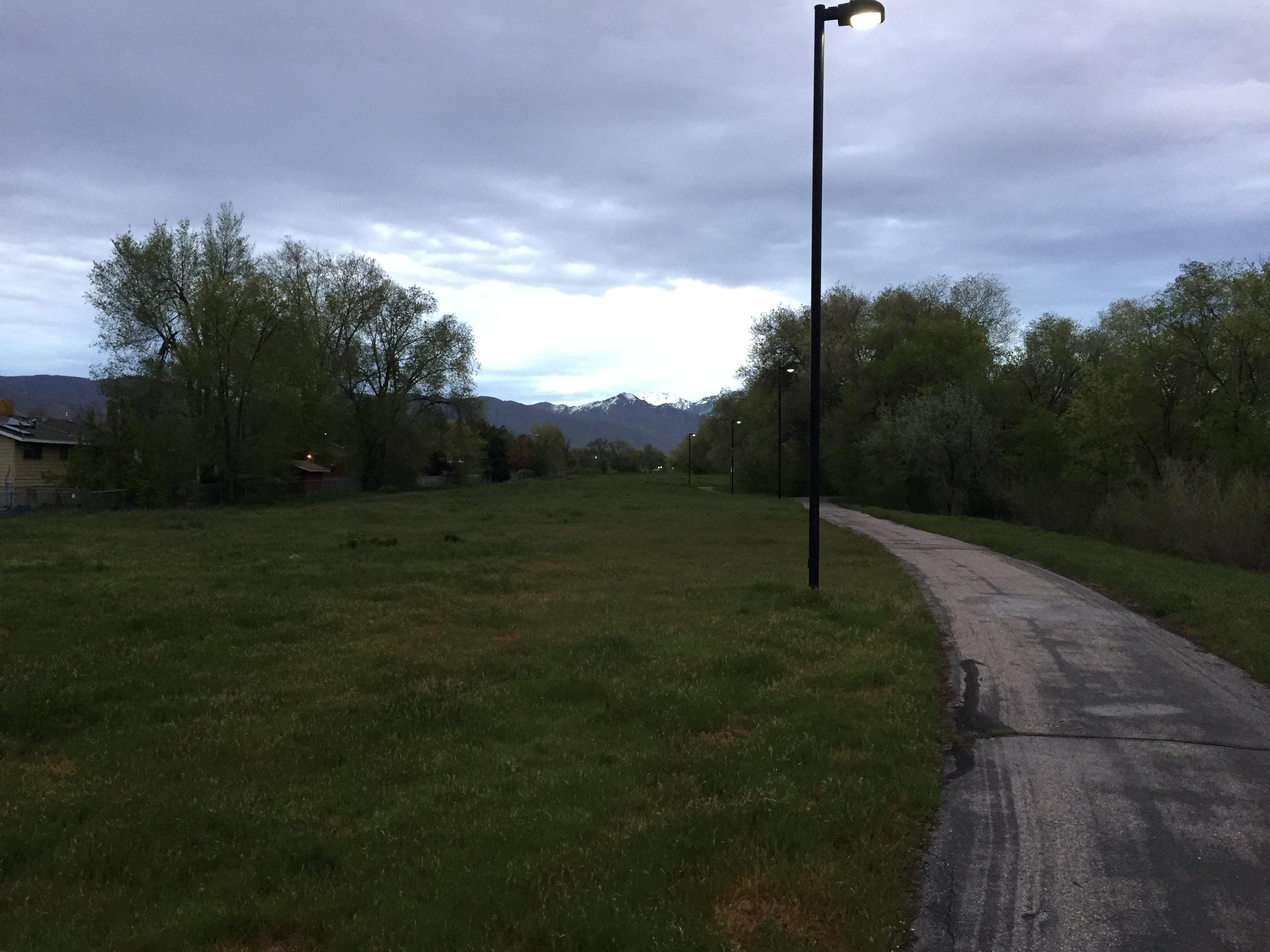
Jordan River Parkway Trail
Within a half mile from the KOA is a huge dog park right along the trail, so if you are looking for a nice walk for doggy, this is a wonderful trail to take. I will say. While running early morning (during the week) I was a bit uneasy, as there were numerous homeless folks that use the Jordan River banks as their overnight beds. Some of the trail got a bit closed in and isolated, which added to my concern. I make sure to make eye contact, say good morning and keep moving.
I needed to take Sam for grooming, so I headed to the East side of SLC. While Sam was getting a once over I headed to the Parley’s Historic Nature Park, a 68-acre open park in Parley’s Canyon. This is a completely fenced in park where dogs are permitted off-leash and free to run. And with Parley’s Creek (what else would it be named) running through the park, there is plenty of drinking spots for pets.
The entire park is fenced in for dogs
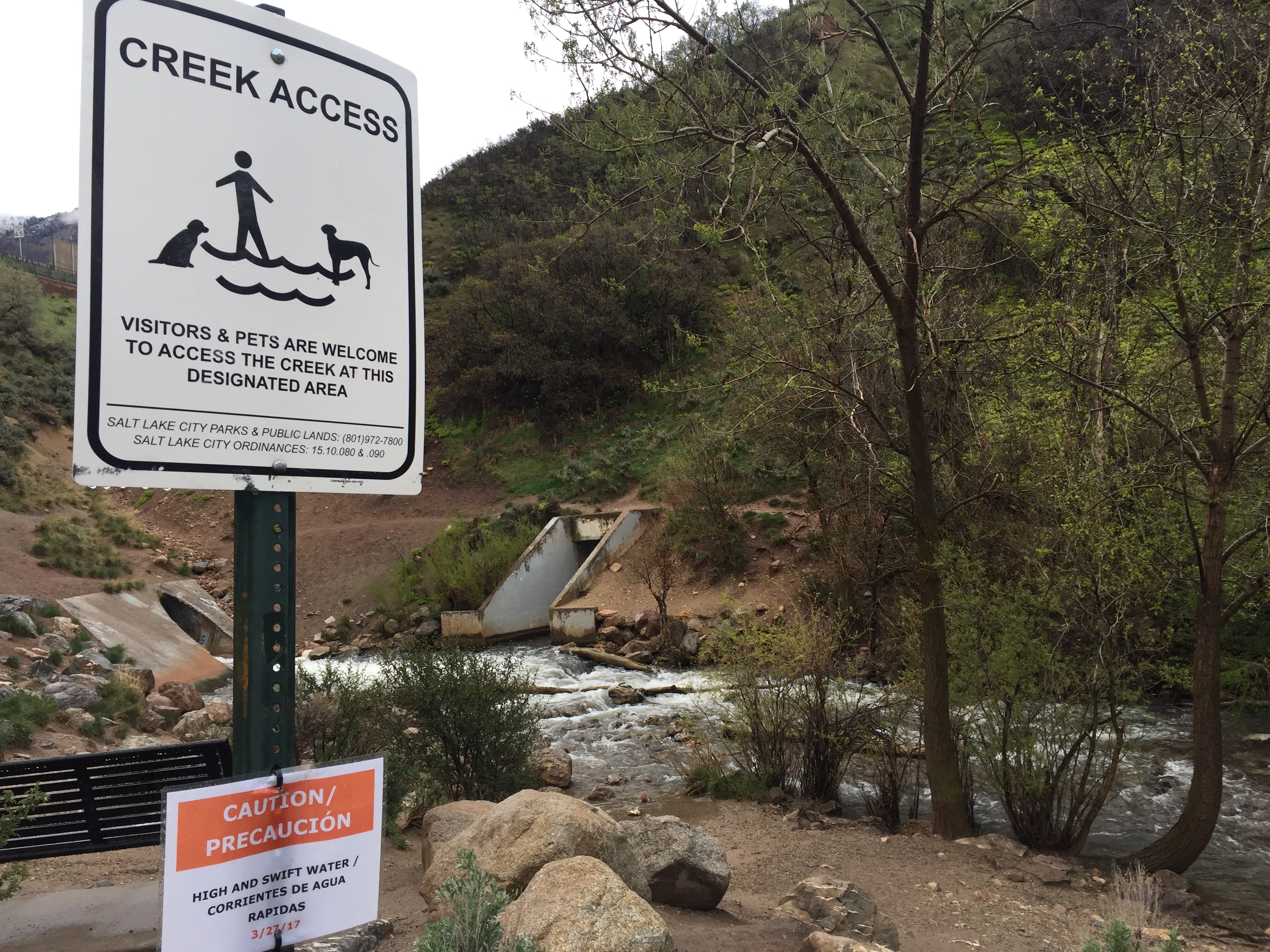
Creek access
Beautiful views
The views were amazing and it was such a tranquil place despite running right next to a major highway. One loop around the park was 2-miles with some good hills to get the heart rate up. I was going for 3 loops and got caught in the rain. Luckily I was close to the parking lot where I could wait it out and then jumped back out to get my last 2 miles in.
While in SLC, Preppercon was having its annual show.
Preppercon is an event that showcases disaster preparedness and for some, the apocalyptic zombie invasion. Not really being afraid of Zombies, this is not a topic of interest to us. We went to see if it would be an appropriate event for Dometic to showcase their Mobile Cooling line as a vendor. In case you were wondering…it’s not!
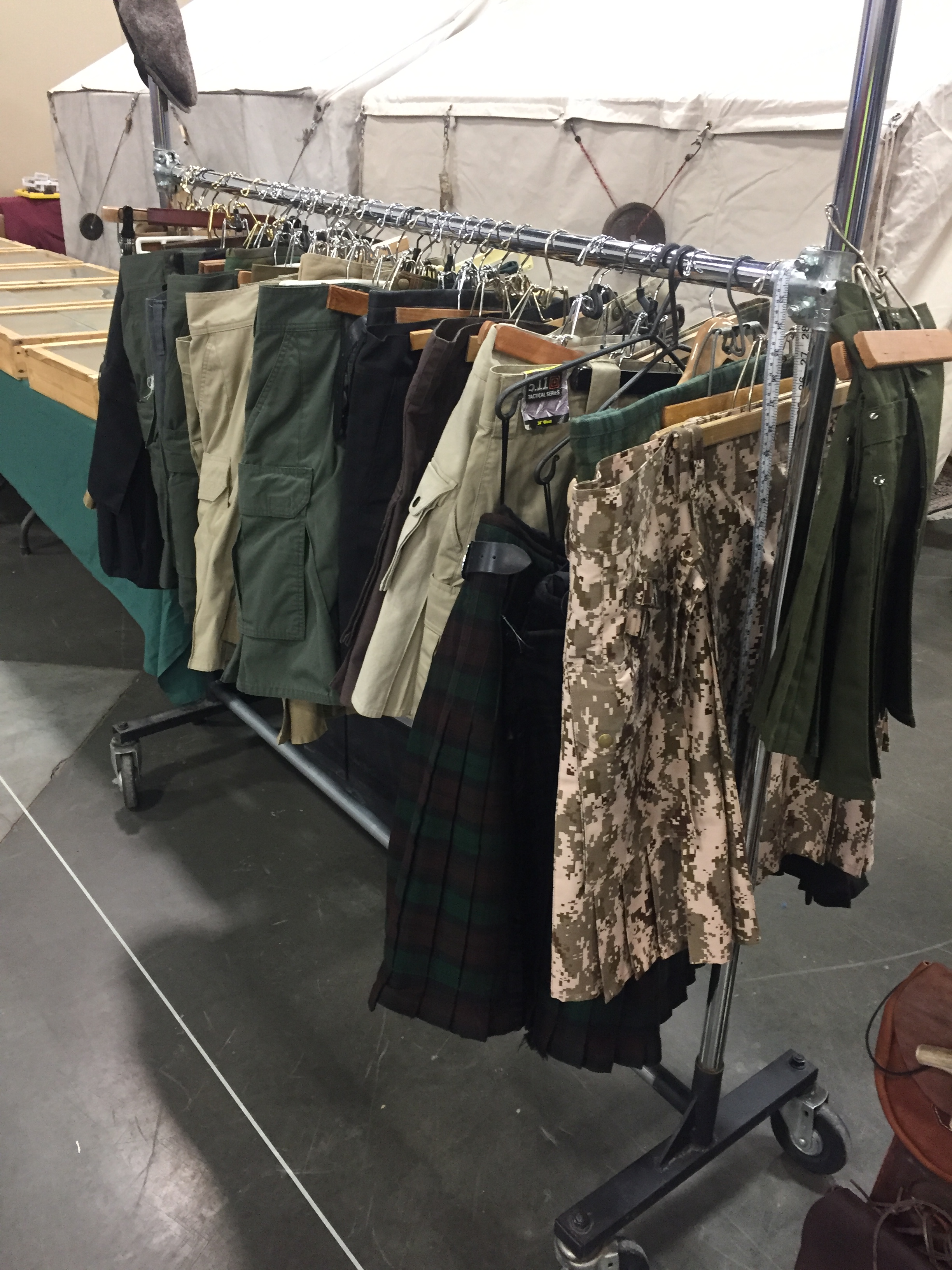
Kilts?
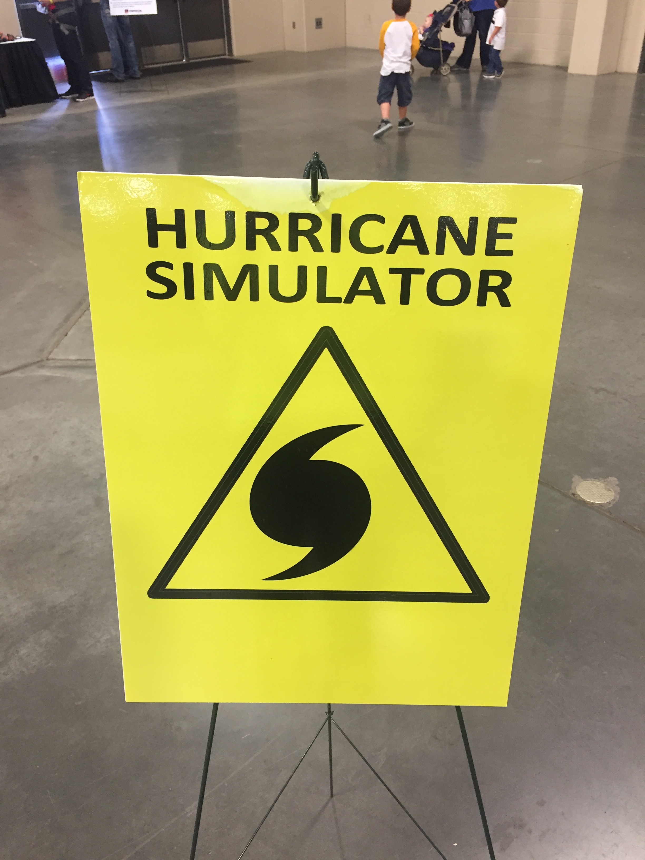
Hurricane Simulator…in Salt Lake City
As a full time RV’er, we have run into some very “interesting” people. Especially in Quartzsite. But this a whole new level of interesting. There was no shortage of kilt wearing men (not sure what that is all about), firearms, dehydrated foods, generators, underground storage containers and a hurricane simulator. Not that there is anything wrong with that. Respectfully, it is just not our thaang.
I did enjoy the self-defense course that was offered. I now know how to get out of a mean chokehold! With all of the isolated running situations I put myself in, the class gave me great hands on tips in a matter of 30-minutes. It‘s all about confidence in certain situations and 30-minutes did just that. My plan is to take a full self-defense course soon, as I could quickly see how valuable this training would be!
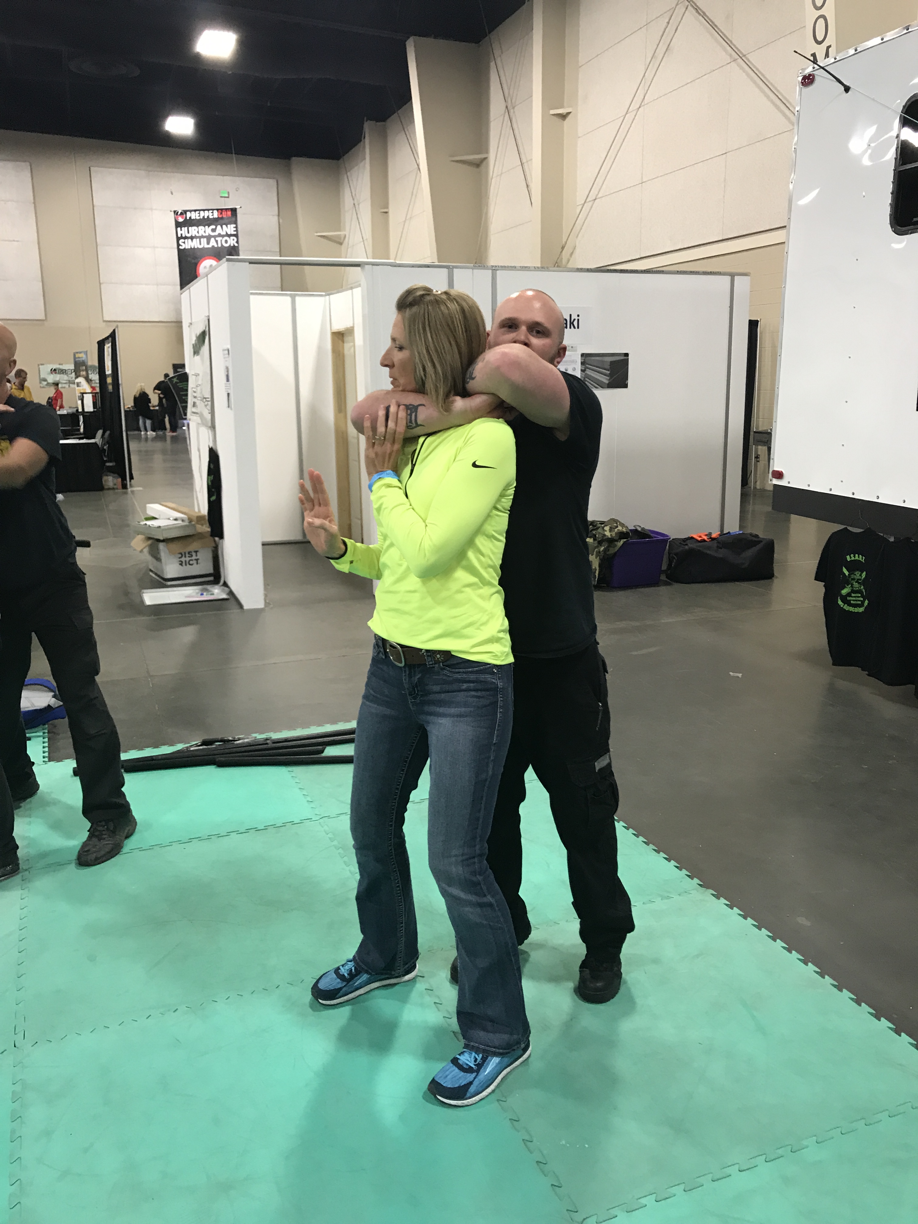
Learning how to get out of a choke hold
After Salt Lake City, we had two weeks before we needed to be in Las Vegas for the National Hardware Show.
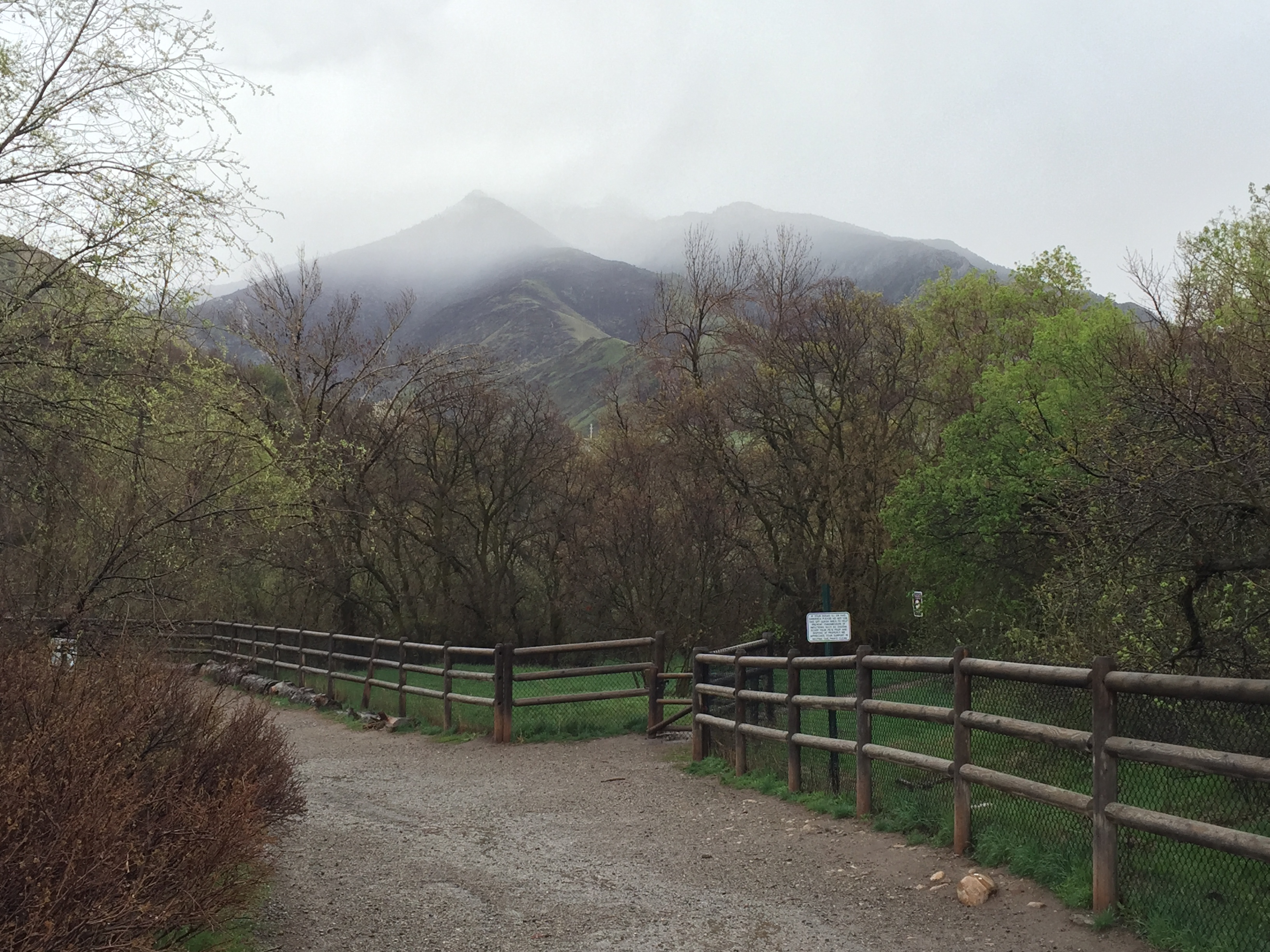
I really wanted to check out The Valley of Fire in Nevada but the temps were already in the 90’s and too hot to boondock. So we decided to head to higher elevation at Capital Reef National Park. This was a 3 hours detour off course but thought it would be worth the adventure.
We researched boondocking spots in the area and found some camping reviews that said where there was a few bars of cell coverage. But after arriving, we couldn’t find a connection. AN.E.WHERE. Since Jeff had been traveling he had some work to catch up on. We quickly decided that Capital Reef was not going to work for a weekday visit and we packed up the next day and headed to St. George Utah.
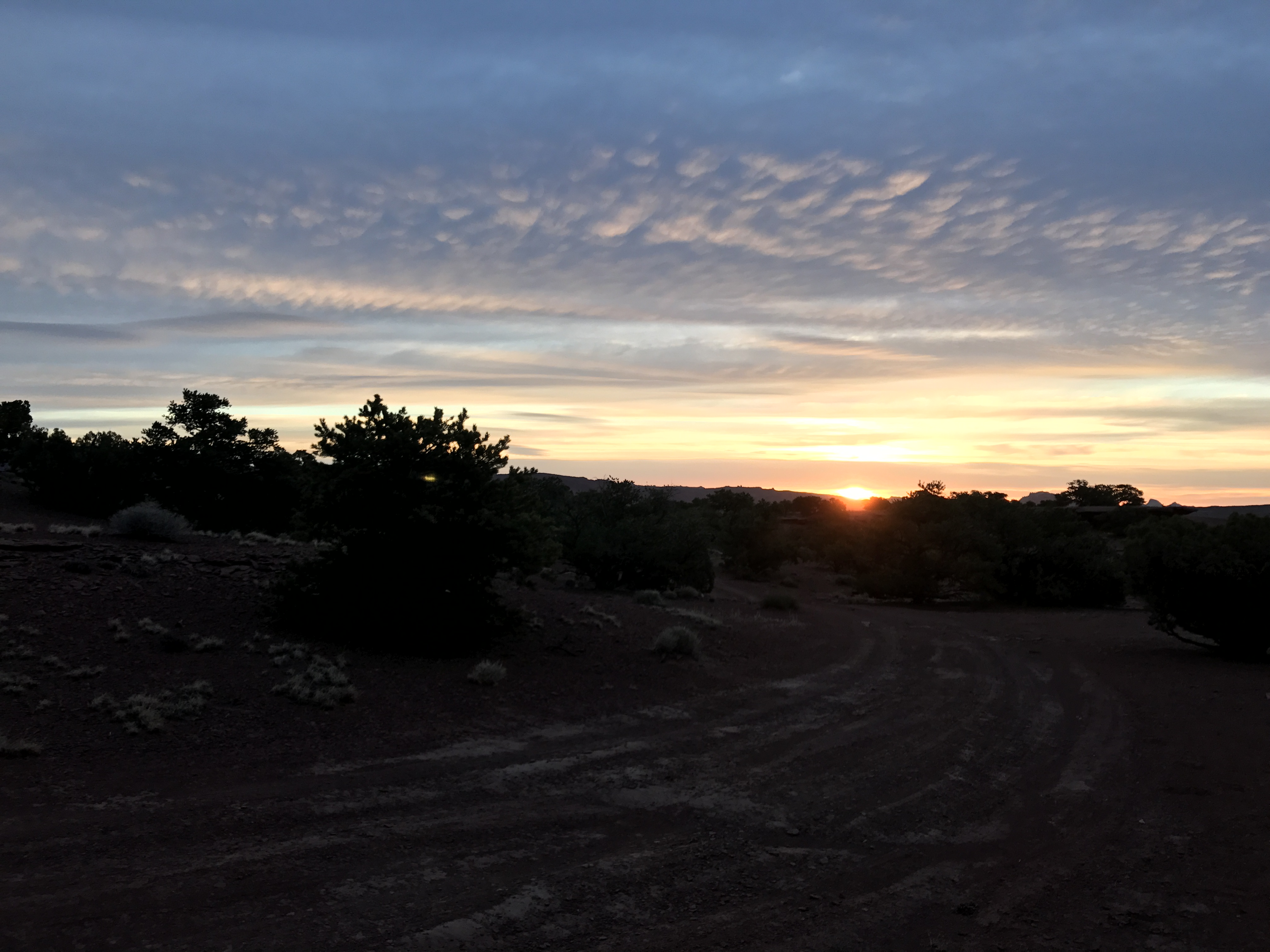
A brief sunset view from Capital Reef
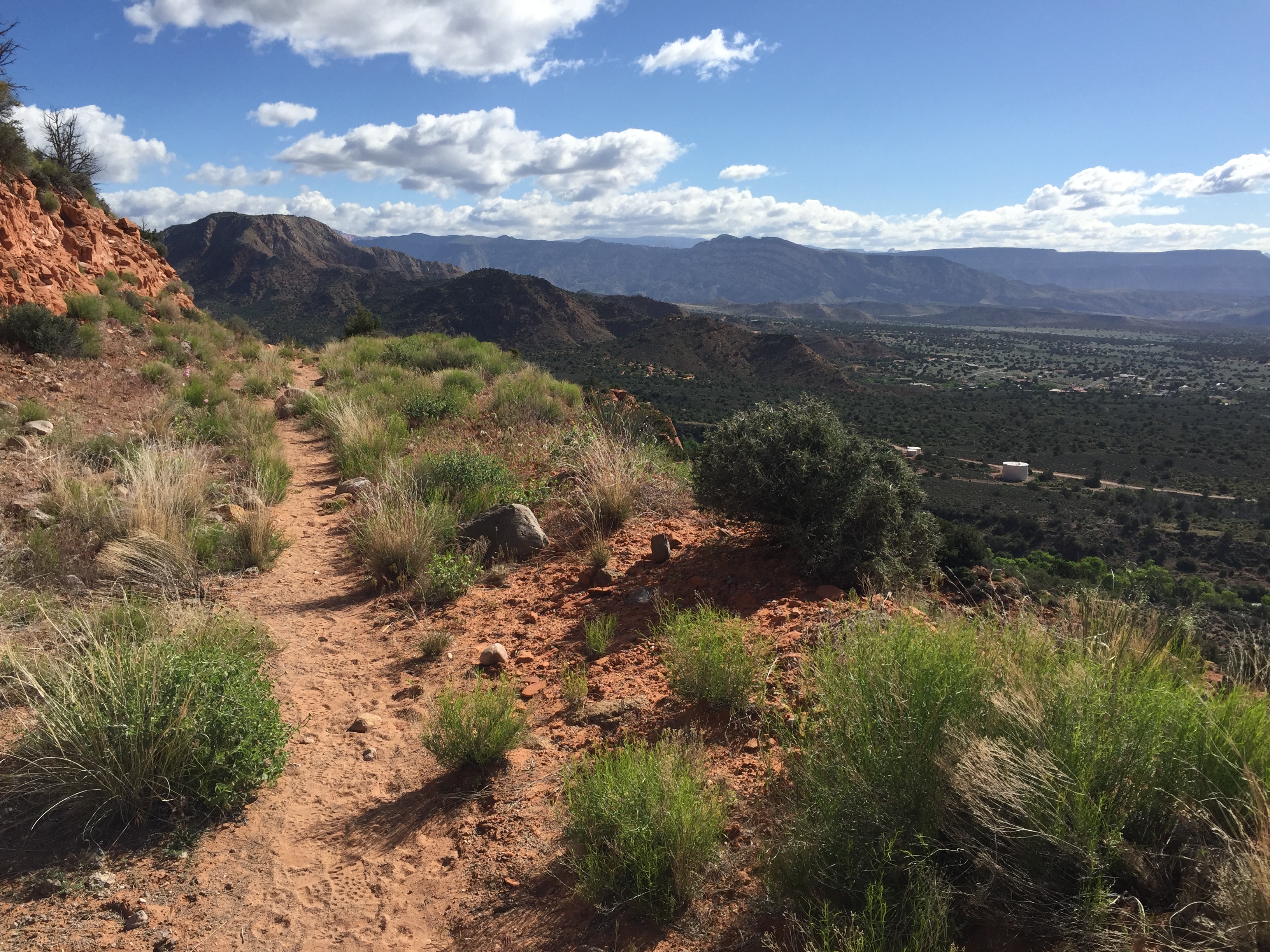
With that 6 hours experiment behind us, we settled into a favorite location in Leeds, where free dispersed camping is offered right along the Red Cliffs. We stayed here last spring as our jumping off point for the Zion Ultra Trail Run (aka Mudageddon) and Zion National Park. After our mouse invasion here last year, I came fully prepared with plenty of mousetraps. I thought maybe the mice were just a fluke. But we were invaded once again! Darn critters!
Despite fighting off the nightly invasions, we really love this location for running.
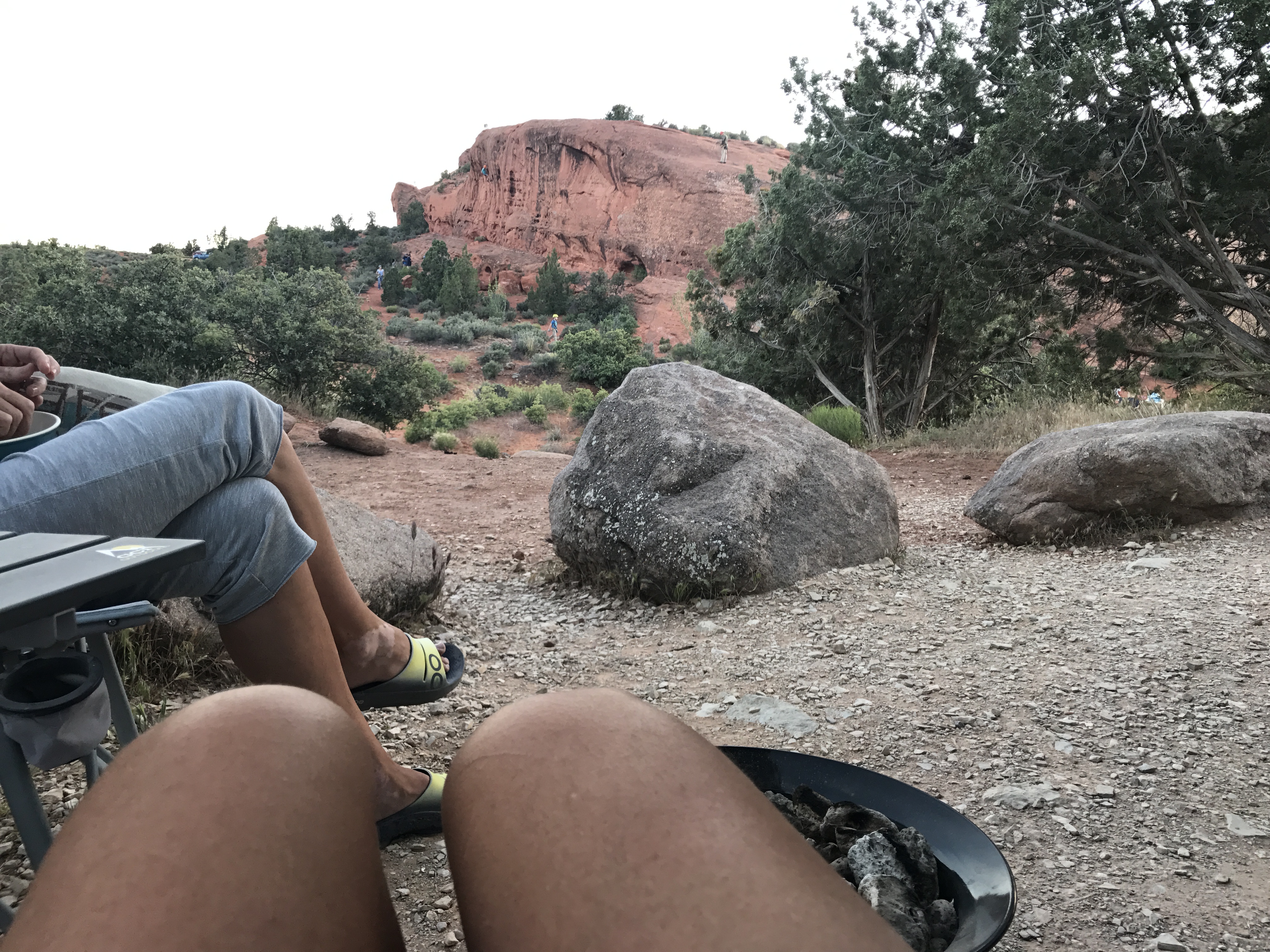
Watching repelling lessons from our campsite
You have every possible trail running opportunity here. Single track, ATV roads and gravel roads are easily accessible and we took advantage of them all! Jeff was on one trail and was startled by something out of the corner of his eye. At the sight of a rattle snake he jumped so hard he hurt his shoulder. Of course he was not injured enough to stop for a photo.
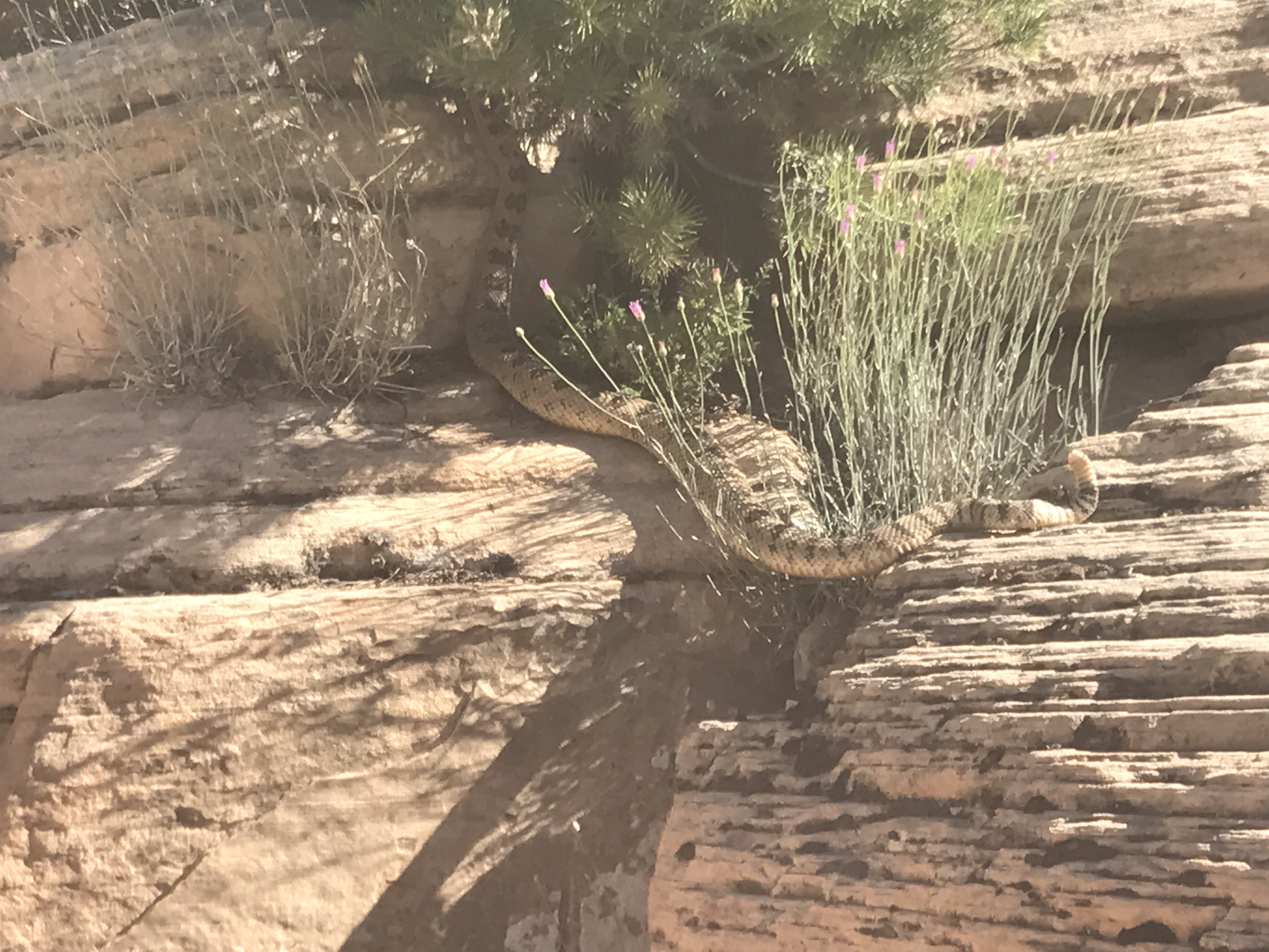
That is one ginormous snake!
It started to get a bit hot while we were here. So hot that we drove into St. George for an afternoon and hung out in a furniture store, then went to dinner just to be in some air-conditioning. The next day we drove down to the holler from our campsite and put our lawn chairs in Leeds Creek and drank smoothies for a few hours. The creek was cool and refreshing, especially after our long runs.
Yummy single track Silver Reef Trail
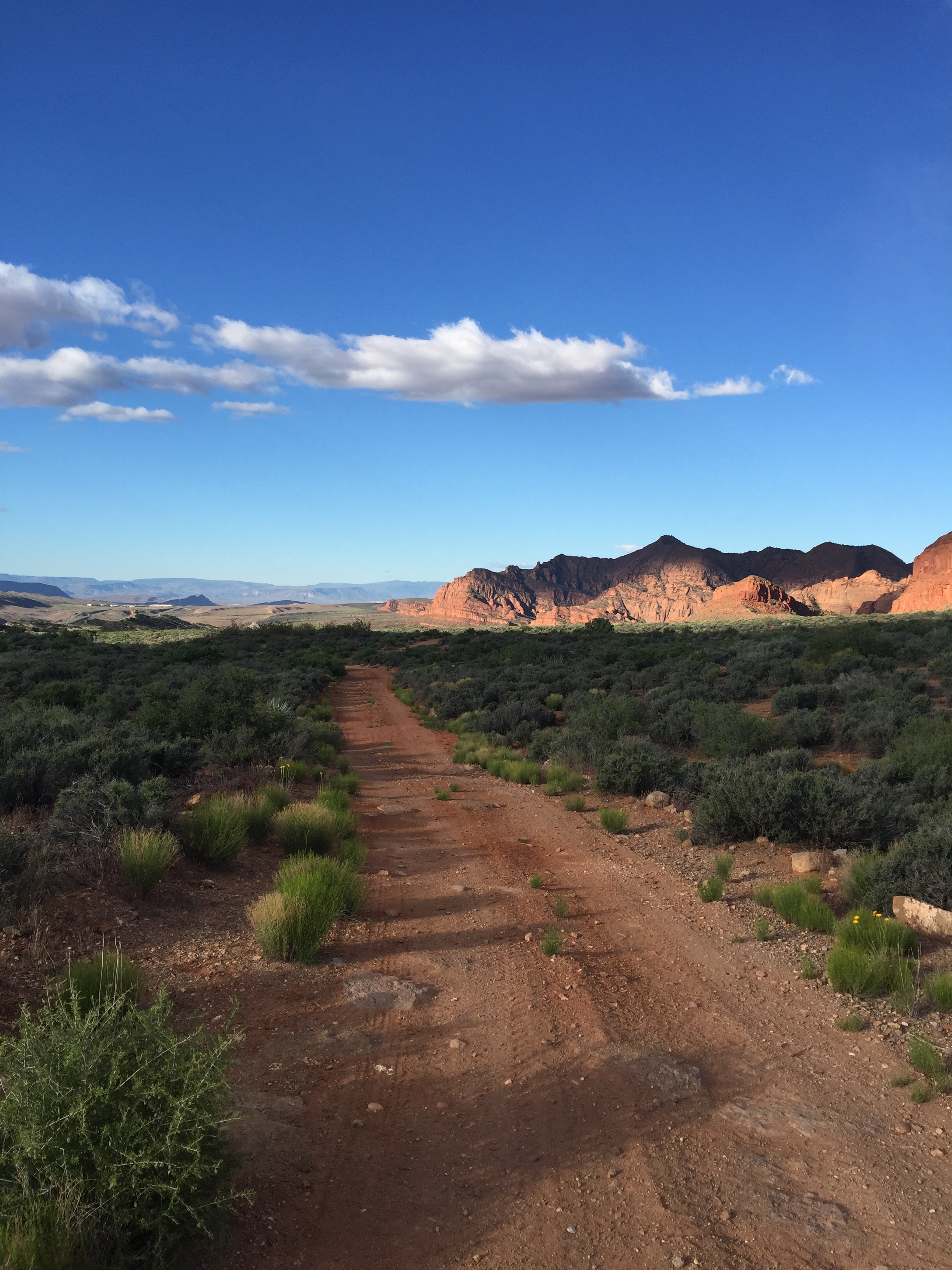
ATV roads along the Red Cliffs
Gravel Roads to somewhere
We had to park in the campsite right next to the Silver Reef Trailhead, which saw a lot of traffic. Groups were coming out for repelling classes, which were entertaining to watch. But instead of taking the trail, the day-users felt comfortable walking right through our campsite just to avoid a few extra steps to their cars. Either I don’t remember this from last year but the road was non-stop with cars and ATV’s driving by day and night with their hair on fire. The wind was fierce this time too and we found ourselves spending more time inside just to get some relief from the dust being kicked up by the cars.
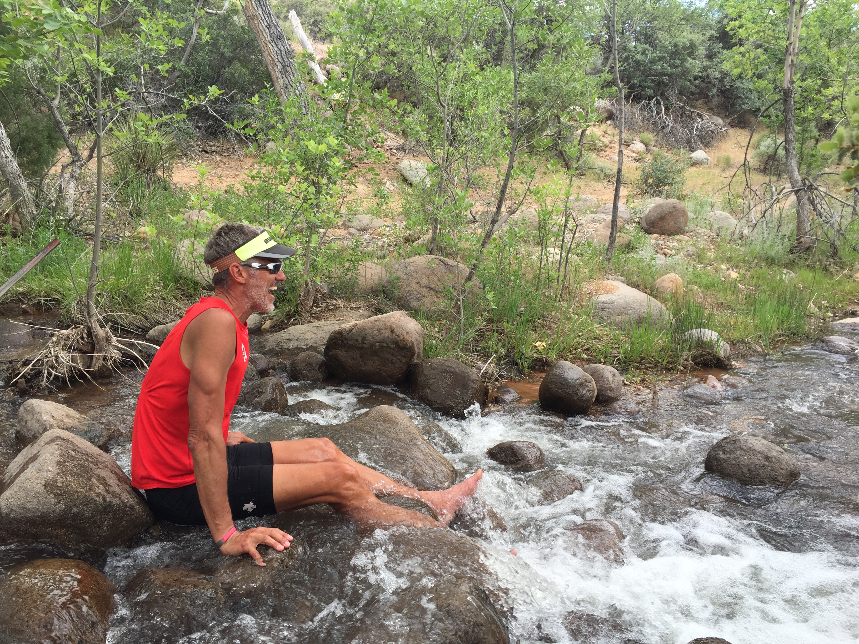
Cooling the dogs in the Leeds River
Overall, we still love it here and will probably be back. I just need to restock the mousetraps before we do.
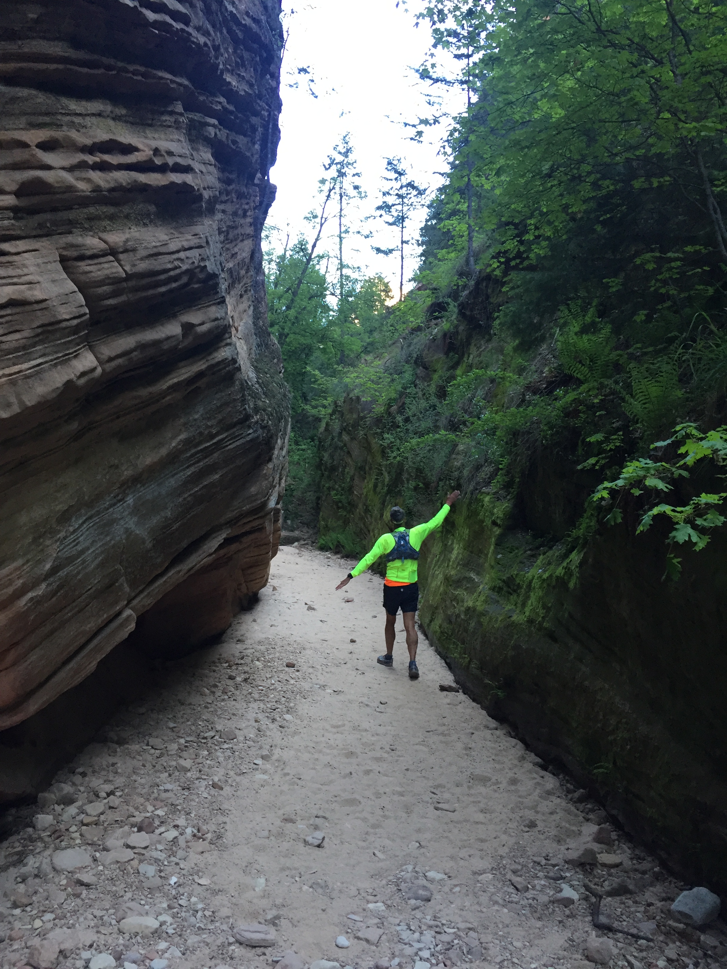
Jeff and I did take an early morning trip over to Zion National Park. We had Sam with us in the truck so we found a shady parking spot and took a short hike to Hidden Canyon. It requires a shuttle ride to Weeping Rock where Hidden Canyon spurs off. It was a short 4 miles round trip, but definitely beautiful and fun.
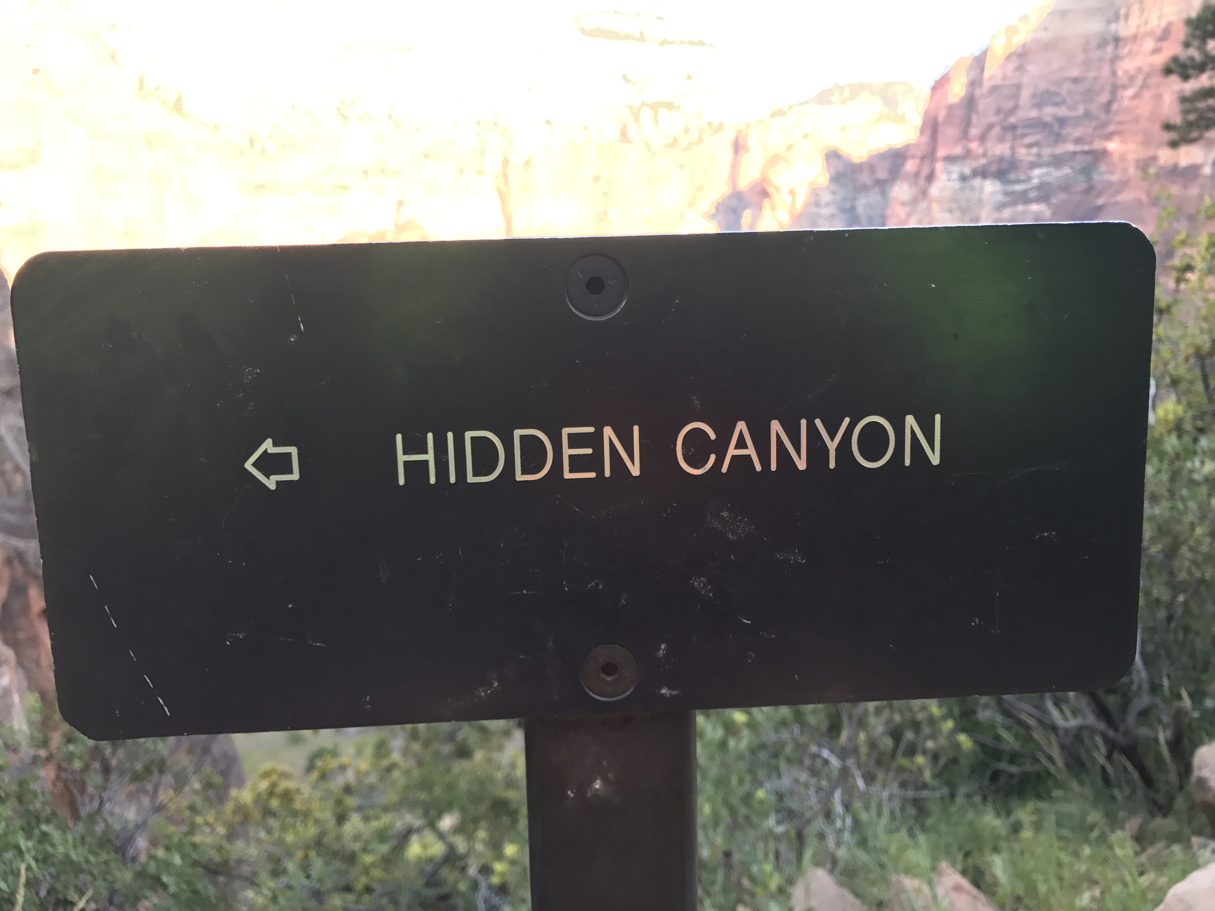
Trailhead
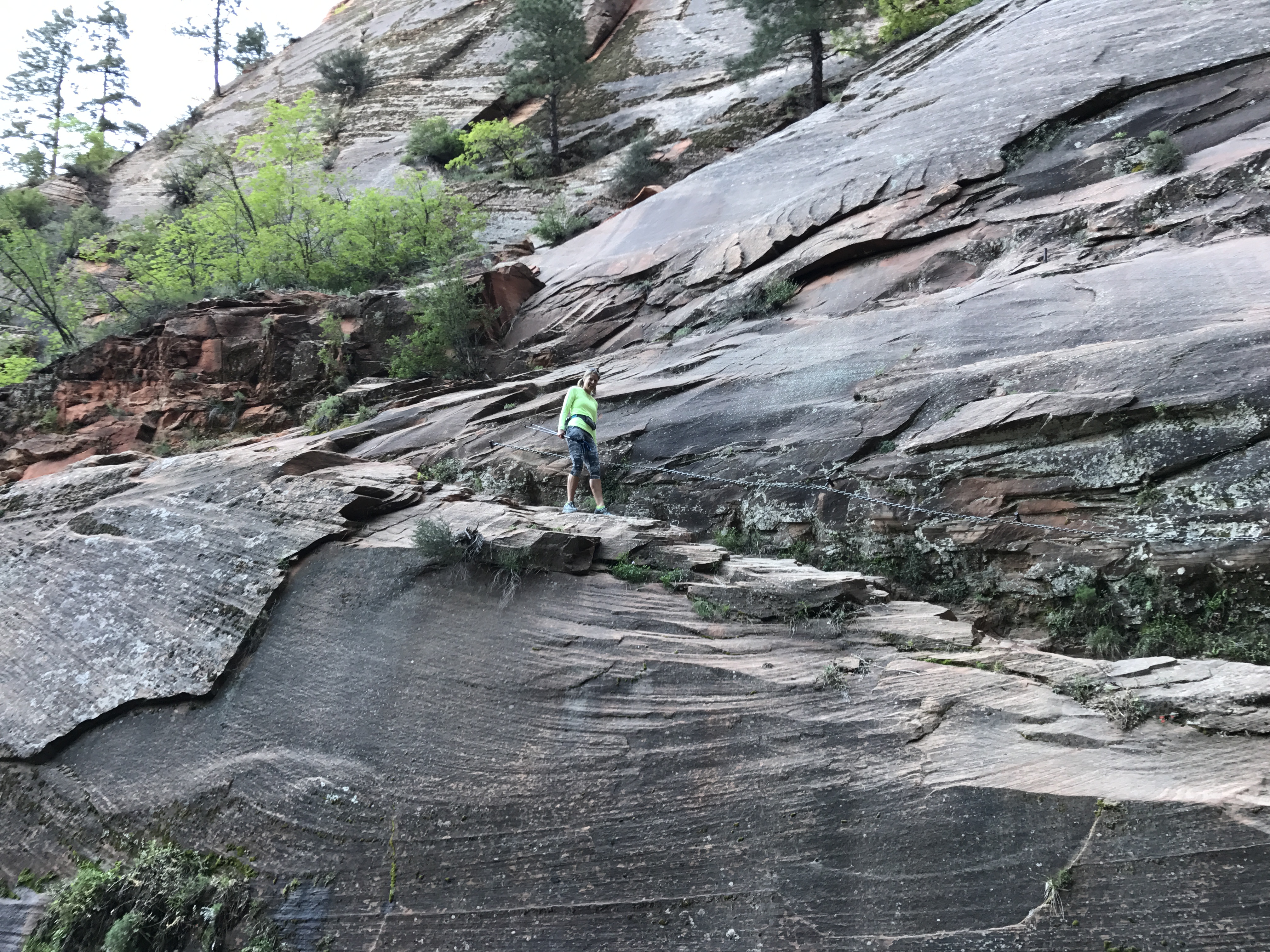
Cut in trail with chains
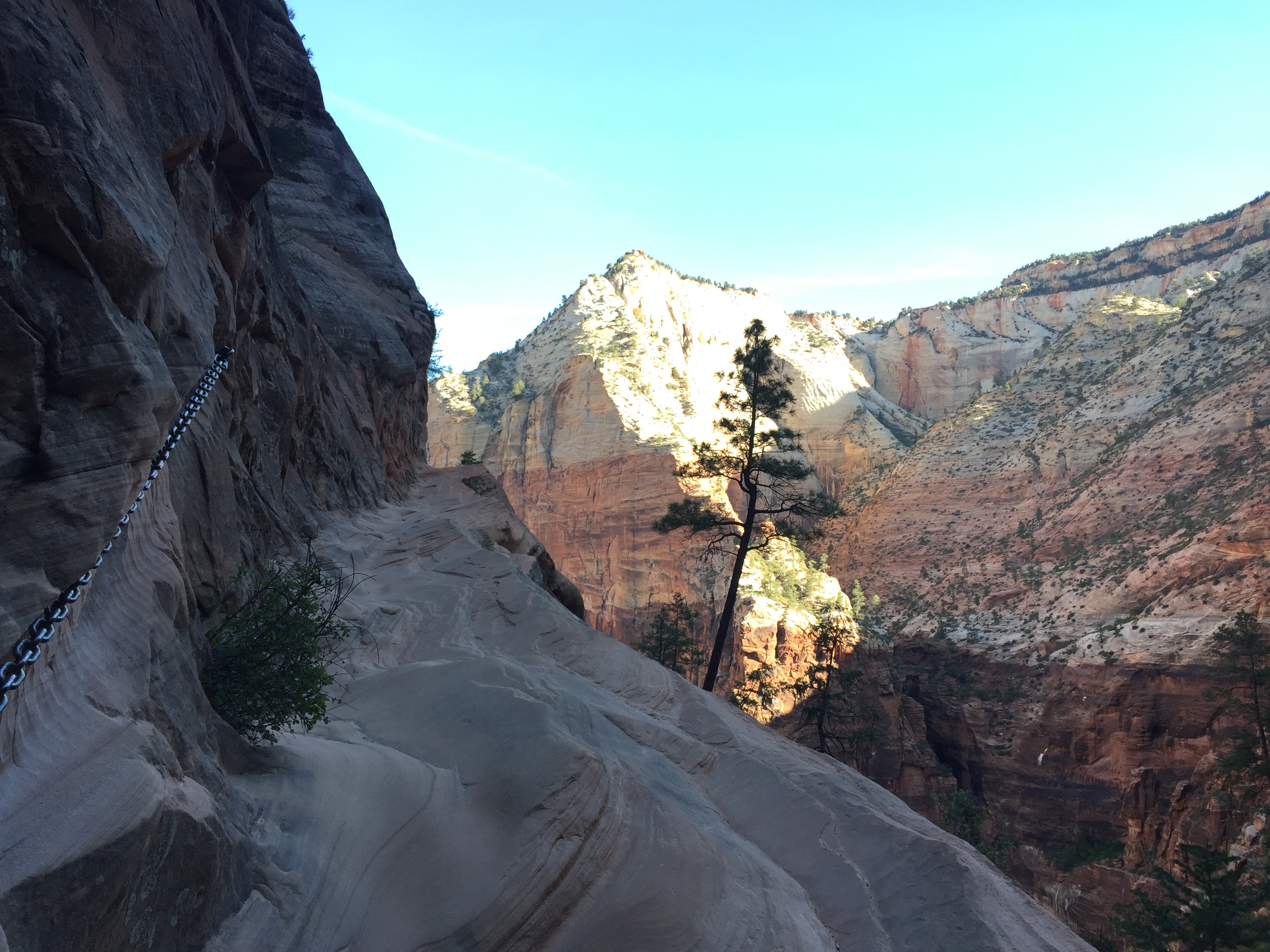
To your right is nothing but net
The initial climb is very steep (just like every trail in Zion) with numerous switchbacks. As things begin to level out the trail becomes narrow. Some areas have permanent chains imbedded in the cliff side to give hikes a bit more security. I’m not sure who put in this trail, but they would have had to have nerves of steel cutting in to a sheer cliff face.
We eventually came to a sandy slot and scrambled over rocks and logs to get to the end of the canyon, denoted by a sign telling us to turn around.
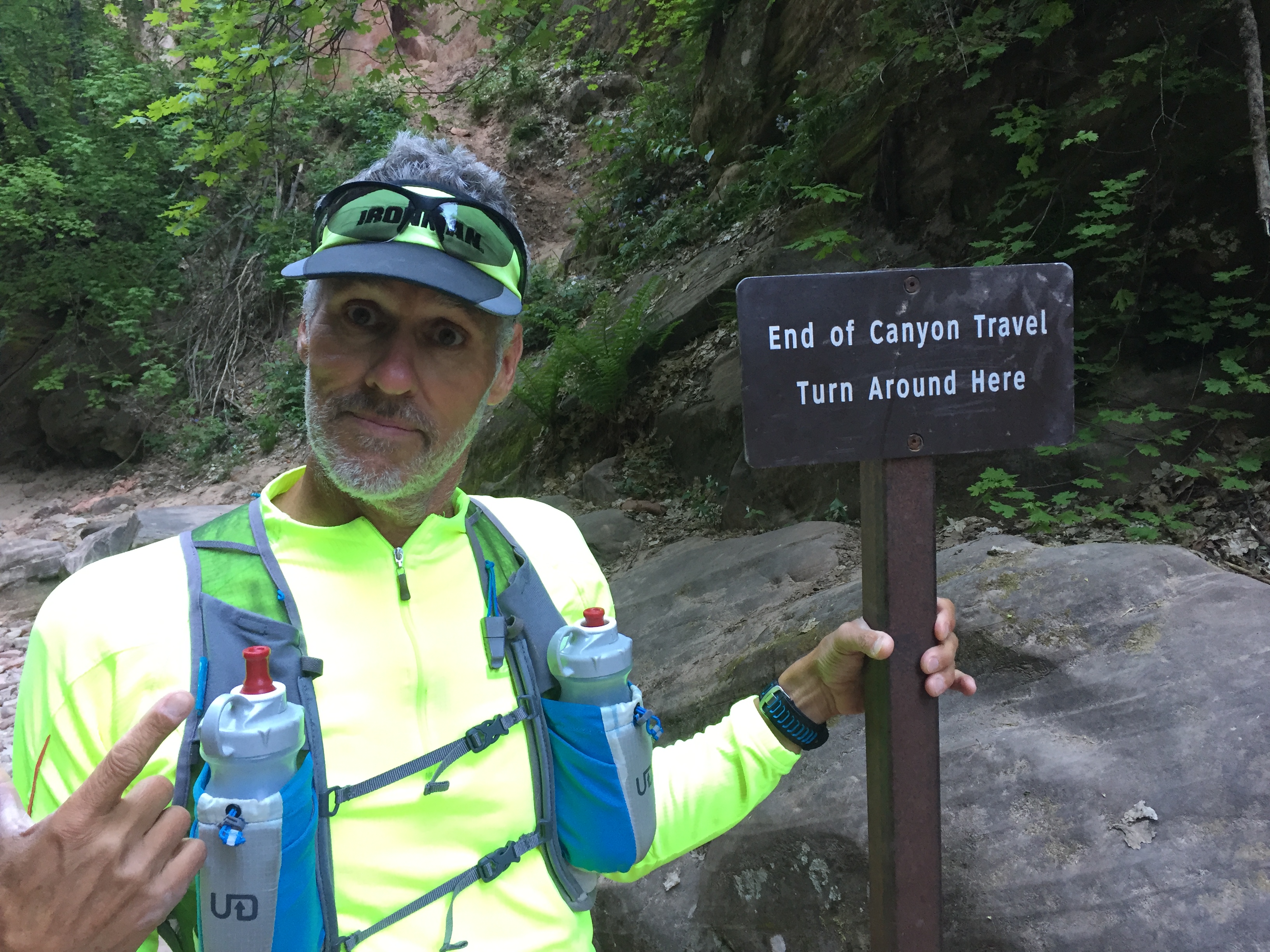
You talking to me?
Sandy slot
On our way back down we turned on to the short trail to Weeping Rock. This is a paved trail and bit crowded, but non-the-less beautiful. Water seeps through cracks in the cliff face above. All the vegetation is green and lush here with a backdrop of deep red, black and green rock. It was refreshing to catch a little bit of dripping water on our skin.
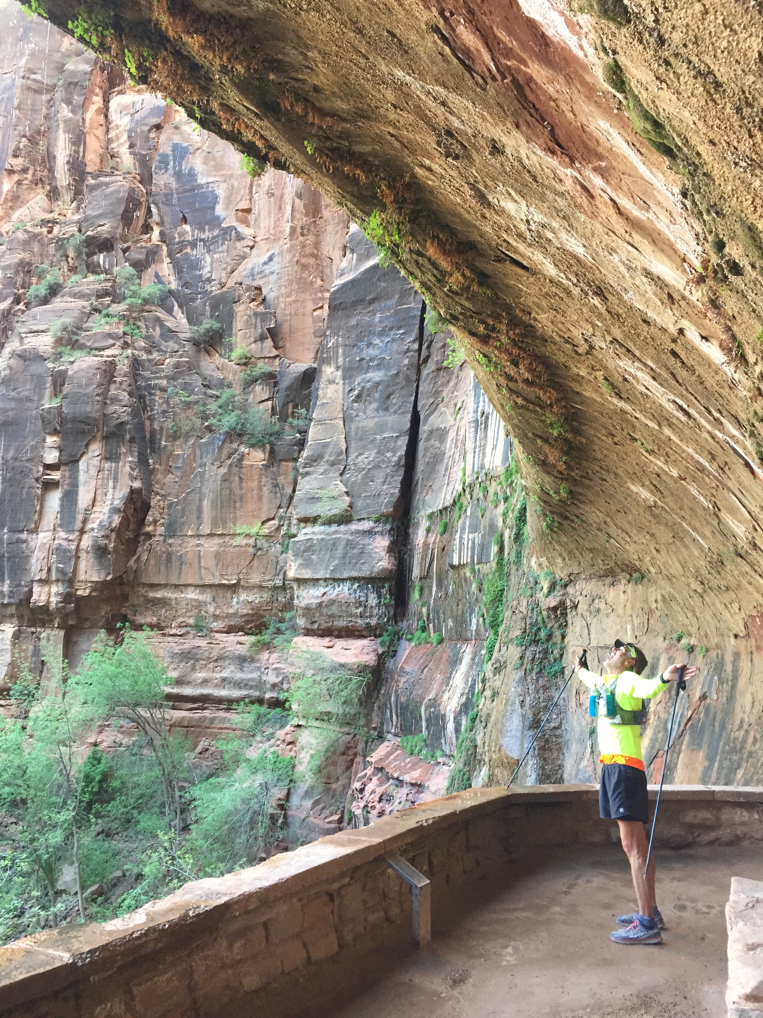
Weeping Rock
After our shuttle back to the parking lot we went to Cafe Soleil in Springdale for lunch. We came here a couple times on our last visit and love their fresh salads and smoothies. We can sit outside with Sam in the gorgeous weather and visit with other tourists.
After Zion we pulled up stakes and made the trek to the belly of the beast…Las Vegas. The only thing I can I say about Las Vegas is that we always look forward to when our time is over and we can get back to solitude.
We again stayed at the Circus Circus RV “Resort” just a mile and a half from the Convention Center. This works out well for me to run back to the RV to relieve Sam during the Hardware Show. Even though CC is quite run down and prime for an epic dynamite implosion, they did add a very nice water park since the last time we were here. The laundry room may not have a single functioning washing machine, but the water park will be fun for families who choose to bring their children to the land of debauchery.
A quick hello with good RVing friends!
We did get to see our RVing buddies John and Becky for a few minutes as Becky was also working the show. Sometimes you just got to squeeze in a howdy and hug where you can, making our Las Vegas trip totally worth it!
Las Vegas was short lived as we left the show a day early to drive to Flagstaff to set up for the Overland West Expo.
Now that’s more our style!
THE END!
Flagstaff and The Fearsome Four
Posted by Deb in Arizona, Arkansas, Boondocking, Destinations, Full Time RV, Highest Peaks, Hiking, Running, Trail Run on October 21, 2016
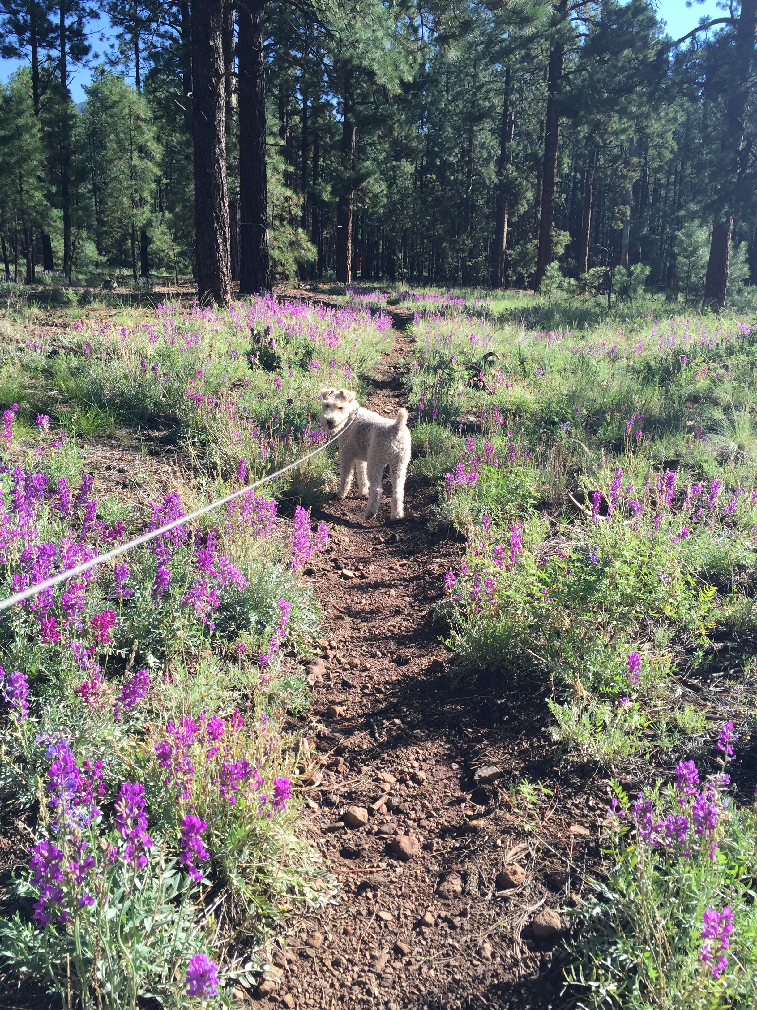
Sam back on the Arizona Trail
August 21-September 21, 2016
After climbing to new heights at Mt. Whitney Jeff and I had about a week before needing to be in steamy Phoenix for business travel. We wanted to camp where we could get a break from the heat just a little longer, so we headed straight for Flagstaff, Arizona.
We’ve been camping in Flag off and on for the past year, one of our favorite locations. There is an abundance of free forestry land to camp in with endless trails to run, hike or mountain bike just outside your door. This and being close to town makes us feel like we live in the community. Flag is definitely familiar to us now and there is no need for GPS to get around town any more.
A delightful sunny spot amongst the trees
Not only was the 70 degree temps sublime, but Jeff has been training for the Stagecoach 100. Stagecoach is a 100 mile ultra trail run that starts in Flag and ends at the IMAX theater at the Grand Canyon. Jeff is running a relay with a buddy. 55 miles for Jeff and his friend Jason running 45. Since the race was just 4 weeks away some high altitude trail training was in order.
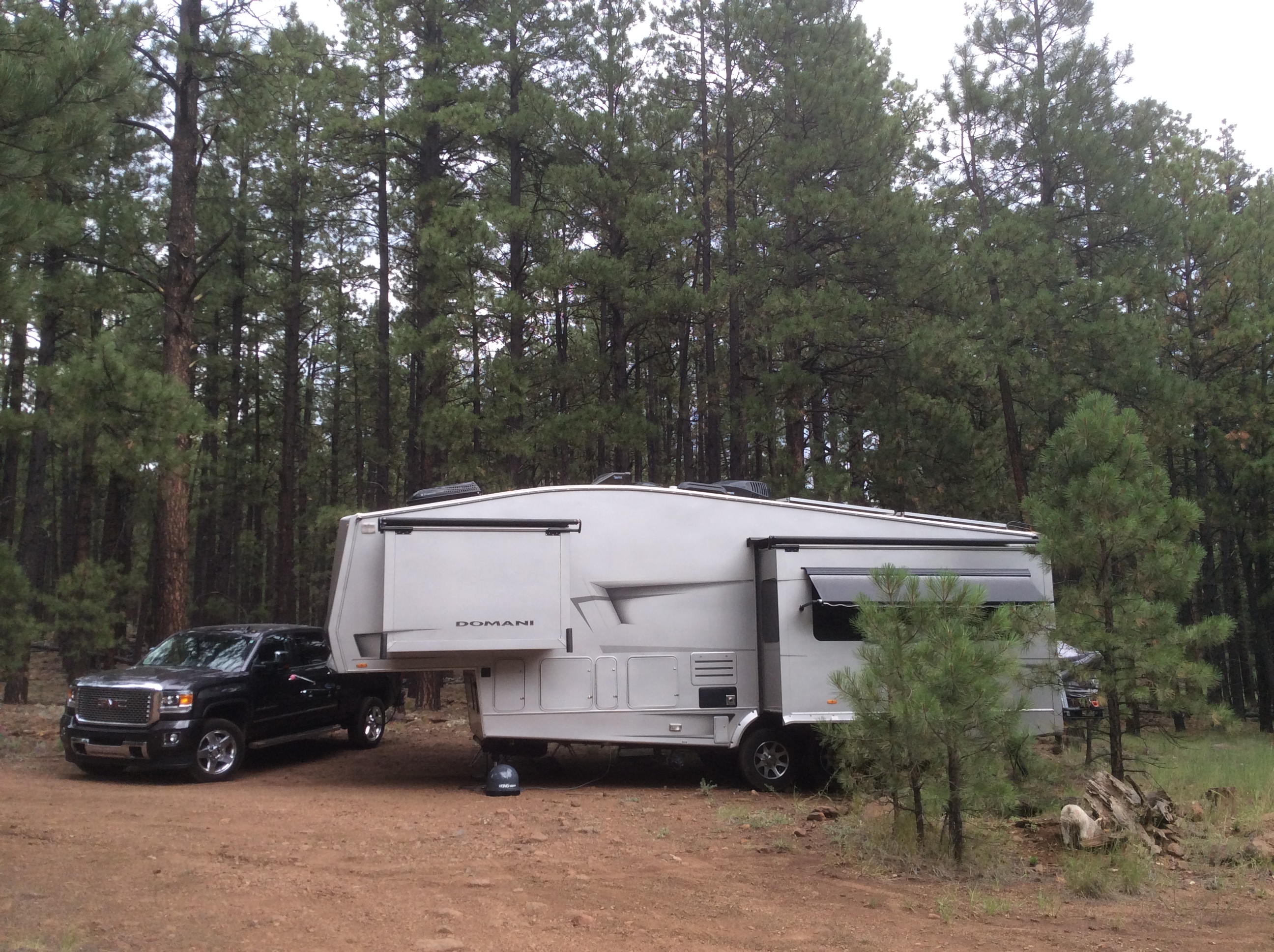
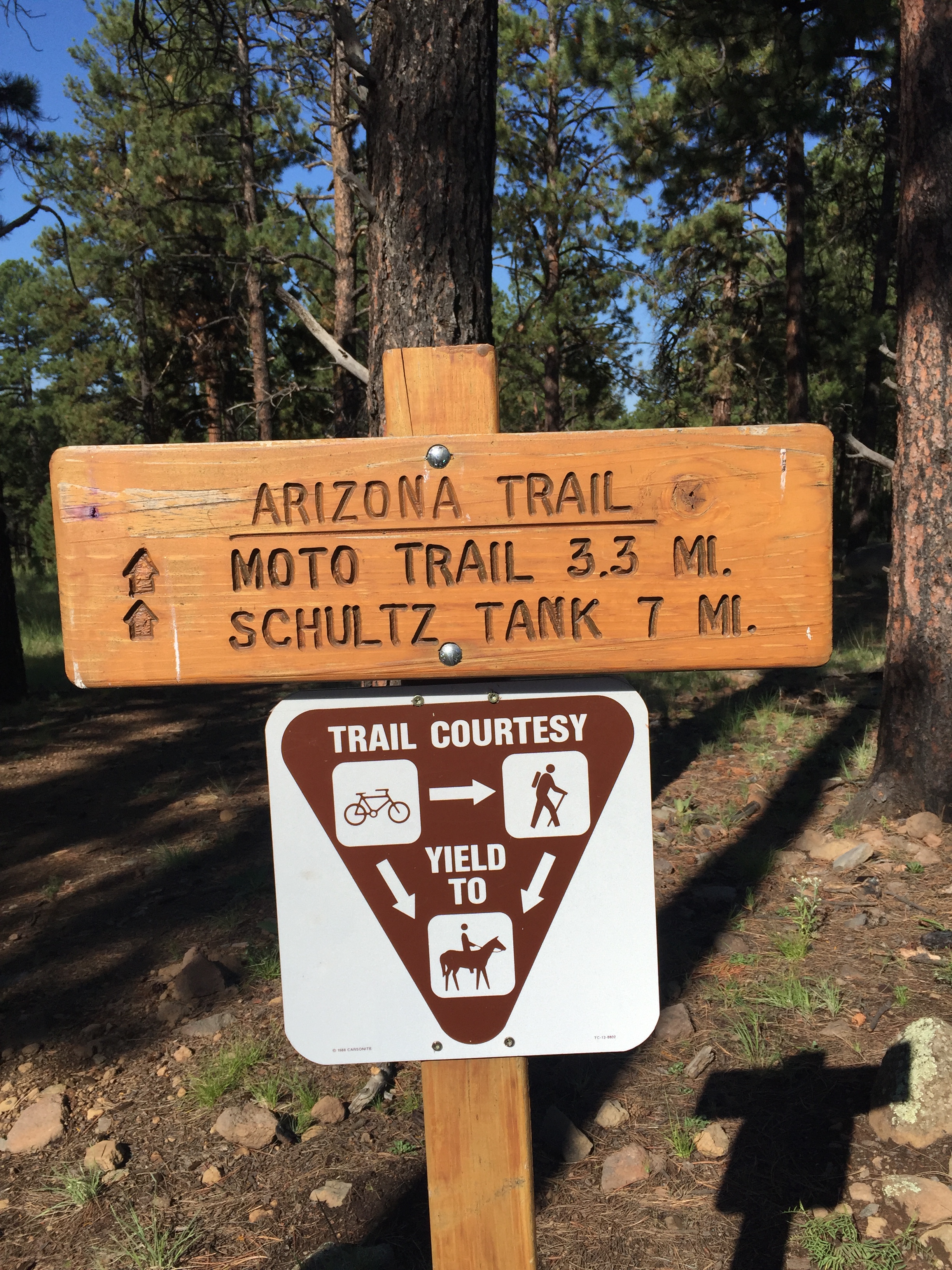
We camped at a new boondocking site on FR6051 near Snow Bowl on the North side of town. The road was a bit rough, but we were able to wedge our modest 32’ into a nice spot for maximum solar gain. There are endless forestry roads here with several short spurs that connect directly to the Arizona Trail. So getting in our trail runs was a piece of single track cake!
Oh Arizona Trail, how I love thee!
One of the first things we usually do when getting to a new location is to see if there are any running events happening during our stay. We have done this in Moab, Chico and Whistler among others, and it keeps us motivated to get out and exercise on a consistent basis. Without the motivation I would struggle with the RV-15 (think freshman-15) and bedsores!
One of the things we learned about is the Flagstaff Fearsome Four Challenge. Four peaks, 34 miles, 10,307 of elevation over 2 days. Sure…why not! As part of Jeff’s ultra training this challenge was right up his ally.
Here is how the challenge works. Hike or run Humphreys Peak, Kendrick Peak, Mount Elden and O’Leary Peak in any order. If you accomplish this challenge under 15 hours (not including driving time) in a 24hr period you are honored with the status of “Ultra” runner. Well then. Lets get to it!

Things that go bump in the night…what was that noise?
Jeff started at 1am at Kendrick Peak. Besides being scared by some sort of large animal in the woods, this was pretty uneventful. Humphreys Peak, the highest peak in Arizona and most challenging of the four, was next. Jeff ran into a couple of trail runners that run Humphrey’s 9 miles in under 3hrs, twice as fast as I hiked this beast! It had snowed on this peak the day before, so some of the trail was still covered.
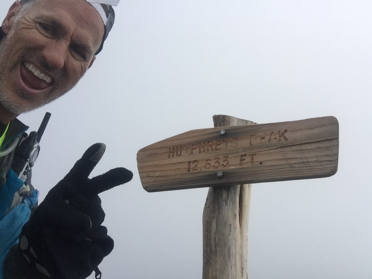
Summit of Humphrey’s Peak
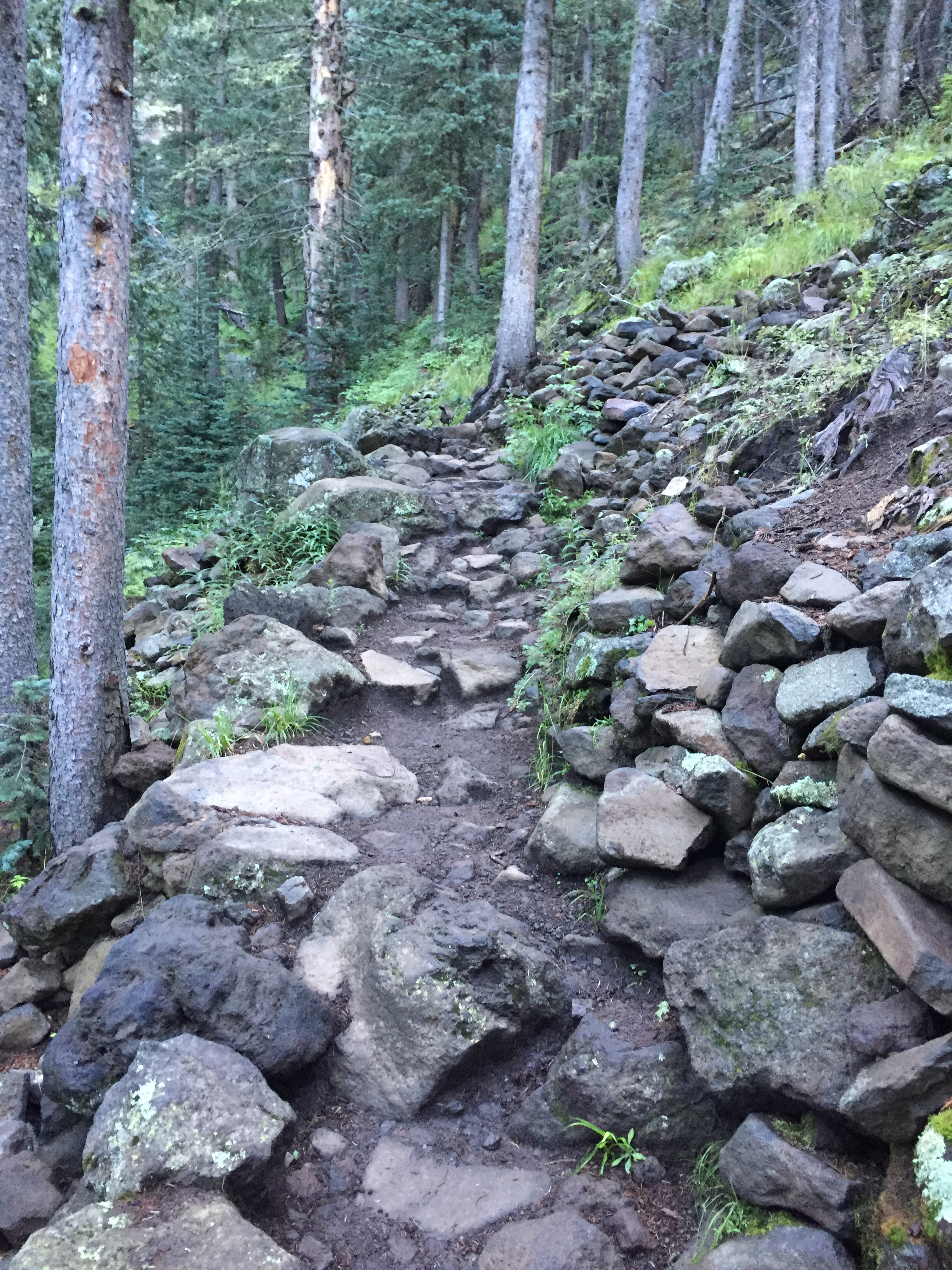
Rugged trail
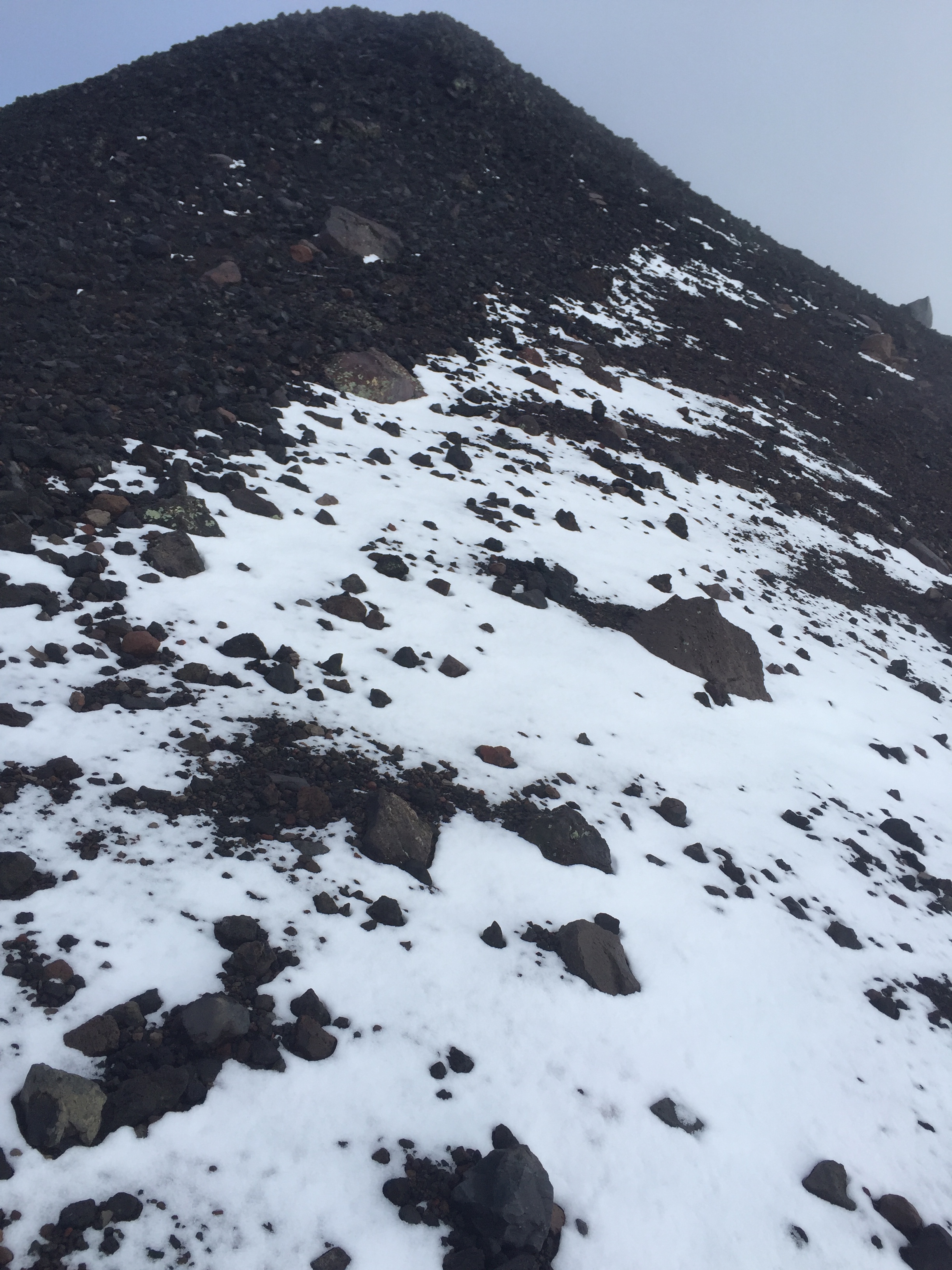
Snow covered trail
After a brief refueling of bacon and a nap at the RV it was on to Elden and O’Leary’s peak. Sam and I joined Jeff for the final two hikes. Though Elden is a short 4-5 miles round-trip, it is very rocky, technical and steep. We were glad to be hiking this one in the daylight!
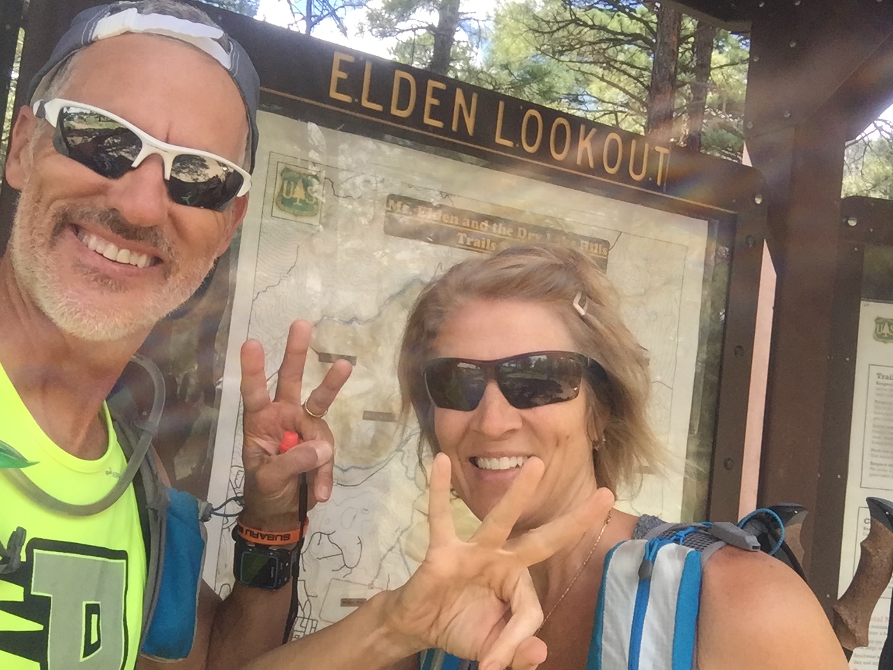
Third peak in the bank!
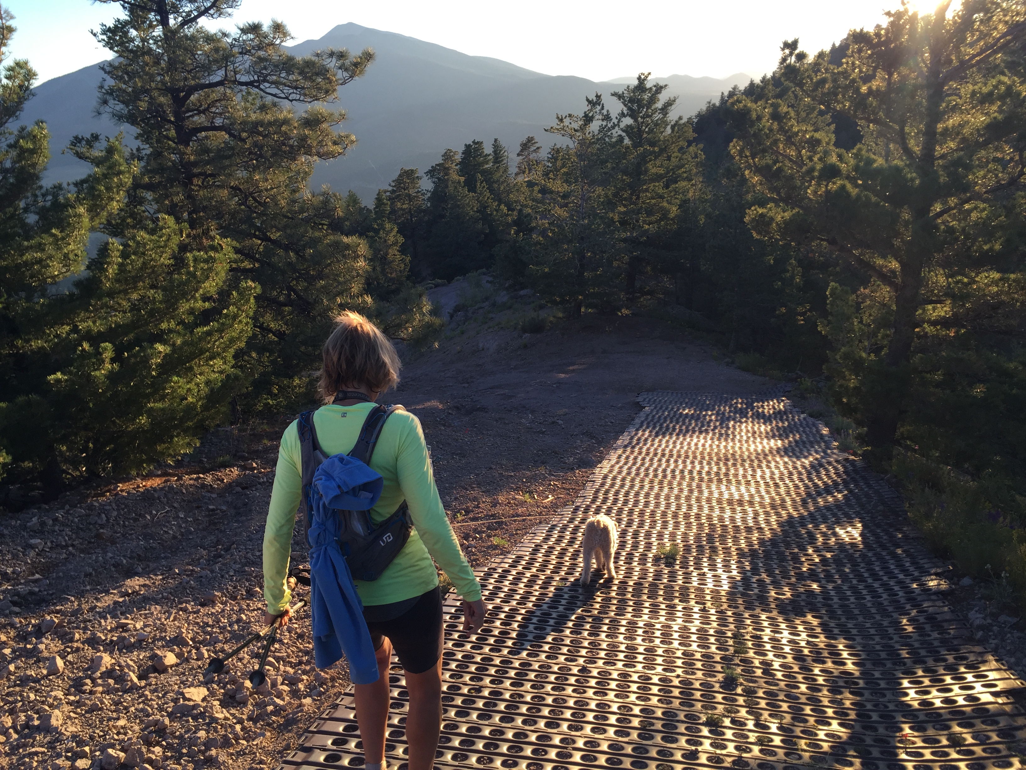
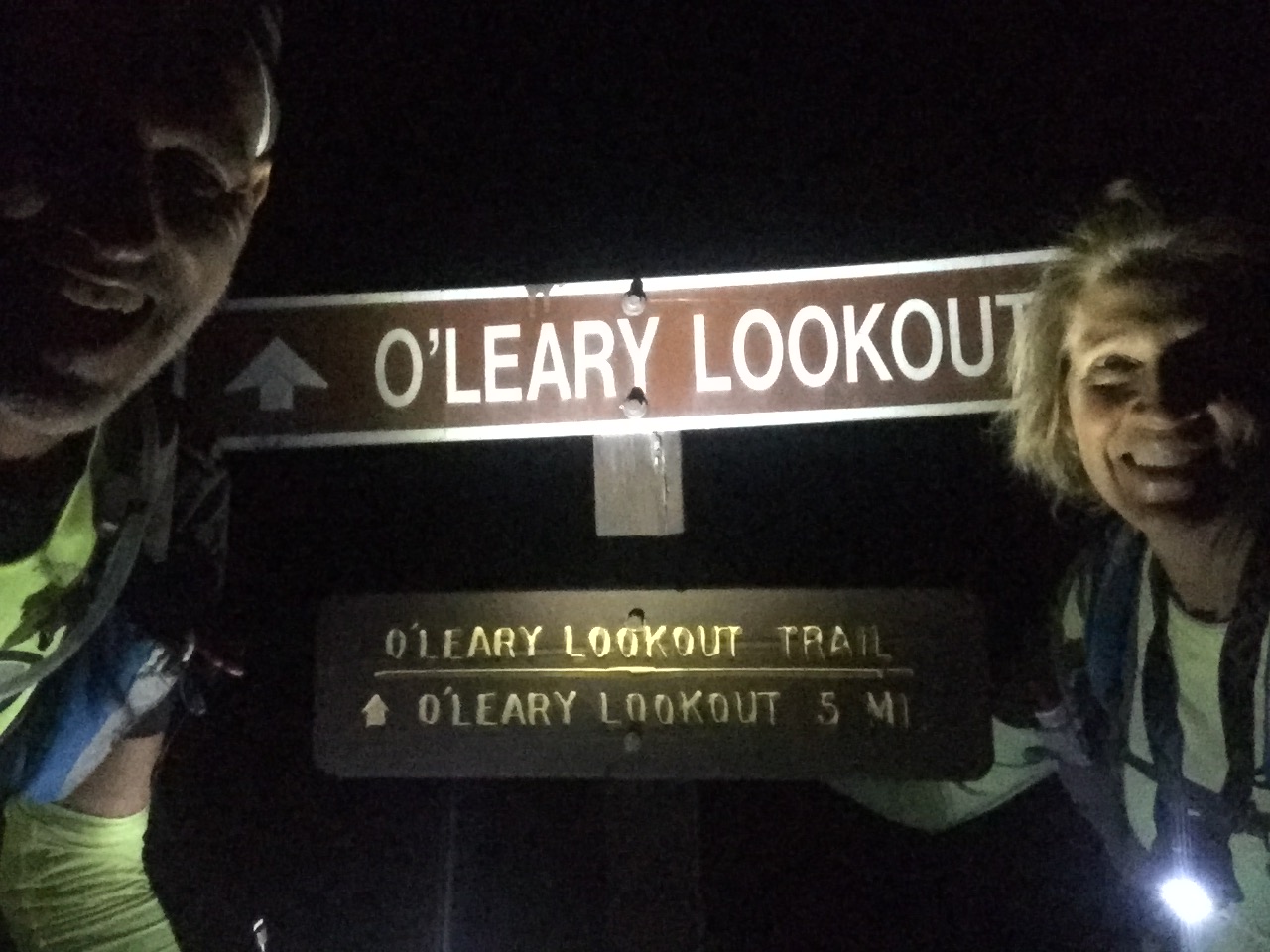
Heading further north we finished with O’Leary’s. This trail was a well-groomed forestry road all the way to O’Leary’s lookout, where we took in sunset views before racing back down the mountain to finished after dark.
Jeff did an amazing job coming in under 15 hours for the Fearsome Four and we celebrated with some late night BBQ!
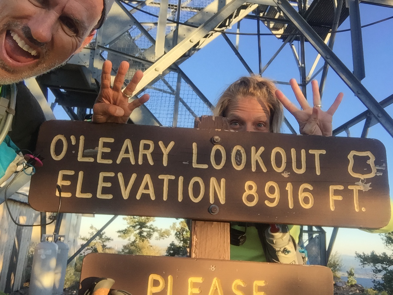
Number four…O’Leary Lookout!
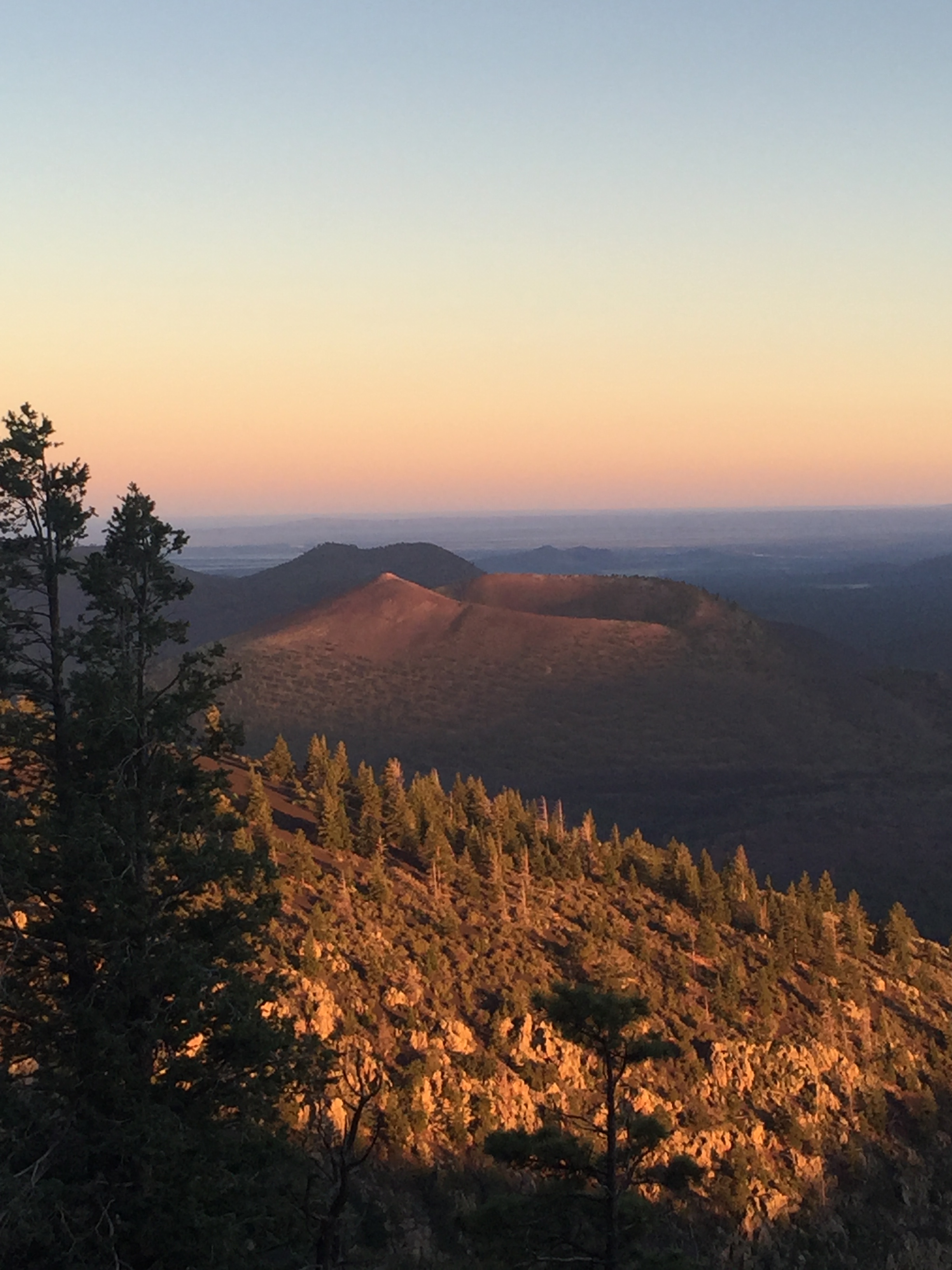
Racing the sun
Steapest section at O’Leary Lookout
After dark finish!
The next day we packed up and headed for Phoenix where we jumped on a plane and flew to Dallas. The Dometic show vehicle needed to be transported to Elkhart, Indiana for the RV industries open house.
A stop over in Bentonville, Arkansas was in order and we stayed for two weeks. This gave us a chance to check on family and our beloved Beaver Lake cabin.
I tell ya, when I sit on that porch swing overlooking the Lake, it’s hard to think of ever leaving! I love the smell of fresh lake water, hearing fish flopping in the early morning hours, swimming in water so clear you can scuba dive. I love that I can lace up my shoes and go for a run on lake roads that only a few locals travel. I ended up with 5 of the neighborhood dogs on one of my runs, which helped with missing Sam on our trip.
The view from our deck
Well hello humidity! Where have you been?
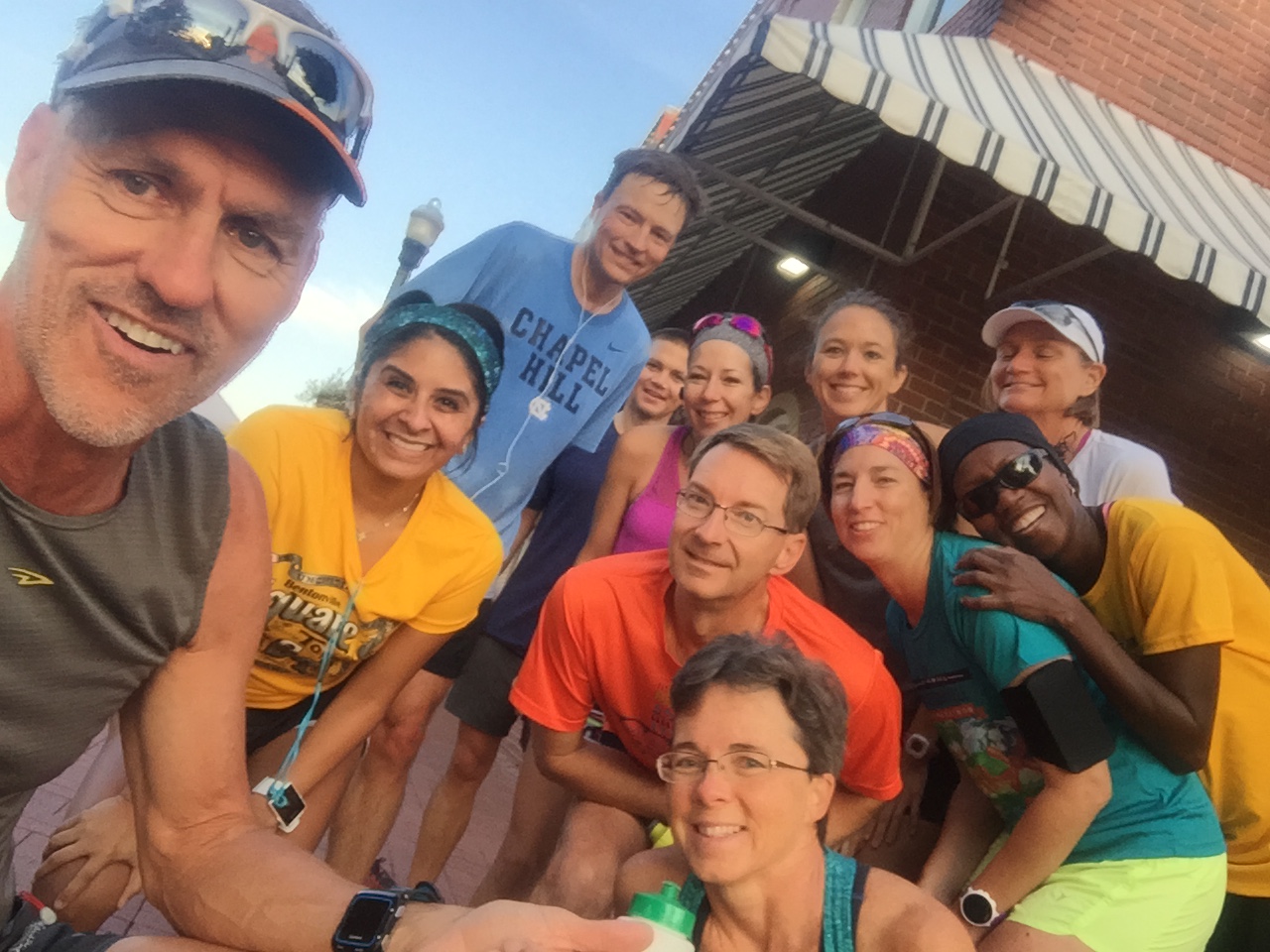
Getting in a Saturday morning run with friends
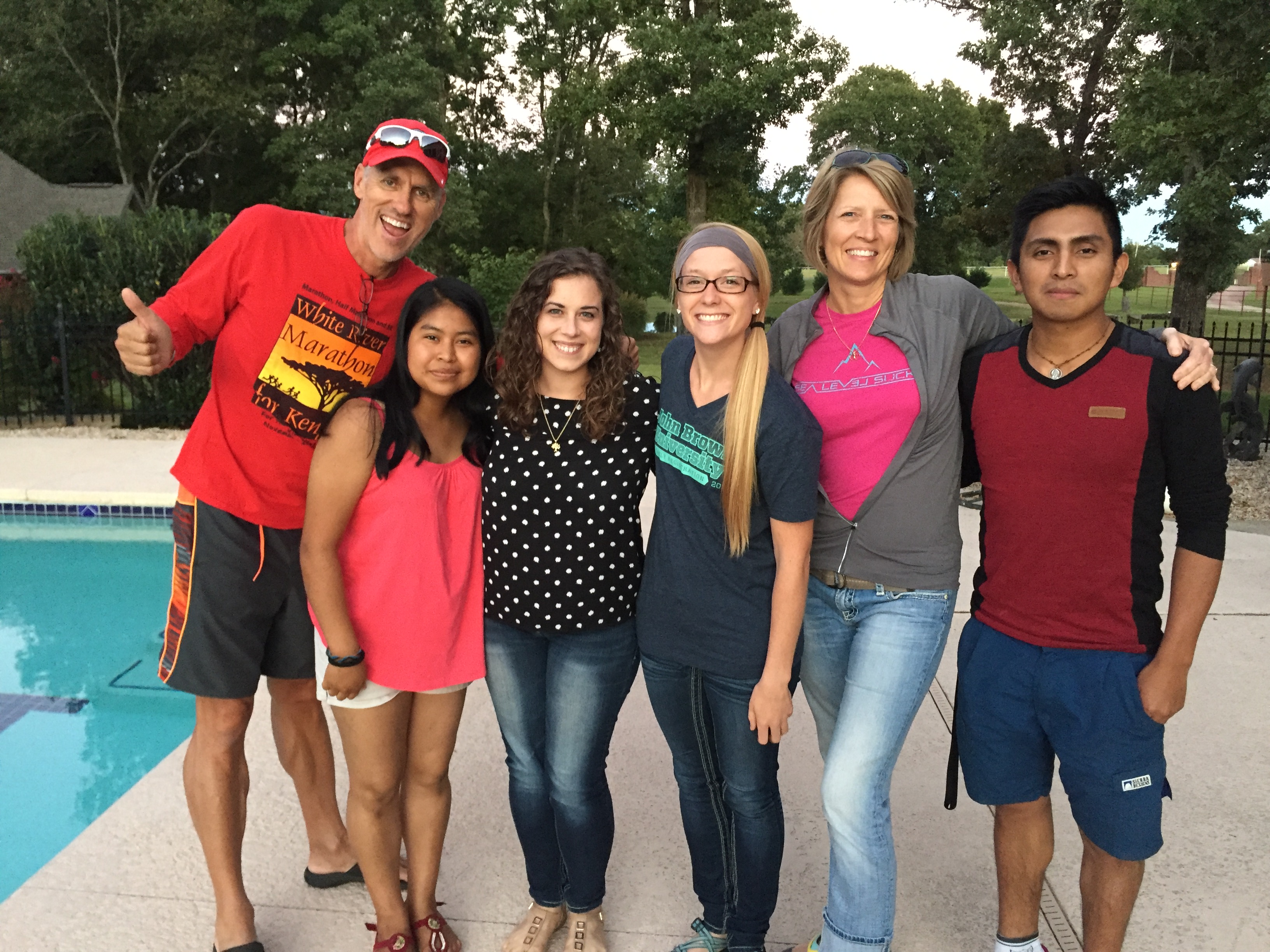
Quick visit with two of our Guatemalan students in AR on Walton Scholarships to John Brown University…so proud of them!
Arkansas is a beautiful place to call home for sure and I always shed a tear when we leave. But the road calls, and we must go and off to Elkhart we went.
We arrived over the weekend so that we could visit with some wonderful friends. The open house went well and we headed south with the RV to Louisville before flying back to Phoenix. It was a hard pressed 3 week trip and we were glad to get back to our dog and our RV.
With only 3 days before the Stagecoach 100, we were rushing again to get back to Flag for the race. So after landing at 6:45am, we picked up our dog and were on the road with the RV by 9am, and parked in the woods by that afternoon.
Holly moly…that was a tiring trip!

Continued Migration to the Pacific North West
Posted by Deb in Canada, Destinations, Hiking, RV Parks, RV Upgrades, Solar, Trail Run on August 28, 2016
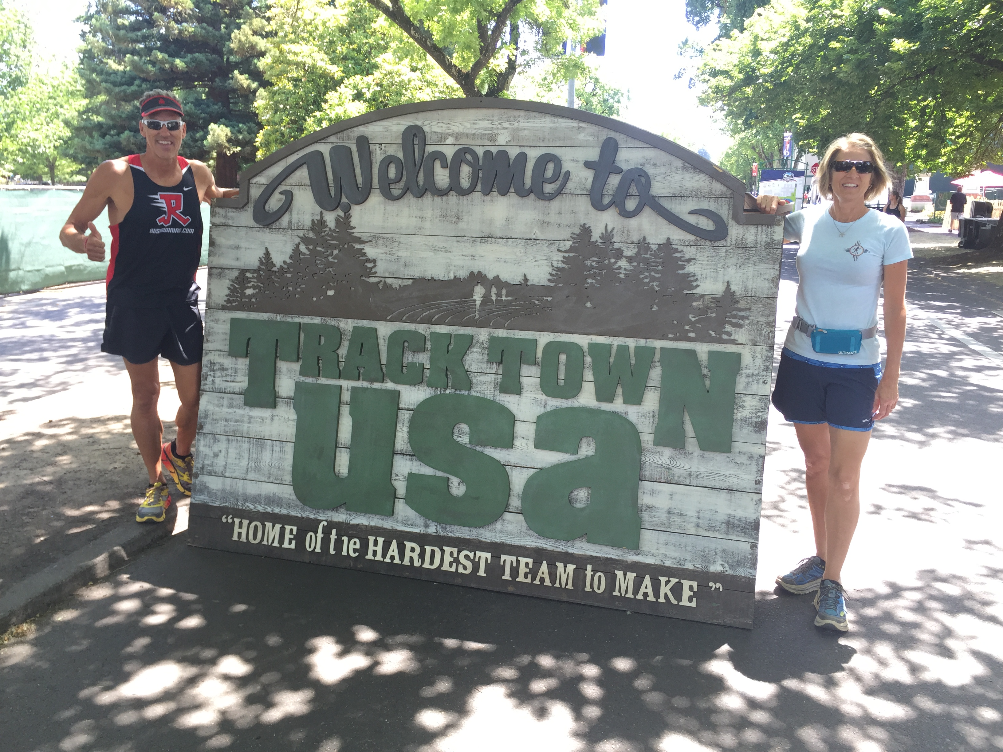
Welcome to Track Town USA!
After leaving Bend, Oregon Jeff and I headed west to Eugene so that we could stop into AM Solar.
About a year ago we got most of our RV projects/repairs completed in Elkhart, Indiana and made a dash back to Arkansas to regroup. We had planned on having a month to catch our breath and install our final project, solar, before we headed to the Albuquerque Balloon Fiesta.
Unfortunately our repairs lingered on in Indiana and we were left with a measly week to complete our final project.
As I mentioned in my last post, Jeff is extremely handy. His single Mom of five kids became a General Contractor in California and raised her kids to know how to “raise a barn” from the ground up. Jeff was certified in solar installation and has installed hundreds of solar water heaters all over California and Arkansas.


Installing 4-6 little solar panels on an RV roof would be a breeze!
Oh our plans!
We had a Solar panel that was damaged during shipping and our NorthStar batteries needed to be picked up 2 hours from home. The week flew by and we only got as far as installing 3 panels on the roof, batteries placed and inverter mounted. No connections were made and we left for ABQ without a functioning system.
Once in ABQ we received our replacement panel. With a little help from our friends, Kuhl Odyssey and Technomadia, we finally got our system up and running.
Over time Jeff has tweaked our system and it has been running beautifully. We got all of our supplies from the highly recommended AM Solar in Eugene/Springfield, OR. Since we were in the neighborhood Jeff wanted a consult just to have them give us the once over.
AM Solar made a few modifications and after $800 our completely functioning system… wasn’t working properly! Darn it!!!
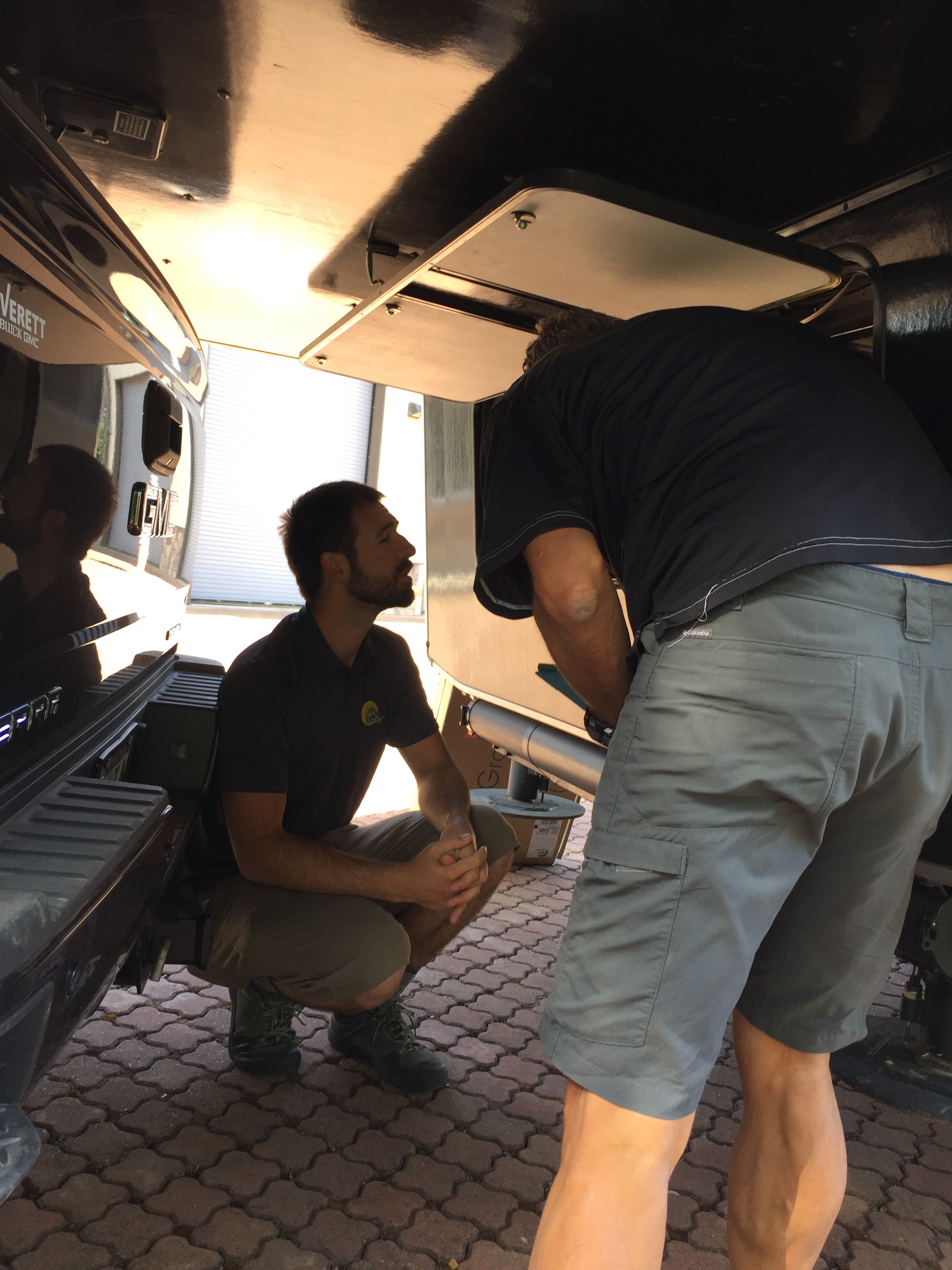
AM Solar “fixing” our system
We couldn’t have planned a delayed stay in Eugene any better since the Track & Field Olympic trials happened to be going on. We headed over to Track Town, USA to Hayward Stadium. Interesting history…The University of Oregon outgrew their football stadium. Instead of demolishing the old stadium it was retained as a track-specific venue that is held in reverence to those who have competed here.
The day we attended, the women’s Hammer Throw was happening. We learned that this was the first time ever that the hammer throw was being held INSIDE the actual stadium. Normally the event was held off-sight with very little attendance. But this year was different and the Hammer Throw was given its just due. The crowd was still small but we heard that the ladies were feeling honored to finally be having their beloved event inside the stadium.
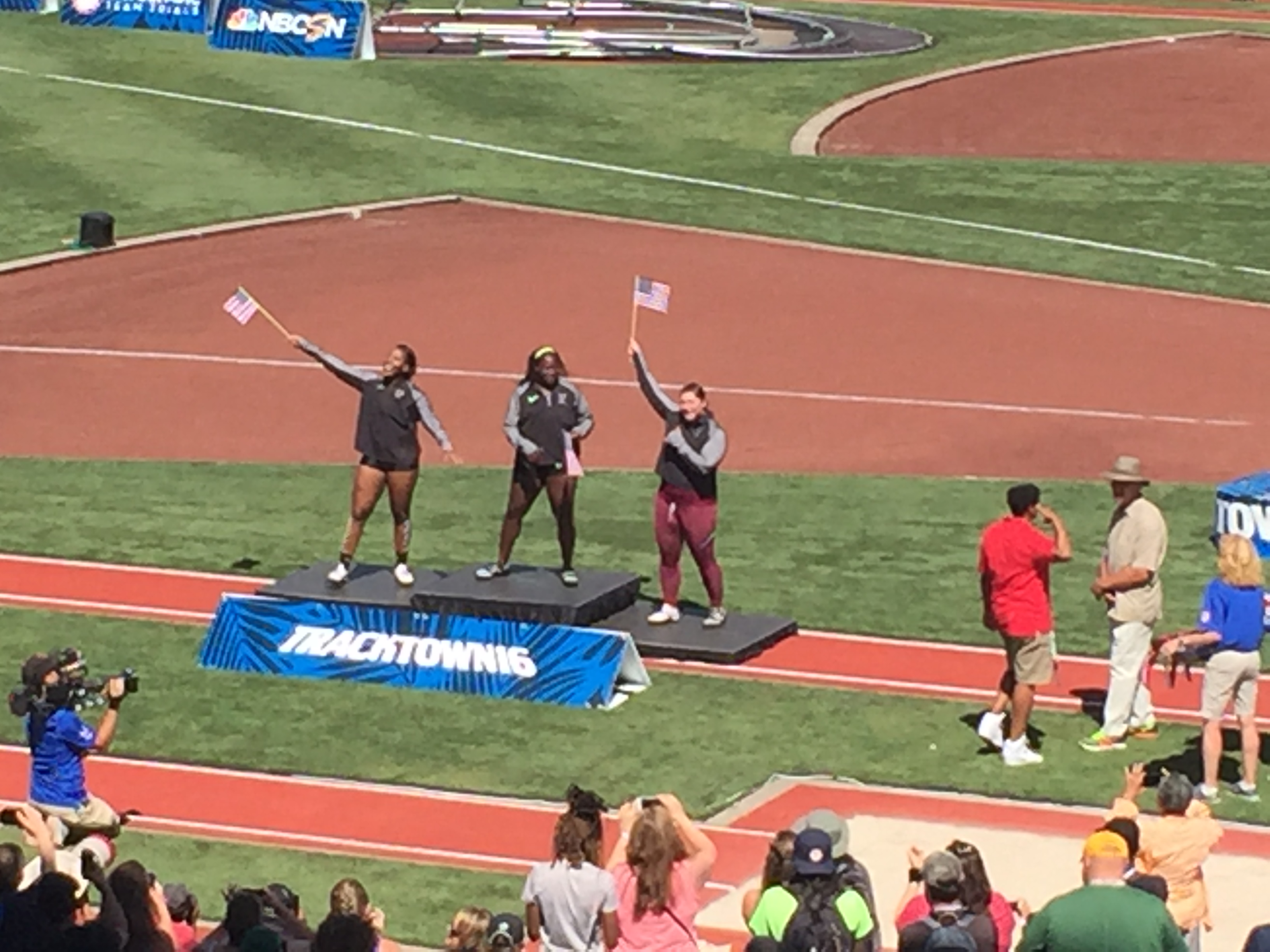
Top 3 Olympic Qualifiers..Good Luck in Rio!
Neither Jeff nor I knew anything about Hammer Throw, despite me growing up in Track and Cross Country. We learned that HT is about pure technique of heel-toe foot action with maximum spin in order to hurl the 8.82lb hammer down field.
The top 2 ladies at Olympic Trials competed in Rio where Amber Campbell finished 6th and DeAnna Price finished 8th.
Toutle, Washington
Toutle (too-tle) is a very small town that was located in the devastation zone of Mount St. Helens that erupted in 1980. There are times in your life that you remember certain world events. The eruption of Mount St. Helens was one of those events for me and I remember hearing about the mushroom cloud of ash that re-routed airplanes states away and covered towns as far as Alberta, Canada.
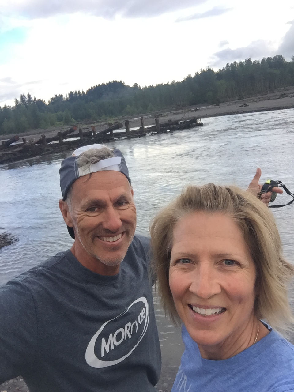
Morning run along the Toutle River right from our campground
Jeff had heard about a training bike ride from Toutle to Mount St. Helens, so we stayed at the Harry Gardner City Park in Toutle. This park was destroyed in the 1980 eruption and was never re-opened until 2015. There is a very nice 14-site campground in the park with water and electric hook-ups for $20/night. We were there on a weekend and were one of only four RV’s parked here. We loved this CG on the Toutle River. Unfortunately there was no connectivity what so ever and we had to shorten our stay.
Jeff’s bike ride was cold, rainy and 80 miles of long hard hills and 6,000’ of elevation. Since I wanted to see Mount St. Helens from the Johnson Observatory, I took a drive and met Jeff there.
Some of the group in front of Mout St Helen
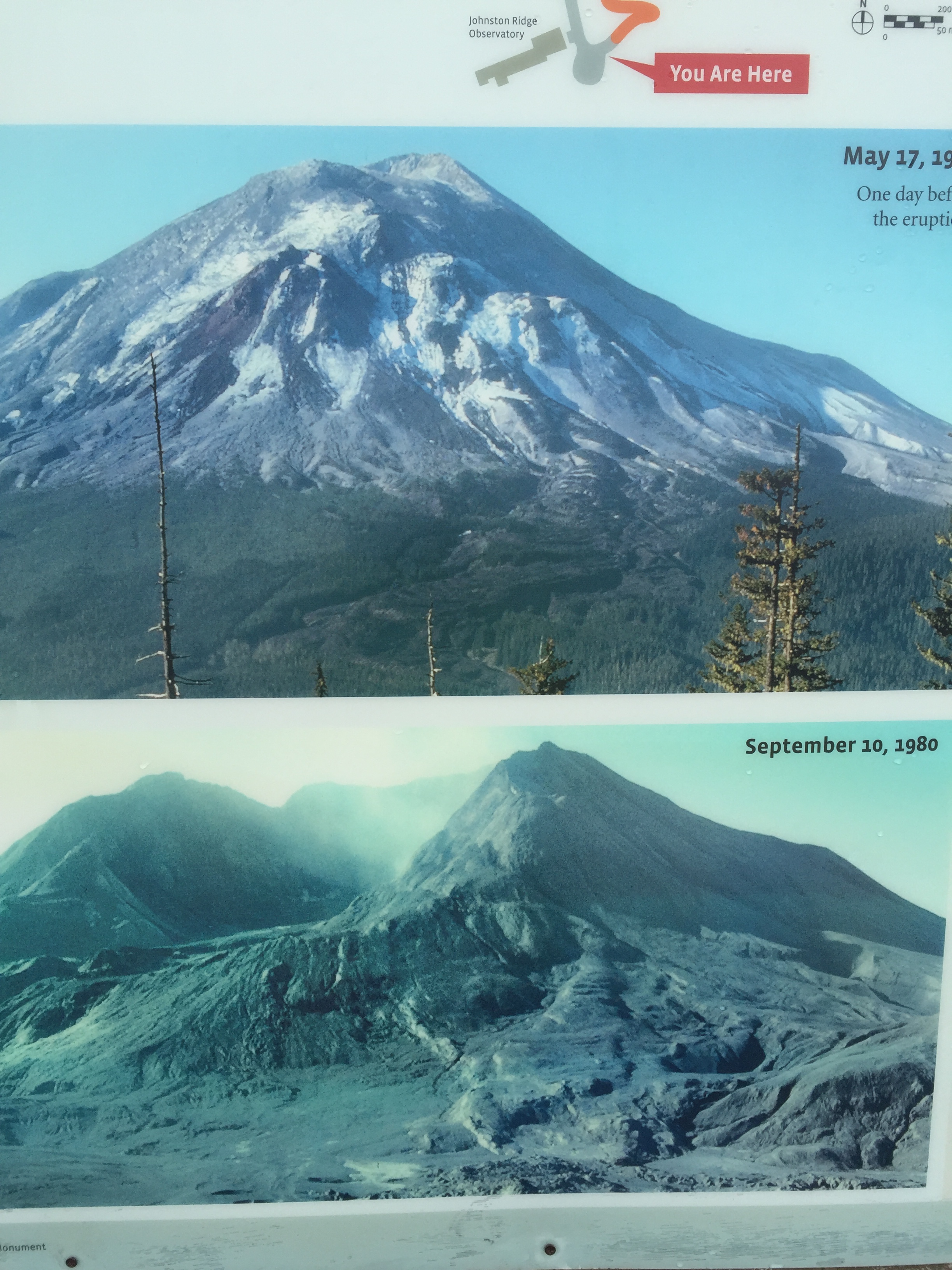
Before and after photos of Mount St. Helens
What a sight! The drive was stunning and the regrowth of trees were so symmetrical that I was almost dizzy until I reached the blast zone. The devastation is still palatable even after 36 years. I listened to the Ranger talk about that fateful day and learned that 57 people lost their lives, how rivers were rerouted, new lakes formed and the mountain lost about 1,300’ of elevation. Ms. Helen has remained active off and on since then, with her last recorded activity as late as 2008.
Auburn, Washington (Seattle)
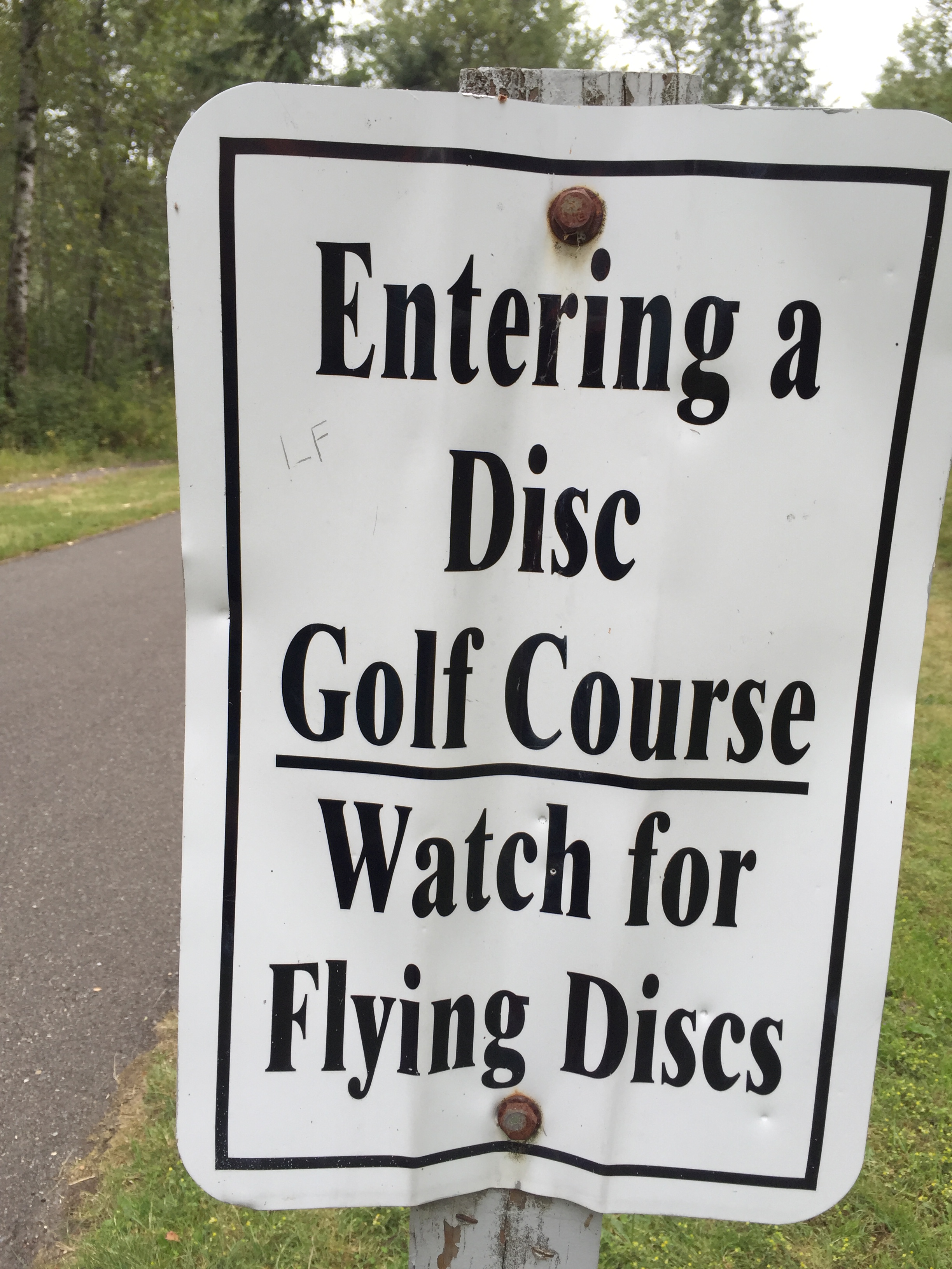
We were getting to Seattle a little earlier than planned so I made last minute reservations at the Game Farm Wilderness Park in Auburn WA. This was another gem of a find especially since most RV parks that I spoke with in Seattle were booked up.
There was a wonderful paved trail system that ran through the park and it was also home to the busiest 18-hole frisbee golf course in the state! Over 300 people come here daily to play!
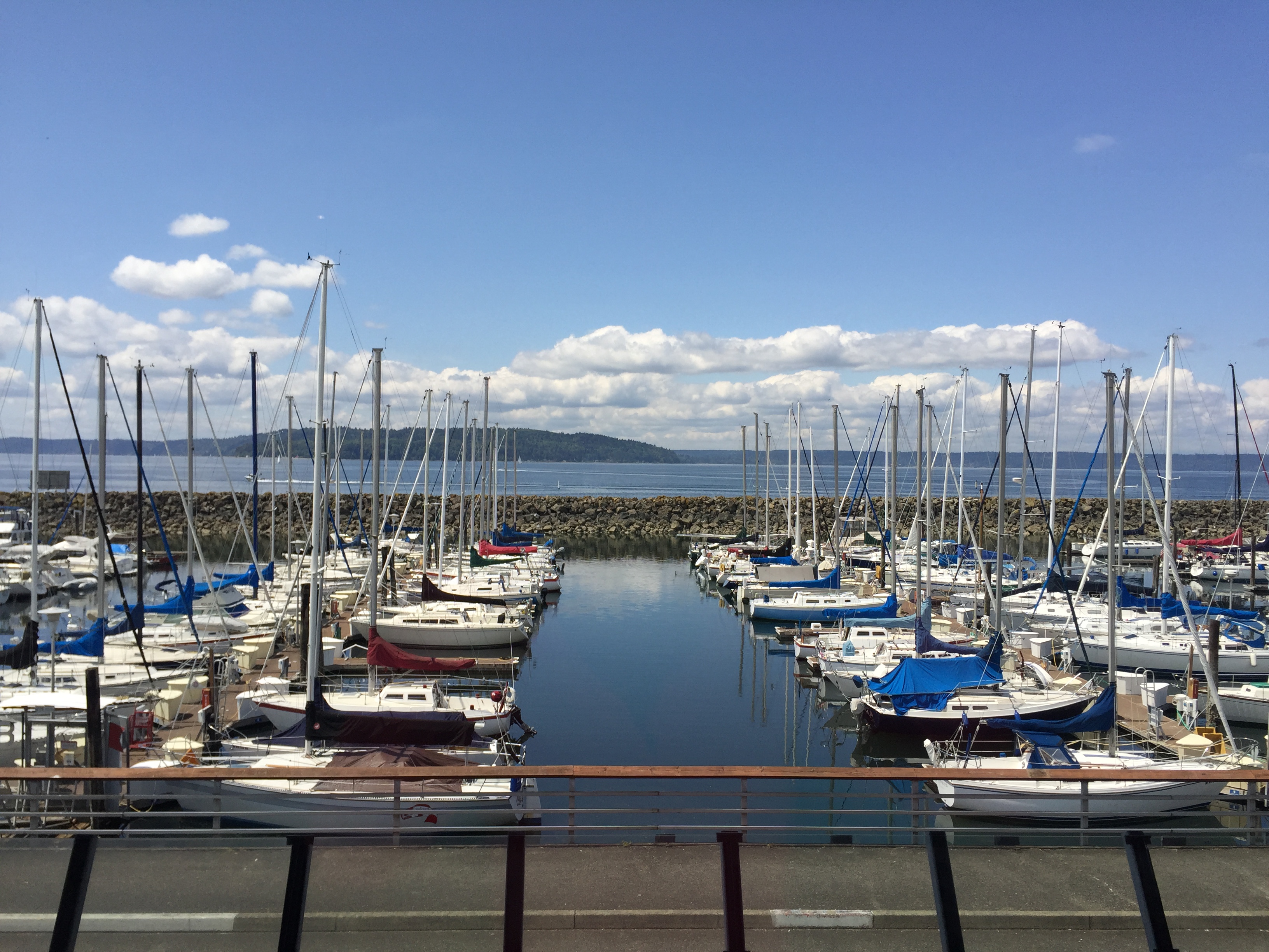
Beautiful Des Moines, WA Marina
Since we had a lot on our plate for work we didn’t really explore too much of Seattle except to have Sunday brunch with a co-worker of Jeff’s at a marina in Des Moines. It was a beautiful sunny day and we finished our meal with a relaxing walk out on a peer.
Abbotsford & Vancouver, Canada
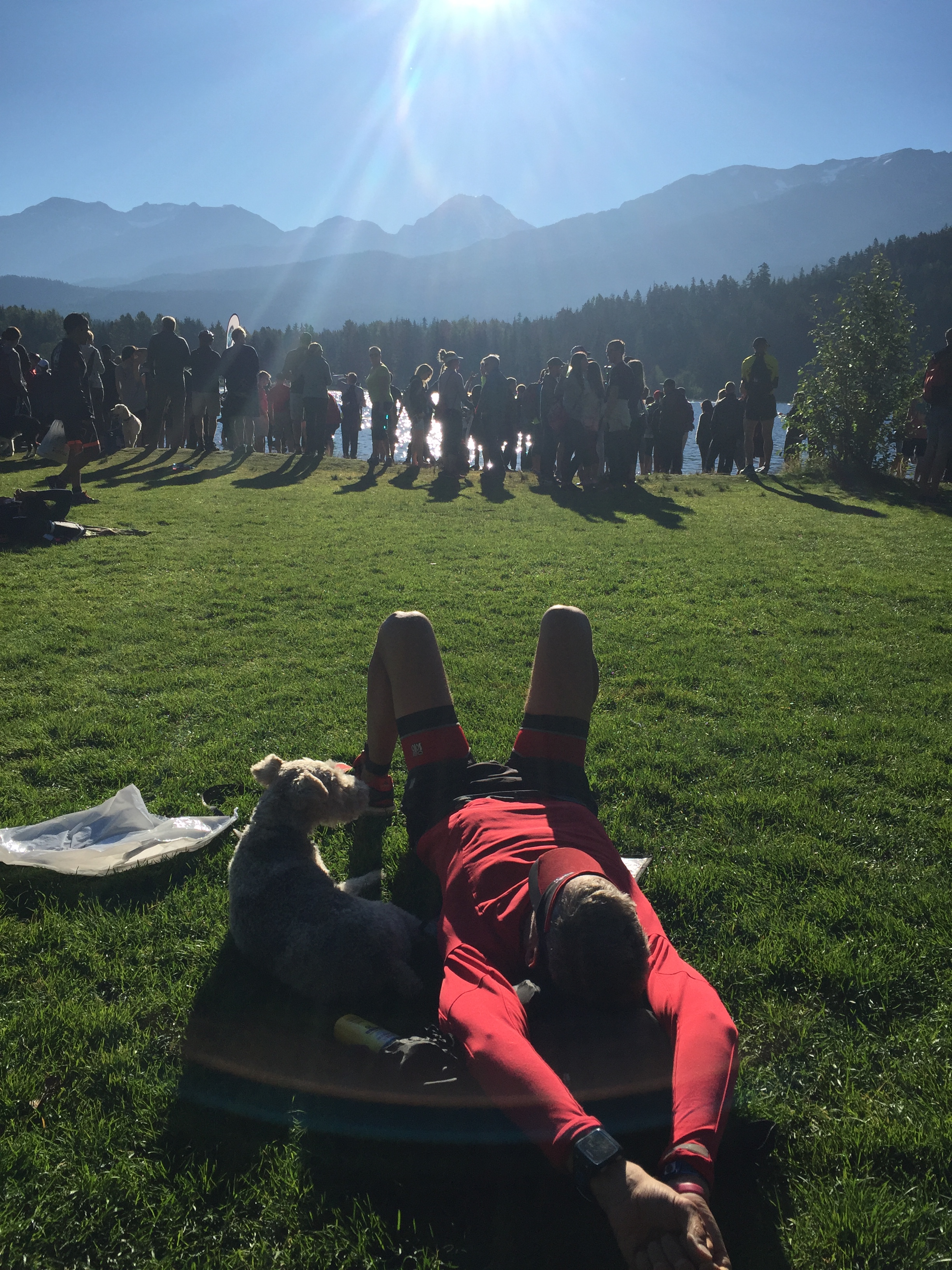
Jeff had an intern years ago that was getting his master degree from John Brown University. They hit it off and have stayed in touch since then. He and his wife have been asking us to come for a Canadian visit for a long time, so we purposed to make it happen this summer. The added “bonus” was that the Ironman Whistler was taking place during our stay. Not one to miss a race, Jeff signed up for the half.
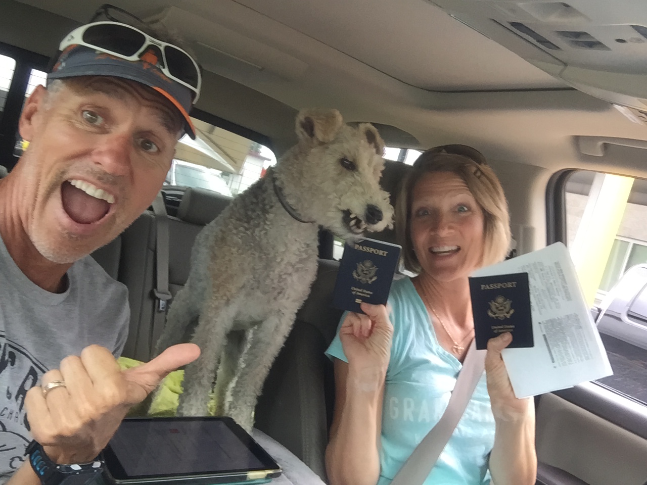
Not sure what Sam was thinking but we were prepared for our boarder crossing!
This was our first boarder crossing in the RV and we were a bit nervous and had braced ourselves for a long wait. We used up most of our produce and got rid of the rest. I had Sam’s medical certificate and our passports ready. We nervously pulled up to an empty boarder crossing where we were asked where we were heading, how long we were staying and if we had any fruit on board. Then we were waved through. Easy peasy!
We spent our first couple nights in our friend’s backyard getting caught up before heading to Whistler for the Half Ironman. The drive from Vancouver to Whistler was spectacular! I’ve never been to Switzerland, but this drive made me think of the Swiss Alps.
Jeff and Sam relaxing before the big race


Incredible blue water, dramatic mountain views and lush forests. We were on sensory overload for sure! We stayed at the Wonderland RV Park in Squamish, B.C. and made the 30-minute drive to Whistler for the race. It was a great race on a beautiful sunny day in a picturesque setting!
Vancouver
After Whistler we returned to our friends backyard in Abbotsford, BC. We spent time exploring their community, visited mutual friends, tasting some farm-to-table food and just hanging out with their family.
Another awesome driveway surfing spot!
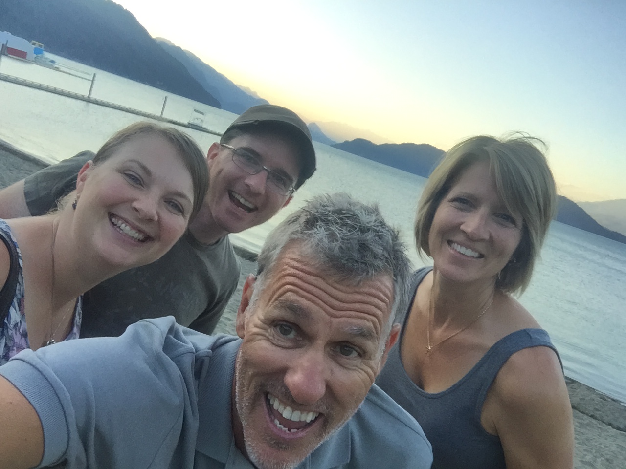
Dear friends Dave and Danaya taking us to Harrison Lake for dinner. Truly a delightful evening!
We planned a day trip to Vancouver via a train, water taxi and city buses with 4 kiddos in tow. Our first stop was Grouse Mountain known for the infamous Grouse Grind. This is a 1.8-mile hike, 2800’ elevation gain, and 2,830 stairs at a 30-degree slope to the top. There is a tracking device at the bottom and top of the mountain and you can see how fast people are hiking here.
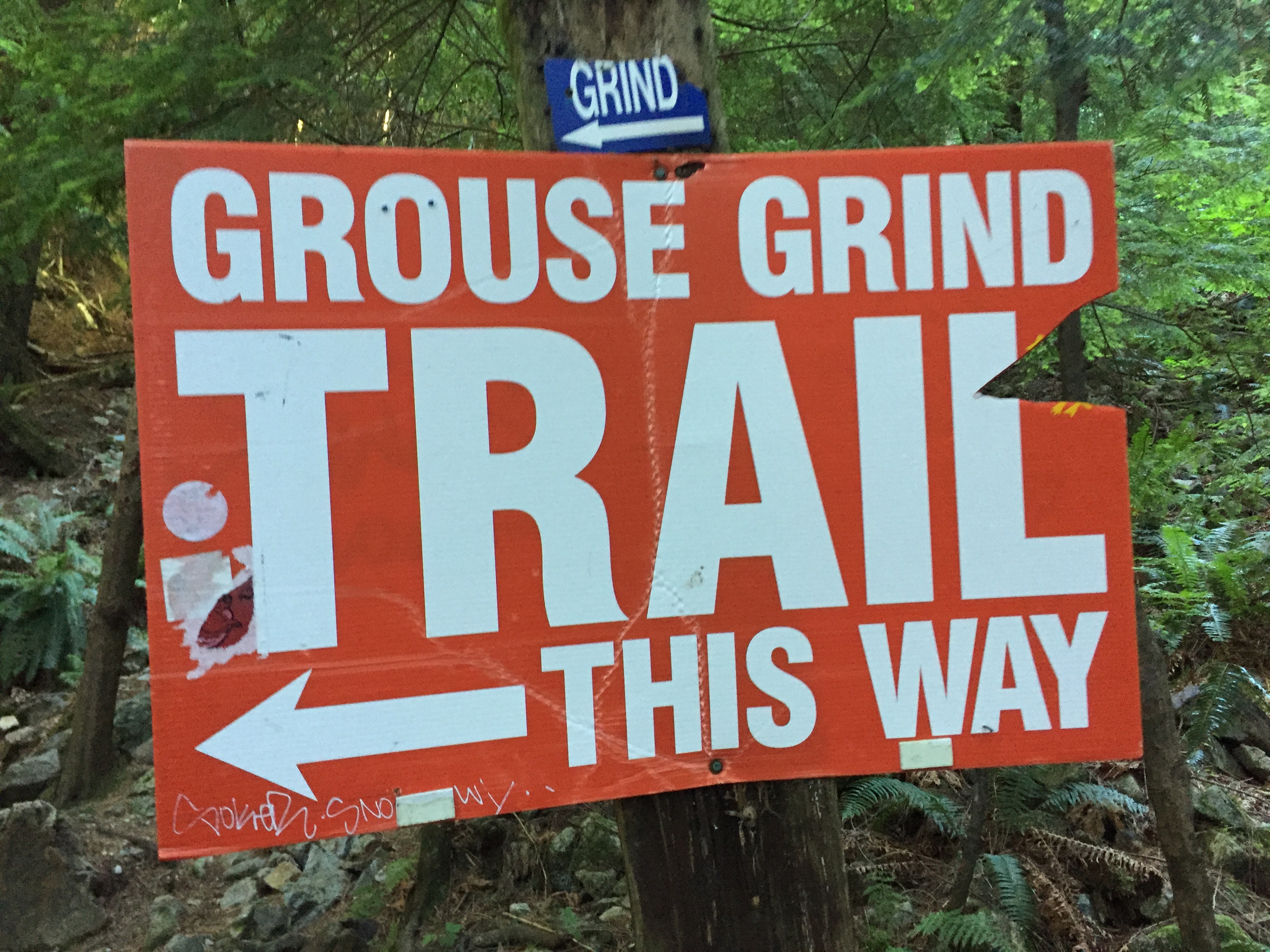
After shredding our gluts and hams on “Natures Stairmaster” we took in the Lumberjack show, saw two grizzly bears in captivity and our favorite…the Birds of Flight show at the top of the mountain.
The Birds of Flight featured an Eagle, Falcon and Owl that were released high above the outdoor amphitheater and swooped down over the crowd to gracefully land on designated perches. What a treat to feel and hear the power of their wings as they flew just above our heads. It was interesting and highly entertaining and we would highly recommend this show!
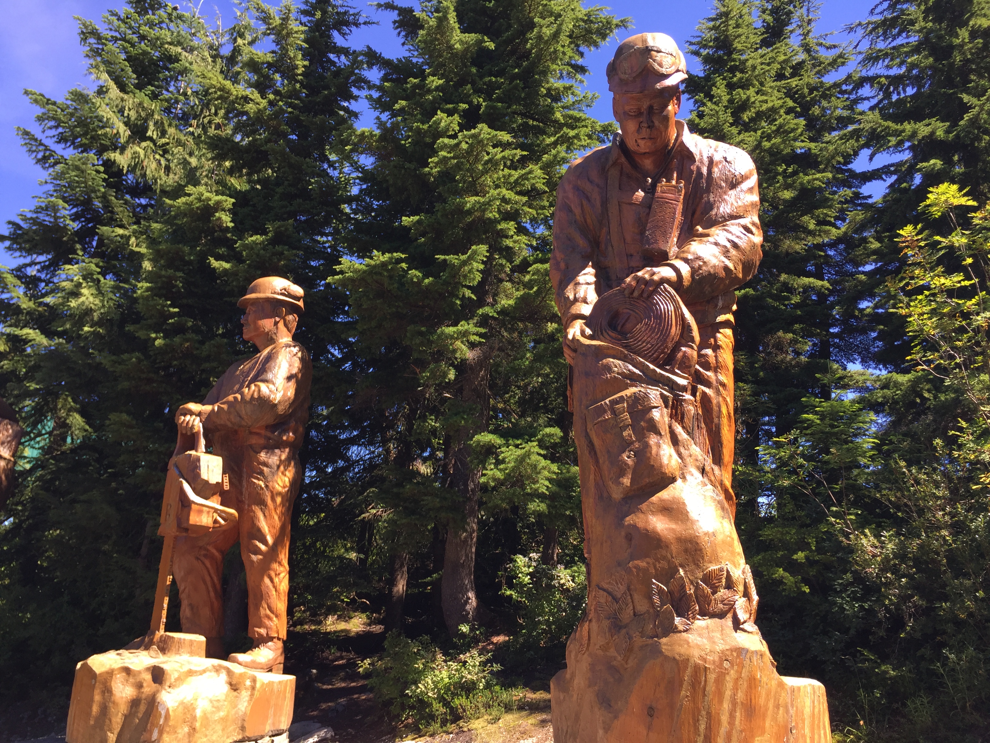
Giant carved lumberjacks
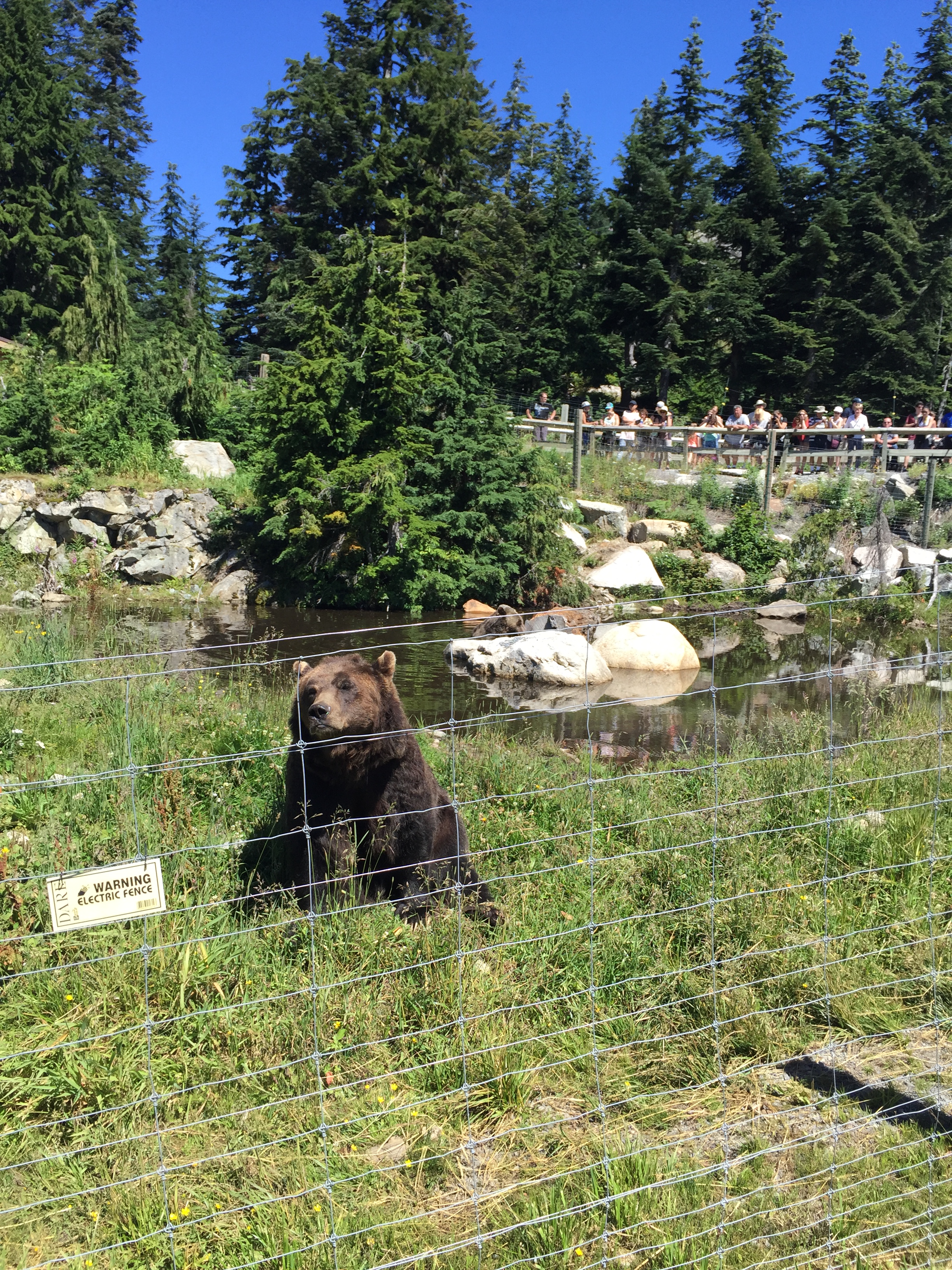
Grouse Mountain resident bears
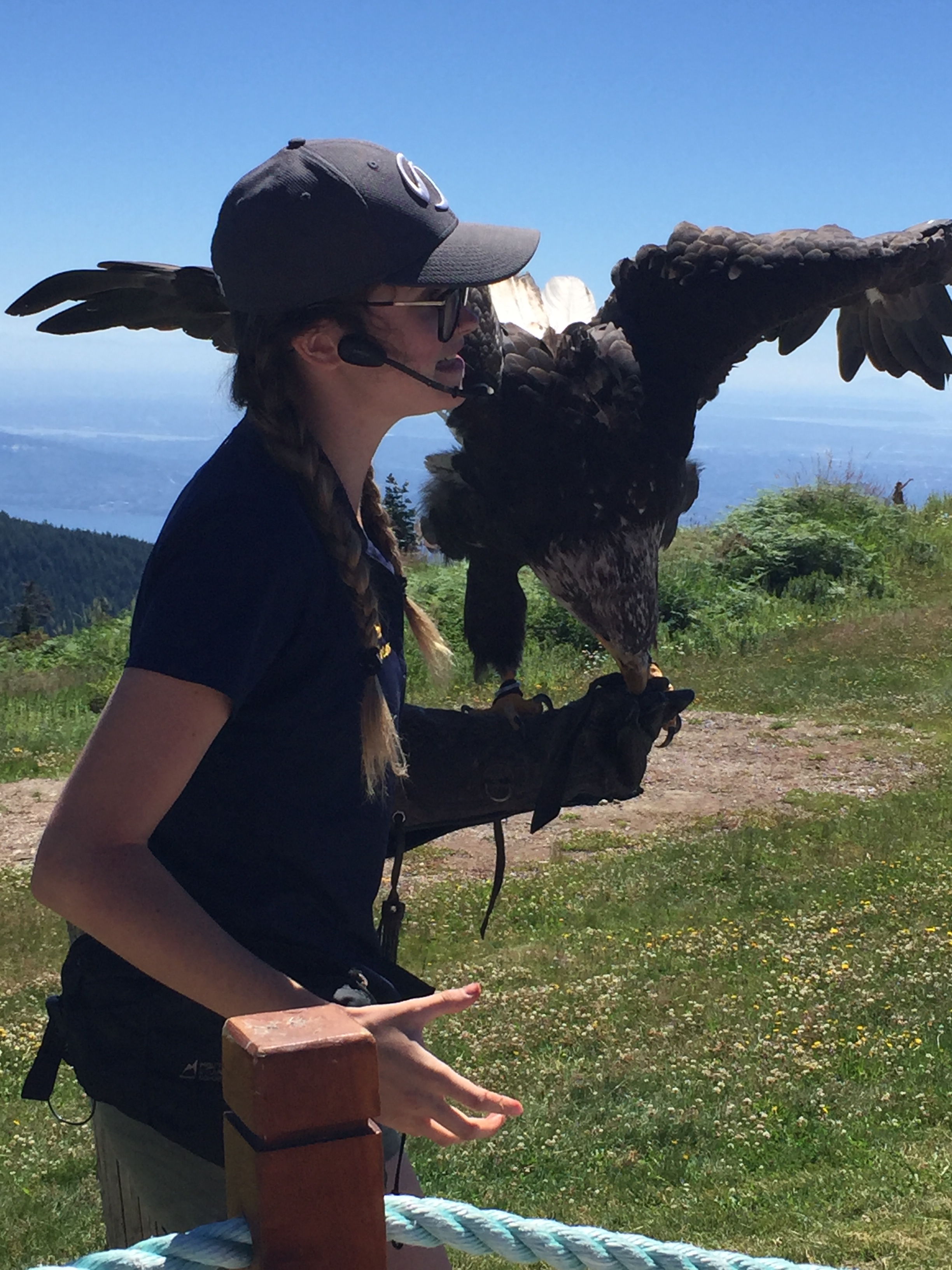
The beautiful eagle on Grouse Mountain
Funny…the falcon flew off into the surrounding valley and was enjoying its freedom until a wild falcon aggressively went after him. The two tangled and the captive Falcon made a b-line back to the safety of his handler. Poor guy. Out for a leisure stroll around the airways when the big bully showed up!
After we were all sufficiently sunburned we took the sky tram down the mountain where we picked up the city bus. The bus was air-conditioned and super comfy and all eight of us took power naps while we were transported back to downtown Vancouver. We stopped for a late lunch then walked the city a bit before catching a train back to Abbotsford.
Train ride into Vancouver
Sky Tram ride down Grouse Mountain
It was a great day full of new adventures with our host family of 6! Our week’s stay flew by and before we knew it, it was time to head back to the states!
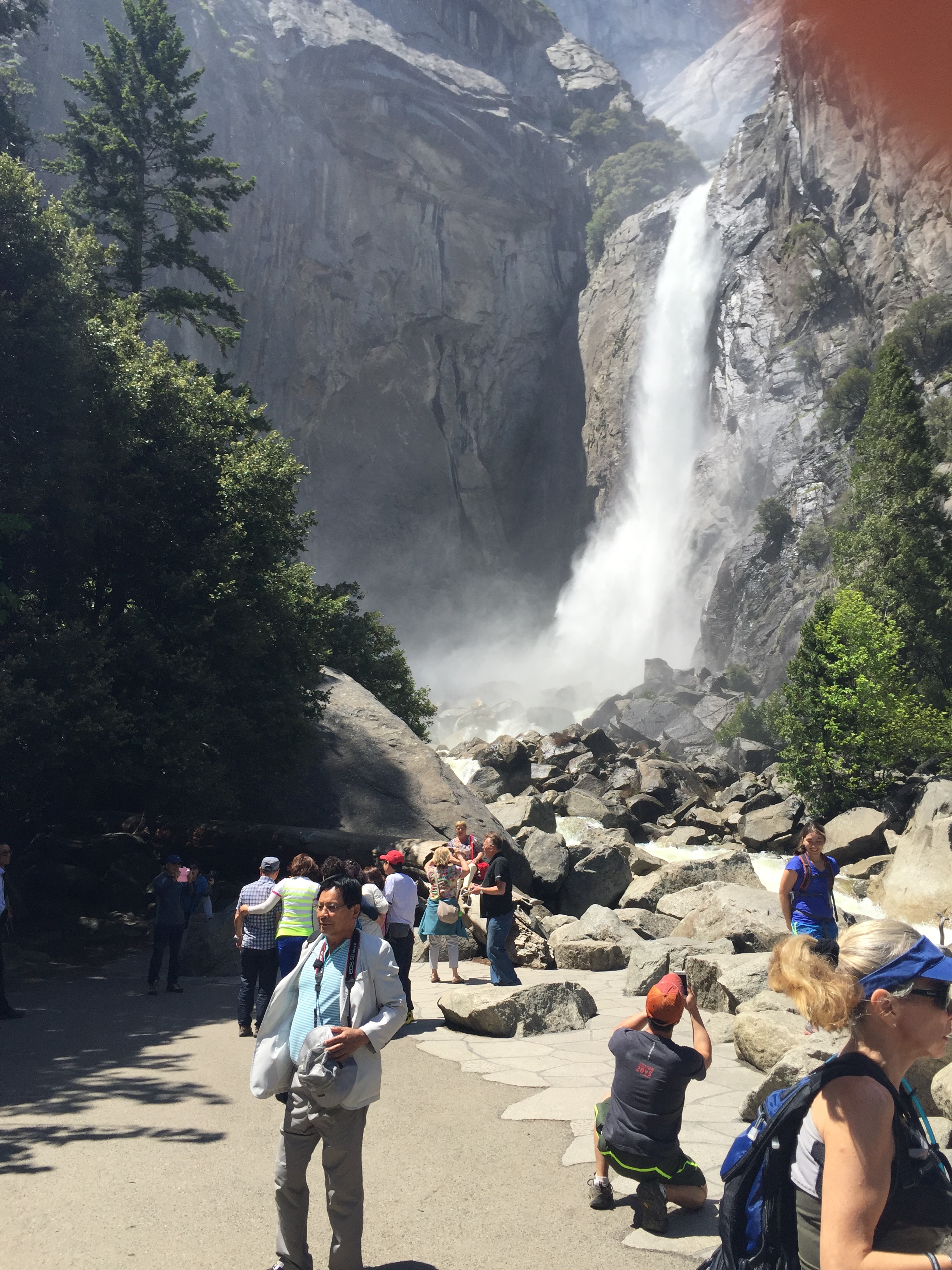
Yosemite National Park-Part II
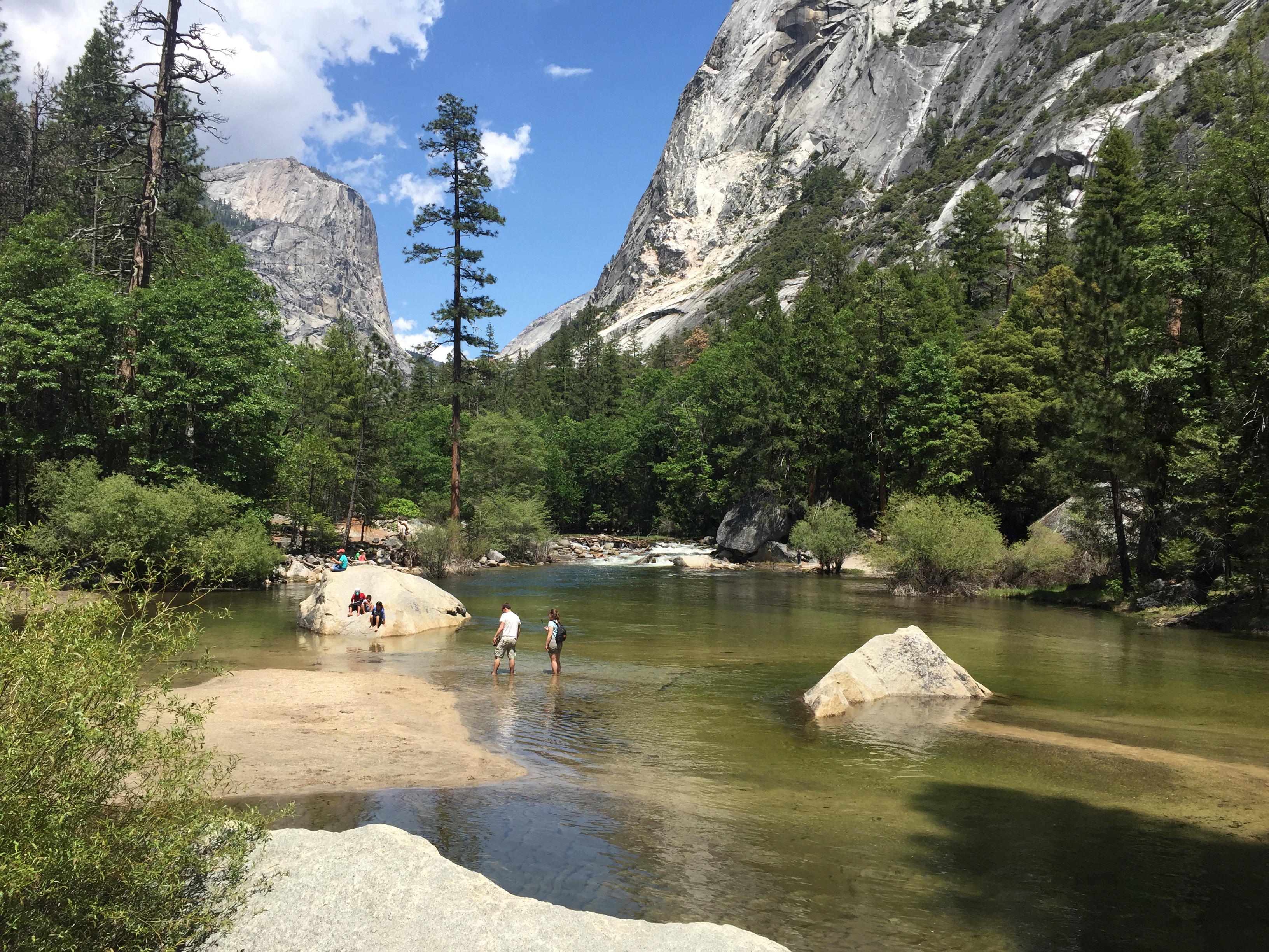
Posted by Deb in California, Destinations, Grand Canyon, Hiking, Yosemite NP on July 1, 2016
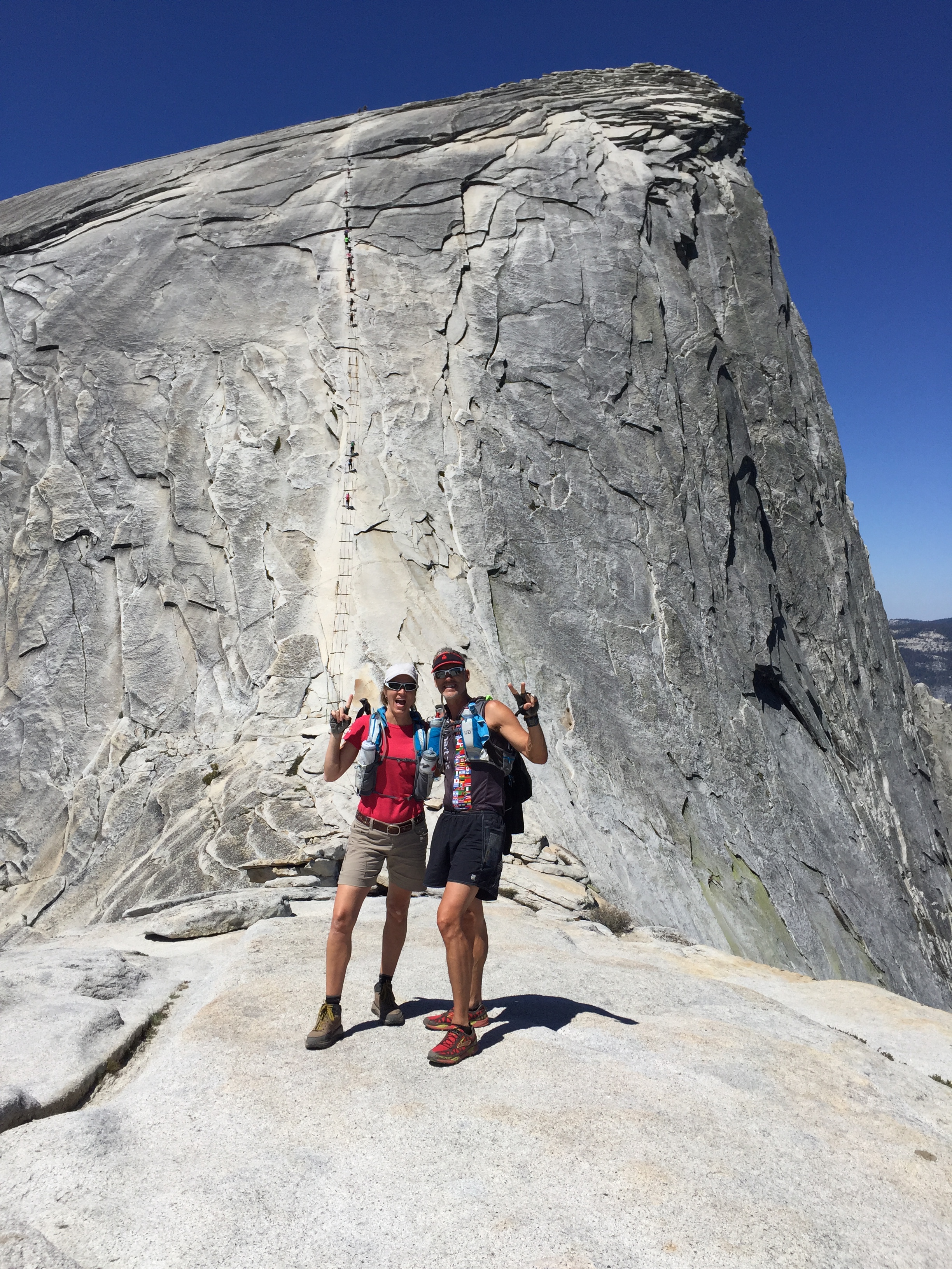
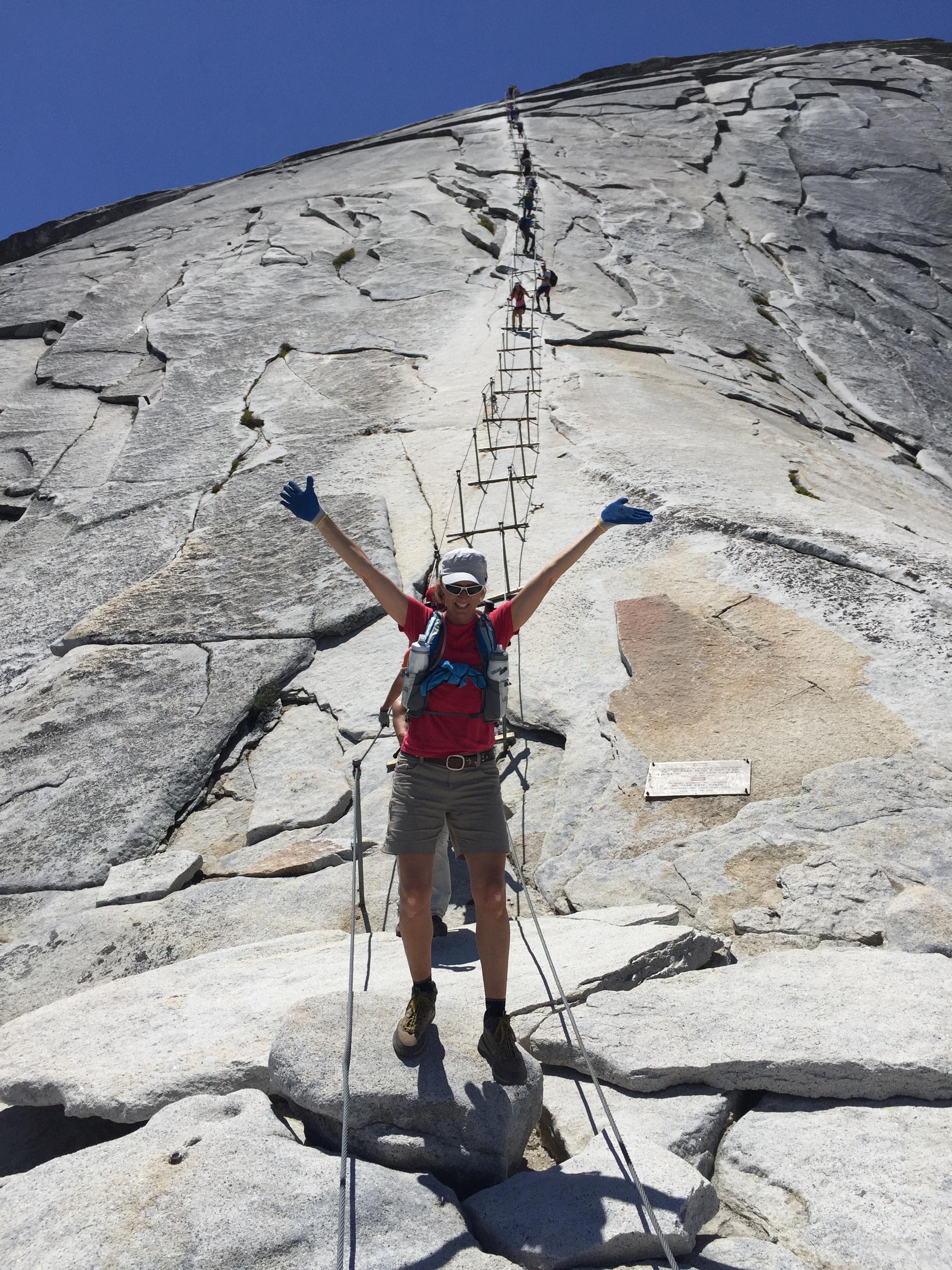
Jeff and I were so excited to snag Half Dome permits. We packed our lightweight running backpacks in preparation for a very long day of hiking. Water reservoirs full, extra water bottles, salty snacks, turkey burgers, string cheese, almonds. We arranged for Sam to be checked on and walked by a neighboring camper back at the RV park.
We are hiking Half Dome Baby!
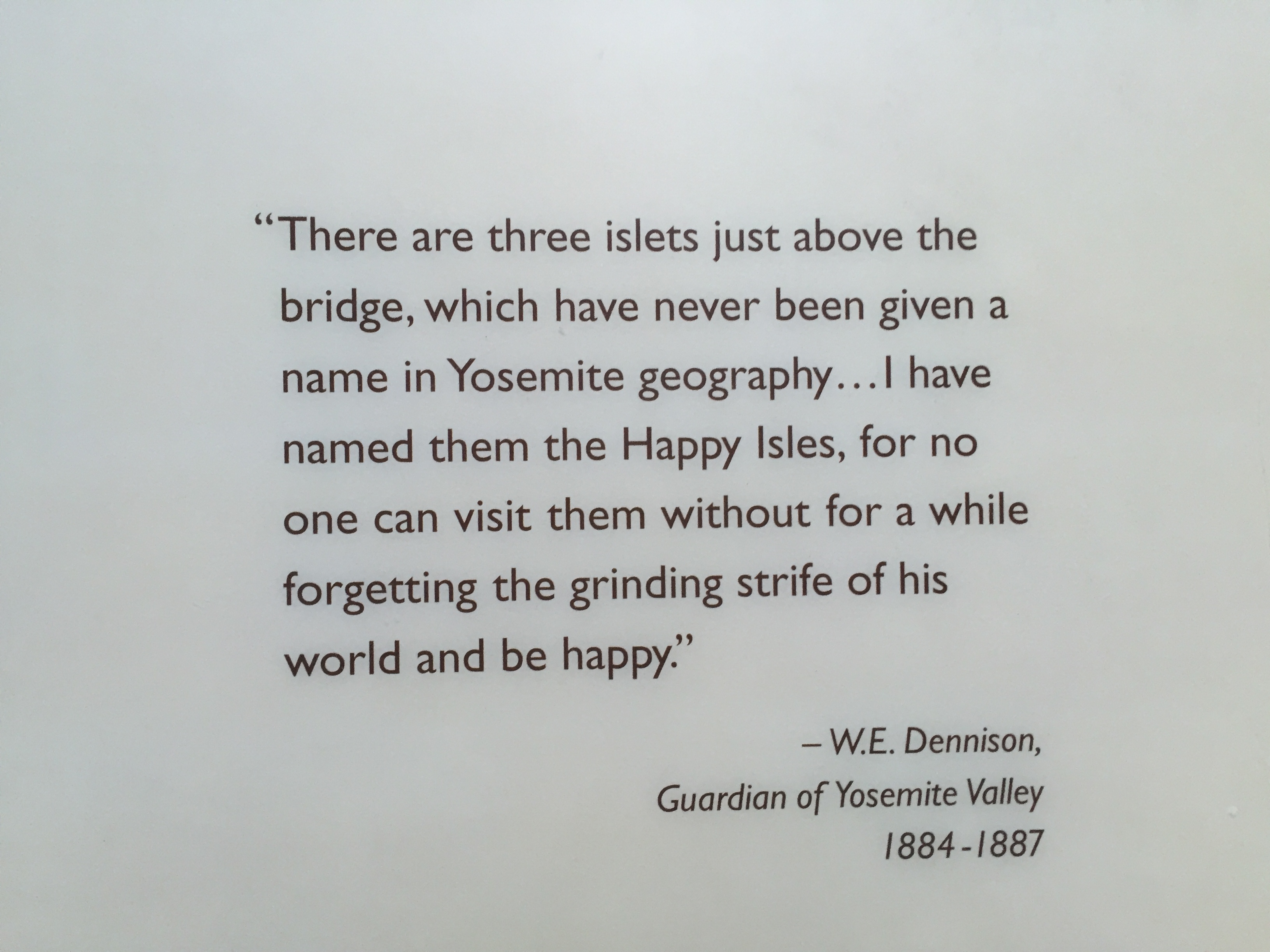
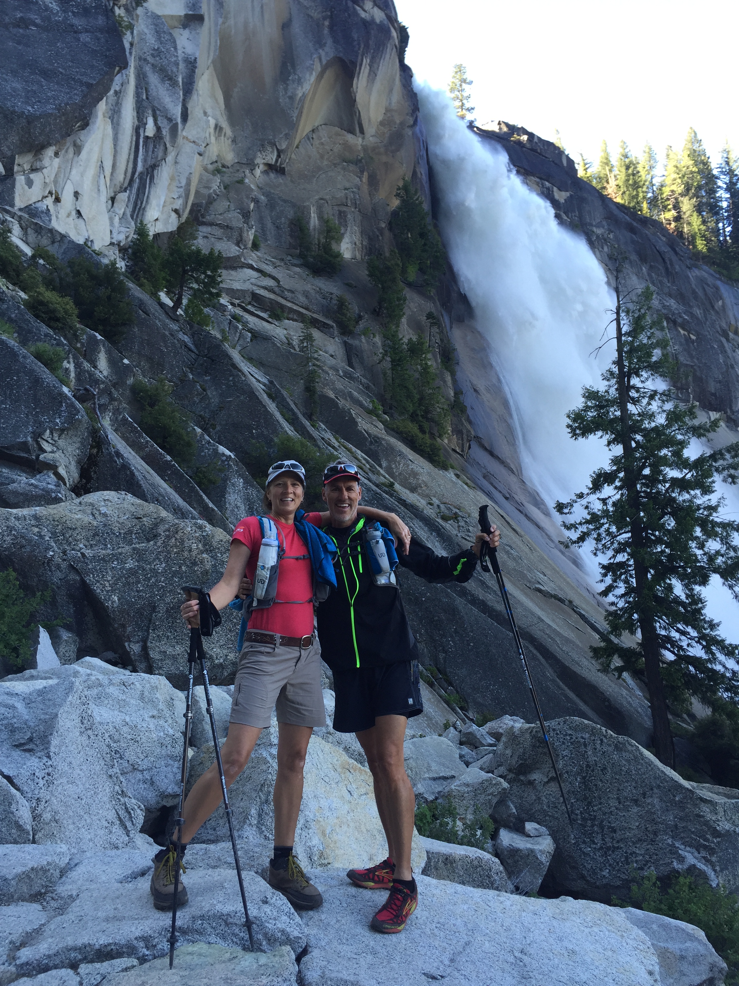
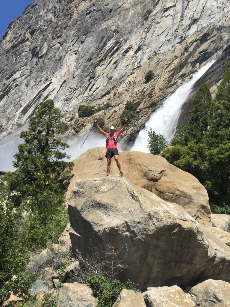
Jeff and I purposed to leave the Happy Isles trailhead at 6AM and found a place to park near the backpacker’s campground. We took the Mist Trail up past Vernal and Nevada Falls. This trail was like an adult water park and we were drenched by the time we made it through the falls. The Mist Trail is a stair step climb with minimal handrails. The granite stairs are a bit slick from being wet and we were thankful to have our hiking poles.
The top of the Nevada falls is a popular turn around for a lot of hikers. You can either head back down the mist trail or join the John Muir trail and loop back down another route. There are pit toilets here as well and there was quite a congregation of folks hanging out here before turning back.
Hiking past Vernal Falls
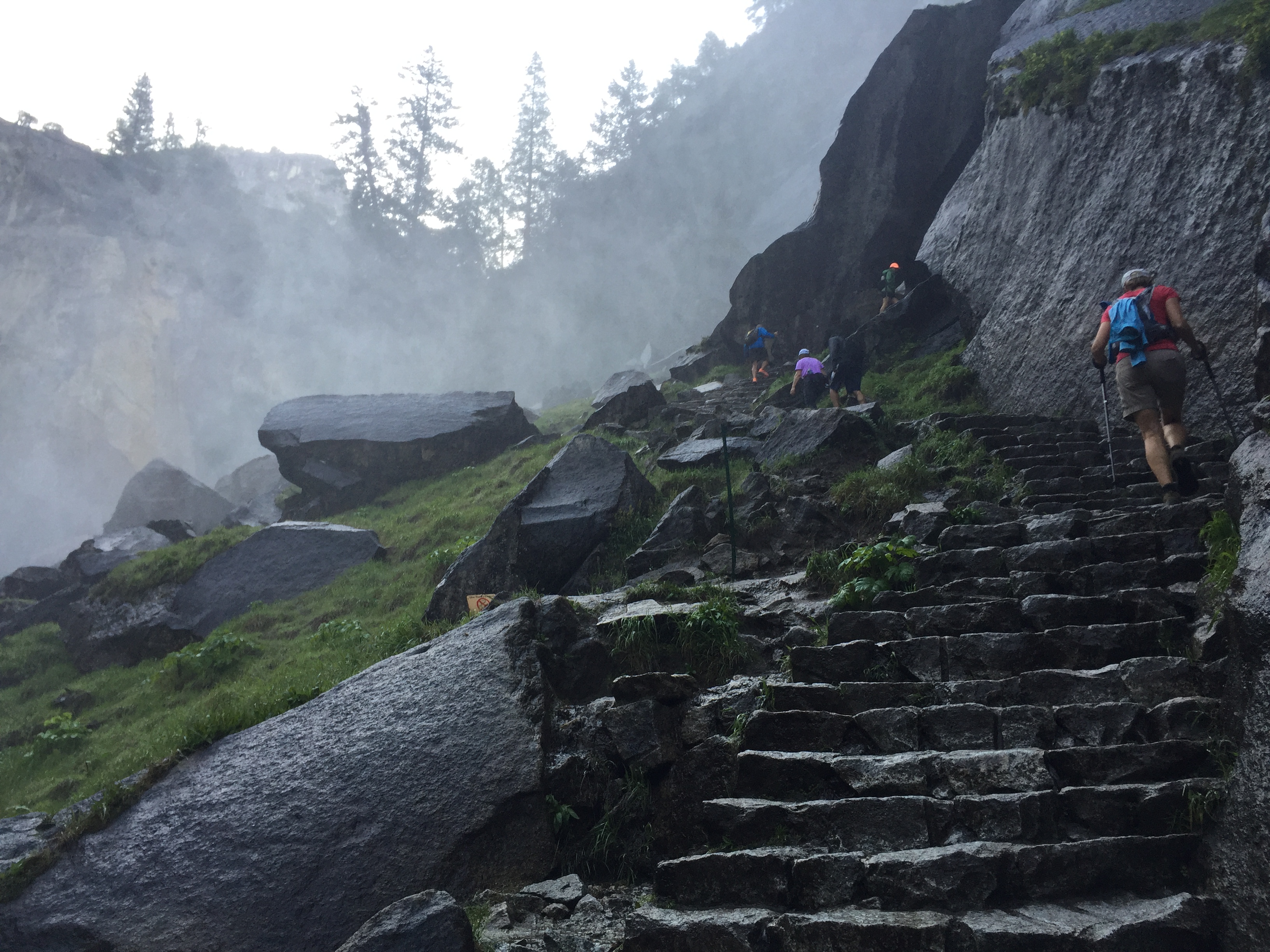
The Mist Trail approaching Nevada Falls
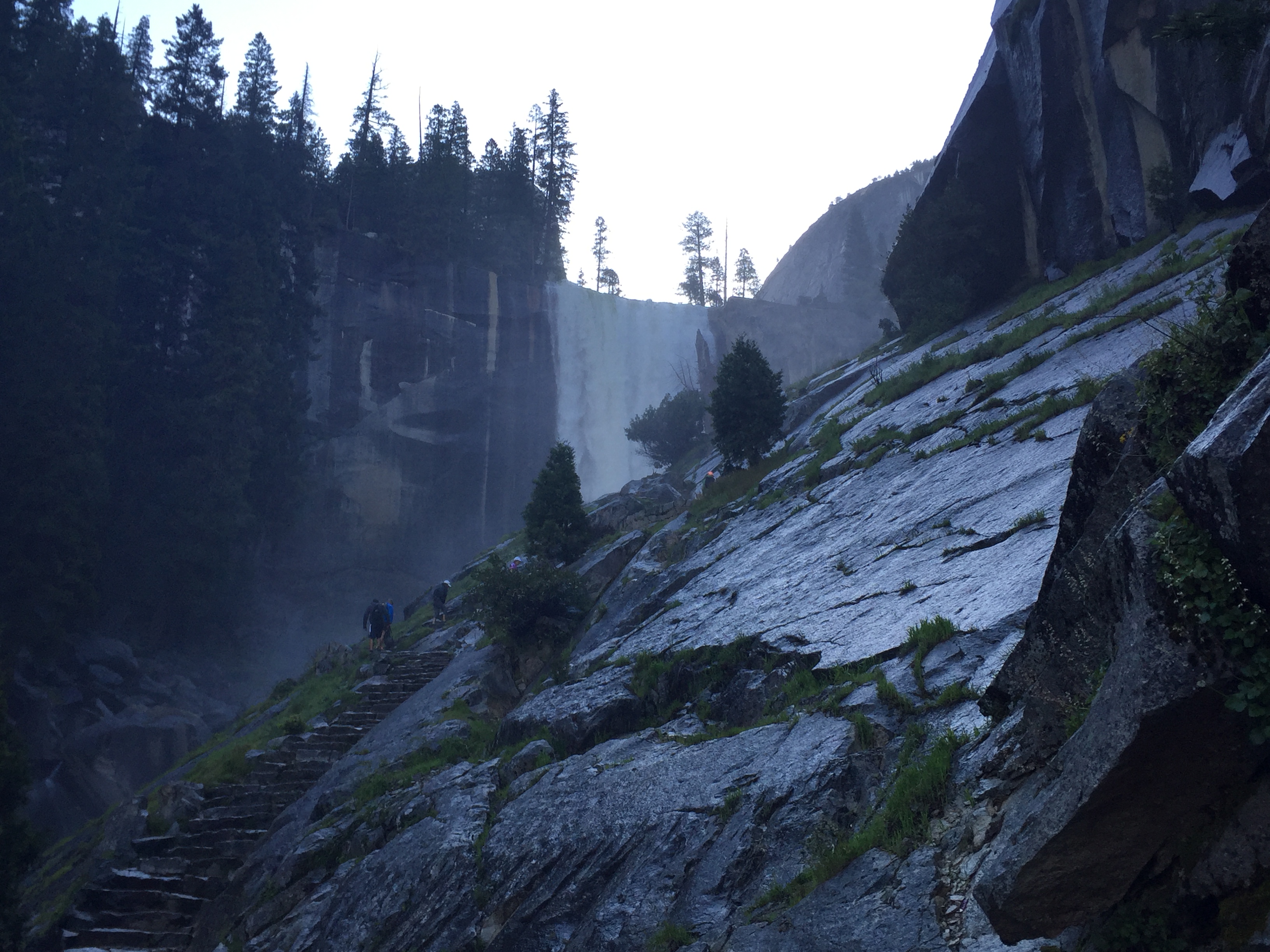
Nevada Falls
One small section of handrails climbing to the top of Nevada Falls
We kept hiking past the Little Yosemite Valley campground (backpackers only) and another 3 miles further up the trail to Sub-Dome.
I started getting nervous here!
Sub-Dome is where things start to get interesting! Permits are required beyond this point. But at 9:30am there were no rangers there, making us wonder why we stood in line the previous day for 5 hours to get a permit. (They were actually there on our way down)
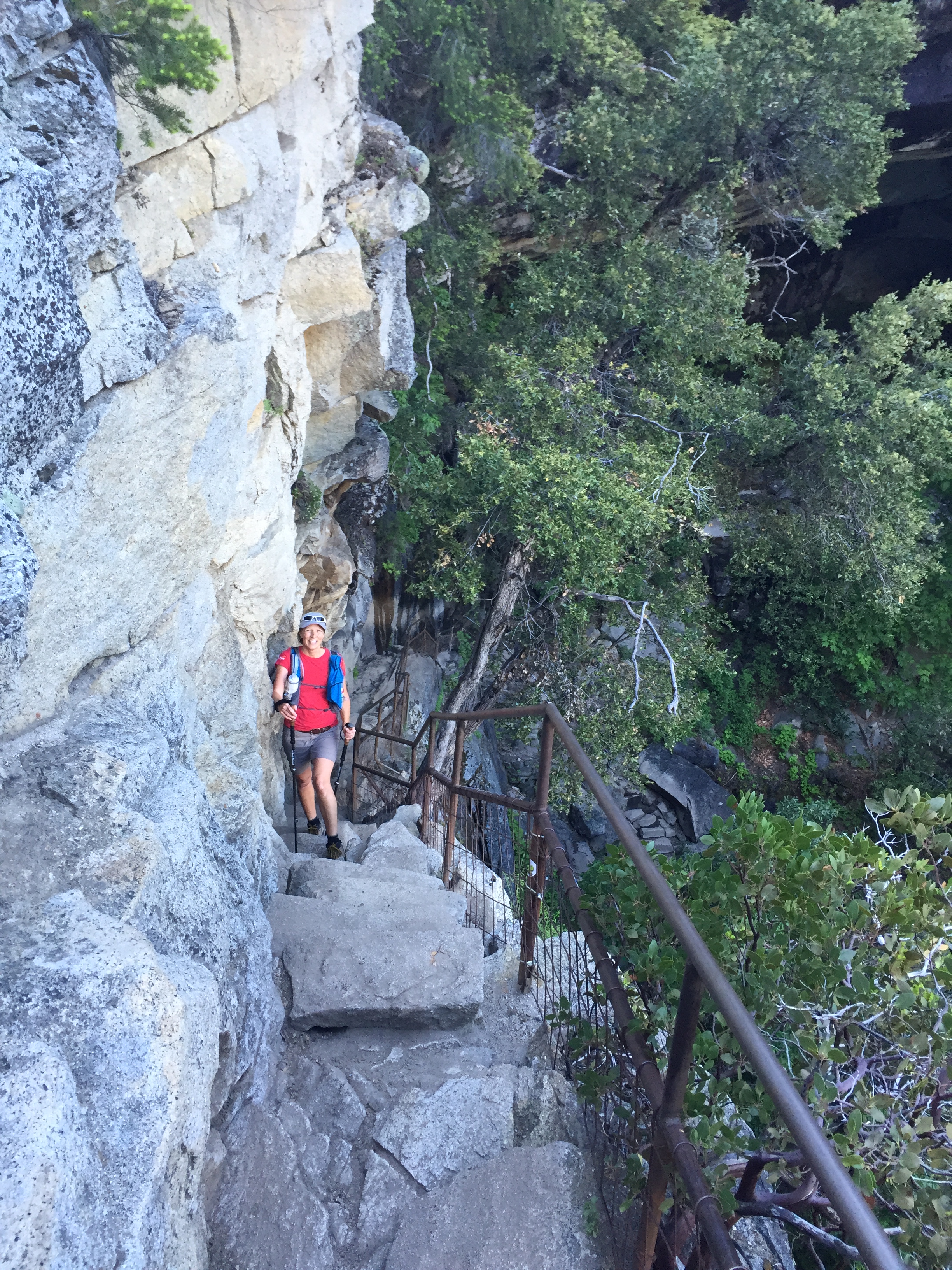
Narrow stairs chiseled out of solid granite, switchbacks and a steep slope was an exercise in vertigo control. I wish I could say what the view was like at this point but I was too focused on where to put me feet without looking down!
We reached to bottom of the cables about 10:30AM and unpacked our rubberized gloves for the final push. The gloves are amazingly helpful for gripping the cables. This section was EXTREMELY STEEP…almost repelling-like, and the gloves helped give extra grip to be more secure.
There was a pile of used gloves at the bottom of the cables that hikers leave for others to use. The wind tends to carry some off so there were a lot of unmatched gloves laying around.
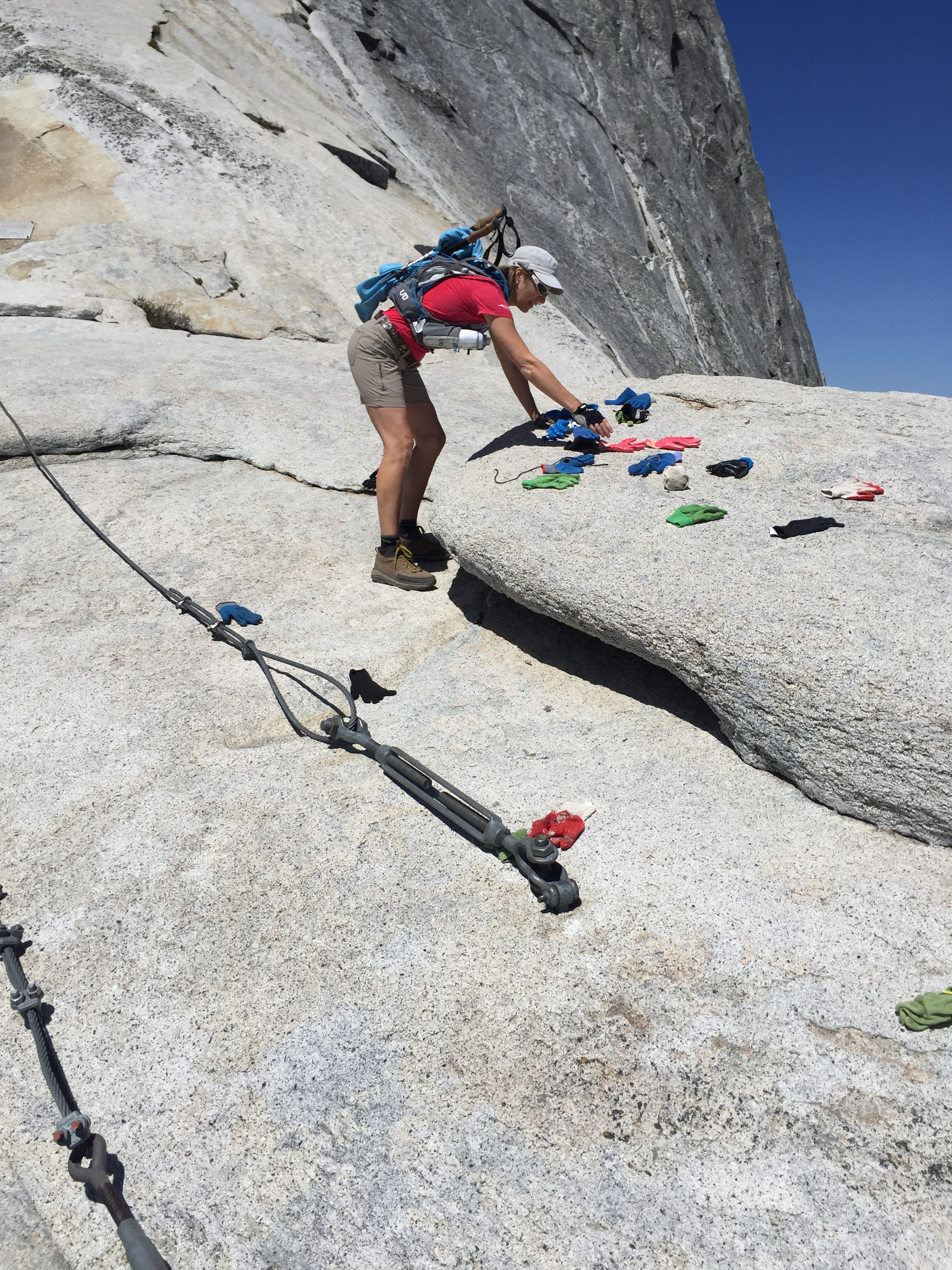
Gloves graciously left by previous hikers…they are a must for the cables!
See those ants over my right shoulder? Yup…that’s where we are going!
Previously, we heard one of the rangers talking about the permit system for Half Dome. That if you couldn’t get a permit, you hate the system. But if you were lucky enough to get a permit, you LOVE the system. Jeff and I couldn’t have agreed more!
The climb up the cables was intense and I can understand why they put permits in place. After the permit system was instituted, half dome deaths dramatically decreased.
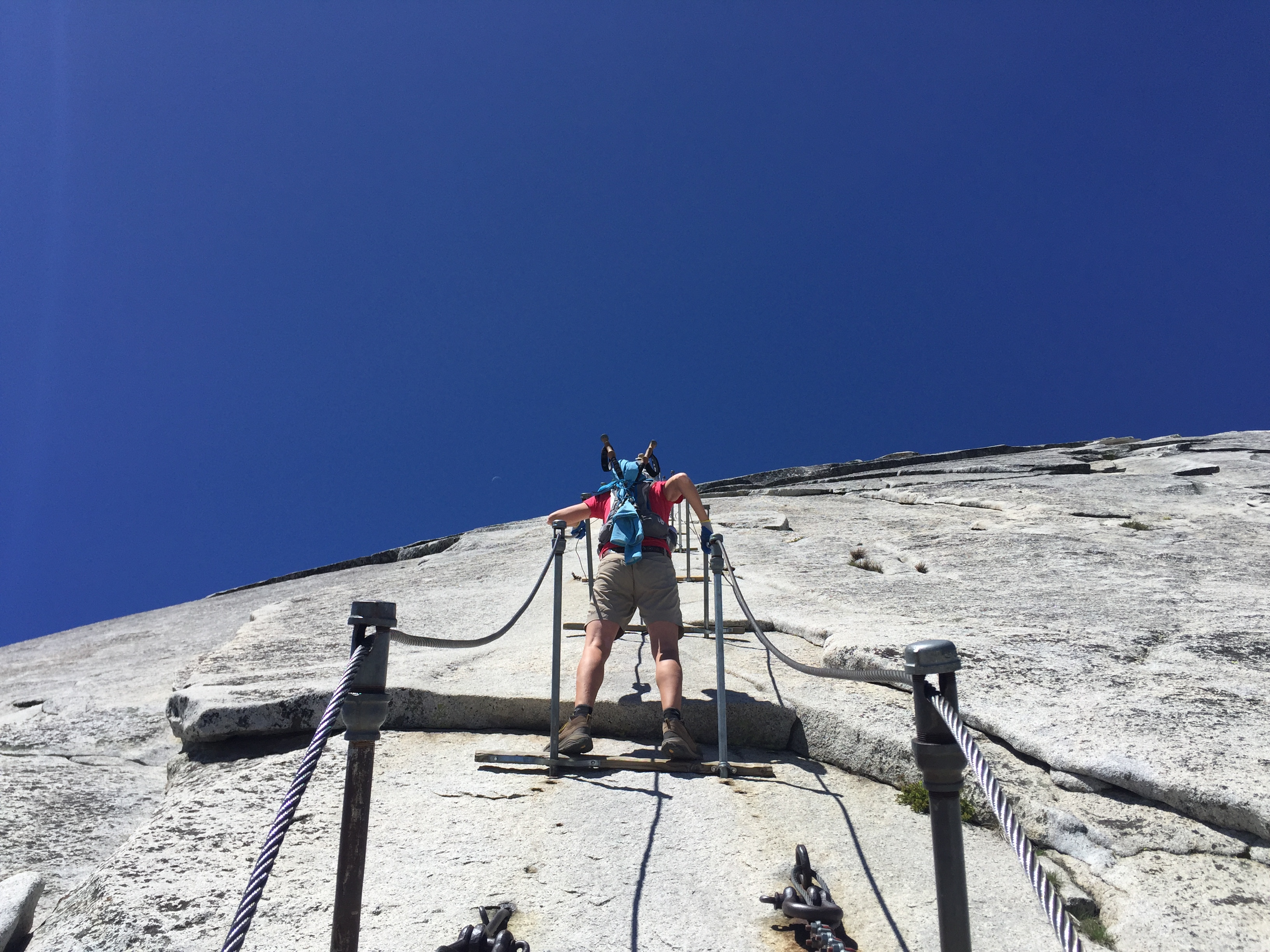
Thankful for the 2X4’s to rest
Each turnbuckle had a 2X4 attached to it to provide stable footing to rest or wait for passing hikers. Even with the limited people allowed on this hike we still got caught in traffic on the cables. But what was really cool was that everyone worked together encouraging one another, communicating, holding on giving each other the right of way. It was neat to see and experience, especially since it was so dangerous.
Just when I thought I couldn’t go any further we reached the top with a loud cheer from a few of the hikers on top. The last 500’ took us about 30 minutes and we celebrated by having a snack overlooking Yosemite Valley.
Thats Jeff and I at the top!
It’s moments like these that I become especially thankful for the ability to hike and climb. To have a body that is healthy and strong. To have a wrist that just 6 months ago was shattered and now I was pulling myself up the cables of Half Dome! We scored a permit to the top and now we are seeing a view not too many people can or will see.
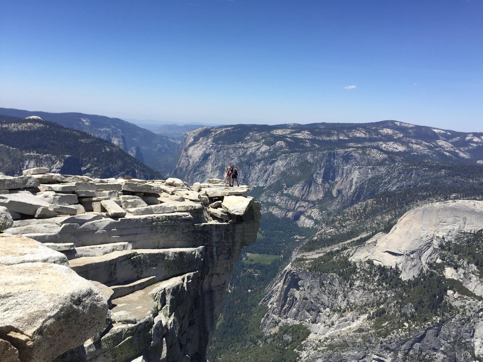
The view on top was so big and grand. Lush green meadows, sparking water of the Merced River, waterfalls spilling over granite cliffs, crisp air, the shear drop off of El Capitan. It was all visible, even palatable from this one spot. What an experience!
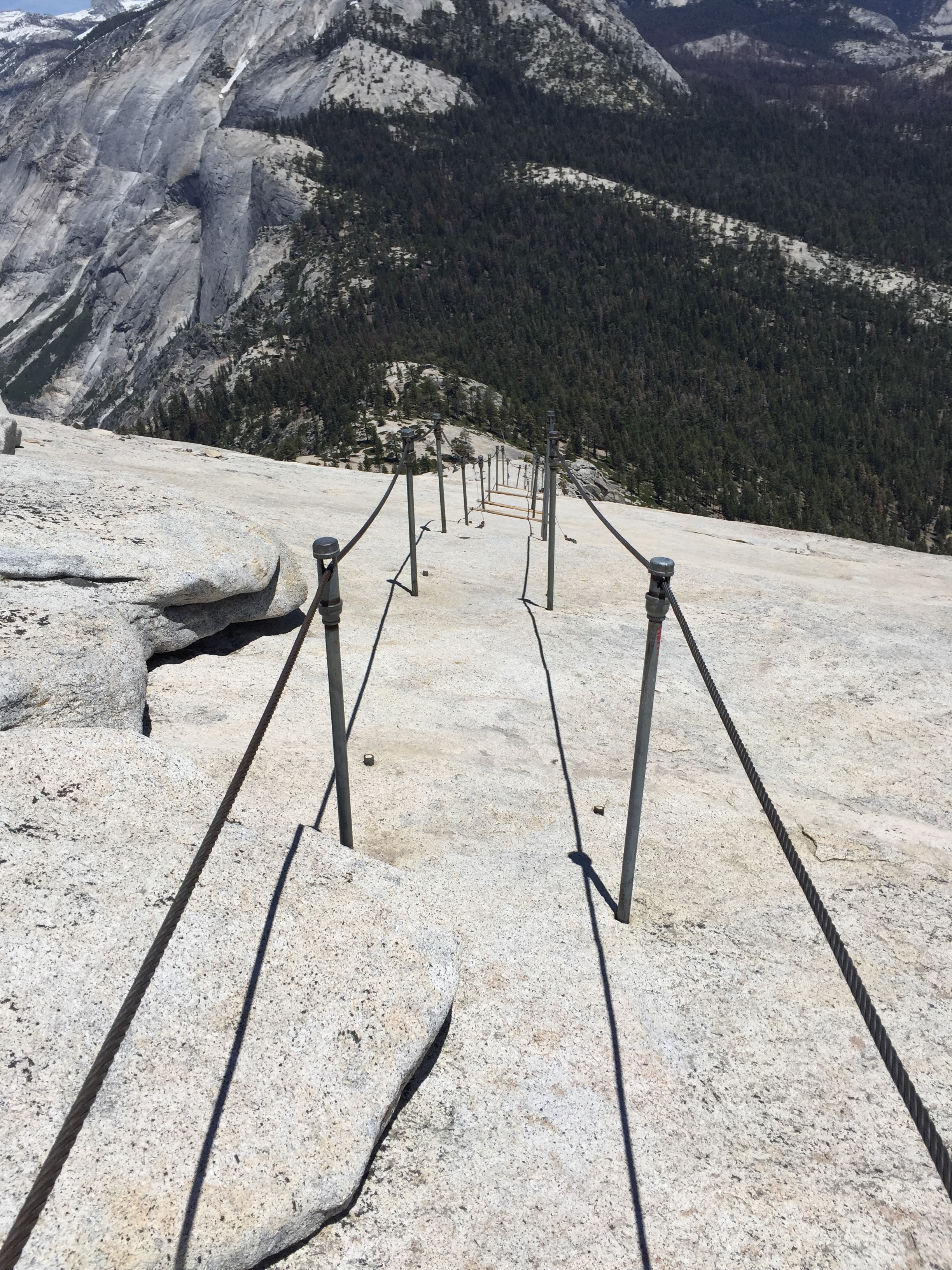
The view heading back down Half Dome
Our climb back down the cables was looming so after an hour at the top we started back down. It’s comical to see the different strategies people use to go down. Face first, side-ways and backwards. I chose the backwards method which worked well. I felt very secure and it kept the vertigo in check. It was much easier getting down and we celebrated with our fellow hikers.
Glad to make it down safely!
Overall this was an 18-mile hike for us that took 11 hours to accomplish. Talk about pooped!
The next day we needed to recover, so we pre-planned taking the Valley Floor tour ($25 each). This is a two-hour open-air tram tour driven by Sam and narrated by ranger Carol. They were affectionately dubbed Yosemite Sam and Christmas Carol!
Jeff and I normally don’t take tours, preferring to avoid tourist attractions. But we REALLY enjoyed this and would highly recommend it. We learned so much more about how the valley was formed, how Muir and Roosevelt worked together to start the National Parks, how bears are controlled in the park, and climbers on El Capitan.
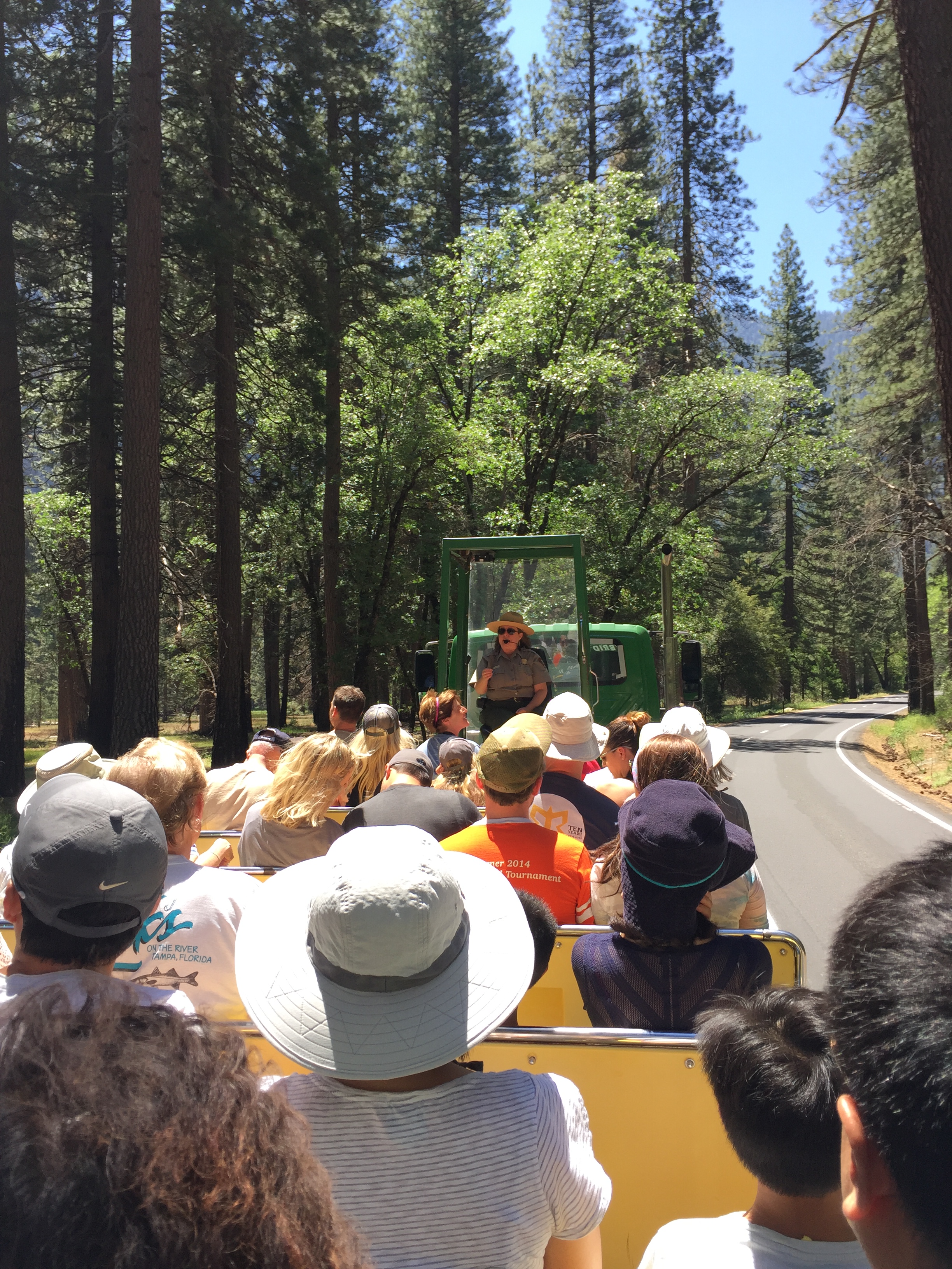
Christmas Carol narrating our Valley Floor tour
My favorite story was when Christmas Carol shared about the flood of 1997. The rapidly rising water took out over 1,000 lodging sites in the form of campgrounds and lodges. Everyone was safely evacuated and not a single life was lost. Carol shared that the most special part of the flood was that the park was closed for 3 months for cleanup and only workers were allowed in. She said that without the crowds the wildlife came out of the woodwork with such peace and quiet. It gave me goose bumps to think about experiencing Yosemite in such a special way. I was envious of her job!
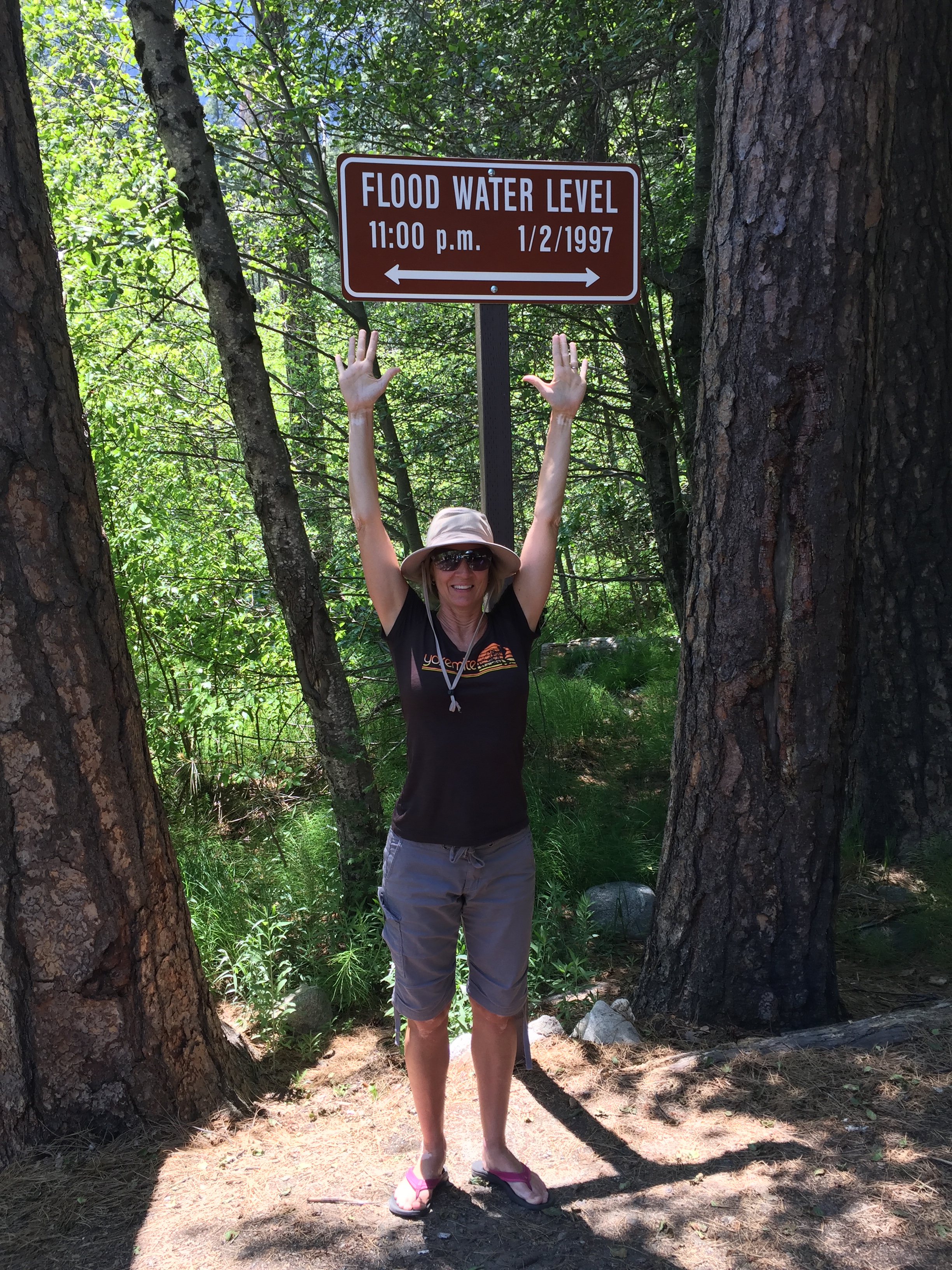
High water mark of the flood of 1997
Taking in the views on our tour
Yosemite Falls and a giant finger…oops!
After our tour we took a stroll over to Yosemite Falls and then called it a day.
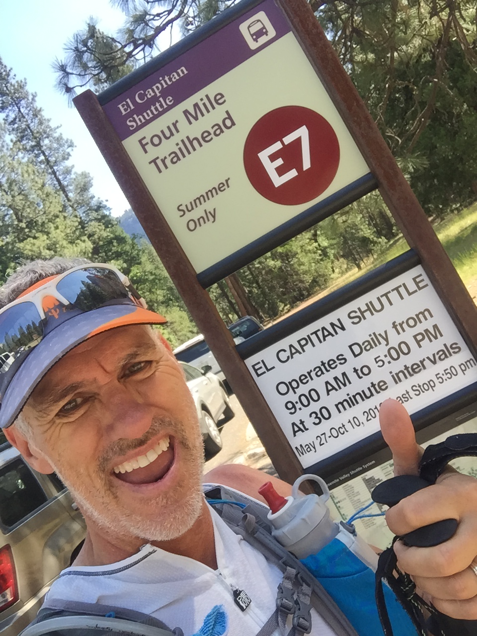
Thursday was our last day at Yosemite and we had two things left that we wanted to do. One was to drive to Glacier Point and the second was to hike the Four Mile hike. So much to still see and so little time!
The Four Mile hike (3200’ elevation gain) once was a toll trail developed in 1872 to connect the Valley Floor to The Mountain House lodge at Glacier Point. It is a strenuous hike that was eventually lengthened to 4.8 miles in order to flatten out some areas of steep grade. Even though mileage was added the historic Four Mile trail name was retained. The lodge burned down and the state of California eventually purchased the “private” trail for $2,500. It then became public property and toll free.
My legs were too shot for the 3200’ climb so we decided to drive to Glacier Point where Jeff would drop me off at the McGurk Meadow Trailhead on the way. This is an 8-mile one-way hike from TH to the Glacier Point. Jeff then parked at Glacier Point and hiked the 4-mile trail down, then back up.
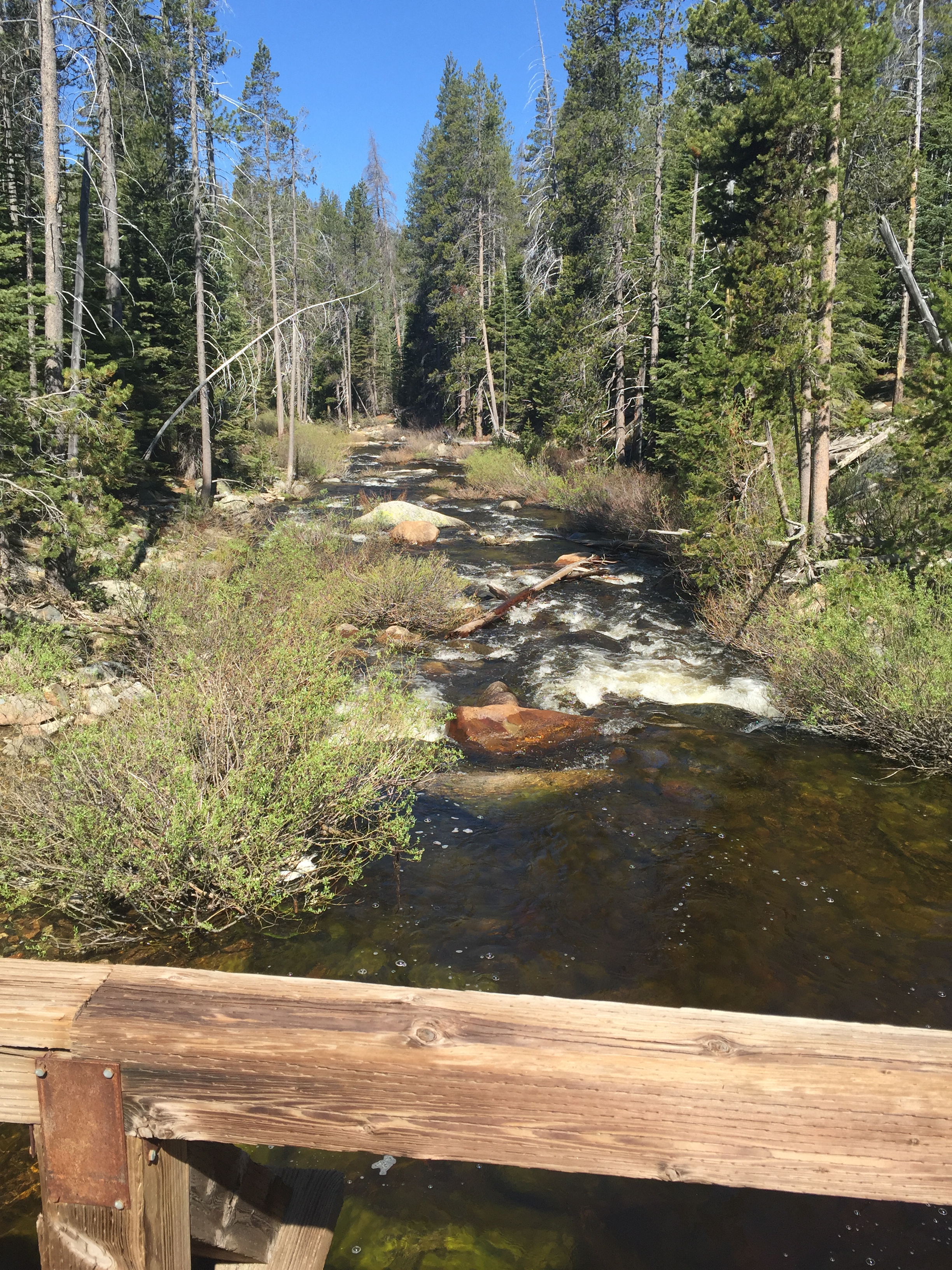
Pretty river crossing on the McGurk Trail
Jeff taking the Four Mile Trail
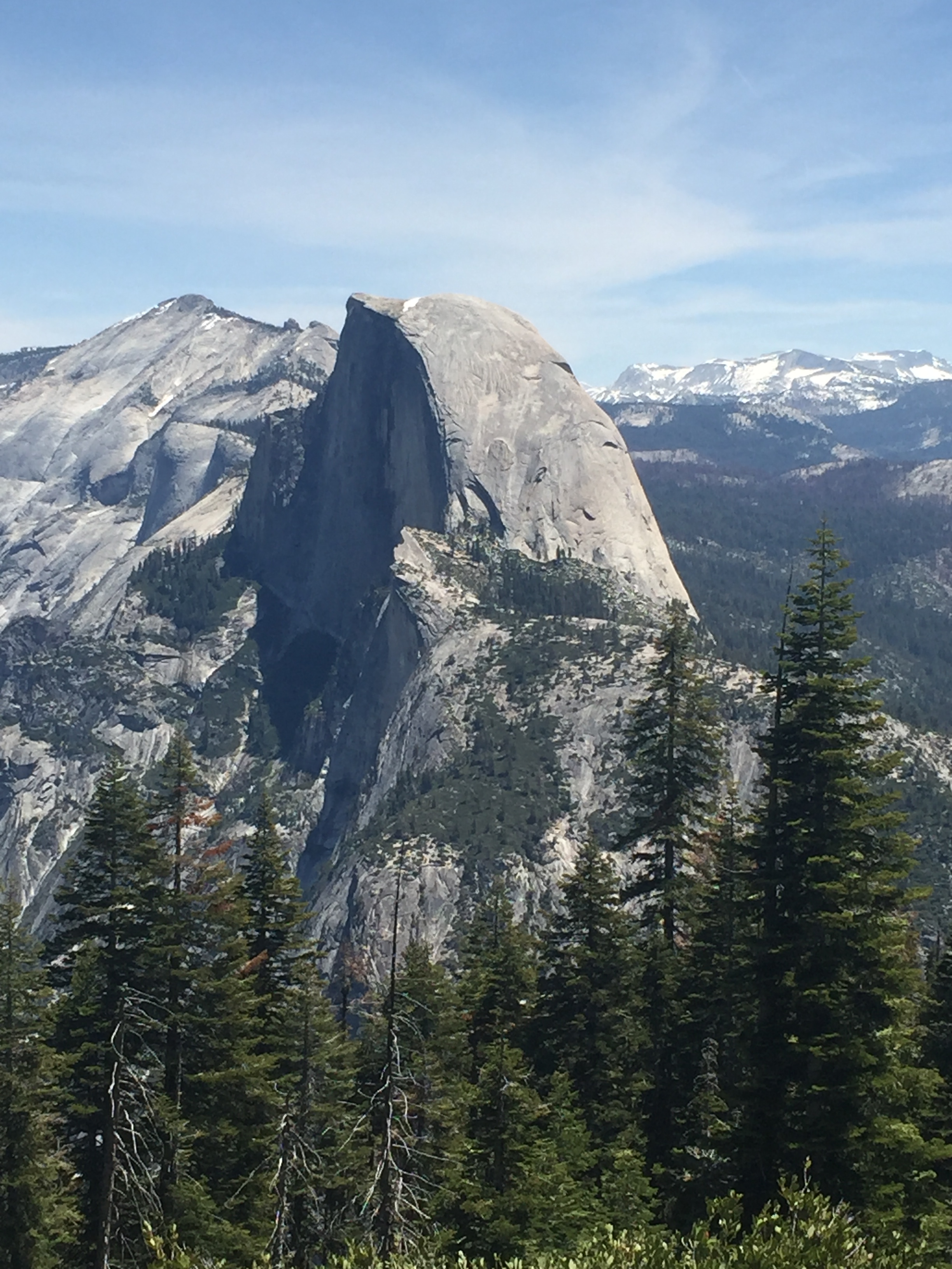
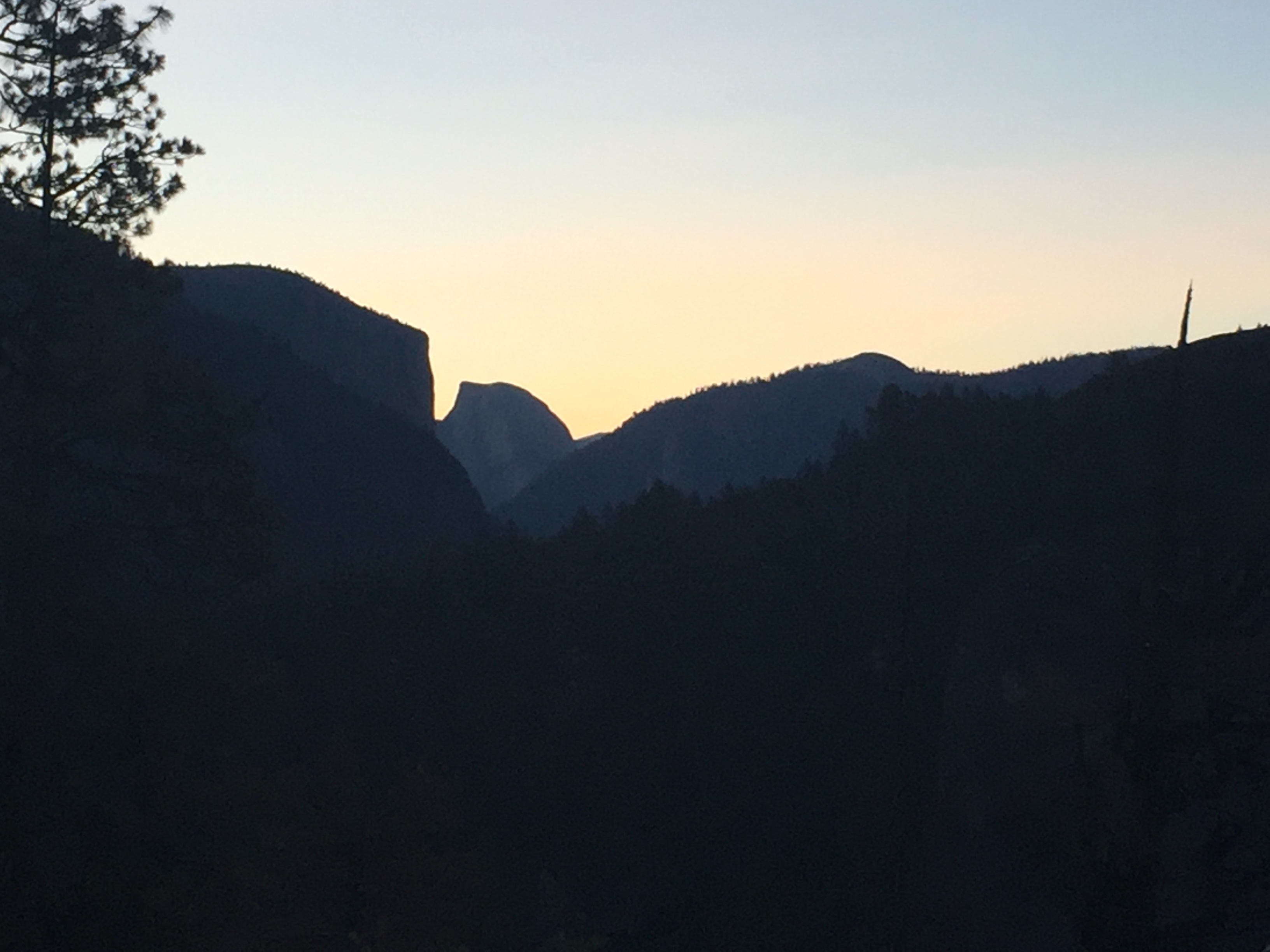
Both hikes were beautiful. Mine was secluded with minimal traffic while Jeff’s was exposed on the side of the cliff with A LOT of people. We both ended our hikes about the same time and we had a great view of Half Dome!
We left Yosemite for the final time that day. We were both really sad. We could have easily spent a second week and still not have gotten in all the additional hikes we wanted to do.
I guess that just means we will have to make another trip back!
Until next time beautiful!
P.S.
TEN TIPS FOR A YOSEMITE VISIT
- Come in the off-season if at all possible-shoulder months are less crowded.
- Avoid the Valley Floor during the weekends-there are great hikes around the perimeter of the park that are much less crowded.
- Arrive at the Park entrance gates before 8:30AM-Cars start backing up at the entrance by then and parking is limited. We heard of others waiting 4 hours in traffic just to get in the park entrance and other who circled parking lots for 2 hours trying to find an open spot.
- Take lawn chairs with you-we set up our chairs under a shade tree in the parking lot to get some work done and make business/family calls. Also, its just nice to sit, regroup and rest then get back out there for the rest of the day.
- Expect no connectivity-We had very poor cell coverage and no WiFi at our RV Park, even with our own hotspot and booster. We did find decent coverage in the parking lot in the Valley so we purposed to get some work done there each day after our hikes.
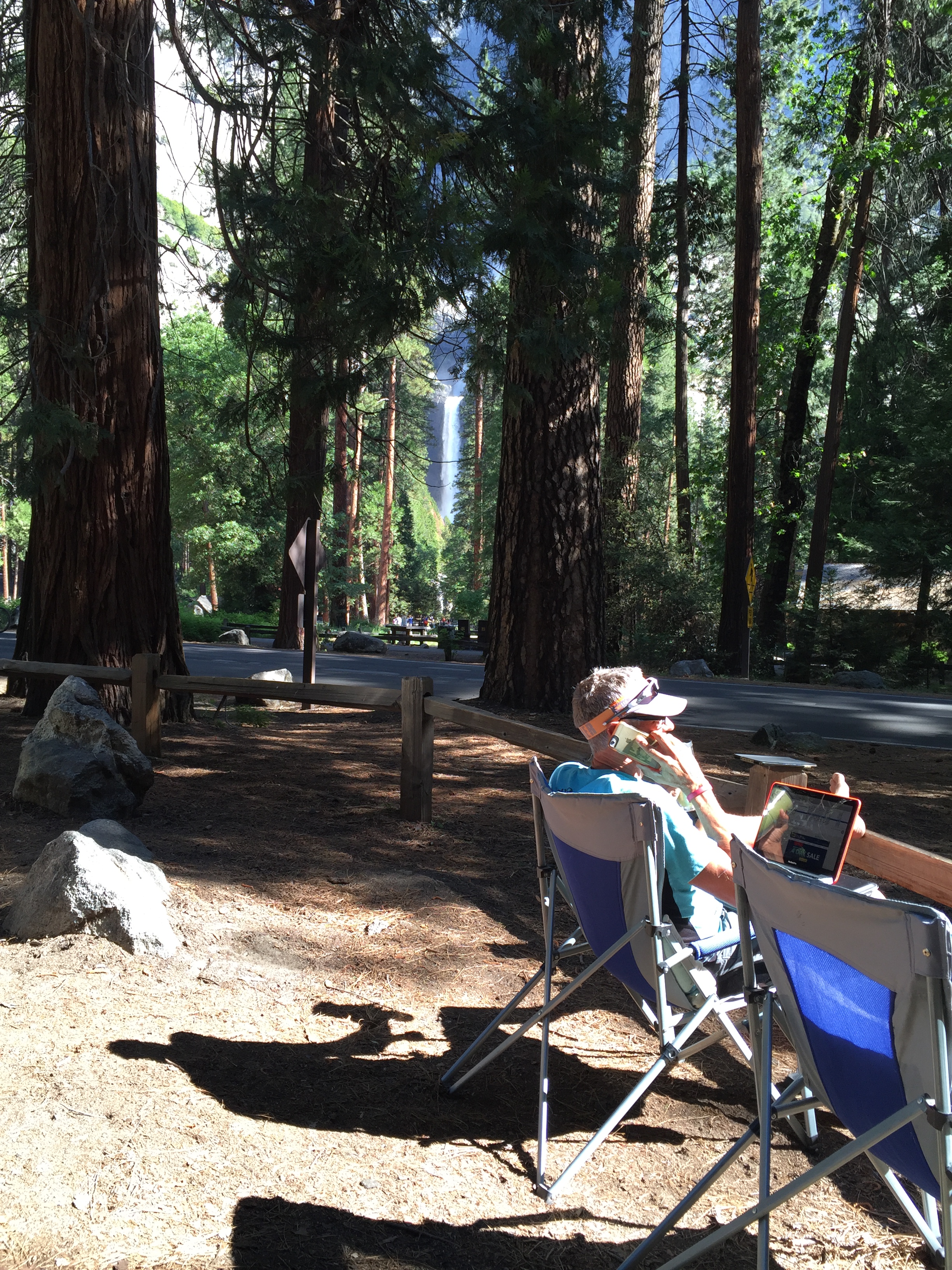
Our office with Yosemite Falls in the background
- Make arrangements for pets-Pets are not allowed on hiking trails but can be taken on any paved paths. There are lots of paved routes, but none that will give you any backcountry experience.
- Bring bikes-If you just want to explore the Valley Floor be sure to take bikes. Waterfall spots and lakes are spaced out making it a very long walk. Bikes will keep you from having to give up your coveted parking spot.
- Take the Valley Floor tour-Well worth the $25/person (reservations required).
- Be mentally prepared for irresponsible people who lack manners, don’t pick up after themselves and who ignore park rules-Its very disappointing to see the amount of trash left on the floors in restrooms and around crowded waterfalls.
- Take plenty of sunscreen and water-Even if it is a short distance, the air is dry and the sun is intense.
Yosemite National Park-Part I
Posted by Deb in Bucket List, California, Destinations, Full Time RV, Hiking, Yosemite NP on June 26, 2016
Let the hiking commence!
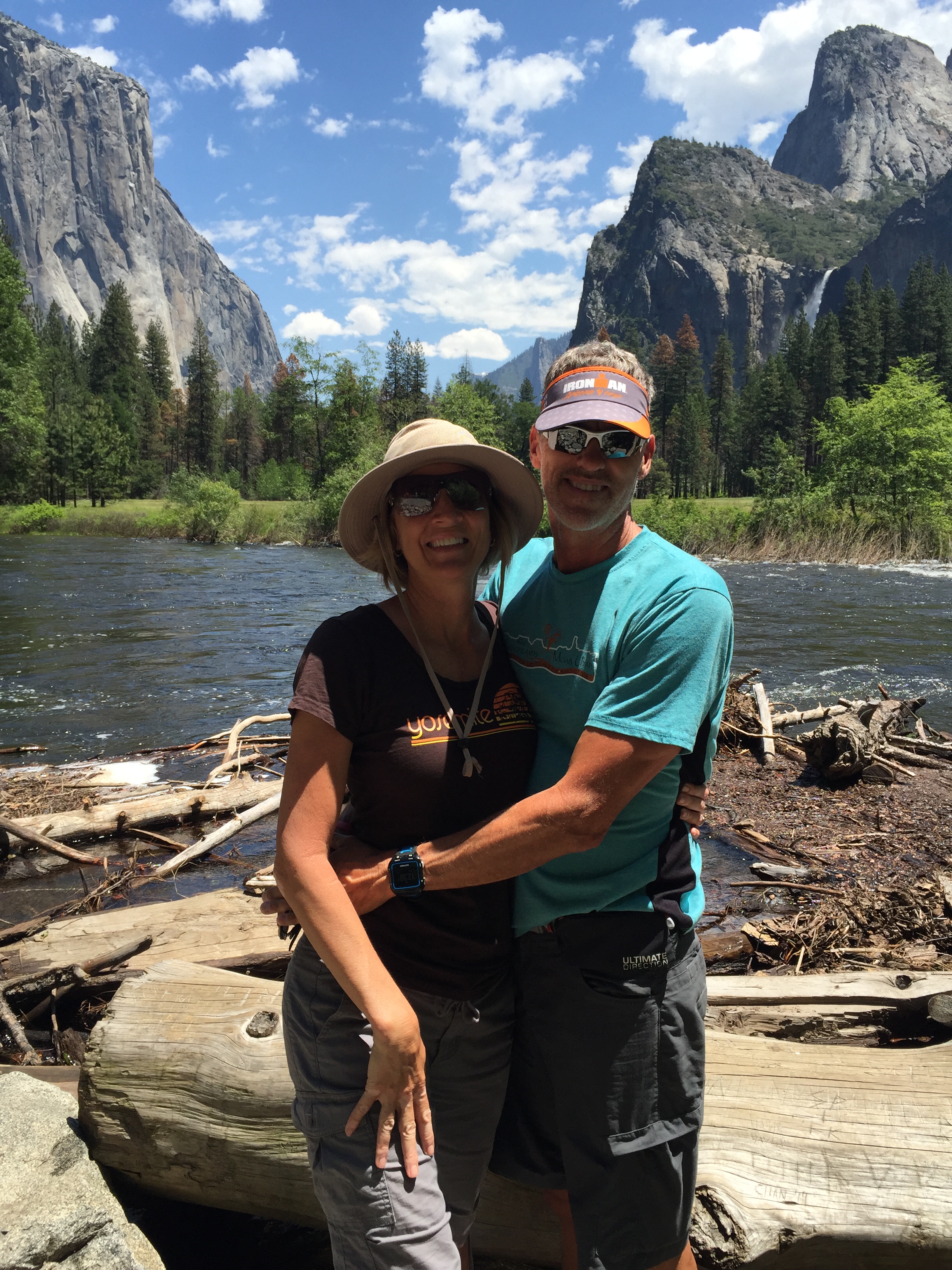
Jeff was a Californian for the first 23 years of his life and one of his most shocking statements was that he has never been to Yosemite. Being a mid-west girl myself, I have a much better excuse why my eyes have never gazed upon El Capitan, Yosemite Falls or Half Dome. But to live within 90 miles of this National treasure and never to have seen it. Well, that’s just plane hard to believe!
Yet here we are, California surfer dude and Illinoisan tomboy, taking in this place together for the very first time. It was spectacular! That first view of Half Dome and El Capitan will forever be engrained in my mind. It’s emotional and spiritual and amazingly beautiful!
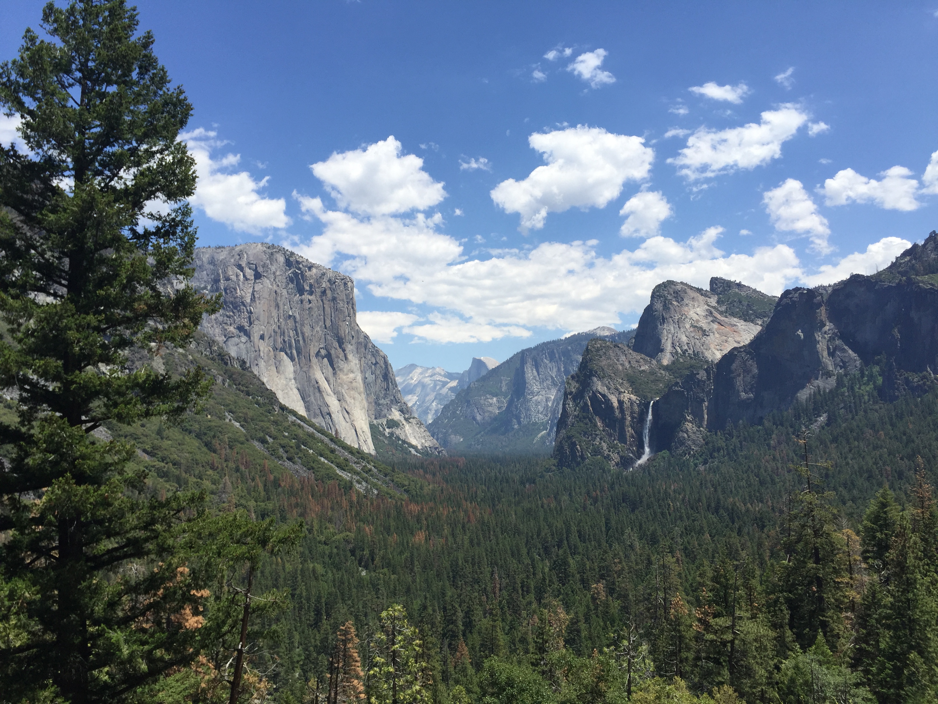
WOWZA!
Being in Yosemite this year is especially spectacular since El Nino’ dumped abundant snow. Its spring and the snowmelt has added volumes of water to all of the falls in the park making for waterfall-palooza everywhere you look. Even the parking lots have incredible views!
Sams loves El Capitan!
It being Memorial Day weekend, I had made a weeks reservation at Yosemite Ridge RV Resort a couple of months in advance. Though the National Park entrance is just 13 miles from the RV Resort, it was still another 30-some miles to Yosemite Valley floor making our commute 45-60 minutes one-way.
We spent our first day (Friday) taking a drive to the Valley floor to get the lay of the land and get information for hiking Half Dome. Then we purposed to avoid the valley floor Memorial Weekend. What a good decision that was! By the time we were driving back to the RV Park each day the lines into the park were backed up for 3 miles.
Hike to Mirror Lake
We stuck to perimeter hikes out Hetch Hetchy to Tueeulala and Wapama Falls (5 miles round trip). The Hetch Hetchy Reservoir provides water to the Bay area and is so pure, no filtration is required. A ranger told us that they cannot tell you its ok to drink out of it without filtration, however, it exceeds EPA standards. The spray from the waterfalls over boardwalk trails were a real treat since it was getting really warm that day.
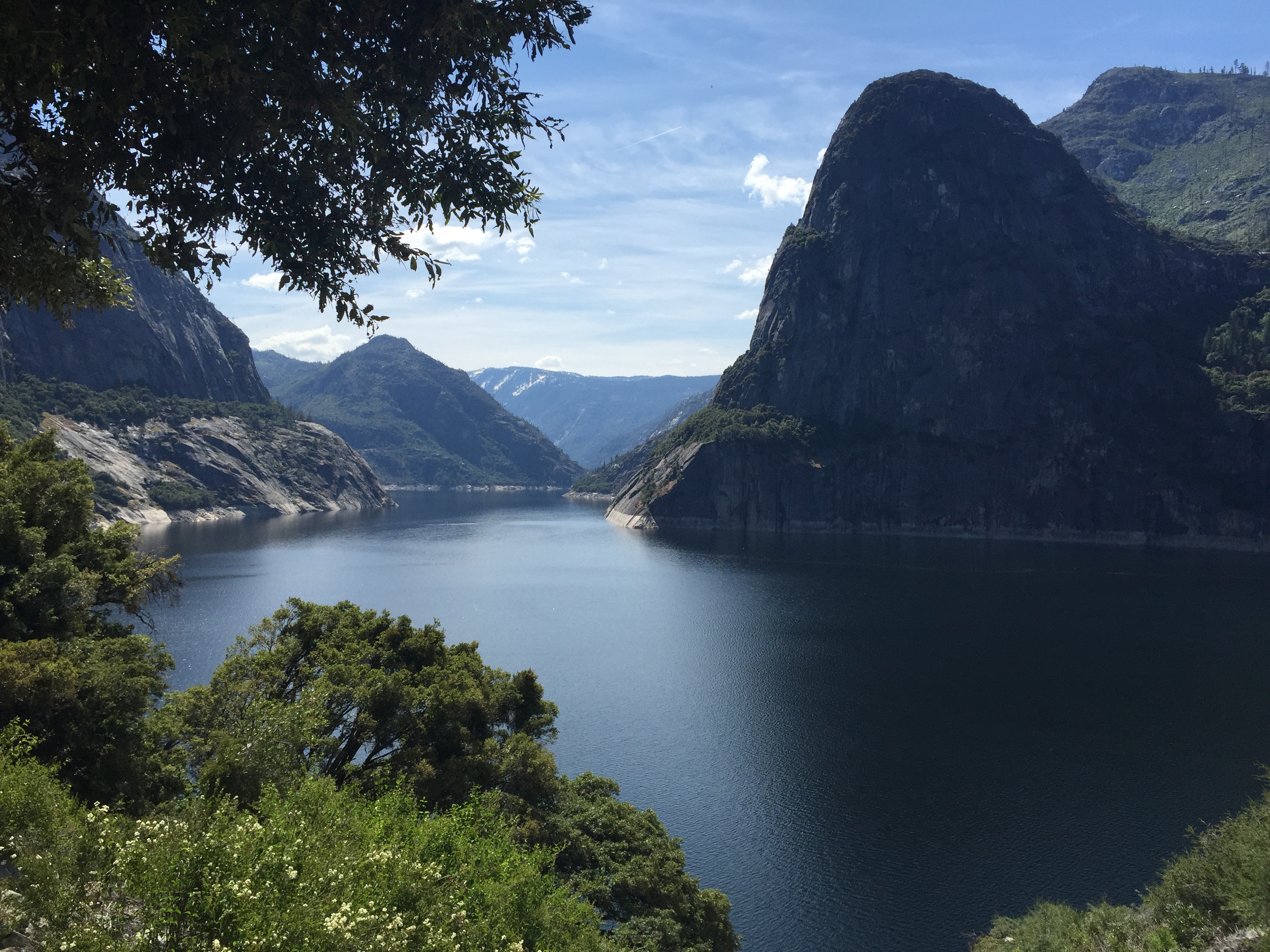
Hetch Hetchy Reservoir
These falls are big!
We are about to get wet
The next day we hiked to the Toulumne Grove from Hodgdon Meadows (10 miles). This is where a grove of Sequoia Redwoods stand. We were virtually alone until we reached the grove on this trail, which was on an old paved logging road and part of the original road into the valley.
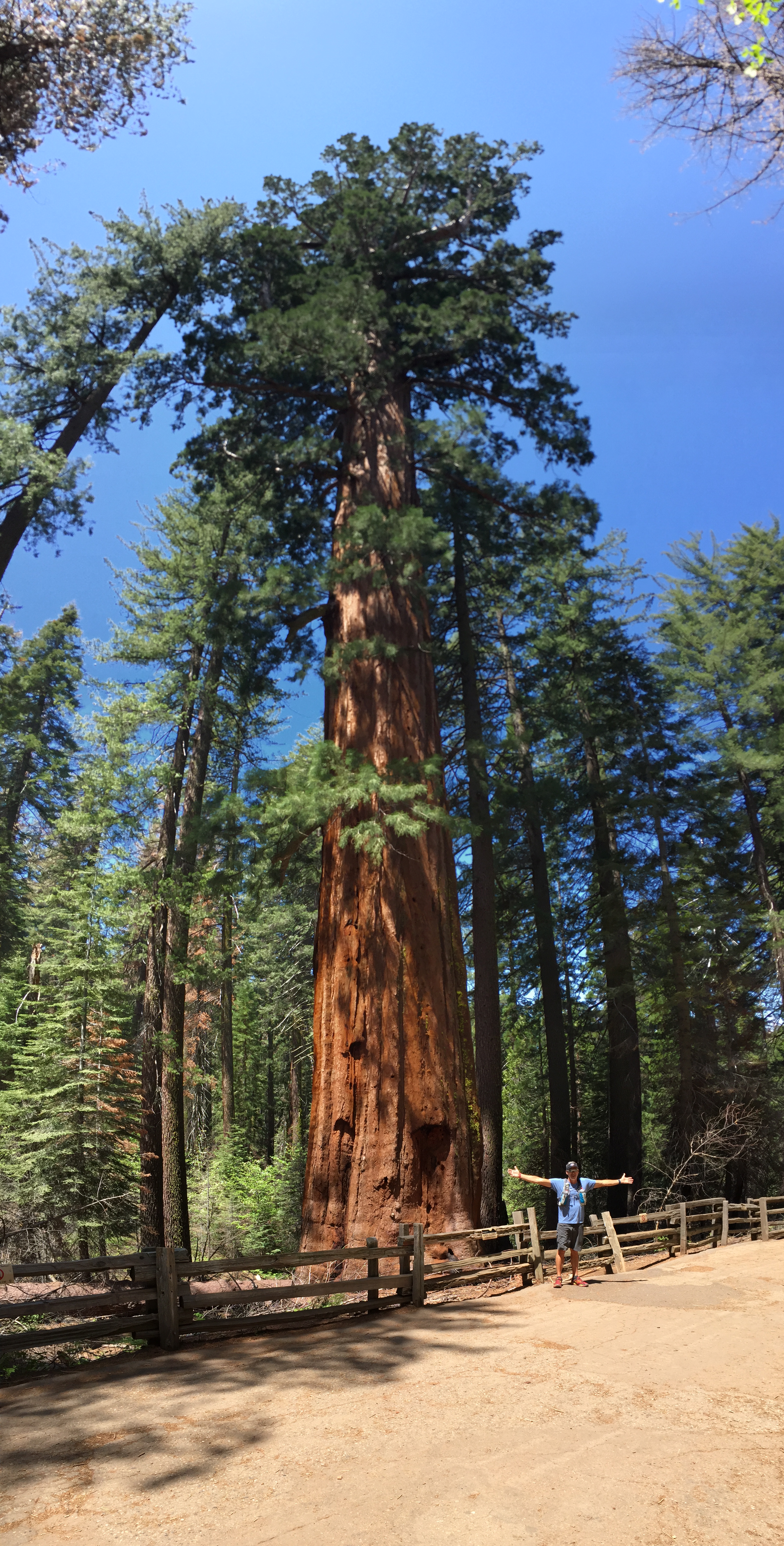
Tree Giants
The really cool part of this hike was seeing the Tunnel Tree that was carved out of a fallen sequoia around 1881 as a tourist attraction. The park entrance road drove right through this tree and a toll was collected! Things like this triggered the National Parks ranger program to prevent future destruction of the majestic redwoods and park resources. Because of the discovered Sequoia grove, the park entrance road was later re-routed to where it is today.
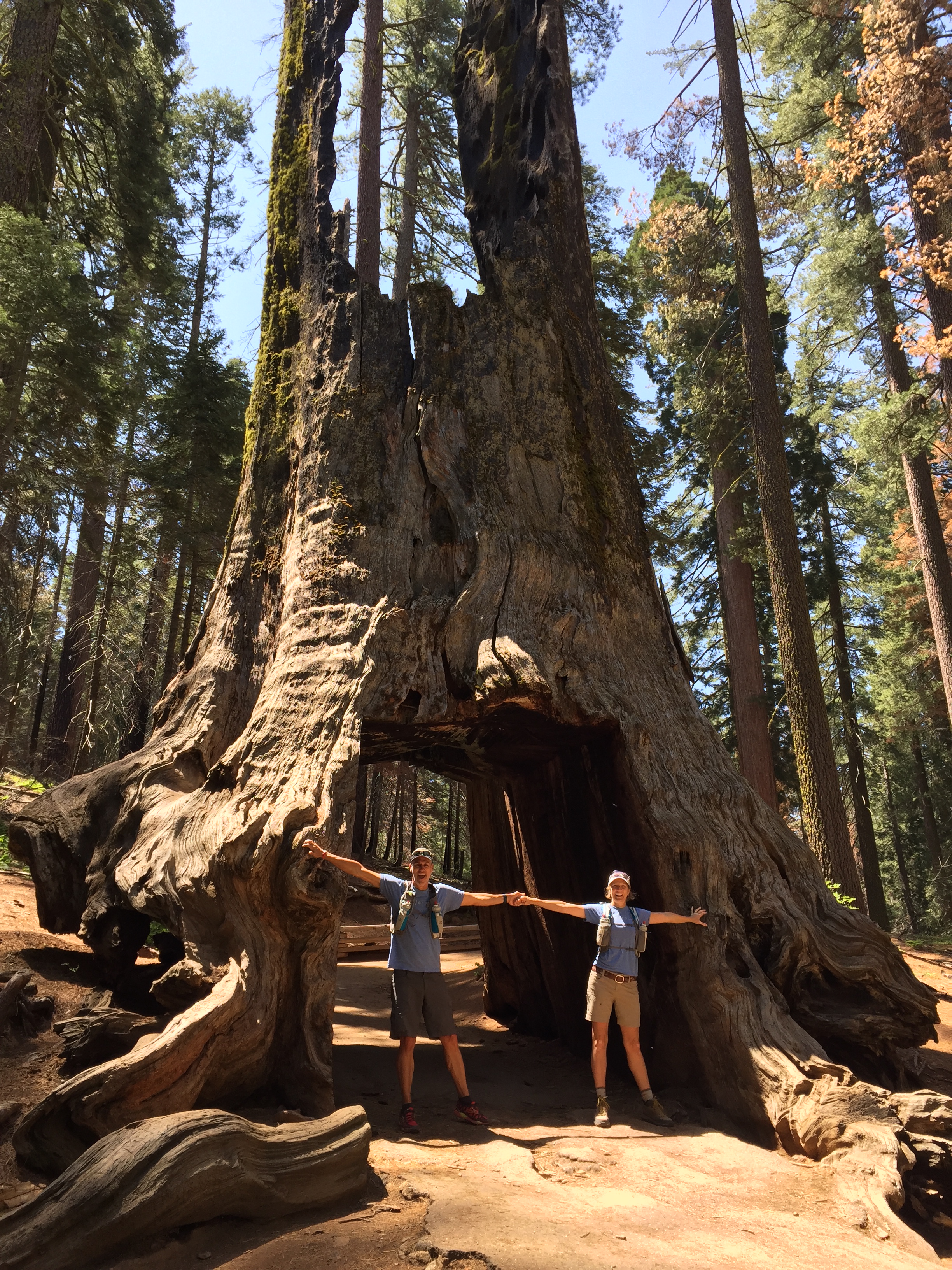
Tunnel Tree at Tuolumne Grove
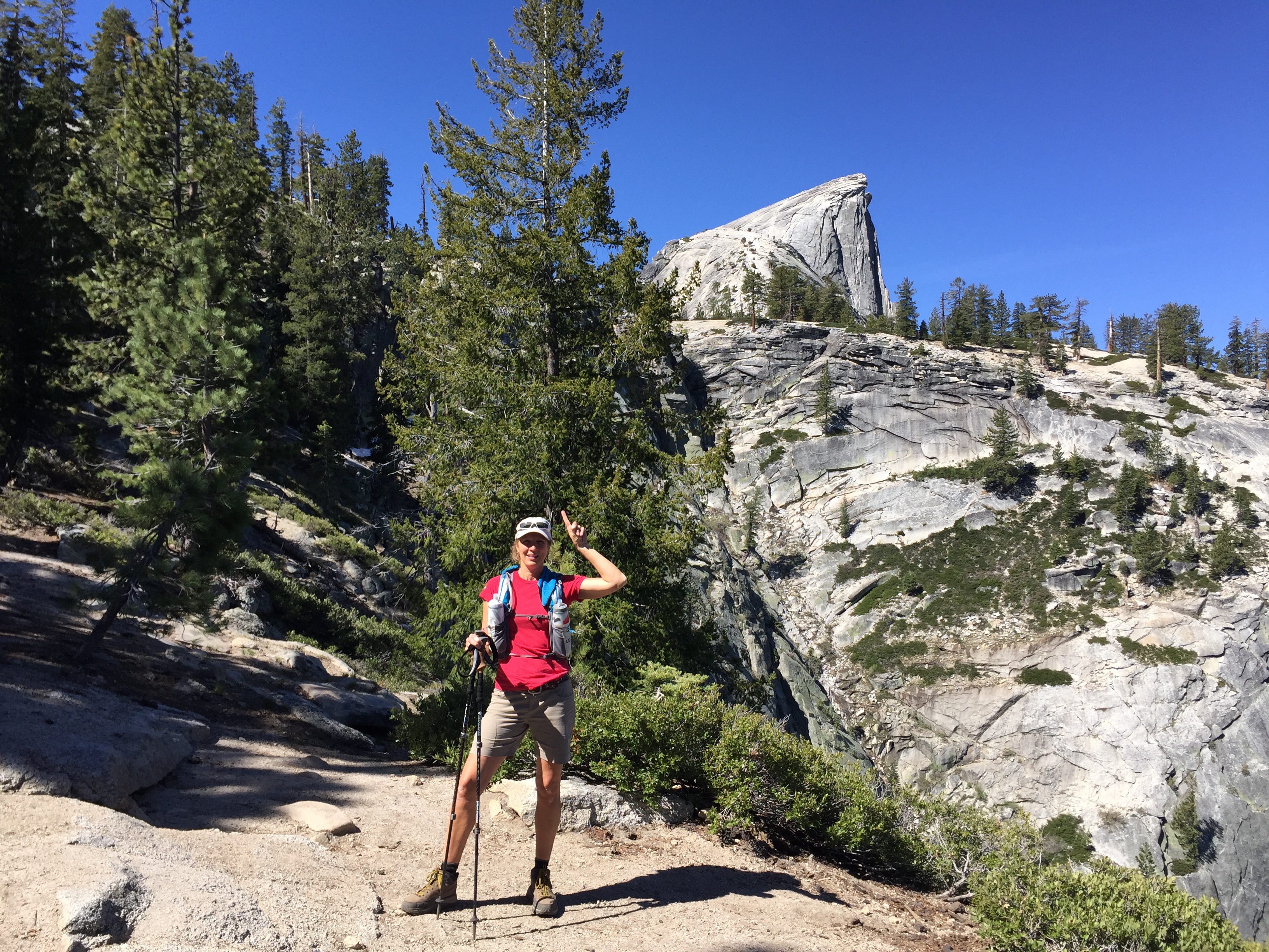
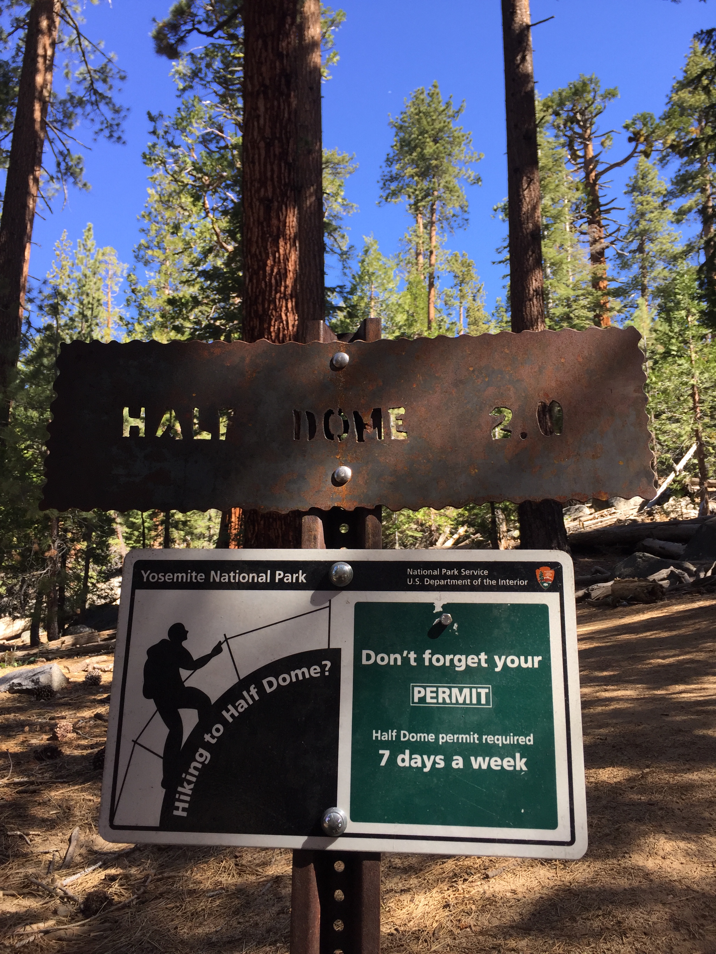
One of our bucket list hikes, second to The Grand Canyon, has been Half Dome. It’s a long day hike (16-18 miles RT depending on where you park) with the last 500 feet of climb up “the cables” to reach the summit.
A permit is required from Sub-Dome and above. There are only 300 permits issued per day with 60% of them available via online lottery up to 6 months in advance. The other 40% are issued via lottery a day in advance.
Since the 60% permits were already issued during our time there, we took a chance and tried the other 40% permits by diligently applying online DAILY at a $4.50 fee with each try…only to receive our Dear John letter every night at midnight.
Since that wasn’t working we found out that there are additional Half Dome permits available, but only if you apply for a backcountry camping permit. These are very limited also and are given out at 11AM on a first come first serve basis for hiking the following day.
In order to have a chance with this strategy we arrived at the backcountry office at 6AM to claim our spot in line and hope they had permits left by the time we reached the desk. Even at 6AM we had 12 others ahead of us and it wasn’t looking good.
But fortunately we had two groups ahead of us that were offered to start their hike THAT DAY which freed up 6 spots for the following day…and we got the last two permits!
SCORE! We got the last two permits. Sorry folks!
WE GET TO HIKE HALF DOME BABY!!!!
Hello beautiful!
Ramping Up and Winding Down
Posted by Deb in Bucket List, Destinations, RV Parks, Trail Run, Utah on May 20, 2016
Angels Landing, Zion National Park
Ooooof! More excuses why I have been very tardy in keeping up with my blog!
Working with an RV company, the full-on RV season has arrived and our show responsibilities have ramped up.
So instead of trying to catch up with multiple posts I’m going to cheat and summarize the last two months of travel in one. That’s the way we catch up around here!
Zion National Park…A Thing of Beauty
Continuing our visit to the Canyonlands we headed over to Zion National Park. I thought since we were visiting during the early season we wouldn’t have any trouble finding camping around the National Park. After checking the recreation.gov website for camping within the park I found 1 campsite left for 3 nights at the Watchman Campground. Not the week stay I was hoping for but we had to take what we could get.
With our Zion Ultra trail run scheduled we needed some additional reservations closer to the venue. I got reservations at the Zion Canyon Campground behind the Quality Inn Hotel in Springdale. It was literally just across the Virgin River from the Watchman…for double the price.

Tight quarters but great views at Zion Canyon Campground
The picturesque Watchman Campground
Our first day at Zion we decided to take a drive through the park traveling through the tunnel on 89A. I’m so glad we did this because we had planned on going out this way on our way out of town. We didn’t realize there was a tunnel for one thing. Secondly, they have a height restriction of 13’2″. Thirdly, if we could have fit (we are 13’ 8”) we would have needed a park escort in order to drive down the middle of the tunnel while traffic was blocked. Lastly, they charge a $15 fee to do so.
Not enough headroom for us tall folks
Despite all that, it was a beautiful drive and gave us a little taste of what was to come during our weeks stay.
Two days before our race we decided to take in an easy hike and headed to the Emerald Pools. There is a high, medium and low pool and we hiked to all three. This is an easy hike and we purposed to leave before 8 AM to avoid any crowds. This time of year you can only access the Trailheads via the shuttle system that we picked up at the visitors center.
There are flashing signs all over town about the National Park parking being completely full by 10AM until 3PM, so we wanted to be sure to get an early start. We waited for the shuttle with 4 other people to head to the TH’s. But when we returned around 10:30 the lines just to get on a shuttle were about a ¼ mile long. It was crazy!
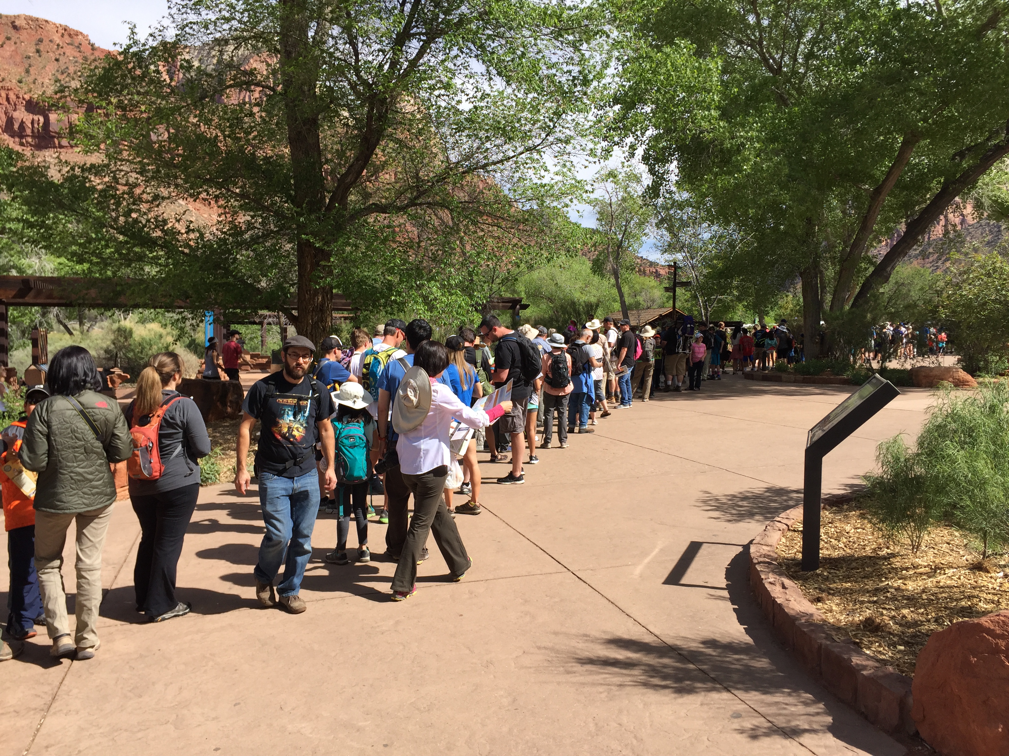
Boy oh boy…go really early or prepare to wait!
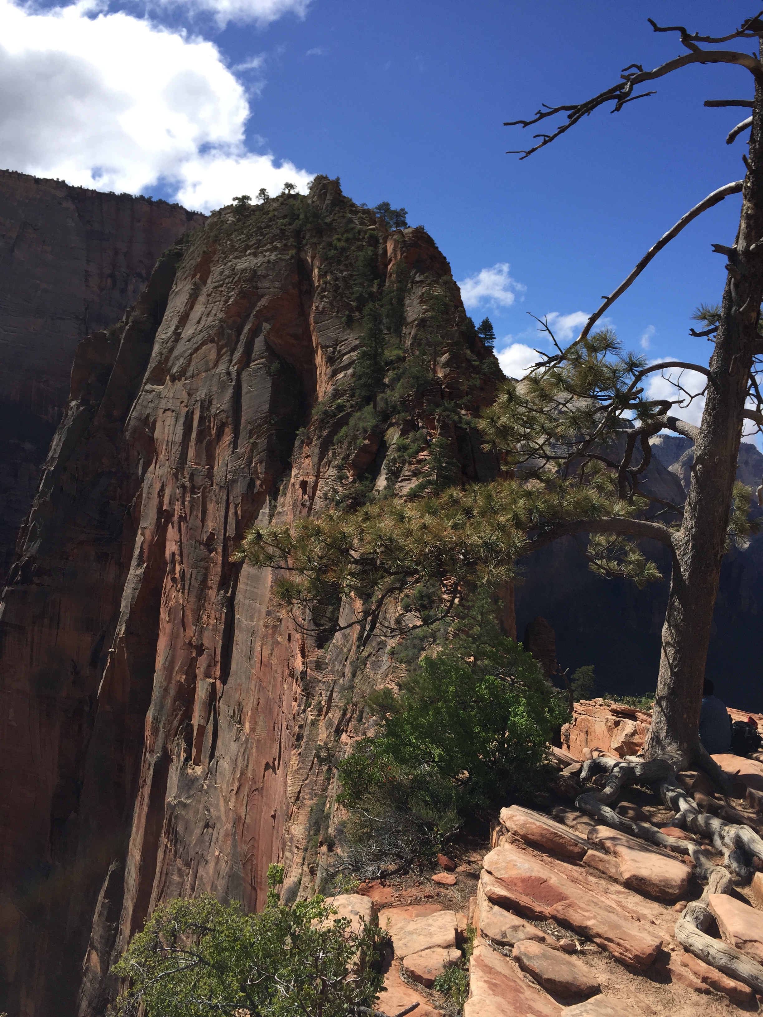
Angels Landing
If you have ever seen pictures of Zion you more than likely have seen Angels Landing. This hike’s iconic knife edge assent with the aid of chains and the infamous Walter’s Wiggles were enough to make this one of our most unique and exciting hikes we have ever done.
And the view from the top… Simply amazing! It’s a great place to have a mid morning snack or a picnic lunch with plenty of room to move around (mild crowds). But if you are scared of heights this hike is not for you!
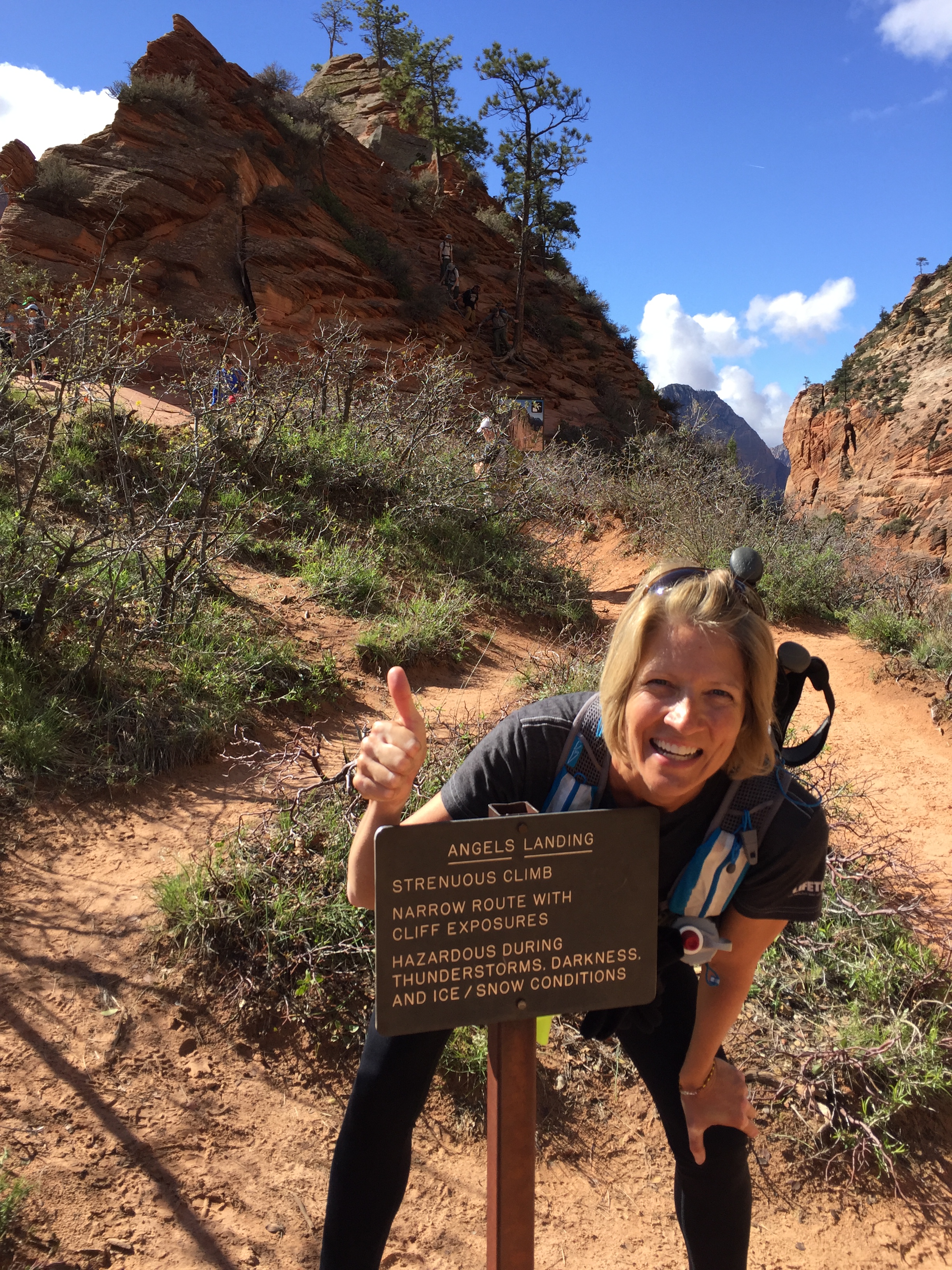
WARNING…You are crazy doing this hike!
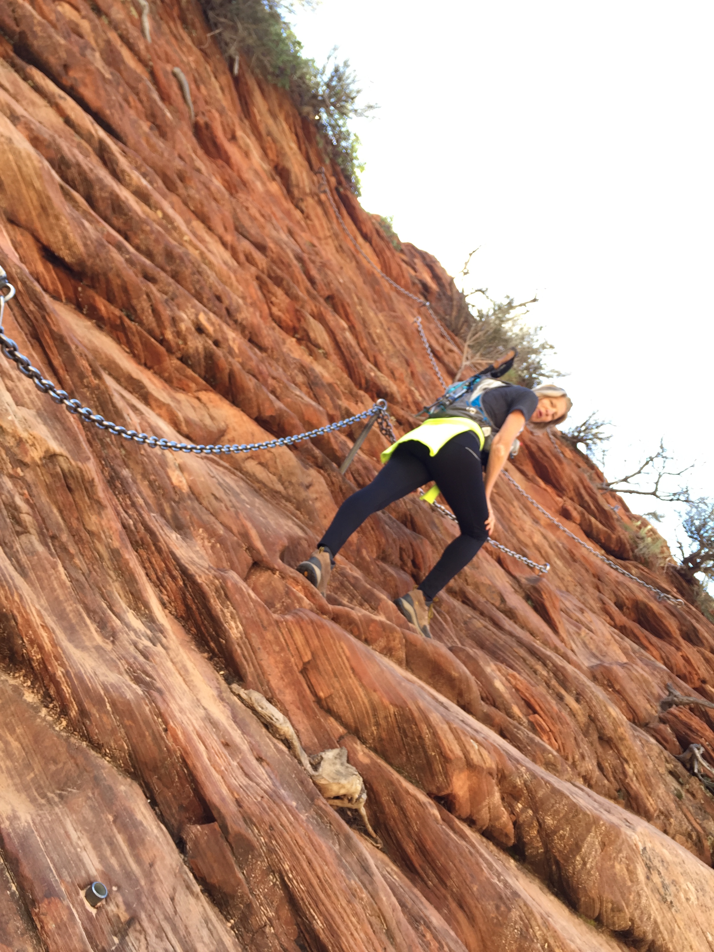
Be sure to do this hike early morning before the crowds kick in. The chain section is for one rear end at a time and even early we had to share the road with A LOT of people including small children and terrified adults. There aren’t too many spots to just pull over and let someone pass, so expect to hang out on the side of a cliff waiting for your turn.
Zion 100 Ultra
The Zion 100 Ultra offered a 100-mile, 100k, 50 mile, 55k and half marathon distance. Jeff signed up for the 55K while I signed up for the half marathon.
We were watching the weather closely the week leading up to the race and as the race got closer the chance of rain increased. So much so that the race director offered the option to back out of the race even though they were going to have it rain or shine.
But nothing could prepare us for…mudageddon!
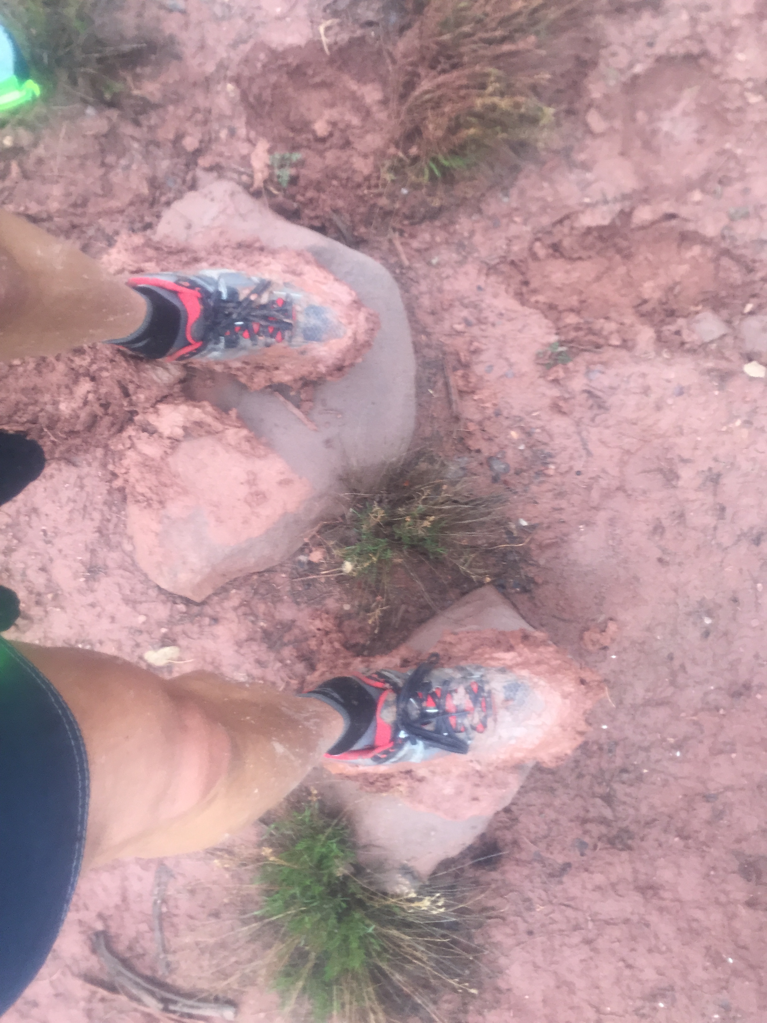
5lbs extra weight right there!
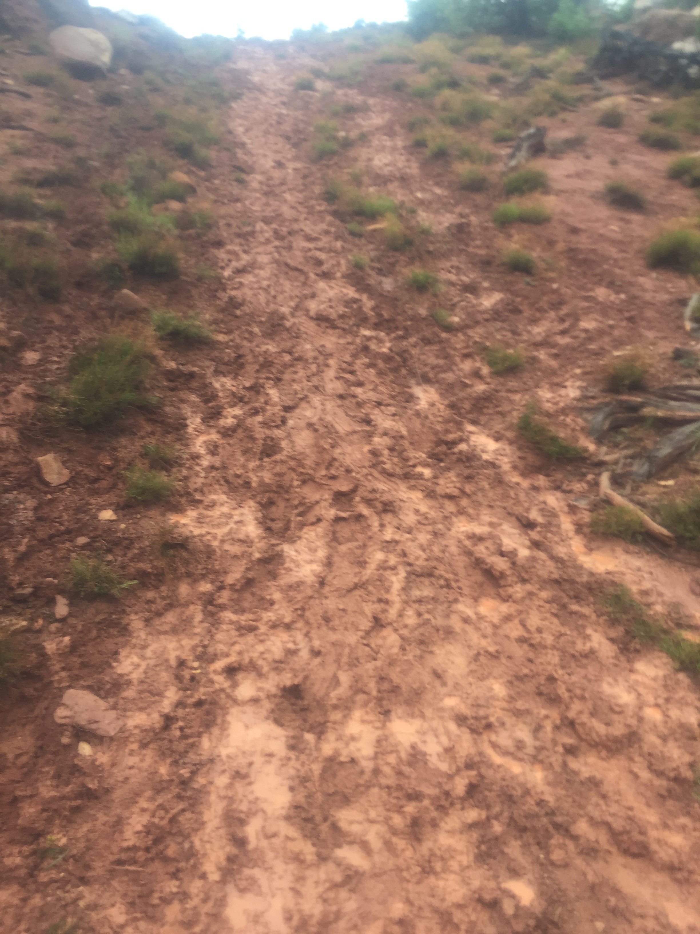
Super slop…just no way around it!
It started to rain about 1AM and rained off and on through the entire race. The rain made the trails a soupy sloppy mess and the course had to be altered at the last minute. I finished my half while Jeff pulled out at mile 22 of his 55k. The mud was relentless and we were both exhausted!
We took a rest day and walked to town for lunch the day after our race. Sam was glad to get outside.Though we love our National Parks we hate that you cannot take your dog with you on the trails. We understand the safety concerns and the trails are really too crowded for both people and dogs. Zion does offer one paved walking trail that pets are allowed on and we were thankful for it.
We really wanted to hike The Narrows which is water/river hiking. But spring runoff had the river running too high and wild to do this trip. We hope to come back in the fall for this one.
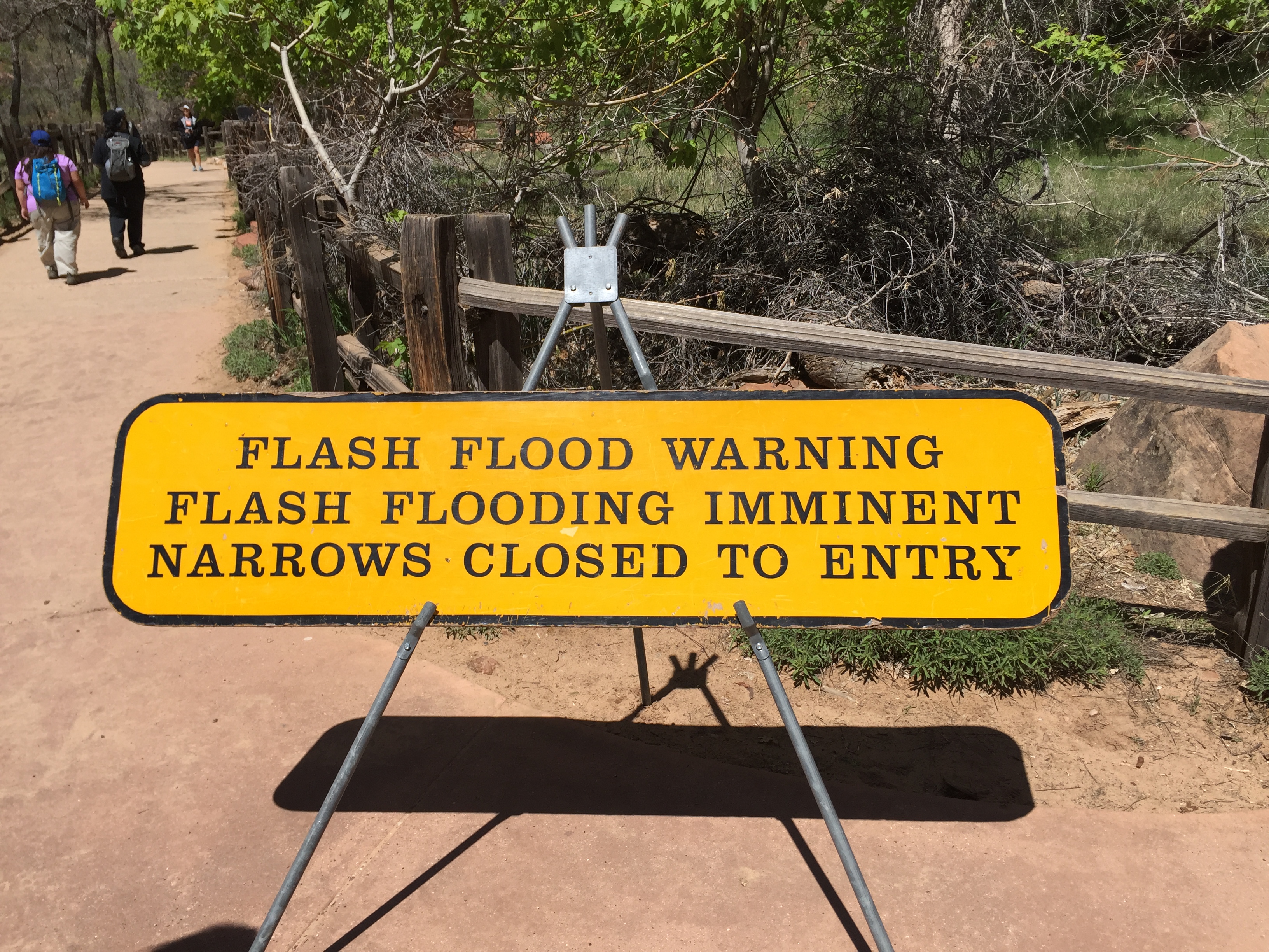
The Narrows…not assessable this trip
The little town of Springdale is within walking distance of the Zion campgrounds and a delightful place to grab lunch, ice-cream or coffee. It’s quaint and friendly, but I can only imagine what it would be like to get around in the height of summer tourism. Springdale is bracing itself for the estimated 5 million visitors expected to Zion this year, so if you are planning a trip pack your patience.
Lee’s Ferry, AZ
After leaving Zion we stopped over at Lee’s Ferry campground in Utah. What a gem of a find!
Lee’s Ferry is the only place for hundreds of miles where you have easy access to cross the Colorado River. Back in the mid 19th century it was the site of Lees ferry that provided a way to cross the Colorado River for those making their trek out west.
The water is smooth and calm here and is where all Grand Canyon rafting trips start their journey.
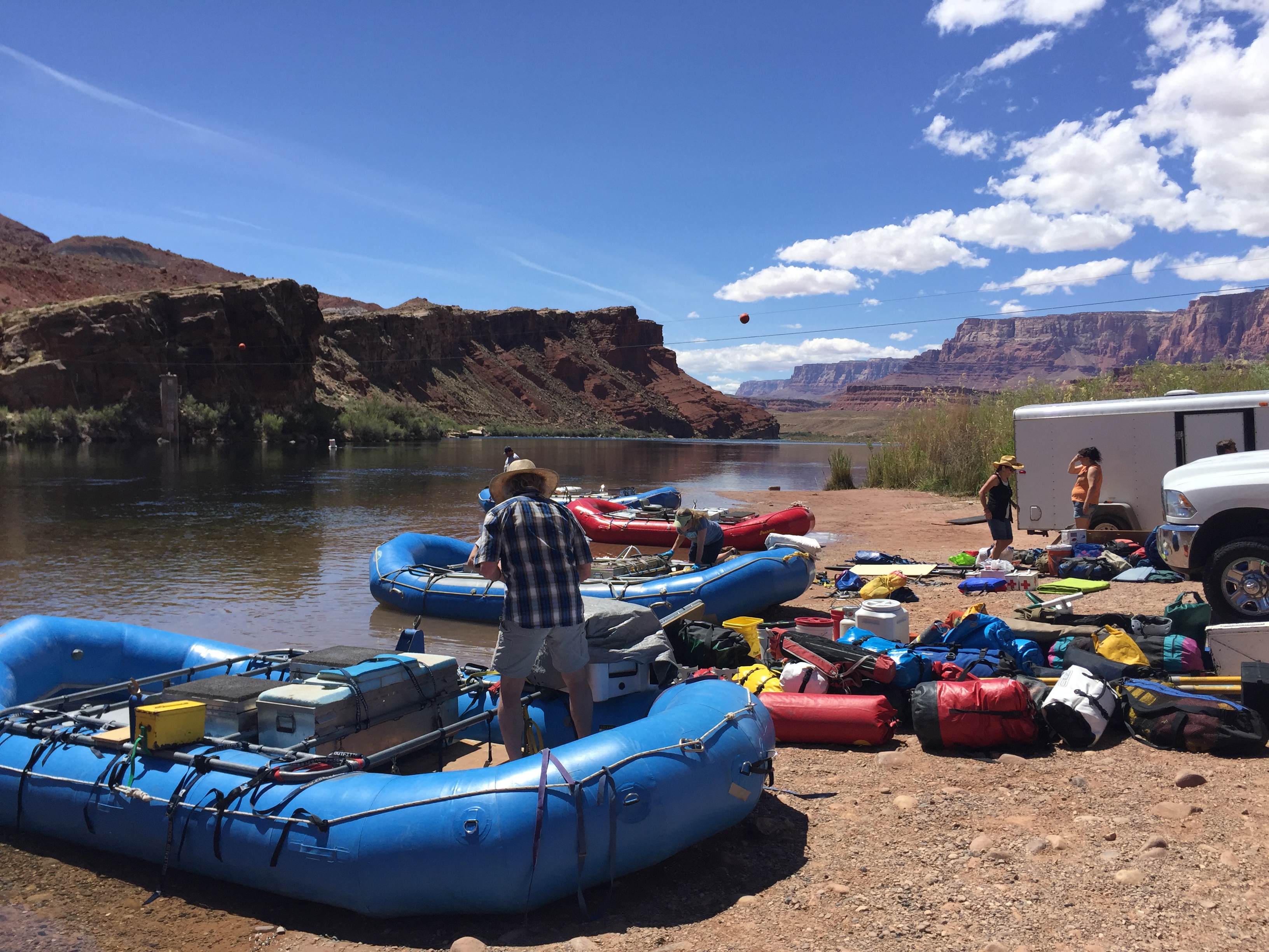
Grand Canyon float trips getting ready for 18-21 day trips. Look at those skies!
The little first come first serve campground is situated on a bluff overlooking the Colorado River. As with all the Canyonlands, the full beauty of Glen Canyon is revealed in the sunrise and sunsets and boy did it put on a show!
The rock formations glowed with the dawn and dusk sun so be sure to set up your chairs and take in the view!
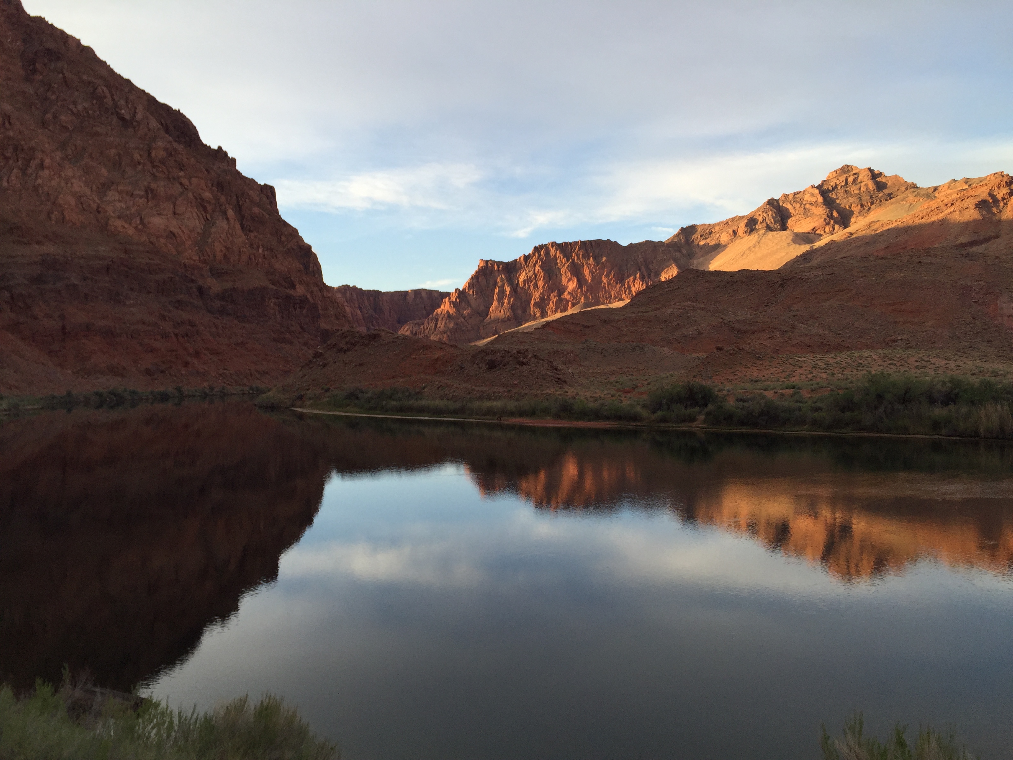
The beautiful Colorado River at Lees Ferry
Phoenix, KY, IL, MO, AR, OK, TX, NM, AZ, NV
Yup…in a matter of 9 days we crossed 9 states and 3 time zones. We flew to Louisville to pick up the Dometic show RV and drove it to National Hardware Show in Las Vegas.
This kicked off 5 weeks of non-stop driving and we are almost finished with our show responsibilities for this round. It has been a whirlwind for sure but next week we will be taking a weeks vacation in the majestic Yosemite National Park.
Stay tuned!
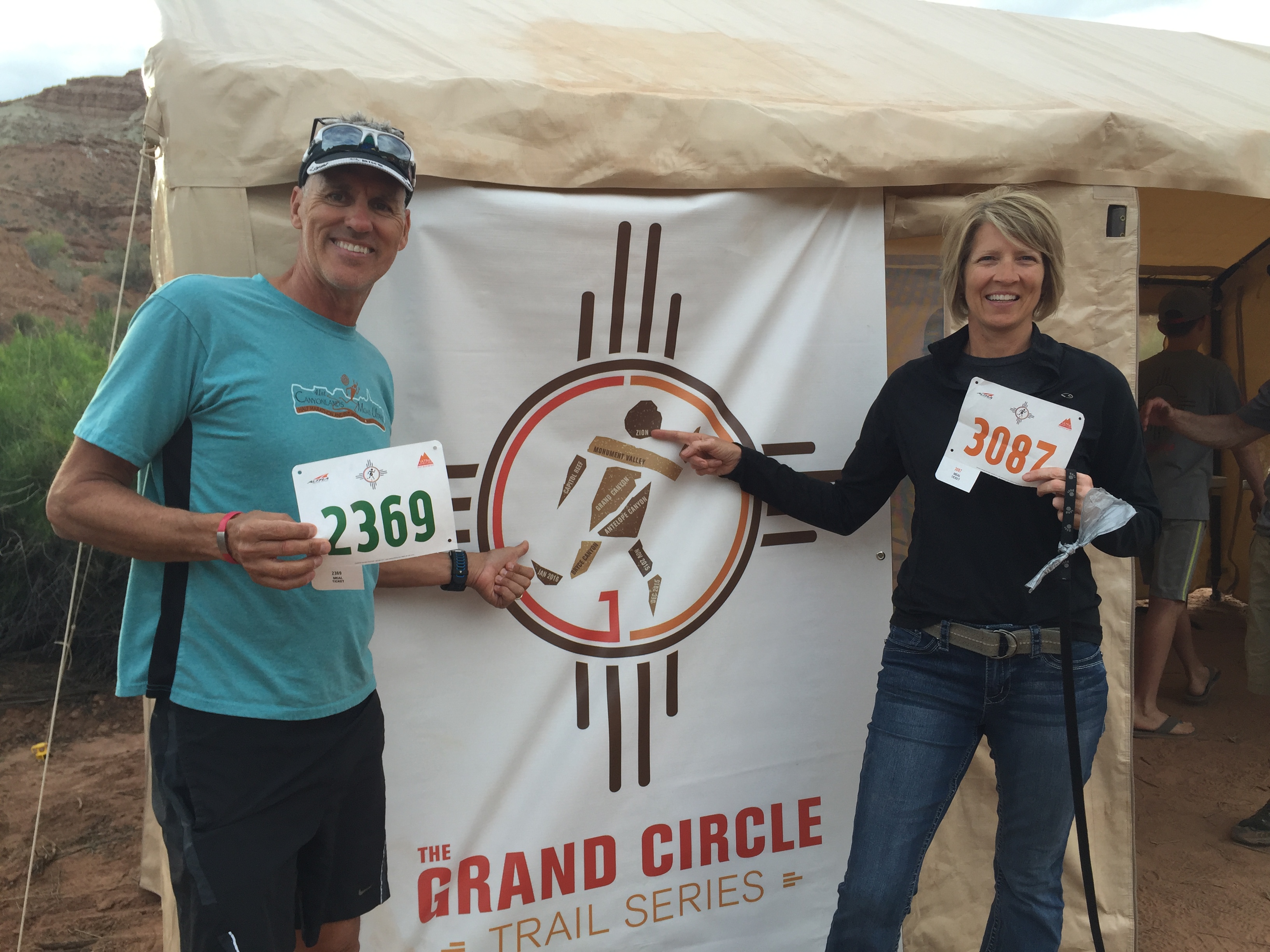
Zion 100…you kicked our butts!
