Posts Tagged California
Camp Hosting…Not for the Faint of Heart
Posted by Deb in California, Full Time RV, Running, RV Parks, Trail Run, Ultra Running on June 28, 2019
After meeting the Doheny State Beach park ranger last spring, Jeff and I committed to camp host for 3 months on the beach at Dana Point, CA.
Doheny State Beach is California’s very first state beach. It was named after oil tycoon Edward L. Doheny who donated 41 acres for public use on May 31, 1931. An additional 21 acres was later added by acquisitions from the Santa Fe Railroad, University of California and the Union Oil Company.
It was interesting to learn that Edward Doheny drilled the first successful oil well in the Los Angeles City Oil Field in 1892 that set off a petroleum boom in Southern CA.
After selling off his California oil properties, he was the first to drill for oil in Mexico and opened new oil fields in Venezuela.
He was later implicated in the Teapot Dome Scandal in the 1920’s, being accused of offering a $100k bribe gift to US secretary of Interior in connection with obtaining a lease of 32,000 acres of government-owned land. The 2007 film There Will Be Blood is loosely based on Edward Doheny.
This is our first experience camp hosting and we where set to make the most of our free coastal living in exchange for 15-20hr of “work” each week.
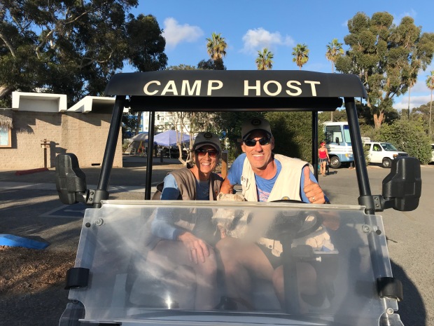
For those not familiar with Camp Hosting, RV parks, campgrounds and National Parks will offer a free campsite (usually with full hookups) in exchange for 15-20hrs/week of volunteer work. It’s a great benefit to the campgrounds to have camp hosts on site to monitor the comings and goings of campers and to help with grounds keeping, bathroom maintenance and selling of firewood.
It’s a win-win for both parties as it offers us full timers an opportunity to give back, have purpose and camp for free while providing the parks with much needed help.
Each campground has it’s own agreements with hosts with different expectations/responsibilities and length of stay. So understanding your roll prior to committing is quite important to having a positive experience.
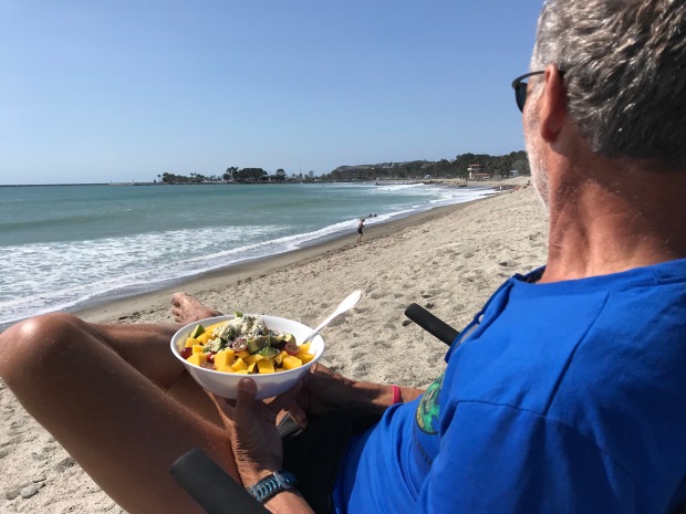
Beachside lunch
The reason we decided to make Doheny State Beach as our first experience was because it did not require cleaning of bathrooms or campsites, the campground is directly on the beach and it only required a 3-month commitment.
We showed up at Doheny a few days prior to our first day of work and did some training with the departing camp hosts.
Up at 5am to retrieve the camper log from the ranger station ½ mile from the campground with the provided golf cart. Drive around the campground to check registrations of campers, make stops around the shower houses, write up warnings to offending campers who string cloths lines from bushes or park in the landscaping. Then return the log back to the ranger station.
At 8am do a quick loop through the campground to remind campers that generator hours don’t start until 10am.
At noon it’s another trip around the campground to get those checking out to move along so that sites can be cleaned by staff before new campers start moving in about 1pm.
From 3-4pm we do an occasional loop to sell firewood for $7/bundle. We keep our RV door open until 8pm and make one more trip to remind folks that generator hours are over at 8pm before calling it a night.
We manage the campground with 1 other camp host couple and worked 2 days on/2 days off/3 days on. The following week we are 2 days off/2 days on/3 days off. That way we were off every other weekend. All hosts are flexible and if we needed a day off or just even a round covered, the other hosts were always willing to cover for us and us for them.
Easy peasy right?
So here is what really happens…
5AM while scanning the showers, if a door is closed and locked it usually means there is a homeless dude or meth-head encamped in the private confines of a shower stall. Whether they have chosen to take a sh*t in said shower stall is always the mystery when the ranger shows up to remove said homeless dude.
Removed these leftover with a stick and made $.55 in the process
Place “friendly reminders” on windshields of those who showed up after hours that they must report to the kiosk to get their tags. Some are legitimate campers with reservations. Others are trying to camp for free by showing up late and leaving early. The ranger issues tickets to offending parties.
8AM we get to delay camper’s consumption of coffee by having them turn off their generators until 10AM. You can imagine how that is received.
Usually between 12-3pm we escort more homeless folks out of the campground who are trying to use the showers, toilets or picking aluminum out of the trash cans or are simply trying to walk off with campers bicycles, cell phones and wallets.
Occasionally we call the rangers on non-camper interactions that involve drug use and/or mental health crazy talk. Excuses for their presence is usually brushed off as they are there to “see a friend” or “a photographer taking family pictures” all the while walking off with someones generator with the extension cord dragging behind.
We’ve also dealt with groups of homeless folks that get one campsite then invite 14 of their friends for late night raves. According to the rangers, there is nothing that can be done since they paid for a campsite.
And when you confront non-campers they usually excuse their poor behavior by saying they are a veteran, saying they are helping veterans or give you a hardy, “God bless you”.
Luckily we only had two midnight knocks on our door that involved loud music. And another incident that involved a car egging after a large group of noisy campers ticked off their neighbors. According to the large group their music was “barely audible”.
I’m not going to lie. The first couple of weeks were a challenge seeing the overt drug use and mental health issues that this campground is surrounded by. But after that we developed quite a sense of humor about it all and realized that MOST people were opportunists rather than physical threats.
Despite some of the riff raff, we met a lot of great campers and got to spend a season living on the coast of California…for free.
Would we do it again?
We committed going back in October!
Doheny State Beach is located in the wonderful community of Dana Point. Within walking distance we had nice restaurants, grocery shopping and the Pacific Coast Trail to run and cycle.
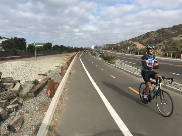
Pacific Coast Trail
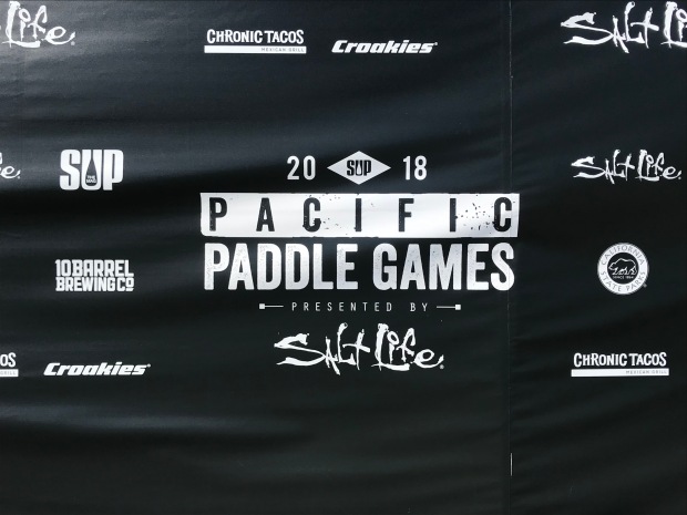
Paddle Games
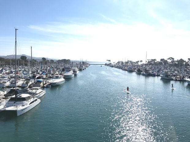
Dana Point Marina
It was a great location for the 10K Spooktacular Halloween run, 10K Turkey trot Thanksgiving Day run, the Cuyamaca 100k trail run and the Glamis Sand Dunes Veterans Day clean up.
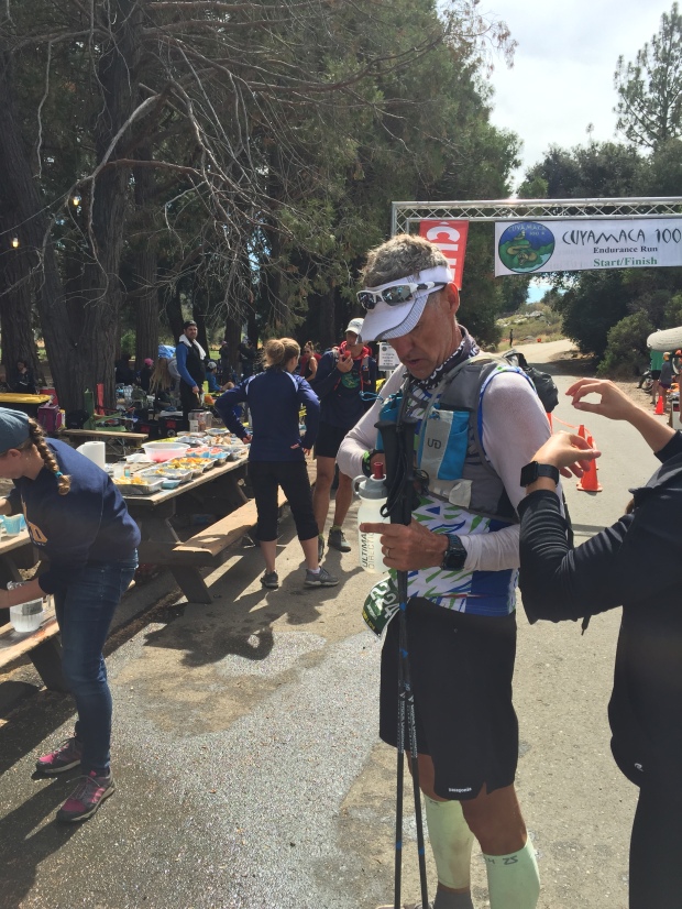
Cuyamaca 100K
We also drove to Newport Beach for the famous Christmas boat parade and took a trip to San Diego to have Thanksgiving dinner with some RV buddies.
Overall we really enjoyed spending fall/winter in shorts and t-shirts in southern California and look forward to returning to the coast in October.

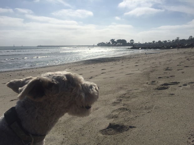
Surfer Jeff
Getting High on Mt. Whitney
Posted by Deb in Boondocking, Bucket List, California, Full Time RV, Highest Peaks, Hiking, Uncategorized on October 3, 2016
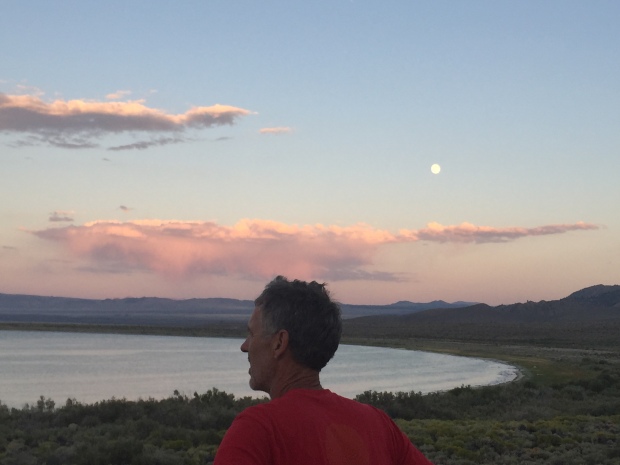
Full moon rising over Mono Lake
After leaving Seattle we had three weeks to make our way to Phoenix. Our working travel schedule gave us a deadline and unfortunately we were headed into the belly of the hot molten volcano in the middle of summer. 106 degrees here we come!
We made quick stops in Eugene and Ashland, Oregon, Redding, CA and Reno, Nevada on our way to Mono Lake, CA.
I had read about some great boondocking at Mono Lake on the eastern side of Yosemite. This really would be our last stop at any elevation (6,378’) in order to avoid the southwest heat. Also, when we were in Yosemite in May, we never made it to Tioga Pass. So stopping at Mono Lake would give us that opportunity.
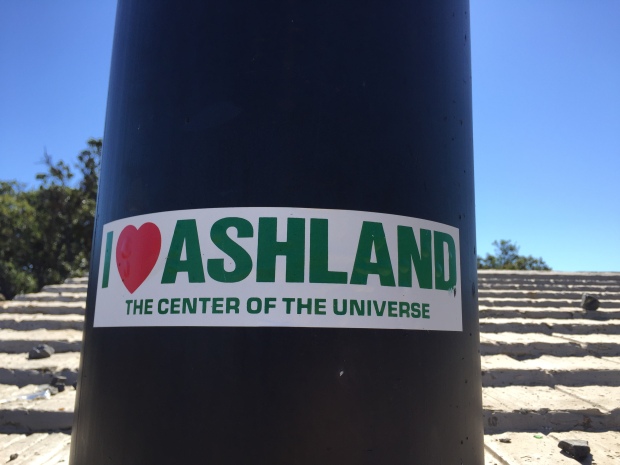
Quick stopover in Ashland, OR
Well, that was the plan anyway…
Last year about this time, Jeff asked me a question about doing something epic, challenging or scary and I blurted out that I would like to hike the highest peaks in each state. A week later I had bagged my first…Mt. Humphreys in Flagstaff, AZ. at 12,633ft.
Ever since then I have been researching the highest peak of each state that we traveled in 2016. Unfortunately, we have been traveling the states with the highest peaks overall that have been snow covered and required ice axes, crampons, repelling equipment, permits, guides, tents, backpacks, etc. MUCH more equipment than what we have.
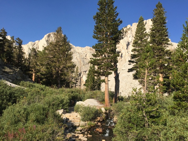
So when I read about hiking California’s massive Mt. Whitney at 14,505ft, the highest peak in the contiguous US and it’s accessibility in late summer, I knew California was an attainable peak.
And look. It just happens to be down the road from Mono Lake! Change of plans…we are hiking Mt. Whitney!
Getting an early start…just not early enough!
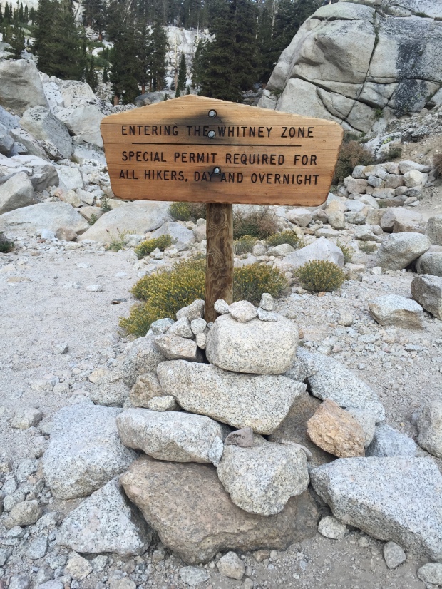
The Mt. Whitney Trail Head starts at Whitney Portal at 8,360ft via the small town of Lone Pine, CA. A permit is required for this hike and the online permit system said that there were no permits available. Learning from our experience at Yosemite we stopped in at the Forest Service center just south of Lone Pine and easily picked up a permit and mandatory “WAG Bag” (Waste Alleviation and Gelling-Bag) for the next day.
Everything I read about this hike said that this VERY STRENUOUS hike could be bagged in one very long day (12-18 hours), although most people take two. Its 22 miles round trip with 6,100ft of elevation gain, topping out at 14,505ft.
Since Jeff and I had spent the better part of the past month at Sea Level, we knew that this was going to be quite a challenge in elevation and distance. One I was not completely confident in completing. But I knew that what goes up must come down and I could turn around at any point in the hike if it got to be too much for this land lubber.
Walk this way!
The morning of our hike we got off to a late start, leaving the Whitney Portal TH at 6:30AM instead of our planned 5AM. Apparently we didn’t do enough research because most hikers leave around 1-3AM for this hike. For me, this was mistake #1!
Jeff tends to futz with his equipment, shoes, GPS and phone A LOT longer than I have patience for (sigh) and I headed off on the trail to get a jump. Jeff hikes much faster than I and I knew it wouldn’t take long before he would catch up with me.
What is really hilarious now is that Jeff had read that some folks were getting Verizon Cell coverage on the top of Mt Whitney, so his plan was to get to the top by 10AM for a conference call.
GEEZ! WHAT ON EARTH WERE WE THINKING?!?
I started at the TH and quickly passed the 6-10 informational boards that described the tenacity needed for such a hike. No need to read those of course…we have a conference call to make!
Immediately the trail started with a moderate incline. The sun was up just enough that no headlamp was needed and I made mistake #2 by leaving it in the truck. After an hour on the trail there was a beautiful sunrise that was enhanced by the smoke from the San Bernardino fires that were burning out of control at the time.
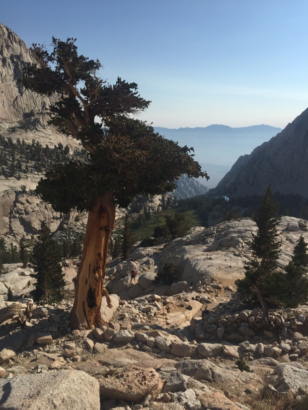
Lone Pine Lake
After about 3 miles I reached Lone Pine Lake. At this point Jeff still had not caught up with me and I grew a bit concerned. Come to find out he took a wrong turn at the beginning of the trail and got on the rugged Mountaineer’s route to Mt. Whitney. He noticed his mistake after about a ½ mile and turned around. That does tend to happen when you hike and post selfies on facebook at the same time!
Jeff finally caught up with me and it was clear that it was going to be a challenge to get to the top before the 10AM conference call. So I sent him ahead to try and make it without me holding him back…with our water filter. Mistake #3 (at least for me).
After Lone Pine Lake the nice smooth trail quickly changed over to a rockier surface. Footing became a bit more of a challenge as trees thinned out. I passed Outpost Camp with its gorgeous waterfall at a little over 10,000ft. There were a lot of backpackers here stopping to acclimatize on their 2-3 day summit push.
“Gee…Maybe I aught to look into some overnight equipment, scratching my head!
I hit a long patch of switchbacks after Outpost Camp.
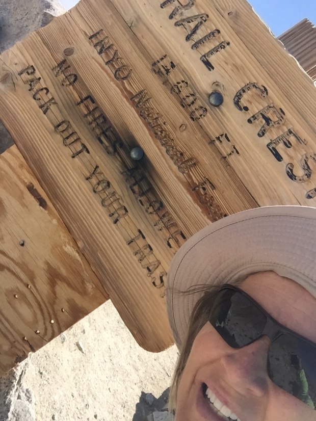
In my quick glance lengthy research of this hike I remembered reading about a section of the trail called “the 99 switchbacks” that came after a campground.
The trail turns rugged
I got pretty excited because I new that the 99 were around mile 7. “Wow, I’m making great time”! I asked a fellow hiker coming down if I was on the infamous 99. Imagine my surprise when she told me, “ Oh no. You have quite a way to go before you get to the 99”.
About this time I saw a trail marker that said Mile 4! I. WAS. CRUSHED!
By now my heart had been pounding in my ears for almost 3 hours. The elevation had reduced my hiking to 45min miles. THIS WAS GOING TO BE A LOOOONG DAY.
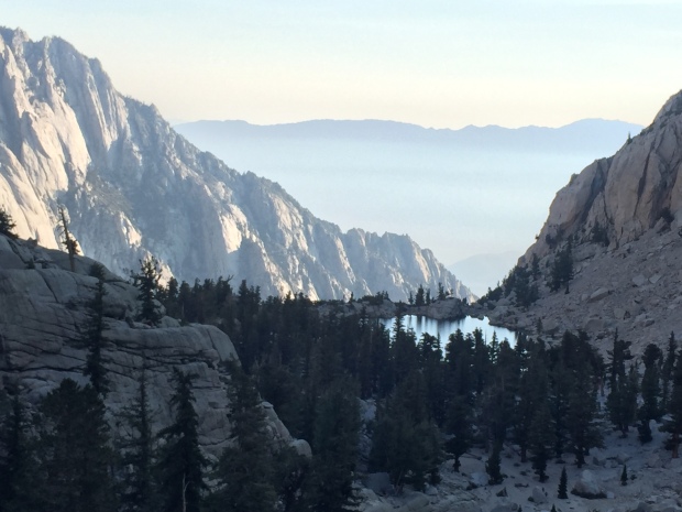
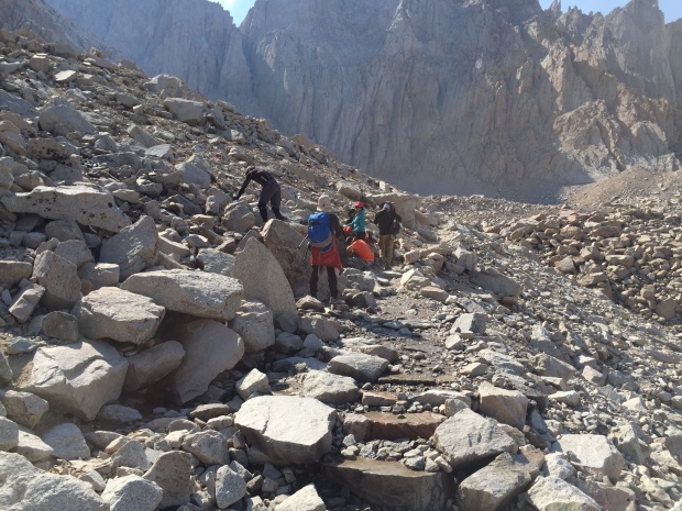
The trail switched from dirt and rocks to granite stair steps. I rose high above pretty Mirror Lake and Meadow. After another 1 ½-2 hours I finally reached Trail Camp at 12,039’.
Trail Camp is located on the shore of Consultation Lake. It could have been on the moon as far as I was concerned due to its barren landscape and granite spires. The camp was full of backpackers as well and by now I’m thinking these people are geniuses for breaking this hike up into several days!
I stopped here for a snack and contemplated the 99 switchbacks that were now staring me in the face. That’s 2.2 miles of switchbacks climbing 1,738’ to Trail Crest. I’m not going to lie…I thought long and hard about stopping here and just calling it a day. But after eating some food and catching my breath I decided to give the 99 a shot.
Surprisingly, the switchbacks were set at a low grade, which was much appreciated at this altitude. After what seemed like 999 switchbacks I finally rounded a corner and was hit with an amazing view to the west. Granite rising up, alpine forests and lakes below. My eyes had trouble taking it all in. I get teary-eyed just thinking about it now.
Reaching Trail Crest at 13,600′
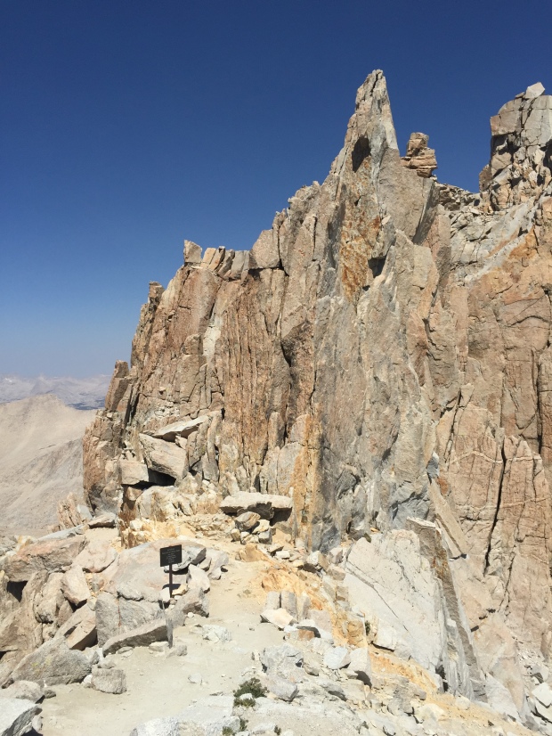
What’s around that granite spire?
I made it to Trail Crest at 13, 800’!
The Mt. Whitney summit is 2.5 miles from here and a mere 845’ of elevation. But these are the most difficult and most draining 2.5 miles of your life…so I’ve heard.
Once I reached Trail Crest I was for sure going to turn around. But after I sat for about 20 minutes and ate some food and got inspired by the beautiful views I started wondering what was just around the corner.
The trail from here took a dip and I really thought hard about having to make up the elevation I had already climbed. But the trail drew me in and I pressed on, “just a little further”.
The trail from Trail Crest is brutal. BRU.TAL!!!
The trail is in there somewhere
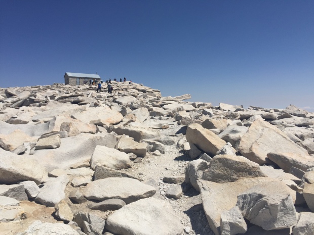
I scrambled for the next mile over unstable rocks, angular slabs, shear drops and technical boulders. After an hour I sat down for a break and saw the Smithsonian hut on the summit off in the distance. By now I was exhausted. The narrow single track trail was closing in. I was having moments of panic as my mind flashed back to my broken wrist less than a year ago.
I asked another hiker how much longer until the summit. When they responded, “about 2 hours” I was finished!
By now it was 12:30pm. I had been hiking 6 hours with 2 more hours to go. I did the math and figured it would take me 4 hours just to get back to this point on the trail. My heart sank realizing I was going to run out of water and day-light, without a filter that was with Jeff and headlamp that was securely back in the truck.
It killed me to be this close and have to call the hike. Just 1.5 miles left to the summit. For me, it had to be over!
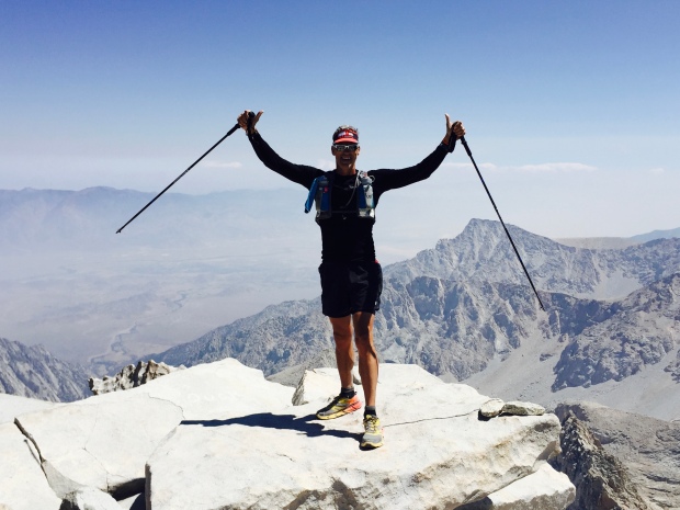
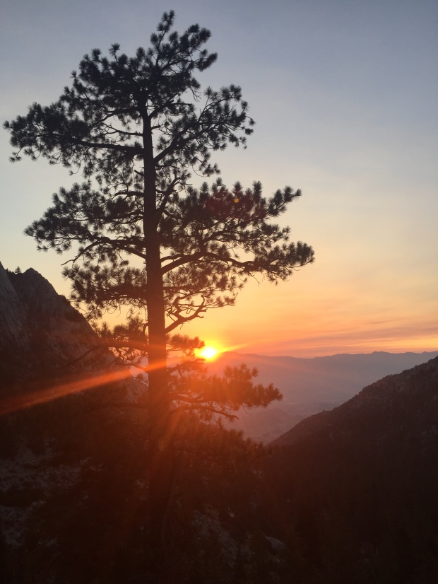
Jeff perseveres! Highest point in the lower 48!
About this time I met Esther. She was making her way back down the mountain after summiting. Wisely, she had left with her husband at 3am.
They had started this hike a few days before, but her husband Joe wasn’t feeling well and they turned around. This morning they started off at 3am again and again Joe didn’t feel well. He encouraged his wife to carry on so that one of them would make it. And that she did!
We started hiking together from here, retracing the technical trail back to Trail Crest. We both moaned at the section where we had to climb in elevation to get there, commenting about our pounding heads.
Down the 99 we went, past camps, meadow, lakes and waterfalls. All the while talking about our lives of adventure and travel. I learned about her amazing two daughters and could hear the affection she had for her husband of many years.
Second half of the battle is getting back down!
Our knees and quads were wearing down, but our time together made the trip so much better. I learned she and Joe take off their real estate business months at a time to travel. Check out their very well written blog here.
We arrived at the TH not a step too soon at 5:30pm, as the sun was going down. I got to meet Joe and instantly noticed they have a relationship like Jeff and I. Those rare relationships when a husband and wife actually like each other, have the same life pursuits and miss each other when we are not together. I can appreciate a happy couple!
I had gotten a text from Jeff that said that he had summited around 2pm, four hours after his missed conference call.
Joe and Esther were kind enough to give me a ride back to my RV Park in Lone Pine, knowing that Jeff would not be down for another 3 hours. I left the keys hidden in the truck so he could drive himself home.
Even though I missed reaching the summit I couldn’t be more proud for reaching 13,000+ feet and hiking 20 miles.
Thanks Esther for getting me down that mountain!
Mt. Whitney, I will be back! But next time I will leave earlier and not plan on making any calls!
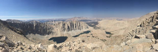
Westerly view from Trail Crest 13,600′
Anarchy in the desert of Borrego Springs CA
Posted by Deb in Boondocking, Borrego Springs, California, Full Time RV on January 9, 2015

Full moon over Borrego Springs
We’ve met tons of new people in the desert at Borrego Springs.
Most RV’ers are drawn to this area to spend winter for the plentiful sunshine, be-still-my-heart 70+ degree January temps and thousands of acres of free camping. Our nearest neighbor is a football field away, yet walk by your neighbor’s camp and you will be greeted with a hearty hello!
We’ve been invited to an outdoor movie/meet-up with a large group of full time, location independent 30-40 something road warriors who have bucked the system and work from their Airstreams, vintage bus or motorhome. Conversations usually revolve around connectivity, data plans, drones, instagram hash tags, is whiskey spelled with an “E” or without, local brews, holding tank management and local farmers market.
-
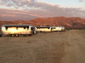
- Hip Airstreamers
-

- Airstream meetup
This is a group of hipsters for sure and Jeff and I went from being some of the youngest in this desert community to being the oldest. But that hasn’t kept us from being invited to the afternoon happy hours, taco tuesdays, nightly bonfires or karaoke night.
Various jobs amongst the tribe include a composor/musician, web and app developers, writers, investment trader, road schoolers, photographer and professional bloggers. It was an inspiration to meet everyone living their version of “the dream” right from their 80-360 square feet of what they call home.
The blog and instagram roll of our group is:
AirstreamLife, Aluminarium, @asolojourner, @dreaknufken,
@journeywithhappiness, @kmpuccio, @malimish_airstream, @russhaynie,
Rolling Recess, @sethkhughes, Tehcnomadia, @theroamingpint,
The Scenic Route, @toddmb, ToSimplify, @upintheairstream, VanTramp, Wheelingit
One evening kicked off with what the group dubbed, “Soup Anarchy”. Everyone brought an ingredient or can of soup and we dumped it all in one pot…like a Hairy Buffalo, but with soup instead of booze. No rules, just wild, throw-caution-to-the-wind, dump what pleases you, into the pot. Ok. There may have been some booze slipped it somewhere because…it is soup anarchy after all!
-

- Anything goes into the pot
-

- Cheri of Technomadia throws in her contribution to the uprising
-

- Let the rebellion begin
It was BYOBS (Bring your own bowl and spoon) and set up a chair for a soup anarchy inspired movie. The selection of movie was picked from films that had to do with soup, anarchy or RV’s. We ended up with “The Adventures of Power” which by the way had nothing to do with anarchy or soup. It did have a split second flash of a vintage bus, and that was good enough for us. It was a quirky, hilarious, sweet movie about a guy named Power who tries winning an air drum competition. Yes, it really was as awful as it sounds. But the film was made memorable by a funky group of RV’ers watching a movie on the side of a vintage bus in the desert. How cool is that?
Borrego Springs has been a memorable stay and a place to come back to for sure, especially if there is an opportunity to see our new community of friends.
We plan on being here for another week before heading back to Quartzsite to the largest gathering of RV’ers in the country. So we may have more to report on Borrego Springs before we go.
Stay tuned!

Can a movie be awful and awesome at the same time?
