Archive for October, 2016
Flagstaff and The Fearsome Four
Posted by Deb in Arizona, Arkansas, Boondocking, Destinations, Full Time RV, Highest Peaks, Hiking, Running, Trail Run on October 21, 2016
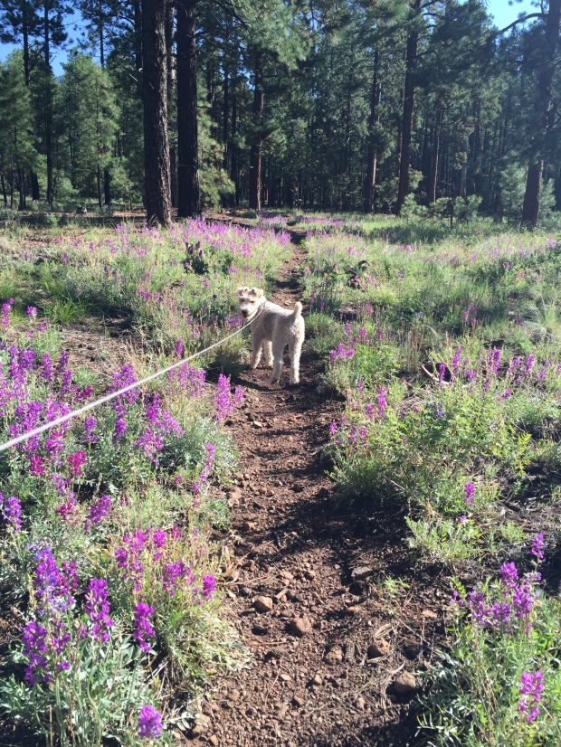
Sam back on the Arizona Trail
August 21-September 21, 2016
After climbing to new heights at Mt. Whitney Jeff and I had about a week before needing to be in steamy Phoenix for business travel. We wanted to camp where we could get a break from the heat just a little longer, so we headed straight for Flagstaff, Arizona.
We’ve been camping in Flag off and on for the past year, one of our favorite locations. There is an abundance of free forestry land to camp in with endless trails to run, hike or mountain bike just outside your door. This and being close to town makes us feel like we live in the community. Flag is definitely familiar to us now and there is no need for GPS to get around town any more.
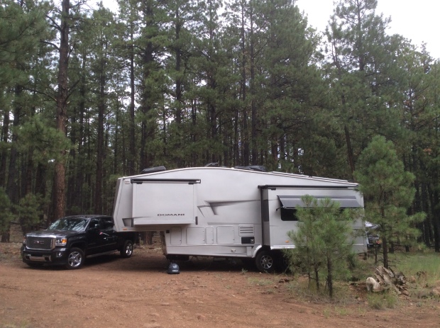
A delightful sunny spot amongst the trees
Not only was the 70 degree temps sublime, but Jeff has been training for the Stagecoach 100. Stagecoach is a 100 mile ultra trail run that starts in Flag and ends at the IMAX theater at the Grand Canyon. Jeff is running a relay with a buddy. 55 miles for Jeff and his friend Jason running 45. Since the race was just 4 weeks away some high altitude trail training was in order.
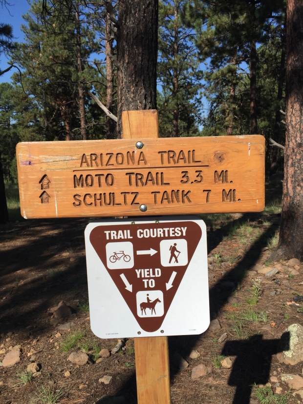
We camped at a new boondocking site on FR6051 near Snow Bowl on the North side of town. The road was a bit rough, but we were able to wedge our modest 32’ into a nice spot for maximum solar gain. There are endless forestry roads here with several short spurs that connect directly to the Arizona Trail. So getting in our trail runs was a piece of single track cake!
Oh Arizona Trail, how I love thee!
One of the first things we usually do when getting to a new location is to see if there are any running events happening during our stay. We have done this in Moab, Chico and Whistler among others, and it keeps us motivated to get out and exercise on a consistent basis. Without the motivation I would struggle with the RV-15 (think freshman-15) and bedsores!
One of the things we learned about is the Flagstaff Fearsome Four Challenge. Four peaks, 34 miles, 10,307 of elevation over 2 days. Sure…why not! As part of Jeff’s ultra training this challenge was right up his ally.
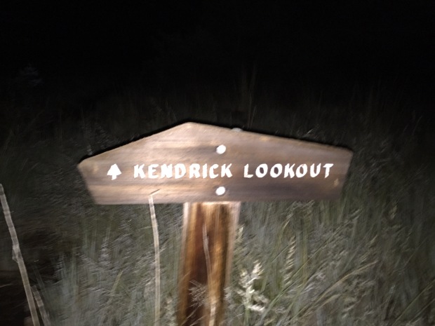
Here is how the challenge works. Hike or run Humphreys Peak, Kendrick Peak, Mount Elden and O’Leary Peak in any order. If you accomplish this challenge under 15 hours (not including driving time) in a 24hr period you are honored with the status of “Ultra” runner. Well then. Lets get to it!
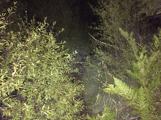
Things that go bump in the night…what was that noise?
Jeff started at 1am at Kendrick Peak. Besides being scared by some sort of large animal in the woods, this was pretty uneventful. Humphreys Peak, the highest peak in Arizona and most challenging of the four, was next. Jeff ran into a couple of trail runners that run Humphrey’s 9 miles in under 3hrs, twice as fast as I hiked this beast! It had snowed on this peak the day before, so some of the trail was still covered.
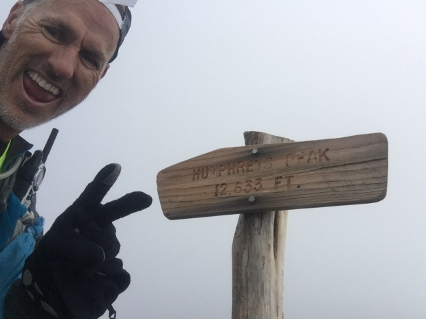
Summit of Humphrey’s Peak
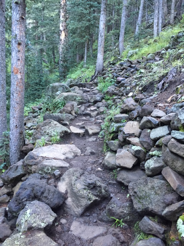
Rugged trail
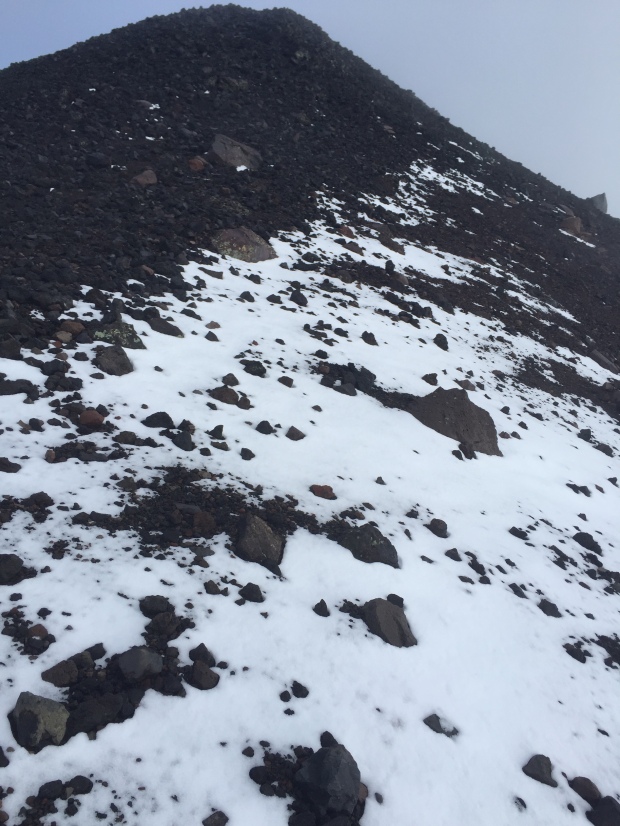
Snow covered trail
After a brief refueling of bacon and a nap at the RV it was on to Elden and O’Leary’s peak. Sam and I joined Jeff for the final two hikes. Though Elden is a short 4-5 miles round-trip, it is very rocky, technical and steep. We were glad to be hiking this one in the daylight!
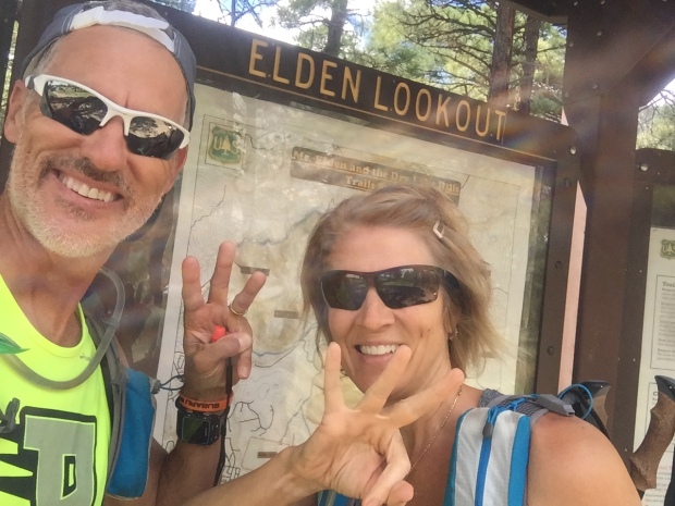
Third peak in the bank!
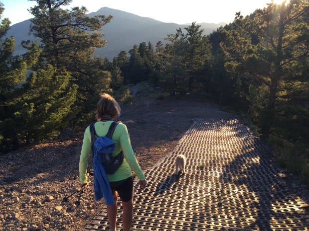
Heading further north we finished with O’Leary’s. This trail was a well-groomed forestry road all the way to O’Leary’s lookout, where we took in sunset views before racing back down the mountain to finished after dark.
Jeff did an amazing job coming in under 15 hours for the Fearsome Four and we celebrated with some late night BBQ!
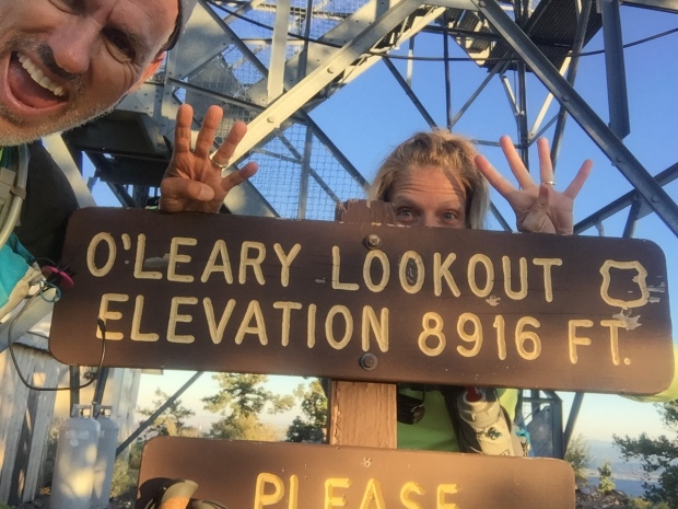
Number four…O’Leary Lookout!

Racing the sun
Steapest section at O’Leary Lookout
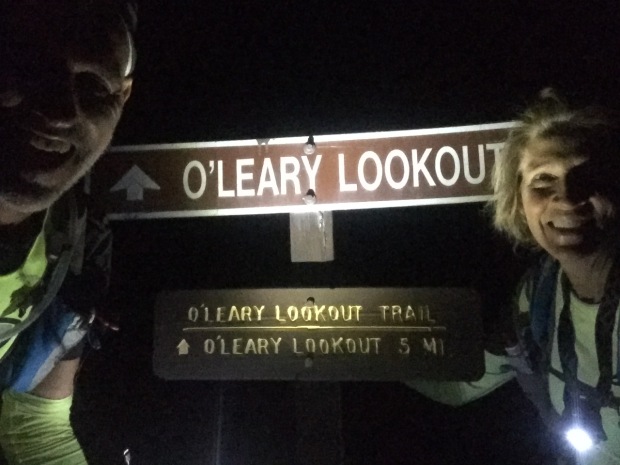
After dark finish!
The next day we packed up and headed for Phoenix where we jumped on a plane and flew to Dallas. The Dometic show vehicle needed to be transported to Elkhart, Indiana for the RV industries open house.
A stop over in Bentonville, Arkansas was in order and we stayed for two weeks. This gave us a chance to check on family and our beloved Beaver Lake cabin.
I tell ya, when I sit on that porch swing overlooking the Lake, it’s hard to think of ever leaving! I love the smell of fresh lake water, hearing fish flopping in the early morning hours, swimming in water so clear you can scuba dive. I love that I can lace up my shoes and go for a run on lake roads that only a few locals travel. I ended up with 5 of the neighborhood dogs on one of my runs, which helped with missing Sam on our trip.
The view from our deck
Well hello humidity! Where have you been?
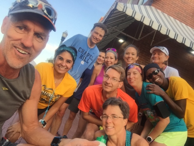
Getting in a Saturday morning run with friends
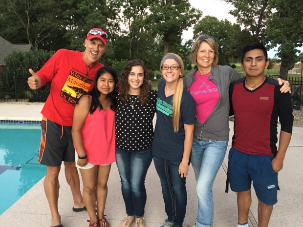
Quick visit with two of our Guatemalan students in AR on Walton Scholarships to John Brown University…so proud of them!
Arkansas is a beautiful place to call home for sure and I always shed a tear when we leave. But the road calls, and we must go and off to Elkhart we went.
We arrived over the weekend so that we could visit with some wonderful friends. The open house went well and we headed south with the RV to Louisville before flying back to Phoenix. It was a hard pressed 3 week trip and we were glad to get back to our dog and our RV.
With only 3 days before the Stagecoach 100, we were rushing again to get back to Flag for the race. So after landing at 6:45am, we picked up our dog and were on the road with the RV by 9am, and parked in the woods by that afternoon.
Holly moly…that was a tiring trip!

Getting High on Mt. Whitney
Posted by Deb in Boondocking, Bucket List, California, Full Time RV, Highest Peaks, Hiking, Uncategorized on October 3, 2016
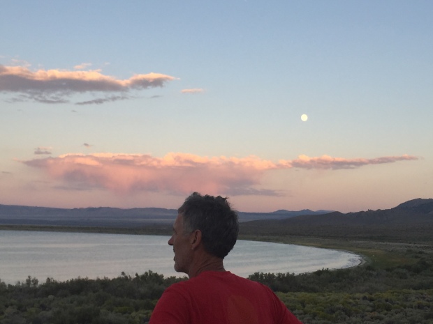
Full moon rising over Mono Lake
After leaving Seattle we had three weeks to make our way to Phoenix. Our working travel schedule gave us a deadline and unfortunately we were headed into the belly of the hot molten volcano in the middle of summer. 106 degrees here we come!
We made quick stops in Eugene and Ashland, Oregon, Redding, CA and Reno, Nevada on our way to Mono Lake, CA.
I had read about some great boondocking at Mono Lake on the eastern side of Yosemite. This really would be our last stop at any elevation (6,378’) in order to avoid the southwest heat. Also, when we were in Yosemite in May, we never made it to Tioga Pass. So stopping at Mono Lake would give us that opportunity.
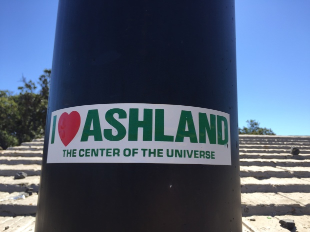
Quick stopover in Ashland, OR
Well, that was the plan anyway…
Last year about this time, Jeff asked me a question about doing something epic, challenging or scary and I blurted out that I would like to hike the highest peaks in each state. A week later I had bagged my first…Mt. Humphreys in Flagstaff, AZ. at 12,633ft.
Ever since then I have been researching the highest peak of each state that we traveled in 2016. Unfortunately, we have been traveling the states with the highest peaks overall that have been snow covered and required ice axes, crampons, repelling equipment, permits, guides, tents, backpacks, etc. MUCH more equipment than what we have.
So when I read about hiking California’s massive Mt. Whitney at 14,505ft, the highest peak in the contiguous US and it’s accessibility in late summer, I knew California was an attainable peak.
And look. It just happens to be down the road from Mono Lake! Change of plans…we are hiking Mt. Whitney!
Getting an early start…just not early enough!
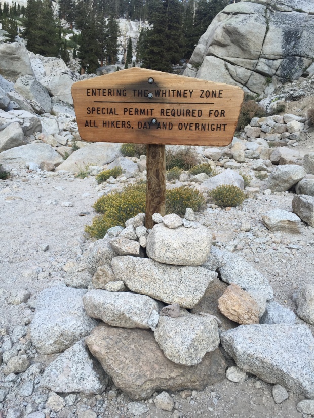
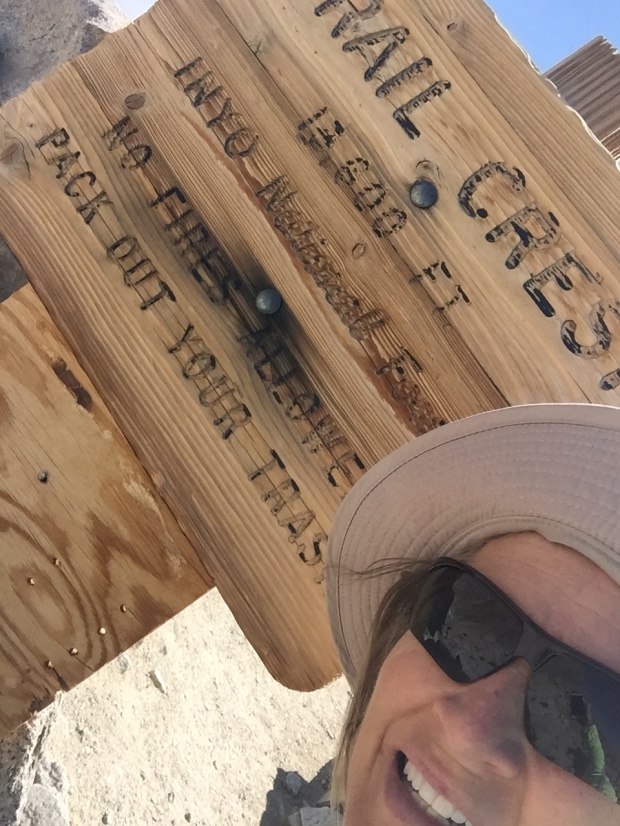
The Mt. Whitney Trail Head starts at Whitney Portal at 8,360ft via the small town of Lone Pine, CA. A permit is required for this hike and the online permit system said that there were no permits available. Learning from our experience at Yosemite we stopped in at the Forest Service center just south of Lone Pine and easily picked up a permit and mandatory “WAG Bag” (Waste Alleviation and Gelling-Bag) for the next day.
Everything I read about this hike said that this VERY STRENUOUS hike could be bagged in one very long day (12-18 hours), although most people take two. Its 22 miles round trip with 6,100ft of elevation gain, topping out at 14,505ft.
Since Jeff and I had spent the better part of the past month at Sea Level, we knew that this was going to be quite a challenge in elevation and distance. One I was not completely confident in completing. But I knew that what goes up must come down and I could turn around at any point in the hike if it got to be too much for this land lubber.
Walk this way!
The morning of our hike we got off to a late start, leaving the Whitney Portal TH at 6:30AM instead of our planned 5AM. Apparently we didn’t do enough research because most hikers leave around 1-3AM for this hike. For me, this was mistake #1!
Jeff tends to futz with his equipment, shoes, GPS and phone A LOT longer than I have patience for (sigh) and I headed off on the trail to get a jump. Jeff hikes much faster than I and I knew it wouldn’t take long before he would catch up with me.
What is really hilarious now is that Jeff had read that some folks were getting Verizon Cell coverage on the top of Mt Whitney, so his plan was to get to the top by 10AM for a conference call.
GEEZ! WHAT ON EARTH WERE WE THINKING?!?
I started at the TH and quickly passed the 6-10 informational boards that described the tenacity needed for such a hike. No need to read those of course…we have a conference call to make!
Immediately the trail started with a moderate incline. The sun was up just enough that no headlamp was needed and I made mistake #2 by leaving it in the truck. After an hour on the trail there was a beautiful sunrise that was enhanced by the smoke from the San Bernardino fires that were burning out of control at the time.
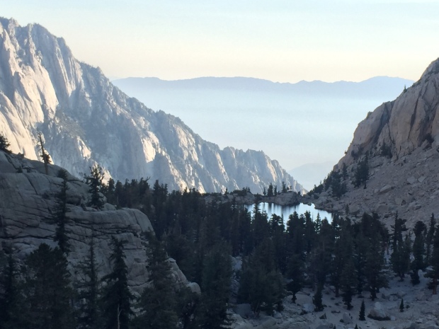
Lone Pine Lake
After about 3 miles I reached Lone Pine Lake. At this point Jeff still had not caught up with me and I grew a bit concerned. Come to find out he took a wrong turn at the beginning of the trail and got on the rugged Mountaineer’s route to Mt. Whitney. He noticed his mistake after about a ½ mile and turned around. That does tend to happen when you hike and post selfies on facebook at the same time!
Jeff finally caught up with me and it was clear that it was going to be a challenge to get to the top before the 10AM conference call. So I sent him ahead to try and make it without me holding him back…with our water filter. Mistake #3 (at least for me).
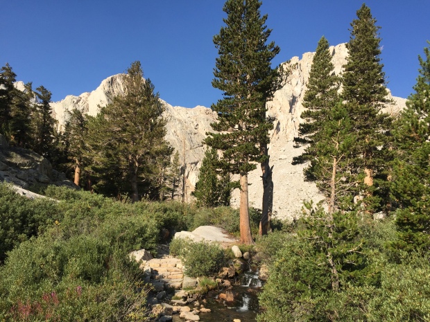
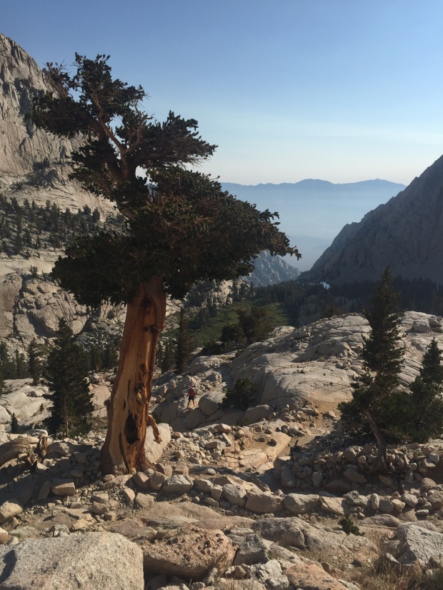
After Lone Pine Lake the nice smooth trail quickly changed over to a rockier surface. Footing became a bit more of a challenge as trees thinned out. I passed Outpost Camp with its gorgeous waterfall at a little over 10,000ft. There were a lot of backpackers here stopping to acclimatize on their 2-3 day summit push.
“Gee…Maybe I aught to look into some overnight equipment, scratching my head!
I hit a long patch of switchbacks after Outpost Camp.
In my quick glance lengthy research of this hike I remembered reading about a section of the trail called “the 99 switchbacks” that came after a campground.
The trail turns rugged
I got pretty excited because I new that the 99 were around mile 7. “Wow, I’m making great time”! I asked a fellow hiker coming down if I was on the infamous 99. Imagine my surprise when she told me, “ Oh no. You have quite a way to go before you get to the 99”.
About this time I saw a trail marker that said Mile 4! I. WAS. CRUSHED!
By now my heart had been pounding in my ears for almost 3 hours. The elevation had reduced my hiking to 45min miles. THIS WAS GOING TO BE A LOOOONG DAY.
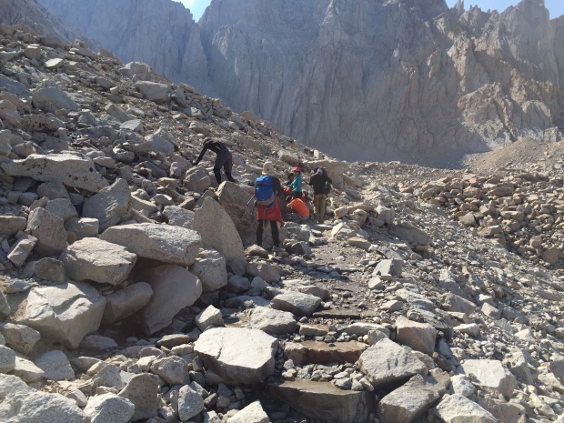
The trail switched from dirt and rocks to granite stair steps. I rose high above pretty Mirror Lake and Meadow. After another 1 ½-2 hours I finally reached Trail Camp at 12,039’.
Trail Camp is located on the shore of Consultation Lake. It could have been on the moon as far as I was concerned due to its barren landscape and granite spires. The camp was full of backpackers as well and by now I’m thinking these people are geniuses for breaking this hike up into several days!
I stopped here for a snack and contemplated the 99 switchbacks that were now staring me in the face. That’s 2.2 miles of switchbacks climbing 1,738’ to Trail Crest. I’m not going to lie…I thought long and hard about stopping here and just calling it a day. But after eating some food and catching my breath I decided to give the 99 a shot.
Surprisingly, the switchbacks were set at a low grade, which was much appreciated at this altitude. After what seemed like 999 switchbacks I finally rounded a corner and was hit with an amazing view to the west. Granite rising up, alpine forests and lakes below. My eyes had trouble taking it all in. I get teary-eyed just thinking about it now.
Reaching Trail Crest at 13,600′
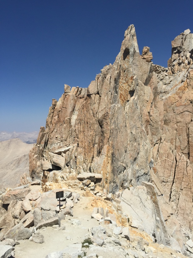
What’s around that granite spire?
I made it to Trail Crest at 13, 800’!
The Mt. Whitney summit is 2.5 miles from here and a mere 845’ of elevation. But these are the most difficult and most draining 2.5 miles of your life…so I’ve heard.
Once I reached Trail Crest I was for sure going to turn around. But after I sat for about 20 minutes and ate some food and got inspired by the beautiful views I started wondering what was just around the corner.
The trail from here took a dip and I really thought hard about having to make up the elevation I had already climbed. But the trail drew me in and I pressed on, “just a little further”.
The trail from Trail Crest is brutal. BRU.TAL!!!
The trail is in there somewhere
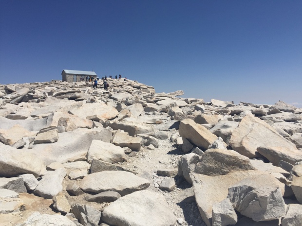
I scrambled for the next mile over unstable rocks, angular slabs, shear drops and technical boulders. After an hour I sat down for a break and saw the Smithsonian hut on the summit off in the distance. By now I was exhausted. The narrow single track trail was closing in. I was having moments of panic as my mind flashed back to my broken wrist less than a year ago.
I asked another hiker how much longer until the summit. When they responded, “about 2 hours” I was finished!
By now it was 12:30pm. I had been hiking 6 hours with 2 more hours to go. I did the math and figured it would take me 4 hours just to get back to this point on the trail. My heart sank realizing I was going to run out of water and day-light, without a filter that was with Jeff and headlamp that was securely back in the truck.
It killed me to be this close and have to call the hike. Just 1.5 miles left to the summit. For me, it had to be over!
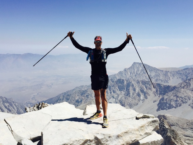
Jeff perseveres! Highest point in the lower 48!
About this time I met Esther. She was making her way back down the mountain after summiting. Wisely, she had left with her husband at 3am.
They had started this hike a few days before, but her husband Joe wasn’t feeling well and they turned around. This morning they started off at 3am again and again Joe didn’t feel well. He encouraged his wife to carry on so that one of them would make it. And that she did!
We started hiking together from here, retracing the technical trail back to Trail Crest. We both moaned at the section where we had to climb in elevation to get there, commenting about our pounding heads.
Down the 99 we went, past camps, meadow, lakes and waterfalls. All the while talking about our lives of adventure and travel. I learned about her amazing two daughters and could hear the affection she had for her husband of many years.
Second half of the battle is getting back down!
Our knees and quads were wearing down, but our time together made the trip so much better. I learned she and Joe take off their real estate business months at a time to travel. Check out their very well written blog here.
We arrived at the TH not a step too soon at 5:30pm, as the sun was going down. I got to meet Joe and instantly noticed they have a relationship like Jeff and I. Those rare relationships when a husband and wife actually like each other, have the same life pursuits and miss each other when we are not together. I can appreciate a happy couple!
I had gotten a text from Jeff that said that he had summited around 2pm, four hours after his missed conference call.
Joe and Esther were kind enough to give me a ride back to my RV Park in Lone Pine, knowing that Jeff would not be down for another 3 hours. I left the keys hidden in the truck so he could drive himself home.
Even though I missed reaching the summit I couldn’t be more proud for reaching 13,000+ feet and hiking 20 miles.
Thanks Esther for getting me down that mountain!
Mt. Whitney, I will be back! But next time I will leave earlier and not plan on making any calls!
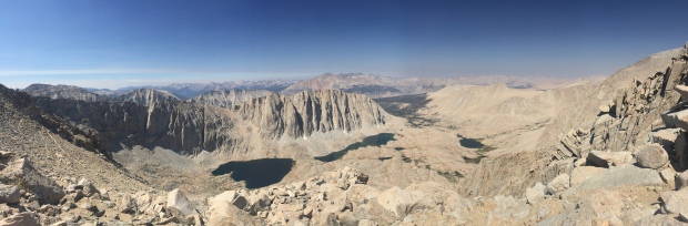
Westerly view from Trail Crest 13,600′
