Archive for category Boondocking
Getting High on Mt. Whitney
Posted by Deb in Boondocking, Bucket List, California, Full Time RV, Highest Peaks, Hiking, Uncategorized on October 3, 2016
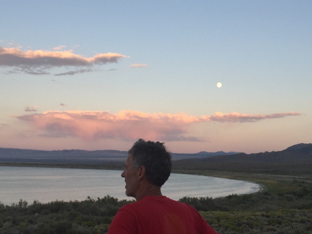
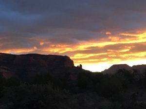
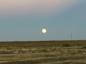
Full moon rising over Mono Lake
After leaving Seattle we had three weeks to make our way to Phoenix. Our working travel schedule gave us a deadline and unfortunately we were headed into the belly of the hot molten volcano in the middle of summer. 106 degrees here we come!
We made quick stops in Eugene and Ashland, Oregon, Redding, CA and Reno, Nevada on our way to Mono Lake, CA.
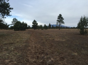
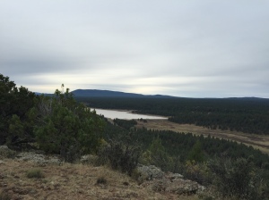
I had read about some great boondocking at Mono Lake on the eastern side of Yosemite. This really would be our last stop at any elevation (6,378’) in order to avoid the southwest heat. Also, when we were in Yosemite in May, we never made it to Tioga Pass. So stopping at Mono Lake would give us that opportunity.
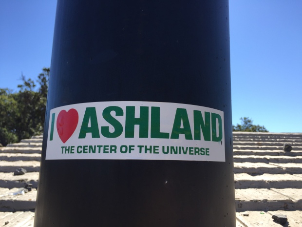
Quick stopover in Ashland, OR
Well, that was the plan anyway…
Last year about this time, Jeff asked me a question about doing something epic, challenging or scary and I blurted out that I would like to hike the highest peaks in each state. A week later I had bagged my first…Mt. Humphreys in Flagstaff, AZ. at 12,633ft.
Ever since then I have been researching the highest peak of each state that we traveled in 2016. Unfortunately, we have been traveling the states with the highest peaks overall that have been snow covered and required ice axes, crampons, repelling equipment, permits, guides, tents, backpacks, etc. MUCH more equipment than what we have.
So when I read about hiking California’s massive Mt. Whitney at 14,505ft, the highest peak in the contiguous US and it’s accessibility in late summer, I knew California was an attainable peak.
And look. It just happens to be down the road from Mono Lake! Change of plans…we are hiking Mt. Whitney!
Getting an early start…just not early enough!
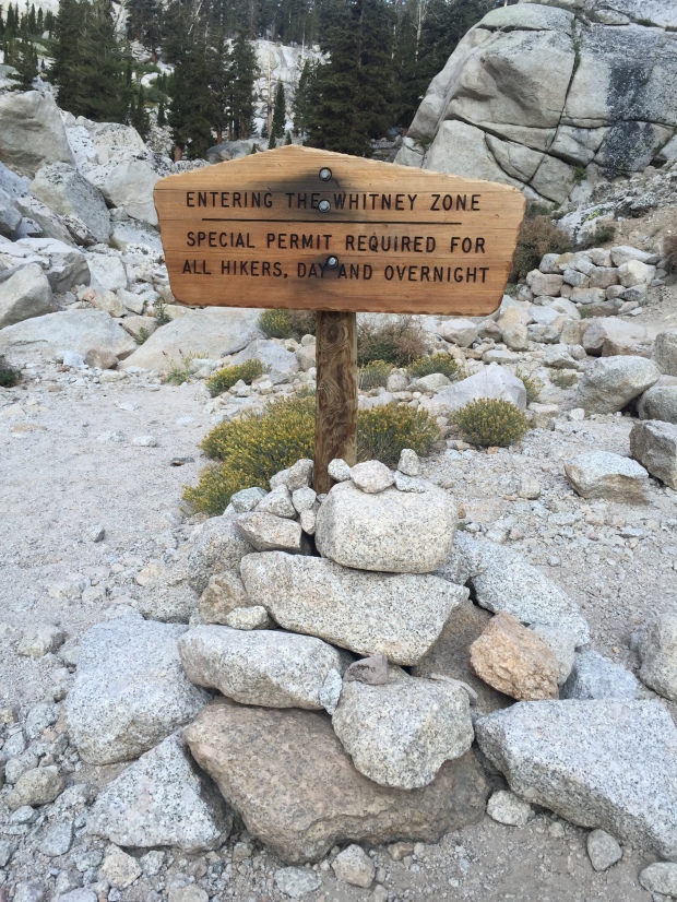
The Mt. Whitney Trail Head starts at Whitney Portal at 8,360ft via the small town of Lone Pine, CA. A permit is required for this hike and the online permit system said that there were no permits available. Learning from our experience at Yosemite we stopped in at the Forest Service center just south of Lone Pine and easily picked up a permit and mandatory “WAG Bag” (Waste Alleviation and Gelling-Bag) for the next day.
Everything I read about this hike said that this VERY STRENUOUS hike could be bagged in one very long day (12-18 hours), although most people take two. Its 22 miles round trip with 6,100ft of elevation gain, topping out at 14,505ft.
Since Jeff and I had spent the better part of the past month at Sea Level, we knew that this was going to be quite a challenge in elevation and distance. One I was not completely confident in completing. But I knew that what goes up must come down and I could turn around at any point in the hike if it got to be too much for this land lubber.
Walk this way!
The morning of our hike we got off to a late start, leaving the Whitney Portal TH at 6:30AM instead of our planned 5AM. Apparently we didn’t do enough research because most hikers leave around 1-3AM for this hike. For me, this was mistake #1!
Jeff tends to futz with his equipment, shoes, GPS and phone A LOT longer than I have patience for (sigh) and I headed off on the trail to get a jump. Jeff hikes much faster than I and I knew it wouldn’t take long before he would catch up with me.
What is really hilarious now is that Jeff had read that some folks were getting Verizon Cell coverage on the top of Mt Whitney, so his plan was to get to the top by 10AM for a conference call.
GEEZ! WHAT ON EARTH WERE WE THINKING?!?
I started at the TH and quickly passed the 6-10 informational boards that described the tenacity needed for such a hike. No need to read those of course…we have a conference call to make!
Immediately the trail started with a moderate incline. The sun was up just enough that no headlamp was needed and I made mistake #2 by leaving it in the truck. After an hour on the trail there was a beautiful sunrise that was enhanced by the smoke from the San Bernardino fires that were burning out of control at the time.
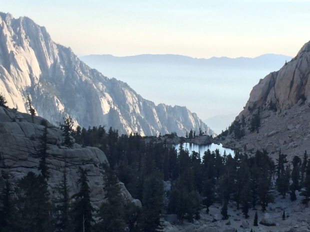
Lone Pine Lake
After about 3 miles I reached Lone Pine Lake. At this point Jeff still had not caught up with me and I grew a bit concerned. Come to find out he took a wrong turn at the beginning of the trail and got on the rugged Mountaineer’s route to Mt. Whitney. He noticed his mistake after about a ½ mile and turned around. That does tend to happen when you hike and post selfies on facebook at the same time!
Jeff finally caught up with me and it was clear that it was going to be a challenge to get to the top before the 10AM conference call. So I sent him ahead to try and make it without me holding him back…with our water filter. Mistake #3 (at least for me).

After Lone Pine Lake the nice smooth trail quickly changed over to a rockier surface. Footing became a bit more of a challenge as trees thinned out. I passed Outpost Camp with its gorgeous waterfall at a little over 10,000ft. There were a lot of backpackers here stopping to acclimatize on their 2-3 day summit push.
“Gee…Maybe I aught to look into some overnight equipment, scratching my head!
I hit a long patch of switchbacks after Outpost Camp.
In my quick glance lengthy research of this hike I remembered reading about a section of the trail called “the 99 switchbacks” that came after a campground.
The trail turns rugged
I got pretty excited because I new that the 99 were around mile 7. “Wow, I’m making great time”! I asked a fellow hiker coming down if I was on the infamous 99. Imagine my surprise when she told me, “ Oh no. You have quite a way to go before you get to the 99”.
About this time I saw a trail marker that said Mile 4! I. WAS. CRUSHED!
By now my heart had been pounding in my ears for almost 3 hours. The elevation had reduced my hiking to 45min miles. THIS WAS GOING TO BE A LOOOONG DAY.
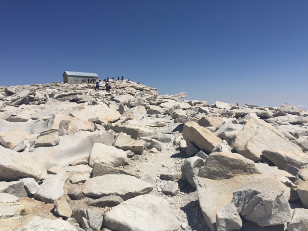
The trail switched from dirt and rocks to granite stair steps. I rose high above pretty Mirror Lake and Meadow. After another 1 ½-2 hours I finally reached Trail Camp at 12,039’.
Trail Camp is located on the shore of Consultation Lake. It could have been on the moon as far as I was concerned due to its barren landscape and granite spires. The camp was full of backpackers as well and by now I’m thinking these people are geniuses for breaking this hike up into several days!
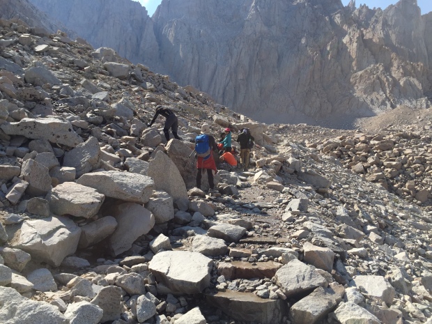
I stopped here for a snack and contemplated the 99 switchbacks that were now staring me in the face. That’s 2.2 miles of switchbacks climbing 1,738’ to Trail Crest. I’m not going to lie…I thought long and hard about stopping here and just calling it a day. But after eating some food and catching my breath I decided to give the 99 a shot.
Surprisingly, the switchbacks were set at a low grade, which was much appreciated at this altitude. After what seemed like 999 switchbacks I finally rounded a corner and was hit with an amazing view to the west. Granite rising up, alpine forests and lakes below. My eyes had trouble taking it all in. I get teary-eyed just thinking about it now.

Reaching Trail Crest at 13,600′
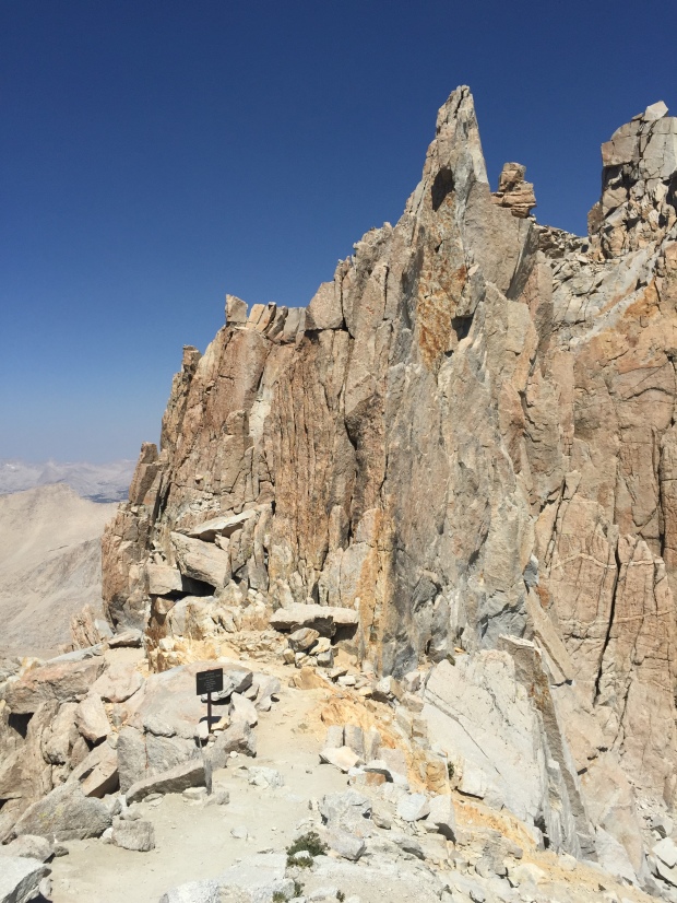
What’s around that granite spire?
I made it to Trail Crest at 13, 800’!
The Mt. Whitney summit is 2.5 miles from here and a mere 845’ of elevation. But these are the most difficult and most draining 2.5 miles of your life…so I’ve heard.
Once I reached Trail Crest I was for sure going to turn around. But after I sat for about 20 minutes and ate some food and got inspired by the beautiful views I started wondering what was just around the corner.
The trail from here took a dip and I really thought hard about having to make up the elevation I had already climbed. But the trail drew me in and I pressed on, “just a little further”.
The trail from Trail Crest is brutal. BRU.TAL!!!
The trail is in there somewhere
I scrambled for the next mile over unstable rocks, angular slabs, shear drops and technical boulders. After an hour I sat down for a break and saw the Smithsonian hut on the summit off in the distance. By now I was exhausted. The narrow single track trail was closing in. I was having moments of panic as my mind flashed back to my broken wrist less than a year ago.
I asked another hiker how much longer until the summit. When they responded, “about 2 hours” I was finished!
By now it was 12:30pm. I had been hiking 6 hours with 2 more hours to go. I did the math and figured it would take me 4 hours just to get back to this point on the trail. My heart sank realizing I was going to run out of water and day-light, without a filter that was with Jeff and headlamp that was securely back in the truck.
It killed me to be this close and have to call the hike. Just 1.5 miles left to the summit. For me, it had to be over!
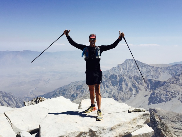
Jeff perseveres! Highest point in the lower 48!
About this time I met Esther. She was making her way back down the mountain after summiting. Wisely, she had left with her husband at 3am.
They had started this hike a few days before, but her husband Joe wasn’t feeling well and they turned around. This morning they started off at 3am again and again Joe didn’t feel well. He encouraged his wife to carry on so that one of them would make it. And that she did!
We started hiking together from here, retracing the technical trail back to Trail Crest. We both moaned at the section where we had to climb in elevation to get there, commenting about our pounding heads.
Down the 99 we went, past camps, meadow, lakes and waterfalls. All the while talking about our lives of adventure and travel. I learned about her amazing two daughters and could hear the affection she had for her husband of many years.
Second half of the battle is getting back down!
Our knees and quads were wearing down, but our time together made the trip so much better. I learned she and Joe take off their real estate business months at a time to travel. Check out their very well written blog here.
We arrived at the TH not a step too soon at 5:30pm, as the sun was going down. I got to meet Joe and instantly noticed they have a relationship like Jeff and I. Those rare relationships when a husband and wife actually like each other, have the same life pursuits and miss each other when we are not together. I can appreciate a happy couple!
I had gotten a text from Jeff that said that he had summited around 2pm, four hours after his missed conference call.
Joe and Esther were kind enough to give me a ride back to my RV Park in Lone Pine, knowing that Jeff would not be down for another 3 hours. I left the keys hidden in the truck so he could drive himself home.
Even though I missed reaching the summit I couldn’t be more proud for reaching 13,000+ feet and hiking 20 miles.
Thanks Esther for getting me down that mountain!
Mt. Whitney, I will be back! But next time I will leave earlier and not plan on making any calls!

Westerly view from Trail Crest 13,600′
Critters and Clingers
Posted by Deb in Boondocking, Hiking, Running, Sam-a-lama-ding-dong, Trail Run, Utah on April 14, 2016
Silver Reef, Leeds Utah
After leaving Moab, Jeff and I headed north to Salt Lake City for a day of business. We checked in to the Springville/Provo KOA just south of SLC. I can’t believe I am going to say this, but we were looking forward to some peace and quiet after Moab in a KOA of all places, and it delivered.
We were surrounded by snowcapped mountains right our front door. While we have done well to not experience winter on our travels so far, we got a little flavor of it during our stay. We had rain, sleet, snow and wind. The cold damp air chilled us to the bone and made us thankful that we have only participated in winter 4 days rather than 4 months.
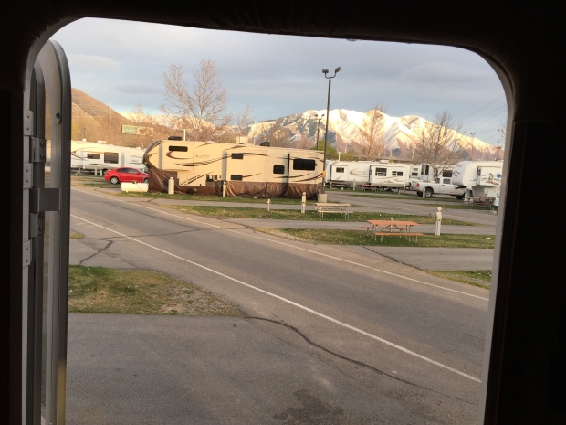
View out our door at the Provo KOA

Getting in a quick trail run before leaving our 4 days of winter!
Time to head south towards Zion National Park.
Zion National Park was on our radar for two reasons. 1. Neither of us have been there and 2. There is an Ultra Trail Run that fit into our schedule on April 9th.
Since we were arriving a week before our race we decided to camp near St. George, UT. We read about Silver Reef on Campendium in Leeds, UT in the Dixie National Forest. Free dispersed camping on National Forestry land with designated campsites and good connectivity for work is just our style.
Though this is considered dispersed camping it was “camp in designated campsites only” and we were fortunate enough to snag the last site open. WOW…what a find! Bright spring green vegetation and freshly sprouted cottonwood trees against the backdrop of the red rock canyons. Throw in a babbling creek and gobbling turkeys and we were on sensory overload!

Now that’s a campsite!
Jeff and I were pinching ourselves at such a wonderful campsite UNTIL… I heard a something at 4AM that sounded like a raccoon INSIDE our camper, munching and scampering around. Jeff on the other hand can sleep through a parade, so I had to wake him up to have him investigate. I love a man who will take on ferocious beasts in the middle of the night in is underwear!
Imagine my surprise when I saw a big scary… mouse run across the camper! That’s it! We are moving!!!
He (the mouse, not Jeff) had been snacking on our bananas and Lara Bar I had out on the counter. Who knew mice like bananas. Avocados? Not so much!

You dirty rat!
This is the first time we have had a mouse inside our camper.
In 2013, we had a mouse outside making its home in the end cap of our Travel Trailer (that I thought was a raccoon too). That’s when we put out one of those sticky pad mousetraps with a piece of dog food on it. That seemed like a good idea until Sam, not being able to resist his dog food, tried to eat his kibble and ended up having his face stuck to the mousetrap!
You learn something new every day folks!
We went into operation, “kill the dirty rat” and set out traps all over the camper. By 11:30pm we had caught our mouse! YEA…problem solved. I could shut my eyes knowing that some little varmint wasn’t going to snuggle up with me or poop on my pillow in the middle of the night.
But within 30 minutes we could hear movement again and had caught mouse #2. Dang…two mice…in our house!!!
But wait, there’s more! By morning we could hear a third invader stuck to another trap. OMG there were 3 mice!
The next night we set up a trap in a shoe box with a hole in the side outside the camper by our tires to try and catch any additional mice before they got inside. No invaders inside the camper but we caught a 4th in the shoebox overnight!
I’m not sure if we parked right over a rat hole, but all was quiet after that. Peace and harmony was restored. YEA!

Sam inspecting the carnage…that he slept through!
That is until we had an invader of another sort.
We have heard of this phenomenon from other dispersed campers. One minute you are in private solitude, miles apart from your next neighbor. The next minute someone is parked so close you can smell what they are having for dinner. That my friend is what is known as “a clinger”!
Yes, there are people who will move right in on your designated campsite just because it is big enough for two and then apologize because “there were no other sites open”. Instead of moving on like any normal respectable person would do, they encroach on your space and then proceed to run their generator at 6:30am.

Clingers
I put clingers in the same category as those who decide to put their jacks down, set up their satellite dish and put out the mat and lawn chairs at a Walmart parking lot.
Despite our inconsiderate invading “guests” we did have a fabulous time at Silver Reef.
There are miles of places to run, hike, ATV and mountain bike as our camping road connected to the Red Cliffs Recreation Area. All this and only a 15-minute drive to St. George.
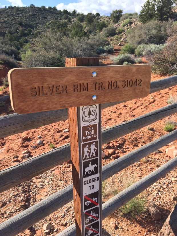
Silver Rim Trail steps from our front door
I needed to get in a 10 mile run so I headed south to the Red Cliffs not knowing where I would end up. I just happen to pop out at the delightful Red Cliffs Campground.
Red Cliffs has only 11 sites with a 25’ max RV length and no hookups. While I was running the loop a camper told me about “the pools”, so I started down a trail right from the CG and ended up at an amazing find! Canyon pools spilling from one level to the next, creating a water oasis in a dry parched land.
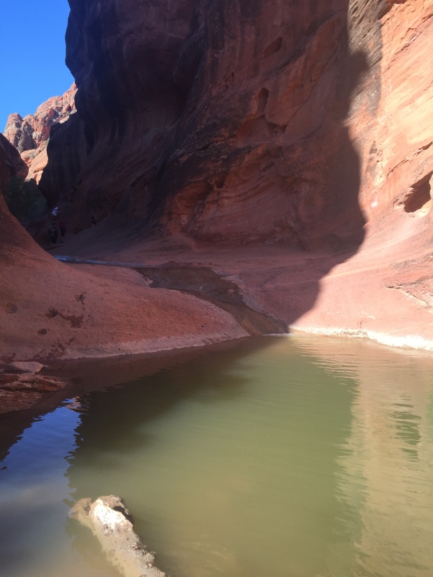

The red cliff pools
What a treat!
With hiking trails, well-maintained gravel roads and incredible scenery we will definitely stay here again. We will just bring extra mousetraps and a can of patience when we do!
Ahhhh…serenity!
Migration South
Posted by Deb in Arizona, Boondocking, Destinations, Full Time RV, Hiking, Sam-a-lama-ding-dong, Uncategorized on December 9, 2015

It’s been a while since I posted on my blog. My last entry was about our epic hike at the Grand Canyon back in October. I started typing my next post when something went drastically wrong leaving me unable to keep typing!
After Jeff and I left the Grand Canyon we headed back to Flagstaff where we dispersed camped at one of our favorite spots by Lake Mary. The alpine forest, miles of forestry roads to get lost on and hiking on the Arizona trail are some of my favorite reasons to camp here.
We did try a new location just north of Flag after calling the Forestry Department. “There are plenty of camping spots up there”, they said. “Good access”, they said. But after an hour of narrow roads and only two camp spots that were impossible to get in to, we decided to “go with what we know” and pushed on to Lake Mary. Trouble was, we were up a creek without a paddle. Or in RV’ing terms…down a narrow road without a turnout! After carefully backing up a 1/2 mile we finally swung the 5’er into to weeds to get turned around.

Contemplating how to get this thing turned around
I’ve found the most challenging parts of dispersed camping is that you never know what you are getting you and your rig into.
One persons opinion of “plenty of clearance” is usually nowhere close to the reality of our specific rig. If someone has wedged a 30,000lb forty-foot motorhome in a spot, then I have a bit more confidence in their recommendations. But NEVER take the word of a non-RV’er unless you want to find out what serious heartburn is like.
Lake Mary works out well for a Triathlete in training. The pool at the college is an easy 10 miles away and Lake Mary Rd is a major thoroughfare for cyclists and runners. Perfect for Jeff to continue some high altitude training for the Arizona Ironman.

The Arizona trail just steps from our campsite
While Jeff trained, I hiked a portion of the Arizona trail just steps from our camping spot.
The Arizona Trail is a National Scenic Trail that runs from the border of Mexico to the Utah border, traversing the North/ South length of Arizona for 800 miles. It was officially opened December 16, 2011.
The section I hiked was near the Lowell Observatory and Marshall Lake. It was not particularly scenic with primarily flat hiking through cattle fields.
-
- Not much to see here folks
-
- Lake Mary…the only scenic part of my hike
Sam dog is a great little hiker as he follows the trail very well. If I come to a part where I’m not sure where the trail is I just follow him…he knows every time. But he did step off the trail briefly and ended up with a big cholla ball stuck to his front leg. When that happens he tries to keep going because he HATES when I pull those dang things out. He hollers like you wouldn’t believe and comically when I pulled this one out to his great displeasure it flung out and stuck his back leg, doubling the experience. Once we start moving again all is forgiven and Sam stayed on the trail.
-
- Our free alpine camping at Lake Mary
-
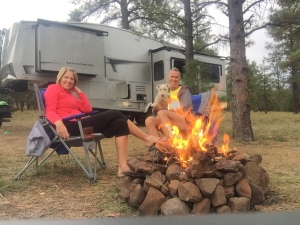
- One of the rare moments we actually sit by a campfire
We decided to pull out of Flagstaff a day early since wet weather was coming in and we were on soft ground with low batteries. So we pulled up the jacks and headed to Sedona.
There is free dispersed camping available west of town on Forestry Road 525. We camped here last year and learned if you travel about 5 miles back on the washboard roads you are treated with some spectacular views and close hiking trails. We had some great days of sun and got the batteries charged back up to 100%.

Scene out our front door

Sam tearing it up and turning a nice shade of Sedona red
-

- Rain and rainbows
-
- Sunrises and sunsets
Sedona is incredibly beautiful and is one of my top 5 places to see thus far in our travels.
Hiking is spectacular in Sedona, but it is also very popular. If you are looking for a get away from it all experience you will have to travel a little further out of town. But what I love the most about hiking here is the sandy red soil contrasted with the green scrub bushes, Junipers, Arizona pines and Pinon Pines. Mix that in with the scent of toasted pine needles on the trail, red rock views at every turn and warm sun and you have yourself hiking nirvana!
After paying a $5 day use fee Sam and I set off on Soldier Pass Trail. This trail is a great loop with incredible views of the red rock formations, slabs and the city. We hiked the trail counterclockwise; since I have hiked this trail clockwise a couple of times before.

Trail dog Sam leading the way
The initial accent takes to you to some red slabs with wide-open views. It’s a great spot for a picnic and photos before heading up natural stairs towards Brin Mesa. At the top of Soldier pass the trail flattens out and turns from red to a light sand color. I wanted to take the Brin Mesa tail for an out and back, to log some additional miles.
The Brin Mesa trail takes a steep decent back down the other side of the mountain. I always laugh at myself after descents like these because my mind automatically thinks about having to hike back up. Like the Grand Canyon my mind blows up the imagined accent to be much more difficult than it actually is. Then I’m always surprised when I get to the top wondering if I still have “the hill” to go. Silly self!
I mistakenly thought the Brin Mesa trail would actually take me to a mesa. But once I ran into a forestry road, my turn around point, I was informed by other hikers that the actual mesa was off some other offshoot from Soldier Pass. I’ll have to catch that one the next time.
-
- Stunning contrast of color
-
- Slabs near “The Sinkhole”
Back on Soldier pass, Sam and I started down the west side of the mountain back into red soil. It was getting hot by now and my two bottles of water were starting to get low. Thankfully we reached more slabs on this part of the trail. The slabs have some natural pools that form from bowl shaped indentations in the rocks. These pools had collected fresh water from recent rains, which Sam found refreshing for consumption and wading in, leaving the remaining water in the bottles for me.
Closer to the west side Soldier Pass Trailhead near “The Sinkhole” it gets pretty noisy from jeep tours and ATV’s that are allowed on the trail here. We jumped off Soldier Pass at this point and took the Jordon trail heading east back to our parking lot.
Sam found another pool that was pretty murky and large and waded in to cool his dogs. Problem was it was very deep. To both our surprise he disappeared underwater only to bob back up sputtering. He wasn’t too thrilled about going scuba diving but he was super frisky after that. I guess his bath really cooled him down.

Sam cooling down in a shady spot
We ended up hiking 8.5 miles over 3 hours…what a great time!
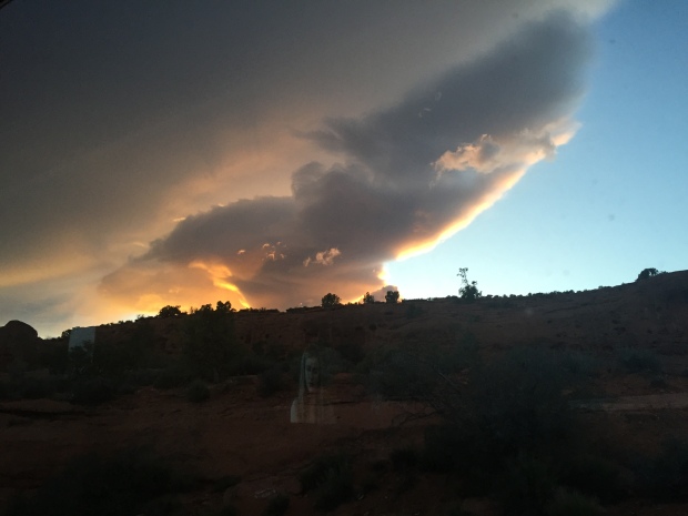
After a week in Sedona rain and snow moved in. It was stunning to wake up to a ring of white snow on the red rocks at the higher elevations. But to maintain our shorts and flip flop temps we moved on to Phoenix/Mesa…. where things turned very interesting!

What the heck!
Flagstaff Boonies and Peaks
Posted by Deb in Arizona, Boondocking, Bucket List, Full Time RV, Highest Peaks, Hiking, Uncategorized on October 25, 2015

Welcome to 7,000 ft…catch your breath!
-
- Clingers in the nicest way!
-

- Dinner with friends…we really like these two

The trail calls and I must go!

Agassiz Peak from Humphreys Peak Trail. San Francisco Mountains.
-

- Humphreys Peak Trailhead…here we go!
-
- Aspens in full glow!
Jeff, Sam and I left Humphreys Peak TH from the Arizona Snow Bowl following a smooth trail that took us through a field of glowing aspens. But the smooth trail was short lived as we quickly entered a hole in the tree line and the trail quickly turned rugged and rocky. It was an ankle turner almost the entire way and Jeff rolled his and launched himself over the side of the trail, only to be stopped by a small tree. That. Was. Close!

Navigating the rough trail

View from Mt. Humphreys with aspens far below and controlled burn in the distance!

Sunset from Mt Humphreys TH set off by a controlled burn in the distance

This is how we roll…me driving and the boys sleeping!
The B-line to Albuquerque
Posted by Deb in Boondocking, Full Time RV, New Mexico, RV Parks, Solar, Uncategorized on October 10, 2015

Sunset from the road heading west
We made a B-line to Albuquerque to take in the splendor of the Balloon Fiesta and IT IS SPECTACULAR!
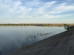
From Dumas Texas we made a 2 hour drive to Ute Lake State Park to camp for two nights. This is a dry, barrow campground overlooking the very nice Ute Lake. Evidently this is a great spot for birders and fisherman alike. The lake is shallow with a lot of reeds and grasses along the banks. What is brown and desolate by day turns to an incredible glow of oranges, yellows, blues, purples and pinks when the sun hangs low.
-
- Ute Lake State Park…great spacing and hookups for $14/night…yes please
-
- Ute Lake
The sites are packed gravel, super long and have great separation. Each site has a covered patio with picnic table, fire pit, grill and lots and lots of goat head stickers. Sam enthusiastically jumped out of the camper ready to explore his new surroundings and was stopped in his tracks with paws full of stickers.
If it were not for the goat heads we would have stayed a bit longer. But after two days we decided to move on.
-
- Perfect site for watching the lunar eclipse
-
- Dang goat head stickers. Sam was not a happy camper!
Our next stop was just 20 miles down the road in the little town of Tucumcari, New Mexico. Tucumcari mountain is an isolated mountain in a sea of brown dessert that was a landmark back in the 1800s for those traveling west from Arkansas to California.
We camped at the nastalgic Cactus RV Park, one of those original destinations back in the hay day of Route 66.

Tucumcari Mountain…a landmark for wary travelers heading West
-
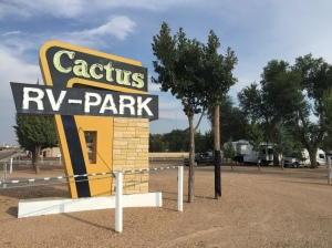
- The nostalgic Cactus RV Park…but don’t expect any frills!
-

- Cactus RV Park. Nicely groomed and offered shade on a hot day.

Sandra’s Mountains from our ABQ campsite

Be sure to check your shoes. You never know what you will find in the desert!
Anarchy in the desert of Borrego Springs CA
Posted by Deb in Boondocking, Borrego Springs, California, Full Time RV on January 9, 2015

Full moon over Borrego Springs
We’ve met tons of new people in the desert at Borrego Springs.
Most RV’ers are drawn to this area to spend winter for the plentiful sunshine, be-still-my-heart 70+ degree January temps and thousands of acres of free camping. Our nearest neighbor is a football field away, yet walk by your neighbor’s camp and you will be greeted with a hearty hello!
We’ve been invited to an outdoor movie/meet-up with a large group of full time, location independent 30-40 something road warriors who have bucked the system and work from their Airstreams, vintage bus or motorhome. Conversations usually revolve around connectivity, data plans, drones, instagram hash tags, is whiskey spelled with an “E” or without, local brews, holding tank management and local farmers market.
-

- Hip Airstreamers
-

- Airstream meetup
This is a group of hipsters for sure and Jeff and I went from being some of the youngest in this desert community to being the oldest. But that hasn’t kept us from being invited to the afternoon happy hours, taco tuesdays, nightly bonfires or karaoke night.
Various jobs amongst the tribe include a composor/musician, web and app developers, writers, investment trader, road schoolers, photographer and professional bloggers. It was an inspiration to meet everyone living their version of “the dream” right from their 80-360 square feet of what they call home.
The blog and instagram roll of our group is:
AirstreamLife, Aluminarium, @asolojourner, @dreaknufken,
@journeywithhappiness, @kmpuccio, @malimish_airstream, @russhaynie,
Rolling Recess, @sethkhughes, Tehcnomadia, @theroamingpint,
The Scenic Route, @toddmb, ToSimplify, @upintheairstream, VanTramp, Wheelingit
One evening kicked off with what the group dubbed, “Soup Anarchy”. Everyone brought an ingredient or can of soup and we dumped it all in one pot…like a Hairy Buffalo, but with soup instead of booze. No rules, just wild, throw-caution-to-the-wind, dump what pleases you, into the pot. Ok. There may have been some booze slipped it somewhere because…it is soup anarchy after all!
-

- Anything goes into the pot
-

- Cheri of Technomadia throws in her contribution to the uprising
-

- Let the rebellion begin
It was BYOBS (Bring your own bowl and spoon) and set up a chair for a soup anarchy inspired movie. The selection of movie was picked from films that had to do with soup, anarchy or RV’s. We ended up with “The Adventures of Power” which by the way had nothing to do with anarchy or soup. It did have a split second flash of a vintage bus, and that was good enough for us. It was a quirky, hilarious, sweet movie about a guy named Power who tries winning an air drum competition. Yes, it really was as awful as it sounds. But the film was made memorable by a funky group of RV’ers watching a movie on the side of a vintage bus in the desert. How cool is that?
Borrego Springs has been a memorable stay and a place to come back to for sure, especially if there is an opportunity to see our new community of friends.
We plan on being here for another week before heading back to Quartzsite to the largest gathering of RV’ers in the country. So we may have more to report on Borrego Springs before we go.
Stay tuned!

Can a movie be awful and awesome at the same time?
A Remarkable 2014
Posted by Deb in Arizona, Boondocking, Bucket List, California, Destinations, Full Time RV, Hiking, New Mexico on January 3, 2015

New Years morning surprise…snow!
It’s New Years Day here in Borrego Springs, CA and we woke to spectacular scene in the desert…SNOW! What a beautiful sight to help summarize a beautiful year.


Jeff and I celebrated our 20th anniversary in January. His fun-loving, try anything once attitude takes us on many crazy adventures…usually things that scare the crap out of me. But I have never regretted any of our experiences and my life is so much more full because of the one I love. (I really like this guy!)
March we headed off to Guatemala for 3 weeks on a service trip. We visited some remarkable teens trying to improve their lives by learning English…their ticket out of poverty. Even with so little, even with so much daily effort to live day-to-day, they persevere and overcome obstacles just so they can get an education. Their montra…”It is difficult but not impossible”. One of those students, Miguel, was chosen for a Walton International Scholarship to John Brown University in NW Arkansas…his dream! And one more highlight from our trip. Roasting marshmallows on an active volcano!
-

- Half Marathon Springfield MO
-

- Mom is now an official Arkansan…she got the T-shirt.
-

- RAGBRAI 2014
Spring and early summer brought lots of triathlon, ½ marathons and trail runs.
May Jeff made a last-minute trip to Red Bluff CA to help his Mom move out of her home after it sold. Finding out she could no longer live alone, the family made the decision to move her to Arkansas in August. This ended up being a great move and his Mom is very happy to be near 3 of her 5 kids.
July we headed off in our camper for RAGRAI for our second year. This is a week-long bike ride across the state of Iowa. This trip kicked off a 2 month road trip that took us from Iowa to Louisville, KY, Salt Lake City, Redmond OR, Henry IL, Hershey PA, Elkhart IN and back to Louisville. The highlight of the trip was camping in the Black Hills of S. Dakota and seeing Mount Rushmore.
Back home in September for two weeks we reloaded and left for an EPIC adventure to hike the Grand Canyon rim to rim (Deb) and rim to rim to rim (Jeff) in October. But not before we stopped over at the magical Albuquerque Balloon Fiesta. We crossed off two bucket list items on this trip.
-

- Fan favorite…spider pig! Albuquerque Balloon Fiesta
-

- Epic Grand Canyon Rim2Rim…2Rim
-

- High altitude training, Flagstaff AZ
We boondocked in Flagstaff before and after the Epic GC hike for some high altitude training before heading into Sedona for spectacular red rock scenery, hiking and a hot air balloon invasion. Those Canadians sure know how to make a grand entrance!
After Sedona we headed down to Tempe AZ where we driveway camped leading up to the Arizona Ironman competition. Jeff did a great job in the competition and finished under 12 hours. I on the other hand (besides being an Ironsherpa )surfed the net, took naps and ate ice cream during that 12 hour period. Spectating is tough stuff people!
-

- Canadians making a grand entrance
-

- My Ironman
-

- Cheap viagra anyone?
After Ironman was a trip back to Arkansas for business and plans to head to our next destination….Yuma AZ. Yuma is a mecca for Snow Birds with over 32,000 RV sites. 80% of those are filled with Canadians who stay for 5-6 months out of the year. We crossed over the border into Mexico for a few hours. Just long enough to check out the vibrant pharmaceutical & dental scene (300+ Dental offices) and have lunch. If you are looking for cheap implants, crowns, cleanings or Viagra this is the place to go!

“The Crack” Lake Havasu City AZ
We headed north from there with a brief stop over in Quartzsite before coming to a stop in Lake Havasu City AZ for the lighted boat Christmas parade. We boondocked in a couple of different locations and hiked our first slot canyons.
December we moseyed over to Desert Hot Springs RV Family Spa and lazed around the mineral spas until we were completed pickled and hiked the Thousand Palm Oasis. We met up with some full time RV bloggers and online mentors.
After a week of spas we headed down to Borrego Springs CA to celebrate Christmas and New Years in the fabulous desert and hooked up with friends Stephen and Denise. We met them last year while camping in Colorado. They taught us how to play pickle ball, invited us to their RV park potluck for Christmas AND had us over to watch the Razorbacks take down Texas in the Texas Bowl. Go hawgs!

Closest thing to a Christmas tree in the desert.
It is hard to imagine that we have done so much when the year has flown by so fast. We already have some plans made through March 2015 and we hope that you come along for the ride. Our next destination? The big Quartzsite RV and rock show in January. Stay tuned!
Boondocking and Booties, Lake Havasu City, AZ
Posted by Deb in Arizona, Boondocking, Hiking, Sam-a-lama-ding-dong on December 10, 2014
After a brief two night stop over in Quartzite, AZ we moved on to Lake Havasu City. Not sure how we landed on going there but think it had something to do with water. It usually does.
Lake Havasu City is an interesting town and has been featured in the “Best Places to Retire” lists in Money Magazine, Portfolio.com. It is a mecca for ATV hobbyists, northerners who come here to stay warm for the winter and Californians to utilize the beautiful lake in the summer.
LHC boasts 300 days of sunshine and less than 3″ of rain a year. Summers are extremely hot averaging over 100 degrees.

There is many opportunities to boondock close to town. So we stayed at Craggy Wash just north of the airport.There is a camp host who issued a free 14 day pass. The entrance was quite crowded with many RV’s…some that appeared to have overstayed the 14 day limit. But as we traveled further in, the RV’s thin out and we had plenty of private options to choose from.
There are many hiking opportunities here and we were able to see some wild burros and big horn sheep. Sam got a little more up close and personal. We were walking the wash when we heard him way off in the distance. Finally seeing movement up on a mountain about a 1/2 mile away, big horn sheep were scattering on the hillside as a little white fur ball gave chase.
Crazy dog! He sliced up his feet pretty good and he walked around tender footed for a week. This put a damper on our other hiking plans since he goes with us everywhere. So we stopped in at Petsmart and bought a set of doggie booties for his tender toes. It was hysterical to watch Sam walk around the store for the first time with his new shoes. But once we arrived at Dead Burro to hike this 5 miler, Sam was in happy mode.
After about 3 miles, however, he had run so much the shoes started falling apart. We returned them on the way back home. We were happy with the fit and how well they stayed on his feet, but the quality of construction had some obvious issues

Shredded Booties
.

Sam’s new shoes
Dead Burrow was a great hike…once we found the trail. There are no real trail markers around these parts so we were left with other hikers directions to find the trail.
Description for this hike went something like this. “Drive the wash until you pass the hills on the left, then take a jeep road to the right and go to the right on the hill to the left. Back track to the other side of the mountain and take the small wash around a curve that will take you to a mesa. Cross the fence on foot and look for a poorly defined trail. Follow this trail to another wash that will traverse the right side of the canyon”.
If that wasn’t confusing enough there were unlimited hills, washes, jeep roads, mesas and burro tails that will take you off in directions not even close to the canyon you are trying to find. After taking many jeep roads and poorly defined trails, by some small miracle, we actually found the right canyon. It was definitely a great hike overall and like nothing we have done before.
The adventure was fun and it challenged us mentally.
If you happen to come here for yourself just be sure to take the second wash on the right.

Very important to elevate your feet after a strenous hike!
Map. Darts. Our Next Destination.
Posted by Deb in Arizona, Boondocking, Destinations, Full Time RV on November 25, 2014

Searching the Arizona BLM map for free camping
Jeff and I are having a hard time deciding where we are going next. I know…tough problem, right?
This RV travel planning was easy when we had events on our calendar. But once the Rim2Rim/Rim2Rim2Rim at the Grand Canyon and Ironman Arizona in Phoenix was over, we found ourselves in a “throw the dart” moment on where to point the RV.
So, how do you decide where to go when you don’t have to be anywhere?

Visiting a highschool swim buddy in Mesa, AZ.

Caught the Albuquerque Balloon Fiesta!
Here are some things that helped us finally hitch up the RV and go.
1. Just pick the next stop. We got stuck trying to figure out the next 2 months at one time. So rather than throwing darts (which I don’t recommend in a small RV…you’ll poke your eye out) draw a 150 mile circle around your current location to narrow your choices on where to stop next.
2. If you don’t like the destination, hook up and move.
We had another RV’er tell us, “we have wheels under our homes for a reason and we can use them any time we like!”.
Too hot…hook up and move. Neighbor with loud music or barking dog…hook up and move. Don’t like the local ice cream…hook up and move.
There is comfort in knowing that if you don’t enjoy your destination you can leave and go somewhere else…unless it is your Mother-in-laws house for the holidays. Then it’s best to stick around as long as your wife says.

Mittry Lake, Yuma AZ. Moved earlier than planned due to swarms of mosquitos at 5pm sharp every day!
- Look at where others have gone before.
Consult your favorite RVing blogs to see where they have gone. This helped us find our current free BLM campsite in Yuma.
- Check out a cities calendar of events on their website.
Once you narrow down your search, pull up the cities calendar of events to see if they are doing something that interests you. We saw that Lake Havasu is having a festival of lights, lighted boat parade and an ugly Christmas sweater 5K in December. Who wouldn’t want to run a 5K in the dessert in a hot ugly Christmas sweater?
- Look for inspiration
A relative’s birthplace, a memorable childhood camping trip, a place you have always wanted to see. For us, Jeff’s Mom was born in Yuma. We felt a pull to visit while she still had some memory and stories of the place that would bring the town to life.
Surprisingly, picking our next destination has been the hardest and biggest surprise so far about full time RVing. But with a little bit of thought, research and inspiration we have managed to pull up the jacks and move on down the road 150 miles further.
Now, where did I put those ugly sweaters?
The Beauty of the Dessert Is Cast Low
Posted by Deb in Arizona, Boondocking, Bucket List, California, Hiking on November 8, 2014

Nothing to see here folks
Jeff and I have been on the road now for 4 months. We tend to gravitate towards trees, hills or mountains and higher altitudes so that we have natural air conditioning to keep us comfortable.
But as November comes into view and talk of a Polar Vortex descending out of Alaska, we made a run for the flats of the Arizona desert.

Jeff adding a bit of color to a sea of brown
But after the first evening at Lake Pleasant, AZ, what I discovered was that the real beauty of the dessert is found in the sunrises and sunsets as the sun casts low on the horizon.
Hills and mountains begin to glow red, pink , orange and purple and cacti cast dark humanlike shadows. The sky is big and unobstructed and the complete darkness allows you to see galaxies beyond. Throw in a yipping coyote for good measure and you have the making of an incredible, surprising western experience.
Oh yes…the dessert. I am now a huge fan!


